Castlake Quarry Copse

Wood, Forest in Somerset Somerset West and Taunton

England

Castlake Quarry Copse

Above Wood Farm, Stogumber, 1949 Three young boys messing around in the stream.
Above Wood Farm, Stogumber, 1949 Credit: David M Murray-Rust

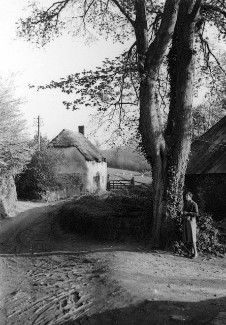
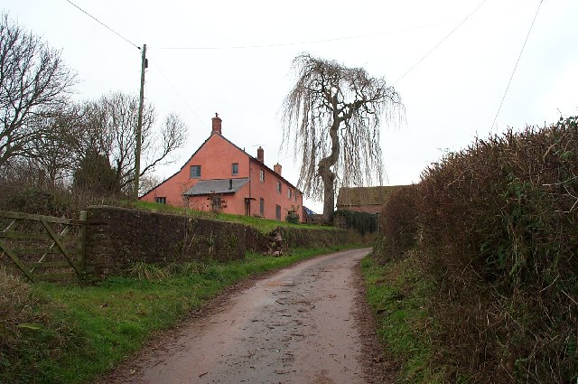
Castlake Quarry Copse is a picturesque woodland located in Somerset, England. Covering an area of approximately 10 acres, it is situated near the village of Castlake and is easily accessible for nature enthusiasts and hikers.

The copse is characterized by its dense canopy of mixed deciduous and coniferous trees, creating a vibrant and diverse ecosystem. The woodland is made up of a variety of tree species, including oak, beech, birch, and spruce, providing a rich habitat for a wide range of flora and fauna.

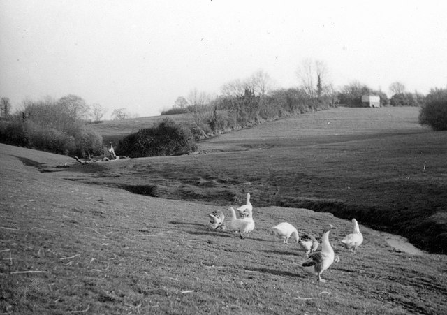
Walking through Castlake Quarry Copse, visitors can explore a network of well-maintained footpaths that wind their way through the trees, offering a tranquil and serene environment. The copse is home to a diverse range of wildlife, with numerous bird species, such as woodpeckers and song thrushes, frequently seen and heard. Small mammals, such as squirrels and rabbits, can also be spotted darting through the undergrowth.

The copse boasts a beautiful display of wildflowers during spring and summer, with bluebells, primroses, and foxgloves adding splashes of color to the forest floor. In addition to its natural beauty, Castlake Quarry Copse also has historical significance, with remnants of old stone quarries and mining activities dating back to the 19th century. These remnants provide an interesting insight into the area's industrial past.

Overall, Castlake Quarry Copse offers a peaceful and scenic retreat for nature lovers, providing a haven for wildlife and a serene escape from the hustle and bustle of everyday life.

If you have any feedback on the listing, please let us know in the comments section below.

Castlake Quarry Copse Images

Images are sourced within 2km of 51.115083/-3.2680663 or Grid Reference ST1135. Thanks to Geograph Open Source API. All images are credited.

Above Wood Farm, Stogumber, 1949 Three young boys messing around in the stream.
Above Wood Farm, Stogumber, 1949
Three young boys messing around in the stream.
Forge Cottage, Stogumber, 1950 The foreground has since been grown over with trees and bushes, and the stream dammed to form a small pond.
Forge Cottage, Stogumber, 1950
The foreground has since been grown over with trees and bushes, and the stream dammed to form a small pond.
Wood Lane, Stogumber, 1950 Looking towards Forge Cottage, on the right the entrance to Wood Farm.
Wood Lane, Stogumber, 1950
Looking towards Forge Cottage, on the right the entrance to Wood Farm.
Gate at Forge Cottage, Stogumber, 1950 The area beyond the gate now forms the garden of Forge Cottage. The 1:25k mapping still shows the public right of way running along this track, but the Current right of way mapping shows that it has been diverted to pass the cottage to the east on Wood Lane before rejoining the track visible above the gate approximately 100 metres further on.
Gate at Forge Cottage, Stogumber, 1950
The area beyond the gate now forms the garden of Forge Cottage. The 1:25k mapping still shows the public right of way running along this track, but the Current right of way mapping shows that it has been diverted to pass the cottage to the east on Wood Lane before rejoining the track visible above the gate approximately 100 metres further on.
Geese near Forge Cottage, Stogumber, 1950 The immediate foreground area is now grown over with trees and bushes and a small pond has been created in the stream as part of the grounds of Forge Cottage.
Geese near Forge Cottage, Stogumber, 1950
The immediate foreground area is now grown over with trees and bushes and a small pond has been created in the stream as part of the grounds of Forge Cottage.
Station Road, Stogumber
Channel to Channel (473) This junction is at Wood Farm.
Channel to Channel (473)
This junction is at Wood Farm.
Channel to Channel (474) Here's a look back towards Wood Farm.  See also the first submission for the square at <a title="https://www.geograph.org.uk/photo/108368" href="https://www.geograph.org.uk/photo/108368">Link</a>.
Channel to Channel (474)
Here's a look back towards Wood Farm. See also the first submission for the square at Link.
Channel to Channel (475) This stile is taken for the footpath to Stogumber.
Channel to Channel (475)
This stile is taken for the footpath to Stogumber.
Channel to Channel (476) Here the view is westwards over a barn roof.
Channel to Channel (476)
Here the view is westwards over a barn roof.
Channel to Channel (477) This is a look back to the road.
Channel to Channel (477)
This is a look back to the road.
Channel to Channel (478) The path goes through a gate into a scrubby area.
Channel to Channel (478)
The path goes through a gate into a scrubby area.
Lane from Stogumber to Wood Farm. Typical of the rolling countryside around Stogumber.Wood Farm and its buildings are in the middle distance.
Lane from Stogumber to Wood Farm.
Typical of the rolling countryside around Stogumber.Wood Farm and its buildings are in the middle distance.
Preston Farm , south of Stogumber. A typical Somerset farmhouse, recently refurbished and covered in limewash. The large tree is a weeping ash.
Preston Farm , south of Stogumber.
A typical Somerset farmhouse, recently refurbished and covered in limewash. The large tree is a weeping ash.
Stogumber School Stogumber is a small village to the west of the Quantock Hills. The village has a church, Post Office, village hall, school and a pub. A station on the West Somerset Line is to the east of the village.
Stogumber School
Stogumber is a small village to the west of the Quantock Hills. The village has a church, Post Office, village hall, school and a pub. A station on the West Somerset Line is to the east of the village.
Stogumber Village Hall Stogumber is a small village to the west of the Quantock Hills. The village has a church, Post Office, village hall, school and a pub. A station on the West Somerset Line is to the east of the village.
Stogumber Village Hall
Stogumber is a small village to the west of the Quantock Hills. The village has a church, Post Office, village hall, school and a pub. A station on the West Somerset Line is to the east of the village.
Hall Farm
Hall Farm
Show me another place!

Castlake Quarry Copse is located at Grid Ref: ST1135 (Lat: 51.115083, Lng: -3.2680663)

Administrative County: Somerset

District: Somerset West and Taunton

Police Authority: Avon and Somerset

What 3 Words

///folks.tilting.require. Near Williton, Somerset

Related Wikis

Stogumber railway station

Stogumber railway station is a station in Kingswood, Somerset, England which serves the nearby village of Stogumber. It was opened by the West Somerset...

Roebuck Meadows

Roebuck Meadows (grid reference ST132354) is a 3.6 hectare (8.9 acre) biological Site of Special Scientific Interest south of Crowcombe in Somerset, notified...

Stogumber

Stogumber () is a village and civil parish in Somerset, England, on the eastern flank of the Brendon Hills. Besides Stogumber village itself, the parish...

Halsway Manor

Halsway Manor (also known as Halsway Court) is a manor house in Halsway, Somerset. It is owned by the Halsway Manor Society who operate the manor as a...

Curdon Camp

Curdon Camp is a univallate Iron Age hill fort in the West Somerset district of Somerset, England. It is a Scheduled Ancient Monument.The hill fort is...

Crowcombe Court

Crowcombe Court in Crowcombe, Somerset, England is a large country house dating from 1724 to 1739. It is Grade I listed.It was built, in English regional...

Crowcombe Heathfield railway station

Crowcombe Heathfield railway station is a station on the West Somerset Railway, a heritage railway in Somerset, England. It is situated 2 miles (3.2 km...

Crowcombe

Crowcombe is a village and civil parish under the Quantock Hills in Somerset, England, 5.5 miles (9 km) southeast of Watchet, and 8 miles (13 km) from...

Nearby Amenities

Located within 500m of 51.115083,-3.2680663
Power: tower
Source: bing
Lat/Long: 51.1133437/-3.2688992
Power: tower
Source: bing
Lat/Long: 51.1165219/-3.2692371
Brand: National Grid
Brand Wikidata: Q1465461
Material: wood
Operator: National Grid Electricity Distribution Plc
Operator Old: Western Power Distribution
Operator Wikidata: Q7988183
Owner: National Grid Electricity Distribution (South West) Plc
Owner Wikidata: Q114397866
Power: pole
Lat/Long: 51.1132665/-3.274544
Brand: National Grid
Brand Wikidata: Q1465461
Material: wood
Operator: National Grid Electricity Distribution Plc
Operator Old: Western Power Distribution
Operator Wikidata: Q7988183
Owner: National Grid Electricity Distribution (South West) Plc
Owner Wikidata: Q114397866
Power: pole
Lat/Long: 51.1128043/-3.2737313
Brand: National Grid
Brand Wikidata: Q1465461
Material: wood
Operator: National Grid Electricity Distribution Plc
Operator Old: Western Power Distribution
Operator Wikidata: Q7988183
Owner: National Grid Electricity Distribution (South West) Plc
Owner Wikidata: Q114397866
Power: pole
Lat/Long: 51.1124103/-3.2730111
Brand: National Grid
Brand Wikidata: Q1465461
Material: wood
Operator: National Grid Electricity Distribution Plc
Operator Old: Western Power Distribution
Operator Wikidata: Q7988183
Owner: National Grid Electricity Distribution (South West) Plc
Owner Wikidata: Q114397866
Power: pole
Lat/Long: 51.1117039/-3.2717331
Brand: National Grid
Brand Wikidata: Q1465461
Material: wood
Operator: National Grid Electricity Distribution Plc
Operator Old: Western Power Distribution
Operator Wikidata: Q7988183
Owner: National Grid Electricity Distribution (South West) Plc
Owner Wikidata: Q114397866
Power: pole
Lat/Long: 51.1110547/-3.2705636
Give Way
Direction: forward
Lat/Long: 51.1117553/-3.2711624
Give Way
Direction: forward
Lat/Long: 51.111783/-3.2711604
Give Way
Direction: forward
Lat/Long: 51.1164026/-3.261542
Brand: National Grid
Brand Wikidata: Q1465461
Devices: 1
Frequency: 50
Guyed: yes
Location Transition: yes
Material: wood
Operator: National Grid Electricity Distribution Plc
Operator Old: Western Power Distribution
Operator Wikidata: Q7988183
Owner: National Grid Electricity Distribution (South West) Plc
Owner Wikidata: Q114397866
Phases: 1
Power: pole
Transformer: distribution
Lat/Long: 51.1116012/-3.2721274
The data included in this document is from www.openstreetmap.org. The data is made available under ODbL.

Have you been to Castlake Quarry Copse?

Leave your review of Castlake Quarry Copse below (or comments, questions and feedback).