Paddock Plantation

Wood, Forest in Cumberland Allerdale

England

Paddock Plantation

Hotchberry Road, near Cockermouth Hotchberry Road is a minor lane through Cumbrian countryside.
Hotchberry Road, near Cockermouth Credit: Malc McDonald

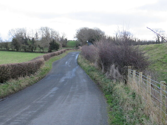
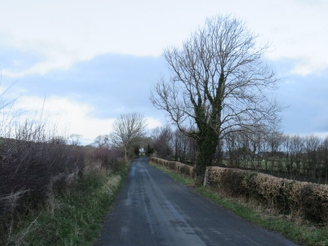
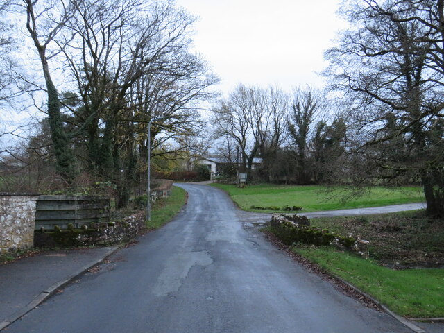
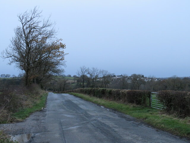
Paddock Plantation is a vast wooded area located in Cumberland, a historic county in the northwest of England. Spanning over several acres, the plantation is characterized by its dense forest, towering trees, and diverse wildlife. The area is renowned for its natural beauty and is a popular destination for nature enthusiasts and hikers.

The woodland in Paddock Plantation is predominantly composed of deciduous trees, such as oak, beech, and birch, which create a lush canopy that provides shade and shelter for a wide variety of flora and fauna. The forest floor is adorned with ferns, wildflowers, and mosses, adding to the charm and tranquility of the surroundings.

The plantation is home to numerous animal species, including deer, foxes, badgers, and a variety of bird species. Birdwatchers can catch glimpses of woodpeckers, owls, and thrushes among the rich avian population. The diverse ecosystem of Paddock Plantation also supports an abundance of insects, reptiles, and small mammals.

Visitors to the plantation can explore its many walking trails and enjoy the peaceful ambiance of the woods. The well-maintained paths meander through the forest, offering glimpses of picturesque clearings and small streams. The plantation is also equipped with picnic areas and benches, providing opportunities for visitors to relax and appreciate the natural surroundings.

Paddock Plantation is a cherished natural treasure in Cumberland, providing a haven for both wildlife and those seeking solace in nature. Its beautiful woodland, diverse wildlife, and tranquil atmosphere make it a must-visit destination for anyone looking to immerse themselves in the beauty of the English countryside.

If you have any feedback on the listing, please let us know in the comments section below.

Paddock Plantation Images

Images are sourced within 2km of 54.652351/-3.3858888 or Grid Reference NY1029. Thanks to Geograph Open Source API. All images are credited.

Hotchberry Road, near Cockermouth Hotchberry Road is a minor lane through Cumbrian countryside.
Hotchberry Road, near Cockermouth
Hotchberry Road is a minor lane through Cumbrian countryside.
Hotchberry Road, near Cockermouth Hotchberry Road is a minor lane through Cumbrian countryside.  This image was taken on a late November day.  The trees had shed their leaves over the preceding weeks, in preparation for the winter months ahead.
Hotchberry Road, near Cockermouth
Hotchberry Road is a minor lane through Cumbrian countryside. This image was taken on a late November day. The trees had shed their leaves over the preceding weeks, in preparation for the winter months ahead.
Ellerbeck Brow, Brigham, near Cockermouth Ellerbeck Brow is a minor road entering the village of Brigham in Cumbria.
Ellerbeck Brow, Brigham, near Cockermouth
Ellerbeck Brow is a minor road entering the village of Brigham in Cumbria.
Brigham Road, near Cockermouth Brigham Road is a minor road leading to the village of Brigham, in Cumbria.  Here, the speed limit changes to 30 miles per hour through the village ahead.
Brigham Road, near Cockermouth
Brigham Road is a minor road leading to the village of Brigham, in Cumbria. Here, the speed limit changes to 30 miles per hour through the village ahead.
Direction Sign – Signpost in Eaglesfield Located on the south side of the T junction in Eaglesfield, Dean parish. 2 arms and annulus finial. See also <span class="nowrap"><a title="http://www.geog.port.ac.uk/webmap/thelakes/photos/bwa65.jpg" rel="nofollow ugc noopener" href="http://www.geog.port.ac.uk/webmap/thelakes/photos/bwa65.jpg">Link</a><img style="margin-left:2px;" alt="External link" title="External link - shift click to open in new window" src="https://s1.geograph.org.uk/img/external.png" width="10" height="10"/></span>.

Milestone Society National ID: CU_NY0928
Direction Sign – Signpost in Eaglesfield
Located on the south side of the T junction in Eaglesfield, Dean parish. 2 arms and annulus finial. See also LinkExternal link. Milestone Society National ID: CU_NY0928
Brigham, near Cockermouth The village of Brigham lies approximately two miles west of Cockermouth, in Cumbria.
Brigham, near Cockermouth
The village of Brigham lies approximately two miles west of Cockermouth, in Cumbria.
Ellerbeck Brow, Brigham, near Cockermouth Ellerbeck Brow is a minor road leading out of the village of Brigham, in Cumbria.
Ellerbeck Brow, Brigham, near Cockermouth
Ellerbeck Brow is a minor road leading out of the village of Brigham, in Cumbria.
Ellerbeck Brow, Brigham, near Cockermouth Ellerbeck Brow is a minor road leading out of the village of Brigham in Cumbria.  Here the road crosses Eller Beck, a small stream.
Ellerbeck Brow, Brigham, near Cockermouth
Ellerbeck Brow is a minor road leading out of the village of Brigham in Cumbria. Here the road crosses Eller Beck, a small stream.
Brigham Road, near Cockermouth Brigham Road is a minor road in Cumbria.  It leads to the village of Brigham, visible on the hillside in the distance.
Brigham Road, near Cockermouth
Brigham Road is a minor road in Cumbria. It leads to the village of Brigham, visible on the hillside in the distance.
Black Cock Inn (former) "John Holmes" picture of 2005 showed this pub as a welcoming place serving ales & good grub, but now it is quite the opposite. The only things thriving here are the brambles growing over the door & windows.
Black Cock Inn (former)
"John Holmes" picture of 2005 showed this pub as a welcoming place serving ales & good grub, but now it is quite the opposite. The only things thriving here are the brambles growing over the door & windows.
Entering Eaglesfield from the East Looking along the minor country road which becomes the main street through Eaglesfield. The small village is located to the south west of Cockermouth.
Entering Eaglesfield from the East
Looking along the minor country road which becomes the main street through Eaglesfield. The small village is located to the south west of Cockermouth.
Entrance into Hollins Farm, Eaglesfield Looking through the gate into the steading of Hollins Farm on the outskirts of Eaglesfield. The sun has broken through a small gap in the clouds and is reflecting off the wet concrete of the farmyard.
Entrance into Hollins Farm, Eaglesfield
Looking through the gate into the steading of Hollins Farm on the outskirts of Eaglesfield. The sun has broken through a small gap in the clouds and is reflecting off the wet concrete of the farmyard.
Hollins Farm, Eaglesfield Looking across a grass paddock towards the buildings at Hollins Farm. The buildings of the farm appear to be laid out in a linear fashion leading away from the road up the hillside.
Hollins Farm, Eaglesfield
Looking across a grass paddock towards the buildings at Hollins Farm. The buildings of the farm appear to be laid out in a linear fashion leading away from the road up the hillside.
The former Black Cock Inn, Eaglesfield The former Black Cock Inn in Eaglesfield. The long established pub closed in 2010 following the death of its long serving landlady. In 2013 a planning application was submitted to the local council to convert the pub into 2 dwellings and that work appears to be in progress here. A link to a local newspaper article detailing the pubs sad demise can be found here: <span class="nowrap"><a title="http://www.newsandstar.co.uk/news/plan-to-turn-cumbrian-pub-into-houses-1.1099742" rel="nofollow ugc noopener" href="http://www.newsandstar.co.uk/news/plan-to-turn-cumbrian-pub-into-houses-1.1099742">Link</a><img style="margin-left:2px;" alt="External link" title="External link - shift click to open in new window" src="https://s1.geograph.org.uk/img/external.png" width="10" height="10"/></span>
The former Black Cock Inn, Eaglesfield
The former Black Cock Inn in Eaglesfield. The long established pub closed in 2010 following the death of its long serving landlady. In 2013 a planning application was submitted to the local council to convert the pub into 2 dwellings and that work appears to be in progress here. A link to a local newspaper article detailing the pubs sad demise can be found here: LinkExternal link
Phone box and post box, Eaglesfield A public telephone box, post box and litter bin stand next to each other beside the road in the centre of Eaglesfield.
Phone box and post box, Eaglesfield
A public telephone box, post box and litter bin stand next to each other beside the road in the centre of Eaglesfield.
Eaglesfield village scene A scene in the centre of Eaglesfield showing a grassed area in the foreground and a community noticeboard. A post box and telephone box are located further up the road which is lined with a range of different houses.
Eaglesfield village scene
A scene in the centre of Eaglesfield showing a grassed area in the foreground and a community noticeboard. A post box and telephone box are located further up the road which is lined with a range of different houses.
The birthplace of John Dalton, Eaglesfield This small cottage in Eaglesfield was the birthplace of John Dalton, a meteorologist and scientist, best known for his work on colour blindness and development of modern atomic theory. 

The cottage itself is grade II listed and now forms one property with the larger house which is mostly out of shot on the left. The building dates from the mid 17th Century. English Heritage listing text can be found here: <span class="nowrap"><a title="http://list.english-heritage.org.uk/resultsingle.aspx?uid=1326881" rel="nofollow ugc noopener" href="http://list.english-heritage.org.uk/resultsingle.aspx?uid=1326881">Link</a><img style="margin-left:2px;" alt="External link" title="External link - shift click to open in new window" src="https://s1.geograph.org.uk/img/external.png" width="10" height="10"/></span>

Some of his remarkable achievements and his legacy can be found at Wikipedia <span class="nowrap"><a title="http://en.wikipedia.org/wiki/John_Dalton" rel="nofollow ugc noopener" href="http://en.wikipedia.org/wiki/John_Dalton">Link</a><img style="margin-left:2px;" alt="External link" title="External link - shift click to open in new window" src="https://s1.geograph.org.uk/img/external.png" width="10" height="10"/></span> and at Biography.com <span class="nowrap"><a title="http://www.biography.com/people/john-dalton-9265201#synopsis" rel="nofollow ugc noopener" href="http://www.biography.com/people/john-dalton-9265201#synopsis">Link</a><img style="margin-left:2px;" alt="External link" title="External link - shift click to open in new window" src="https://s1.geograph.org.uk/img/external.png" width="10" height="10"/></span>
The birthplace of John Dalton, Eaglesfield
This small cottage in Eaglesfield was the birthplace of John Dalton, a meteorologist and scientist, best known for his work on colour blindness and development of modern atomic theory. The cottage itself is grade II listed and now forms one property with the larger house which is mostly out of shot on the left. The building dates from the mid 17th Century. English Heritage listing text can be found here: LinkExternal link Some of his remarkable achievements and his legacy can be found at Wikipedia LinkExternal link and at Biography.com LinkExternal link
Inscription above the door, birthplace of John Dalton, Eaglesfield The inscription painted on a panel of wood above the door to the cottage <a href="https://www.geograph.org.uk/photo/4245522">NY0928 : The birthplace of John Dalton, Eaglesfield</a> in which John Dalton, scientist, was born in 1766. The cottage (and the adjoining farm house) is grade II listed. 

The inscription reads:
JOHN DALTON DCL LLD
THE DISCOVERER OF
THE ATOMIC THEORY
WAS BORN HERE SEPT 5 1766
DIED AT MANCHESTER JULY 27 1844
Inscription above the door, birthplace of John Dalton, Eaglesfield
The inscription painted on a panel of wood above the door to the cottage NY0928 : The birthplace of John Dalton, Eaglesfield in which John Dalton, scientist, was born in 1766. The cottage (and the adjoining farm house) is grade II listed. The inscription reads: JOHN DALTON DCL LLD THE DISCOVERER OF THE ATOMIC THEORY WAS BORN HERE SEPT 5 1766 DIED AT MANCHESTER JULY 27 1844
Show me another place!

Paddock Plantation is located at Grid Ref: NY1029 (Lat: 54.652351, Lng: -3.3858888)

Administrative County: Cumbria

District: Allerdale

Police Authority: Cumbria

What 3 Words

///confronts.bulges.other. Near Cockermouth, Cumbria

Related Wikis

Cockermouth railway station (Cockermouth and Workington Railway)

The original Cockermouth railway station was the eastern terminus of the Cockermouth & Workington Railway. It served the town of Cockermouth, Cumbria,...

Cockermouth railway station

Cockermouth railway station was situated on the Cockermouth, Keswick and Penrith Railway and served the town of Cockermouth, Cumbria, England. The station...
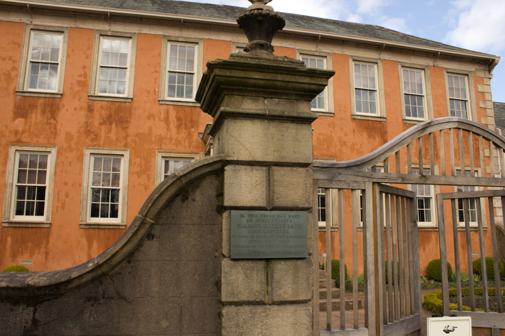
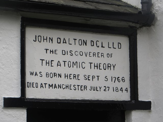
Wordsworth House

Wordsworth House is a Georgian townhouse situated in Cockermouth, Cumbria, England, and in the ownership of the National Trust. It was built in the mid...

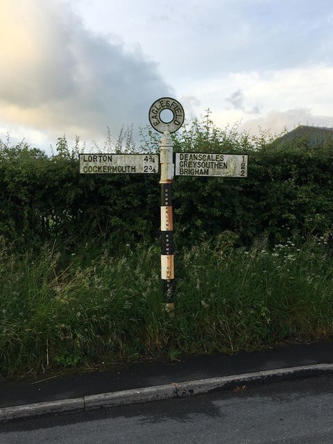
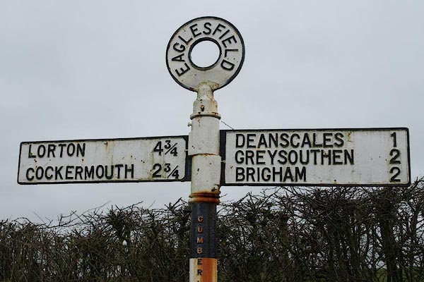
Eaglesfield, Cumbria

Eaglesfield is a village in the parish of Dean in Cumberland in Cumbria, England. It is near the A5086 road, 2.5 miles (4 km) southwest of Cockermouth...

Cockermouth Rural District

Cockermouth was a rural district in Cumberland, England, from 1894 to 1974. It was created by the Local Government Act 1894 based on Cockermouth rural...

Cockermouth United Reformed Church

Cockermouth United Reformed Church is a congregation first established at Cockermouth, England, in 1651. Originally known as Cockermouth Independent Church...
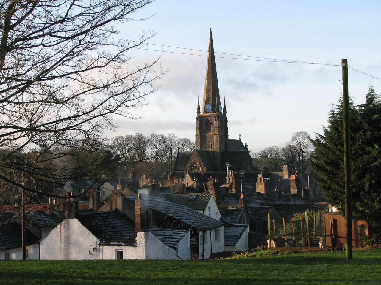
Cockermouth

Cockermouth is a market town and civil parish in the Cumberland unitary area of Cumbria, England, so named because it is at the confluence of the River...

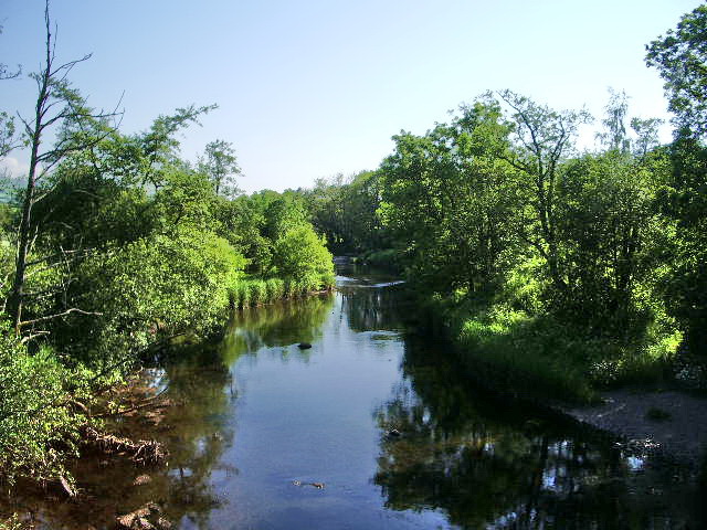
River Cocker, Cumbria

The River Cocker is a river in the Lake District in North West England, in the county of Cumbria. Its source is at the head of the Buttermere valley. It...

Nearby Amenities

Located within 500m of 54.652351,-3.3858888
Cafe
Wellington Farm Cafe & Tearoom
Addr City: Cockermouth
Addr Postcode: CA13 0QU
Addr Street: Lamplugh Road
Phone: +44 1900 822777
Website: https://www.wellingtonjerseys.co.uk/
Lat/Long: 54.6528873/-3.3840942
Harrot Hill
Ele: 118
Natural: peak
Lat/Long: 54.6552542/-3.384387
Wellington Plantation
Place: locality
Lat/Long: 54.6512886/-3.3901423
Power: pole
Lat/Long: 54.653306/-3.383875
Power: pole
Lat/Long: 54.6537138/-3.3837717
Power: pole
Lat/Long: 54.6541333/-3.3836603
Power: pole
Lat/Long: 54.6549513/-3.3834638
Power: pole
Lat/Long: 54.6557059/-3.3832633
The data included in this document is from www.openstreetmap.org. The data is made available under ODbL.

Have you been to Paddock Plantation?

Leave your review of Paddock Plantation below (or comments, questions and feedback).