Haggs Wood
Wood, Forest in Cumberland Copeland
England
Haggs Wood

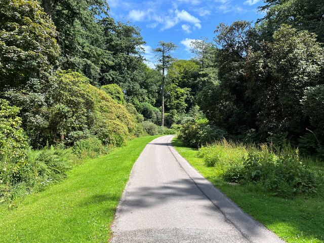
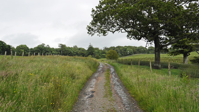
Haggs Wood, located in Cumberland, England, is a picturesque woodland area known for its natural beauty and rich biodiversity. Covering an approximate area of 100 acres, this enchanting forest is home to a diverse range of flora and fauna, making it a popular destination for nature enthusiasts and hikers alike.
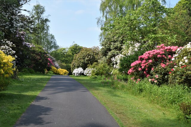
The wood is predominantly composed of native tree species such as oak, beech, and ash, which create a dense canopy, providing shade and shelter for the woodland floor. A variety of smaller plants and flowers, including bluebells, primroses, and wild garlic, can be found carpeting the forest floor during the spring months, adding vibrant splashes of color to the landscape.
Haggs Wood is not only visually stunning but also serves as a haven for numerous wildlife species. The forest provides a habitat for various birds, including woodpeckers, thrushes, and owls, which can often be spotted flitting through the trees or heard singing their melodic tunes. Additionally, the wood is home to a range of mammals, such as badgers, foxes, and squirrels, which thrive in this natural environment.
The wood is crisscrossed by a network of well-maintained walking trails, enabling visitors to explore its beauty while enjoying the tranquility and peacefulness of the surroundings. These trails offer breathtaking views of the surrounding countryside, making it an ideal location for photography enthusiasts.
Overall, Haggs Wood in Cumberland is a captivating forest that offers a serene escape from the hustle and bustle of daily life, providing visitors with an opportunity to connect with nature and appreciate the wonders of the natural world.
If you have any feedback on the listing, please let us know in the comments section below.
Haggs Wood Images
Images are sourced within 2km of 54.350717/-3.3761318 or Grid Reference SD1095. Thanks to Geograph Open Source API. All images are credited.


Haggs Wood is located at Grid Ref: SD1095 (Lat: 54.350717, Lng: -3.3761318)
Administrative County: Cumbria
District: Copeland
Police Authority: Cumbria
What 3 Words
///playing.bloodshot.scorching. Near Seascale, Cumbria
Nearby Locations
Related Wikis

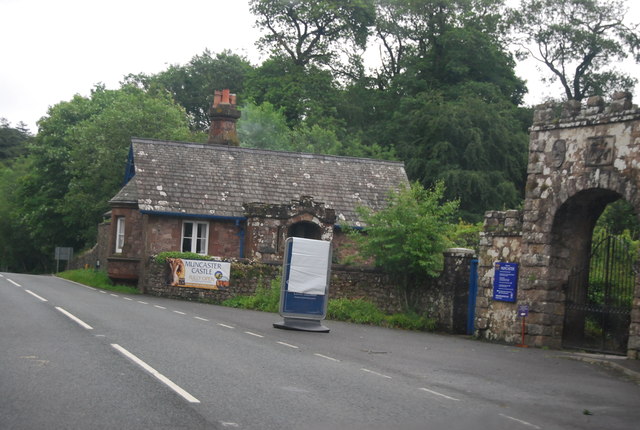
Muncaster Castle
Muncaster Castle is a privately owned castle overlooking the River Esk, about a mile east of the west-coastal town of Ravenglass in Cumbria, England. It...

Muncaster
Muncaster is a civil parish in Cumbria, North West England. The parish is 41 miles (66 km) south west of the city of Carlisle, in the Copeland district...

St Michael's Church, Muncaster
St Michael's Church is in the grounds of Muncaster Castle, near Ravenglass, Cumbria, England. It is an active Anglican parish church in the deanery of...

St John's Church, Waberthwaite
St John's Church is situated on the south bank of the River Esk in the hamlet of Hall Waberthwaite in the former civil parish of Waberthwaite (now part...

Broad Oak, Cumbria
Broad Oak is a hamlet in Cumbria, England. It is located along the A595 road, 14.4 miles (23.2 km) by road south of Egremont. == See also == List of places...

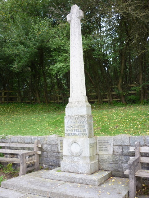
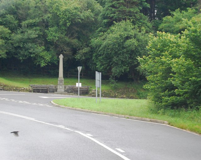
Muncaster War Memorial
Muncaster War Memorial is a First World War memorial in the parish of Muncaster on the west coast of Cumbria in the far north-west of England. The memorial...
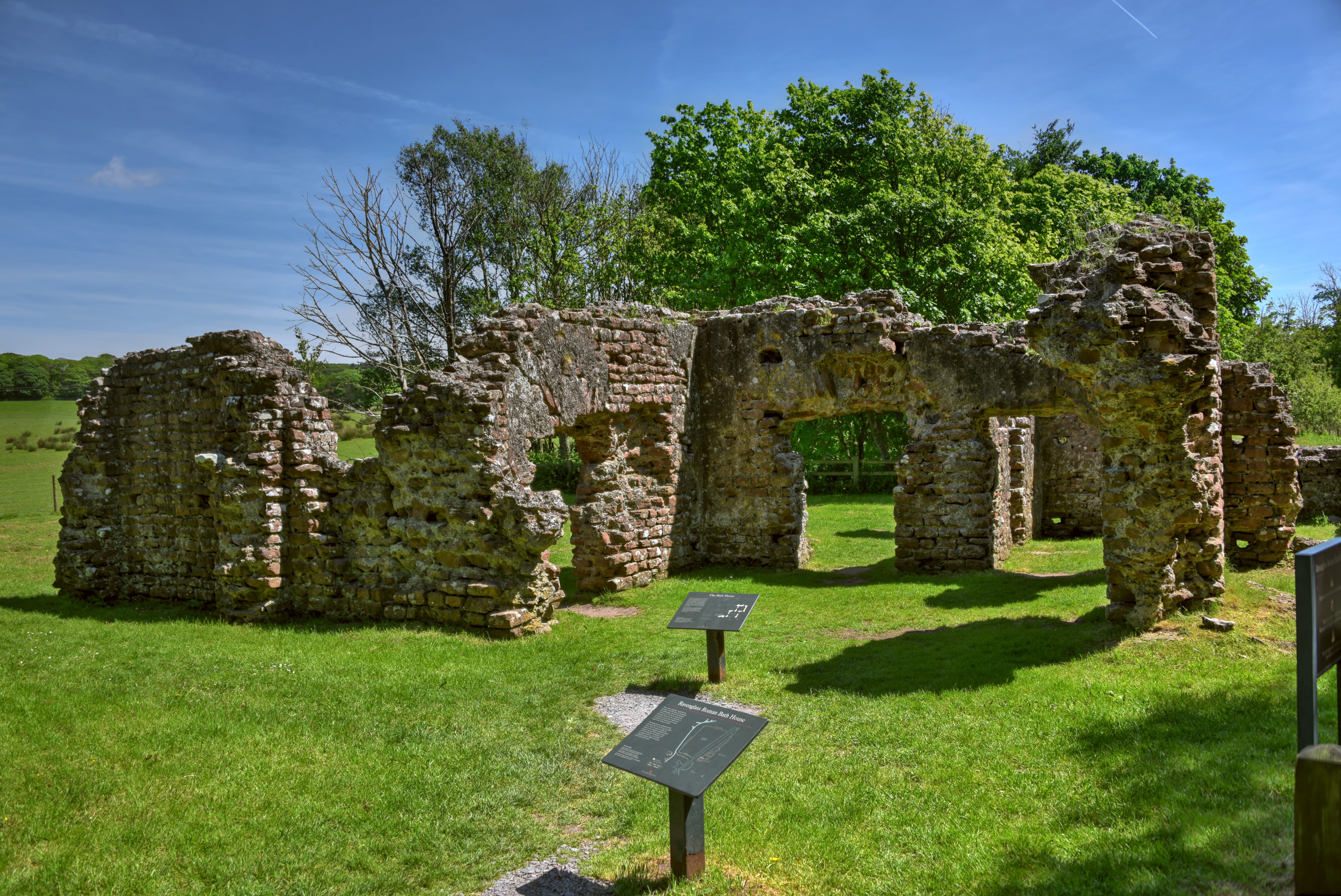
Ravenglass Roman Bath House
Ravenglass Roman Bath House (also known as Walls Castle) is a ruined ancient Roman bath house at Ravenglass, Cumbria, England. Belonging to a 2nd-century...
Glannoventa
Glannoventa is a Roman fort associated with the Roman naval base at Ravenglass in Cumbria, England. Its name is derived from the Latin place-name Clanoventa...
Nearby Amenities
Located within 500m of 54.350717,-3.3761318Have you been to Haggs Wood?
Leave your review of Haggs Wood below (or comments, questions and feedback).