Annishader

Settlement in Inverness-shire

Scotland

Annishader

Loch Eyre sunset A spectacular sky seen over Loch Eyre as the sun drops behind Lyndale Point.
Loch Eyre sunset Credit: John Allan

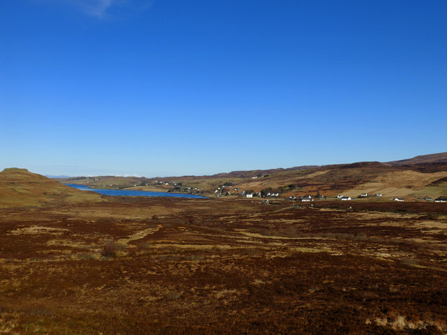
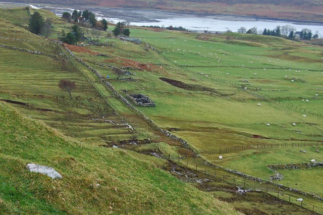
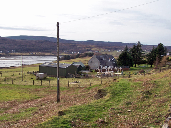
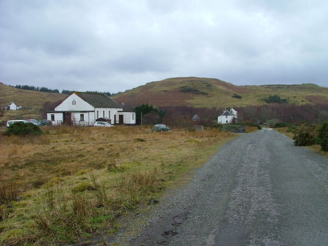
Annishader is a small village located in Inverness-shire, Scotland. Situated in the western part of the region, Annishader is nestled in a picturesque valley surrounded by rolling hills and breathtaking landscapes. It falls within the Highland Council area and is part of the wider Isle of Skye community.

With a population of around 200 residents, Annishader is known for its tranquil atmosphere and unspoiled natural beauty. The village offers a peaceful escape from the hustle and bustle of city life, making it a popular destination for those seeking relaxation and rejuvenation in a serene setting.

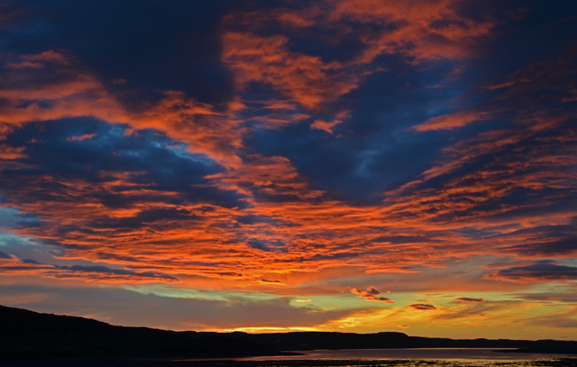
One of the notable features of Annishader is its proximity to the stunning Portree Bay, which is just a short distance away. This allows residents and visitors to enjoy the scenic coastal views and engage in various outdoor activities such as hiking, fishing, and wildlife spotting. The village also boasts easy access to the famous Quiraing, a unique geological formation renowned for its striking rock formations and dramatic landscapes.

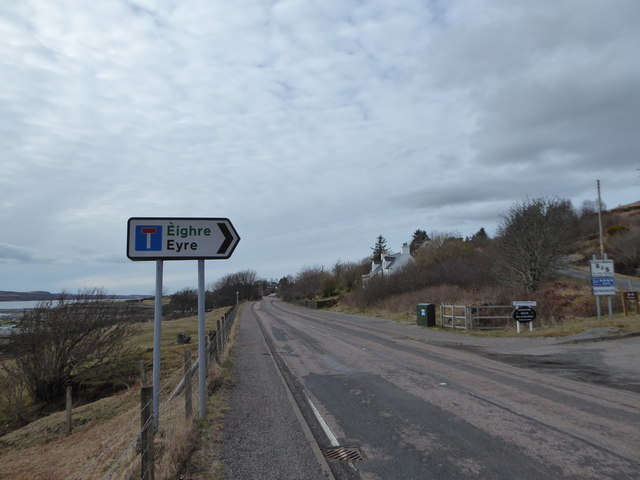
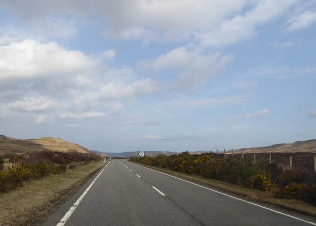
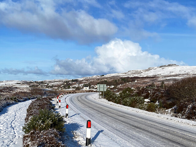
In terms of amenities, Annishader has limited facilities, but neighboring towns like Portree provide a wider range of services including shops, restaurants, and accommodation options. The village is well-connected by road, with the A855 providing access to other parts of the Isle of Skye and the mainland.

Overall, Annishader offers a peaceful and idyllic setting for those seeking a rural escape in the heart of the Scottish Highlands. Its natural beauty and proximity to popular tourist attractions make it an attractive destination for nature enthusiasts and outdoor adventurers.

If you have any feedback on the listing, please let us know in the comments section below.
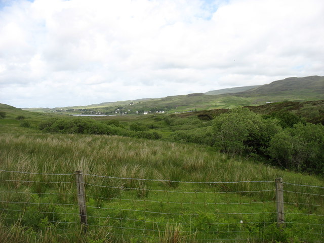
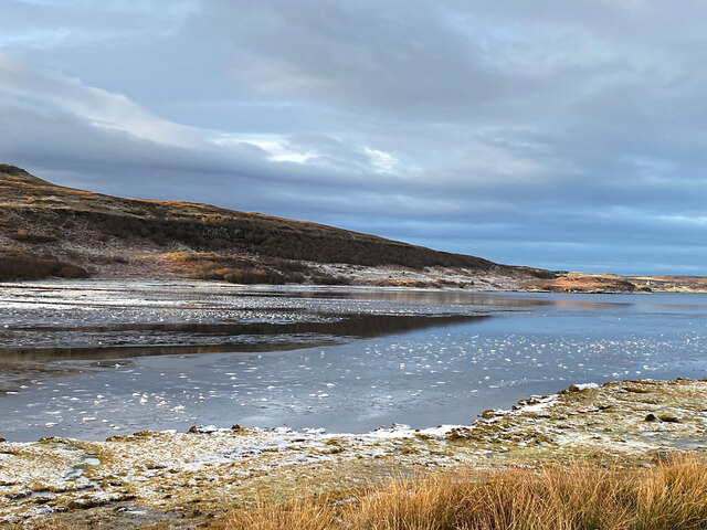
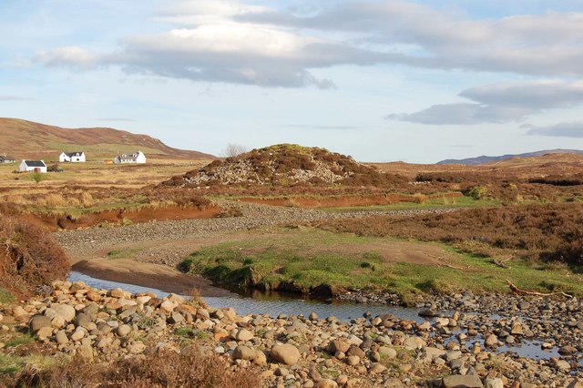
Annishader Images

Images are sourced within 2km of 57.476704/-6.291517 or Grid Reference NG4251. Thanks to Geograph Open Source API. All images are credited.

Loch Eyre sunset A spectacular sky seen over Loch Eyre as the sun drops behind Lyndale Point.
Loch Eyre sunset
A spectacular sky seen over Loch Eyre as the sun drops behind Lyndale Point.
Moorland at Prabost Taken from the high point of this expanse of rough moorland, looking towards Kensaleyre and Loch Eyre.
Moorland at Prabost
Taken from the high point of this expanse of rough moorland, looking towards Kensaleyre and Loch Eyre.
Church of Scotland, Kensaleyre
Snizort Parish Church, Kensaleyre Situated at the head of Loch Eyre, at the south end of the settlement of Kensaleyre, this Church of Scotland building is by James Gillespie Graham and dates from 1801.
Snizort Parish Church, Kensaleyre
Situated at the head of Loch Eyre, at the south end of the settlement of Kensaleyre, this Church of Scotland building is by James Gillespie Graham and dates from 1801.
Croft land at Keistle Rough grazing for sheep in the settlement of Keistle. The far summit is the less familiar western flank of the famous Storr. <a href="https://www.geograph.org.uk/photo/1034984">NG4953 : The Storr over Loch Fada</a>
Croft land at Keistle
Rough grazing for sheep in the settlement of Keistle. The far summit is the less familiar western flank of the famous Storr. NG4953 : The Storr over Loch Fada
Where? Eyre! With apologies to Dave Fergusson who got there first <a title="https://www.geograph.org.uk/photo/2018679" href="https://www.geograph.org.uk/photo/2018679">Link</a>
Where? Eyre!
With apologies to Dave Fergusson who got there first Link
Turning for Prabost
Turning for Prabost
Bridge over the River Haultin
A87 at Eyre
A87 at Eyre
Country south of Eyre
The church at Kensaleyre
Banks of Loch Eyre
Banks of Loch Eyre
Church at Kensaleyre
Ice near the head of Loch Eyre The loch here is shallow and dries at low tide. The River Haultin enters the sea close by, so the water is quite low in salinity and prone to freezing in cold weather.
Ice near the head of Loch Eyre
The loch here is shallow and dries at low tide. The River Haultin enters the sea close by, so the water is quite low in salinity and prone to freezing in cold weather.
The A87 to Uig, approaching the Annishader junction
A87 The A87 runs 99 miles from Invergarry to Uig on the Isle of Skye <a href="https://www.geograph.org.uk/photo/7374675">NG3863 : End of the A87, Uig</a>.
<span class="nowrap"><a title="https://www.sabre-roads.org.uk/wiki/index.php?title=A87" rel="nofollow ugc noopener" href="https://www.sabre-roads.org.uk/wiki/index.php?title=A87">Link</a><img style="margin-left:2px;" alt="External link" title="External link - shift click to open in new window" src="https://s1.geograph.org.uk/img/external.png" width="10" height="10"/></span>
A87
The A87 runs 99 miles from Invergarry to Uig on the Isle of Skye NG3863 : End of the A87, Uig. LinkExternal link
Moorland near Prabost Moorland beside the A87 Uig road.
Moorland near Prabost
Moorland beside the A87 Uig road.
Show me another place!

Annishader is located at Grid Ref: NG4251 (Lat: 57.476704, Lng: -6.291517)

Unitary Authority: Highland

Police Authority: Highlands and Islands

What 3 Words

///clutches.vanished.confined. Near Portree, Highland

Related Wikis

Nearby Amenities

Located within 500m of 57.476704,-6.291517
Birkisco
Name Gd: Birceasgo
Place: hamlet
Source: NLS-OS 6 INCH 1842-82.
Lat/Long: 57.4777062/-6.2846156
Ardachaidh B&B
Addr City: Snizort
Addr Postcode: IV51 9XF
Addr Street: Rhenetra
Email: evi777@hotmail.co.uk
Phone: +44 1470 532525
Tourism: guest_house
Lat/Long: 57.4802796/-6.2890734
Power: pole
Lat/Long: 57.4807191/-6.2905571
Power: pole
Lat/Long: 57.4803609/-6.2905169
Power: pole
Lat/Long: 57.4795677/-6.2904182
Power: pole
Lat/Long: 57.4786889/-6.2903196
Power: pole
Lat/Long: 57.4778827/-6.2898465
Power: pole
Lat/Long: 57.4773686/-6.2895547
Power: pole
Lat/Long: 57.4767193/-6.2891762
Power: pole
Lat/Long: 57.4759184/-6.2887253
Power: pole
Lat/Long: 57.4753058/-6.288365
Power: pole
Lat/Long: 57.4746618/-6.2879805
Power: pole
Lat/Long: 57.4740449/-6.2876141
Power: pole
Lat/Long: 57.4733479/-6.2872075
Power: pole
Lat/Long: 57.480679/-6.2907121
Power: pole
Lat/Long: 57.4796845/-6.2905913
Power: pole
Lat/Long: 57.4786662/-6.2904746
Power: pole
Lat/Long: 57.4778426/-6.2900056
Power: pole
Lat/Long: 57.4768816/-6.2894419
Power: pole
Lat/Long: 57.4760104/-6.2889306
Power: pole
Lat/Long: 57.4751976/-6.2884616
Power: pole
Lat/Long: 57.474191/-6.2878698
Power: pole
Lat/Long: 57.473218/-6.2873062
Rhenetra
Name En: Rhenetra
Name Gd: Rèineatra
Place: hamlet
Lat/Long: 57.4802055/-6.2924877
The data included in this document is from www.openstreetmap.org. The data is made available under ODbL.

Have you been to Annishader?

Leave your review of Annishader below (or comments, questions and feedback).