Annitsford

Settlement in Northumberland

England

Annitsford

Front Street (B1505), Annitsford
Front Street (B1505), Annitsford Credit: habiloid

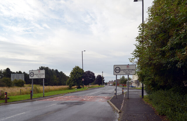
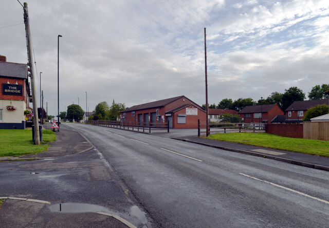
Annitsford is a small village located in the county of Northumberland, in the northeast of England. Situated approximately 8 miles north of Newcastle upon Tyne, it falls within the administrative boundaries of the North Tyneside Council.

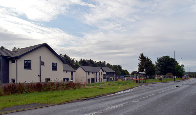
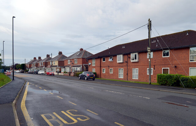
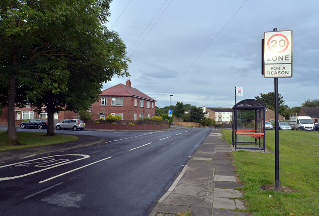
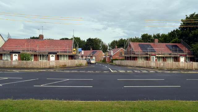
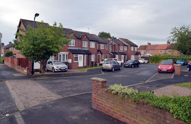
The village is primarily residential in nature, with a population of around 4,000 people. It is known for its close-knit community and friendly atmosphere. Annitsford offers a range of housing options, including detached houses, semi-detached houses, and bungalows, catering to different preferences and needs.

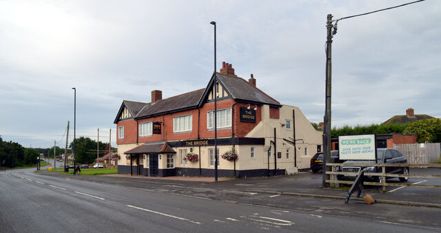
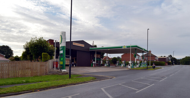
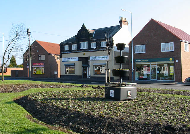
In terms of amenities, Annitsford has a few local shops, including convenience stores, a post office, and a pharmacy, providing residents with essential services. Additionally, there are a couple of traditional pubs in the area where locals can socialize and relax.

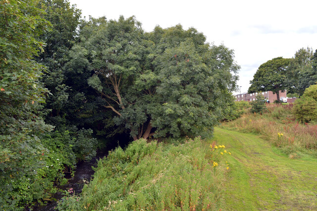
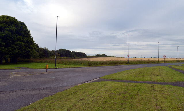
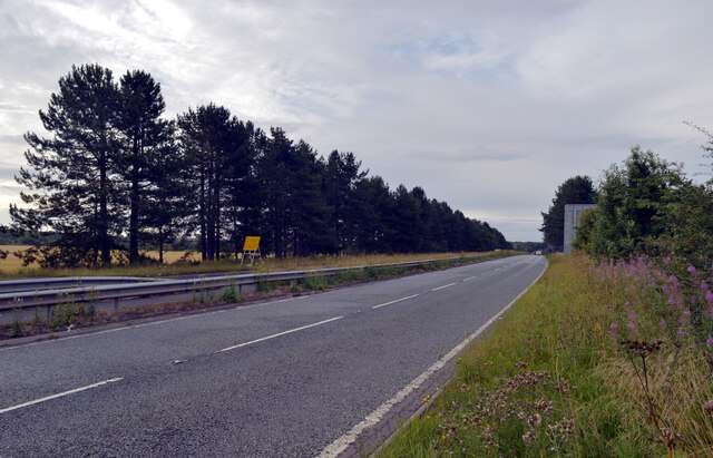
For outdoor enthusiasts, Annitsford boasts several green spaces, including the nearby East Cramlington Nature Reserve. This nature reserve offers beautiful walking trails and is home to a variety of wildlife, providing opportunities for peaceful and scenic walks.

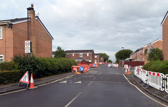
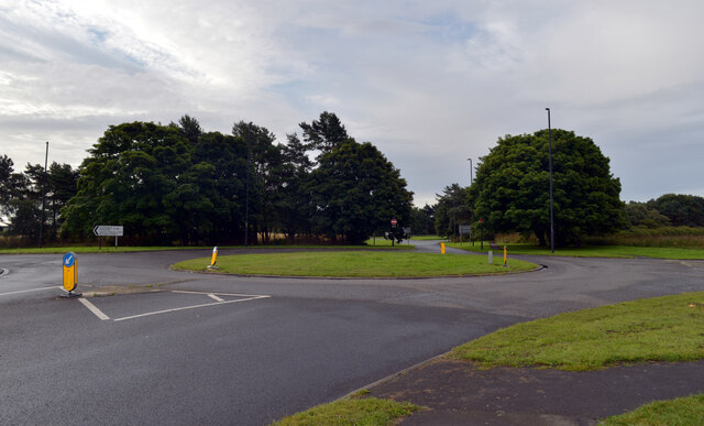
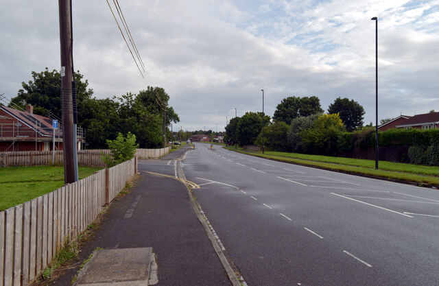
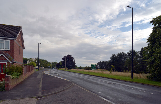
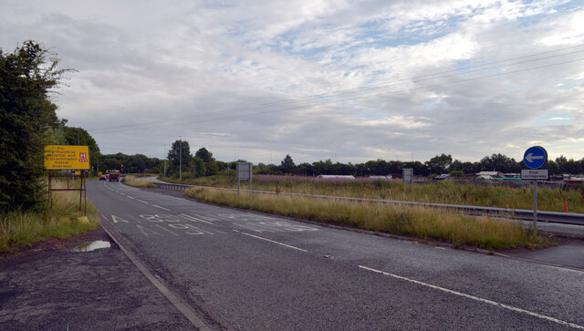
Transport links in Annitsford are well-developed, with easy access to major roads such as the A19 and A189, which connect the village to surrounding towns and cities. There are also regular bus services that operate in the area, providing convenient transportation options for residents.

Overall, Annitsford offers a quiet and picturesque place to live, with its friendly community, range of housing options, and easy access to amenities and transportation links.

If you have any feedback on the listing, please let us know in the comments section below.

Annitsford Images

Images are sourced within 2km of 55.060683/-1.581161 or Grid Reference NZ2674. Thanks to Geograph Open Source API. All images are credited.

Front Street (B1505), Annitsford
New houses, Front Street (B1505), Annitsford
Front Street (B1505), Annitsford
The Bridge, Front Street (B1505), Annitsford
Harrison Court, Annitsford
Seaton Burn seen from Front Street, Annitsford
Petrol station, Front Street (B1505), Annitsford
Roundabout at the junction of Front Street (B1505) and the B1321, Annitsford
The B1321, Annitsford Leaving the roundabout at its junction with Front Street (B1505).
The B1321, Annitsford
Leaving the roundabout at its junction with Front Street (B1505).
Petrol station, Front Street (B1505), Annitsford
Fern Drive, Annitsford
Front Street (B1505), Annitsford
Bridge Cottages seen from Front Street (B1505), Annitsford
Front Street (B1505), Annitsford The Bridge pub and Bridge Garage are on this part of Front Street; houses on The Spinney can be seen behind the garage.
Front Street (B1505), Annitsford
The Bridge pub and Bridge Garage are on this part of Front Street; houses on The Spinney can be seen behind the garage.
Front Street (B1505), Annitsford The large road sign beyond the grass is on the A189.
Front Street (B1505), Annitsford
The large road sign beyond the grass is on the A189.
Hanover Court seen from Front Street (B1505), Annitsford
The A189, Annitsford The A189 is an important A-road in southeast Northumberland, running for almost 21 miles from Gateshead to Ashington.

North of urban Tyne and Wear, the A189 is often referred to as simply “the Spine Road”. It is an example of a road which was constructed to promote regeneration of a whole area by improving road access to Tyneside and the A1 and A19 trunk roads. Construction of the Spine Road was undertaken in stages in the late 1960s and 1970s to facilitate regeneration of the historic coalfield area of South East Northumberland, which by this time was suffering from pit closures and loss of employment.

<span class="nowrap"><a title="https://www.sabre-roads.org.uk/wiki/index.php?title=A189" rel="nofollow ugc noopener" href="https://www.sabre-roads.org.uk/wiki/index.php?title=A189">Link</a><img style="margin-left:2px;" alt="External link" title="External link - shift click to open in new window" src="https://s1.geograph.org.uk/img/external.png" width="10" height="10"/></span> SABRE
<span class="nowrap"><a title="https://www.ciht.org.uk/media/8078/the_a189_spine_road.pdf" rel="nofollow ugc noopener" href="https://www.ciht.org.uk/media/8078/the_a189_spine_road.pdf">Link</a><img style="margin-left:2px;" alt="External link" title="External link - shift click to open in new window" src="https://s1.geograph.org.uk/img/external.png" width="10" height="10"/></span> CIHT
The A189, Annitsford
The A189 is an important A-road in southeast Northumberland, running for almost 21 miles from Gateshead to Ashington. North of urban Tyne and Wear, the A189 is often referred to as simply “the Spine Road”. It is an example of a road which was constructed to promote regeneration of a whole area by improving road access to Tyneside and the A1 and A19 trunk roads. Construction of the Spine Road was undertaken in stages in the late 1960s and 1970s to facilitate regeneration of the historic coalfield area of South East Northumberland, which by this time was suffering from pit closures and loss of employment. LinkExternal link SABRE LinkExternal link CIHT
Show me another place!

Annitsford is located at Grid Ref: NZ2674 (Lat: 55.060683, Lng: -1.581161)

Unitary Authority: North Tyneside

Police Authority: Northumbria

What 3 Words

///intend.loose.asset. Near Seghill, Northumberland

Nearby Locations

Valley Park Annitsford

Related Wikis

Related Videos

Travel To UK 🇬🇧Competition! First Trip to UK, මගේ පලමු UK ගමන Vlog, 2වන International Competition

Travel To UK Competition! First Trip to UK, මගේ පලමු UK ගමන Vlog, 2වන International Competition ...

Walking, waffling, foraging for wild garlic, spooky statues and giant spoon art

Local door to door walk. Not been round this way for a while now. Had the urge to get some wild garlic and see the giant spoon ...

Tyne & Wear Heritage Way - Stages 3&4 - Burradon to Ponteland to Wylam

Stage 3 - Burradon to Ponteland, 8.5 miles. Passing almost straight away through the beautiful Weetslade County Park then Big ...

Nearby Amenities

Located within 500m of 55.060683,-1.581161
Annitsford
Place: village
Wikidata: Q4769545
Lat/Long: 55.0601705/-1.5802372
Post Box
Operator: Royal Mail
Operator Wikidata: Q638098
Post Box Type: lamp
Postal Code: NE23 7AH
Ref: NE23 89
Royal Cypher: EIIR
Royal Cypher Wikidata: Q33102113
Lat/Long: 55.056407/-1.5829284
Post Box
Postal Code: NE23 7UD
Ref: NE23 805
Lat/Long: 55.0599451/-1.585155
Post Box
Drive Through: no
Operator: Royal Mail
Operator Wikidata: Q638098
Postal Code: NE23 7BF
Ref: NE23 11
Lat/Long: 55.0642255/-1.5813871
Post Box
Drive Through: no
Operator: Royal Mail
Operator Wikidata: Q638098
Postal Code: NE23 7BF
Ref: NE23 25
Lat/Long: 55.0642159/-1.5813843
Bus Stop
Annitsford
Bench: yes
Bus: yes
Local Ref: N
Naptan AtcoCode: 410000003010
Naptan Bearing: N
Naptan CommonName: ANNITSFORD
Naptan Indicator: N
Naptan Landmark: OUTSIDE BURNSIDE COTTAGES
Naptan NaptanCode: twradgwg
Naptan Street: FRONT ST
Naptan Verified: no
Public Transport: platform
Shelter: yes
Source: naptan_import
Lat/Long: 55.0587183/-1.5783205
Bus Stop
Annitsford Front Street
Bus: yes
Departures Board: timetable
Local Ref: N
Naptan AtcoCode: 410000003011
Naptan Bearing: N
Naptan CommonName: FRONT STREET-N/B
Naptan Indicator: N
Naptan Landmark: OUTSIDE QUEENS GARDENS
Naptan NaptanCode: twradgwj
Naptan Street: FRONT ST
Naptan Verified: no
Public Transport: platform
Shelter: yes
Source: naptan_import
Lat/Long: 55.0617766/-1.5790974
Bus Stop
Annitsford, Front Street
Bench: yes
Bin: no
Bus: yes
Departures Board: timetable
Local Ref: S
Naptan AtcoCode: 410000003012
Naptan Bearing: S
Naptan CommonName: FRONT STREET-S/B
Naptan Indicator: S
Naptan Landmark: OPPOSITE QUEEN ST
Naptan NaptanCode: twradgwm
Naptan Street: FRONT ST
Naptan Verified: no
Public Transport: platform
Shelter: yes
Source: naptan_import
Lat/Long: 55.061238/-1.57876
Bus Stop
Annitsford Front Street
Bus: yes
Departures Board: timetable
Local Ref: S
Naptan AtcoCode: 410000003013
Naptan Bearing: S
Naptan CommonName: ANNITSFORD
Naptan Indicator: S
Naptan Landmark: OPPOSITE BURNSIDE AVENUE
Naptan NaptanCode: twradgwp
Naptan Street: FRONT ST
Naptan Verified: no
Public Transport: platform
Shelter: yes
Source: naptan_import
Lat/Long: 55.0583335/-1.5781956
Bus Stop
FERN DRIVE-ANNITSFORD DRVE-E/B
Bus: yes
Local Ref: E
Naptan AtcoCode: 410000003044
Naptan Bearing: E
Naptan CommonName: FERN DRIVE-ANNITSFORD DRVE-E/B
Naptan Indicator: E
Naptan Landmark: OPPOSITE NO. 134 FERN DRIVE
Naptan NaptanCode: twradjmw
Naptan Street: FERN DRIVE
Naptan Verified: no
Public Transport: platform
Shelter: yes
Source: naptan_import
Lat/Long: 55.0563702/-1.5828337
Noexit: yes
Lat/Long: 55.0589612/-1.5811892
Noexit: yes
Lat/Long: 55.0580445/-1.5837074
Noexit: yes
Lat/Long: 55.0591654/-1.5794226
Noexit: yes
Lat/Long: 55.0572227/-1.5810423
Noexit: yes
Lat/Long: 55.0582706/-1.5837437
Noexit: yes
Lat/Long: 55.0574745/-1.5837814
Noexit: yes
Lat/Long: 55.0572961/-1.5807458
Noexit: yes
Lat/Long: 55.0568088/-1.5794872
Noexit: yes
Lat/Long: 55.0582684/-1.5807046
Noexit: yes
Lat/Long: 55.0576718/-1.5849432
Barrier: bollard
Bicycle: yes
Foot: yes
Lat/Long: 55.0592252/-1.5811413
Noexit: yes
Lat/Long: 55.0563989/-1.5805856
Noexit: yes
Lat/Long: 55.0584618/-1.5833068
Noexit: yes
Lat/Long: 55.058787/-1.5825219
Noexit: yes
Lat/Long: 55.0567228/-1.5830736
Noexit: yes
Lat/Long: 55.0567556/-1.5828969
Noexit: yes
Lat/Long: 55.0600778/-1.5875569
Noexit: yes
Lat/Long: 55.0569775/-1.577316
Noexit: yes
Lat/Long: 55.0604889/-1.5870899
Noexit: yes
Lat/Long: 55.0604674/-1.5888639
Noexit: yes
Lat/Long: 55.0614033/-1.5794556
Noexit: yes
Lat/Long: 55.0607013/-1.58639
Post Box
Postal Code: NE23 7RD
Ref: NE23 3
Lat/Long: 55.0609256/-1.5810332
Noexit: yes
Lat/Long: 55.0592602/-1.5869907
Noexit: yes
Lat/Long: 55.0603752/-1.5802517
Noexit: yes
Lat/Long: 55.0624522/-1.5794152
Noexit: yes
Lat/Long: 55.0601702/-1.5848888
Noexit: yes
Lat/Long: 55.060673/-1.587759
Noexit: yes
Lat/Long: 55.0597054/-1.5859413
Noexit: yes
Lat/Long: 55.0568525/-1.5773983
Noexit: yes
Lat/Long: 55.0606677/-1.5866759
Noexit: yes
Lat/Long: 55.0611609/-1.5810044
Noexit: yes
Lat/Long: 55.0615404/-1.5794843
Noexit: yes
Lat/Long: 55.0602624/-1.5866019
Noexit: yes
Lat/Long: 55.0596263/-1.586559
Noexit: yes
Lat/Long: 55.0575047/-1.5772523
Noexit: yes
Lat/Long: 55.0604136/-1.5852062
Noexit: yes
Lat/Long: 55.0597291/-1.5775366
Noexit: yes
Lat/Long: 55.0580062/-1.5777774
Noexit: yes
Lat/Long: 55.0604827/-1.5880625
Noexit: yes
Lat/Long: 55.0581669/-1.5775027
Noexit: yes
Lat/Long: 55.0602574/-1.5864138
Noexit: yes
Lat/Long: 55.0596788/-1.5780255
Noexit: yes
Lat/Long: 55.0592063/-1.5809859
Fast Food
Annitsford Tandoori Take Away
Addr Postcode: NE23 7QS
Cuisine: indian
Fhrs Id: 718075
Lat/Long: 55.0624898/-1.5792545
Noexit: yes
Lat/Long: 55.059567/-1.5871693
Noexit: yes
Lat/Long: 55.0623755/-1.5792814
Noexit: yes
Lat/Long: 55.0593749/-1.5789526
Noexit: yes
Lat/Long: 55.0601283/-1.5879116
Noexit: yes
Lat/Long: 55.0603111/-1.5848569
Noexit: yes
Lat/Long: 55.0595324/-1.587493
Noexit: yes
Lat/Long: 55.0593235/-1.5812113
Noexit: yes
Lat/Long: 55.0593037/-1.579798
Noexit: yes
Lat/Long: 55.0576456/-1.5774223
Noexit: yes
Lat/Long: 55.0592794/-1.5861779
Noexit: yes
Lat/Long: 55.0606112/-1.5887085
Noexit: yes
Lat/Long: 55.0618134/-1.5793324
Fast Food
K&L Fisheries
Addr Postcode: NE23 7QS
Cuisine: fish_and_chips
Fhrs Id: 77240
Lat/Long: 55.0625761/-1.5792841
Power: pole
Lat/Long: 55.0630985/-1.5776948
Power: pole
Lat/Long: 55.0641779/-1.5788208
Power: pole
Lat/Long: 55.0644873/-1.5796114
Noexit: yes
Lat/Long: 55.0648758/-1.5814012
Traffic Signals
Traffic Signals: signal
Lat/Long: 55.0647723/-1.578501
Noexit: yes
Lat/Long: 55.0598201/-1.5837738
Noexit: yes
Lat/Long: 55.0599144/-1.5829583
Power: pole
Lat/Long: 55.0623818/-1.5761741
Power: pole
Lat/Long: 55.0617515/-1.5748366
Noexit: yes
Lat/Long: 55.0574351/-1.5813996
Man Made: tower
Source: survey
Tower Type: communication
Lat/Long: 55.0640343/-1.5791291
Defibrillator
Access: yes
Defibrillator Location: The Bridge Inn, box near entrance
Defibrillator Type: IPAD, CU Medical Systems, Inc.
Emergency: defibrillator
Opening Hours: 24/7
Operator: NEAS
Source: survey
Wheelchair: yes
Lat/Long: 55.0592505/-1.5784521
Noexit: yes
Lat/Long: 55.0651255/-1.5821523
Noexit: yes
Lat/Long: 55.0647933/-1.5822749
Generator Method: photovoltaic
Generator Output Electricity: yes
Generator Source: solar
Generator Type: solar_photovoltaic_panel
Location: roof
Power: generator
Lat/Long: 55.0628947/-1.5794584
Generator Method: photovoltaic
Generator Output Electricity: yes
Generator Source: solar
Generator Type: solar_photovoltaic_panel
Location: roof
Power: generator
Lat/Long: 55.0628871/-1.5793404
Generator Method: photovoltaic
Generator Output Electricity: yes
Generator Source: solar
Generator Type: solar_photovoltaic_panel
Location: roof
Power: generator
Lat/Long: 55.0626744/-1.5795692
Generator Method: photovoltaic
Generator Output Electricity: yes
Generator Source: solar
Generator Type: solar_photovoltaic_panel
Location: roof
Power: generator
Lat/Long: 55.0626759/-1.5797623
Generator Method: photovoltaic
Generator Output Electricity: yes
Generator Source: solar
Generator Type: solar_photovoltaic_panel
Location: roof
Power: generator
Lat/Long: 55.0627005/-1.5797274
Generator Method: photovoltaic
Generator Output Electricity: yes
Generator Source: solar
Generator Type: solar_photovoltaic_panel
Location: roof
Power: generator
Lat/Long: 55.0605115/-1.5793457
Generator Method: photovoltaic
Generator Output Electricity: yes
Generator Source: solar
Generator Type: solar_photovoltaic_panel
Location: roof
Power: generator
Lat/Long: 55.0599747/-1.5792666
Generator Method: photovoltaic
Generator Output Electricity: yes
Generator Source: solar
Generator Type: solar_photovoltaic_panel
Location: roof
Power: generator
Lat/Long: 55.0602535/-1.5812113
Generator Method: photovoltaic
Generator Output Electricity: yes
Generator Source: solar
Generator Type: solar_photovoltaic_panel
Location: roof
Power: generator
Lat/Long: 55.0602611/-1.5811335
Generator Method: photovoltaic
Generator Output Electricity: yes
Generator Source: solar
Generator Type: solar_photovoltaic_panel
Location: roof
Power: generator
Lat/Long: 55.0602734/-1.5810235
Generator Method: photovoltaic
Generator Output Electricity: yes
Generator Source: solar
Generator Type: solar_photovoltaic_panel
Location: roof
Power: generator
Lat/Long: 55.0602734/-1.5809082
Generator Method: photovoltaic
Generator Output Electricity: yes
Generator Source: solar
Generator Type: solar_photovoltaic_panel
Location: roof
Power: generator
Lat/Long: 55.060278/-1.5808009
Generator Method: photovoltaic
Generator Output Electricity: yes
Generator Source: solar
Generator Type: solar_photovoltaic_panel
Location: roof
Power: generator
Lat/Long: 55.0602919/-1.580699
Generator Method: photovoltaic
Generator Output Electricity: yes
Generator Source: solar
Generator Type: solar_photovoltaic_panel
Location: roof
Power: generator
Lat/Long: 55.0591605/-1.58318
Generator Method: photovoltaic
Generator Output Electricity: yes
Generator Source: solar
Generator Type: solar_photovoltaic_panel
Location: roof
Power: generator
Lat/Long: 55.0592058/-1.5826489
Generator Method: photovoltaic
Generator Output Electricity: yes
Generator Source: solar
Generator Type: solar_photovoltaic_panel
Location: roof
Power: generator
Lat/Long: 55.0593164/-1.5818214
Generator Method: photovoltaic
Generator Output Electricity: yes
Generator Source: solar
Generator Type: solar_photovoltaic_panel
Location: roof
Power: generator
Lat/Long: 55.0589178/-1.5824853
Generator Method: photovoltaic
Generator Output Electricity: yes
Generator Source: solar
Generator Type: solar_photovoltaic_panel
Location: roof
Power: generator
Lat/Long: 55.058907/-1.5826972
Generator Method: photovoltaic
Generator Output Electricity: yes
Generator Source: solar
Generator Type: solar_photovoltaic_panel
Location: roof
Power: generator
Lat/Long: 55.0588209/-1.5835769
Generator Method: photovoltaic
Generator Output Electricity: yes
Generator Source: solar
Generator Type: solar_photovoltaic_panel
Location: roof
Power: generator
Lat/Long: 55.0589024/-1.5827991
Generator Method: photovoltaic
Generator Output Electricity: yes
Generator Source: solar
Generator Type: solar_photovoltaic_panel
Location: roof
Power: generator
Lat/Long: 55.0588901/-1.5829225
Generator Method: photovoltaic
Generator Output Electricity: yes
Generator Source: solar
Generator Type: solar_photovoltaic_panel
Location: roof
Power: generator
Lat/Long: 55.0588617/-1.5803596
Generator Method: photovoltaic
Generator Output Electricity: yes
Generator Source: solar
Generator Type: solar_photovoltaic_panel
Location: roof
Power: generator
Lat/Long: 55.0579915/-1.5809658
Generator Method: photovoltaic
Generator Output Electricity: yes
Generator Source: solar
Generator Type: solar_photovoltaic_panel
Location: roof
Power: generator
Lat/Long: 55.0580053/-1.5808531
Generator Method: photovoltaic
Generator Output Electricity: yes
Generator Source: solar
Generator Type: solar_photovoltaic_panel
Location: roof
Power: generator
Lat/Long: 55.0579692/-1.5812675
Generator Method: photovoltaic
Generator Output Electricity: yes
Generator Source: solar
Generator Type: solar_photovoltaic_panel
Location: roof
Power: generator
Lat/Long: 55.0578892/-1.581875
Generator Method: photovoltaic
Generator Output Electricity: yes
Generator Source: solar
Generator Type: solar_photovoltaic_panel
Location: roof
Power: generator
Lat/Long: 55.0576127/-1.5815237
Generator Method: photovoltaic
Generator Output Electricity: yes
Generator Source: solar
Generator Type: solar_photovoltaic_panel
Location: roof
Power: generator
Lat/Long: 55.057622/-1.5813735
Generator Method: photovoltaic
Generator Output Electricity: yes
Generator Source: solar
Generator Type: solar_photovoltaic_panel
Location: roof
Power: generator
Lat/Long: 55.0576343/-1.5812769
Generator Method: photovoltaic
Generator Output Electricity: yes
Generator Source: solar
Generator Type: solar_photovoltaic_panel
Location: roof
Power: generator
Lat/Long: 55.0581975/-1.5821329
Generator Method: photovoltaic
Generator Output Electricity: yes
Generator Source: solar
Generator Type: solar_photovoltaic_panel
Location: roof
Power: generator
Lat/Long: 55.058191/-1.5822422
Generator Method: photovoltaic
Generator Output Electricity: yes
Generator Source: solar
Generator Type: solar_photovoltaic_panel
Location: roof
Power: generator
Lat/Long: 55.0576204/-1.5836292
Generator Method: photovoltaic
Generator Output Electricity: yes
Generator Source: solar
Generator Type: solar_photovoltaic_panel
Location: roof
Power: generator
Lat/Long: 55.057582/-1.5837258
Generator Method: photovoltaic
Generator Output Electricity: yes
Generator Source: solar
Generator Type: solar_photovoltaic_panel
Location: roof
Power: generator
Lat/Long: 55.0575559/-1.5838545
Generator Method: photovoltaic
Generator Output Electricity: yes
Generator Source: solar
Generator Type: solar_photovoltaic_panel
Location: roof
Power: generator
Lat/Long: 55.0575236/-1.5839484
Generator Method: photovoltaic
Generator Output Electricity: yes
Generator Source: solar
Generator Type: solar_photovoltaic_panel
Location: roof
Power: generator
Lat/Long: 55.0567973/-1.5831706
Generator Method: photovoltaic
Generator Output Electricity: yes
Generator Source: solar
Generator Type: solar_photovoltaic_panel
Location: roof
Power: generator
Lat/Long: 55.0568511/-1.5828487
Generator Method: photovoltaic
Generator Output Electricity: yes
Generator Source: solar
Generator Type: solar_photovoltaic_panel
Location: roof
Power: generator
Lat/Long: 55.0604122/-1.5849682
Generator Method: photovoltaic
Generator Output Electricity: yes
Generator Source: solar
Generator Type: solar_photovoltaic_panel
Location: roof
Power: generator
Lat/Long: 55.0600062/-1.5848703
Generator Method: photovoltaic
Generator Output Electricity: yes
Generator Source: solar
Generator Type: solar_photovoltaic_panel
Location: roof
Power: generator
Lat/Long: 55.0593687/-1.5885396
Generator Method: photovoltaic
Generator Output Electricity: yes
Generator Source: solar
Generator Type: solar_photovoltaic_panel
Location: roof
Power: generator
Lat/Long: 55.0602182/-1.5878663
Generator Method: photovoltaic
Generator Output Electricity: yes
Generator Source: solar
Generator Type: solar_photovoltaic_panel
Location: roof
Power: generator
Lat/Long: 55.0602044/-1.5879039
Noexit: yes
Lat/Long: 55.0579164/-1.587153
Direction: both
Traffic Calming: cushion
Lat/Long: 55.059593/-1.5783794
Bus Stop
Bench: no
Bus: yes
Public Transport: platform
Shelter: no
Lat/Long: 55.0642425/-1.5799775
Generator Method: photovoltaic
Generator Output Electricity: yes
Generator Source: solar
Generator Type: solar_photovoltaic_panel
Power: generator
Lat/Long: 55.0566163/-1.578024
Noexit: yes
Lat/Long: 55.0602935/-1.5784078
Noexit: yes
Lat/Long: 55.0613716/-1.5782104
Noexit: yes
Lat/Long: 55.0613232/-1.5785873
Noexit: yes
Lat/Long: 55.060447/-1.5780458
Noexit: yes
Lat/Long: 55.0604145/-1.5783348
Direction: both
Surface: asphalt
Traffic Calming: cushion
Lat/Long: 55.0588772/-1.5782491
More Local
Shop: convenience
Lat/Long: 55.0602735/-1.578829
Generator Method: photovoltaic
Generator Output Electricity: yes
Generator Source: solar
Generator Type: solar_photovoltaic_panel
Location: roof
Power: generator
Lat/Long: 55.0649068/-1.5816557
Generator Method: photovoltaic
Generator Output Electricity: yes
Generator Source: solar
Generator Type: solar_photovoltaic_panel
Location: roof
Power: generator
Lat/Long: 55.0646948/-1.5817389
Generator Method: photovoltaic
Generator Output Electricity: yes
Generator Source: solar
Generator Type: solar_photovoltaic_panel
Location: roof
Power: generator
Lat/Long: 55.0584437/-1.5822981
Generator Method: photovoltaic
Generator Output Electricity: yes
Generator Source: solar
Generator Type: solar_photovoltaic_panel
Location: roof
Power: generator
Lat/Long: 55.0586465/-1.5827474
Generator Method: photovoltaic
Generator Output Electricity: yes
Generator Source: solar
Generator Type: solar_photovoltaic_panel
Location: roof
Power: generator
Lat/Long: 55.0585666/-1.5834461
Generator Method: photovoltaic
Generator Output Electricity: yes
Generator Source: solar
Generator Type: solar_photovoltaic_panel
Location: roof
Power: generator
Lat/Long: 55.0585658/-1.5835413
Give Way
Direction: forward
Lat/Long: 55.0564271/-1.5826579
Give Way
Direction: backward
Lat/Long: 55.0565313/-1.5817027
Give Way
Direction: forward
Lat/Long: 55.0570021/-1.5785426
Give Way
Direction: forward
Lat/Long: 55.0574054/-1.5786987
Noexit: yes
Lat/Long: 55.0571041/-1.5797541
Give Way
Direction: forward
Lat/Long: 55.0581586/-1.5784594
Give Way
Direction: forward
Lat/Long: 55.0581662/-1.5788713
Generator Method: photovoltaic
Generator Output Electricity: yes
Generator Source: solar
Generator Type: solar_photovoltaic_panel
Location: roof
Power: generator
Lat/Long: 55.0586642/-1.5773401
The data included in this document is from www.openstreetmap.org. The data is made available under ODbL.

Have you been to Annitsford?

Leave your review of Annitsford below (or comments, questions and feedback).