Church Wood

Wood, Forest in Somerset Somerset West and Taunton

England

Church Wood

Langham Hill Pit foundations This was an iron ore mine and this pit was sunk in 1865-66 and a second hand rotative beam pumping and winding engine was brought over from South Wales. This had a 25" cylinder. It was later moved to Burrow Farm were it was installed in 1879. These foundations were excavated in 1995 and include the engine house, boiler house for two boiler, chimney base and flywheel pit. The shaft is nearby and fenced off.
Langham Hill Pit foundations Credit: Chris Allen

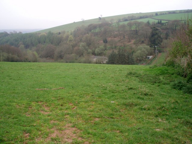
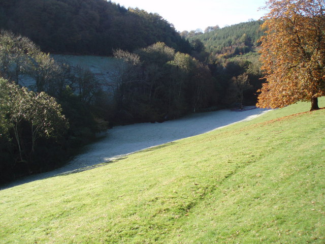
Church Wood is a charming woodland located in the county of Somerset, England. Situated near the village of Churchstanton, the wood covers an area of approximately 50 acres and is a popular destination for nature enthusiasts and hikers.

The wood is predominantly made up of native broadleaf trees, such as oak, ash, and beech, which create a diverse and vibrant ecosystem. The canopy of the wood provides shade and shelter for a variety of flora and fauna, including bluebells, wild garlic, and wood anemones. The forest floor is covered in a thick layer of leaf litter, which not only adds to the natural beauty of the wood but also supports a rich array of insects and small mammals.

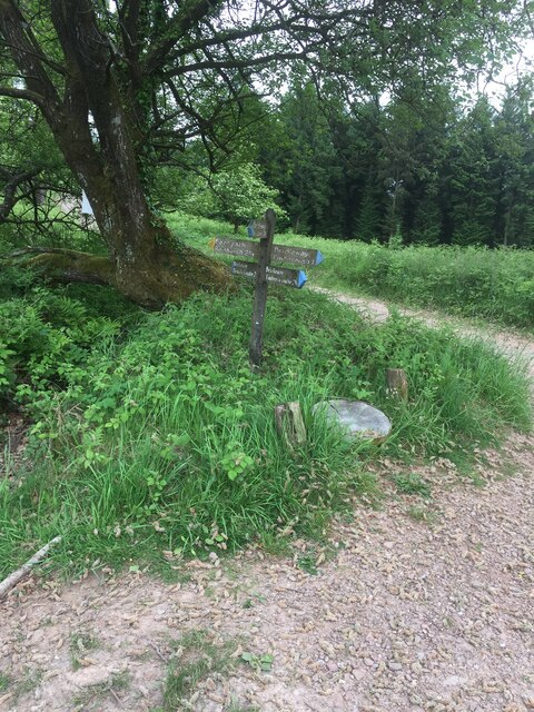
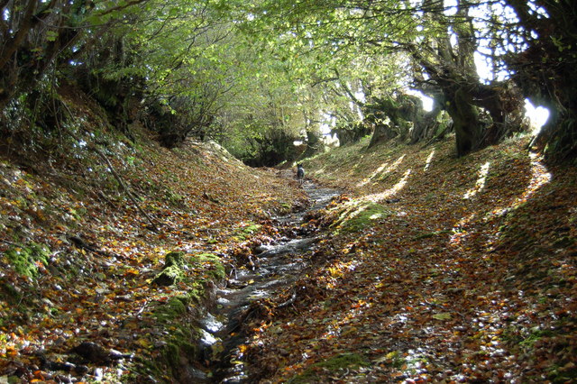
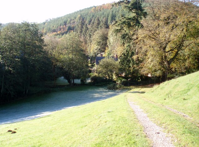
A network of well-maintained footpaths and trails wind through Church Wood, allowing visitors to explore its tranquil beauty. The paths meander along babbling streams and through sun-dappled glades, providing a peaceful and immersive experience in nature. There are also several picnic areas and benches scattered throughout the wood, providing the perfect spot for visitors to rest and take in the serene surroundings.

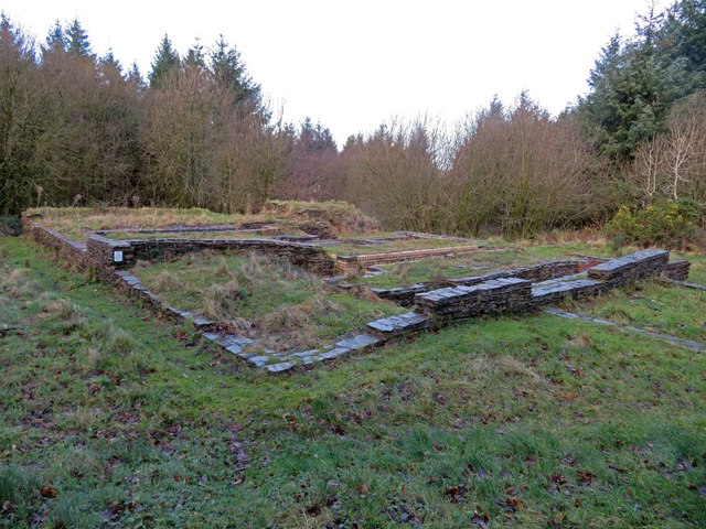
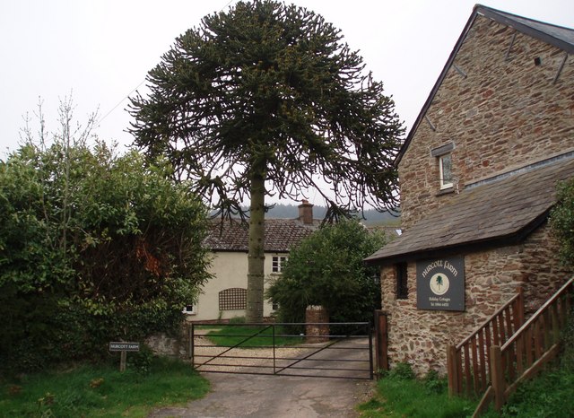
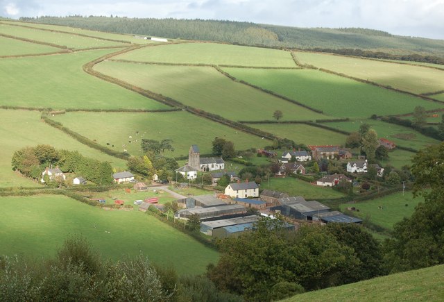
Church Wood is not only a haven for wildlife and a place of natural beauty, but it also has historical significance. The wood is home to the ruins of an ancient church, after which the wood and the nearby village are named. The remnants of the church serve as a reminder of the area's rich history and add to the mystical atmosphere of the wood.

Overall, Church Wood in Somerset offers a delightful escape into nature, with its diverse vegetation, well-maintained trails, and historical landmarks. It is a place where visitors can immerse themselves in the sights, sounds, and scents of a quintessential English woodland.

If you have any feedback on the listing, please let us know in the comments section below.

Church Wood Images

Images are sourced within 2km of 51.127952/-3.4635477 or Grid Reference SS9737. Thanks to Geograph Open Source API. All images are credited.

Langham Hill Pit foundations This was an iron ore mine and this pit was sunk in 1865-66 and a second hand rotative beam pumping and winding engine was brought over from South Wales. This had a 25" cylinder. It was later moved to Burrow Farm were it was installed in 1879. These foundations were excavated in 1995 and include the engine house, boiler house for two boiler, chimney base and flywheel pit. The shaft is nearby and fenced off.
Langham Hill Pit foundations
This was an iron ore mine and this pit was sunk in 1865-66 and a second hand rotative beam pumping and winding engine was brought over from South Wales. This had a 25" cylinder. It was later moved to Burrow Farm were it was installed in 1879. These foundations were excavated in 1995 and include the engine house, boiler house for two boiler, chimney base and flywheel pit. The shaft is nearby and fenced off.
Bearland Wood Iron Mine ventilation furnace chimney This is a Scheduled Ancient Monument and was used to ventilate underground iron mine workings by means of a furnace. The chimney was built c1860 but mining had ceased in the area by 1883.
Bearland Wood Iron Mine ventilation furnace chimney
This is a Scheduled Ancient Monument and was used to ventilate underground iron mine workings by means of a furnace. The chimney was built c1860 but mining had ceased in the area by 1883.
Sign Post near Croydon Hill Trig Point
LUXBOROUGH, St Mary's Church, Somerset St Mary's Church
LUXBOROUGH, St Mary's Church, Somerset
St Mary's Church
The Royal Oak at Luxborough This part of Luxborough is known as Kingsbridge. The Inn did feature in the Daily Telegraph's Best UK pub a few years ago!
The Royal Oak at Luxborough
This part of Luxborough is known as Kingsbridge. The Inn did feature in the Daily Telegraph's Best UK pub a few years ago!
Lower road bridge at Pooltown, Luxborough The infant Washford river, having started higher up as Tarr Water, first runs west, here turns north through Luxborough then runs NE through Roadwater to enter the Bristol Channel at Watchet
Lower road bridge at Pooltown, Luxborough
The infant Washford river, having started higher up as Tarr Water, first runs west, here turns north through Luxborough then runs NE through Roadwater to enter the Bristol Channel at Watchet
St. Mary's Church Luxborough This unusual little church has an elevated position just above the part of Luxborough known as Churchtown.
St. Mary's Church Luxborough
This unusual little church has an elevated position just above the part of Luxborough known as Churchtown.
Nurcott Farm. This smart farm now offers holiday cottages to rent.
Nurcott Farm.
This smart farm now offers holiday cottages to rent.
Coming down from Monkham Wood. The lane ahead is Stout's Way Lane.
Coming down from Monkham Wood.
The lane ahead is Stout's Way Lane.
Des Res. This stunning house is approached by a long private drive on the other side of the Washford River which runs through the garden. The photograph is taken from the lane between Luxborough and Roadwater.
Des Res.
This stunning house is approached by a long private drive on the other side of the Washford River which runs through the garden. The photograph is taken from the lane between Luxborough and Roadwater.
View across the Valley Taken on a drizzly spring day, the solitary house in the bottom of the valley is on the lane to Chargot House.
View across the Valley
Taken on a drizzly spring day, the solitary house in the bottom of the valley is on the lane to Chargot House.
Bridleway along the edge of Croydon Hill Forest The forestry plantation is on the left hand side of the track; to the right is farmland.
Bridleway along the edge of Croydon Hill Forest
The forestry plantation is on the left hand side of the track; to the right is farmland.
Lane to Pooltown
Lane to Pooltown
Part of The Samaritans Way (South West) Torrential rain had recently washed away the thin layer of soil to expose the bedrock down the centre of this old and little-used bridleway.
Part of The Samaritans Way (South West)
Torrential rain had recently washed away the thin layer of soil to expose the bedrock down the centre of this old and little-used bridleway.
Churchtown viewed from Samaritans Way Churchtown, with it historic church, is one of the three hamlets which make up the Parish of Luxborough.
Churchtown viewed from Samaritans Way
Churchtown, with it historic church, is one of the three hamlets which make up the Parish of Luxborough.
Collyhill Wood From the footpath to Kennisham Hill.
Collyhill Wood
From the footpath to Kennisham Hill.
Ground frost and autumn sunshine Chargot Wood in the background.
Ground frost and autumn sunshine
Chargot Wood in the background.
House at the edge of Chargot Wood
Show me another place!

Church Wood is located at Grid Ref: SS9737 (Lat: 51.127952, Lng: -3.4635477)

Administrative County: Somerset

District: Somerset West and Taunton

Police Authority: Avon and Somerset

What 3 Words

///runner.holly.astounded. Near Minehead, Somerset

Related Wikis

Luxborough

Luxborough is a small village and civil parish located some 6 miles (9.7 km) south of Dunster, lying amongst the Brendon Hills and the Exmoor National...

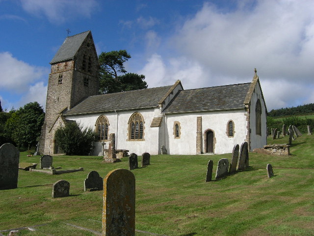
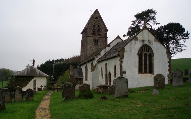
St Mary's Church, Luxborough

The Anglican St Mary's Church at Luxborough within the English county of Somerset dates from the 13th century. It is a Grade II listed building.The chancel...

Luxborough Road railway station

Luxborough Road (sometimes referred to as "Langham" or "Langham Hill") was an intermediate station on the West Somerset Mineral Railway (WSMR), which was...

Gupworthy railway station

Gupworthy (sometimes referred to as "Goosemoor") was originally intended as an intermediate station on the West Somerset Mineral Railway (WSMR), but neither...

Brendon Hills

The Brendon Hills are a range of hills in west Somerset, England. The hills merge level into the eastern side of Exmoor and are included within the Exmoor...

Rodhuish Common

Rodhuish Common is a univallate Iron Age hill fort in the West Somerset district of Somerset, England. There is a small oval enclosure which is thought...

Church of St Peter, Williton

The Anglican Church of St Peter in Williton in the English county of Somerset is recorded in the National Heritage List for England as a designated Grade...

St Peter's Church, Treborough

The Anglican St Peter's Church at Treborough within the English county of Somerset dates from the 14th century. It is a Grade II* listed building.Although...

Nearby Amenities

Located within 500m of 51.127952,-3.4635477
Churchtown
Place: hamlet
Source: OS_OpenData_StreetView
Lat/Long: 51.1315221/-3.466044
Luxborough
Is In: Somerset, England, UK
Place: village
Source: OS_OpenData_StreetView
Wikidata: Q1851067
Wikipedia: en:Luxborough
Lat/Long: 51.1309926/-3.4630594
The data included in this document is from www.openstreetmap.org. The data is made available under ODbL.

Have you been to Church Wood?

Leave your review of Church Wood below (or comments, questions and feedback).