Sunnyside Plantation

Wood, Forest in Devon Mid Devon

England

Sunnyside Plantation

St Thomas church, Chevithorne This is home church to the Heathcoat Amory family of Knightshayes.
A number of memorials can be seen inside.
St Thomas church, Chevithorne Credit: Anthony Vosper

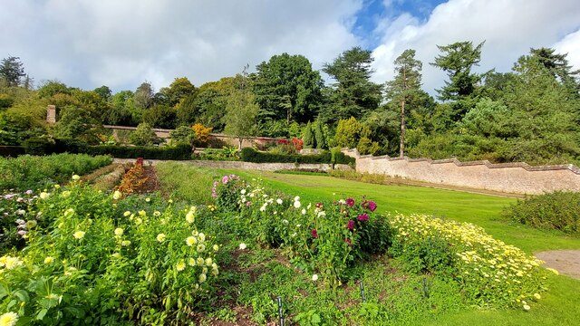
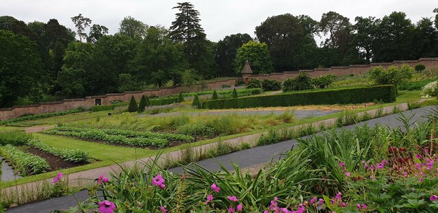
Sunnyside Plantation, located in the serene countryside of Devon, is a picturesque woodland estate known for its stunning natural beauty and rich history. Nestled amidst rolling hills and ancient forests, this enchanting plantation spans across several acres, offering visitors a tranquil retreat from the hustle and bustle of city life.

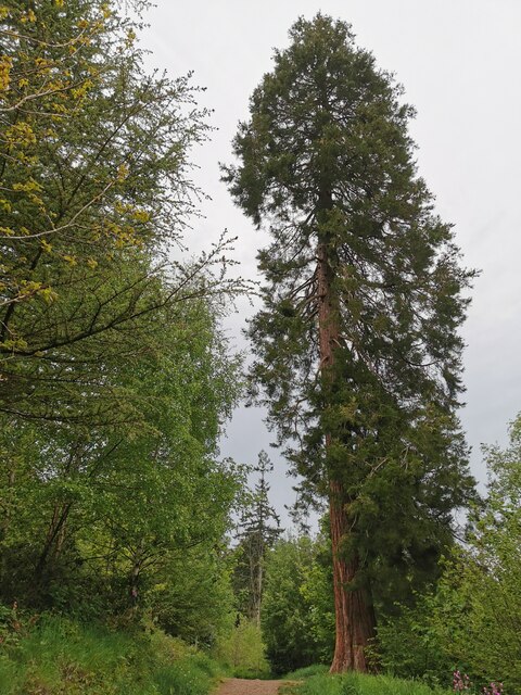
The plantation is renowned for its diverse range of tree species, including towering oak, beech, and chestnut trees that create a lush canopy over the landscape. The forest floor is adorned with a vibrant carpet of ferns, wildflowers, and moss, creating a haven for various wildlife species such as deer, foxes, and a myriad of bird species.

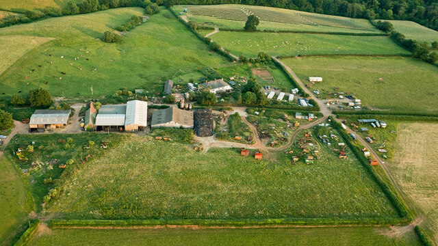
Steeped in history, Sunnyside Plantation has been in existence for over two centuries. Originally established as a timber plantation, it played a crucial role in supplying wood for the thriving shipbuilding industry in the region. Today, remnants of the old sawmill and logging trails can still be found, serving as a testament to its past.

Visitors to Sunnyside Plantation can explore the numerous walking trails that wind through the estate, offering breathtaking views of the surrounding countryside. The plantation also boasts a quaint picnic area, where visitors can relax and enjoy the tranquility of nature.

Sunnyside Plantation, with its idyllic setting and historical significance, is a cherished gem in the heart of Devon. Whether one is an avid nature enthusiast, a history buff, or simply seeking a peaceful escape, this woodland estate promises an unforgettable experience.

If you have any feedback on the listing, please let us know in the comments section below.

Sunnyside Plantation Images

Images are sourced within 2km of 50.942917/-3.4627673 or Grid Reference SS9716. Thanks to Geograph Open Source API. All images are credited.

St Thomas church, Chevithorne This is home church to the Heathcoat Amory family of Knightshayes.
A number of memorials can be seen inside.
St Thomas church, Chevithorne
This is home church to the Heathcoat Amory family of Knightshayes. A number of memorials can be seen inside.
The main street, Chevithorne A quiet mid Devon hamlet.
The wall contains a Victorian postbox.
The main street, Chevithorne
A quiet mid Devon hamlet. The wall contains a Victorian postbox.
Chevithorne War Memorial Framed by the churchyard gate. The memorial cross appears to have a lantern on its top.
Photographed by accident and not design.
Chevithorne War Memorial
Framed by the churchyard gate. The memorial cross appears to have a lantern on its top. Photographed by accident and not design.
A new lease of life Chevithorne Methodist church. <a href="https://www.geograph.org.uk/photo/1395815">SS9715 : Chevithorne Methodist Chapel</a> is undergoing another transformation.
<a href="https://www.geograph.org.uk/photo/5197495">SS9715 : Redundant chapel, Chevithorpe</a> and is being turned into a private dwelling.
A new lease of life
Chevithorne Methodist church. SS9715 : Chevithorne Methodist Chapel is undergoing another transformation. SS9715 : Redundant chapel, Chevithorpe and is being turned into a private dwelling.
Knightshayes Court walled kitchen garden
Chettiscombe : Footpath A footpath heading through the Knightshayes Estate.
Chettiscombe : Footpath
A footpath heading through the Knightshayes Estate.
Chettiscombe : Footpath A footpath heading through the Knightshayes Estate.
Chettiscombe : Footpath
A footpath heading through the Knightshayes Estate.
Chettiscombe : Allers Water Treatment Works Looking down to the water works.
Chettiscombe : Allers Water Treatment Works
Looking down to the water works.
Chettiscombe : Footpath Looking along a footpath through the Knightshayes Estate.
Chettiscombe : Footpath
Looking along a footpath through the Knightshayes Estate.
Chettiscombe : Footpath A footpath through the Knightshayes Estate.
Chettiscombe : Footpath
A footpath through the Knightshayes Estate.
Chettiscombe : Tree A tree at the Knightshayes Estate.
Chettiscombe : Tree
A tree at the Knightshayes Estate.
Chettiscombe : Woodland Looking across the woods at the Knightshayes Estate.
Chettiscombe : Woodland
Looking across the woods at the Knightshayes Estate.
Chettiscombe : Footpath A footpath through the woods at Knightshayes.
Chettiscombe : Footpath
A footpath through the woods at Knightshayes.
Chevithorne : Lane A lane alongside the house.
Chevithorne : Lane
A lane alongside the house.
Chevithorne : St Thomas Church Anglican church. 1843 by Benjamin Ferrey, under the Rev. William Rayer.
Chevithorne : St Thomas Church
Anglican church. 1843 by Benjamin Ferrey, under the Rev. William Rayer.
Walled garden at Knightshayes Court The garden is on a hill so has stepped walls all around the perimeter. It is managed by the National Trust.
Walled garden at Knightshayes Court
The garden is on a hill so has stepped walls all around the perimeter. It is managed by the National Trust.
Palfrey's Barton
Palfrey's Barton
Chevithorne : Peadhill Cottages Cottages in Chevithorne.
Chevithorne : Peadhill Cottages
Cottages in Chevithorne.
Show me another place!

Sunnyside Plantation is located at Grid Ref: SS9716 (Lat: 50.942917, Lng: -3.4627673)

Administrative County: Devon

District: Mid Devon

Police Authority: Devon and Cornwall

What 3 Words

///trendy.storage.annotated. Near Tiverton, Devon

Related Wikis

Knightshayes Court

Knightshayes Court is a Victorian country house near Tiverton, Devon, England, designed by William Burges for the Heathcoat-Amory family. Nikolaus Pevsner...

Chevithorne

Chevithorne (grid reference SS9715) is a small village near Tiverton, Devon. It lies three miles to the North East of Tiverton. 'Chenetorne' is identified...

Coombe, Mid Devon

Coombe is a settlement in the English county of Devon, situated some 5 miles (8.0 km) north-east of the town of Tiverton. == External links == grid reference...

Crazelowman

Crazelowman (Craze Lowman) is a hamlet in mid Devon, situated near the town of Tiverton and in that town's civil parish. It is situated to the north of...

Nearby Amenities

Located within 500m of 50.942917,-3.4627673
Power: pole
Source: bing
Lat/Long: 50.9452993/-3.4683967
Power: pole
Source: bing
Lat/Long: 50.9444644/-3.468689
Power: pole
Source: bing
Lat/Long: 50.9433947/-3.4690377
Power: pole
Source: bing
Lat/Long: 50.9425209/-3.4693354
Power: pole
Source: bing
Lat/Long: 50.9417857/-3.4695768
Power: pole
Source: bing
Lat/Long: 50.9392049/-3.4599102
Power: pole
Source: bing
Lat/Long: 50.9402444/-3.4588829
Power: pole
Source: bing
Lat/Long: 50.9406939/-3.4584457
Power: pole
Source: bing
Lat/Long: 50.9417756/-3.458561
Power: pole
Source: bing
Lat/Long: 50.9424989/-3.4586307
Power: pole
Source: bing
Lat/Long: 50.9450002/-3.4588668
The data included in this document is from www.openstreetmap.org. The data is made available under ODbL.

Have you been to Sunnyside Plantation?

Leave your review of Sunnyside Plantation below (or comments, questions and feedback).