Leigh Wood

Wood, Forest in Somerset Somerset West and Taunton

England

Leigh Wood

Morebath : Timewell Hill, B3190 Looking along the road.
Morebath : Timewell Hill, B3190 Credit: Lewis Clarke

Leigh Wood, Somerset, also known as Wood or Forest, is a picturesque village located in the county of Somerset, England. Situated within the Mendip Hills Area of Outstanding Natural Beauty, Leigh Wood offers a tranquil and idyllic setting for residents and visitors alike.

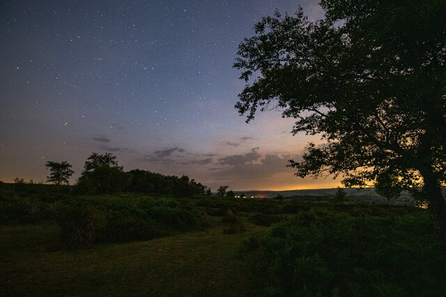
The village is characterized by its lush greenery, encompassing sprawling woodlands and rolling hills. It is home to a variety of trees, including oak, beech, and ash, creating a rich and diverse ecosystem. The woodlands provide a haven for wildlife, with numerous species of birds, mammals, and insects thriving in this natural habitat.

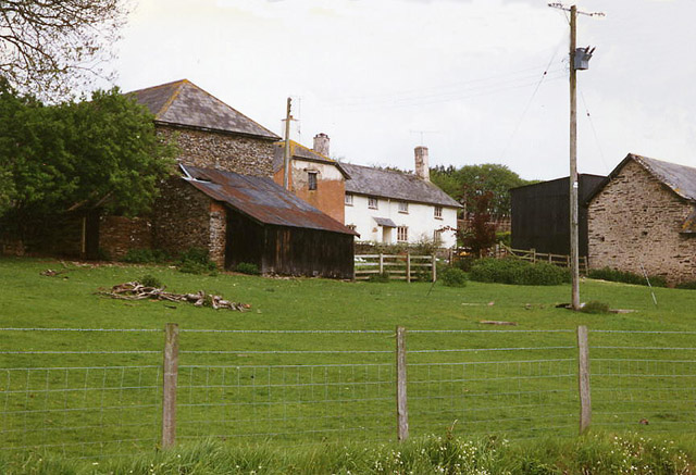
Leigh Wood boasts a close-knit community, with a population of approximately 500 residents. The village is known for its friendly and welcoming atmosphere, with a strong sense of community spirit. Local amenities include a village hall, a primary school, a church, and a pub, which serves as a social hub for gatherings and events.

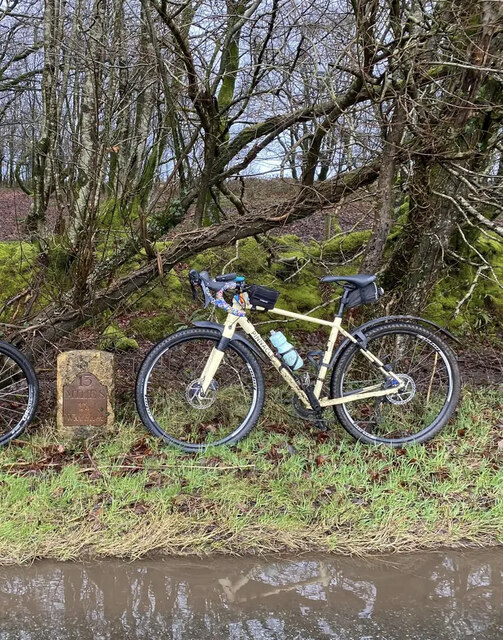
The surrounding area offers plenty of opportunities for outdoor activities, such as hiking, cycling, and horseback riding. There are also several walking trails and nature reserves nearby, allowing visitors to explore the beauty of the Somerset countryside.

Leigh Wood is conveniently located near the town of Wells, which is known for its stunning cathedral and historic architecture. The city of Bath is also within easy reach, offering a wealth of cultural attractions, shopping, and dining experiences.

In summary, Leigh Wood, Somerset, is a charming village nestled within a beautiful woodland setting. With its strong sense of community and abundance of natural beauty, it is a truly special place to live or visit.

If you have any feedback on the listing, please let us know in the comments section below.
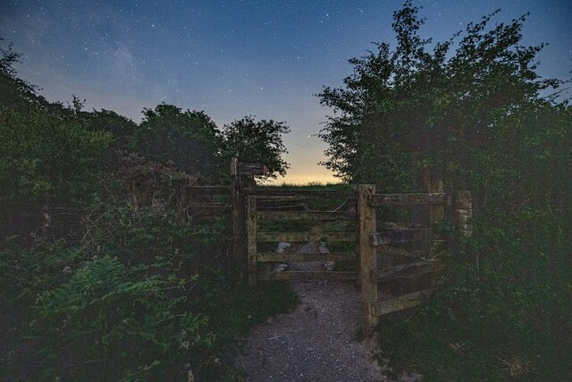
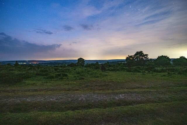
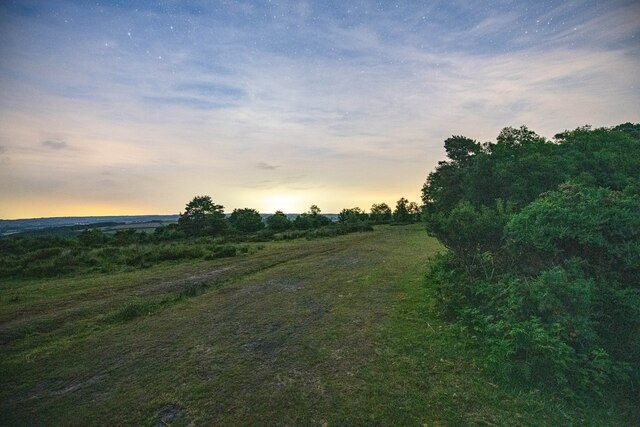
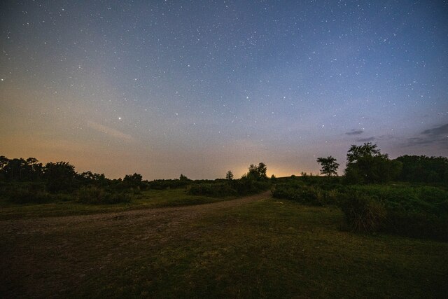
Leigh Wood Images

Images are sourced within 2km of 51.030195/-3.4654569 or Grid Reference SS9726. Thanks to Geograph Open Source API. All images are credited.

Morebath : Timewell Hill, B3190 Looking along the road.
Morebath : Timewell Hill, B3190
Looking along the road.
Morebath : Timewell Hill, B3190 A car tries to barge through cattle which have escaped onto the road.
Morebath : Timewell Hill, B3190
A car tries to barge through cattle which have escaped onto the road.
Morebath : Timewell Hill, B3190 Looking along the road where cows have caused some traffic issues.
Morebath : Timewell Hill, B3190
Looking along the road where cows have caused some traffic issues.
Morebath : Timewell Hill, B3190 Looking along a road with cows in it.
Morebath : Timewell Hill, B3190
Looking along a road with cows in it.
Skilgate : Car Park A car park atop Haddon Hill.
Skilgate : Car Park
A car park atop Haddon Hill.
Brompton Regis : Footpath The gate from the car park to Haddon Hill and Exmoor.
Brompton Regis : Footpath
The gate from the car park to Haddon Hill and Exmoor.
Brompton Regis : Exmoor Scenery Looking across Exmoor from Haddon Hill at around 00:10.
Brompton Regis : Exmoor Scenery
Looking across Exmoor from Haddon Hill at around 00:10.
Brompton Regis : Exmoor Scenery A track heads over Haddon Hill.
Brompton Regis : Exmoor Scenery
A track heads over Haddon Hill.
Brompton Regis : Exmoor Scenery A footpath over Haddon Hill.
Brompton Regis : Exmoor Scenery
A footpath over Haddon Hill.
Brompton Regis : Footpath A footpath heading up Haddon Hill on Exmoor.
Brompton Regis : Footpath
A footpath heading up Haddon Hill on Exmoor.
Brompton Regis : Exmoor Scenery Looking across Exmoor at around midnight on Haddon Hill.
Brompton Regis : Exmoor Scenery
Looking across Exmoor at around midnight on Haddon Hill.
Brompton Regis : Exmoor Scenery At Haddon Hill on Exmoor.
Brompton Regis : Exmoor Scenery
At Haddon Hill on Exmoor.
Brompton Regis : Footpath A footpath up to the top of Haddon Hill.
Brompton Regis : Footpath
A footpath up to the top of Haddon Hill.
Skilgate : Car Park A car park for people heading to Haddon Hill.
Skilgate : Car Park
A car park for people heading to Haddon Hill.
Old Milestone by the B3190, Haddon Hill Metal plate attached to stone post by the B3190, in parish of SKILGATE (WEST SOMERSET District), 400m East of entrance to Haddon Hill car park, a mile West of Upton, on grass verge by road, on North side of road. Minehead iron plate, erected by the Minehead & Bampton Road turnpike trust in the 19th century. 

Inscription reads:-
13
MILES
To
Watchet 

Grade II listed. List Entry Number: 1248032
<span class="nowrap"><a title="https://historicengland.org.uk/listing/the-list/list-entry/1248032" rel="nofollow ugc noopener" href="https://historicengland.org.uk/listing/the-list/list-entry/1248032">Link</a><img style="margin-left:2px;" alt="External link" title="External link - shift click to open in new window" src="https://s1.geograph.org.uk/img/external.png" width="10" height="10"/></span>

Milestone Society National ID: SO_WTTV13.
Old Milestone by the B3190, Haddon Hill
Metal plate attached to stone post by the B3190, in parish of SKILGATE (WEST SOMERSET District), 400m East of entrance to Haddon Hill car park, a mile West of Upton, on grass verge by road, on North side of road. Minehead iron plate, erected by the Minehead & Bampton Road turnpike trust in the 19th century. Inscription reads:- 13 MILES To Watchet Grade II listed. List Entry Number: 1248032 LinkExternal link Milestone Society National ID: SO_WTTV13.
Claypits Claypits is a widespread collection of dwellings near Morebath.
Claypits
Claypits is a widespread collection of dwellings near Morebath.
Court Farm Some of the buildings of Court Farm are just visible at the end of this track
Court Farm
Some of the buildings of Court Farm are just visible at the end of this track
Skilgate: Surridge Farm The building nearest the camera was apparently a water-powered saw mill. The leat has long since been ploughed up and the millpond is now a small copse. To left of the building a large overshot waterwheel survived in 1996, in an overgrown wheelpit
Skilgate: Surridge Farm
The building nearest the camera was apparently a water-powered saw mill. The leat has long since been ploughed up and the millpond is now a small copse. To left of the building a large overshot waterwheel survived in 1996, in an overgrown wheelpit
Show me another place!

Leigh Wood is located at Grid Ref: SS9726 (Lat: 51.030195, Lng: -3.4654569)

Administrative County: Somerset

District: Somerset West and Taunton

Police Authority: Avon and Somerset

What 3 Words

///gentlemen.chambers.remaining. Near Dulverton, Somerset

Related Wikis

Skilgate

Skilgate is a village and civil parish 5 miles (8 km) east of Dulverton and 8 miles (13 km) west of Wiveliscombe in the Somerset West and Taunton district...

Church of St John, Skilgate

The Anglican Church of St John in Skilgate, Somerset, England was built in the 14th century. It is a Grade II* listed building. == History == The church...

Morebath

Morebath is an upland village in the county of Devon, England. It is mostly given over to sheep-farming, and situated on the southern edge of Exmoor. An...

Haddon Hill

Haddon Hill is a prominent east–west aligned ridge in west Somerset, England, close to Hartford within the civil parish of Brompton Regis. It lies on the...

Have you been to Leigh Wood?

Leave your review of Leigh Wood below (or comments, questions and feedback).