Lower Pitt Copse
Wood, Forest in Devon Mid Devon
England
Lower Pitt Copse

Lower Pitt Copse is a beautiful woodland located in the county of Devon, England. Situated near the village of Pitt, this copse covers an area of approximately 50 acres and is a popular destination for nature enthusiasts and hikers alike.
The woodland is predominantly composed of broadleaf trees, including oak, beech, and ash, which create a dense and vibrant canopy, providing a haven for a variety of wildlife. The forest floor is covered in a rich carpet of ferns, bluebells, and wildflowers, adding to the charm and natural beauty of the area.
Lower Pitt Copse is crisscrossed with a network of well-maintained footpaths, allowing visitors to explore the woodlands at their own pace. These paths lead to scenic viewpoints, hidden clearings, and tranquil streams, providing ample opportunities for peaceful walks and picnics.
The copse is home to a diverse range of wildlife, including deer, foxes, badgers, and a multitude of bird species. Birdwatchers often flock to the area to catch a glimpse of rare and migratory species that can be found here throughout the year.
Lower Pitt Copse is managed by a local conservation group, which ensures that the woodland remains protected and preserved for future generations. The group conducts regular maintenance work, including tree planting, path clearance, and the removal of invasive species, to maintain the ecological balance and enhance the natural habitat.
Overall, Lower Pitt Copse is a tranquil haven of natural beauty, offering visitors the opportunity to immerse themselves in the peacefulness of the forest and experience the wonders of the Devon countryside.
If you have any feedback on the listing, please let us know in the comments section below.
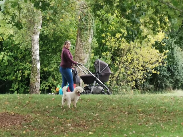
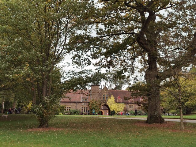
Lower Pitt Copse Images
Images are sourced within 2km of 50.938847/-3.4667245 or Grid Reference SS9716. Thanks to Geograph Open Source API. All images are credited.


Lower Pitt Copse is located at Grid Ref: SS9716 (Lat: 50.938847, Lng: -3.4667245)
Administrative County: Devon
District: Mid Devon
Police Authority: Devon and Cornwall
What 3 Words
///aimlessly.kept.magnum. Near Tiverton, Devon
Nearby Locations
Related Wikis

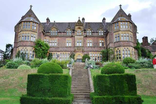
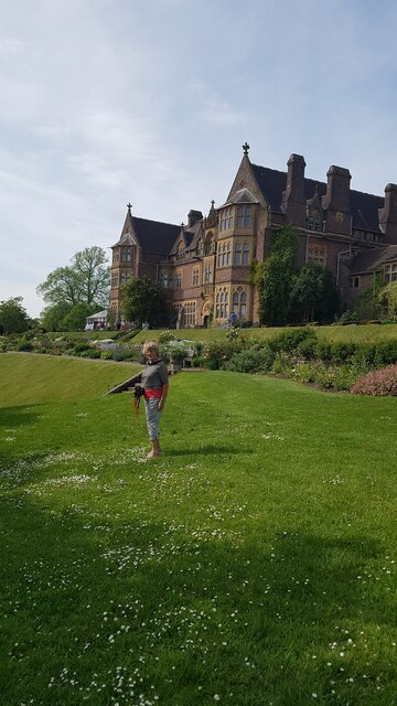
Knightshayes Court
Knightshayes Court is a Victorian country house near Tiverton, Devon, England, designed by William Burges for the Heathcoat-Amory family. Nikolaus Pevsner...

Chevithorne
Chevithorne (grid reference SS9715) is a small village near Tiverton, Devon. It lies three miles to the North East of Tiverton. 'Chenetorne' is identified...
Crazelowman
Crazelowman (Craze Lowman) is a hamlet in mid Devon, situated near the town of Tiverton and in that town's civil parish. It is situated to the north of...
Coombe, Mid Devon
Coombe is a settlement in the English county of Devon, situated some 5 miles (8.0 km) north-east of the town of Tiverton. == External links == grid reference...
Tiverton Cemetery
Tiverton Cemetery is the burial ground for the town of Tiverton in Devon. The cemetery covers eight acres and is owned and maintained by Mid Devon Council...

Washfield
Washfield is a village, parish and former manor in Devon, England, situated about 2 miles north-west of Tiverton. The parish church is dedicated to St...

Blundell's School
Blundell's School is an independent co-educational boarding and day school in the English public school tradition, located in Tiverton, Devon. It was founded...

Bolham, Devon
Bolham is a village in the parish of Tiverton in Devon, England. It was the object of much attention in December 2011 when a Stags head, said to resemble...
Nearby Amenities
Located within 500m of 50.938847,-3.4667245Have you been to Lower Pitt Copse?
Leave your review of Lower Pitt Copse below (or comments, questions and feedback).