Moor Plantation

Wood, Forest in Devon East Devon

England

Moor Plantation

Poltimore Churchyard Cross The cross survives as a 15th century socket stone and shaft with a modern head and arms (Scale 1m) <span class="nowrap"><a title="https://historicengland.org.uk/listing/the-list/list-entry/1016219?section=official-list-entry" rel="nofollow ugc noopener" href="https://historicengland.org.uk/listing/the-list/list-entry/1016219?section=official-list-entry">Link</a><img style="margin-left:2px;" alt="External link" title="External link - shift click to open in new window" src="https://s1.geograph.org.uk/img/external.png" width="10" height="10"/></span>
Poltimore Churchyard Cross Credit: Sandy Gerrard

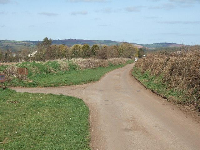
Moor Plantation, located in Devon, England, is a sprawling woodland area known for its picturesque beauty and rich biodiversity. Covering an expansive area of approximately 500 acres, it is a popular destination for nature enthusiasts, hikers, and wildlife photographers.

The plantation is characterized by its dense forest of predominantly deciduous trees, including oak, beech, and birch, which create a vibrant and colorful canopy during the autumn months. The diverse range of tree species provides a habitat for numerous woodland creatures, such as squirrels, badgers, and various bird species, including woodpeckers and owls.

Traversing through Moor Plantation, visitors can explore a network of well-maintained trails, allowing them to immerse themselves in the serene environment and discover the hidden treasures of the woodland. The paths vary in difficulty, catering to both casual walkers and avid hikers, and offer breathtaking views of the surrounding countryside.

In addition to its natural beauty, Moor Plantation also holds historical significance. The area was once part of an ancient forest that covered much of the region and was used for hunting by the nobility. Remnants of this history can still be seen in the form of old stone walls and ruins of hunting lodges scattered throughout the woodland, adding an air of mystique and intrigue.

Moor Plantation truly provides a sanctuary for those seeking solace in nature. Its tranquil atmosphere, stunning vistas, and abundant wildlife make it a must-visit destination for anyone wishing to reconnect with the natural world.

If you have any feedback on the listing, please let us know in the comments section below.

Moor Plantation Images

Images are sourced within 2km of 50.771327/-3.4615484 or Grid Reference SX9797. Thanks to Geograph Open Source API. All images are credited.

Poltimore Churchyard Cross The cross survives as a 15th century socket stone and shaft with a modern head and arms (Scale 1m) <span class="nowrap"><a title="https://historicengland.org.uk/listing/the-list/list-entry/1016219?section=official-list-entry" rel="nofollow ugc noopener" href="https://historicengland.org.uk/listing/the-list/list-entry/1016219?section=official-list-entry">Link</a><img style="margin-left:2px;" alt="External link" title="External link - shift click to open in new window" src="https://s1.geograph.org.uk/img/external.png" width="10" height="10"/></span>
Poltimore Churchyard Cross
The cross survives as a 15th century socket stone and shaft with a modern head and arms (Scale 1m) LinkExternal link
The M5 north at B 250.4 marker
The M5 north neat Broadclyst Moor
The M5 north at B 248.9 marker
The M5 north at B 248.4 marker
The Red Lion Inn, Broadclyst An eighteenth century building enlarged in the nineteenth and twentieth century <span class="nowrap"><a title="https://historicengland.org.uk/listing/the-list/list-entry/1098317?section=official-list-entryes" rel="nofollow ugc noopener" href="https://historicengland.org.uk/listing/the-list/list-entry/1098317?section=official-list-entryes">Link</a><img style="margin-left:2px;" alt="External link" title="External link - shift click to open in new window" src="https://s1.geograph.org.uk/img/external.png" width="10" height="10"/></span>
The Red Lion Inn, Broadclyst
An eighteenth century building enlarged in the nineteenth and twentieth century LinkExternal link
Lychgates at Broadclyst
Churchyard cross, Broadclyst Dates from the fifteenth century <span class="nowrap"><a title="https://historicengland.org.uk/listing/the-list/list-entry/1306066?section=official-list-entry" rel="nofollow ugc noopener" href="https://historicengland.org.uk/listing/the-list/list-entry/1306066?section=official-list-entry">Link</a><img style="margin-left:2px;" alt="External link" title="External link - shift click to open in new window" src="https://s1.geograph.org.uk/img/external.png" width="10" height="10"/></span>
Churchyard cross, Broadclyst
Dates from the fifteenth century LinkExternal link
Stocks at Broadclyst Beneath a modern shelter <span class="nowrap"><a title="https://historicengland.org.uk/listing/the-list/list-entry/1098319?section=official-list-entry" rel="nofollow ugc noopener" href="https://historicengland.org.uk/listing/the-list/list-entry/1098319?section=official-list-entry">Link</a><img style="margin-left:2px;" alt="External link" title="External link - shift click to open in new window" src="https://s1.geograph.org.uk/img/external.png" width="10" height="10"/></span>
Stocks at Broadclyst
Beneath a modern shelter LinkExternal link
Gate into the churchyard, Broadclyst
Church of St John the Baptist, Broadclyst The tower dates from the fifteenth century <span class="nowrap"><a title="https://historicengland.org.uk/listing/the-list/list-entry/1170465?section=official-list-entry" rel="nofollow ugc noopener" href="https://historicengland.org.uk/listing/the-list/list-entry/1170465?section=official-list-entry">Link</a><img style="margin-left:2px;" alt="External link" title="External link - shift click to open in new window" src="https://s1.geograph.org.uk/img/external.png" width="10" height="10"/></span>
Church of St John the Baptist, Broadclyst
The tower dates from the fifteenth century LinkExternal link
The churchyard, Broadclyst
Grass field, Broadclyst
Old Milestone by the cut-off road, Broad Clyst, East Devon Carved stone post by the UC road off B3181 (was A38), in parish of BROAD CLYST (EAST DEVON District), on private drive to Newhall Equestrian Centre, 120m North of junction with the B3181, in roadside bank (on link road between old and new Exeter turnpike routes), on West side of road. Exeter tombstone, erected by the Exeter turnpike trust in the 19th century. An earlier photograph can be found here <a title="https://www.geograph.org.uk/photo/6045262" href="https://www.geograph.org.uk/photo/6045262">Link</a>.

Inscription reads:- : 6 / MILES / To / Exeter : 

Milestone Society National ID: DV_EXCM06.
Old Milestone by the cut-off road, Broad Clyst, East Devon
Carved stone post by the UC road off B3181 (was A38), in parish of BROAD CLYST (EAST DEVON District), on private drive to Newhall Equestrian Centre, 120m North of junction with the B3181, in roadside bank (on link road between old and new Exeter turnpike routes), on West side of road. Exeter tombstone, erected by the Exeter turnpike trust in the 19th century. An earlier photograph can be found here Link. Inscription reads:- : 6 / MILES / To / Exeter : Milestone Society National ID: DV_EXCM06.
Emergency Gate to Playing Field Emergency gate leading to the playing field in Broadclyst, Devon.
Emergency Gate to Playing Field
Emergency gate leading to the playing field in Broadclyst, Devon.
Entrance to Bussell's farm Country road north of Huxham passing Bussell's farm
Entrance to Bussell's farm
Country road north of Huxham passing Bussell's farm
Brookleigh and a thatched house
Road north of Brookleigh
Show me another place!

Moor Plantation is located at Grid Ref: SX9797 (Lat: 50.771327, Lng: -3.4615484)

Administrative County: Devon

District: East Devon

Police Authority: Devon and Cornwall

What 3 Words

///sending.spearhead.weds. Near Silverton, Devon

Nearby Locations

Moor Plantation

Related Wikis

Poltimore

Poltimore is a village, civil parish and former manor in the East Devon district, in the county of Devon, England. It lies approximately 5 miles (8.0 km...

Poltimore House

Poltimore House is an 18th-century country house in Poltimore, Devon, England. The Manor of Poltimore was from the 13th to the 20th century the seat of...

Broadclyst

Broadclyst is a village and civil parish in the East Devon local government district. It lies approximately 5 miles northeast of the city of Exeter, Devon...

Clyst Vale Community College

Clyst Vale Community College is a school in Broadclyst, East Devon near Exeter in England, UK. Since April 2011 it has been an academy. The school is a...

Killerton

Killerton is an 18th-century house in Broadclyst, Exeter, Devon, England, which, with its hillside garden and estate, has been owned by the National Trust...

Huxham

Huxham is a hamlet and civil parish in the county of Devon, England and the district of East Devon and lies about 3 miles from Exeter. The parish has an...

Dolbury

Dolbury is another local name for the Iron Age hill fort or enclosure at Killerton Park in Devon, England. It is referred to as such in several books and...
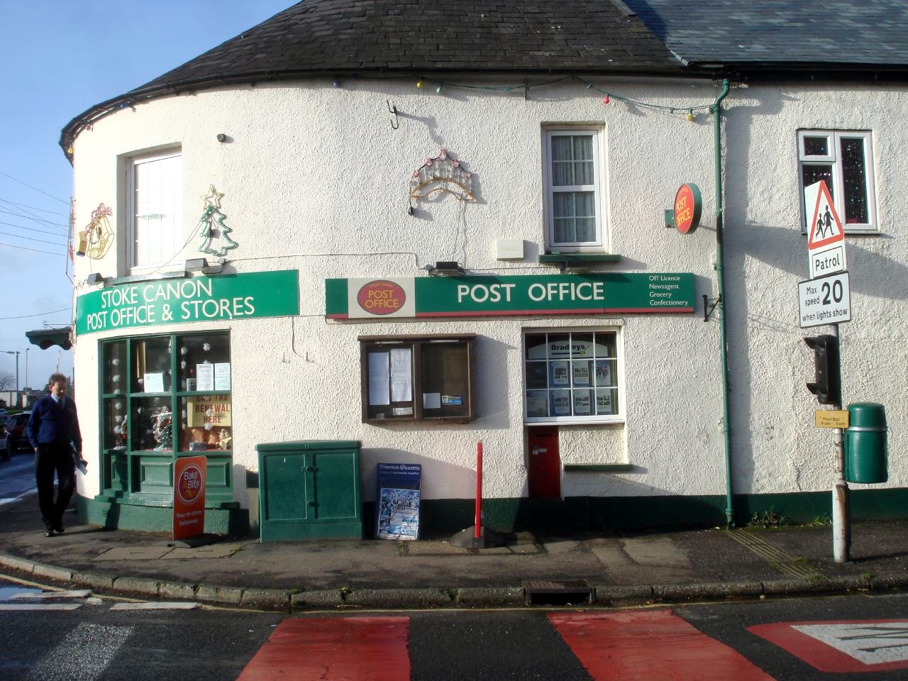
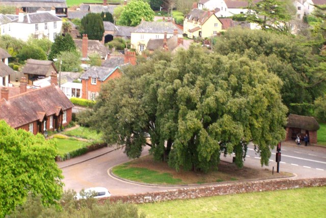
Stoke Canon

Stoke Canon is a small village and civil parish near the confluence of the rivers Exe and Culm on the main A396 between Exeter and Tiverton in the English...

Nearby Amenities

Located within 500m of 50.771327,-3.4615484
Colour: gray
Design: barrel
Line Attachment: suspension
Material: metal
Power: tower
Ref: 4YF292
Structure: lattice
Lat/Long: 50.7702605/-3.463641
Colour: gray
Design: barrel
Line Attachment: suspension
Material: metal
Power: tower
Ref: 4YF293
Structure: lattice
Lat/Long: 50.769882/-3.4592417
Waterway: stream_end
Lat/Long: 50.7681114/-3.4650196
Phone
Emergency: phone
Operator: National Highways
Operator Type: government
Operator Wikidata: Q5760006
Lat/Long: 50.7739233/-3.4583956
Phone
Emergency: phone
Operator: National Highways
Operator Type: government
Operator Wikidata: Q5760006
Lat/Long: 50.7740022/-3.4588467
Brand: National Grid
Brand Wikidata: Q1465461
Material: wood
Operator: National Grid Electricity Distribution Plc
Operator Old: Western Power Distribution
Operator Wikidata: Q7988183
Owner: National Grid Electricity Distribution (South West) Plc
Owner Wikidata: Q114397866
Power: pole
Lat/Long: 50.7738599/-3.467324
Brand: National Grid
Brand Wikidata: Q1465461
Material: wood
Operator: National Grid Electricity Distribution Plc
Operator Old: Western Power Distribution
Operator Wikidata: Q7988183
Owner: National Grid Electricity Distribution (South West) Plc
Owner Wikidata: Q114397866
Power: pole
Lat/Long: 50.7733035/-3.4639873
Brand: National Grid
Brand Wikidata: Q1465461
Material: wood
Operator: National Grid Electricity Distribution Plc
Operator Old: Western Power Distribution
Operator Wikidata: Q7988183
Owner: National Grid Electricity Distribution (South West) Plc
Owner Wikidata: Q114397866
Power: pole
Lat/Long: 50.7729439/-3.4617987
Brand: National Grid
Brand Wikidata: Q1465461
Guyed: yes
Material: wood
Operator: National Grid Electricity Distribution Plc
Operator Old: Western Power Distribution
Operator Wikidata: Q7988183
Owner: National Grid Electricity Distribution (South West) Plc
Owner Wikidata: Q114397866
Power: pole
Lat/Long: 50.772581/-3.4597025
Brand: National Grid
Brand Wikidata: Q1465461
Material: wood
Operator: National Grid Electricity Distribution Plc
Operator Old: Western Power Distribution
Operator Wikidata: Q7988183
Owner: National Grid Electricity Distribution (South West) Plc
Owner Wikidata: Q114397866
Power: pole
Lat/Long: 50.7723943/-3.4587033
Brand: National Grid
Brand Wikidata: Q1465461
Guyed: yes
Line Management: split
Material: wood
Operator: National Grid Electricity Distribution Plc
Operator Old: Western Power Distribution
Operator Wikidata: Q7988183
Owner: National Grid Electricity Distribution (South West) Plc
Owner Wikidata: Q114397866
Power: pole
Lat/Long: 50.772011/-3.4573864
Brand: National Grid
Brand Wikidata: Q1465461
Material: wood
Operator: National Grid Electricity Distribution Plc
Operator Old: Western Power Distribution
Operator Wikidata: Q7988183
Owner: National Grid Electricity Distribution (South West) Plc
Owner Wikidata: Q114397866
Power: pole
Lat/Long: 50.7715604/-3.4557712
Brand: National Grid
Brand Wikidata: Q1465461
Material: wood
Operator: National Grid Electricity Distribution Plc
Operator Old: Western Power Distribution
Operator Wikidata: Q7988183
Owner: National Grid Electricity Distribution (South West) Plc
Owner Wikidata: Q114397866
Power: pole
Lat/Long: 50.7715123/-3.466153
Devices: 1
Location: outdoor
Operator: Lightsource BP
Phases: 3
Power: transformer
Transformer: generator
Lat/Long: 50.7718253/-3.4677462
Devices: 1
Location: outdoor
Operator: Lightsource BP
Phases: 3
Power: transformer
Transformer: generator
Lat/Long: 50.7718359/-3.4678026
Brand: National Grid
Brand Wikidata: Q1465461
Material: wood
Operator: National Grid Electricity Distribution Plc
Operator Old: Western Power Distribution
Operator Wikidata: Q7988183
Owner: National Grid Electricity Distribution (South West) Plc
Owner Wikidata: Q114397866
Power: pole
Lat/Long: 50.7731568/-3.4630376
Camera Mount: pole
Camera Type: fixed
Height: 3
Man Made: surveillance
Operator: Lightsource BP
Surveillance: outdoor
Surveillance Type: camera
Surveillance Zone: power_plant
Lat/Long: 50.7732883/-3.4631945
Camera Mount: pole
Camera Type: fixed
Height: 3
Man Made: surveillance
Operator: Lightsource BP
Surveillance: outdoor
Surveillance Type: camera
Surveillance Zone: power_plant
Lat/Long: 50.7734189/-3.4639697
Camera Mount: pole
Camera Type: fixed
Height: 3
Man Made: surveillance
Operator: Lightsource BP
Surveillance: outdoor
Surveillance Type: camera
Surveillance Zone: power_plant
Lat/Long: 50.7729121/-3.4661208
Brand: National Grid
Brand Wikidata: Q1465461
Guyed: yes
Material: wood
Operator: National Grid Electricity Distribution Plc
Operator Old: Western Power Distribution
Operator Wikidata: Q7988183
Owner: National Grid Electricity Distribution (South West) Plc
Owner Wikidata: Q114397866
Power: pole
Lat/Long: 50.7722133/-3.4676785
Brand: National Grid
Brand Wikidata: Q1465461
Material: wood
Operator: National Grid Electricity Distribution Plc
Operator Old: Western Power Distribution
Operator Wikidata: Q7988183
Owner: National Grid Electricity Distribution (South West) Plc
Owner Wikidata: Q114397866
Power: pole
Lat/Long: 50.772123/-3.467484
Brand: National Grid
Brand Wikidata: Q1465461
Material: wood
Operator: National Grid Electricity Distribution Plc
Operator Old: Western Power Distribution
Operator Wikidata: Q7988183
Owner: National Grid Electricity Distribution (South West) Plc
Owner Wikidata: Q114397866
Power: pole
Lat/Long: 50.7721128/-3.4674619
Camera Mount: pole
Camera Type: fixed
Height: 3
Man Made: surveillance
Operator: Lightsource BP
Surveillance: outdoor
Surveillance Type: camera
Surveillance Zone: power_plant
Lat/Long: 50.771983/-3.4678562
Camera Mount: pole
Camera Type: fixed
Height: 3
Man Made: surveillance
Operator: Lightsource BP
Surveillance: outdoor
Surveillance Type: camera
Surveillance Zone: power_plant
Lat/Long: 50.7706023/-3.4679621
Camera Mount: pole
Camera Type: fixed
Height: 3
Man Made: surveillance
Operator: Lightsource BP
Surveillance: outdoor
Surveillance Type: camera
Surveillance Zone: power_plant
Lat/Long: 50.7707553/-3.4660102
Camera Mount: pole
Camera Type: fixed
Height: 3
Man Made: surveillance
Operator: Lightsource BP
Surveillance: outdoor
Surveillance Type: camera
Surveillance Zone: power_plant
Lat/Long: 50.771511/-3.4654301
Camera Mount: pole
Camera Type: fixed
Height: 3
Man Made: surveillance
Operator: Lightsource BP
Surveillance: outdoor
Surveillance Type: camera
Surveillance Zone: power_plant
Lat/Long: 50.7720558/-3.4632854
Camera Mount: pole
Camera Type: fixed
Height: 3
Man Made: surveillance
Operator: Lightsource BP
Surveillance: outdoor
Surveillance Type: camera
Surveillance Zone: power_plant
Lat/Long: 50.7708639/-3.4650211
Camera Mount: pole
Camera Type: fixed
Height: 3
Man Made: surveillance
Operator: Lightsource BP
Surveillance: outdoor
Surveillance Type: camera
Surveillance Zone: power_plant
Lat/Long: 50.7743492/-3.4610856
Camera Mount: pole
Camera Type: fixed
Height: 3
Man Made: surveillance
Operator: Lightsource BP
Surveillance: outdoor
Surveillance Type: camera
Surveillance Zone: power_plant
Lat/Long: 50.773834/-3.4591786
Camera Mount: pole
Camera Type: fixed
Height: 3
Man Made: surveillance
Operator: Lightsource BP
Surveillance: outdoor
Surveillance Type: camera
Surveillance Zone: power_plant
Lat/Long: 50.7753156/-3.4582968
Camera Mount: pole
Camera Type: fixed
Height: 3
Man Made: surveillance
Operator: Lightsource BP
Surveillance: outdoor
Surveillance Type: camera
Surveillance Zone: power_plant
Lat/Long: 50.7748918/-3.4600141
Devices: 1
Location: outdoor
Operator: Lightsource BP
Phases: 3
Power: transformer
Transformer: generator
Lat/Long: 50.7748576/-3.4598507
Turning Circle
Lat/Long: 50.7749577/-3.4597432
Brand: National Grid
Brand Wikidata: Q1465461
Guyed: yes
Material: wood
Operator: National Grid Electricity Distribution Plc
Operator Old: Western Power Distribution
Operator Wikidata: Q7988183
Owner: National Grid Electricity Distribution (South West) Plc
Owner Wikidata: Q114397866
Power: pole
Lat/Long: 50.770682/-3.4644002
Brand: National Grid
Brand Wikidata: Q1465461
Material: wood
Operator: National Grid Electricity Distribution Plc
Operator Old: Western Power Distribution
Operator Wikidata: Q7988183
Owner: National Grid Electricity Distribution (South West) Plc
Owner Wikidata: Q114397866
Power: pole
Lat/Long: 50.7670467/-3.4602937
Brand: National Grid
Brand Wikidata: Q1465461
Material: wood
Operator: National Grid Electricity Distribution Plc
Operator Old: Western Power Distribution
Operator Wikidata: Q7988183
Owner: National Grid Electricity Distribution (South West) Plc
Owner Wikidata: Q114397866
Power: pole
Lat/Long: 50.7670535/-3.4634104
Brand: National Grid
Brand Wikidata: Q1465461
Material: wood
Operator: National Grid Electricity Distribution Plc
Operator Old: Western Power Distribution
Operator Wikidata: Q7988183
Owner: National Grid Electricity Distribution (South West) Plc
Owner Wikidata: Q114397866
Power: pole
Lat/Long: 50.7709958/-3.4578878
Brand: National Grid
Brand Wikidata: Q1465461
Guyed: yes
Material: wood
Operator: National Grid Electricity Distribution Plc
Operator Old: Western Power Distribution
Operator Wikidata: Q7988183
Owner: National Grid Electricity Distribution (South West) Plc
Owner Wikidata: Q114397866
Power: pole
Lat/Long: 50.7701086/-3.4583277
Brand: National Grid
Brand Wikidata: Q1465461
Material: wood
Operator: National Grid Electricity Distribution Plc
Operator Old: Western Power Distribution
Operator Wikidata: Q7988183
Owner: National Grid Electricity Distribution (South West) Plc
Owner Wikidata: Q114397866
Power: pole
Lat/Long: 50.7693147/-3.45965
Brand: National Grid
Brand Wikidata: Q1465461
Material: wood
Operator: National Grid Electricity Distribution Plc
Operator Old: Western Power Distribution
Operator Wikidata: Q7988183
Owner: National Grid Electricity Distribution (South West) Plc
Owner Wikidata: Q114397866
Power: pole
Lat/Long: 50.7695641/-3.4592235
Brand: National Grid
Brand Wikidata: Q1465461
Material: wood
Operator: National Grid Electricity Distribution Plc
Operator Old: Western Power Distribution
Operator Wikidata: Q7988183
Owner: National Grid Electricity Distribution (South West) Plc
Owner Wikidata: Q114397866
Power: pole
Lat/Long: 50.768721/-3.460452
Brand: National Grid
Brand Wikidata: Q1465461
Material: wood
Operator: National Grid Electricity Distribution Plc
Operator Old: Western Power Distribution
Operator Wikidata: Q7988183
Owner: National Grid Electricity Distribution (South West) Plc
Owner Wikidata: Q114397866
Power: pole
Lat/Long: 50.7683003/-3.4613183
Brand: National Grid
Brand Wikidata: Q1465461
Material: wood
Operator: National Grid Electricity Distribution Plc
Operator Old: Western Power Distribution
Operator Wikidata: Q7988183
Owner: National Grid Electricity Distribution (South West) Plc
Owner Wikidata: Q114397866
Power: pole
Lat/Long: 50.7675692/-3.4610313
Brand: National Grid
Brand Wikidata: Q1465461
Material: wood
Operator: National Grid Electricity Distribution Plc
Operator Old: Western Power Distribution
Operator Wikidata: Q7988183
Owner: National Grid Electricity Distribution (South West) Plc
Owner Wikidata: Q114397866
Power: pole
Lat/Long: 50.7677507/-3.4622061
Brand: National Grid
Brand Wikidata: Q1465461
Material: wood
Operator: National Grid Electricity Distribution Plc
Operator Old: Western Power Distribution
Operator Wikidata: Q7988183
Owner: National Grid Electricity Distribution (South West) Plc
Owner Wikidata: Q114397866
Power: pole
Lat/Long: 50.7680764/-3.4617783
Brand: National Grid
Brand Wikidata: Q1465461
Material: wood
Operator: National Grid Electricity Distribution Plc
Operator Old: Western Power Distribution
Operator Wikidata: Q7988183
Owner: National Grid Electricity Distribution (South West) Plc
Owner Wikidata: Q114397866
Power: pole
Lat/Long: 50.76847/-3.4623389
Brand: National Grid
Brand Wikidata: Q1465461
Guyed: yes
Material: wood
Operator: National Grid Electricity Distribution Plc
Operator Old: Western Power Distribution
Operator Wikidata: Q7988183
Owner: National Grid Electricity Distribution (South West) Plc
Owner Wikidata: Q114397866
Power: pole
Lat/Long: 50.7691544/-3.463334
Brand: National Grid
Brand Wikidata: Q1465461
Material: wood
Operator: National Grid Electricity Distribution Plc
Operator Old: Western Power Distribution
Operator Wikidata: Q7988183
Owner: National Grid Electricity Distribution (South West) Plc
Owner Wikidata: Q114397866
Power: pole
Lat/Long: 50.7700789/-3.4639576
Brand: National Grid
Brand Wikidata: Q1465461
Material: wood
Operator: National Grid Electricity Distribution Plc
Operator Old: Western Power Distribution
Operator Wikidata: Q7988183
Owner: National Grid Electricity Distribution (South West) Plc
Owner Wikidata: Q114397866
Power: pole
Lat/Long: 50.771084/-3.4652209
Brand: National Grid
Brand Wikidata: Q1465461
Material: wood
Operator: National Grid Electricity Distribution Plc
Operator Old: Western Power Distribution
Operator Wikidata: Q7988183
Owner: National Grid Electricity Distribution (South West) Plc
Owner Wikidata: Q114397866
Power: pole
Lat/Long: 50.7727599/-3.4607323
Communication Mobile Phone: yes
Man Made: tower
Operator: Vodafone
Ref: 1320
Technology: GSM 1800;GSM 900;UTMS
Tower Construction: freestanding
Tower Type: communication
Lat/Long: 50.7672528/-3.459371
Communication Mobile Phone: yes
Man Made: tower
Tower Construction: freestanding
Tower Type: communication
Lat/Long: 50.7722197/-3.458966
The data included in this document is from www.openstreetmap.org. The data is made available under ODbL.

Have you been to Moor Plantation?

Leave your review of Moor Plantation below (or comments, questions and feedback).