Westerpiece Brake

Wood, Forest in Somerset Somerset West and Taunton

England

Westerpiece Brake

Selbourne Place, Minehead Number 41 Selbourne Place, Minehead. This property also has an Ordnance Survey bench mark.
<a href="https://www.geograph.org.uk/photo/6999397">SS9646 : Ordnance Survey Bench Mark</a>
Selbourne Place, Minehead Credit: V1ncenze

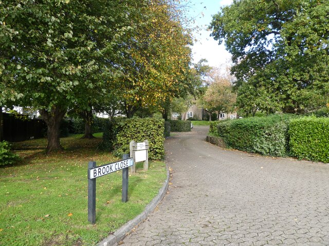
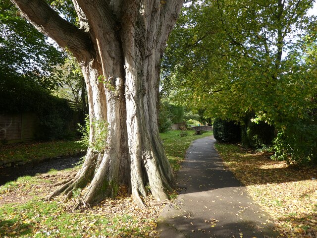
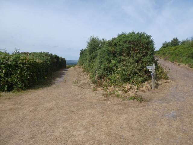
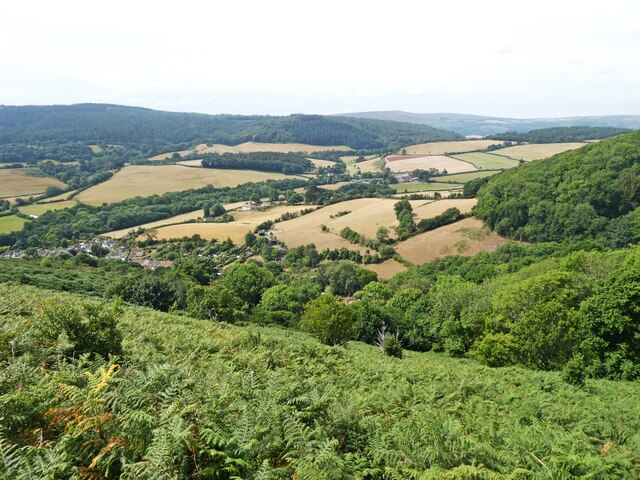
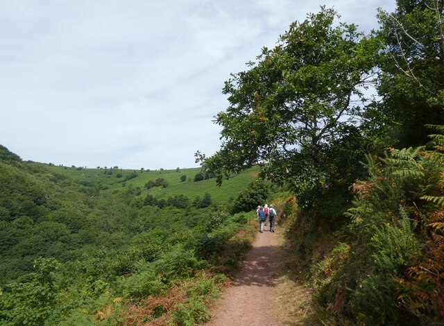
Westerpiece Brake, located in Somerset, England, is a dense woodland area that offers a picturesque and serene environment for nature lovers and outdoor enthusiasts. Spread over several acres, this forest is predominantly made up of various species of wood, including oak, beech, and pine trees.

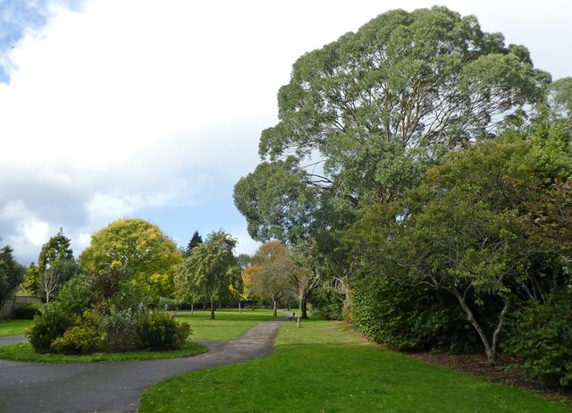
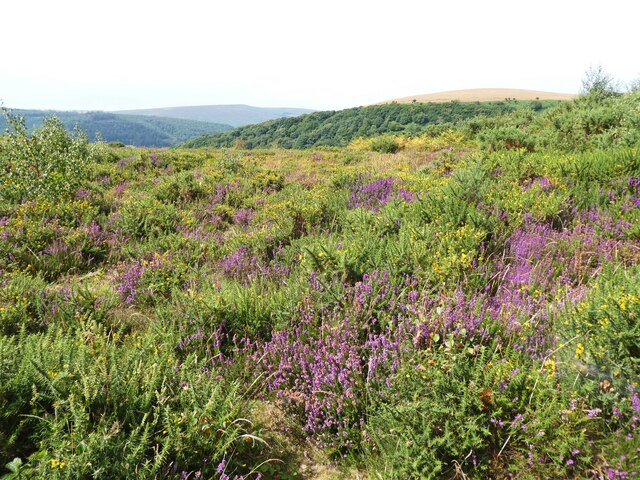
The woodland is known for its diverse flora and fauna, providing a habitat for numerous wildlife species such as deer, badgers, foxes, and an array of bird species. The forest floor is adorned with a carpet of wildflowers during the spring and summer months, creating a vibrant and colorful sight.

Westerpiece Brake is a popular destination for hikers, walkers, and cyclists, with an extensive network of well-maintained trails winding through the forest. The trails cater to all levels of fitness and offer varying levels of difficulty, allowing visitors to explore the woodland at their own pace. Nature enthusiasts can also enjoy birdwatching, as the forest is home to several species of rare and migratory birds.

The woodland is well-preserved and managed, ensuring the conservation of this natural habitat. It is also equipped with picnic areas, making it an ideal spot for families and groups to enjoy a day out surrounded by nature. The tranquil atmosphere and stunning scenery make Westerpiece Brake a haven for those seeking solace and a break from the hustle and bustle of everyday life.

Overall, Westerpiece Brake in Somerset is a pristine woodland area that offers a diverse range of outdoor activities and an opportunity to reconnect with nature in a peaceful setting.

If you have any feedback on the listing, please let us know in the comments section below.

Westerpiece Brake Images

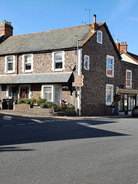
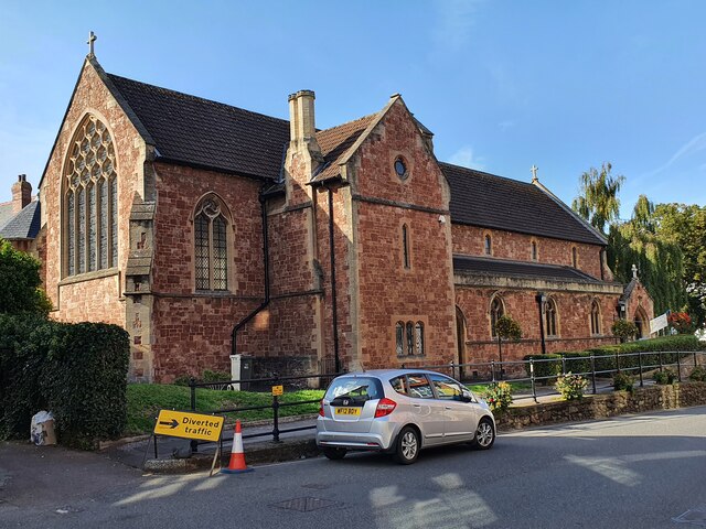
Images are sourced within 2km of 51.199724/-3.5037662 or Grid Reference SS9545. Thanks to Geograph Open Source API. All images are credited.

Selbourne Place, Minehead Number 41 Selbourne Place, Minehead. This property also has an Ordnance Survey bench mark.
<a href="https://www.geograph.org.uk/photo/6999397">SS9646 : Ordnance Survey Bench Mark</a>
Selbourne Place, Minehead
Number 41 Selbourne Place, Minehead. This property also has an Ordnance Survey bench mark. SS9646 : Ordnance Survey Bench Mark
Ordnance Survey Bench Mark This mark is located on the wall at 41 Selbourne Place, Minehead. These marks were used by Ordnance Survey for mapping purposes.
<a href="https://www.geograph.org.uk/photo/6999393">SS9646 : Selbourne Place, Minehead</a>
Ordnance Survey Bench Mark
This mark is located on the wall at 41 Selbourne Place, Minehead. These marks were used by Ordnance Survey for mapping purposes. SS9646 : Selbourne Place, Minehead
Church of St Andrew, Minehead The Church of St Andrew, Minehead. The Church also has an Ordnance Survey bench mark.
<a href="https://www.geograph.org.uk/photo/6999438">SS9646 : Ordnance Survey Bench Mark</a>
Church of St Andrew, Minehead
The Church of St Andrew, Minehead. The Church also has an Ordnance Survey bench mark. SS9646 : Ordnance Survey Bench Mark
Ordnance Survey Bench Mark This mark is located on a stone gatepost at the Church of St Andrew in Minehead. these marks were used by Ordnance Survey for mapping purposes.
<a href="https://www.geograph.org.uk/photo/6999436">SS9646 : Church of St Andrew, Minehead</a>
Ordnance Survey Bench Mark
This mark is located on a stone gatepost at the Church of St Andrew in Minehead. these marks were used by Ordnance Survey for mapping purposes. SS9646 : Church of St Andrew, Minehead
Entrance to Brook Close
Paths through 'The Parks', Minehead
Mature Poplar tree in  'The Parks', Minehead
Mature Poplar tree in 'The Parks', Minehead
Model railway exhibition at Sainsbury Hall
Playground at Minehead First School
The blue and yellow colours of Ukraine, in Wellington Square Bunting erected by Minehead Town Council, in a gesture of support for the brave people of Ukraine, who are facing an unprovoked invasion by Russian armed forces.
The blue and yellow colours of Ukraine, in Wellington Square
Bunting erected by Minehead Town Council, in a gesture of support for the brave people of Ukraine, who are facing an unprovoked invasion by Russian armed forces.
Path junction above Woodcombe
The colours of mid summer on North Hill
View towards Headon Cross
Path, above Wood Coombe
Minehead : The Parade The Parade in Minehead.
Minehead : The Parade
The Parade in Minehead.
Minehead : The Parade Looking along The Parade.
Minehead : The Parade
Looking along The Parade.
Greenbelt Housing, on Hopcott Road Totally out of character for this part of the town and intruding on its green hinterland.

<a href="https://www.geograph.org.uk/photo/6767860">SS9645 : Land clearance at Lower Hopcott</a>
Greenbelt Housing, on Hopcott Road
Totally out of character for this part of the town and intruding on its green hinterland. SS9645 : Land clearance at Lower Hopcott
Dwellings, south of Hopcott Road
Show me another place!

Westerpiece Brake is located at Grid Ref: SS9545 (Lat: 51.199724, Lng: -3.5037662)

Administrative County: Somerset

District: Somerset West and Taunton

Police Authority: Avon and Somerset

What 3 Words

///inhales.encodes.dime. Near Minehead, Somerset

Related Wikis

Minehead Without

Minehead Without is a civil parish in the English county of Somerset, and within the Exmoor National Park. As its name suggests, the parish covers a rural...

Bratton Court

Bratton Court in the hamlet of Bratton within the parish of Minehead Without, Somerset, England was built as a manor house, with a 14th-century open hall...

Dunster Park and Heathlands

Dunster Park and Heathlands (grid reference SS955441) is a 466.6 hectare biological Site of Special Scientific Interest in Somerset, notified in 2000....

Chapel of St Leonard, Tivington

The Anglican Chapel of St Leonard in Tivington, Somerset, England was built in the mid 14th century as a chapel of ease. It is a Grade II* listed building...

Nearby Amenities

Located within 500m of 51.199724,-3.5037662
Minehead & Exmoor Caravan & Camping Park
Toilets: yes
Tourism: caravan_site
Lat/Long: 51.2013417/-3.5025544
Middlecombe
Place: locality
Lat/Long: 51.2010622/-3.5019248
Power: pole
Lat/Long: 51.1987385/-3.5096477
Power: pole
Lat/Long: 51.1986696/-3.5089892
Power: pole
Lat/Long: 51.1985813/-3.5082462
Power: pole
Lat/Long: 51.1994393/-3.5104778
Power: pole
Lat/Long: 51.1988217/-3.5088779
Power: pole
Lat/Long: 51.1987309/-3.5081269
Power: pole
Lat/Long: 51.1984998/-3.5061783
Power: pole
Lat/Long: 51.1984116/-3.5055225
Power: pole
Lat/Long: 51.1980737/-3.5050531
Power: pole
Lat/Long: 51.1972594/-3.5039198
Power: pole
Lat/Long: 51.1983116/-3.5057491
Power: pole
Lat/Long: 51.1981023/-3.5050303
Power: pole
Lat/Long: 51.1977712/-3.5038823
Power: pole
Lat/Long: 51.1975393/-3.5031085
Power: pole
Lat/Long: 51.1972098/-3.5019954
Power: pole
Lat/Long: 51.196872/-3.5003471
Power: pole
Lat/Long: 51.1970317/-3.5022153
Power: pole
Lat/Long: 51.1967753/-3.5003485
Power: pole
Lat/Long: 51.1970779/-3.4989417
Power: pole
Lat/Long: 51.1979947/-3.4978366
Power: pole
Lat/Long: 51.1990956/-3.4976596
Power: pole
Lat/Long: 51.2001952/-3.4975395
Power: pole
Lat/Long: 51.2001771/-3.4973384
Power: pole
Source: bing
Lat/Long: 51.2006998/-3.5030334
Power: pole
Source: bing
Lat/Long: 51.2005284/-3.5042591
Power: pole
Source: bing
Lat/Long: 51.2002982/-3.5059489
Power: pole
Source: bing
Lat/Long: 51.2001788/-3.5068166
Power: pole
Source: bing
Lat/Long: 51.2007309/-3.5077098
Power: pole
Source: bing
Lat/Long: 51.201357/-3.5087585
Power: pole
Source: bing
Transformer: distribution
Lat/Long: 51.2022981/-3.5045569
Power: pole
Source: bing
Lat/Long: 51.202788/-3.5047245
Power: pole
Source: bing
Lat/Long: 51.2031552/-3.5048506
Power: pole
Source: bing
Lat/Long: 51.2040131/-3.5051402
Turning Circle
Lat/Long: 51.2022645/-3.5032995
Communication 2G: yes
Communication 3G: yes
Communication 4G: yes
Communication 4G+: yes
Man Made: antenna
Operator: Vodafone and o2
Lat/Long: 51.199009/-3.4985821
The data included in this document is from www.openstreetmap.org. The data is made available under ODbL.

Have you been to Westerpiece Brake?

Leave your review of Westerpiece Brake below (or comments, questions and feedback).