Mount Brake

Wood, Forest in Somerset Somerset West and Taunton

England

Mount Brake

A Somerset County League Div 1 game at Minehead AFC Minehead repel an attack in the second half. The game ended Minehead 3 Nailsea & Tickenham Reserves 0.
A Somerset County League Div 1 game at Minehead AFC Credit: Roger Cornfoot

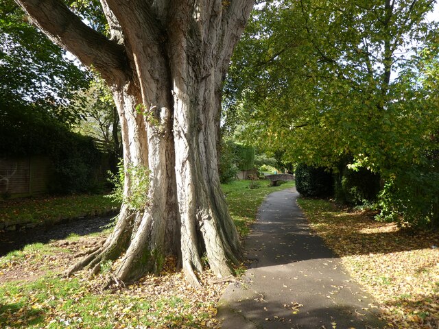
Mount Brake, Somerset, also known as Wood or Forest, is a picturesque and idyllic location situated in the county of Somerset, England. Nestled amidst rolling hills and lush greenery, Mount Brake offers a tranquil escape from the hustle and bustle of everyday life.

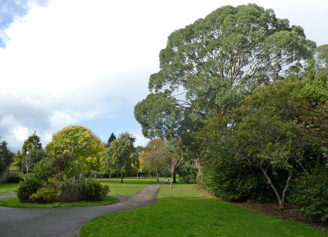
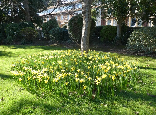
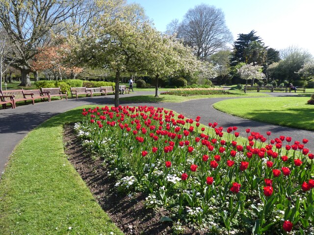
Covering an area of approximately 100 acres, this woodland paradise is home to a diverse range of flora and fauna. The forest is predominantly made up of deciduous trees such as oak, beech, and birch, which create a beautiful canopy that filters sunlight and provides a serene atmosphere. The forest floor is carpeted with a variety of wildflowers, adding splashes of color to the landscape.

Mount Brake is a haven for wildlife enthusiasts, with an abundance of animals that call this place home. Visitors may be lucky enough to spot deer, foxes, badgers, and a wide array of bird species, including owls and woodpeckers.

The woodland is crisscrossed with a network of well-maintained walking trails, allowing visitors to explore the area at their leisure. These paths lead to charming picnic spots and viewpoints, offering breathtaking vistas of the surrounding countryside.

For those seeking adventure, Mount Brake also features a number of challenging mountain biking trails, attracting riders of all skill levels. The undulating terrain and natural obstacles make it a thrilling and exhilarating experience for adrenaline junkies.

Mount Brake, Somerset, is truly a hidden gem that offers a perfect blend of natural beauty, tranquility, and outdoor activities. Whether one seeks a peaceful retreat or an adrenaline-fueled adventure, this woodland paradise has something to offer for everyone.

If you have any feedback on the listing, please let us know in the comments section below.

Mount Brake Images

Images are sourced within 2km of 51.202234/-3.5009278 or Grid Reference SS9545. Thanks to Geograph Open Source API. All images are credited.

A Somerset County League Div 1 game at Minehead AFC Minehead repel an attack in the second half. The game ended Minehead 3 Nailsea & Tickenham Reserves 0.
A Somerset County League Div 1 game at Minehead AFC
Minehead repel an attack in the second half. The game ended Minehead 3 Nailsea & Tickenham Reserves 0.
Minehead manager, Avril Cooke makes a late substitution at Irnham Road The game ended Minehead 3 Nailsea & Tickenham Reserves 0.
Minehead manager, Avril Cooke makes a late substitution at Irnham Road
The game ended Minehead 3 Nailsea & Tickenham Reserves 0.
Selbourne Place, Minehead Number 41 Selbourne Place, Minehead. This property also has an Ordnance Survey bench mark.
<a href="https://www.geograph.org.uk/photo/6999397">SS9646 : Ordnance Survey Bench Mark</a>
Selbourne Place, Minehead
Number 41 Selbourne Place, Minehead. This property also has an Ordnance Survey bench mark. SS9646 : Ordnance Survey Bench Mark
Ordnance Survey Bench Mark This mark is located on the wall at 41 Selbourne Place, Minehead. These marks were used by Ordnance Survey for mapping purposes.
<a href="https://www.geograph.org.uk/photo/6999393">SS9646 : Selbourne Place, Minehead</a>
Ordnance Survey Bench Mark
This mark is located on the wall at 41 Selbourne Place, Minehead. These marks were used by Ordnance Survey for mapping purposes. SS9646 : Selbourne Place, Minehead
Church of St Andrew, Minehead The Church of St Andrew, Minehead. The Church also has an Ordnance Survey bench mark.
<a href="https://www.geograph.org.uk/photo/6999438">SS9646 : Ordnance Survey Bench Mark</a>
Church of St Andrew, Minehead
The Church of St Andrew, Minehead. The Church also has an Ordnance Survey bench mark. SS9646 : Ordnance Survey Bench Mark
Ordnance Survey Bench Mark This mark is located on a stone gatepost at the Church of St Andrew in Minehead. these marks were used by Ordnance Survey for mapping purposes.
<a href="https://www.geograph.org.uk/photo/6999436">SS9646 : Church of St Andrew, Minehead</a>
Ordnance Survey Bench Mark
This mark is located on a stone gatepost at the Church of St Andrew in Minehead. these marks were used by Ordnance Survey for mapping purposes. SS9646 : Church of St Andrew, Minehead
Entrance to Brook Close
Paths through 'The Parks', Minehead
Mature Poplar tree in  'The Parks', Minehead
Mature Poplar tree in 'The Parks', Minehead
Model railway exhibition at Sainsbury Hall
Playground at Minehead First School
Car charging point, Alexandra Road Car Park
North Road Car Park, Minehead
Early daffodils in Blenheim Park
Birthplace of Arthur C. Clarke, in Minehead 16th December, 1917.
Birthplace of Arthur C. Clarke, in Minehead
16th December, 1917.
The blue and yellow colours of Ukraine, in Wellington Square Bunting erected by Minehead Town Council, in a gesture of support for the brave people of Ukraine, who are facing an unprovoked invasion by Russian armed forces.
The blue and yellow colours of Ukraine, in Wellington Square
Bunting erected by Minehead Town Council, in a gesture of support for the brave people of Ukraine, who are facing an unprovoked invasion by Russian armed forces.
Spot the ball Minehead defend a corner at Irnham Road. Final result: Minehead 2 Saltford 0
Spot the ball
Minehead defend a corner at Irnham Road. Final result: Minehead 2 Saltford 0
Spring bedding, Blenheim Gardens
Show me another place!

Mount Brake is located at Grid Ref: SS9545 (Lat: 51.202234, Lng: -3.5009278)

Administrative County: Somerset

District: Somerset West and Taunton

Police Authority: Avon and Somerset

What 3 Words

///vocals.headboard.headings. Near Minehead, Somerset

Related Wikis

Minehead Without

Minehead Without is a civil parish in the English county of Somerset, and within the Exmoor National Park. As its name suggests, the parish covers a rural...

Bratton Court

Bratton Court in the hamlet of Bratton within the parish of Minehead Without, Somerset, England was built as a manor house, with a 14th-century open hall...

Statue of Queen Anne, Minehead

The Statue of Queen Anne in Minehead, Somerset, England was built in 1719. It is a Grade II* listed building. == History == The statue depicts Queen Anne...

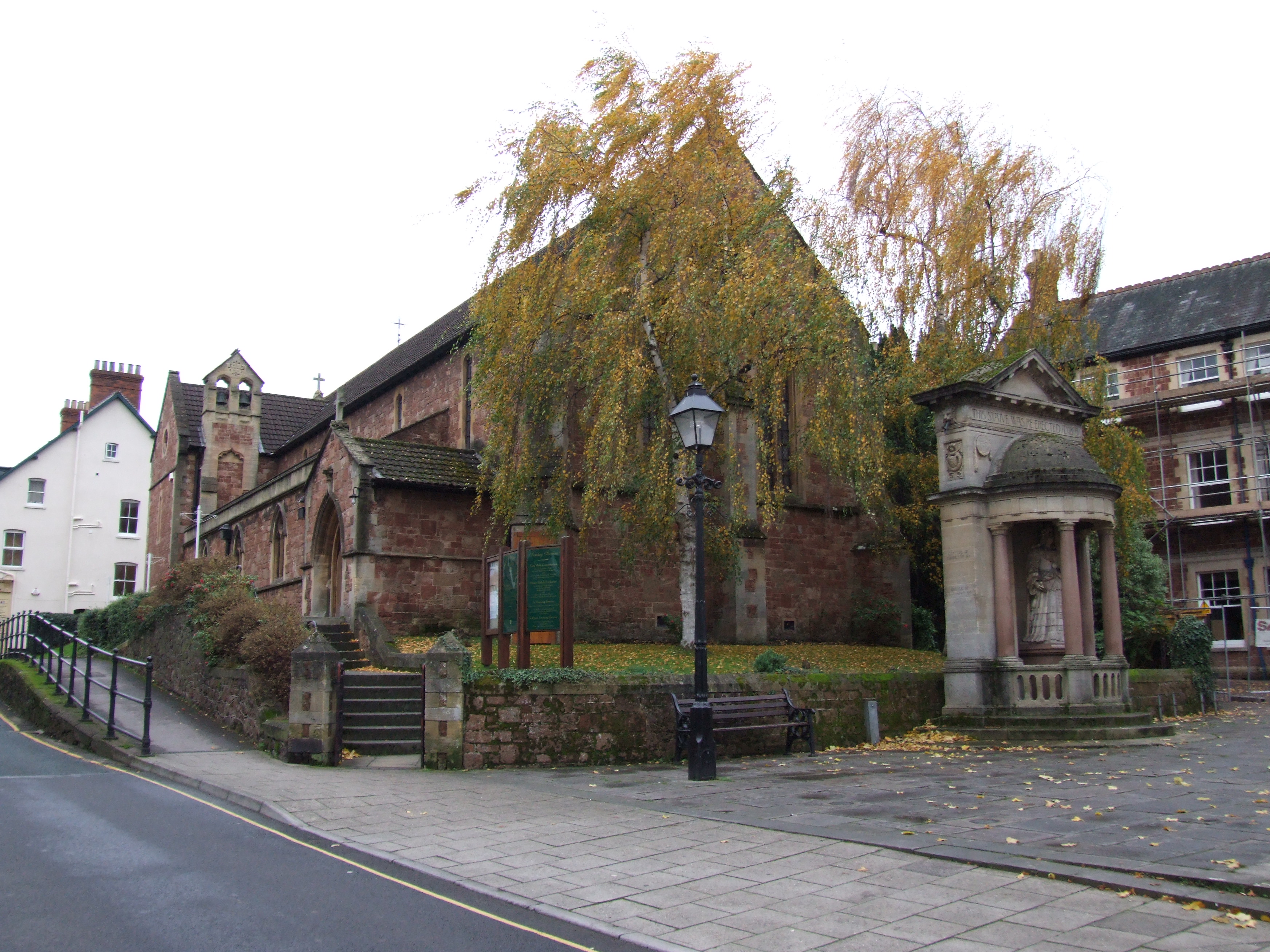
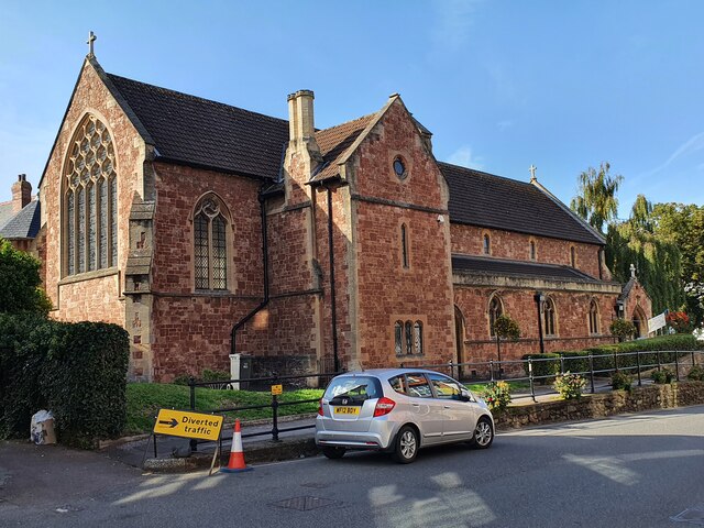
St Andrew's Church, Minehead

St Andrew's Church is a Church of England church in Minehead, Somerset, England. Designed by George Edmund Street, it was built in 1877–80 and has been...
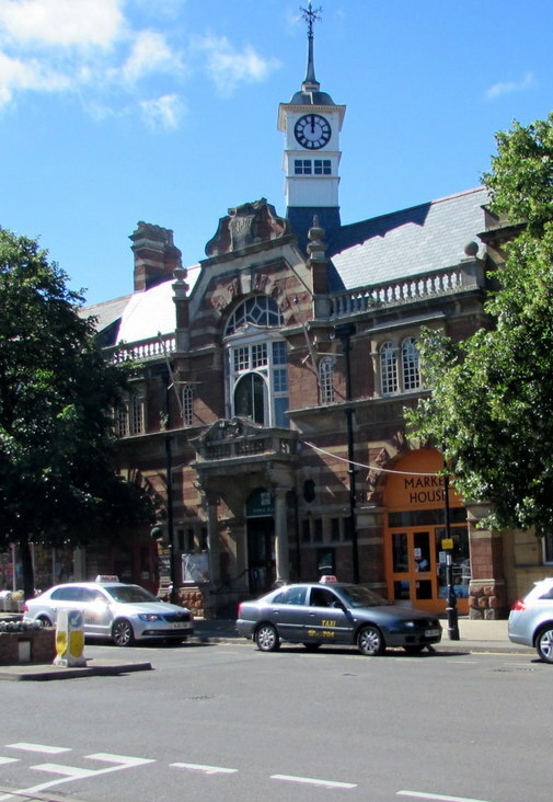
Minehead Town Hall

Minehead Town Hall is a municipal building in The Parade, Minehead, Somerset, England. The structure, which is the meeting place of Minehead Town Council...

The Kildare Lodge Inn

The Kildare Lodge Inn in Minehead, Somerset, England, was built in 1905/6, and is located at 18 Townsend Road, to the south east of the town centre of...

Church of St Michael, Minehead

The Anglican Church of St Michael in Minehead, Somerset, England was built in the 15th century. It is a Grade II* listed building. == History == The church...

Dunster Park and Heathlands

Dunster Park and Heathlands (grid reference SS955441) is a 466.6 hectare biological Site of Special Scientific Interest in Somerset, notified in 2000....

Nearby Amenities

Located within 500m of 51.202234,-3.5009278
Minehead & Exmoor Caravan & Camping Park
Toilets: yes
Tourism: caravan_site
Lat/Long: 51.2013417/-3.5025544
Barrier: bollard
Lat/Long: 51.2007986/-3.4966081
Middlecombe
Place: locality
Lat/Long: 51.2010622/-3.5019248
Power: pole
Lat/Long: 51.1990956/-3.4976596
Power: pole
Lat/Long: 51.2001952/-3.4975395
Power: pole
Lat/Long: 51.2001771/-3.4973384
Power: pole
Source: bing
Lat/Long: 51.2006998/-3.5030334
Power: pole
Source: bing
Lat/Long: 51.2005284/-3.5042591
Power: pole
Source: bing
Lat/Long: 51.2002982/-3.5059489
Power: pole
Source: bing
Lat/Long: 51.2001788/-3.5068166
Power: pole
Source: bing
Lat/Long: 51.2063969/-3.5005389
Power: pole
Source: bing
Lat/Long: 51.2062692/-3.5020168
Power: pole
Source: bing
Lat/Long: 51.2061566/-3.5034867
Power: pole
Source: bing
Transformer: distribution
Lat/Long: 51.2022981/-3.5045569
Power: pole
Source: bing
Lat/Long: 51.202788/-3.5047245
Power: pole
Source: bing
Lat/Long: 51.2031552/-3.5048506
Power: pole
Source: bing
Lat/Long: 51.2040131/-3.5051402
Power: pole
Source: bing
Lat/Long: 51.2049786/-3.5054635
Power: pole
Source: bing
Lat/Long: 51.2060575/-3.5047004
Generator Method: photovoltaic
Generator Output Electricity: yes
Generator Source: solar
Generator Type: solar_photovoltaic_panel
Location: roof
Power: generator
Lat/Long: 51.2026393/-3.4980525
Generator Method: photovoltaic
Generator Output Electricity: yes
Generator Source: solar
Generator Type: solar_photovoltaic_panel
Location: roof
Power: generator
Lat/Long: 51.2024754/-3.4951812
Generator Method: photovoltaic
Generator Output Electricity: yes
Generator Source: solar
Generator Type: solar_photovoltaic_panel
Location: roof
Power: generator
Lat/Long: 51.2036468/-3.4956855
Generator Method: photovoltaic
Generator Output Electricity: yes
Generator Source: solar
Generator Type: solar_photovoltaic_panel
Location: roof
Power: generator
Lat/Long: 51.2036787/-3.4957203
Generator Method: photovoltaic
Generator Output Electricity: yes
Generator Source: solar
Generator Type: solar_photovoltaic_panel
Location: roof
Power: generator
Lat/Long: 51.2032686/-3.4968013
Generator Method: photovoltaic
Generator Output Electricity: yes
Generator Source: solar
Generator Type: solar_photovoltaic_panel
Location: roof
Power: generator
Lat/Long: 51.2032199/-3.4968549
Generator Method: photovoltaic
Generator Output Electricity: yes
Generator Source: solar
Generator Type: solar_photovoltaic_panel
Location: roof
Power: generator
Lat/Long: 51.2028586/-3.4979653
Generator Method: photovoltaic
Generator Output Electricity: yes
Generator Source: solar
Generator Type: solar_photovoltaic_panel
Location: roof
Power: generator
Lat/Long: 51.2029275/-3.4979063
Generator Method: photovoltaic
Generator Output Electricity: yes
Generator Source: solar
Generator Type: solar_photovoltaic_panel
Location: roof
Power: generator
Lat/Long: 51.2029325/-3.4976059
Generator Method: photovoltaic
Generator Output Electricity: yes
Generator Source: solar
Generator Type: solar_photovoltaic_panel
Location: roof
Power: generator
Lat/Long: 51.2029779/-3.4977186
Generator Method: photovoltaic
Generator Output Electricity: yes
Generator Source: solar
Generator Type: solar_photovoltaic_panel
Location: roof
Power: generator
Lat/Long: 51.2033275/-3.4972653
Generator Method: photovoltaic
Generator Output Electricity: yes
Generator Source: solar
Generator Type: solar_photovoltaic_panel
Location: roof
Power: generator
Lat/Long: 51.2039594/-3.4962139
Generator Method: photovoltaic
Generator Output Electricity: yes
Generator Source: solar
Generator Type: solar_photovoltaic_panel
Location: roof
Power: generator
Lat/Long: 51.2040367/-3.4961656
Turning Circle
Lat/Long: 51.2022645/-3.5032995
Communication 2G: yes
Communication 3G: yes
Communication 4G: yes
Communication 4G+: yes
Man Made: antenna
Operator: Vodafone and o2
Lat/Long: 51.199009/-3.4985821
Traffic Calming: choker
Lat/Long: 51.2032199/-3.4959223
Periton
Old Name: Perriton
Place: neighbourhood
Lat/Long: 51.2018053/-3.4961693
The data included in this document is from www.openstreetmap.org. The data is made available under ODbL.

Have you been to Mount Brake?

Leave your review of Mount Brake below (or comments, questions and feedback).