Vanters Cleeve Plantation

Wood, Forest in Somerset Somerset West and Taunton

England

Vanters Cleeve Plantation

Haddeo Valley Lady Harriet Acland's drive in the Haddeo valley near the village of Bury.
Haddeo Valley Credit: Philip Halling

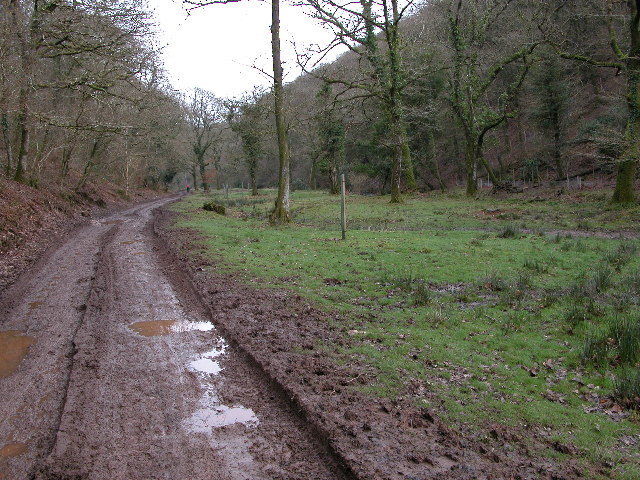
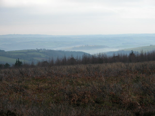
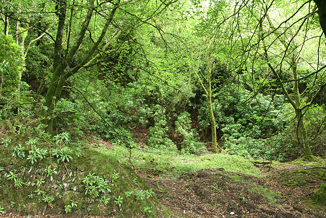
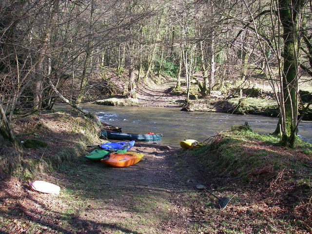
Vanters Cleeve Plantation is a woodland area located in Somerset, England. Spanning approximately 200 acres, it is a notable site for nature enthusiasts and those seeking tranquility amidst natural surroundings. The plantation is situated in a rural area, characterized by rolling hills and picturesque landscapes.

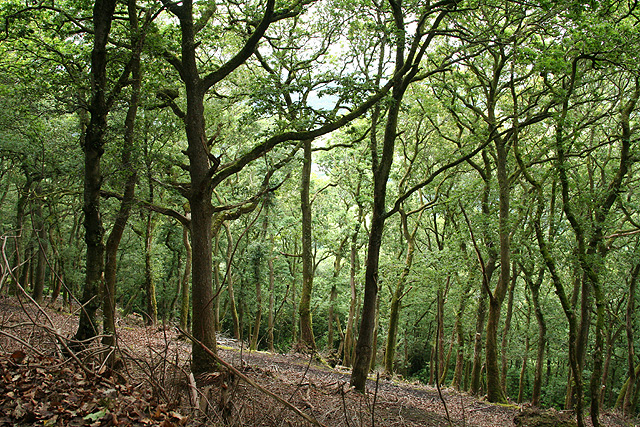
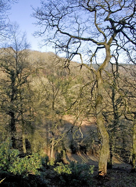
The woodland is predominantly made up of native broadleaf trees such as oak, beech, and ash. These trees create a dense canopy that provides shade and shelter for a diverse range of flora and fauna. The forest floor is adorned with an array of wildflowers, including bluebells in the springtime, adding a vibrant touch to the serene environment.

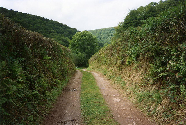
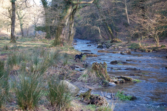
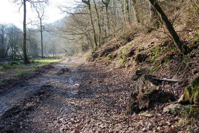
Vanters Cleeve Plantation offers numerous walking trails, allowing visitors to explore its beauty at their own pace. The pathways wind through the trees, offering glimpses of wildlife such as deer, squirrels, and a variety of bird species. These trails are well-maintained and accessible, making it suitable for individuals of all ages and abilities.

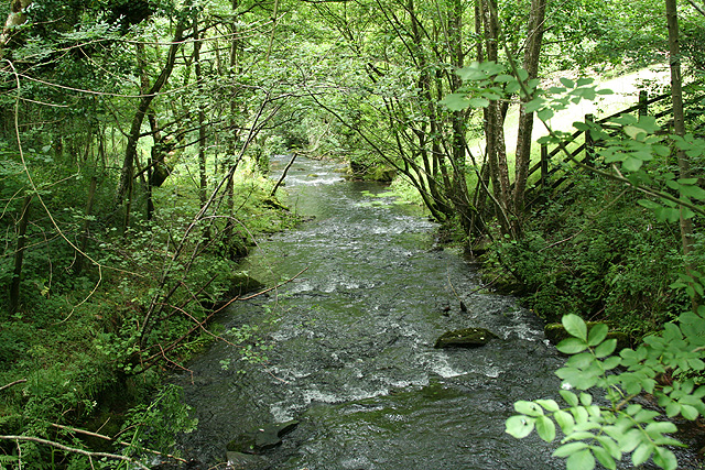
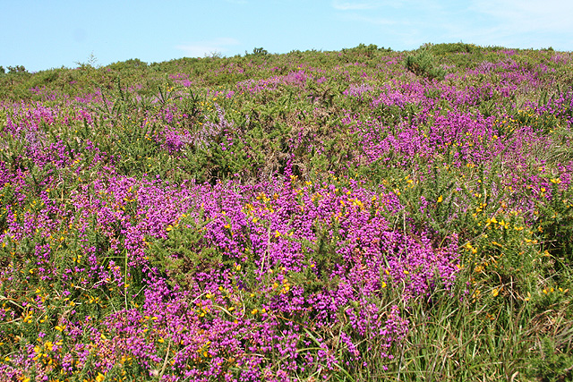
The plantation is also a designated Site of Special Scientific Interest (SSSI) due to its ecological significance. It supports a diverse range of habitats, including ancient woodland, wetland areas, and limestone grassland. This diversity attracts a wide range of animal species, including bats, butterflies, and rare birds.

Vanters Cleeve Plantation provides an ideal setting for nature lovers to reconnect with the natural world and enjoy the tranquility of a woodland environment. Its rich biodiversity and well-preserved landscapes make it a cherished location for both locals and tourists seeking an escape from the hustle and bustle of daily life.

If you have any feedback on the listing, please let us know in the comments section below.

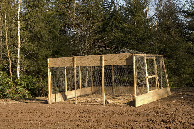
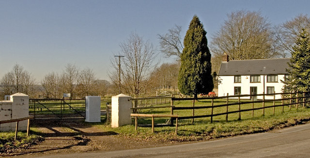
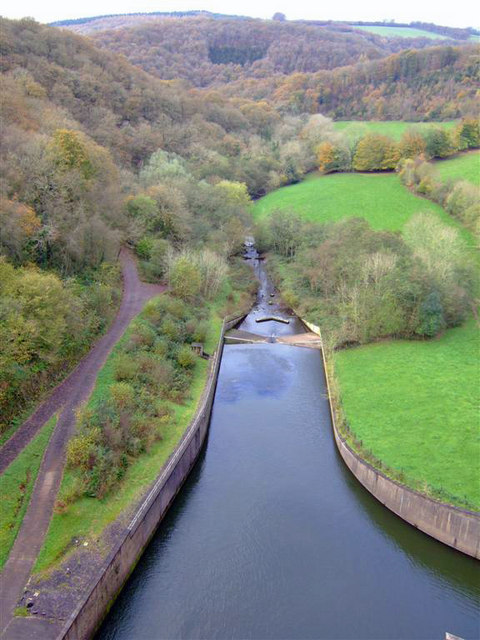
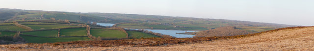
Vanters Cleeve Plantation Images

Images are sourced within 2km of 51.056635/-3.5084712 or Grid Reference SS9429. Thanks to Geograph Open Source API. All images are credited.

Haddeo Valley Lady Harriet Acland's drive in the Haddeo valley near the village of Bury.
Haddeo Valley
Lady Harriet Acland's drive in the Haddeo valley near the village of Bury.
View south-west from Haddon Hill
Brompton Regis: ford at Hartford The ford is a crossing of the Pulham River, a tributary of the Haddeo. The location was revisited by the photographer in October 2005 and in all essentials the view remains the same, although the light conditions did not obtain
Brompton Regis: ford at Hartford
The ford is a crossing of the Pulham River, a tributary of the Haddeo. The location was revisited by the photographer in October 2005 and in all essentials the view remains the same, although the light conditions did not obtain
Brompton Regis: Hartford Track and bridleway in the Haddeo valley leading to Bury. Looking west
Brompton Regis: Hartford
Track and bridleway in the Haddeo valley leading to Bury. Looking west
Dulverton: Stockham Former farm buildings. Looking east-north-east
Dulverton: Stockham
Former farm buildings. Looking east-north-east
Brompton Regis: the A396 in the Exe Valley River and road adjoin. Looking west-south-west on the edge of Brockhole Wood
Brompton Regis: the A396 in the Exe Valley
River and road adjoin. Looking west-south-west on the edge of Brockhole Wood
Brompton Regis: old quarry On Bury Hill by the road from Machine Cross, and now populated with rhododendrons. Looking north east
Brompton Regis: old quarry
On Bury Hill by the road from Machine Cross, and now populated with rhododendrons. Looking north east
Brompton Regis: Barlynch Wood A hanging wood in the Exe valley. Looking south-south-west
Brompton Regis: Barlynch Wood
A hanging wood in the Exe valley. Looking south-south-west
Brompton Regis: the River Haddeo Looking west-north-west from a footbridge below the Wimbleball dam
Brompton Regis: the River Haddeo
Looking west-north-west from a footbridge below the Wimbleball dam
Brompton Regis: heather on Haddon Hill Looking north
Brompton Regis: heather on Haddon Hill
Looking north
Ford over the Exe A ford where a private track crosses the river Exe
Ford over the Exe
A ford where a private track crosses the river Exe
View from the banks of River Haddeo
Heading Southwest along Bridleway next to River Haddeo
Lyncombe Wood Ancient oaks dominate this part of the wood where the land falls steeply towards the River Haddeo after it emerges from the Wimbleball Reservoir dam.  It is now possible to reach Hartford and the reservoir by this permitted footpath from Louisa Gate.
Lyncombe Wood
Ancient oaks dominate this part of the wood where the land falls steeply towards the River Haddeo after it emerges from the Wimbleball Reservoir dam. It is now possible to reach Hartford and the reservoir by this permitted footpath from Louisa Gate.
Lyncombe Wood There are several pheasant feeding stations beside the permitted path.  Smart birds will fly SE and seek refuge in the League Against Cruel Sports sanctuary at Louisa Gate.
Lyncombe Wood
There are several pheasant feeding stations beside the permitted path. Smart birds will fly SE and seek refuge in the League Against Cruel Sports sanctuary at Louisa Gate.
Baronsdown Deer Sanctuary The sanctuary is run by the League Against Cruel Sports and the high fencing can be seen behind the white notice.
Baronsdown Deer Sanctuary
The sanctuary is run by the League Against Cruel Sports and the high fencing can be seen behind the white notice.
Wimbleball Dam View downstream from the top of the dam
Wimbleball Dam
View downstream from the top of the dam
Exmoor : Wimbleball Lake & Scenery A panorama taken from Haddon Hill looking back towards the lake and its surroundings.
Exmoor : Wimbleball Lake & Scenery
A panorama taken from Haddon Hill looking back towards the lake and its surroundings.
Show me another place!

Vanters Cleeve Plantation is located at Grid Ref: SS9429 (Lat: 51.056635, Lng: -3.5084712)

Administrative County: Somerset

District: Somerset West and Taunton

Police Authority: Avon and Somerset

What 3 Words

///drove.hedgehog.boils. Near Dulverton, Somerset

Related Wikis

Haddon Hill

Haddon Hill is a prominent east–west aligned ridge in west Somerset, England, close to Hartford within the civil parish of Brompton Regis. It lies on the...

Church of St Mary, Brompton Regis

The Anglican Church of St Mary in Brompton Regis, Somerset, England was built in the 13th century. It is a Grade II* listed building. == History == The...

Brompton Regis

Brompton Regis (formerly known as Kingsbrompton) is a village and civil parish in the Somerset West and Taunton district of Somerset, England about 5 miles...

Barlynch Priory

Barlynch Priory (also known as St Nicholas's Priory and sometimes spelled Barlich Priory) in Brompton Regis, Somerset, England was an Augustinian priory...

Nearby Amenities

Located within 500m of 51.056635,-3.5084712
Storridge Plantations
Place: locality
Lat/Long: 51.0561805/-3.502784
Lyncombe Lake
Place: locality
Lat/Long: 51.0546394/-3.5069427
Vanters Cleeve Plantation
Place: locality
Lat/Long: 51.0553384/-3.5091512
Lyncombe Wood
Place: locality
Lat/Long: 51.052562/-3.5093861
The data included in this document is from www.openstreetmap.org. The data is made available under ODbL.

Have you been to Vanters Cleeve Plantation?

Leave your review of Vanters Cleeve Plantation below (or comments, questions and feedback).