Higher Waydown Plantation

Wood, Forest in Somerset Somerset West and Taunton

England

Higher Waydown Plantation

Ordnance Survey Cut Mark This OS cut mark can be found on the wall of the old rectory. It marks a point 117.433m above mean sea level.
Ordnance Survey Cut Mark Credit: Adrian Dust

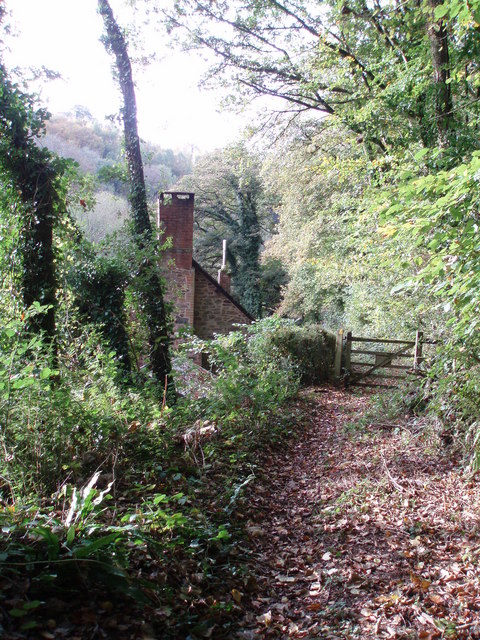
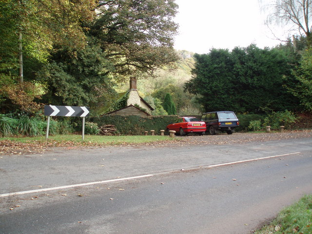
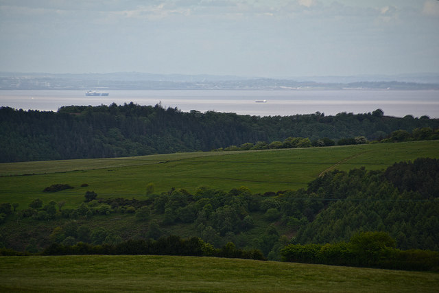
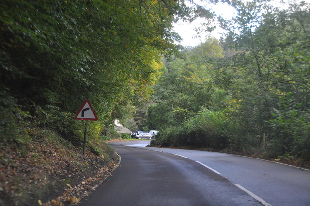
Higher Waydown Plantation is a picturesque woodland estate located in Somerset, England. Situated amidst lush greenery and majestic trees, this enchanting forest covers an expansive area, making it a haven for nature enthusiasts and those seeking tranquility.

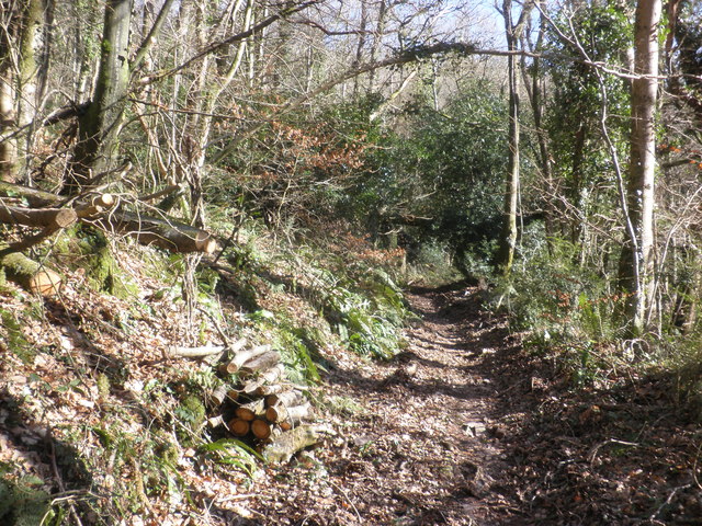
The plantation boasts a diverse range of flora, including towering oak trees, delicate wildflowers, and vibrant ferns. These plants create a harmonious environment, providing a sanctuary for a variety of wildlife. It is not uncommon to spot deer gracefully roaming through the forest or catch a glimpse of rare bird species nesting in the treetops.

Visitors to Higher Waydown Plantation can explore its numerous walking trails that wind through the woodlands. These paths offer breathtaking views of the surrounding countryside and provide an opportunity to immerse oneself in the natural beauty of the area. The plantation also features picnic spots, inviting visitors to relax and enjoy a meal in the midst of nature.

For those interested in the history of the estate, Higher Waydown Plantation has a rich heritage dating back several centuries. The site was once a working plantation, with evidence of past farming activities still visible today. This historical significance adds an extra layer of charm and intrigue to the plantation.

Higher Waydown Plantation is a true gem in Somerset, offering a unique and captivating experience for visitors of all ages. Whether you are an avid nature lover, history enthusiast, or simply seeking a peaceful retreat, this woodland estate is sure to leave a lasting impression.

If you have any feedback on the listing, please let us know in the comments section below.

Higher Waydown Plantation Images

Images are sourced within 2km of 51.162009/-3.5149387 or Grid Reference SS9441. Thanks to Geograph Open Source API. All images are credited.

Ordnance Survey Cut Mark This OS cut mark can be found on the wall of the old rectory. It marks a point 117.433m above mean sea level.
Ordnance Survey Cut Mark
This OS cut mark can be found on the wall of the old rectory. It marks a point 117.433m above mean sea level.
Ordnance Survey Cut Mark This OS cut mark can be found on the wall of Huntsham. It marks a point 72.713m above mean sea level.
Ordnance Survey Cut Mark
This OS cut mark can be found on the wall of Huntsham. It marks a point 72.713m above mean sea level.
Ordnance Survey Cut Mark This OS cut mark can be found on the east parapet of Cow Bridge. It marks a point 62.410m above mean sea level.
Ordnance Survey Cut Mark
This OS cut mark can be found on the east parapet of Cow Bridge. It marks a point 62.410m above mean sea level.
Ordnance Survey Flush Bracket (11195) This OS Flush Bracket can be found on the NE angle of the school house. It marks a point 77.073m above mean sea level.
Ordnance Survey Flush Bracket (11195)
This OS Flush Bracket can be found on the NE angle of the school house. It marks a point 77.073m above mean sea level.
Ordnance Survey Cut Mark This OS cut mark can be found on the SW angle of St Petrock's Church. It marks a point 81.800m above mean sea level.
Ordnance Survey Cut Mark
This OS cut mark can be found on the SW angle of St Petrock's Church. It marks a point 81.800m above mean sea level.
Sully Sully consists of one cottage. Photo taken from the footpath in the woods behind the cottage.
Sully
Sully consists of one cottage. Photo taken from the footpath in the woods behind the cottage.
Sully, on the A396 near Wheddon Cross. The one and only dwelling in Sully.
Sully, on the A396 near Wheddon Cross.
The one and only dwelling in Sully.
Sunset over Stowey Ball The last of a beautifully cloudless February day on Exmoor.
Sunset over Stowey Ball
The last of a beautifully cloudless February day on Exmoor.
West Somerset : Grassy Field A digger in the field seen while heading along the right of way.
West Somerset : Grassy Field
A digger in the field seen while heading along the right of way.
West Somerset : Grassy Field & Sheep Sheep grazing in a grassy field.
West Somerset : Grassy Field & Sheep
Sheep grazing in a grassy field.
West Somerset : Countryside Scenery Looking out across the West Somerset countryside.
West Somerset : Countryside Scenery
Looking out across the West Somerset countryside.
West Somerset : Countryside Scenery Looking out across the countryside with the Bristol Channel in view with some ships in the sea.
West Somerset : Countryside Scenery
Looking out across the countryside with the Bristol Channel in view with some ships in the sea.
West Somerset : Country Lane A small lane heading through the West Somerset countryside.
West Somerset : Country Lane
A small lane heading through the West Somerset countryside.
West Somerset : Country Lane A lane heads to West Harwood Farm.
West Somerset : Country Lane
A lane heads to West Harwood Farm.
Cottage at Sully
Cottage at Sully
Footpath through Stowey Wood
West Somerset : The A396 The A396 heading through West Somerset.
West Somerset : The A396
The A396 heading through West Somerset.
West Somerset : The A396 The A396 heading through the West Somerset countryside.
West Somerset : The A396
The A396 heading through the West Somerset countryside.
Show me another place!

Higher Waydown Plantation is located at Grid Ref: SS9441 (Lat: 51.162009, Lng: -3.5149387)

Administrative County: Somerset

District: Somerset West and Taunton

Police Authority: Avon and Somerset

What 3 Words

///emeralds.flops.drags. Near Minehead, Somerset

Related Wikis

Wootton Courtenay

Wootton Courtenay is a village and civil parish on Exmoor in the Somerset West and Taunton district of Somerset, England. The parish includes the hamlets...

Church of St John, Cutcombe

The Anglican Church of St John in Cutcombe, Somerset, England was built in the 13th and 14th centuries. It is a Grade II* listed building. == History... ==

Cutcombe

Cutcombe is a village and civil parish 9 miles (14 km) south of Minehead and north of Dulverton straddling the ridge between Exmoor and the Brendon Hills...

Dunster Park and Heathlands

Dunster Park and Heathlands (grid reference SS955441) is a 466.6 hectare biological Site of Special Scientific Interest in Somerset, notified in 2000....

Timberscombe

Timberscombe is a village and civil parish on the River Avill 2.5 miles (4 km) south-west of Dunster, and 5.5 miles (9 km) south of Minehead within the...

Chapel of St Leonard, Tivington

The Anglican Chapel of St Leonard in Tivington, Somerset, England was built in the mid 14th century as a chapel of ease. It is a Grade II* listed building...

Long Wood Enclosure

Long Wood Enclosure is an enclosure which may have been a univallate Iron Age hill fort, in the West Somerset district of Somerset, England. The hill fort...

Dovecot at Blackford Farm

The Dovecot At Blackford Farm in Selworthy on Exmoor within the English county of Somerset was probably built in the 11th century. It is a Grade II* listed...

Nearby Amenities

Located within 500m of 51.162009,-3.5149387
Harwood Cross
Junction: yes
Lat/Long: 51.1622763/-3.5111964
Historic: milestone
Inscription: 6 Miles to Minehead
Lat/Long: 51.163797/-3.5090159
Power: pole
Lat/Long: 51.158512/-3.5172035
Power: pole
Lat/Long: 51.1601858/-3.514941
Power: pole
Lat/Long: 51.1617249/-3.5128865
Power: pole
Lat/Long: 51.1625895/-3.5115293
Power: pole
Lat/Long: 51.163301/-3.510392
Power: pole
Lat/Long: 51.1641033/-3.5091582
The data included in this document is from www.openstreetmap.org. The data is made available under ODbL.

Have you been to Higher Waydown Plantation?

Leave your review of Higher Waydown Plantation below (or comments, questions and feedback).