Black Cleeve Copse
Wood, Forest in Somerset Somerset West and Taunton
England
Black Cleeve Copse
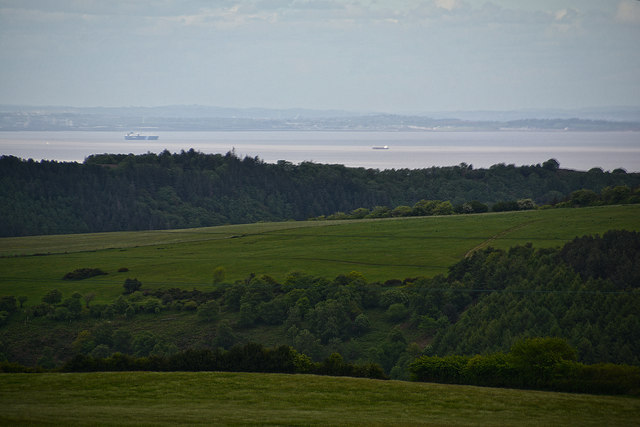
Black Cleeve Copse is a scenic woodland located in Somerset, England. Covering an area of approximately 20 hectares, this ancient forest is renowned for its natural beauty and diverse ecosystem. The copse is situated on the slopes of Black Cleeve Hill, offering stunning views of the surrounding countryside.
The woodland is predominantly composed of deciduous trees, including oak, beech, and ash, which create a dense canopy overhead. These trees provide a habitat for a wide range of flora and fauna, making it a popular spot for nature enthusiasts and wildlife photographers. The forest floor is adorned with an array of wildflowers, such as bluebells and primroses, adding to its charm.
Black Cleeve Copse is also home to various species of birds, including woodpeckers, owls, and warblers. Visitors may also spot mammals like deer, foxes, and badgers roaming the forest. The copse is a designated Site of Special Scientific Interest (SSSI), highlighting its importance for conservation and biodiversity.
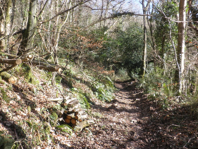
The woodland offers several walking trails, allowing visitors to fully immerse themselves in its tranquil atmosphere. These paths meander through the trees, revealing hidden clearings and enchanting glades. The copse is a haven for those seeking solace in nature, providing a peaceful retreat away from the hustle and bustle of daily life.
Overall, Black Cleeve Copse is a captivating woodland that showcases the natural beauty of Somerset. Its rich biodiversity and picturesque landscapes make it a must-visit destination for anyone looking to connect with nature.
If you have any feedback on the listing, please let us know in the comments section below.
Black Cleeve Copse Images
Images are sourced within 2km of 51.161404/-3.5171928 or Grid Reference SS9441. Thanks to Geograph Open Source API. All images are credited.


Black Cleeve Copse is located at Grid Ref: SS9441 (Lat: 51.161404, Lng: -3.5171928)
Administrative County: Somerset
District: Somerset West and Taunton
Police Authority: Avon and Somerset
What 3 Words
///impaired.hiking.masks. Near Minehead, Somerset
Related Wikis

Wootton Courtenay
Wootton Courtenay is a village and civil parish on Exmoor in the Somerset West and Taunton district of Somerset, England. The parish includes the hamlets...

Church of St John, Cutcombe
The Anglican Church of St John in Cutcombe, Somerset, England was built in the 13th and 14th centuries. It is a Grade II* listed building. == History... ==
Cutcombe
Cutcombe is a village and civil parish 9 miles (14 km) south of Minehead and north of Dulverton straddling the ridge between Exmoor and the Brendon Hills...

Timberscombe
Timberscombe is a village and civil parish on the River Avill 2.5 miles (4 km) south-west of Dunster, and 5.5 miles (9 km) south of Minehead within the...

Dunster Park and Heathlands
Dunster Park and Heathlands (grid reference SS955441) is a 466.6 hectare biological Site of Special Scientific Interest in Somerset, notified in 2000....

Chapel of St Leonard, Tivington
The Anglican Chapel of St Leonard in Tivington, Somerset, England was built in the mid 14th century as a chapel of ease. It is a Grade II* listed building...

Long Wood Enclosure
Long Wood Enclosure is an enclosure which may have been a univallate Iron Age hill fort, in the West Somerset district of Somerset, England. The hill fort...

Dovecot at Blackford Farm
The Dovecot At Blackford Farm in Selworthy on Exmoor within the English county of Somerset was probably built in the 11th century. It is a Grade II* listed...
Nearby Amenities
Located within 500m of 51.161404,-3.5171928Have you been to Black Cleeve Copse?
Leave your review of Black Cleeve Copse below (or comments, questions and feedback).