Wootton Plantation

Wood, Forest in Somerset Somerset West and Taunton

England

Wootton Plantation

Ordnance Survey Cut Mark This OS cut mark can be found on the wall of the old rectory. It marks a point 117.433m above mean sea level.
Ordnance Survey Cut Mark Credit: Adrian Dust

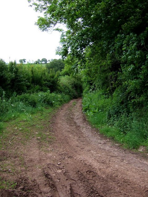
Wootton Plantation, located in Somerset, England, is a picturesque woodland area known for its natural beauty and rich history. Situated in the heart of the county, this sprawling plantation is surrounded by lush green forests and rolling hills, making it a haven for nature enthusiasts and history buffs alike.

Covering an extensive area, Wootton Plantation is home to a diverse range of flora and fauna, including towering oak and beech trees, vibrant wildflowers, and a variety of bird species. The plantation's dense woodland provides shelter and sustenance for many animals, creating a thriving ecosystem within its borders.

In addition to its natural wonders, Wootton Plantation holds significant historical value. It is believed to have been in existence since medieval times, with records dating back to the 13th century. Throughout the years, the plantation has witnessed various events and changes, making it a fascinating site for archaeological and historical research.

Visitors to Wootton Plantation can explore its vast network of walking trails and enjoy the tranquil ambiance of the surrounding natural environment. The plantation also offers opportunities for birdwatching, photography, and picnicking. Additionally, guided tours are available for those interested in delving deeper into the plantation's history and heritage.

Wootton Plantation, Somerset, is a testament to the enduring beauty of nature and the rich tapestry of human history. Its combination of stunning landscapes and historical significance makes it a must-visit destination for those seeking a blend of natural splendor and cultural exploration.

If you have any feedback on the listing, please let us know in the comments section below.

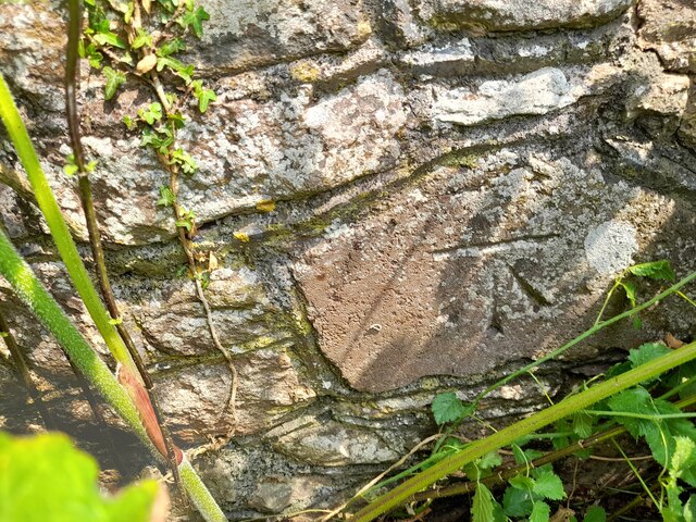
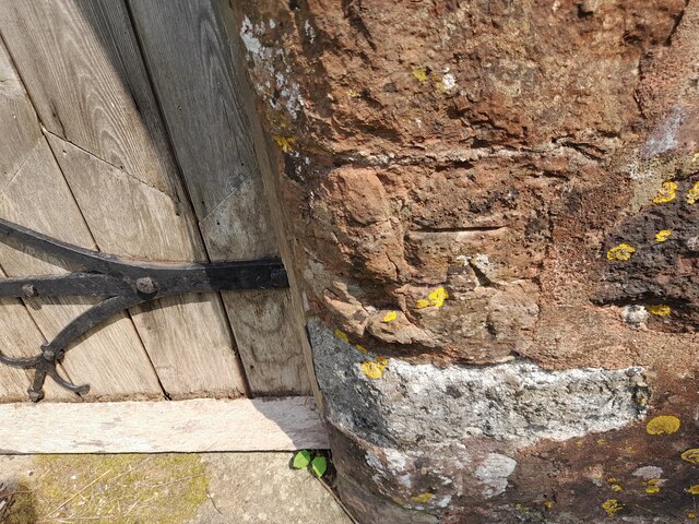
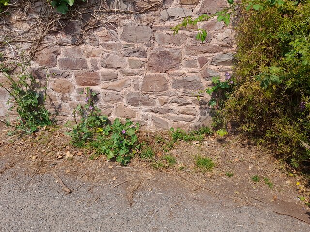
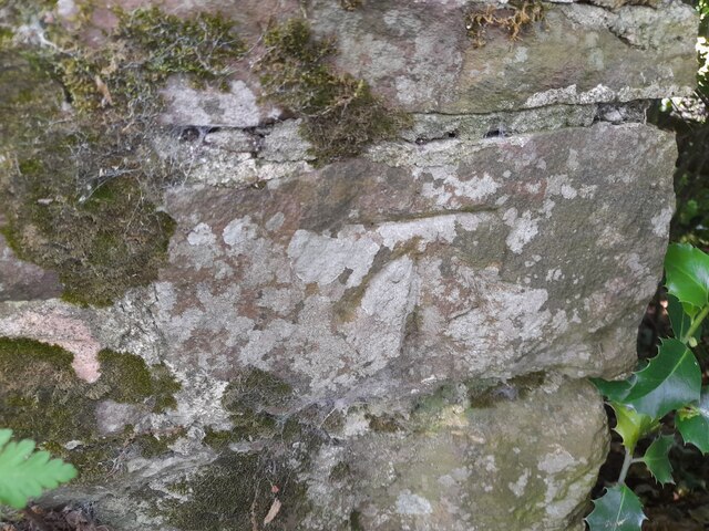
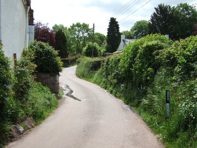
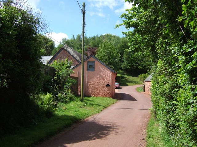
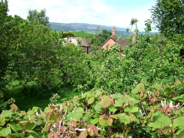
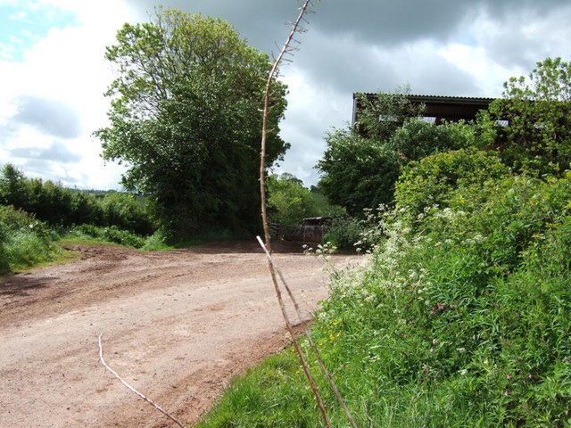
Wootton Plantation Images

Images are sourced within 2km of 51.176011/-3.517701 or Grid Reference SS9442. Thanks to Geograph Open Source API. All images are credited.

Ordnance Survey Cut Mark This OS cut mark can be found on the wall of the old rectory. It marks a point 117.433m above mean sea level.
Ordnance Survey Cut Mark
This OS cut mark can be found on the wall of the old rectory. It marks a point 117.433m above mean sea level.
Ordnance Survey Cut Mark This OS cut mark can be found on the NW angle of All Saints Church. It marks a point 129.863m above mean sea level.
Ordnance Survey Cut Mark
This OS cut mark can be found on the NW angle of All Saints Church. It marks a point 129.863m above mean sea level.
Ordnance Survey Cut Mark This OS cut mark can be found on the wall of Huntsham. It marks a point 72.713m above mean sea level.
Ordnance Survey Cut Mark
This OS cut mark can be found on the wall of Huntsham. It marks a point 72.713m above mean sea level.
Ordnance Survey Cut Mark This OS cut mark can be found on the east parapet of Cow Bridge. It marks a point 62.410m above mean sea level.
Ordnance Survey Cut Mark
This OS cut mark can be found on the east parapet of Cow Bridge. It marks a point 62.410m above mean sea level.
Ordnance Survey Flush Bracket (11195) This OS Flush Bracket can be found on the NE angle of the school house. It marks a point 77.073m above mean sea level.
Ordnance Survey Flush Bracket (11195)
This OS Flush Bracket can be found on the NE angle of the school house. It marks a point 77.073m above mean sea level.
Ordnance Survey Cut Mark This OS cut mark can be found on the SW angle of St Petrock's Church. It marks a point 81.800m above mean sea level.
Ordnance Survey Cut Mark
This OS cut mark can be found on the SW angle of St Petrock's Church. It marks a point 81.800m above mean sea level.
Wootton Courtenay, Somerset The church of All Saints
Wootton Courtenay, Somerset
The church of All Saints
Timberscombe, Somerset The church of St Petrock
Timberscombe, Somerset
The church of St Petrock
House at Cowbridge Cross. This very smart house is quietly situated on the lane to Wootton Courtenay. The sign bears testimony to the fact that a large proportion of the passing traffic has four legs.
House at Cowbridge Cross.
This very smart house is quietly situated on the lane to Wootton Courtenay. The sign bears testimony to the fact that a large proportion of the passing traffic has four legs.
Woodland Bridleway near Wootton Courtenay This photograph looks south towards Exmoor, the bridleway goes to Ranscombe Farm.
Woodland Bridleway near Wootton Courtenay
This photograph looks south towards Exmoor, the bridleway goes to Ranscombe Farm.
Trig Point above Wootton Courtenay. Coloured white to make it easy to spot amongst the trees, this trig point is at a height of 295m. Behind the photographer is a clear view towards the Bristol Channel.
Trig Point above Wootton Courtenay.
Coloured white to make it easy to spot amongst the trees, this trig point is at a height of 295m. Behind the photographer is a clear view towards the Bristol Channel.
Huntscott The hamlet of Huntscott between the villages of Luccombe and Wootton Courtenay.
Exmoor has many of these picturesque hamlets and villages, far more so than its more rugged counterparts of Dartmoor and Bodmin Moor.
Huntscott
The hamlet of Huntscott between the villages of Luccombe and Wootton Courtenay. Exmoor has many of these picturesque hamlets and villages, far more so than its more rugged counterparts of Dartmoor and Bodmin Moor.
Brockwell Farm There is a small cluster of farm buildings at Brockwell on the lane from Wootton Courtenay to Ford. The rich pink colour looks surprisingly harmonious against the verdant greenery.
Brockwell Farm
There is a small cluster of farm buildings at Brockwell on the lane from Wootton Courtenay to Ford. The rich pink colour looks surprisingly harmonious against the verdant greenery.
Cottage at Ford Coming across cottages such as this is one of the great bonuses of Geographing. Almost at the end of a dead-end lane, probably very few people ever see this beautiful example of an Exmoor cottage.
Cottage at Ford
Coming across cottages such as this is one of the great bonuses of Geographing. Almost at the end of a dead-end lane, probably very few people ever see this beautiful example of an Exmoor cottage.
Tivington Knowle Hiding behind a hedge and orchards nestle the cottages of Tivington Knowle. The hills of Exmoor can be seen rising in the background.
Tivington Knowle
Hiding behind a hedge and orchards nestle the cottages of Tivington Knowle. The hills of Exmoor can be seen rising in the background.
Stile Down There is a large barn here and a considerable quantity of large farm machinery is parked on the verges. At this 90º bend in the lane a track (Elscombe Lane) continues on straight ahead.
Stile Down
There is a large barn here and a considerable quantity of large farm machinery is parked on the verges. At this 90º bend in the lane a track (Elscombe Lane) continues on straight ahead.
Elscombe Lane, Stile Down This track initially heads off southwards then veers more eastward as it crosses a brook. It eventually gets to Waydown Cross. I think the valley which the brook runs through is probably Elscombe giving the lane its name.
Elscombe Lane, Stile Down
This track initially heads off southwards then veers more eastward as it crosses a brook. It eventually gets to Waydown Cross. I think the valley which the brook runs through is probably Elscombe giving the lane its name.
Annicombe This is the entrance and track to the property called Annicombe which is off Spangate Lane near Stile. Beyond it is Elsworthy Allotment.
Annicombe
This is the entrance and track to the property called Annicombe which is off Spangate Lane near Stile. Beyond it is Elsworthy Allotment.
Show me another place!

Wootton Plantation is located at Grid Ref: SS9442 (Lat: 51.176011, Lng: -3.517701)

Administrative County: Somerset

District: Somerset West and Taunton

Police Authority: Avon and Somerset

What 3 Words

///shunted.regarding.pardon. Near Minehead, Somerset

Related Wikis

Wootton Courtenay

Wootton Courtenay is a village and civil parish on Exmoor in the Somerset West and Taunton district of Somerset, England. The parish includes the hamlets...

Dunster Park and Heathlands

Dunster Park and Heathlands (grid reference SS955441) is a 466.6 hectare biological Site of Special Scientific Interest in Somerset, notified in 2000....

Chapel of St Leonard, Tivington

The Anglican Chapel of St Leonard in Tivington, Somerset, England was built in the mid 14th century as a chapel of ease. It is a Grade II* listed building...

Dovecot at Blackford Farm

The Dovecot At Blackford Farm in Selworthy on Exmoor within the English county of Somerset was probably built in the 11th century. It is a Grade II* listed...

Minehead Without

Minehead Without is a civil parish in the English county of Somerset, and within the Exmoor National Park. As its name suggests, the parish covers a rural...

Luccombe, Somerset

Luccombe or Luckham is a village and civil parish in the Exmoor National Park in the English county of Somerset. It at the foot of the moor's highest hill...

Bratton Court

Bratton Court in the hamlet of Bratton within the parish of Minehead Without, Somerset, England was built as a manor house, with a 14th-century open hall...

Church of St John, Cutcombe

The Anglican Church of St John in Cutcombe, Somerset, England was built in the 13th and 14th centuries. It is a Grade II* listed building. == History... ==

Nearby Amenities

Located within 500m of 51.176011,-3.517701
Wootton Courtenay
Place: village
Wikidata: Q2237459
Wikipedia: en:Wootton Courtenay
Lat/Long: 51.1797974/-3.5204268
Post Box
Brand: Royal Mail
Brand Wikidata: Q638098
Brand Wikipedia: en:Royal Mail
Collection Times: Mo-Fr 16:00; Sa 10:45
Operator: Royal Mail
Operator Wikidata: Q638098
Post Box Type: wall
Ref: TA24 61
Royal Cypher: EIIR
Royal Cypher Wikidata: Q33102113
Lat/Long: 51.1797599/-3.5208195
The Villagers' Stores
Addr City: Minehead
Addr Country: GB
Addr County: Somerset
Addr Postcode: TA24 8RH
Addr Village: Wootton Courtenay
Fhrs Authority: West Somerset
Fhrs Id: 161226
Fhrs Local Authority Id: PI/000001196
Shop: convenience
Lat/Long: 51.179837/-3.5206765
Post Office
Wootton Courtenay Post Office
Addr City: Minehead
Addr Country: GB
Addr County: Somerset
Addr Postcode: TA24 8RH
Addr Village: Wootton Courtenay
Brand: Post Office
Brand Wikidata: Q1783168
Brand Wikipedia: en:Post Office Ltd
Opening Hours: Mo-Th 09:00-12:45
Operator: Post Office Ltd
Ref Pol Id: 10241
Lat/Long: 51.1798204/-3.5206788
Access: yes
Barrier: stile
Foot: yes
Material: wood
Stile: stepover
Vehicle: no
Lat/Long: 51.1745313/-3.5134314
Barrier: stile
Foot: yes
Material: wood
Stile: stepover
Lat/Long: 51.1804037/-3.5181896
Power: pole
Lat/Long: 51.1723292/-3.5163519
Power: pole
Lat/Long: 51.1726907/-3.5177493
Power: pole
Lat/Long: 51.1731759/-3.519313
Power: pole
Lat/Long: 51.1736754/-3.5209344
Power: pole
Lat/Long: 51.1740453/-3.5220717
Power: pole
Lat/Long: 51.174401/-3.5232277
Power: pole
Lat/Long: 51.1748802/-3.5237145
Power: pole
Lat/Long: 51.1759531/-3.5247284
Hiking: yes
Information: guidepost
Tourism: information
Lat/Long: 51.1803999/-3.5182297
Hiking: yes
Information: guidepost
Tourism: information
Lat/Long: 51.1782411/-3.5220314
Hiking: yes
Information: guidepost
Tourism: information
Lat/Long: 51.1772568/-3.5223685
Telephone
Booth: K6
Covered: booth
Listed Status: Grade II
Lat/Long: 51.1797979/-3.5200219
The data included in this document is from www.openstreetmap.org. The data is made available under ODbL.

Have you been to Wootton Plantation?

Leave your review of Wootton Plantation below (or comments, questions and feedback).