Allerford Plantation

Wood, Forest in Somerset Somerset West and Taunton

England

Allerford Plantation

Thatched cottage at Bossington c.1970
Thatched cottage at Bossington c.1970 Credit: Ronald Searle

Allerford Plantation is a picturesque woodland located in Somerset, England. Situated near the village of Allerford, the plantation covers a vast area of land and is known for its lush greenery, diverse flora and fauna, and serene atmosphere. It is a popular destination for nature enthusiasts, hikers, and birdwatchers.

The woodland is predominantly composed of various species of trees, including oak, beech, and pine. These trees create a dense canopy, providing shade and making it an ideal habitat for a wide range of wildlife. Visitors can expect to see an array of bird species, such as woodpeckers, owls, and thrushes, as well as small mammals like squirrels and rabbits.

Allerford Plantation is also home to a network of well-maintained walking trails, allowing visitors to explore its natural beauty. These trails offer stunning views of the surrounding countryside and provide an opportunity to experience the tranquility of the woodland firsthand. Additionally, there are several picnic areas scattered throughout the plantation, providing a perfect spot for families and friends to enjoy a leisurely lunch amidst the natural beauty.

The plantation is managed by the local authorities, who ensure the preservation of its rich biodiversity. They have implemented various conservation efforts, including tree planting programs and habitat restoration projects, to maintain the ecological balance of the woodland.

Overall, Allerford Plantation is a haven for nature lovers, offering a peaceful retreat from the hustle and bustle of daily life. With its scenic beauty, diverse wildlife, and well-maintained trails, it is a must-visit destination for anyone seeking a connection with nature in Somerset.

If you have any feedback on the listing, please let us know in the comments section below.

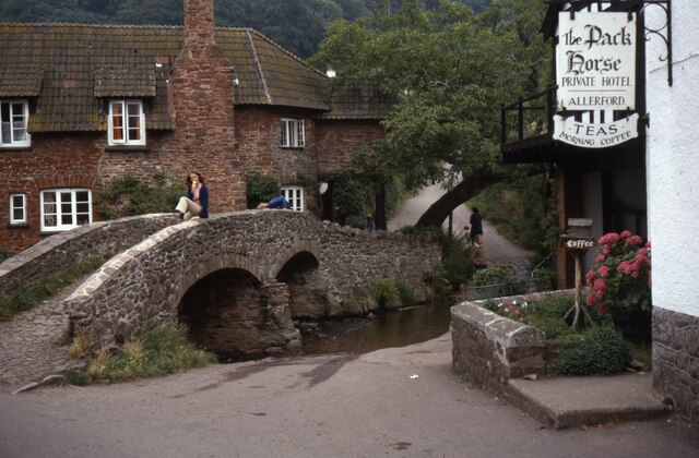
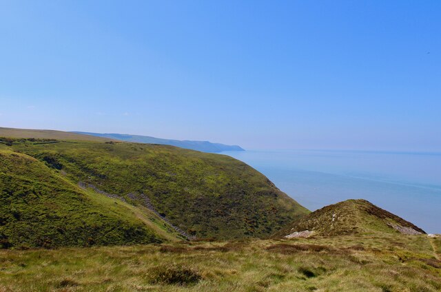
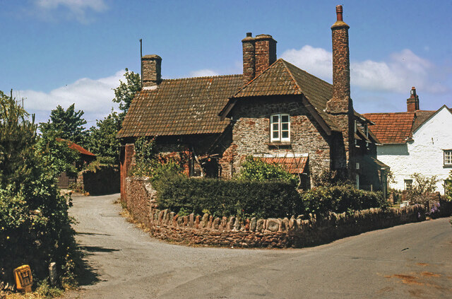
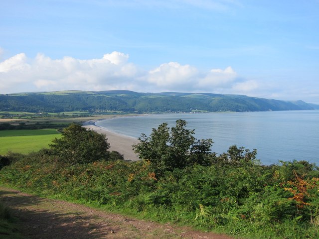
Allerford Plantation Images

Images are sourced within 2km of 51.216535/-3.56723 or Grid Reference SS9047. Thanks to Geograph Open Source API. All images are credited.

Thatched cottage at Bossington c.1970
All Saints' Church, Selworthy, Somerset All Saints' Church at Selworthy, Somerset. The Church also has an Ordnance Survey bench mark.
<a href="https://www.geograph.org.uk/photo/6999454">SS9146 : Ordnance Survey Bench Mark</a>
All Saints' Church, Selworthy, Somerset
All Saints' Church at Selworthy, Somerset. The Church also has an Ordnance Survey bench mark. SS9146 : Ordnance Survey Bench Mark
Ordnance Survey Bench Mark A very warn mark located at All Saints' Church, Selworthy. These marks were used by Ordnance Survey  for mapping purposes.
<a href="https://www.geograph.org.uk/photo/6999451">SS9146 : All Saints' Church, Selworthy, Somerset</a>
Ordnance Survey Bench Mark
A very warn mark located at All Saints' Church, Selworthy. These marks were used by Ordnance Survey for mapping purposes. SS9146 : All Saints' Church, Selworthy, Somerset
Allerford's packhorse bridge The bridge now only carries those on foot, other traffic takes the ford alongside.
Allerford's packhorse bridge
The bridge now only carries those on foot, other traffic takes the ford alongside.
South West Coast Path The South West Coast Path National Trail - 630 miles of superb coastal walking. From Minehead on the edge of the Exmoor National Park to the shores of Poole Harbour in Dorset. It is the longest of all Britain's National Trails.
Website: <span class="nowrap"><a title="http://www.southwestcoastpath.com/" rel="nofollow ugc noopener" href="http://www.southwestcoastpath.com/">Link</a><img style="margin-left:2px;" alt="External link" title="External link - shift click to open in new window" src="https://s1.geograph.org.uk/img/external.png" width="10" height="10"/></span>
South West Coast Path
The South West Coast Path National Trail - 630 miles of superb coastal walking. From Minehead on the edge of the Exmoor National Park to the shores of Poole Harbour in Dorset. It is the longest of all Britain's National Trails. Website: LinkExternal link
Allerford Post Office c.1970 Still the village Post Office to this day. Allerford, along with Bossington and Selworthy, is contained within the National Trust’s Holnicote Estate, which takes in over 12,000 acres of Exmoor coast and countryside.
Allerford Post Office c.1970
Still the village Post Office to this day. Allerford, along with Bossington and Selworthy, is contained within the National Trust’s Holnicote Estate, which takes in over 12,000 acres of Exmoor coast and countryside.
Ordnance Survey Rivet This OS rivet can be found on the small dam. It marks a point 246.639m above mean sea level.
Ordnance Survey Rivet
This OS rivet can be found on the small dam. It marks a point 246.639m above mean sea level.
Luccombe : Bossington Hill Looking towards Bossington Hill and beyond to the Bristol Channel. The Prince of Wales Bridge and Severn Bridge can be seen in the very hazy distance.
Luccombe : Bossington Hill
Looking towards Bossington Hill and beyond to the Bristol Channel. The Prince of Wales Bridge and Severn Bridge can be seen in the very hazy distance.
Porlock : Bossington Hill Looking across to Bossington Hill and beyond to the Bristol Channel.
Porlock : Bossington Hill
Looking across to Bossington Hill and beyond to the Bristol Channel.
Porlock Bay from the South West Coastal Path Porlock Weir and Gore Point are visible in the distance.
Porlock Bay from the South West Coastal Path
Porlock Weir and Gore Point are visible in the distance.
The Eastern limit of Porlock Bay viewed from The South West Coastal Path
Hurlstone Point and Porlock Bay viewed from the South West Coastal Path
Bossington Beach and Porlock Bay viewed from the South West Coastal Path The true scale of this beach is only appreciated when you notice the two individuals walking along the shingle ridge in the centre. The stones are large and walking is very difficult.
Bossington Beach and Porlock Bay viewed from the South West Coastal Path
The true scale of this beach is only appreciated when you notice the two individuals walking along the shingle ridge in the centre. The stones are large and walking is very difficult.
West Somerset's favourite sunset viewpoint? Overlooking Porlock Bay, with Foreland Point on the horizon. There must be quite a few viewpoints that people in West Somerset can go to view a sunset that promises to be spectacular. This is probably the most popular. The advantage of this location is its relative easy & quick accessibility, combined with quiet and serene surroundings. And the possibility of seeing deer on the move in the fading twilight.
West Somerset's favourite sunset viewpoint?
Overlooking Porlock Bay, with Foreland Point on the horizon. There must be quite a few viewpoints that people in West Somerset can go to view a sunset that promises to be spectacular. This is probably the most popular. The advantage of this location is its relative easy & quick accessibility, combined with quiet and serene surroundings. And the possibility of seeing deer on the move in the fading twilight.
Ordnance Survey Cut Mark This OS cut mark can be found on the SE face of the Lime Kiln. It marks a point 6.462m above mean sea level.
Ordnance Survey Cut Mark
This OS cut mark can be found on the SE face of the Lime Kiln. It marks a point 6.462m above mean sea level.
Ordnance Survey Cut Mark This OS cut mark can be found on the Methodist Chapel. It marks a point 17.654m above mean sea level.
Ordnance Survey Cut Mark
This OS cut mark can be found on the Methodist Chapel. It marks a point 17.654m above mean sea level.
Dovery Manor Museum, Porlock
Bossington Beach
Bossington Beach
Show me another place!

Allerford Plantation is located at Grid Ref: SS9047 (Lat: 51.216535, Lng: -3.56723)

Administrative County: Somerset

District: Somerset West and Taunton

Police Authority: Avon and Somerset

What 3 Words

///polo.latched.upsetting. Near Porlock, Somerset

Related Wikis

Nearby Amenities

Located within 500m of 51.216535,-3.56723
Barrier: stile
Foot: yes
Lat/Long: 51.212535/-3.5667805
Tourism: viewpoint
Lat/Long: 51.2178554/-3.5614452
Bench
Lat/Long: 51.2125565/-3.5666756
Bench
Lat/Long: 51.2130623/-3.568419
Bench
Lat/Long: 51.2202665/-3.5689233
Bench
Lat/Long: 51.214949/-3.5695993
Saint Agnes Fountain
Natural: spring
Lat/Long: 51.2150029/-3.5695026
Hiking: yes
Information: guidepost
Source: GPS survey
Tourism: information
Lat/Long: 51.2147875/-3.5693738
Bench
Lat/Long: 51.2149824/-3.5695937
Hiking: yes
Information: guidepost
Source: GPS survey
Tourism: information
Lat/Long: 51.2132384/-3.5650313
Shelter
Lat/Long: 51.2148816/-3.5655731
Hiking: yes
Information: guidepost
Source: GPS survey
Tourism: information
Lat/Long: 51.2181837/-3.5650782
Hiking: yes
Information: board
Source: GPS survey
Tourism: information
Lat/Long: 51.2182073/-3.5650004
Bench
Backrest: no
Lat/Long: 51.2179359/-3.5617979
Bench
Backrest: no
Lat/Long: 51.2178981/-3.56181
Bench
Backrest: no
Lat/Long: 51.2178519/-3.5618033
Vending Machine
Vending: parking_tickets
Lat/Long: 51.217815/-3.5612574
Hiking: yes
Information: board
Source: GPS survey
Tourism: information
Lat/Long: 51.2177579/-3.5616034
Parking
Lat/Long: 51.2177369/-3.5614479
Bossington Hall
Internet Access: yes
Operator: Bossington Hall Ltd
Rooms: 9
Tourism: guest_house
Lat/Long: 51.2171128/-3.572522
The data included in this document is from www.openstreetmap.org. The data is made available under ODbL.

Have you been to Allerford Plantation?

Leave your review of Allerford Plantation below (or comments, questions and feedback).