Sideway Wood

Wood, Forest in Somerset Somerset West and Taunton

England

Sideway Wood

Dunkery Beacon Dunkery Beacon on Exmoor, with the view of the Brendon Hills and more distant Quantock Hills behind.
Dunkery Beacon Credit: Marika Reinholds

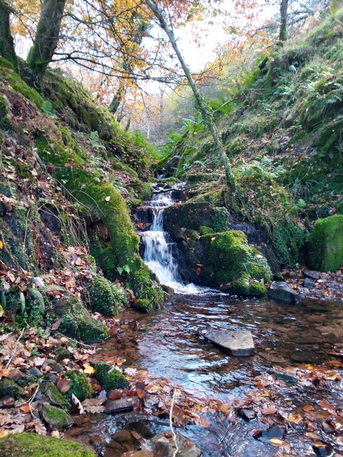
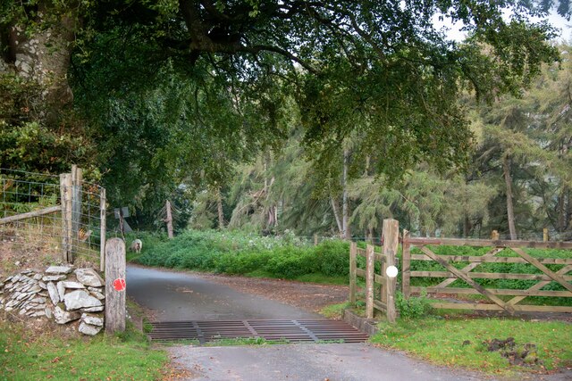
Sideway Wood is a picturesque woodland located in Somerset, England. Covering an area of approximately 50 acres, it is a popular destination for nature lovers and outdoor enthusiasts. The wood is characterized by its diverse range of tree species, including oak, beech, ash, and birch, which create a vibrant and lush environment throughout the year.

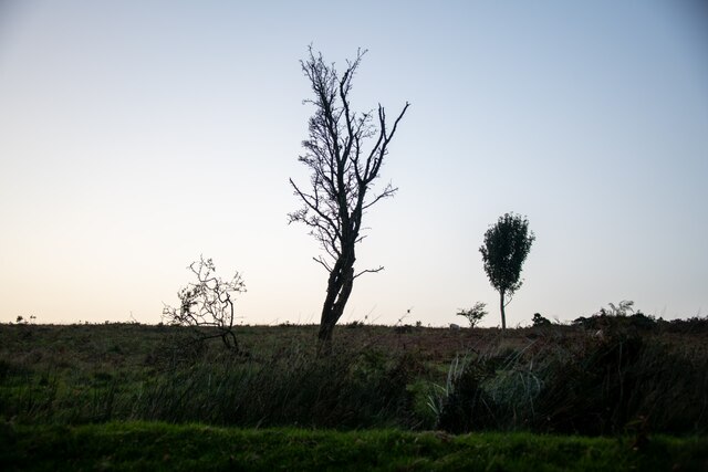
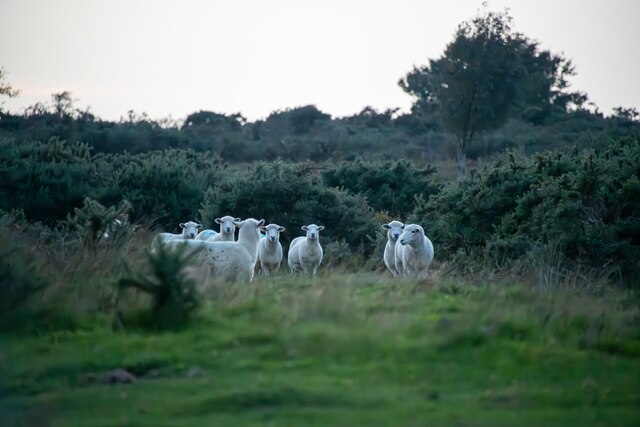
The woodland is home to a variety of wildlife, providing a haven for many species. Visitors may be lucky enough to spot deer, foxes, and a range of bird species, including woodpeckers and owls. Sideway Wood is also known for its abundance of wildflowers, which carpet the forest floor during the spring and summer months, adding to its natural beauty.

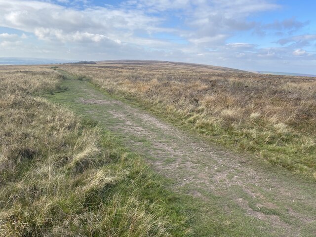
There are several walking trails that meander through the woods, allowing visitors to explore the area at their own pace. The paths are well-maintained and signposted, ensuring a safe and enjoyable experience for all. Along the way, benches are strategically placed, providing opportunities to rest and soak in the tranquil surroundings.

The wood is easily accessible, with a car park located nearby, making it a popular destination for day trips and family outings. It is a peaceful and serene location, offering a welcome escape from the hustle and bustle of everyday life.

Overall, Sideway Wood is a captivating natural haven, offering visitors a chance to immerse themselves in the beauty of Somerset's countryside and connect with nature.

If you have any feedback on the listing, please let us know in the comments section below.

Sideway Wood Images

Images are sourced within 2km of 51.174836/-3.5785618 or Grid Reference SS8942. Thanks to Geograph Open Source API. All images are credited.

Dunkery Beacon Dunkery Beacon on Exmoor, with the view of the Brendon Hills and more distant Quantock Hills behind.
Dunkery Beacon
Dunkery Beacon on Exmoor, with the view of the Brendon Hills and more distant Quantock Hills behind.
Moorland track, west of Dunkery Beacon
Dunkery Beacon At 519m the highest point on Exmoor.
Dunkery Beacon
At 519m the highest point on Exmoor.
Stream in November An upland stream which might be a raging torrent after heavy rainfall but on a fine sunny day it was just beautiful.
Stream in November
An upland stream which might be a raging torrent after heavy rainfall but on a fine sunny day it was just beautiful.
Cutcombe : Exmoor - Dunkery Beacon I headed up to Dunkery Beacon on a clear September evening to see if I could see the stars and the Milky Way, after all, they do say this is a good spot for it. Got to the top, and soon after two other chaps were doing the same thing. One of them had a red light on his hat, it illuminated the beacon. He (Farmer Torque), wanted to get a nice shot of him looking at the stars.
Cutcombe : Exmoor - Dunkery Beacon
I headed up to Dunkery Beacon on a clear September evening to see if I could see the stars and the Milky Way, after all, they do say this is a good spot for it. Got to the top, and soon after two other chaps were doing the same thing. One of them had a red light on his hat, it illuminated the beacon. He (Farmer Torque), wanted to get a nice shot of him looking at the stars.
Cutcombe : Exmoor - Dunkery Beacon A man is taking photographs of the night sky.
Cutcombe : Exmoor - Dunkery Beacon
A man is taking photographs of the night sky.
Cutcombe : Exmoor - Moorland Scenery The Moon has come into view over the Bristol Channel.
Cutcombe : Exmoor - Moorland Scenery
The Moon has come into view over the Bristol Channel.
Cutcombe : Exmoor - Moorland Scenery Looking down the moorland from Dunkery Beacon and across the Bristol Channel where the lights of South Wales glow.
Cutcombe : Exmoor - Moorland Scenery
Looking down the moorland from Dunkery Beacon and across the Bristol Channel where the lights of South Wales glow.
Cutcombe : Exmoor - Dunkery Beacon Looking towards Dunkery Beacon with the many stars seen in the sky, including the white glow of the Milky Way.
Cutcombe : Exmoor - Dunkery Beacon
Looking towards Dunkery Beacon with the many stars seen in the sky, including the white glow of the Milky Way.
Cutcombe : Exmoor - Moorland Scenery From the top of Dunkery Beacon, looking into the night sky with the Milky Way in view.
Cutcombe : Exmoor - Moorland Scenery
From the top of Dunkery Beacon, looking into the night sky with the Milky Way in view.
Luccombe : Exmoor Scenery From the road looking towards some trees.
Luccombe : Exmoor Scenery
From the road looking towards some trees.
Cutcombe : Exmoor - Dunkery Beacon Looking across Exmoor from the top of Dunkery Beacon, with the Milky Way in view.
Cutcombe : Exmoor - Dunkery Beacon
Looking across Exmoor from the top of Dunkery Beacon, with the Milky Way in view.
Luccombe : Exmoor Ponies Exmoor ponies seen on the moors.
Luccombe : Exmoor Ponies
Exmoor ponies seen on the moors.
Luccombe : Exmoor Ponies Exmoor ponies on the moors.
Luccombe : Exmoor Ponies
Exmoor ponies on the moors.
Luccombe : Exmoor Scenery Looking across to some sheep on Exmoor.
Luccombe : Exmoor Scenery
Looking across to some sheep on Exmoor.
Luccombe : Road A road heading across Exmoor.
Luccombe : Road
A road heading across Exmoor.
Luccombe : Exmoor Scenery Looking towards a tree and some sheep on Exmoor.
Luccombe : Exmoor Scenery
Looking towards a tree and some sheep on Exmoor.
Luccombe : Road A road heading across Exmoor .
Luccombe : Road
A road heading across Exmoor .
Show me another place!

Sideway Wood is located at Grid Ref: SS8942 (Lat: 51.174836, Lng: -3.5785618)

Administrative County: Somerset

District: Somerset West and Taunton

Police Authority: Avon and Somerset

What 3 Words

///loads.crusaders.fuel. Near Porlock, Somerset

Related Wikis

Sweetworthy

Sweetworthy is the site of two Iron Age hill forts or enclosures at Luccombe, 4 kilometres (2 mi) south of Porlock, Somerset, England. They are on the...

Dunkery Hill

Dunkery Beacon at the summit of Dunkery Hill is the highest point on Exmoor and in Somerset, England. It is also the highest point in southern England...

Stoke Pero Church

Stoke Pero Church in Stoke Pero, Somerset, England was built in the 13th century. It is a Grade II* listed building. Standing 1,013 feet (309 meters) above...

Luccombe, Somerset

Luccombe or Luckham is a village and civil parish in the Exmoor National Park in the English county of Somerset. It at the foot of the moor's highest hill...

Hawkcombe Woods

Hawkcombe Woods is a national nature reserve near Porlock on Exmoor, Somerset, England.The 101 hectares (250 acres) woodlands are notable for their lichens...

Dovecot at Blackford Farm

The Dovecot At Blackford Farm in Selworthy on Exmoor within the English county of Somerset was probably built in the 11th century. It is a Grade II* listed...

Holnicote Estate

Holnicote (pronounced "Hunnicutt") in the parish of Selworthy, West Somerset, England, is a historic estate consisting of 12,420 acres (5,026 hectares...

Nutscale Reservoir

Nutscale Reservoir is a reservoir located in Exmoor in north west Somerset, England. It supplies the town of Minehead and nearby Porlock and Porlock Weir...

Nearby Amenities

Located within 500m of 51.174836,-3.5785618
Ford: yes
Lat/Long: 51.1757497/-3.5781415
Ford: yes
Lat/Long: 51.1753513/-3.5853662
Sideway Wood
Place: locality
Lat/Long: 51.1751396/-3.5792285
Hollow Combe
Place: locality
Lat/Long: 51.1740449/-3.5748111
Ford: yes
Lat/Long: 51.1756637/-3.5845042
Ford: yes
Lat/Long: 51.1781828/-3.5748582
The data included in this document is from www.openstreetmap.org. The data is made available under ODbL.

Have you been to Sideway Wood?

Leave your review of Sideway Wood below (or comments, questions and feedback).