Hollow Combe

Valley in Somerset Somerset West and Taunton

England

Hollow Combe

Dunkery Beacon Dunkery Beacon on Exmoor, with the view of the Brendon Hills and more distant Quantock Hills behind.
Dunkery Beacon Credit: Marika Reinholds

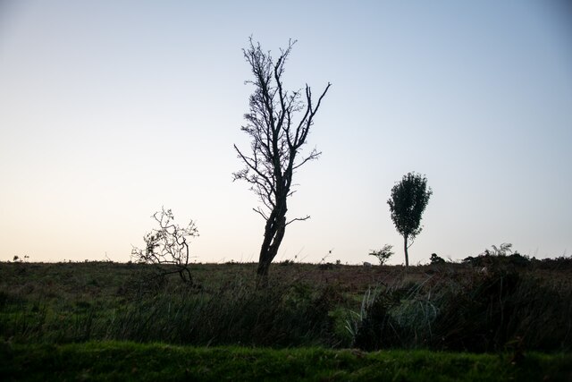
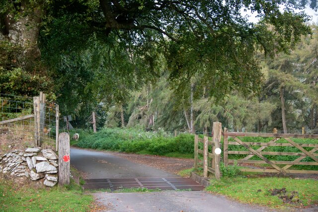
Hollow Combe is a picturesque valley located in the county of Somerset, England. Nestled between rolling hills and surrounded by lush greenery, it is a haven of natural beauty and tranquility. The valley is situated in the Mendip Hills Area of Outstanding Natural Beauty, further enhancing its scenic charm.

The idyllic village of Hollow Combe is home to a small and close-knit community. Traditional stone cottages line the streets, exuding a charming and rustic atmosphere. The village church, St. Mary's, stands proudly at the heart of Hollow Combe, its historic architecture attracting both locals and visitors.

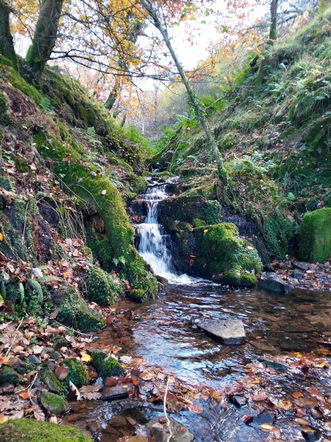
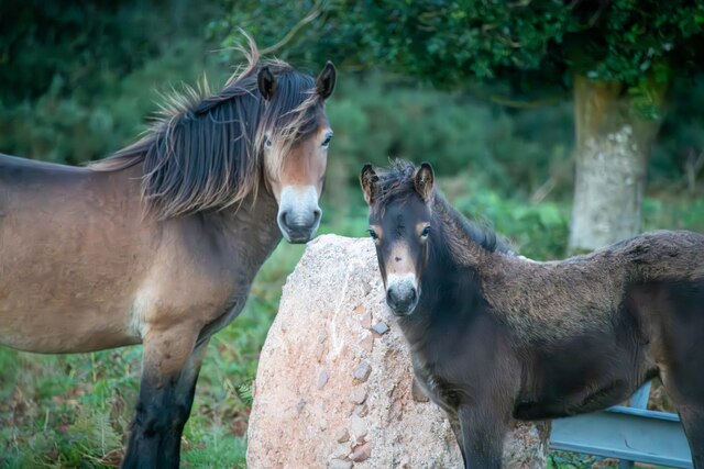
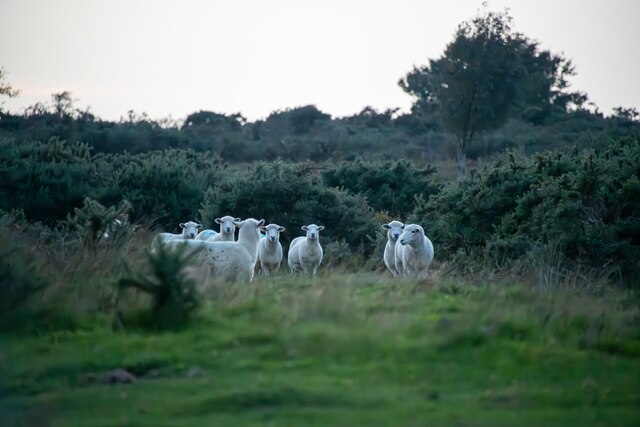
The focal point of the valley is the meandering river that flows through it, providing a serene and calming presence. The river supports a diverse ecosystem, attracting a variety of wildlife, including ducks, herons, and kingfishers. Walking along the riverbanks offers breathtaking views of the surrounding countryside and opportunities for peaceful reflection.

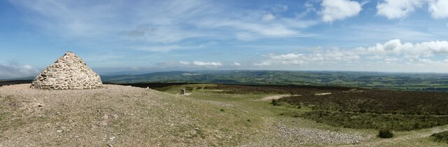
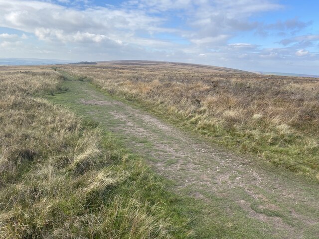
Hollow Combe is a popular destination for outdoor enthusiasts, offering a network of walking and hiking trails. The valley's undulating terrain provides both gentle strolls and more challenging routes, catering to all abilities. These trails allow visitors to explore the stunning landscape, revealing hidden gems such as waterfalls and ancient woodland.

For those seeking a taste of local culture, Hollow Combe hosts an annual summer fair, where residents and visitors come together to celebrate the traditions and heritage of the area. The fair features traditional music, local crafts, and delicious regional cuisine, making it a must-visit event for those looking to immerse themselves in the local community.

In summary, Hollow Combe is a veritable paradise nestled in the heart of Somerset. Its natural beauty, charming village, and range of outdoor activities make it a haven for nature lovers and a must-visit destination for anyone seeking an escape from the hustle and bustle of everyday life.

If you have any feedback on the listing, please let us know in the comments section below.

Hollow Combe Images

Images are sourced within 2km of 51.174771/-3.5754123 or Grid Reference SS8942. Thanks to Geograph Open Source API. All images are credited.

Dunkery Beacon Dunkery Beacon on Exmoor, with the view of the Brendon Hills and more distant Quantock Hills behind.
Dunkery Beacon
Dunkery Beacon on Exmoor, with the view of the Brendon Hills and more distant Quantock Hills behind.
Moorland track, west of Dunkery Beacon
Dunkery Beacon At 519m the highest point on Exmoor.
Dunkery Beacon
At 519m the highest point on Exmoor.
Stream in November An upland stream which might be a raging torrent after heavy rainfall but on a fine sunny day it was just beautiful.
Stream in November
An upland stream which might be a raging torrent after heavy rainfall but on a fine sunny day it was just beautiful.
Cutcombe : Exmoor - Dunkery Beacon I headed up to Dunkery Beacon on a clear September evening to see if I could see the stars and the Milky Way, after all, they do say this is a good spot for it. Got to the top, and soon after two other chaps were doing the same thing. One of them had a red light on his hat, it illuminated the beacon. He (Farmer Torque), wanted to get a nice shot of him looking at the stars.
Cutcombe : Exmoor - Dunkery Beacon
I headed up to Dunkery Beacon on a clear September evening to see if I could see the stars and the Milky Way, after all, they do say this is a good spot for it. Got to the top, and soon after two other chaps were doing the same thing. One of them had a red light on his hat, it illuminated the beacon. He (Farmer Torque), wanted to get a nice shot of him looking at the stars.
Cutcombe : Exmoor - Dunkery Beacon A man is taking photographs of the night sky.
Cutcombe : Exmoor - Dunkery Beacon
A man is taking photographs of the night sky.
Cutcombe : Exmoor - Moorland Scenery The Moon has come into view over the Bristol Channel.
Cutcombe : Exmoor - Moorland Scenery
The Moon has come into view over the Bristol Channel.
Cutcombe : Exmoor - Moorland Scenery Looking down the moorland from Dunkery Beacon and across the Bristol Channel where the lights of South Wales glow.
Cutcombe : Exmoor - Moorland Scenery
Looking down the moorland from Dunkery Beacon and across the Bristol Channel where the lights of South Wales glow.
Cutcombe : Exmoor - Dunkery Beacon Looking towards Dunkery Beacon with the many stars seen in the sky, including the white glow of the Milky Way.
Cutcombe : Exmoor - Dunkery Beacon
Looking towards Dunkery Beacon with the many stars seen in the sky, including the white glow of the Milky Way.
Cutcombe : Exmoor - Moorland Scenery From the top of Dunkery Beacon, looking into the night sky with the Milky Way in view.
Cutcombe : Exmoor - Moorland Scenery
From the top of Dunkery Beacon, looking into the night sky with the Milky Way in view.
Luccombe : Exmoor Scenery From the road looking towards some trees.
Luccombe : Exmoor Scenery
From the road looking towards some trees.
Cutcombe : Exmoor - Dunkery Beacon Looking across Exmoor from the top of Dunkery Beacon, with the Milky Way in view.
Cutcombe : Exmoor - Dunkery Beacon
Looking across Exmoor from the top of Dunkery Beacon, with the Milky Way in view.
Luccombe : Exmoor Ponies Exmoor ponies seen on the moors.
Luccombe : Exmoor Ponies
Exmoor ponies seen on the moors.
Luccombe : Exmoor Ponies Exmoor ponies on the moors.
Luccombe : Exmoor Ponies
Exmoor ponies on the moors.
Luccombe : Exmoor Scenery Looking across to some sheep on Exmoor.
Luccombe : Exmoor Scenery
Looking across to some sheep on Exmoor.
Luccombe : Road A road heading across Exmoor.
Luccombe : Road
A road heading across Exmoor.
Luccombe : Exmoor Scenery Looking towards a tree and some sheep on Exmoor.
Luccombe : Exmoor Scenery
Looking towards a tree and some sheep on Exmoor.
Luccombe : Road A road heading across Exmoor .
Luccombe : Road
A road heading across Exmoor .
Show me another place!

Hollow Combe is located at Grid Ref: SS8942 (Lat: 51.174771, Lng: -3.5754123)

Administrative County: Somerset

District: Somerset West and Taunton

Police Authority: Avon and Somerset

What 3 Words

///cone.custard.outhouse. Near Porlock, Somerset

Related Wikis

Sweetworthy

Sweetworthy is the site of two Iron Age hill forts or enclosures at Luccombe, 4 kilometres (2 mi) south of Porlock, Somerset, England. They are on the...

Dunkery Hill

Dunkery Beacon at the summit of Dunkery Hill is the highest point on Exmoor and in Somerset, England. It is also the highest point in southern England...

Luccombe, Somerset

Luccombe or Luckham is a village and civil parish in the Exmoor National Park in the English county of Somerset. It at the foot of the moor's highest hill...

Stoke Pero Church

Stoke Pero Church in Stoke Pero, Somerset, England was built in the 13th century. It is a Grade II* listed building. Standing 1,013 feet (309 meters) above...

Hawkcombe Woods

Hawkcombe Woods is a national nature reserve near Porlock on Exmoor, Somerset, England.The 101 hectares (250 acres) woodlands are notable for their lichens...

Dovecot at Blackford Farm

The Dovecot At Blackford Farm in Selworthy on Exmoor within the English county of Somerset was probably built in the 11th century. It is a Grade II* listed...

Holnicote Estate

Holnicote (pronounced "Hunnicutt") in the parish of Selworthy, West Somerset, England, is a historic estate consisting of 12,420 acres (5,026 hectares...

Coleridge Way

The Coleridge Way is a 51-mile (82 km) long-distance trail in Somerset and Devon, England. It was opened in April 2005, and the route links several sites...

Nearby Amenities

Located within 500m of 51.174771,-3.5754123
Ford: yes
Lat/Long: 51.1757497/-3.5781415
Ford: yes
Lat/Long: 51.1786388/-3.5746282
Easter Hill
Place: locality
Lat/Long: 51.175351/-3.5712167
Sideway Wood
Place: locality
Lat/Long: 51.1751396/-3.5792285
Hollow Combe
Place: locality
Lat/Long: 51.1740449/-3.5748111
Ford: yes
Lat/Long: 51.1781828/-3.5748582
The data included in this document is from www.openstreetmap.org. The data is made available under ODbL.

Have you been to Hollow Combe?

Leave your review of Hollow Combe below (or comments, questions and feedback).