Kiln Copse

Wood, Forest in Devon Teignbridge

England

Kiln Copse

Luton (Devon) - Dutch Barn A barrel roof but no walls. Dutch barns are a relatively recent feature in British farm architecture, most dating from the 19th century. Nowadays they are more commonly used to store hay and straw.
Luton (Devon) - Dutch Barn Credit: Colin Smith

Kiln Copse, located in Devon, is a serene and picturesque woodland area that showcases the rich natural beauty of the region. Spanning over a vast expanse, this forest is a popular destination for nature enthusiasts and those seeking a peaceful retreat away from the hustle and bustle of city life.

The copse is characterized by its dense and diverse tree cover, with a variety of species such as oak, beech, and chestnut. These majestic trees create a cool and shaded atmosphere, making it an ideal spot for a leisurely walk or a picnic amidst the tranquil surroundings. Additionally, the forest floor is adorned with a vibrant carpet of wildflowers during the spring and summer months, adding an enchanting touch to the already picturesque scenery.

Kiln Copse is also home to a plethora of wildlife, making it a haven for animal lovers and birdwatchers. Visitors may spot deer, foxes, and squirrels, as well as a wide range of bird species, including woodpeckers, owls, and thrushes. Nature enthusiasts can immerse themselves in the symphony of bird songs and the rustling of leaves, creating an immersive experience in the heart of nature.

For those interested in the history of the area, Kiln Copse also features remnants of old lime kilns, which were once used to produce lime for agricultural purposes. These kilns serve as a reminder of the past and provide a glimpse into the industrial heritage of the region.

Overall, Kiln Copse in Devon is a captivating woodland that offers a serene escape into nature. With its lush vegetation, diverse wildlife, and historic features, it is a must-visit destination for anyone seeking solace and tranquility in the heart of the countryside.

If you have any feedback on the listing, please let us know in the comments section below.
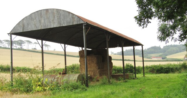
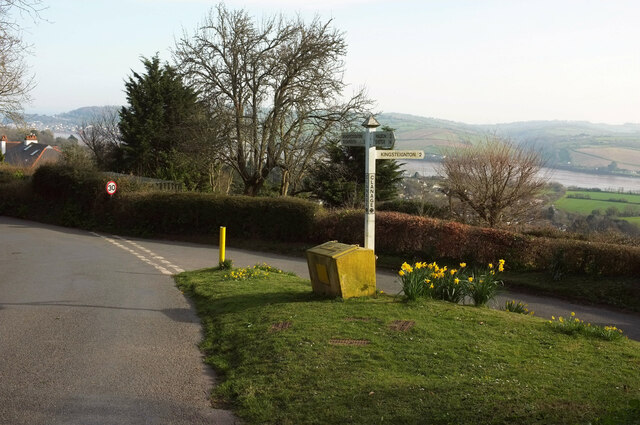
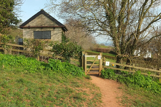
Kiln Copse Images

Images are sourced within 2km of 50.559185/-3.5671738 or Grid Reference SX8974. Thanks to Geograph Open Source API. All images are credited.

Luton (Devon) - Dutch Barn A barrel roof but no walls. Dutch barns are a relatively recent feature in British farm architecture, most dating from the 19th century. Nowadays they are more commonly used to store hay and straw.
Luton (Devon) - Dutch Barn
A barrel roof but no walls. Dutch barns are a relatively recent feature in British farm architecture, most dating from the 19th century. Nowadays they are more commonly used to store hay and straw.
Sheep above Bishopsteignton From Bishopsteignton footpath 5, which doesn't go through the well-guarded gateway. The sheep have the freedom of two sizeable and very steep fields above the village. How can they not appreciate the spectacular views? One of the pair of lambs in the background has taken to gambolling in a big way.
Sheep above Bishopsteignton
From Bishopsteignton footpath 5, which doesn't go through the well-guarded gateway. The sheep have the freedom of two sizeable and very steep fields above the village. How can they not appreciate the spectacular views? One of the pair of lambs in the background has taken to gambolling in a big way.
View above Bishopsteignton Gorse in bloom on a steep hillside next to the Old Walls Vineyard. Beyond housing on the east side of the village rises The Lea, with the Teign estuary and Shaldon beyond.
View above Bishopsteignton
Gorse in bloom on a steep hillside next to the Old Walls Vineyard. Beyond housing on the east side of the village rises The Lea, with the Teign estuary and Shaldon beyond.
Sundog, Bishopsteignton At, I assume, its correct 22° angle to the sun on the left, this is seen from Teign View Road. Has it also captivated the bird on the wire? Several of the images at <a title="https://www.geograph.org.uk/search.php?i=153718676" href="https://www.geograph.org.uk/search.php?i=153718676">Link</a> carry an explanation of the phenomenon.
Sundog, Bishopsteignton
At, I assume, its correct 22° angle to the sun on the left, this is seen from Teign View Road. Has it also captivated the bird on the wire? Several of the images at Link carry an explanation of the phenomenon.
Clanage Cross Two lanes meet at the top of the village of Bishopsteignton by a small triangle of green, with a view to the Teign estuary.
Clanage Cross
Two lanes meet at the top of the village of Bishopsteignton by a small triangle of green, with a view to the Teign estuary.
Modern house, Lindridge Road, Bishopsteignton Rowden House is set above the village, with excellent views.
Modern house, Lindridge Road, Bishopsteignton
Rowden House is set above the village, with excellent views.
Lindridge Road, Bishopsteignton Work is taking place at the cemetery just ahead, hence the van at the entrance.
Lindridge Road, Bishopsteignton
Work is taking place at the cemetery just ahead, hence the van at the entrance.
Stile, Bishopsteignton Cemetery This can be seen to the left of the main gate in <a href="https://www.geograph.org.uk/photo/970633">SX9074 : Bishopsteignton Cemetery</a>. An odd affair, but the gate was occupied by the van seen in <a href="https://www.geograph.org.uk/photo/7127381">SX9074 : Lindridge Road, Bishopsteignton</a>. The footpath sign points heavenwards, appropriately.
Stile, Bishopsteignton Cemetery
This can be seen to the left of the main gate in SX9074 : Bishopsteignton Cemetery. An odd affair, but the gate was occupied by the van seen in SX9074 : Lindridge Road, Bishopsteignton. The footpath sign points heavenwards, appropriately.
Bishopsteignton Cemetery From Bishopsteignton footpath 11, or at least the grass track that <a href="https://www.geograph.org.uk/photo/7127415">SX9074 : Stile, Bishopsteignton Cemetery</a> led us onto.
Bishopsteignton Cemetery
From Bishopsteignton footpath 11, or at least the grass track that SX9074 : Stile, Bishopsteignton Cemetery led us onto.
Bishopsteignton Cemetery The majority of the memorials are behind the camera; an open area sits between them and a cluster near the entrance.
Bishopsteignton Cemetery
The majority of the memorials are behind the camera; an open area sits between them and a cluster near the entrance.
Bishopsteignton Cemetery The western side of the cemetery, with an outbuilding of Rowden House over the hedge.
Bishopsteignton Cemetery
The western side of the cemetery, with an outbuilding of Rowden House over the hedge.
Path entering Bishopsteignton Cemetery Bishopsteignton footpath 11 approaches the gate into the cemetery.
Path entering Bishopsteignton Cemetery
Bishopsteignton footpath 11 approaches the gate into the cemetery.
Field by Bishopsteignton Cemetery Looking left from <a href="https://www.geograph.org.uk/photo/7127500">SX9074 : Path entering Bishopsteignton Cemetery</a>, with a hedge bordering Lindridge Road.
Field by Bishopsteignton Cemetery
Looking left from SX9074 : Path entering Bishopsteignton Cemetery, with a hedge bordering Lindridge Road.
Field by Bishopsteignton Cemetery The southeastern corner of the field shown in <a href="https://www.geograph.org.uk/photo/7127509">SX9074 : Field by Bishopsteignton Cemetery</a>, with the outbuilding seen in <a href="https://www.geograph.org.uk/photo/7127462">SX9074 : Bishopsteignton Cemetery</a>.
Field by Bishopsteignton Cemetery
The southeastern corner of the field shown in SX9074 : Field by Bishopsteignton Cemetery, with the outbuilding seen in SX9074 : Bishopsteignton Cemetery.
Field by Rowden Cross Taken further west from <a href="https://www.geograph.org.uk/photo/7127509">SX9074 : Field by Bishopsteignton Cemetery</a> along the footpath to Ashwell. The wood is Beacon Park Plantation.
Field by Rowden Cross
Taken further west from SX9074 : Field by Bishopsteignton Cemetery along the footpath to Ashwell. The wood is Beacon Park Plantation.
Rowden Cross The lane from Little Haldon approaches the crossroads shown in <a href="https://www.geograph.org.uk/photo/120111">SX9074 : Rowden Cross, Bishopsteignton</a>, with buildings at Ashwell beyond.
Rowden Cross
The lane from Little Haldon approaches the crossroads shown in SX9074 : Rowden Cross, Bishopsteignton, with buildings at Ashwell beyond.
Lane from Rowden Cross Taken a little east of <a href="https://www.geograph.org.uk/photo/7127896">SX9074 : Rowden Cross</a>, looking in the opposite direction.
Lane from Rowden Cross
Taken a little east of SX9074 : Rowden Cross, looking in the opposite direction.
Lane near Higher Radway Farm The lane from Rowden Cross levels out for a bit, with gates on either side and a lay-by. Up a track on the right are farm buildings; the farmhouse is down the hill to the right. The lane bears left at the track. Beacon Park Plantation is in the background.
Lane near Higher Radway Farm
The lane from Rowden Cross levels out for a bit, with gates on either side and a lay-by. Up a track on the right are farm buildings; the farmhouse is down the hill to the right. The lane bears left at the track. Beacon Park Plantation is in the background.
Show me another place!

Kiln Copse is located at Grid Ref: SX8974 (Lat: 50.559185, Lng: -3.5671738)

Administrative County: Devon

District: Teignbridge

Police Authority: Devon and Cornwall

What 3 Words

///limelight.hairstyle.slamming. Near Kingsteignton, Devon

Related Wikis

Ashwell, Devon

Ashwell is a village in Devon, England.
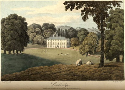
Lindridge House

Lindridge House was a large 17th-century mansion (with 20th-century alterations), one of the finest in the south-west situated about 1 mile south of Ideford...
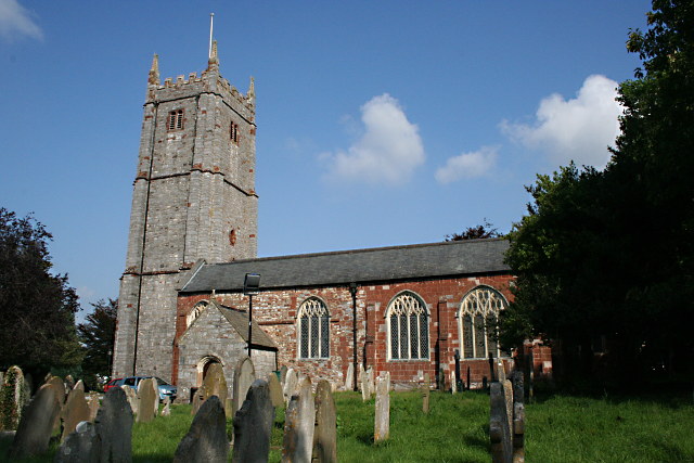
Bishopsteignton

Bishopsteignton is a village and civil parish in South Devon, England, between Newton Abbot and Teignmouth, close to the Teign Estuary. The village is...
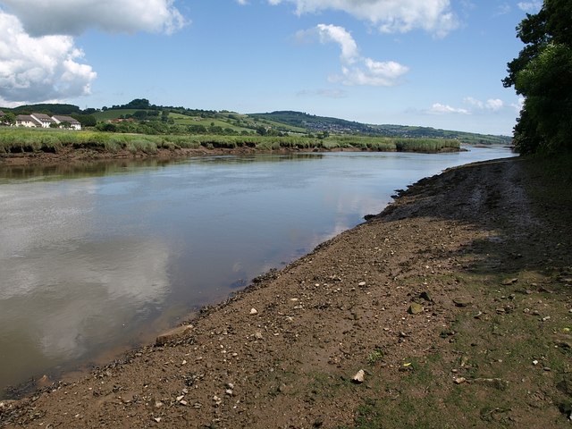
Coombe Cellars

Coombe Cellars Inn is a public house on the south bank of the estuary of the River Teign in south Devon, England. It is in the parish of Haccombe with...
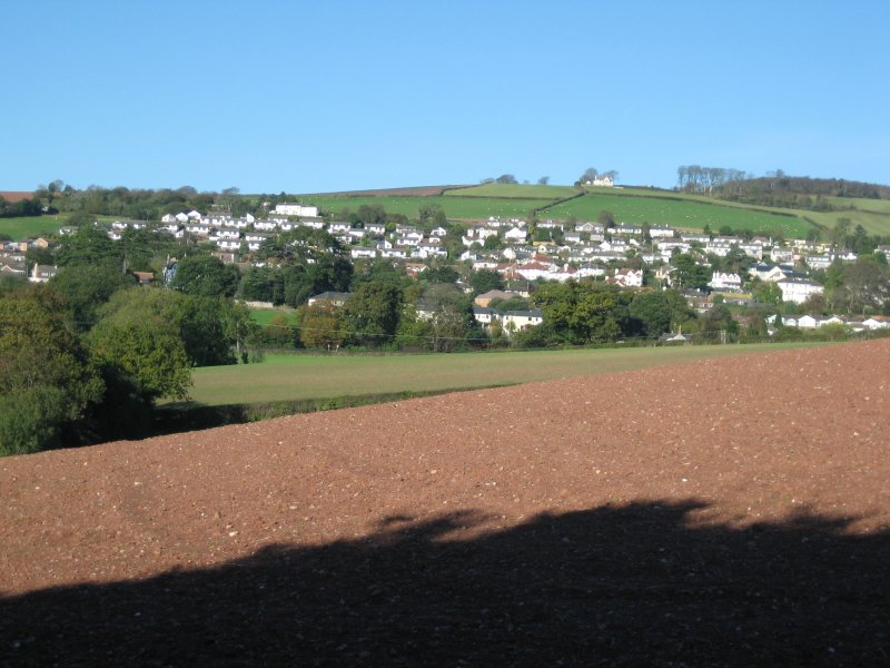
Kingsteignton

Kingsteignton ( king-STAYN-tən), is a town and civil parish in south Devon, England. It lies at the head of the Teign Estuary to the west of Teignmouth...

Teign School

Teign School is an 11–18 academy school located in Kingsteignton, a town to the north of Newton Abbot. The original 1936 building has been expanded upon...

A380 road

The A380 is a road in South West England, connecting the Torbay area to the Devon Expressway, and hence to the rest of Great Britain's main road network...

Hackney Marshes, Devon

Hackney Marshes is a local nature reserve in Devon, England. It comprises a low-lying area of flood meadows located at the head of the Teign Estuary by...

Nearby Amenities

Located within 500m of 50.559185,-3.5671738
Power: tower
Lat/Long: 50.5580457/-3.5720994
Power: tower
Lat/Long: 50.5609198/-3.5715586
Power: pole
Lat/Long: 50.5550626/-3.5675874
Power: pole
Lat/Long: 50.5557365/-3.5664931
Power: pole
Lat/Long: 50.5563253/-3.565553
Power: pole
Lat/Long: 50.5570401/-3.5644345
Power: pole
Lat/Long: 50.5583616/-3.5623491
Power: pole
Lat/Long: 50.5591181/-3.5610938
The data included in this document is from www.openstreetmap.org. The data is made available under ODbL.

Have you been to Kiln Copse?

Leave your review of Kiln Copse below (or comments, questions and feedback).