Ashwell

Settlement in Devon Teignbridge

England

Ashwell

Luton - Lane Hedge-lined lane in deepest Devon, close to Westhayes Farm, a dairy farm.
Luton - Lane Credit: Colin Smith

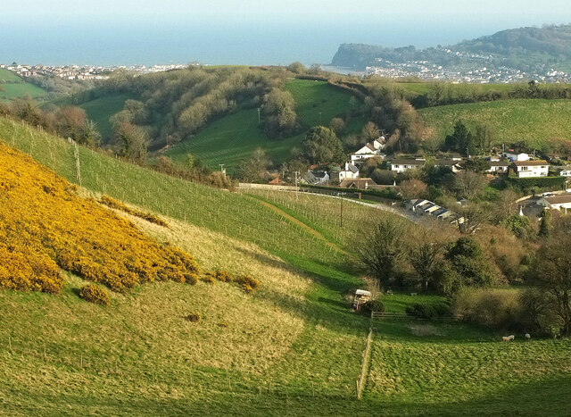
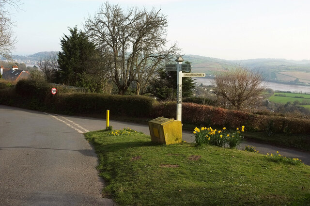
Ashwell is a quaint village located in the county of Devon, England. Situated in the picturesque Teign Valley, it is nestled between the rolling hills of Dartmoor National Park and the beautiful Devonshire countryside. The village is part of the Teignbridge district and is approximately 5 miles southwest of the town of Newton Abbot.

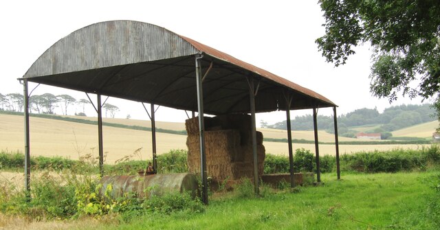
Ashwell is a small and close-knit community with a population of around 500 residents. It consists of a cluster of traditional stone-built houses, many of which date back several centuries, giving the village a charming and historic atmosphere. The local economy is primarily centered around agriculture, with farming and dairy production being prominent in the area.

The village is known for its stunning natural surroundings, including the River Teign which flows nearby. Nature enthusiasts can explore the numerous walking trails and enjoy the abundant wildlife that inhabits the area. The nearby Dartmoor National Park offers further opportunities for outdoor activities such as hiking, cycling, and birdwatching.

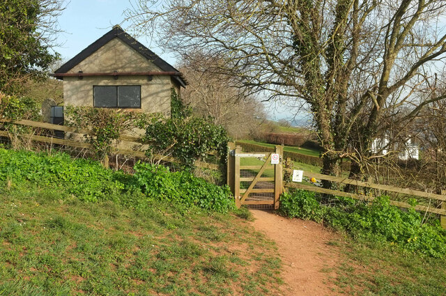
Ashwell also boasts a strong sense of community spirit, with various local events and activities organized throughout the year. The village has a primary school, a small church, and a community center which serves as a hub for social gatherings and events.

Overall, Ashwell is a tranquil and picturesque village that offers residents and visitors a peaceful retreat in the heart of the Devonshire countryside. Its natural beauty, historic charm, and close-knit community make it an idyllic place to live or visit.

If you have any feedback on the listing, please let us know in the comments section below.

Ashwell Images

Images are sourced within 2km of 50.563305/-3.561561 or Grid Reference SX8974. Thanks to Geograph Open Source API. All images are credited.

Luton - Lane Hedge-lined lane in deepest Devon, close to Westhayes Farm, a dairy farm.
Luton - Lane
Hedge-lined lane in deepest Devon, close to Westhayes Farm, a dairy farm.
Luton (Devon) - Dutch Barn A barrel roof but no walls. Dutch barns are a relatively recent feature in British farm architecture, most dating from the 19th century. Nowadays they are more commonly used to store hay and straw.
Luton (Devon) - Dutch Barn
A barrel roof but no walls. Dutch barns are a relatively recent feature in British farm architecture, most dating from the 19th century. Nowadays they are more commonly used to store hay and straw.
Humber - Humber Barn Patchwork of cereal fields lined by hedgerows with Humber Barn nestling in a valley on the hillside.
Humber - Humber Barn
Patchwork of cereal fields lined by hedgerows with Humber Barn nestling in a valley on the hillside.
Sheep above Bishopsteignton From Bishopsteignton footpath 5, which doesn't go through the well-guarded gateway. The sheep have the freedom of two sizeable and very steep fields above the village. How can they not appreciate the spectacular views? One of the pair of lambs in the background has taken to gambolling in a big way.
Sheep above Bishopsteignton
From Bishopsteignton footpath 5, which doesn't go through the well-guarded gateway. The sheep have the freedom of two sizeable and very steep fields above the village. How can they not appreciate the spectacular views? One of the pair of lambs in the background has taken to gambolling in a big way.
View above Bishopsteignton Gorse in bloom on a steep hillside next to the Old Walls Vineyard. Beyond housing on the east side of the village rises The Lea, with the Teign estuary and Shaldon beyond.
View above Bishopsteignton
Gorse in bloom on a steep hillside next to the Old Walls Vineyard. Beyond housing on the east side of the village rises The Lea, with the Teign estuary and Shaldon beyond.
Valley above Bishopsteignton With elements of <a href="https://www.geograph.org.uk/photo/7126443">SX9174 : View above Bishopsteignton</a>, taken further down the hillside. The Old Walls Vineyard beyond looks very bare at the moment.
Valley above Bishopsteignton
With elements of SX9174 : View above Bishopsteignton, taken further down the hillside. The Old Walls Vineyard beyond looks very bare at the moment.
Vineyard, Bishopsteignton A clearer view of the Old Walls vineyard seen in <a href="https://www.geograph.org.uk/photo/7126724">SX9174 : Valley above Bishopsteignton</a>, from further down the hill. In the distance are suburbs of Teignmouth.
Vineyard, Bishopsteignton
A clearer view of the Old Walls vineyard seen in SX9174 : Valley above Bishopsteignton, from further down the hill. In the distance are suburbs of Teignmouth.
Sundog, Bishopsteignton At, I assume, its correct 22° angle to the sun on the left, this is seen from Teign View Road. Has it also captivated the bird on the wire? Several of the images at <a title="https://www.geograph.org.uk/search.php?i=153718676" href="https://www.geograph.org.uk/search.php?i=153718676">Link</a> carry an explanation of the phenomenon.
Sundog, Bishopsteignton
At, I assume, its correct 22° angle to the sun on the left, this is seen from Teign View Road. Has it also captivated the bird on the wire? Several of the images at Link carry an explanation of the phenomenon.
Clanage Cross Two lanes meet at the top of the village of Bishopsteignton by a small triangle of green, with a view to the Teign estuary.
Clanage Cross
Two lanes meet at the top of the village of Bishopsteignton by a small triangle of green, with a view to the Teign estuary.
Modern house, Lindridge Road, Bishopsteignton Rowden House is set above the village, with excellent views.
Modern house, Lindridge Road, Bishopsteignton
Rowden House is set above the village, with excellent views.
Lindridge Road, Bishopsteignton Work is taking place at the cemetery just ahead, hence the van at the entrance.
Lindridge Road, Bishopsteignton
Work is taking place at the cemetery just ahead, hence the van at the entrance.
Stile, Bishopsteignton Cemetery This can be seen to the left of the main gate in <a href="https://www.geograph.org.uk/photo/970633">SX9074 : Bishopsteignton Cemetery</a>. An odd affair, but the gate was occupied by the van seen in <a href="https://www.geograph.org.uk/photo/7127381">SX9074 : Lindridge Road, Bishopsteignton</a>. The footpath sign points heavenwards, appropriately.
Stile, Bishopsteignton Cemetery
This can be seen to the left of the main gate in SX9074 : Bishopsteignton Cemetery. An odd affair, but the gate was occupied by the van seen in SX9074 : Lindridge Road, Bishopsteignton. The footpath sign points heavenwards, appropriately.
Bishopsteignton Cemetery From Bishopsteignton footpath 11, or at least the grass track that <a href="https://www.geograph.org.uk/photo/7127415">SX9074 : Stile, Bishopsteignton Cemetery</a> led us onto.
Bishopsteignton Cemetery
From Bishopsteignton footpath 11, or at least the grass track that SX9074 : Stile, Bishopsteignton Cemetery led us onto.
Bishopsteignton Cemetery The majority of the memorials are behind the camera; an open area sits between them and a cluster near the entrance.
Bishopsteignton Cemetery
The majority of the memorials are behind the camera; an open area sits between them and a cluster near the entrance.
Bishopsteignton Cemetery The western side of the cemetery, with an outbuilding of Rowden House over the hedge.
Bishopsteignton Cemetery
The western side of the cemetery, with an outbuilding of Rowden House over the hedge.
Path entering Bishopsteignton Cemetery Bishopsteignton footpath 11 approaches the gate into the cemetery.
Path entering Bishopsteignton Cemetery
Bishopsteignton footpath 11 approaches the gate into the cemetery.
Field by Bishopsteignton Cemetery Looking left from <a href="https://www.geograph.org.uk/photo/7127500">SX9074 : Path entering Bishopsteignton Cemetery</a>, with a hedge bordering Lindridge Road.
Field by Bishopsteignton Cemetery
Looking left from SX9074 : Path entering Bishopsteignton Cemetery, with a hedge bordering Lindridge Road.
Field by Bishopsteignton Cemetery The southeastern corner of the field shown in <a href="https://www.geograph.org.uk/photo/7127509">SX9074 : Field by Bishopsteignton Cemetery</a>, with the outbuilding seen in <a href="https://www.geograph.org.uk/photo/7127462">SX9074 : Bishopsteignton Cemetery</a>.
Field by Bishopsteignton Cemetery
The southeastern corner of the field shown in SX9074 : Field by Bishopsteignton Cemetery, with the outbuilding seen in SX9074 : Bishopsteignton Cemetery.
Show me another place!

Ashwell is located at Grid Ref: SX8974 (Lat: 50.563305, Lng: -3.561561)

Administrative County: Devon

District: Teignbridge

Police Authority: Devon and Cornwall

What 3 Words

///chats.winemaker.lawful. Near Bishopsteignton, Devon

Related Wikis

Ashwell, Devon

Ashwell is a village in Devon, England.
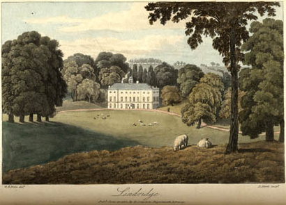
Lindridge House

Lindridge House was a large 17th-century mansion (with 20th-century alterations), one of the finest in the south-west situated about 1 mile south of Ideford...
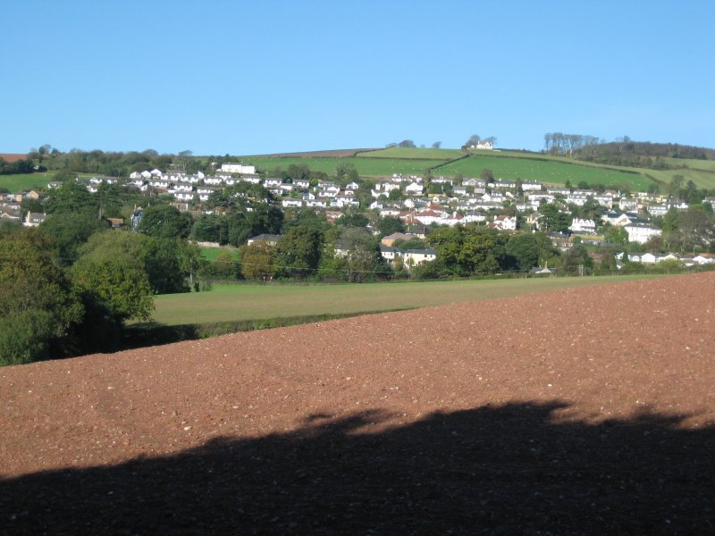
Bishopsteignton

Bishopsteignton is a village and civil parish in South Devon, England, between Newton Abbot and Teignmouth, close to the Teign Estuary. The village is...

Luton, Teignbridge

Luton is a village in Devon, England, within Teignbridge local authority area. Historically Luton formed part of Ashcombe Hundred.The village is in the...

Ideford

Ideford (or Ideford Parish) is a village in the Teignbridge district of Devon, England. It is 5 miles (8 km) north of Newton Abbot. To the west is the...

Haldon Aerodrome

Haldon Aerodrome was the first airfield in Devon. Established in the 1920s as a private flying field, it developed into an airport with scheduled airline...

Coombe Cellars

Coombe Cellars Inn is a public house on the south bank of the estuary of the River Teign in south Devon, England. It is in the parish of Haccombe with...

Olchard

Olchard is a village in Devon, England.

Related Videos

'Walking' by Adam Sweet, Ian Briggs & Ian Jennings 12 August 2023 at The Old Commercial Inn

Three virtuoso musicians gave Teign Jazz & Blues a night to remember on 12th August 2023 at The Old Commercial Inn, ...

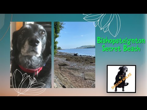
Walk to Secret Beach in Bishopsteignton, Devon

Deserted secret beach at Bishopsteignton. Shadows favourite swimming spot.

Nearby Amenities

Located within 500m of 50.563305,-3.561561
Direction: S
Tourism: viewpoint
Lat/Long: 50.5663386/-3.5574144
Power: pole
Lat/Long: 50.5591181/-3.5610938
Power: pole
Lat/Long: 50.5597588/-3.5578001
The data included in this document is from www.openstreetmap.org. The data is made available under ODbL.

Have you been to Ashwell?

Leave your review of Ashwell below (or comments, questions and feedback).