Ashwell

Settlement in Somerset South Somerset

England

Ashwell

Ilminster This market town takes its name from the River Ile and the Minster church, St Mary's.
Ilminster Credit: Liz Martin

Ashwell is a small village located in the county of Somerset, England. Situated on the southern edge of the Mendip Hills Area of Outstanding Natural Beauty, Ashwell is surrounded by picturesque countryside and offers stunning views of the rolling hills and valleys.

The village itself is home to a close-knit community of around 300 residents. It boasts a charming mix of traditional stone-built cottages and more modern houses, giving it a unique character. The village center features a small square with a few shops, including a local grocery store and a post office.

Ashwell is known for its strong sense of community, with various social events and activities taking place throughout the year. The village hall hosts regular gatherings, such as coffee mornings and craft fairs, providing opportunities for residents to come together and socialize.

Nature enthusiasts are drawn to Ashwell for its proximity to natural attractions. The Mendip Hills offer a range of outdoor activities, including hiking, cycling, and horse riding. Additionally, the nearby Cheddar Gorge, a dramatic limestone gorge, is a popular destination for rock climbers and tourists alike.

For those seeking a taste of history, Ashwell is conveniently located near several historic sites. The city of Wells, with its magnificent cathedral and medieval architecture, is just a short drive away. The village is also within easy reach of Glastonbury Abbey, a site steeped in legend and folklore.

Overall, Ashwell is a charming and idyllic village, offering a peaceful rural lifestyle amidst beautiful natural surroundings.

If you have any feedback on the listing, please let us know in the comments section below.

Ashwell Images

Images are sourced within 2km of 50.939593/-2.906166 or Grid Reference ST3615. Thanks to Geograph Open Source API. All images are credited.

Ilminster This market town takes its name from the River Ile and the Minster church, St Mary's.
Ilminster
This market town takes its name from the River Ile and the Minster church, St Mary's.
Ilminster The recreation and football ground with Herne Hill in the background
Ilminster
The recreation and football ground with Herne Hill in the background
Whitelackington Village Hall
Whitelackington
Village Hall
Dillington House Present house dates back to the 16th Century.  Now a regional centre for adult education and the arts.
Dillington House
Present house dates back to the 16th Century. Now a regional centre for adult education and the arts.
Track in Autumn
Track in Autumn
Market House , Ilminster The cross roads at the heart of Ilminster viewed through the ham stone Market House - <span class="nowrap"><a title="http://webapp1.somerset.gov.uk/her/details.asp?prn=58067" rel="nofollow ugc noopener" href="http://webapp1.somerset.gov.uk/her/details.asp?prn=58067">Link</a><img style="margin-left:2px;" alt="External link" title="External link - shift click to open in new window" src="https://s1.geograph.org.uk/img/external.png" width="10" height="10"/></span>
Market House , Ilminster
The cross roads at the heart of Ilminster viewed through the ham stone Market House - LinkExternal link
Ilminster Library On Ditton Road, south of the town centre. The tablet in the gable reads "The Reading Room, 1889".
Ilminster Library
On Ditton Road, south of the town centre. The tablet in the gable reads "The Reading Room, 1889".
Townsend Farm, Ilminster Seen from the slopes of Pretwood Hill.
Townsend Farm, Ilminster
Seen from the slopes of Pretwood Hill.
Cottages at Knott Oak Seen from the slopes of Pretwood Hill, looking northeast.
Cottages at Knott Oak
Seen from the slopes of Pretwood Hill, looking northeast.
Ilminster fire station Ilminster fire station, Blackdown View, Ilminster, Somerset.
Ilminster fire station
Ilminster fire station, Blackdown View, Ilminster, Somerset.
Ilton: drainage channel On the river Isle flood plain near Ilford Bridge. In north Somerset this channel would be called a rhine. Looking south east
Ilton: drainage channel
On the river Isle flood plain near Ilford Bridge. In north Somerset this channel would be called a rhine. Looking south east
Former chapel, Cad Green, Ilton The chapel is now a private residence.
Former chapel, Cad Green, Ilton
The chapel is now a private residence.
Crossroads at Cad Green The buildings on the right are the former chapel, next to which can be seen the end of a thatched cottage.
Crossroads at Cad Green
The buildings on the right are the former chapel, next to which can be seen the end of a thatched cottage.
St Mary's Church, Whitelackington The church is very close to the manor house, and consequently difficult to photograph from the south. <span class="nowrap"><a title="http://webapp1.somerset.gov.uk/her/details.asp?prn=53358" rel="nofollow ugc noopener" href="http://webapp1.somerset.gov.uk/her/details.asp?prn=53358">Link</a><img style="margin-left:2px;" alt="External link" title="External link - shift click to open in new window" src="https://s1.geograph.org.uk/img/external.png" width="10" height="10"/></span>
St Mary's Church, Whitelackington
The church is very close to the manor house, and consequently difficult to photograph from the south. LinkExternal link
Dillington Park A view from the long drive that approaches Dillington House from Whitelackington.
Dillington Park
A view from the long drive that approaches Dillington House from Whitelackington.
Dillington Park Farm The farm lies in the landscape park of Dillington House. A workshop among the buildings houses a firm of cabinet makers. See also <a href="https://www.geograph.org.uk/photo/1307455">ST3715 : Fishing lake, Dillington</a>.
Dillington Park Farm
The farm lies in the landscape park of Dillington House. A workshop among the buildings houses a firm of cabinet makers. See also ST3715 : Fishing lake, Dillington.
Dillington House Another view of the west facade of <a href="https://www.geograph.org.uk/photo/11185">ST3615 : Dillington House</a>. Architectural details at <span class="nowrap"><a title="http://webapp1.somerset.gov.uk/her/details.asp?prn=56603" rel="nofollow ugc noopener" href="http://webapp1.somerset.gov.uk/her/details.asp?prn=56603">Link</a><img style="margin-left:2px;" alt="External link" title="External link - shift click to open in new window" src="https://s1.geograph.org.uk/img/external.png" width="10" height="10"/></span> , and notes on its use during World War Two at <span class="nowrap"><a title="http://webapp1.somerset.gov.uk/her/details.asp?prn=15029" rel="nofollow ugc noopener" href="http://webapp1.somerset.gov.uk/her/details.asp?prn=15029">Link</a><img style="margin-left:2px;" alt="External link" title="External link - shift click to open in new window" src="https://s1.geograph.org.uk/img/external.png" width="10" height="10"/></span> .
Dillington House
Another view of the west facade of ST3615 : Dillington House. Architectural details at LinkExternal link , and notes on its use during World War Two at LinkExternal link .
Sculpture at Dillington House The wooden figure (unable to trace any details so far) is beside footpath CH14/14 as it passes Dillington House in the background, and is one of several pieces of artwork in the grounds, doubtless related to the many art-related courses run at the centre.
Sculpture at Dillington House
The wooden figure (unable to trace any details so far) is beside footpath CH14/14 as it passes Dillington House in the background, and is one of several pieces of artwork in the grounds, doubtless related to the many art-related courses run at the centre.
Show me another place!

Ashwell is located at Grid Ref: ST3615 (Lat: 50.939593, Lng: -2.906166)

Administrative County: Somerset

District: South Somerset

Police Authority: Avon and Somerset

What 3 Words

///orbited.tools.factored. Near Ilminster, Somerset

Related Wikis

Dillington House

Dillington House is a residential adult education college near Ilminster in the parish of Whitelackington, Somerset, England. The present house, which...

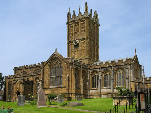
St Mary's Church, Ilminster

The Church of St Mary in Ilminster, Somerset, England, dates from the 15th century and has been designated as a Grade I listed building. == History... ==
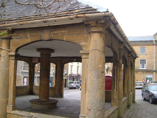
Ilminster

Ilminster is a minster town and civil parish in the South Somerset district of Somerset, England, with a population of 5,808. Bypassed in 1988, the town...

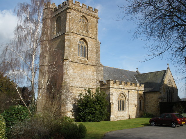
Church of St Mary the Virgin, Whitelackington

The Anglican Church of St Mary the Virgin in Whitelackington, Somerset, England was built in the 14th and 15th centuries. It is a Grade II* listed building...

Ilton

Ilton is a village and civil parish in Somerset, England, situated 8 miles (12.9 km) south-east of Taunton, and 2 miles (3.2 km) north of Ilminster in...

Church of St Peter, Ilton

The Anglican Church of St Peter in Ilton, Somerset, England was built in the 14th century, incorporating fragments from 12th and 13th. It is a Grade II...

Whitelackington

Whitelackington is a village and civil parish on the A303 one mile north east of Ilminster, in Somerset, England. The parish includes Dillington Park and...

Church of St Mary Magdalene, Stocklinch

The Church of St Mary Magdalen in Stocklinch, Somerset, England, dates from the 13th century. It is recorded in the National Heritage List for England...

Nearby Amenities

Located within 500m of 50.939593,-2.906166
Power: pole
Lat/Long: 50.936749/-2.9029387
Power: pole
Lat/Long: 50.9371141/-2.9041994
Power: pole
Lat/Long: 50.9374792/-2.9053313
Power: pole
Lat/Long: 50.9407751/-2.9078633
Power: pole
Lat/Long: 50.940481/-2.9074019
Power: pole
Lat/Long: 50.940001/-2.9064792
Power: pole
Lat/Long: 50.9394635/-2.9055458
Power: pole
Lat/Long: 50.9380454/-2.9066107
Power: pole
Lat/Long: 50.9383243/-2.9053205
Power: pole
Lat/Long: 50.938855/-2.9044622
Power: pole
Lat/Long: 50.9394263/-2.90362
Power: pole
Lat/Long: 50.9399807/-2.9028261
Power: pole
Lat/Long: 50.9405553/-2.9020268
Power: pole
Lat/Long: 50.9406432/-2.9008412
Power: pole
Lat/Long: 50.9407311/-2.8996021
Ashwell
Place: hamlet
Lat/Long: 50.9394394/-2.9091595
Power: pole
Lat/Long: 50.9359955/-2.9084977
Power: pole
Lat/Long: 50.9365736/-2.9077628
The data included in this document is from www.openstreetmap.org. The data is made available under ODbL.

Have you been to Ashwell?

Leave your review of Ashwell below (or comments, questions and feedback).