Tin Copse

Wood, Forest in Devon Teignbridge

England

Tin Copse

Rocks in Sunny Copse Something of a tor just off the permissive path through Shaptor Woods.
Rocks in Sunny Copse Credit: Derek Harper

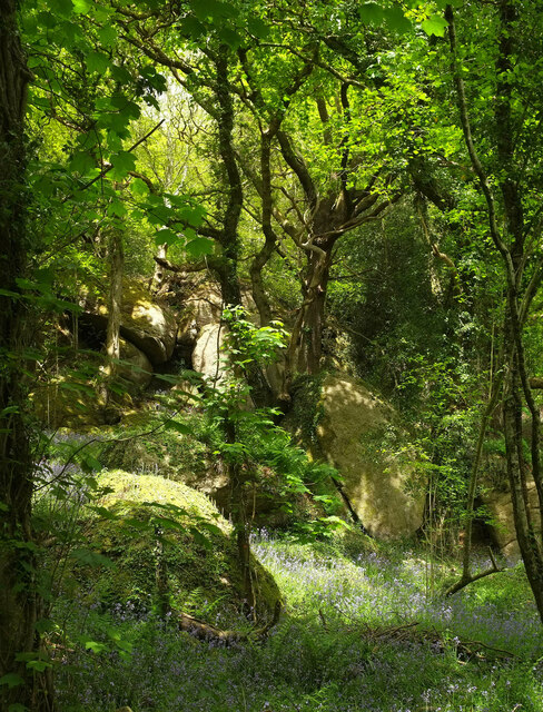
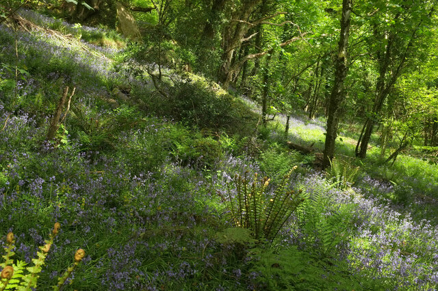
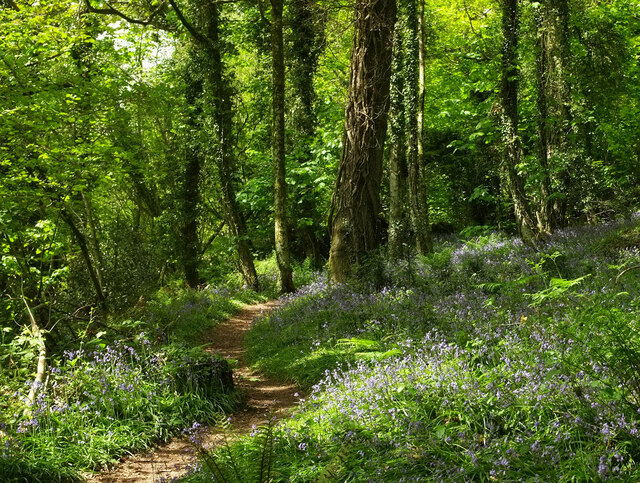
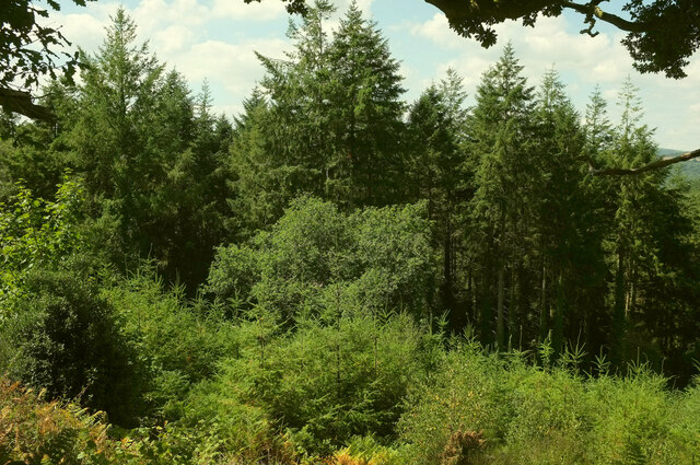
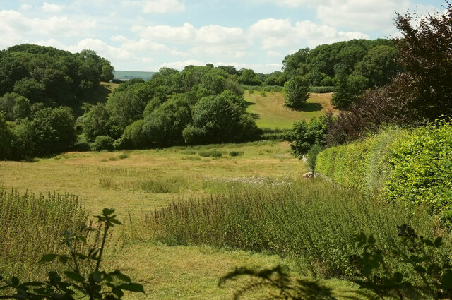
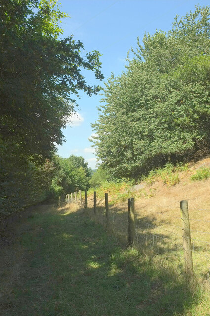
Tin Copse is a picturesque woodland located in Devon, England. It is situated in the heart of the Devonshire countryside and covers an area of approximately 50 hectares. The copse is known for its dense, ancient woodland, which is predominantly composed of oak and beech trees, creating a diverse and vibrant ecosystem.

The woodland is a haven for wildlife, providing a home to a wide variety of species. It is particularly renowned for its bird population, attracting birdwatchers from around the country. Visitors can expect to spot species such as woodpeckers, nightjars, and tawny owls, among others.

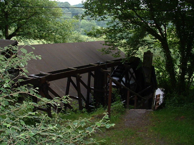
Tin Copse is also rich in history, with evidence of human activity dating back centuries. The area was once used for tin mining, hence its name, and remnants of old mining structures can still be seen today. The copse has also played a role in local folklore, with tales of hidden treasure and mystical creatures adding to its allure.

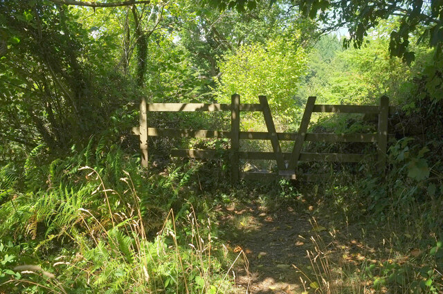
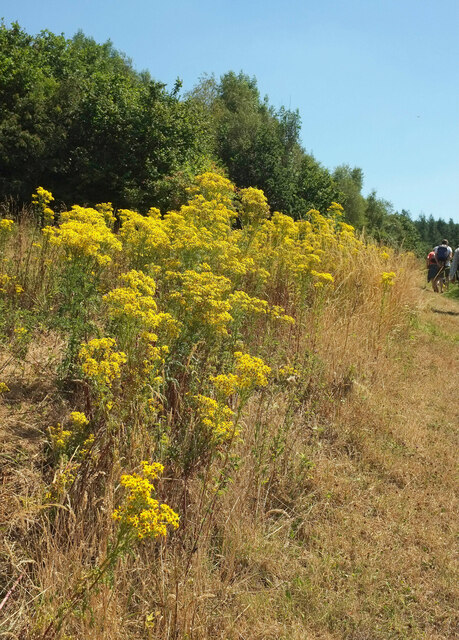
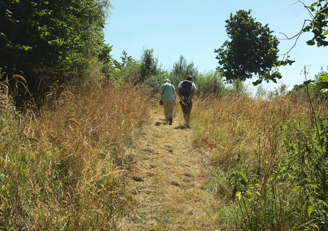
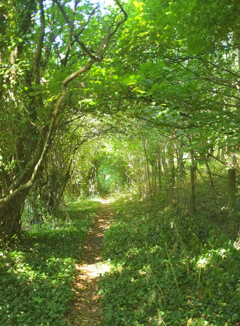
The woodland offers a tranquil escape for nature enthusiasts, with several walking trails meandering through the trees. These paths lead visitors through the heart of the copse, allowing them to immerse themselves in its natural beauty. Additionally, there are designated picnic areas for visitors to relax and enjoy the peaceful surroundings.

Tin Copse is a cherished natural gem in Devon, attracting both locals and tourists alike. Its enchanting woodland, abundant wildlife, and historical significance make it a must-visit destination for anyone seeking a serene and captivating experience in the heart of the English countryside.

If you have any feedback on the listing, please let us know in the comments section below.

Tin Copse Images

Images are sourced within 2km of 50.623701/-3.7032317 or Grid Reference SX7981. Thanks to Geograph Open Source API. All images are credited.

Rocks in Sunny Copse Something of a tor just off the permissive path through Shaptor Woods.
Rocks in Sunny Copse
Something of a tor just off the permissive path through Shaptor Woods.
Bluebells, Sunny Copse Looking right from close to where <a href="https://www.geograph.org.uk/photo/7168231">SX8080 : Rocks in Sunny Copse</a> was taken, down a steep hillside.
Bluebells, Sunny Copse
Looking right from close to where SX8080 : Rocks in Sunny Copse was taken, down a steep hillside.
Path through bluebells, Sunny Copse The permissive path winds its way up through Shaptor Woods.
Path through bluebells, Sunny Copse
The permissive path winds its way up through Shaptor Woods.
Stile from Shaptor Woods Bovey Tracey footpath 19 leaving the Woodland Trust access woodland beside the sign shown in <a href="https://www.geograph.org.uk/photo/3423955">SX8080 : At the entrance to Shaptor Woods</a> and <a href="https://www.geograph.org.uk/photo/1470252">SX8080 : Shaptor Woods</a>.
Stile from Shaptor Woods
Bovey Tracey footpath 19 leaving the Woodland Trust access woodland beside the sign shown in SX8080 : At the entrance to Shaptor Woods and SX8080 : Shaptor Woods.
Woodland below Shaptor Taken not far beyond the stile shown in <a href="https://www.geograph.org.uk/photo/7243611">SX8080 : Stile from Shaptor Woods</a>, with young and older conifer plantations on the steep hillside above Hawkmoor.
Woodland below Shaptor
Taken not far beyond the stile shown in SX8080 : Stile from Shaptor Woods, with young and older conifer plantations on the steep hillside above Hawkmoor.
Ragwort near Hawkmoor On the right is Bovey Tracey footpath 19.
Ragwort near Hawkmoor
On the right is Bovey Tracey footpath 19.
Walkers near Hawkmoor On Bovey Tracey footpath 19 as it climbs a slope below Gladstone Rock.
Walkers near Hawkmoor
On Bovey Tracey footpath 19 as it climbs a slope below Gladstone Rock.
Footpath to Slade Farm Bovey Tracey footpath 19 heads through a tunnel of trees.
Footpath to Slade Farm
Bovey Tracey footpath 19 heads through a tunnel of trees.
Field near Slade Farm From Bovey Tracey footpath 19. The A382 runs across the image between the hedges and past the central trees. The only wood named on maps is Slade Copse, in the right background.
Field near Slade Farm
From Bovey Tracey footpath 19. The A382 runs across the image between the hedges and past the central trees. The only wood named on maps is Slade Copse, in the right background.
Footpath to Slade Farm Bovey Tracey footpath 19 has changed character here over the last few decades. I remember it as a very muddy path leading through a farmyard; now it runs beside mature trees on the left which hide the farm from view.
Footpath to Slade Farm
Bovey Tracey footpath 19 has changed character here over the last few decades. I remember it as a very muddy path leading through a farmyard; now it runs beside mature trees on the left which hide the farm from view.
South end of Tottiford Reservoir  Seen through the trees from the road junction to the east.
South end of Tottiford Reservoir
Seen through the trees from the road junction to the east.
Tottiford Farm above the Beadon Brook valley
Trenchford Reservoir Pier
Car park entrance, Trenchford Reservoir Or exit, viewed in this direction. The footpath sign points towards the camera, along Bovey Tracey Footpath 41, which skirts the northern side of the reservoir. Picnic table on right.
Car park entrance, Trenchford Reservoir
Or exit, viewed in this direction. The footpath sign points towards the camera, along Bovey Tracey Footpath 41, which skirts the northern side of the reservoir. Picnic table on right.
Footpath, Trenchford Reservoir Bovey Tracey Footpath 41 just north of the car park, the start of many walks around the reservoirs. The notice warns against swimming or launching of boats, for health and safety reasons.
Footpath, Trenchford Reservoir
Bovey Tracey Footpath 41 just north of the car park, the start of many walks around the reservoirs. The notice warns against swimming or launching of boats, for health and safety reasons.
By Trenchford Reservoir Bovey Tracey Footpath 41, shown in <a href="https://www.geograph.org.uk/photo/2996998">SX8082 : Footpath, Trenchford Reservoir</a>, runs through woodland at some distance from the western shore for half its length. This is the first point north of the car park at which you can easily reach the water's edge.
By Trenchford Reservoir
Bovey Tracey Footpath 41, shown in SX8082 : Footpath, Trenchford Reservoir, runs through woodland at some distance from the western shore for half its length. This is the first point north of the car park at which you can easily reach the water's edge.
Footbridge across Trenchford Reservoir Other images of the footbridge are at <a title="https://www.geograph.org.uk/gridref/SX8082?centi=SX802828" href="https://www.geograph.org.uk/gridref/SX8082?centi=SX802828">Link</a> . Bluebells in the foreground.
Footbridge across Trenchford Reservoir
Other images of the footbridge are at Link . Bluebells in the foreground.
Tottiford Reservoir The footpath along the eastern edge of the reservoir approaches the bay at its "heel".
Tottiford Reservoir
The footpath along the eastern edge of the reservoir approaches the bay at its "heel".
Show me another place!

Tin Copse is located at Grid Ref: SX7981 (Lat: 50.623701, Lng: -3.7032317)

Administrative County: Devon

District: Teignbridge

Police Authority: Devon and Cornwall

What 3 Words

///occupiers.provide.onwards. Near Bovey Tracey, Devon

Related Wikis

Kelly Mine, Devon

Kelly Mine is a disused metalliferous mine situated on the eastern flank of Dartmoor near the village of Lustleigh in Devon, England. It was intermittently...

Lustleigh railway station

Lustleigh station was on the Moretonhampstead and South Devon Railway serving the village of Lustleigh, Devon, England. Lustleigh was the penultimate station...

Hawkmoor Hospital

Hawkmoor Hospital, originally known as Hawkmoor County Sanatorium, was a specialist hospital near Bovey Tracey in Devon, England, founded in 1913 as a...

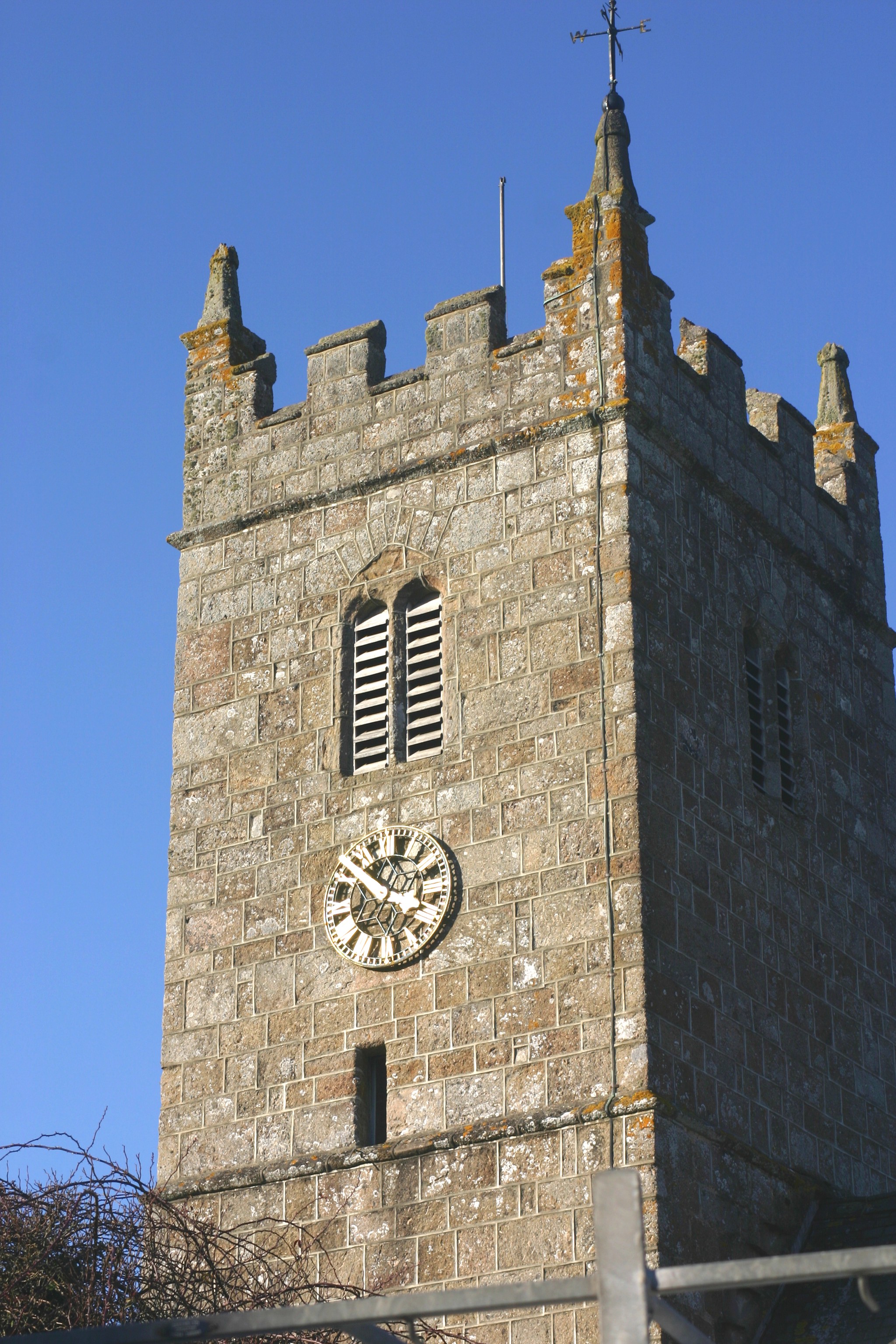
Church of St John the Baptist, Lustleigh

The Church of St John the Baptist is the Church of England parish church of the village of Lustleigh, Devon, located in the centre of the village. ��2...

Related Videos

Walking Tour 4K, Picture perfect 13th century village, Lustleigh, Dartmoor's most beautiful village.

Often dubbed 'the prettiest village in Dartmoor', Lustleigh is a beautiful blend of thatched cottages, narrow lanes and lush green ...

Walking tour Old English village Lustleigh Dartmoor England Babbling Brook (No Talking Just Walking)

Embark on a serene journey through the picturesque landscapes of South West England with a captivating "No Talking" just ...

Walk With Me (No Talking - Just Walking) English Village Walks

A preview to the Lustleigh 'Walk With Me' video - (No Talking - Just Walking) 4K Binaural best watched with headphones to ...

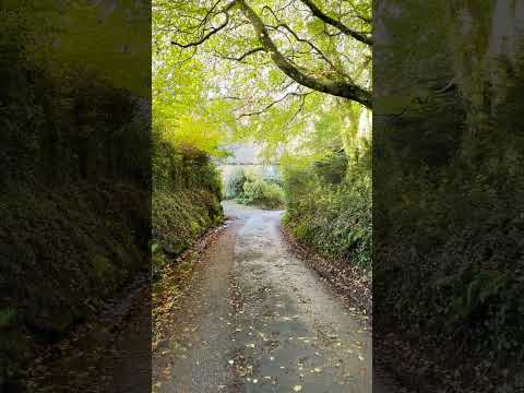
Walk with Me- East Dartmoor (pt. 5) #nature #walking #shorts

Join me for the fifth part of our walk through Pullabrook Woods in Dartmoor National Park, England. This part of the walk takes us ...

Nearby Amenities

Located within 500m of 50.623701,-3.7032317
Kelly Mine
Tourism: museum
Wikidata: Q6386203
Wikipedia: en:Kelly Mine, Devon
Lat/Long: 50.6231332/-3.7050641
Barrier: stile
Lat/Long: 50.6227892/-3.7052191
Kelly
Place: locality
Lat/Long: 50.6234686/-3.7085934
Power: pole
Lat/Long: 50.6207704/-3.7084892
The data included in this document is from www.openstreetmap.org. The data is made available under ODbL.

Have you been to Tin Copse?

Leave your review of Tin Copse below (or comments, questions and feedback).