Slade Copse

Wood, Forest in Devon Teignbridge

England

Slade Copse

White bluebell, Pixey Close I suppose one must call these rare, since this was the only white bloom I noticed among hundreds of thousands of blue bluebells carpeting these woods during this walk, but if they are around, they are very easy to spot!
White bluebell, Pixey Close Credit: Derek Harper

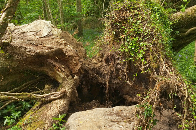
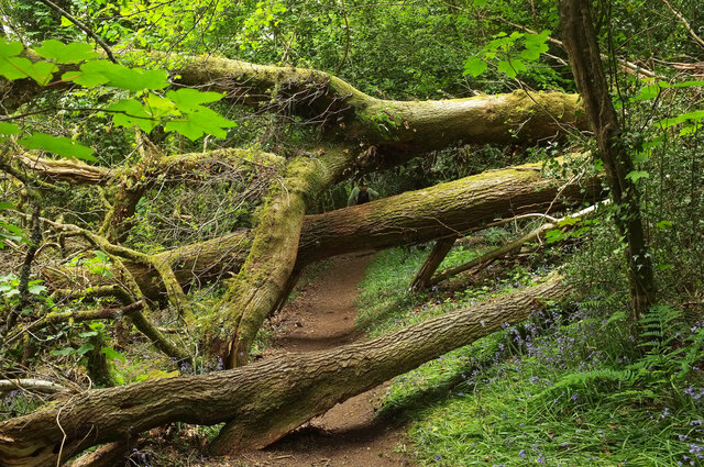
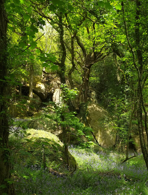
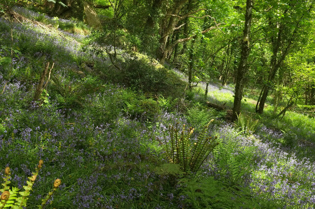
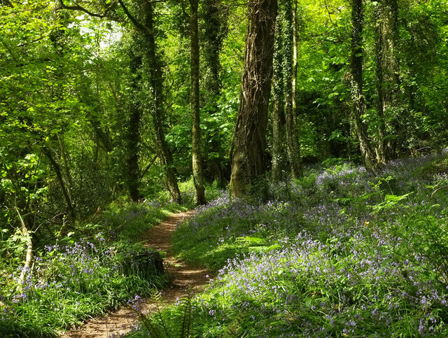
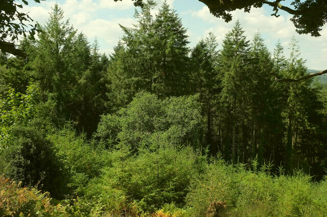
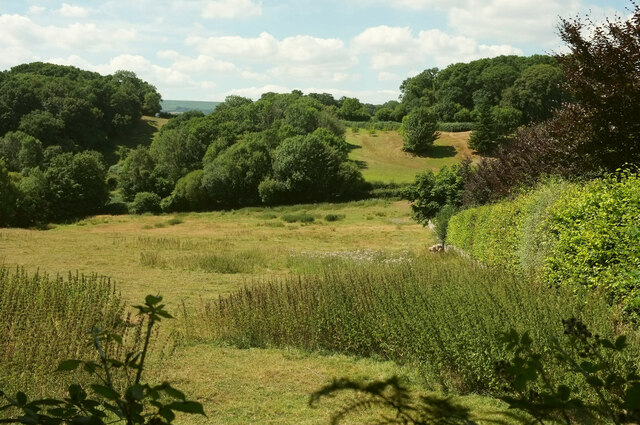
Slade Copse, located in Devon, is a charming and picturesque wood that covers an area of approximately 40 acres. Nestled amidst the rolling hills and scenic countryside, it serves as a haven for nature enthusiasts and adventurers alike. The copse is composed primarily of deciduous trees, such as oak, beech, and ash, which create a dense canopy, providing shade and shelter for the myriad of wildlife that calls this woodland home.

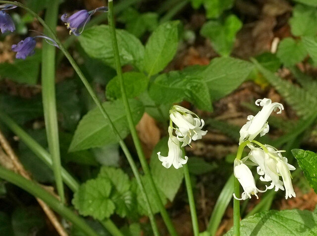
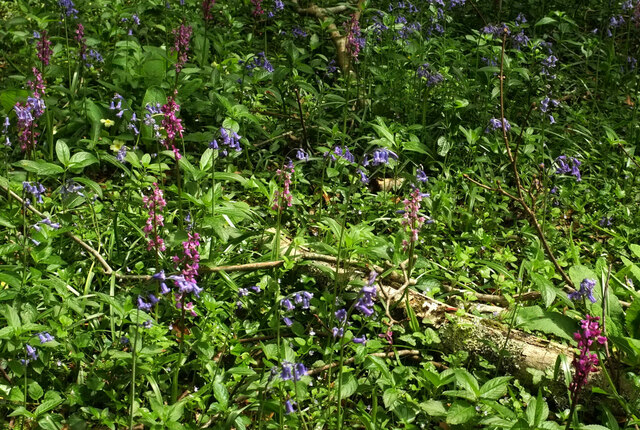
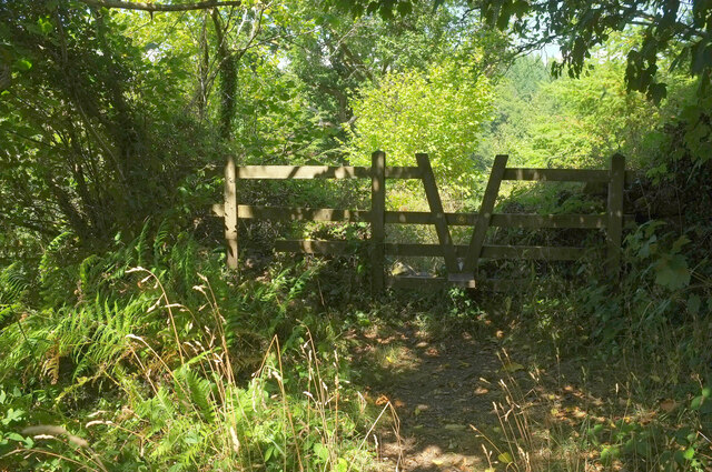
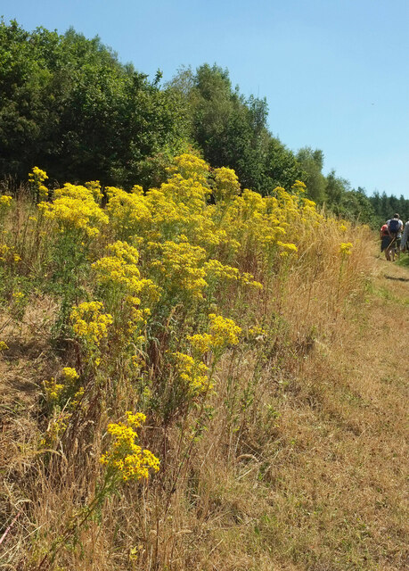
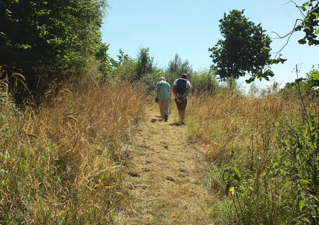
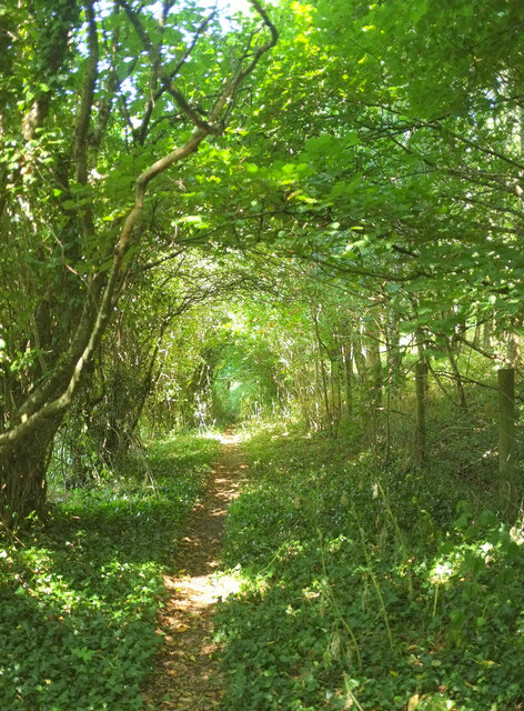
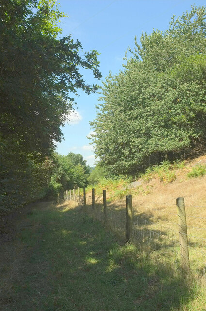
As one enters Slade Copse, a tranquil and serene atmosphere envelops the senses. The air is filled with the sweet scent of blooming wildflowers and the gentle rustling of leaves. The forest floor, covered in a rich carpet of moss and ferns, adds to the enchanting ambiance. Walking trails meander through the copse, allowing visitors to explore its hidden treasures.

The biodiversity within Slade Copse is astounding. Birdwatchers will be delighted by the wide array of avian species that inhabit the woods, including woodpeckers, tits, and warblers. Squirrels gracefully navigate the treetops, while rabbits and voles scurry about on the forest floor. Patient observers may even catch a glimpse of the elusive roe deer that occasionally roam the area.

For those seeking a moment of tranquility or a break from the hustle and bustle of everyday life, Slade Copse offers the perfect retreat. Whether it be a leisurely stroll, a picnic among the trees, or simply the opportunity to immerse oneself in the wonders of nature, this wood in Devon promises a rejuvenating and memorable experience for all who visit.

If you have any feedback on the listing, please let us know in the comments section below.

Slade Copse Images

Images are sourced within 2km of 50.618622/-3.7024544 or Grid Reference SX7981. Thanks to Geograph Open Source API. All images are credited.

White bluebell, Pixey Close I suppose one must call these rare, since this was the only white bloom I noticed among hundreds of thousands of blue bluebells carpeting these woods during this walk, but if they are around, they are very easy to spot!
White bluebell, Pixey Close
I suppose one must call these rare, since this was the only white bloom I noticed among hundreds of thousands of blue bluebells carpeting these woods during this walk, but if they are around, they are very easy to spot!
Fallen trees, Pixey Close They have fallen in opposite directions - or is it one tree that has split? The trunk onn the left has blocked the permissive path through Shaptor Woods, requiring a diversion to duck beneath the trunk on the right; not the only such diversion on this walk.
Fallen trees, Pixey Close
They have fallen in opposite directions - or is it one tree that has split? The trunk onn the left has blocked the permissive path through Shaptor Woods, requiring a diversion to duck beneath the trunk on the right; not the only such diversion on this walk.
Trees across the path, Sunny Copse See <a href="https://www.geograph.org.uk/photo/7168215">SX8180 : Fallen trees, Pixey Close</a>; here on a steep slope there is no diversion so these fallen trunks must be scrambled over or crawled under.
Trees across the path, Sunny Copse
See SX8180 : Fallen trees, Pixey Close; here on a steep slope there is no diversion so these fallen trunks must be scrambled over or crawled under.
Rocks in Sunny Copse Something of a tor just off the permissive path through Shaptor Woods.
Rocks in Sunny Copse
Something of a tor just off the permissive path through Shaptor Woods.
Bluebells, Sunny Copse Looking right from close to where <a href="https://www.geograph.org.uk/photo/7168231">SX8080 : Rocks in Sunny Copse</a> was taken, down a steep hillside.
Bluebells, Sunny Copse
Looking right from close to where SX8080 : Rocks in Sunny Copse was taken, down a steep hillside.
Path through bluebells, Sunny Copse The permissive path winds its way up through Shaptor Woods.
Path through bluebells, Sunny Copse
The permissive path winds its way up through Shaptor Woods.
Bluebells and orchids, Pixey Close The number of early purple orchids rivals that of bluebells in this part of the woods.
Bluebells and orchids, Pixey Close
The number of early purple orchids rivals that of bluebells in this part of the woods.
Stile from Shaptor Woods Bovey Tracey footpath 19 leaving the Woodland Trust access woodland beside the sign shown in <a href="https://www.geograph.org.uk/photo/3423955">SX8080 : At the entrance to Shaptor Woods</a> and <a href="https://www.geograph.org.uk/photo/1470252">SX8080 : Shaptor Woods</a>.
Stile from Shaptor Woods
Bovey Tracey footpath 19 leaving the Woodland Trust access woodland beside the sign shown in SX8080 : At the entrance to Shaptor Woods and SX8080 : Shaptor Woods.
Woodland below Shaptor Taken not far beyond the stile shown in <a href="https://www.geograph.org.uk/photo/7243611">SX8080 : Stile from Shaptor Woods</a>, with young and older conifer plantations on the steep hillside above Hawkmoor.
Woodland below Shaptor
Taken not far beyond the stile shown in SX8080 : Stile from Shaptor Woods, with young and older conifer plantations on the steep hillside above Hawkmoor.
Ragwort near Hawkmoor On the right is Bovey Tracey footpath 19.
Ragwort near Hawkmoor
On the right is Bovey Tracey footpath 19.
Walkers near Hawkmoor On Bovey Tracey footpath 19 as it climbs a slope below Gladstone Rock.
Walkers near Hawkmoor
On Bovey Tracey footpath 19 as it climbs a slope below Gladstone Rock.
Footpath to Slade Farm Bovey Tracey footpath 19 heads through a tunnel of trees.
Footpath to Slade Farm
Bovey Tracey footpath 19 heads through a tunnel of trees.
Field near Slade Farm From Bovey Tracey footpath 19. The A382 runs across the image between the hedges and past the central trees. The only wood named on maps is Slade Copse, in the right background.
Field near Slade Farm
From Bovey Tracey footpath 19. The A382 runs across the image between the hedges and past the central trees. The only wood named on maps is Slade Copse, in the right background.
Footpath to Slade Farm Bovey Tracey footpath 19 has changed character here over the last few decades. I remember it as a very muddy path leading through a farmyard; now it runs beside mature trees on the left which hide the farm from view.
Footpath to Slade Farm
Bovey Tracey footpath 19 has changed character here over the last few decades. I remember it as a very muddy path leading through a farmyard; now it runs beside mature trees on the left which hide the farm from view.
Trenchford Reservoir Pier
Car park entrance, Trenchford Reservoir Or exit, viewed in this direction. The footpath sign points towards the camera, along Bovey Tracey Footpath 41, which skirts the northern side of the reservoir. Picnic table on right.
Car park entrance, Trenchford Reservoir
Or exit, viewed in this direction. The footpath sign points towards the camera, along Bovey Tracey Footpath 41, which skirts the northern side of the reservoir. Picnic table on right.
Footpath, Trenchford Reservoir Bovey Tracey Footpath 41 just north of the car park, the start of many walks around the reservoirs. The notice warns against swimming or launching of boats, for health and safety reasons.
Footpath, Trenchford Reservoir
Bovey Tracey Footpath 41 just north of the car park, the start of many walks around the reservoirs. The notice warns against swimming or launching of boats, for health and safety reasons.
By Trenchford Reservoir Bovey Tracey Footpath 41, shown in <a href="https://www.geograph.org.uk/photo/2996998">SX8082 : Footpath, Trenchford Reservoir</a>, runs through woodland at some distance from the western shore for half its length. This is the first point north of the car park at which you can easily reach the water's edge.
By Trenchford Reservoir
Bovey Tracey Footpath 41, shown in SX8082 : Footpath, Trenchford Reservoir, runs through woodland at some distance from the western shore for half its length. This is the first point north of the car park at which you can easily reach the water's edge.
Show me another place!

Slade Copse is located at Grid Ref: SX7981 (Lat: 50.618622, Lng: -3.7024544)

Administrative County: Devon

District: Teignbridge

Police Authority: Devon and Cornwall

What 3 Words

///samplers.rungs.asterisk. Near Bovey Tracey, Devon

Related Wikis

Kelly Mine, Devon

Kelly Mine is a disused metalliferous mine situated on the eastern flank of Dartmoor near the village of Lustleigh in Devon, England. It was intermittently...

Hawkmoor Hospital

Hawkmoor Hospital, originally known as Hawkmoor County Sanatorium, was a specialist hospital near Bovey Tracey in Devon, England, founded in 1913 as a...

Lustleigh railway station

Lustleigh station was on the Moretonhampstead and South Devon Railway serving the village of Lustleigh, Devon, England. Lustleigh was the penultimate station...

Church of St John the Baptist, Lustleigh

The Church of St John the Baptist is the Church of England parish church of the village of Lustleigh, Devon, located in the centre of the village. ��2...

Nearby Amenities

Located within 500m of 50.618622,-3.7024544
Slade Cross
Place: locality
Source: NPE
Lat/Long: 50.6183649/-3.6993597
Barrier: stile
Lat/Long: 50.6190598/-3.6981714
Generator Method: photovoltaic
Generator Output Electricity: yes
Generator Source: solar
Generator Type: solar_photovoltaic_panel
Location: roof
Power: generator
Lat/Long: 50.6198702/-3.6978368
Power: pole
Lat/Long: 50.6207704/-3.7084892
Power: pole
Lat/Long: 50.6199944/-3.707289
Power: pole
Lat/Long: 50.6191257/-3.7059572
Power: pole
Lat/Long: 50.6187972/-3.7044632
Power: pole
Lat/Long: 50.617988/-3.703782
Power: pole
Lat/Long: 50.6173362/-3.7033045
Power: pole
Lat/Long: 50.616464/-3.7026876
Power: pole
Lat/Long: 50.6155135/-3.7019996
Power: pole
Lat/Long: 50.6144992/-3.7012942
Hatherleigh Tor
Ele: 160
Natural: peak
Website: https://www.torsofdartmoor.co.uk/tor-page.php?tor=hatherleigh-tor
Lat/Long: 50.6151186/-3.6996437
Willmead Tor
Ele: 165
Natural: peak
Source: local knowledge;https://www.torsofdartmoor.co.uk/tor-page.php?tor=willmead-tor
Lat/Long: 50.6158399/-3.7018581
Slade Copse Tor
Ele: 155
Natural: peak
Source: local knowledge;https://www.torsofdartmoor.co.uk/tor-page.php?tor=slade-copse-tor
Lat/Long: 50.6182131/-3.7012727
The data included in this document is from www.openstreetmap.org. The data is made available under ODbL.

Have you been to Slade Copse?

Leave your review of Slade Copse below (or comments, questions and feedback).