Western Barham Wood

Wood, Forest in Devon North Devon

England

Western Barham Wood

North Molton: Higher North Radworthy Looking north west towards a new silo
North Molton: Higher North Radworthy Credit: Martin Bodman

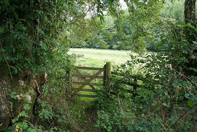
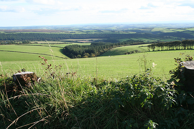
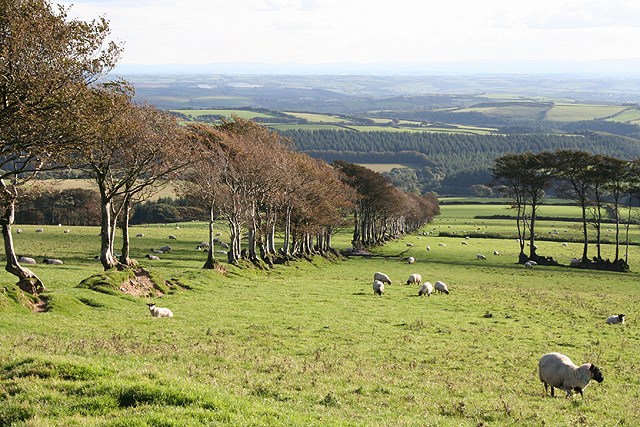
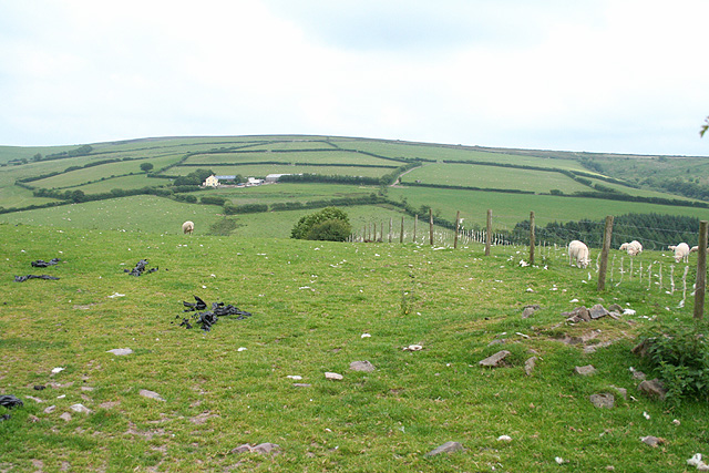
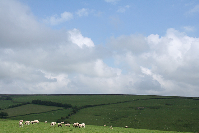
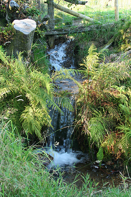
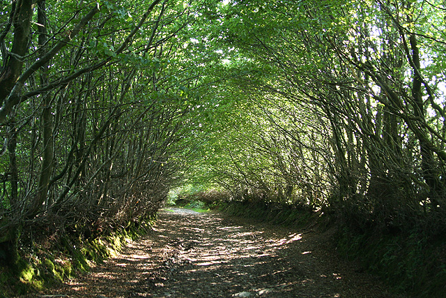
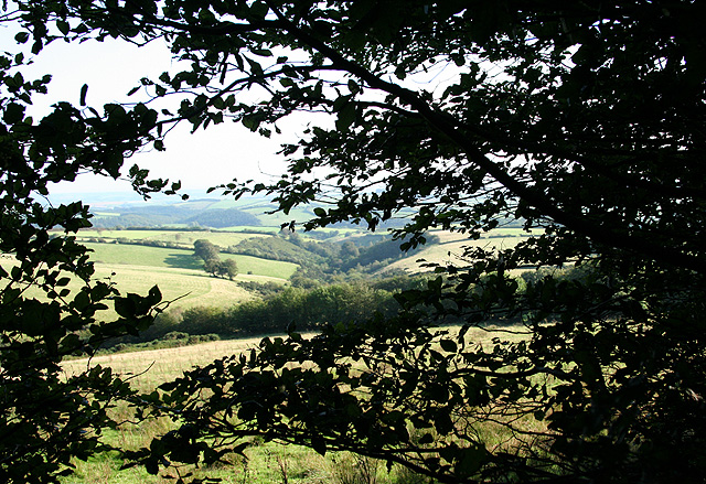
Western Barham Wood is a beautiful forest located in Devon, England. Covering an area of approximately 50 hectares, this woodland is a mix of broadleaf and coniferous trees, providing a diverse habitat for a variety of plant and animal species.

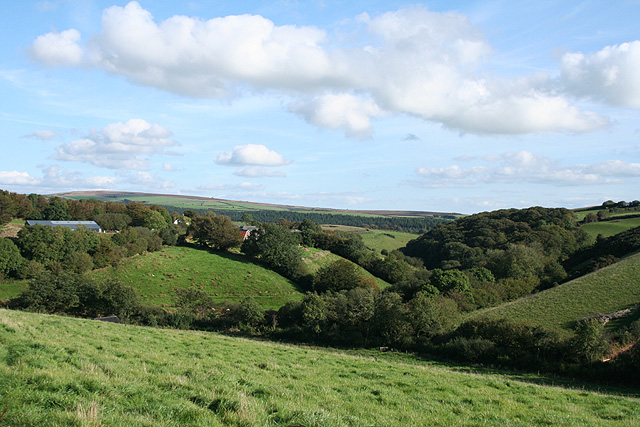
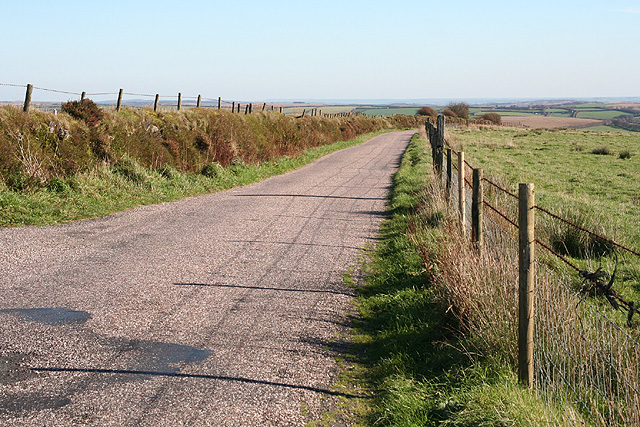
The forest is popular among hikers, nature enthusiasts, and birdwatchers due to its tranquil atmosphere and abundance of wildlife. Visitors can explore the network of trails that wind through the woods, offering scenic views of the surrounding countryside and opportunities to spot deer, squirrels, and various species of birds.

Western Barham Wood is also home to a number of rare and protected species, making it an important site for conservation efforts. The forest is managed sustainably, with efforts to preserve its natural beauty and biodiversity for future generations to enjoy.

Overall, Western Barham Wood is a peaceful and picturesque destination for those looking to immerse themselves in nature and escape the hustle and bustle of everyday life. Whether you're seeking a leisurely stroll, a challenging hike, or simply a place to relax and unwind, this forest has something to offer for everyone.

If you have any feedback on the listing, please let us know in the comments section below.

Western Barham Wood Images

Images are sourced within 2km of 51.094481/-3.7933671 or Grid Reference SS7434. Thanks to Geograph Open Source API. All images are credited.

North Molton: Higher North Radworthy Looking north west towards a new silo
North Molton: Higher North Radworthy
Looking north west towards a new silo
North Molton: in the Mole valley A footpath between Mines Bridge and Higher Mines Wood. Looking east-south-east
North Molton: in the Mole valley
A footpath between Mines Bridge and Higher Mines Wood. Looking east-south-east
North Molton: Bampfylde Mine The mine was worked for copper in the 18th and 19th centuries. Seven waterwheels were on site in 1868, powered by more than one leat; these were used for pumping the mine and crushing and dressing the ores. Looking south east. [For more information see ‘Exmoor’s Industrial Archaeology’, edited by Michael Atkinson, Exmoor Press, 1997]
North Molton: Bampfylde Mine
The mine was worked for copper in the 18th and 19th centuries. Seven waterwheels were on site in 1868, powered by more than one leat; these were used for pumping the mine and crushing and dressing the ores. Looking south east. [For more information see ‘Exmoor’s Industrial Archaeology’, edited by Michael Atkinson, Exmoor Press, 1997]
North Molton: North Heasley Part of the complex of farm buildings here. Looking south-south-east
North Molton: North Heasley
Part of the complex of farm buildings here. Looking south-south-east
North Molton: towards Heasley Wood The wood is on the right of the valley. On the left, hidden behind trees is Bentwitchen, a complex of farm buildings, some now converted to private homes. Looking south east in late afternoon light, September
North Molton: towards Heasley Wood
The wood is on the right of the valley. On the left, hidden behind trees is Bentwitchen, a complex of farm buildings, some now converted to private homes. Looking south east in late afternoon light, September
North Molton: Bentwitchen Looking south towards a converted horse-engine house: the building beyond the gate. A leat runs south to Bentwitchen but apparently was used for potable water and for irrigation: power was provided by horses rather than by a waterwheel
North Molton: Bentwitchen
Looking south towards a converted horse-engine house: the building beyond the gate. A leat runs south to Bentwitchen but apparently was used for potable water and for irrigation: power was provided by horses rather than by a waterwheel
North Molton: on Fyldon Hill Sheep penned waiting for attention to their hooves near Span Head. Looking east-south-east
North Molton: on Fyldon Hill
Sheep penned waiting for attention to their hooves near Span Head. Looking east-south-east
North Molton: on Fyldon Common Looking south to Fyldon Wood and Deercombe Wood. In the distance Long Wood, a plantation, stands on the southern edge of the Mole valley
North Molton: on Fyldon Common
Looking south to Fyldon Wood and Deercombe Wood. In the distance Long Wood, a plantation, stands on the southern edge of the Mole valley
North Molton: on Fyldon Common Looking south over sheep country. The plantation in the distance is Long Wood, by the Mole valley
North Molton: on Fyldon Common
Looking south over sheep country. The plantation in the distance is Long Wood, by the Mole valley
Exmoor: on Hangley Cleave Looking north-north-west towards Kinsford from the top of one of the ‘Two Barrows’ which is just inside the Somerset border with Devon
Exmoor: on Hangley Cleave
Looking north-north-west towards Kinsford from the top of one of the ‘Two Barrows’ which is just inside the Somerset border with Devon
North Molton: on Fyldon Common Looking east-south-east on the road between Kinsford Gate Cross and Sandway Cross. This route is the border between Devon and Somerset
North Molton: on Fyldon Common
Looking east-south-east on the road between Kinsford Gate Cross and Sandway Cross. This route is the border between Devon and Somerset
North Molton: Higher South Radway Looking east-south-east
North Molton: Higher South Radway
Looking east-south-east
North Molton: towards Tabor Hill Tabor Hill is the farm across the valley beyond the square
North Molton: towards Tabor Hill
Tabor Hill is the farm across the valley beyond the square
North Molton: towards North Molton Ridge Looking south east
North Molton: towards North Molton Ridge
Looking south east
North Molton: Span Head Water course on Fyldon Common
North Molton: Span Head
Water course on Fyldon Common
North Molton: track to Bentwitchen Looking south west below Span Head
North Molton: track to Bentwitchen
Looking south west below Span Head
North Molton: towards Lyddicombe Bottom With Fyldon Hill to the left. Seen from the tree-lined track that runs from Span Head to Bentwitchen
North Molton: towards Lyddicombe Bottom
With Fyldon Hill to the left. Seen from the tree-lined track that runs from Span Head to Bentwitchen
North Molton: on Fyldon Common Looking south-south-west towards Lyddicombe Bottom
North Molton: on Fyldon Common
Looking south-south-west towards Lyddicombe Bottom
Show me another place!

Western Barham Wood is located at Grid Ref: SS7434 (Lat: 51.094481, Lng: -3.7933671)

Administrative County: Devon

District: North Devon

Police Authority: Devon and Cornwall

What 3 Words

///edit.knees.downhill. Near South Molton, Devon

Related Wikis

North Radworthy

North Radworthy is a hamlet and historic estate in the civil parish and former manor of North Molton, in the North Devon district of the county of Devon...

Bentwitchen

Bentwitchen is a hamlet in Devon, England. == References ==

South Radworthy

South Radworthy is a hamlet in the civil parish of North Molton, in the North Devon District of the county of Devon, England. It is about three miles to...

North Molton

North Molton is a village, parish and former manor in North Devon, England. The population of the parish in 2001 was 1,047, decreasing to 721 in the 2011...

Have you been to Western Barham Wood?

Leave your review of Western Barham Wood below (or comments, questions and feedback).