Tidicombe Wood

Wood, Forest in Devon North Devon

England

Tidicombe Wood

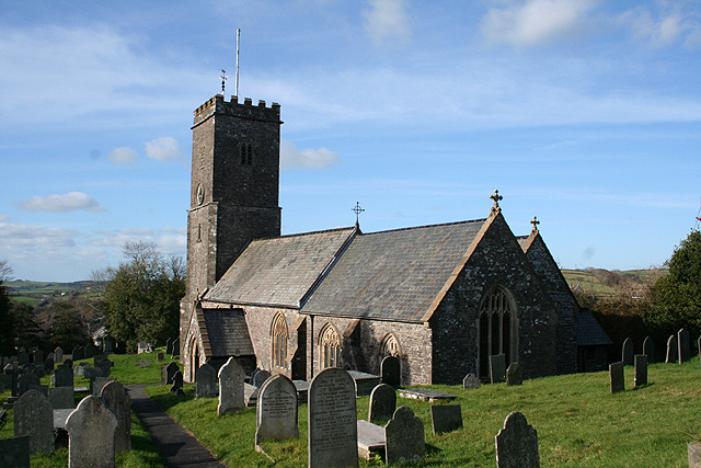
St Peter’s Church, Bratton Fleming
St Peter’s Church, Bratton Fleming Credit: David Martin

Tidicombe Wood is a serene and enchanting forest located in the county of Devon, England. Situated near the charming village of Tidicombe, this woodland exudes a sense of tranquility and natural beauty, attracting nature enthusiasts, hikers, and families alike.

Covering an area of approximately 100 acres, Tidicombe Wood is characterized by its ancient trees and diverse flora and fauna. The woodland is predominantly composed of deciduous trees, including oak, beech, and ash, which provide a rich and vibrant canopy during the summer months. Bluebells, wild garlic, and primroses carpet the forest floor in the spring, creating a picturesque and captivating scene.

A network of well-maintained footpaths and trails wind their way through Tidicombe Wood, allowing visitors to explore its hidden treasures. The paths vary in difficulty, catering to both casual strollers and more avid hikers. Along the way, visitors will encounter babbling brooks, charming meadows, and stunning viewpoints that overlook the surrounding countryside.

The forest is also home to a diverse array of wildlife. Birdwatchers can spot various species, such as woodpeckers, nuthatches, and thrushes, while lucky visitors may even catch a glimpse of elusive creatures like deer and foxes. The peaceful ambiance of Tidicombe Wood makes it an ideal spot for birdwatching and wildlife photography.

With its idyllic setting and abundant natural beauty, Tidicombe Wood offers a peaceful escape from the hustle and bustle of everyday life. Whether one seeks solitude, a leisurely stroll, or an opportunity to immerse oneself in nature, this enchanting forest in Devon provides a captivating and memorable experience for all who visit.

If you have any feedback on the listing, please let us know in the comments section below.

Tidicombe Wood Images

Images are sourced within 2km of 51.136645/-3.9465643 or Grid Reference SS6339. Thanks to Geograph Open Source API. All images are credited.

St Peter’s Church, Bratton Fleming
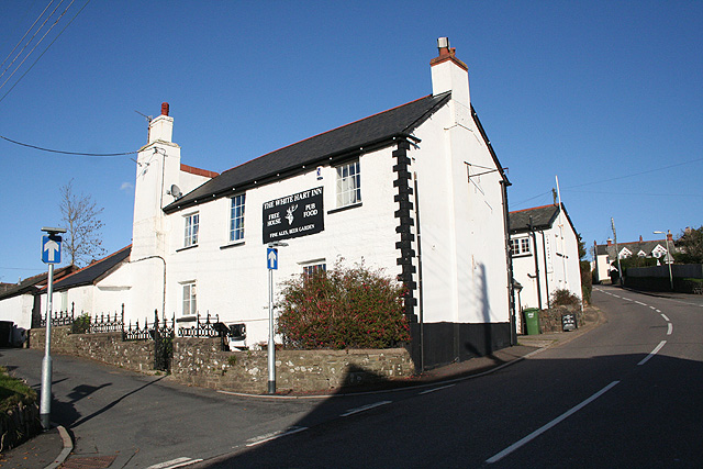
The White Hart, Bratton Fleming The pub appears to be out of business.
The White Hart, Bratton Fleming
The pub appears to be out of business.
View over Bratton Fleming rooftops
Chapel and view, Bratton Fleming
St Peter's Church, Bratton Fleming
St Peter's Church, Bratton Fleming: interior
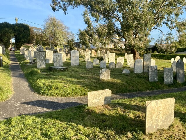
Bratton Fleming churchyard
Bratton Fleming: lane to Knightacott Looking north east. The formation of the Lynton & Barnstaple Railway, closed in 1935, can be seen one field down from the skyline
Bratton Fleming: lane to Knightacott
Looking north east. The formation of the Lynton & Barnstaple Railway, closed in 1935, can be seen one field down from the skyline
Arlington: lane to Coombeshead Farm access road. Looking west-south-west
Arlington: lane to Coombeshead
Farm access road. Looking west-south-west
Bratton Fleming: St Peter’s church The church – nave, chancel, south porch and north aisle – was rebuilt in 1855-61 and only the west tower carries any character through from previous centuries. Looking west-north-west
Bratton Fleming: St Peter’s church
The church – nave, chancel, south porch and north aisle – was rebuilt in 1855-61 and only the west tower carries any character through from previous centuries. Looking west-north-west
Bratton Fleming: river west of the village By the bridge on the public bridleway to Smythapark and Loxhore. The river is a tributary of the river Yeo and at one time powered watermills in Bratton and Loxhore parishes. Looking north-north-east
Bratton Fleming: river west of the village
By the bridge on the public bridleway to Smythapark and Loxhore. The river is a tributary of the river Yeo and at one time powered watermills in Bratton and Loxhore parishes. Looking north-north-east
Loxhore: Smythapark Wood On the edge of the wood. The bridleway leads to Smythapark and Loxhore. Looking west-north-west
Loxhore: Smythapark Wood
On the edge of the wood. The bridleway leads to Smythapark and Loxhore. Looking west-north-west
Bratton Fleming: near Bratton Mill Bratton Mill once supplied the village with its meal and flour but is now a private residence. Looking south west
Bratton Fleming: near Bratton Mill
Bratton Mill once supplied the village with its meal and flour but is now a private residence. Looking south west
Bratton Fleming: course of the Lynton & Barnstaple Railway Near Holywell, looking south west. The formation here looks surprisingly wide for a single-track narrow-gauge railway. The station at Bratton was some way to the north, behind the camera
Bratton Fleming: course of the Lynton & Barnstaple Railway
Near Holywell, looking south west. The formation here looks surprisingly wide for a single-track narrow-gauge railway. The station at Bratton was some way to the north, behind the camera
Bratton Fleming: near Holywell Looking west-south-west over the valley west of the village
Bratton Fleming: near Holywell
Looking west-south-west over the valley west of the village
Bratton Fleming: towards Sloley’s Wood The valley north west of Bratton Fleming village, looking north west. Above the plantation across the valley on the left is the site of a large settlement, perhaps dating from Celtic times
Bratton Fleming: towards Sloley’s Wood
The valley north west of Bratton Fleming village, looking north west. Above the plantation across the valley on the left is the site of a large settlement, perhaps dating from Celtic times
Bratton Fleming: The White Hart Inn By the main road through the village. Looking north east
Bratton Fleming: The White Hart Inn
By the main road through the village. Looking north east
Bratton Fleming: towards Beara A view from Grange Hill towards the northern outskirts of Bratton Fleming village
Bratton Fleming: towards Beara
A view from Grange Hill towards the northern outskirts of Bratton Fleming village
Show me another place!

Tidicombe Wood is located at Grid Ref: SS6339 (Lat: 51.136645, Lng: -3.9465643)

Administrative County: Devon

District: North Devon

Police Authority: Devon and Cornwall

What 3 Words

///project.something.rails. Near Combe Martin, Devon

Related Wikis

Bratton Fleming railway station

Bratton Fleming railway station is a former station on the Lynton and Barnstaple Railway in England, a narrow gauge line that ran through Exmoor from Barnstaple...

Smythapark

Smythapark is the site of an Iron Age hill fort, situated close to the village of Bratton Fleming in Devon, England. The site is on a hillside forming...

Bratton Fleming

Bratton Fleming is a large village, civil parish and former manor in Devon, England, about 6 miles (10 km) north-east of Barnstaple and near the western...

Exmoor Zoo

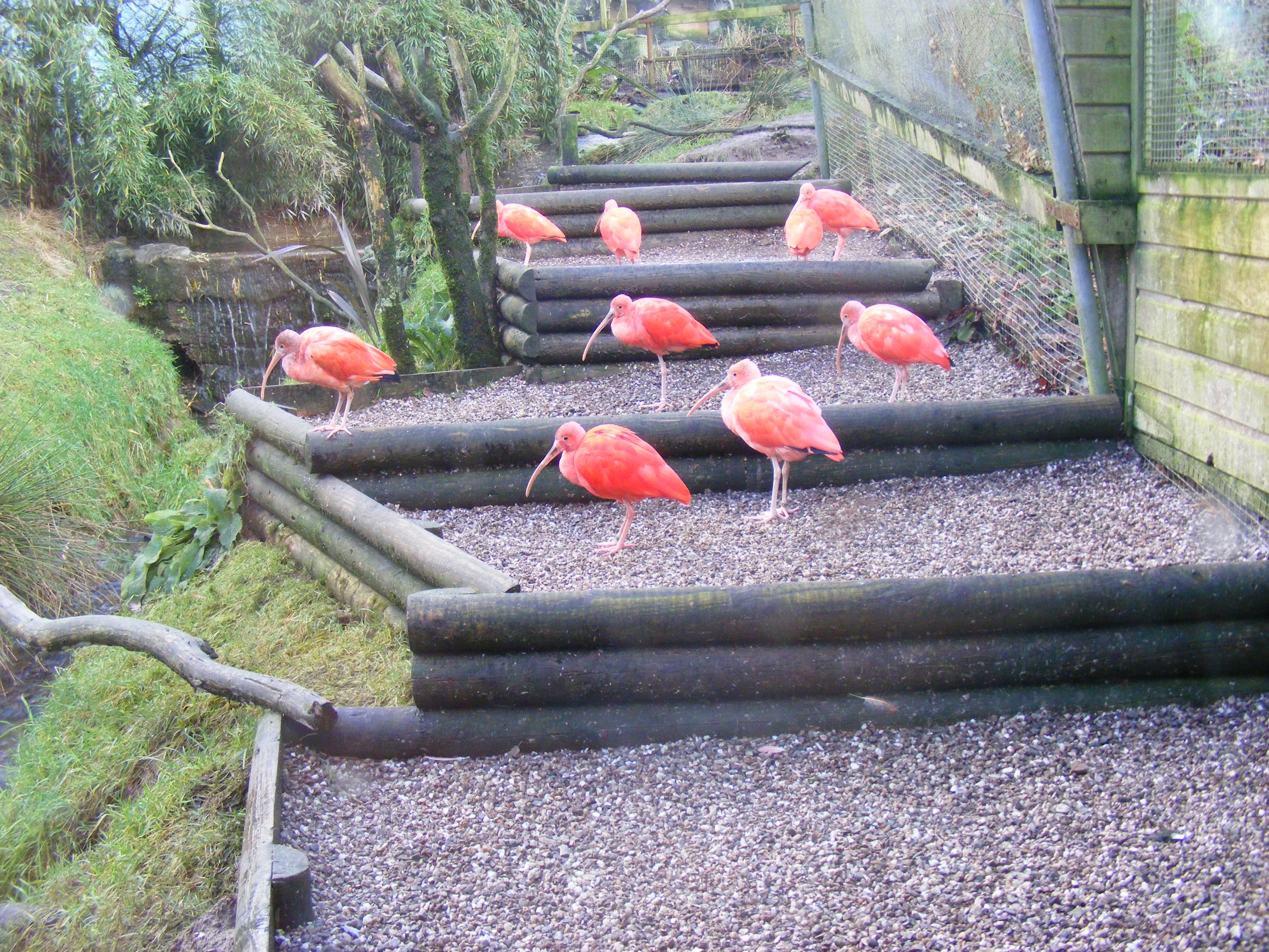
Exmoor Zoo is a conservation centre in Exmoor, North Devon, England. The zoo developed from Exmoor Bird Gardens, opened on the site of a farm in 1982....

Nearby Amenities

Located within 500m of 51.136645,-3.9465643
Barrier: kissing_gate
Lat/Long: 51.1373262/-3.9407206
Rye Park
Place: locality
Lat/Long: 51.1372189/-3.9431477
Barrier: kissing_gate
Lat/Long: 51.1383162/-3.9427428
Barrier: kissing_gate
Lat/Long: 51.1383648/-3.942757
Barrier: stile
Lat/Long: 51.1342804/-3.941875
Generator Method: photovoltaic
Generator Output Electricity: yes
Generator Source: solar
Generator Type: solar_photovoltaic_panel
Location: roof
Power: generator
Lat/Long: 51.1366669/-3.9415839
The data included in this document is from www.openstreetmap.org. The data is made available under ODbL.

Have you been to Tidicombe Wood?

Leave your review of Tidicombe Wood below (or comments, questions and feedback).