Chaddle Wood

Wood, Forest in Devon South Hams

England

Chaddle Wood

Devon Expressway (A38) between Voss Park and Deep Lane Junctions The A38 is a major A-class trunk route. When first designated in 1922, it ran from Derby to Plymouth but it was later extended at both ends so that it now runs for 292 miles from Mansfield in Nottinghamshire to Bodmin in Cornwall.

Prior to the opening of the M5 motorway in the 1960s and 1970s, the A38 formed the main "holiday route" from the Midlands to Somerset, Devon and Cornwall and the south-western section was notorious at holiday times for the congestion. Nowadays, for most of the southern section, the A38 is a fairly quiet road shadowing the M5 extremely closely; often running alongside the motorway as a single carriageway road. The section between Exeter and Plymouth is, however, a busy dual carriageway which serves as the southern extension of the M5 and is known as “the Devon Expressway”.

More information at <span class="nowrap"><a title="http://en.wikipedia.org/wiki/A38_road" rel="nofollow ugc noopener" href="http://en.wikipedia.org/wiki/A38_road">Link</a><img style="margin-left:2px;" alt="External link" title="External link - shift click to open in new window" src="https://s1.geograph.org.uk/img/external.png" width="10" height="10"/></span>  (Wikipedia) and <span class="nowrap"><a title="http://www.sabre-roads.org.uk/wiki/index.php?title=A38" rel="nofollow ugc noopener" href="http://www.sabre-roads.org.uk/wiki/index.php?title=A38">Link</a><img style="margin-left:2px;" alt="External link" title="External link - shift click to open in new window" src="https://s1.geograph.org.uk/img/external.png" width="10" height="10"/></span>  (SABRE).
Devon Expressway (A38) between Voss Park and Deep Lane Junctions Credit: David Dixon

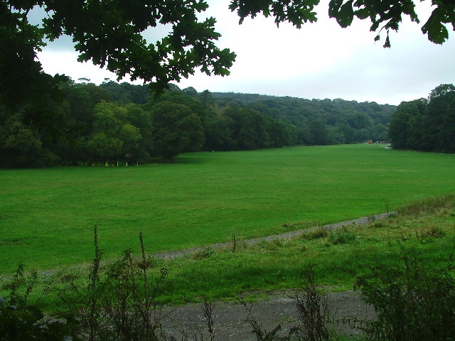
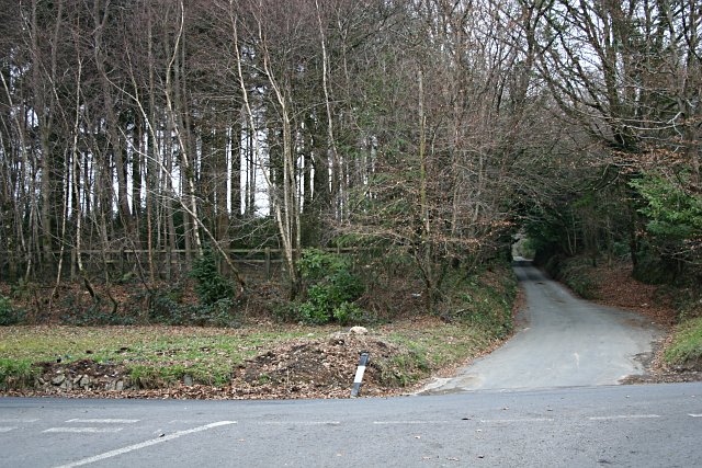
Chaddle Wood is a picturesque woodland located in Devon, England. Situated near the village of Plympton, it covers an area of approximately 170 acres. The wood is known for its diverse range of flora and fauna, making it a popular destination for nature enthusiasts and hikers.

The woodland is characterized by its dense canopy of oak, beech, and ash trees, which provide a sheltered habitat for various species. Bluebells, primroses, and wild garlic are among the many wildflowers that carpet the forest floor during the spring months, creating a stunning display of colors.

Chaddle Wood is home to a wide array of wildlife, including deer, foxes, badgers, and a variety of bird species. Birdwatchers can spot woodpeckers, jays, and various songbirds amongst the trees. The wood also boasts a small pond, which attracts dragonflies, frogs, and other aquatic creatures.

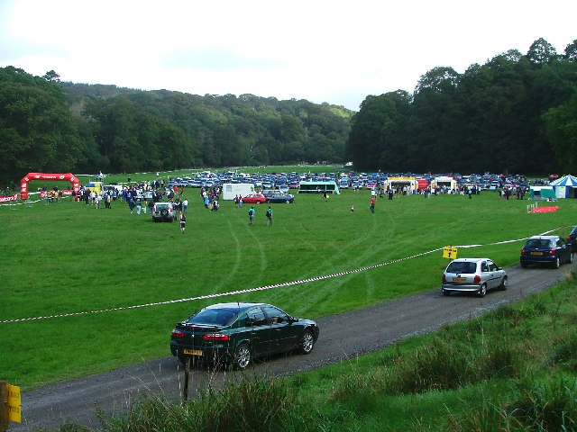
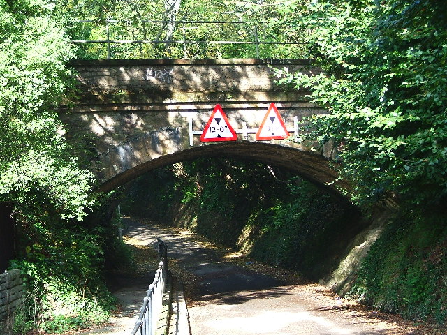
Several well-maintained trails wind their way through Chaddle Wood, offering visitors the opportunity to explore its beauty. The paths are suitable for walkers of all ages and abilities, and there are designated picnic areas where visitors can relax and enjoy the tranquil surroundings.

The wood is managed by a local conservation group, ensuring its preservation and protection for future generations. Regular events and educational programs are organized to raise awareness about the importance of woodland conservation.

Chaddle Wood provides a peaceful escape from the hustle and bustle of urban life, offering visitors a chance to immerse themselves in the beauty of nature. Whether it's a leisurely stroll, a wildlife spotting expedition, or a family picnic, Chaddle Wood has something to offer everyone.

If you have any feedback on the listing, please let us know in the comments section below.
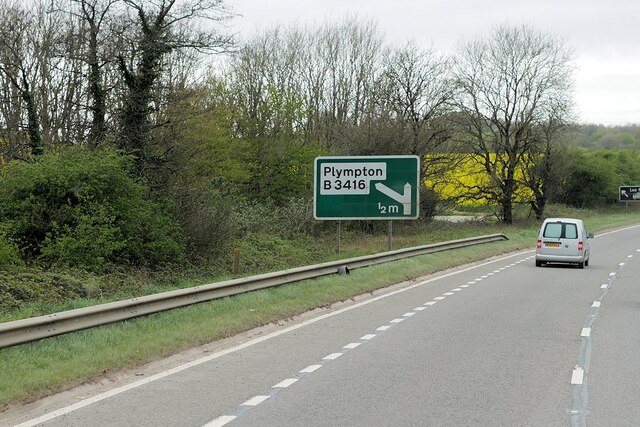
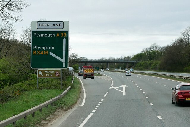
Chaddle Wood Images

Images are sourced within 2km of 50.392569/-4.0227475 or Grid Reference SX5656. Thanks to Geograph Open Source API. All images are credited.

Devon Expressway (A38) between Voss Park and Deep Lane Junctions The A38 is a major A-class trunk route. When first designated in 1922, it ran from Derby to Plymouth but it was later extended at both ends so that it now runs for 292 miles from Mansfield in Nottinghamshire to Bodmin in Cornwall.

Prior to the opening of the M5 motorway in the 1960s and 1970s, the A38 formed the main "holiday route" from the Midlands to Somerset, Devon and Cornwall and the south-western section was notorious at holiday times for the congestion. Nowadays, for most of the southern section, the A38 is a fairly quiet road shadowing the M5 extremely closely; often running alongside the motorway as a single carriageway road. The section between Exeter and Plymouth is, however, a busy dual carriageway which serves as the southern extension of the M5 and is known as “the Devon Expressway”.

More information at <span class="nowrap"><a title="http://en.wikipedia.org/wiki/A38_road" rel="nofollow ugc noopener" href="http://en.wikipedia.org/wiki/A38_road">Link</a><img style="margin-left:2px;" alt="External link" title="External link - shift click to open in new window" src="https://s1.geograph.org.uk/img/external.png" width="10" height="10"/></span>  (Wikipedia) and <span class="nowrap"><a title="http://www.sabre-roads.org.uk/wiki/index.php?title=A38" rel="nofollow ugc noopener" href="http://www.sabre-roads.org.uk/wiki/index.php?title=A38">Link</a><img style="margin-left:2px;" alt="External link" title="External link - shift click to open in new window" src="https://s1.geograph.org.uk/img/external.png" width="10" height="10"/></span>  (SABRE).
Devon Expressway (A38) between Voss Park and Deep Lane Junctions
The A38 is a major A-class trunk route. When first designated in 1922, it ran from Derby to Plymouth but it was later extended at both ends so that it now runs for 292 miles from Mansfield in Nottinghamshire to Bodmin in Cornwall. Prior to the opening of the M5 motorway in the 1960s and 1970s, the A38 formed the main "holiday route" from the Midlands to Somerset, Devon and Cornwall and the south-western section was notorious at holiday times for the congestion. Nowadays, for most of the southern section, the A38 is a fairly quiet road shadowing the M5 extremely closely; often running alongside the motorway as a single carriageway road. The section between Exeter and Plymouth is, however, a busy dual carriageway which serves as the southern extension of the M5 and is known as “the Devon Expressway”. More information at LinkExternal link (Wikipedia) and LinkExternal link (SABRE).
Devon Expressway, Deep Lane Junction The A38 is a major A-class trunk route. When first designated in 1922, it ran from Derby to Plymouth but it was later extended at both ends so that it now runs for 292 miles from Mansfield in Nottinghamshire to Bodmin in Cornwall.

Prior to the opening of the M5 motorway in the 1960s and 1970s, the A38 formed the main "holiday route" from the Midlands to Somerset, Devon and Cornwall and the south-western section was notorious at holiday times for the congestion. Nowadays, for most of the southern section, the A38 is a fairly quiet road shadowing the M5 extremely closely; often running alongside the motorway as a single carriageway road. The section between Exeter and Plymouth is, however, a busy dual carriageway which serves as the southern extension of the M5 and is known as “the Devon Expressway”.

More information at <span class="nowrap"><a title="http://en.wikipedia.org/wiki/A38_road" rel="nofollow ugc noopener" href="http://en.wikipedia.org/wiki/A38_road">Link</a><img style="margin-left:2px;" alt="External link" title="External link - shift click to open in new window" src="https://s1.geograph.org.uk/img/external.png" width="10" height="10"/></span>  (Wikipedia) and <span class="nowrap"><a title="http://www.sabre-roads.org.uk/wiki/index.php?title=A38" rel="nofollow ugc noopener" href="http://www.sabre-roads.org.uk/wiki/index.php?title=A38">Link</a><img style="margin-left:2px;" alt="External link" title="External link - shift click to open in new window" src="https://s1.geograph.org.uk/img/external.png" width="10" height="10"/></span>  (SABRE).
Devon Expressway, Deep Lane Junction
The A38 is a major A-class trunk route. When first designated in 1922, it ran from Derby to Plymouth but it was later extended at both ends so that it now runs for 292 miles from Mansfield in Nottinghamshire to Bodmin in Cornwall. Prior to the opening of the M5 motorway in the 1960s and 1970s, the A38 formed the main "holiday route" from the Midlands to Somerset, Devon and Cornwall and the south-western section was notorious at holiday times for the congestion. Nowadays, for most of the southern section, the A38 is a fairly quiet road shadowing the M5 extremely closely; often running alongside the motorway as a single carriageway road. The section between Exeter and Plymouth is, however, a busy dual carriageway which serves as the southern extension of the M5 and is known as “the Devon Expressway”. More information at LinkExternal link (Wikipedia) and LinkExternal link (SABRE).
Layby on the A38 near to Plympton St Maurice The A38 is a major A-class trunk route. When first designated in 1922, it ran from Derby to Plymouth but it was later extended at both ends so that it now runs for 292 miles from Mansfield in Nottinghamshire to Bodmin in Cornwall.

Prior to the opening of the M5 motorway in the 1960s and 1970s, the A38 formed the main "holiday route" from the Midlands to Somerset, Devon and Cornwall and the south-western section was notorious at holiday times for the congestion. Nowadays, for most of the southern section, the A38 is a fairly quiet road shadowing the M5 extremely closely; often running alongside the motorway as a single carriageway road. The section between Exeter and Plymouth is, however, a busy dual carriageway which serves as the southern extension of the M5 and is known as “the Devon Expressway”.

More information at <span class="nowrap"><a title="http://en.wikipedia.org/wiki/A38_road" rel="nofollow ugc noopener" href="http://en.wikipedia.org/wiki/A38_road">Link</a><img style="margin-left:2px;" alt="External link" title="External link - shift click to open in new window" src="https://s1.geograph.org.uk/img/external.png" width="10" height="10"/></span>  (Wikipedia) and <span class="nowrap"><a title="http://www.sabre-roads.org.uk/wiki/index.php?title=A38" rel="nofollow ugc noopener" href="http://www.sabre-roads.org.uk/wiki/index.php?title=A38">Link</a><img style="margin-left:2px;" alt="External link" title="External link - shift click to open in new window" src="https://s1.geograph.org.uk/img/external.png" width="10" height="10"/></span>  (SABRE).
Layby on the A38 near to Plympton St Maurice
The A38 is a major A-class trunk route. When first designated in 1922, it ran from Derby to Plymouth but it was later extended at both ends so that it now runs for 292 miles from Mansfield in Nottinghamshire to Bodmin in Cornwall. Prior to the opening of the M5 motorway in the 1960s and 1970s, the A38 formed the main "holiday route" from the Midlands to Somerset, Devon and Cornwall and the south-western section was notorious at holiday times for the congestion. Nowadays, for most of the southern section, the A38 is a fairly quiet road shadowing the M5 extremely closely; often running alongside the motorway as a single carriageway road. The section between Exeter and Plymouth is, however, a busy dual carriageway which serves as the southern extension of the M5 and is known as “the Devon Expressway”. More information at LinkExternal link (Wikipedia) and LinkExternal link (SABRE).
Peacock Meadow, Colebrook Regular car boot sales on the meadow aid funding of the community centre and annual events.
Peacock Meadow, Colebrook
Regular car boot sales on the meadow aid funding of the community centre and annual events.
Newnham Park Adjacent to Torry Brook and just off the Lee Moor Road, is Newnham Park; the photograph showing the 'meadow' which is frequently the focal point for a variety of activities ranging from mountain biking, carriage eventing through to trail running and music festivals, dependent on the time and date.
Newnham Park
Adjacent to Torry Brook and just off the Lee Moor Road, is Newnham Park; the photograph showing the 'meadow' which is frequently the focal point for a variety of activities ranging from mountain biking, carriage eventing through to trail running and music festivals, dependent on the time and date.
Newnham Park Scene of the 'gathering' for the 2005 Autumn Trail - an eight mile offroad run in the woods of Newnham Estate.
Newnham Park
Scene of the 'gathering' for the 2005 Autumn Trail - an eight mile offroad run in the woods of Newnham Estate.
George Lane, Plympton Whilst a large part of Plympton and Chaddlewood have been the subject of housing and industrial growth since the mid-1960s, the occasional reminder can be found of the origin 'stannary town'- this is the point where the GWR railway crosses George Lane, which used to run from the Ridgeway, through to the Cornwood/Sparkwell road.
George Lane, Plympton
Whilst a large part of Plympton and Chaddlewood have been the subject of housing and industrial growth since the mid-1960s, the occasional reminder can be found of the origin 'stannary town'- this is the point where the GWR railway crosses George Lane, which used to run from the Ridgeway, through to the Cornwood/Sparkwell road.
Lyneham Inn, near Plympton Once occupying a busy location on the 'old' main A38(seen), the inn is now bypassed by the "A38 Devon Expressway", which passes approximately a 100 yards over to the south (righthand side).
Lyneham Inn, near Plympton
Once occupying a busy location on the 'old' main A38(seen), the inn is now bypassed by the "A38 Devon Expressway", which passes approximately a 100 yards over to the south (righthand side).
Suburban Housing, Chaddlewood.
Local Supermarket, Chaddlewood Nobody walks around here.  Even though this supermarket serves an area of no more than 1km in any direction, in modern suburbia it is essential to provide a large car park.
Local Supermarket, Chaddlewood
Nobody walks around here. Even though this supermarket serves an area of no more than 1km in any direction, in modern suburbia it is essential to provide a large car park.
Langage Science Park Big boxes on the hillside!  Local authorities seem to want to theme their industrial/commercial estates.  This one is for high-tech companies.
Langage Science Park
Big boxes on the hillside! Local authorities seem to want to theme their industrial/commercial estates. This one is for high-tech companies.
Langage Park Office Campus Rather a grand title - and not a University in sight, but that is what these buildings have been called.  They are purpose-built offices on the edge of town and are occupied by companies, such as firms of solicitors, who are more often associated with inner-city locations.
Langage Park Office Campus
Rather a grand title - and not a University in sight, but that is what these buildings have been called. They are purpose-built offices on the edge of town and are occupied by companies, such as firms of solicitors, who are more often associated with inner-city locations.
The Old Cornwood Road, Plympton This section of country lane has been left untouched, even though it has now been completely surrounded by suburban housing.
The Old Cornwood Road, Plympton
This section of country lane has been left untouched, even though it has now been completely surrounded by suburban housing.
Yeoman's Way, Plympton Looking towards the steep ridge which marks the southern boundary of Plympton.
Yeoman's Way, Plympton
Looking towards the steep ridge which marks the southern boundary of Plympton.
The Nonconformist Cemetery, Plympton St Maurice This cemetery was founded in 1844 and is now a wildlife conservation area.
The Nonconformist Cemetery, Plympton St Maurice
This cemetery was founded in 1844 and is now a wildlife conservation area.
Taming the Hedge This hedgerow at Langage Cross had been allowed to grow out into small trees.
Taming the Hedge
This hedgerow at Langage Cross had been allowed to grow out into small trees.
Sparkwell Church All Saints Church
Sparkwell Church
All Saints Church
Beechwood Cross
Beechwood Cross
Show me another place!

Chaddle Wood is located at Grid Ref: SX5656 (Lat: 50.392569, Lng: -4.0227475)

Administrative County: Devon

District: South Hams

Police Authority: Devon and Cornwall

What 3 Words

///flops.report.share. Near Plympton, Devon

Related Wikis

Langage Power Station

Langage Power Station is a combined-cycle power plant near the city of Plymouth in Devon, England. Centrica, the original owners of the site, announced...

Newnham Park

Newnham Park (before circa 1718 Loughtor) is an historic estate in the civil parish of Sparkwell, Devon, UK. It was known as Loughtor until about 1700...

Plympton House

Plympton House is the principal residence at the Plympton House Estate, in the parish of Plympton St Maurice, Devon, England. It is a Grade I listed country...

Longcause Community Special School

Longcause Community Special School is a special school for students aged 4 to 16 with learning difficulties. The college has about 100 students.The school...

Plympton Hundred

Plympton Hundred was the name of one of thirty two ancient administrative units of Devon, England.The parishes in the hundred were: Brixton, Plympton...

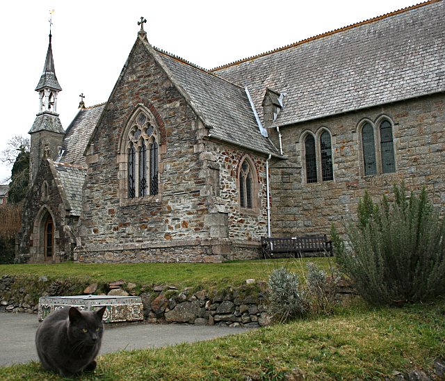
Church of St Maurice, Plympton

Church of St Maurice (also known as the Church of St Thomas at Plympton St Maurice) is located in Plympton, Devon, England. Dating to the 15th century...

Sparkwell

Sparkwell is a small village and civil parish in the South Hams district of Devon. Historically it was part of Haytor Hundred.Its local Anglican church...

Island House, Plympton

Island House is a Grade II listed building in Plympton, Devon, England. Standing at 4 Church Street, at the corner with Fore Street, Plympton's main street...

Nearby Amenities

Located within 500m of 50.392569,-4.0227475
Steer Park
Place: suburb
Lat/Long: 50.3905781/-4.0243334
Mini Roundabout
Direction: clockwise
Lat/Long: 50.3887758/-4.0232722
Post Box
Brand: Royal Mail
Brand Wikidata: Q638098
Brand Wikipedia: en:Royal Mail
Collection Times: Mo-Fr 09:00; Sa 07:00; Su off
Drive Through: no
Operator: Royal Mail
Operator Wikidata: Q638098
Post Box Mounting: pier
Post Box Type: lamp
Ref: PL7 59D
Source: survey;streetlevel imagery;aerial imagery
Lat/Long: 50.3918921/-4.0278368
Generator Method: photovoltaic
Generator Output Electricity: yes
Generator Source: solar
Generator Type: solar_photovoltaic_panel
Location: roof
Power: generator
Lat/Long: 50.3888708/-4.0258294
Generator Method: photovoltaic
Generator Output Electricity: yes
Generator Source: solar
Generator Type: solar_photovoltaic_panel
Location: roof
Power: generator
Lat/Long: 50.3886416/-4.0238312
Generator Method: photovoltaic
Generator Output Electricity: yes
Generator Source: solar
Generator Type: solar_photovoltaic_panel
Location: roof
Power: generator
Lat/Long: 50.3899789/-4.0246385
Generator Method: photovoltaic
Generator Output Electricity: yes
Generator Source: solar
Generator Type: solar_photovoltaic_panel
Location: roof
Power: generator
Lat/Long: 50.3899823/-4.0245929
Generator Method: photovoltaic
Generator Output Electricity: yes
Generator Source: solar
Generator Type: solar_photovoltaic_panel
Location: roof
Power: generator
Lat/Long: 50.3904218/-4.0245339
Generator Method: photovoltaic
Generator Output Electricity: yes
Generator Source: solar
Generator Type: solar_photovoltaic_panel
Location: roof
Power: generator
Lat/Long: 50.390562/-4.0262237
Generator Method: photovoltaic
Generator Output Electricity: yes
Generator Source: solar
Generator Type: solar_photovoltaic_panel
Location: roof
Power: generator
Lat/Long: 50.3905638/-4.0262935
Generator Method: photovoltaic
Generator Output Electricity: yes
Generator Source: solar
Generator Type: solar_photovoltaic_panel
Location: roof
Power: generator
Lat/Long: 50.390733/-4.0261728
Generator Method: photovoltaic
Generator Output Electricity: yes
Generator Source: solar
Generator Type: solar_photovoltaic_panel
Location: roof
Power: generator
Lat/Long: 50.390757/-4.0258884
Generator Method: photovoltaic
Generator Output Electricity: yes
Generator Source: solar
Generator Type: solar_photovoltaic_panel
Location: roof
Power: generator
Lat/Long: 50.3916821/-4.0255411
Generator Method: photovoltaic
Generator Output Electricity: yes
Generator Source: solar
Generator Type: solar_photovoltaic_panel
Location: roof
Power: generator
Lat/Long: 50.391435/-4.0247512
Generator Method: photovoltaic
Generator Output Electricity: yes
Generator Source: solar
Generator Type: solar_photovoltaic_panel
Location: roof
Power: generator
Lat/Long: 50.3912854/-4.0223452
Generator Method: photovoltaic
Generator Output Electricity: yes
Generator Source: solar
Generator Type: solar_photovoltaic_panel
Location: roof
Power: generator
Lat/Long: 50.3907946/-4.0230721
Generator Method: photovoltaic
Generator Output Electricity: yes
Generator Source: solar
Generator Type: solar_photovoltaic_panel
Location: roof
Power: generator
Lat/Long: 50.3905432/-4.0220127
Generator Method: photovoltaic
Generator Output Electricity: yes
Generator Source: solar
Generator Type: solar_photovoltaic_panel
Location: roof
Power: generator
Lat/Long: 50.3903209/-4.0217578
Generator Method: photovoltaic
Generator Output Electricity: yes
Generator Source: solar
Generator Type: solar_photovoltaic_panel
Location: roof
Power: generator
Lat/Long: 50.3897566/-4.0217632
Generator Method: photovoltaic
Generator Output Electricity: yes
Generator Source: solar
Generator Type: solar_photovoltaic_panel
Location: roof
Power: generator
Lat/Long: 50.3896831/-4.0216854
Generator Method: photovoltaic
Generator Output Electricity: yes
Generator Source: solar
Generator Type: solar_photovoltaic_panel
Location: roof
Power: generator
Lat/Long: 50.3893684/-4.0221977
Generator Method: photovoltaic
Generator Output Electricity: yes
Generator Source: solar
Generator Type: solar_photovoltaic_panel
Location: roof
Power: generator
Lat/Long: 50.3890444/-4.0227811
Generator Method: photovoltaic
Generator Output Electricity: yes
Generator Source: solar
Generator Type: solar_photovoltaic_panel
Location: roof
Power: generator
Lat/Long: 50.3890649/-4.022824
Generator Method: photovoltaic
Generator Output Electricity: yes
Generator Source: solar
Generator Type: solar_photovoltaic_panel
Location: roof
Power: generator
Lat/Long: 50.3890931/-4.022812
Power: pole
Lat/Long: 50.3962733/-4.0249872
Power: pole
Lat/Long: 50.3959621/-4.023343
Power: pole
Lat/Long: 50.3955893/-4.0214762
Power: pole
Lat/Long: 50.3951413/-4.0192392
Power: pole
Lat/Long: 50.3947617/-4.0190917
Power: pole
Lat/Long: 50.3924465/-4.018153
Location Transition: yes
Power: pole
Lat/Long: 50.3921814/-4.0180457
Post Box
Brand: Royal Mail
Brand Wikidata: Q638098
Brand Wikipedia: en:Royal Mail
Collection Times: Mo-Fr 09:00; Sa 07:00; Su off
Drive Through: no
Operator: Royal Mail
Operator Wikidata: Q638098
Post Box Design: type_k
Post Box Type: pillar
Ref: PL7 324D
Royal Cypher: EIIR
Royal Cypher Wikidata: Q33102113
Source: survey;streetlevel imagery;aerial imagery
Lat/Long: 50.3896004/-4.0242431
Skills Group
Office: educational_institution
Lat/Long: 50.3914537/-4.0198084
The data included in this document is from www.openstreetmap.org. The data is made available under ODbL.

Have you been to Chaddle Wood?

Leave your review of Chaddle Wood below (or comments, questions and feedback).