Centry Wood

Wood, Forest in Devon South Hams

England

Centry Wood

Caravan park and Stoke Beach
Caravan park and Stoke Beach Credit: David Smith

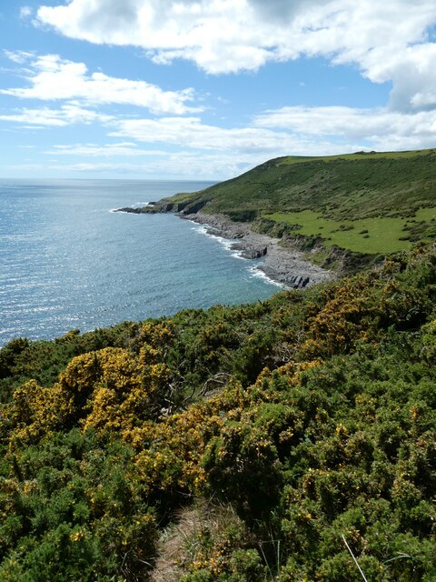
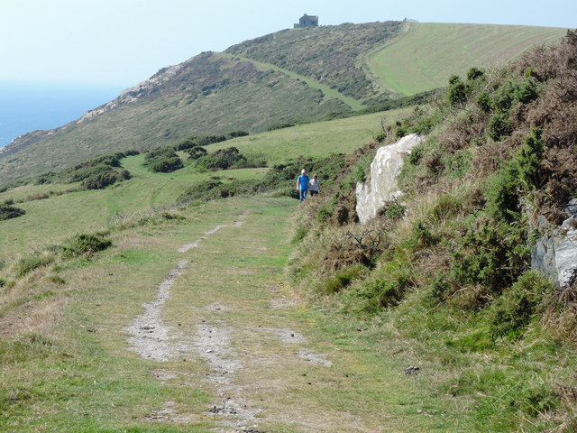
Centry Wood, located in Devon, England, is a picturesque forest that spans over a vast area. With its lush greenery and towering trees, it is a haven for nature enthusiasts and adventurers alike. The wood is renowned for its diverse ecosystem, with a wide variety of flora and fauna calling it home.

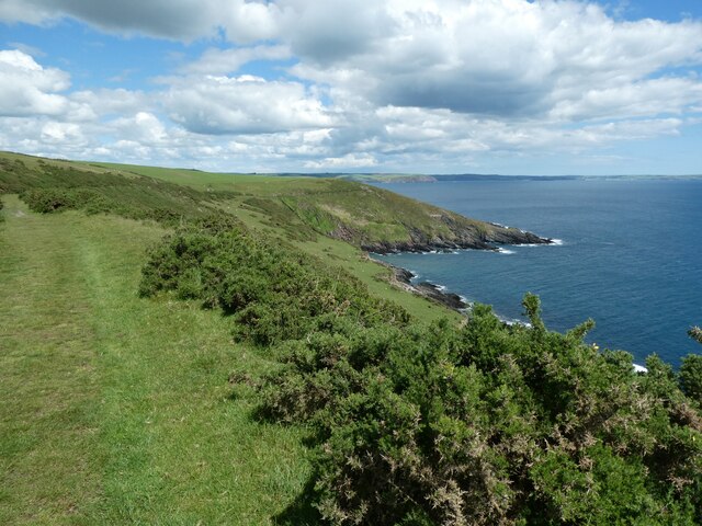
Covering an expansive area of approximately 500 acres, Centry Wood offers a tranquil escape from the hustle and bustle of city life. The forest boasts a mixture of broadleaf and coniferous trees, creating a unique blend of colors and textures throughout the seasons. It is particularly popular during the autumn months when the foliage transforms into a vibrant display of reds, oranges, and yellows.

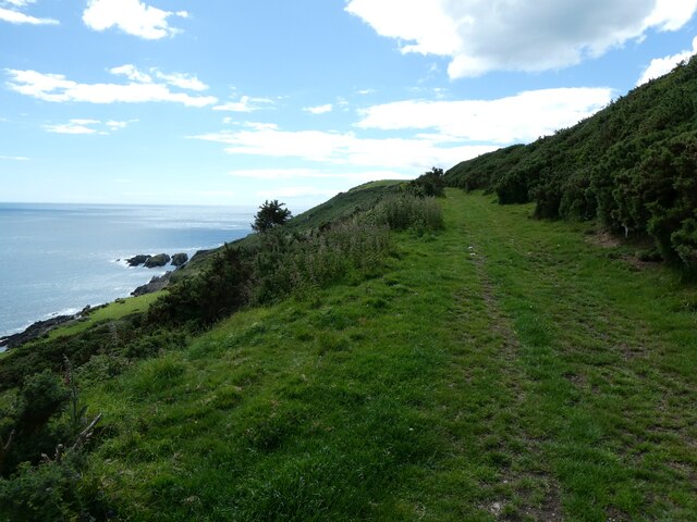
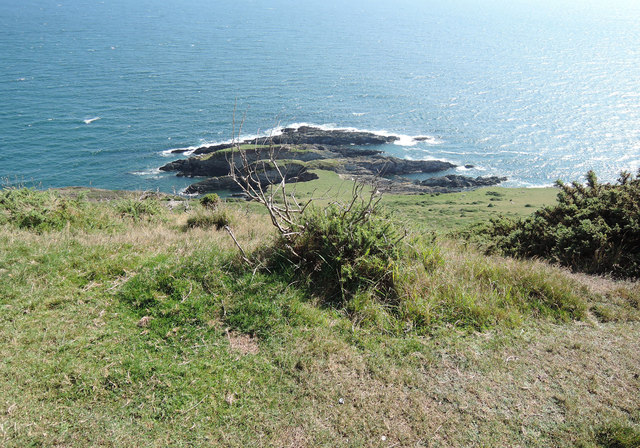
The wood is crisscrossed with numerous trails and paths, making it an ideal location for hiking and walking. Visitors can explore the forest at their own pace, taking in the breathtaking scenery and enjoying the fresh air. The abundance of wildlife in Centry Wood adds to its allure, with sightings of deer, squirrels, and a variety of bird species being common.

For those seeking a more immersive experience, Centry Wood offers camping facilities. Camping enthusiasts can pitch their tents in designated areas and spend the night under the stars, surrounded by the serenity of the forest.

Overall, Centry Wood in Devon is a nature lover's paradise. Its vast expanse, diverse ecosystem, and tranquil atmosphere make it a must-visit destination for anyone seeking a true connection with nature.

If you have any feedback on the listing, please let us know in the comments section below.

Centry Wood Images

Images are sourced within 2km of 50.301229/-4.0187569 or Grid Reference SX5646. Thanks to Geograph Open Source API. All images are credited.

Caravan park and Stoke Beach
The bay of Stoke Beach and cliffs beyond
Church Cove, Stoke
Church Cove, Stoke
View west from Stoke Down The land on the north is Netton Down, and the coves and bays have a range of names, despite being very small
View west from Stoke Down
The land on the north is Netton Down, and the coves and bays have a range of names, despite being very small
The Carriage Drive on Netton Down Part of Lord Revelstoke's private carriage drive <span class="nowrap"><a title="https://www.southdevonaonb.org.uk/wp-content/uploads/2020/06/Noss-Mayo-Revelstoke-Drive-walk-guide.pdf" rel="nofollow ugc noopener" href="https://www.southdevonaonb.org.uk/wp-content/uploads/2020/06/Noss-Mayo-Revelstoke-Drive-walk-guide.pdf">Link</a><img style="margin-left:2px;" alt="External link" title="External link - shift click to open in new window" src="https://s1.geograph.org.uk/img/external.png" width="10" height="10"/></span>
The Carriage Drive on Netton Down
Part of Lord Revelstoke's private carriage drive LinkExternal link
Stoke Point from Netton Down
Netton Down
Netton Down
Netton Island
Netton Island
Towards Rowden Court and Rowden Farm Seen from the National Trust's small Stoke Point car park, by the lane from Netton Farm to Stoke Cross, seen in the foreground
Towards Rowden Court and Rowden Farm
Seen from the National Trust's small Stoke Point car park, by the lane from Netton Farm to Stoke Cross, seen in the foreground
On Revelstoke Drive On Netton Down, looking towards Snellings Down. The late nineteenth-century carriageway created by Lord Revelstoke, now serves as the South West Coast Path for a fair distance between Stoke and the ferry crossing to Wembury
On Revelstoke Drive
On Netton Down, looking towards Snellings Down. The late nineteenth-century carriageway created by Lord Revelstoke, now serves as the South West Coast Path for a fair distance between Stoke and the ferry crossing to Wembury
Stoke Point Seen from the South West Coast Path on Netton Down
Stoke Point
Seen from the South West Coast Path on Netton Down
Stoke Point from Snellings Down Seen from the South West Coast Path. The gorse in the foreground has been subject to swayling. The Devon coastline in the distance is largely lost in the September haze, but on a clear day can be seen running out to Bolt Tail
Stoke Point from Snellings Down
Seen from the South West Coast Path. The gorse in the foreground has been subject to swayling. The Devon coastline in the distance is largely lost in the September haze, but on a clear day can be seen running out to Bolt Tail
Netton Island seen from Snellings Down View from the South West Coast Path
Netton Island seen from Snellings Down
View from the South West Coast Path
On Snellings Down The South West Coast Path looking west towards Gunrow's Down, with the old coastguard lookout forming a landmark on the skyline. The coast path here, formerly Lord Revelstoke's Drive, follows the contours to some extent before ascending Gunrow's Down
On Snellings Down
The South West Coast Path looking west towards Gunrow's Down, with the old coastguard lookout forming a landmark on the skyline. The coast path here, formerly Lord Revelstoke's Drive, follows the contours to some extent before ascending Gunrow's Down
Rocks by Pilot Cove Seen from the South West Coast Path on Snellings Down
Rocks by Pilot Cove
Seen from the South West Coast Path on Snellings Down
Low tide at Newton Ferrers with walkers on the causeway Low tide in the tidal stretch of Newton Creek exposes the narrow causeway from Noss Mayo to Newton Ferrers
Low tide at Newton Ferrers with walkers on the causeway
Low tide in the tidal stretch of Newton Creek exposes the narrow causeway from Noss Mayo to Newton Ferrers
Low tide at Newton Creek, Bridgend
Causeway across Newton Creek At low tide it is possible to use this causeway (Voss) across Newton Creek between Newton Ferrers and Noss Mayo.
Causeway across Newton Creek
At low tide it is possible to use this causeway (Voss) across Newton Creek between Newton Ferrers and Noss Mayo.
Show me another place!

Centry Wood is located at Grid Ref: SX5646 (Lat: 50.301229, Lng: -4.0187569)

Administrative County: Devon

District: South Hams

Police Authority: Devon and Cornwall

What 3 Words

///latest.neatly.dads. Near Newton Ferrers, Devon

Related Wikis

Church of St Peter the Poor Fisherman, Revelstoke

The Church of St Peter the Poor Fisherman in the village of Noss Mayo, in Devon, England, was built in 1226. It is located in the former civil parish of...

Revelstoke, Devon

Revelstoke is a former civil parish, now in the parish of Newton and Noss, in the South Hams district, in the county of Devon, England. It has a church...

St Peter's Church, Noss Mayo

St Peter's Church is a Church of England parish church in Noss Mayo, Devon, England. It was constructed in 1880–82 and designed by the London architect...

Newton Ferrers

Newton Ferrers is a village and former manor, civil and ecclesiastical parish, now in the parish of Newton and Noss, in the South Hams district, in the...

Nearby Amenities

Located within 500m of 50.301229,-4.0187569
Stoke Cross
Place: locality
Lat/Long: 50.3043114/-4.0227123
Barrier: kissing_gate
Lat/Long: 50.3039308/-4.01605
Barrier: kissing_gate
Lat/Long: 50.303023/-4.0203247
Barrier: kissing_gate
Lat/Long: 50.3041003/-4.0186521
Revelstoke
Is In: Devon
Place: locality
Lat/Long: 50.3036639/-4.0215727
Direction: S
Generator Method: photovoltaic
Generator Output Electricity: yes
Generator Solar Modules: 20
Generator Source: solar
Generator Type: solar_photovoltaic_panel
Location: roof
Power: generator
Lat/Long: 50.3038713/-4.0218742
Information: guidepost
Tourism: information
Lat/Long: 50.3031938/-4.0205335
Entrance: main
Lat/Long: 50.3004213/-4.0178329
Barrier: lift_gate
Lat/Long: 50.303186/-4.0201999
Barrier: kissing_gate
Lat/Long: 50.2967613/-4.0193572
The data included in this document is from www.openstreetmap.org. The data is made available under ODbL.

Have you been to Centry Wood?

Leave your review of Centry Wood below (or comments, questions and feedback).