Chaddlewood

Settlement in Devon

England

Chaddlewood

Devon Expressway, Deep Lane Junction The A38 is a major A-class trunk route. When first designated in 1922, it ran from Derby to Plymouth but it was later extended at both ends so that it now runs for 292 miles from Mansfield in Nottinghamshire to Bodmin in Cornwall.

Prior to the opening of the M5 motorway in the 1960s and 1970s, the A38 formed the main "holiday route" from the Midlands to Somerset, Devon and Cornwall and the south-western section was notorious at holiday times for the congestion. Nowadays, for most of the southern section, the A38 is a fairly quiet road shadowing the M5 extremely closely; often running alongside the motorway as a single carriageway road. The section between Exeter and Plymouth is, however, a busy dual carriageway which serves as the southern extension of the M5 and is known as “the Devon Expressway”.

More information at <span class="nowrap"><a title="http://en.wikipedia.org/wiki/A38_road" rel="nofollow ugc noopener" href="http://en.wikipedia.org/wiki/A38_road">Link</a><img style="margin-left:2px;" alt="External link" title="External link - shift click to open in new window" src="https://s1.geograph.org.uk/img/external.png" width="10" height="10"/></span>  (Wikipedia) and <span class="nowrap"><a title="http://www.sabre-roads.org.uk/wiki/index.php?title=A38" rel="nofollow ugc noopener" href="http://www.sabre-roads.org.uk/wiki/index.php?title=A38">Link</a><img style="margin-left:2px;" alt="External link" title="External link - shift click to open in new window" src="https://s1.geograph.org.uk/img/external.png" width="10" height="10"/></span>  (SABRE).
Devon Expressway, Deep Lane Junction Credit: David Dixon

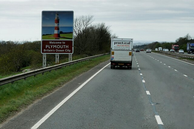
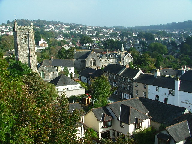
Chaddlewood is a small suburban village located in the county of Devon, South West England. Situated just a few miles north of Plymouth, Chaddlewood is part of the larger district of Plympton, forming a crucial residential area for the city's commuters.

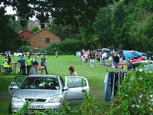
The village boasts a peaceful ambiance, characterized by its leafy streets and well-maintained houses. Chaddlewood's housing stock predominantly consists of detached and semi-detached properties, making it an attractive destination for families and professionals alike. The neighborhood is known for its strong sense of community, with regular events and gatherings organized by local residents.

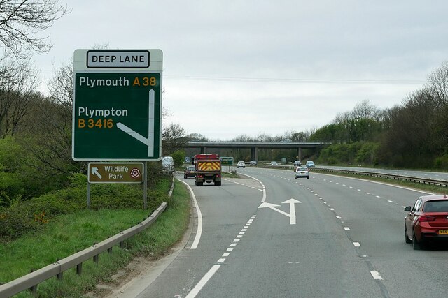
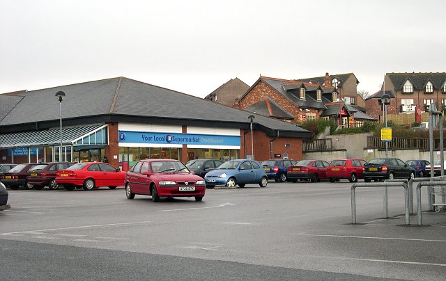
Chaddlewood benefits from excellent transportation links, with easy access to the A38 and the nearby Plympton railway station. This makes commuting to Plymouth or other nearby towns and cities a breeze. In terms of amenities, the village is well-served by a variety of local shops, including convenience stores, bakeries, and a supermarket. There are also several pubs, restaurants, and cafes, providing residents with a range of dining options.

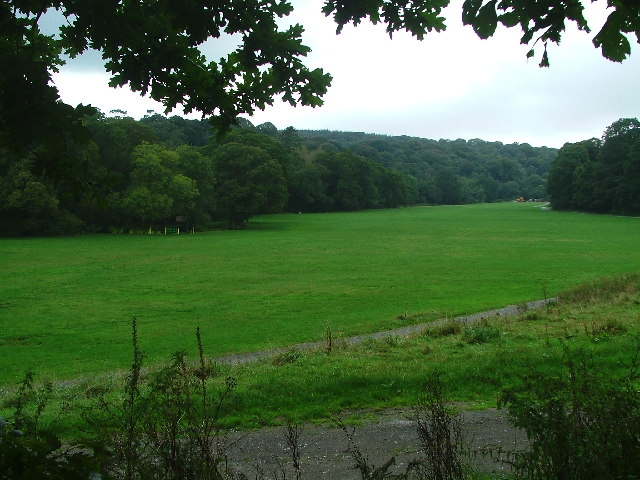
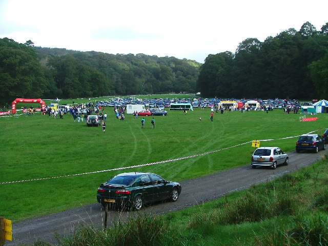
For outdoor enthusiasts, Chaddlewood offers plenty of green spaces and recreational facilities. The nearby Plym Valley Park is a popular destination for walking, cycling, and picnicking, while the local Chaddlewood Primary School provides a safe and nurturing learning environment for young children.

In summary, Chaddlewood is a charming residential village in Devon, offering a tranquil atmosphere and a strong sense of community. With its convenient location, excellent transport links, and range of amenities, it is a highly desirable place to live for those seeking a suburban lifestyle within close proximity to Plymouth.

If you have any feedback on the listing, please let us know in the comments section below.
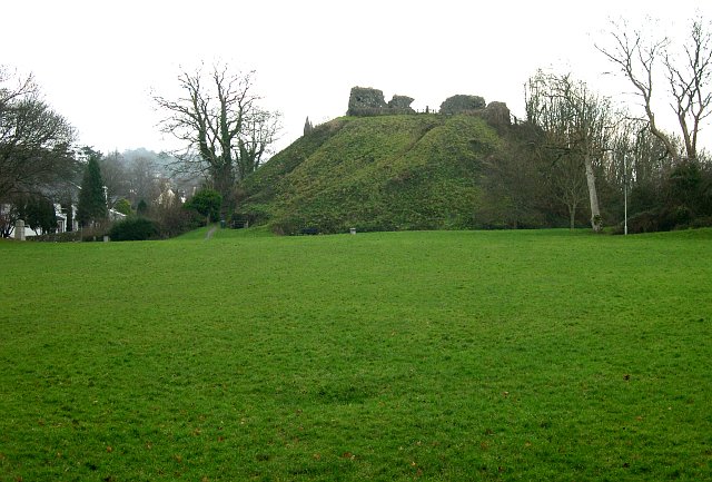
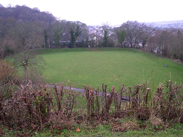
Chaddlewood Images

Images are sourced within 2km of 50.392505/-4.03067 or Grid Reference SX5656. Thanks to Geograph Open Source API. All images are credited.

Devon Expressway, Deep Lane Junction The A38 is a major A-class trunk route. When first designated in 1922, it ran from Derby to Plymouth but it was later extended at both ends so that it now runs for 292 miles from Mansfield in Nottinghamshire to Bodmin in Cornwall.

Prior to the opening of the M5 motorway in the 1960s and 1970s, the A38 formed the main "holiday route" from the Midlands to Somerset, Devon and Cornwall and the south-western section was notorious at holiday times for the congestion. Nowadays, for most of the southern section, the A38 is a fairly quiet road shadowing the M5 extremely closely; often running alongside the motorway as a single carriageway road. The section between Exeter and Plymouth is, however, a busy dual carriageway which serves as the southern extension of the M5 and is known as “the Devon Expressway”.

More information at <span class="nowrap"><a title="http://en.wikipedia.org/wiki/A38_road" rel="nofollow ugc noopener" href="http://en.wikipedia.org/wiki/A38_road">Link</a><img style="margin-left:2px;" alt="External link" title="External link - shift click to open in new window" src="https://s1.geograph.org.uk/img/external.png" width="10" height="10"/></span>  (Wikipedia) and <span class="nowrap"><a title="http://www.sabre-roads.org.uk/wiki/index.php?title=A38" rel="nofollow ugc noopener" href="http://www.sabre-roads.org.uk/wiki/index.php?title=A38">Link</a><img style="margin-left:2px;" alt="External link" title="External link - shift click to open in new window" src="https://s1.geograph.org.uk/img/external.png" width="10" height="10"/></span>  (SABRE).
Devon Expressway, Deep Lane Junction
The A38 is a major A-class trunk route. When first designated in 1922, it ran from Derby to Plymouth but it was later extended at both ends so that it now runs for 292 miles from Mansfield in Nottinghamshire to Bodmin in Cornwall. Prior to the opening of the M5 motorway in the 1960s and 1970s, the A38 formed the main "holiday route" from the Midlands to Somerset, Devon and Cornwall and the south-western section was notorious at holiday times for the congestion. Nowadays, for most of the southern section, the A38 is a fairly quiet road shadowing the M5 extremely closely; often running alongside the motorway as a single carriageway road. The section between Exeter and Plymouth is, however, a busy dual carriageway which serves as the southern extension of the M5 and is known as “the Devon Expressway”. More information at LinkExternal link (Wikipedia) and LinkExternal link (SABRE).
Layby on the A38 near to Plympton St Maurice The A38 is a major A-class trunk route. When first designated in 1922, it ran from Derby to Plymouth but it was later extended at both ends so that it now runs for 292 miles from Mansfield in Nottinghamshire to Bodmin in Cornwall.

Prior to the opening of the M5 motorway in the 1960s and 1970s, the A38 formed the main "holiday route" from the Midlands to Somerset, Devon and Cornwall and the south-western section was notorious at holiday times for the congestion. Nowadays, for most of the southern section, the A38 is a fairly quiet road shadowing the M5 extremely closely; often running alongside the motorway as a single carriageway road. The section between Exeter and Plymouth is, however, a busy dual carriageway which serves as the southern extension of the M5 and is known as “the Devon Expressway”.

More information at <span class="nowrap"><a title="http://en.wikipedia.org/wiki/A38_road" rel="nofollow ugc noopener" href="http://en.wikipedia.org/wiki/A38_road">Link</a><img style="margin-left:2px;" alt="External link" title="External link - shift click to open in new window" src="https://s1.geograph.org.uk/img/external.png" width="10" height="10"/></span>  (Wikipedia) and <span class="nowrap"><a title="http://www.sabre-roads.org.uk/wiki/index.php?title=A38" rel="nofollow ugc noopener" href="http://www.sabre-roads.org.uk/wiki/index.php?title=A38">Link</a><img style="margin-left:2px;" alt="External link" title="External link - shift click to open in new window" src="https://s1.geograph.org.uk/img/external.png" width="10" height="10"/></span>  (SABRE).
Layby on the A38 near to Plympton St Maurice
The A38 is a major A-class trunk route. When first designated in 1922, it ran from Derby to Plymouth but it was later extended at both ends so that it now runs for 292 miles from Mansfield in Nottinghamshire to Bodmin in Cornwall. Prior to the opening of the M5 motorway in the 1960s and 1970s, the A38 formed the main "holiday route" from the Midlands to Somerset, Devon and Cornwall and the south-western section was notorious at holiday times for the congestion. Nowadays, for most of the southern section, the A38 is a fairly quiet road shadowing the M5 extremely closely; often running alongside the motorway as a single carriageway road. The section between Exeter and Plymouth is, however, a busy dual carriageway which serves as the southern extension of the M5 and is known as “the Devon Expressway”. More information at LinkExternal link (Wikipedia) and LinkExternal link (SABRE).
Devon Expressway on the Outskirts of Plymouth The A38 is a major A-class trunk route. When first designated in 1922, it ran from Derby to Plymouth but it was later extended at both ends so that it now runs for 292 miles from Mansfield in Nottinghamshire to Bodmin in Cornwall.

Prior to the opening of the M5 motorway in the 1960s and 1970s, the A38 formed the main "holiday route" from the Midlands to Somerset, Devon and Cornwall and the south-western section was notorious at holiday times for the congestion. Nowadays, for most of the southern section, the A38 is a fairly quiet road shadowing the M5 extremely closely; often running alongside the motorway as a single carriageway road. The section between Exeter and Plymouth is, however, a busy dual carriageway which serves as the southern extension of the M5 and is known as “the Devon Expressway”.

More information at <span class="nowrap"><a title="http://en.wikipedia.org/wiki/A38_road" rel="nofollow ugc noopener" href="http://en.wikipedia.org/wiki/A38_road">Link</a><img style="margin-left:2px;" alt="External link" title="External link - shift click to open in new window" src="https://s1.geograph.org.uk/img/external.png" width="10" height="10"/></span>  (Wikipedia) and <span class="nowrap"><a title="http://www.sabre-roads.org.uk/wiki/index.php?title=A38" rel="nofollow ugc noopener" href="http://www.sabre-roads.org.uk/wiki/index.php?title=A38">Link</a><img style="margin-left:2px;" alt="External link" title="External link - shift click to open in new window" src="https://s1.geograph.org.uk/img/external.png" width="10" height="10"/></span>  (SABRE).
Devon Expressway on the Outskirts of Plymouth
The A38 is a major A-class trunk route. When first designated in 1922, it ran from Derby to Plymouth but it was later extended at both ends so that it now runs for 292 miles from Mansfield in Nottinghamshire to Bodmin in Cornwall. Prior to the opening of the M5 motorway in the 1960s and 1970s, the A38 formed the main "holiday route" from the Midlands to Somerset, Devon and Cornwall and the south-western section was notorious at holiday times for the congestion. Nowadays, for most of the southern section, the A38 is a fairly quiet road shadowing the M5 extremely closely; often running alongside the motorway as a single carriageway road. The section between Exeter and Plymouth is, however, a busy dual carriageway which serves as the southern extension of the M5 and is known as “the Devon Expressway”. More information at LinkExternal link (Wikipedia) and LinkExternal link (SABRE).
Peacock Meadow, Colebrook Regular car boot sales on the meadow aid funding of the community centre and annual events.
Peacock Meadow, Colebrook
Regular car boot sales on the meadow aid funding of the community centre and annual events.
Newnham Park Adjacent to Torry Brook and just off the Lee Moor Road, is Newnham Park; the photograph showing the 'meadow' which is frequently the focal point for a variety of activities ranging from mountain biking, carriage eventing through to trail running and music festivals, dependent on the time and date.
Newnham Park
Adjacent to Torry Brook and just off the Lee Moor Road, is Newnham Park; the photograph showing the 'meadow' which is frequently the focal point for a variety of activities ranging from mountain biking, carriage eventing through to trail running and music festivals, dependent on the time and date.
Newnham Park Scene of the 'gathering' for the 2005 Autumn Trail - an eight mile offroad run in the woods of Newnham Estate.
Newnham Park
Scene of the 'gathering' for the 2005 Autumn Trail - an eight mile offroad run in the woods of Newnham Estate.
Plympton St Maurice Looking down on a part of Plympton St Maurice, from the castle, one can see, from left to right, the 14th century church, the Old Grammar School (1664) and the white building of the London Inn
Plympton St Maurice
Looking down on a part of Plympton St Maurice, from the castle, one can see, from left to right, the 14th century church, the Old Grammar School (1664) and the white building of the London Inn
George Lane, Plympton Whilst a large part of Plympton and Chaddlewood have been the subject of housing and industrial growth since the mid-1960s, the occasional reminder can be found of the origin 'stannary town'- this is the point where the GWR railway crosses George Lane, which used to run from the Ridgeway, through to the Cornwood/Sparkwell road.
George Lane, Plympton
Whilst a large part of Plympton and Chaddlewood have been the subject of housing and industrial growth since the mid-1960s, the occasional reminder can be found of the origin 'stannary town'- this is the point where the GWR railway crosses George Lane, which used to run from the Ridgeway, through to the Cornwood/Sparkwell road.
Suburban Housing, Chaddlewood.
Local Supermarket, Chaddlewood Nobody walks around here.  Even though this supermarket serves an area of no more than 1km in any direction, in modern suburbia it is essential to provide a large car park.
Local Supermarket, Chaddlewood
Nobody walks around here. Even though this supermarket serves an area of no more than 1km in any direction, in modern suburbia it is essential to provide a large car park.
Langage Science Park Big boxes on the hillside!  Local authorities seem to want to theme their industrial/commercial estates.  This one is for high-tech companies.
Langage Science Park
Big boxes on the hillside! Local authorities seem to want to theme their industrial/commercial estates. This one is for high-tech companies.
Langage Park Office Campus Rather a grand title - and not a University in sight, but that is what these buildings have been called.  They are purpose-built offices on the edge of town and are occupied by companies, such as firms of solicitors, who are more often associated with inner-city locations.
Langage Park Office Campus
Rather a grand title - and not a University in sight, but that is what these buildings have been called. They are purpose-built offices on the edge of town and are occupied by companies, such as firms of solicitors, who are more often associated with inner-city locations.
The Old Cornwood Road, Plympton This section of country lane has been left untouched, even though it has now been completely surrounded by suburban housing.
The Old Cornwood Road, Plympton
This section of country lane has been left untouched, even though it has now been completely surrounded by suburban housing.
Yeoman's Way, Plympton Looking towards the steep ridge which marks the southern boundary of Plympton.
Yeoman's Way, Plympton
Looking towards the steep ridge which marks the southern boundary of Plympton.
The Nonconformist Cemetery, Plympton St Maurice This cemetery was founded in 1844 and is now a wildlife conservation area.
The Nonconformist Cemetery, Plympton St Maurice
This cemetery was founded in 1844 and is now a wildlife conservation area.
Plympton St Maurice Church A building which dates back to the 14th or 15th century.  It was extensively restored in 1879.
Plympton St Maurice Church
A building which dates back to the 14th or 15th century. It was extensively restored in 1879.
Plympton Castle This was a motte & bailey castle.  The motte is the high mound with the remains of fortifications on top of it, the bailey is the level area in front of it which is itself some 20 feet above the surrounding ground level. The castle was probably built in the years between 1100 and 1130.  It was besieged on two occasions, in 1136 and 1224, both times when the local resident of the castle came into conflict with the King of the time.  The bailey area is now used for local events and fairs.
Plympton Castle
This was a motte & bailey castle. The motte is the high mound with the remains of fortifications on top of it, the bailey is the level area in front of it which is itself some 20 feet above the surrounding ground level. The castle was probably built in the years between 1100 and 1130. It was besieged on two occasions, in 1136 and 1224, both times when the local resident of the castle came into conflict with the King of the time. The bailey area is now used for local events and fairs.
Plympton Castle Looking down on the rectangular bailey area of the castle from the motte mound.
Plympton Castle
Looking down on the rectangular bailey area of the castle from the motte mound.
Show me another place!

Chaddlewood is located at Grid Ref: SX5656 (Lat: 50.392505, Lng: -4.03067)

Unitary Authority: Plymouth

Police Authority: Devon and Cornwall

What 3 Words

///policy.wipes.fantastic. Near Plympton, Devon

Related Wikis

Newnham Park

Newnham Park (before circa 1718 Loughtor) is an historic estate in the civil parish of Sparkwell, Devon, UK. It was known as Loughtor until about 1700...

Plympton House

Plympton House is the principal residence at the Plympton House Estate, in the parish of Plympton St Maurice, Devon, England. It is a Grade I listed country...

Plympton Hundred

Plympton Hundred was the name of one of thirty two ancient administrative units of Devon, England.The parishes in the hundred were: Brixton, Plympton...

Langage Power Station

Langage Power Station is a combined-cycle power plant near the city of Plymouth in Devon, England. Centrica, the original owners of the site, announced...

Longcause Community Special School

Longcause Community Special School is a special school for students aged 4 to 16 with learning difficulties. The college has about 100 students.The school...

Plympton Academy

Plympton Academy (formerly, The Ridgeway School and, before that, Plympton County Secondary School) is a state secondary school in Plympton, Plymouth,...

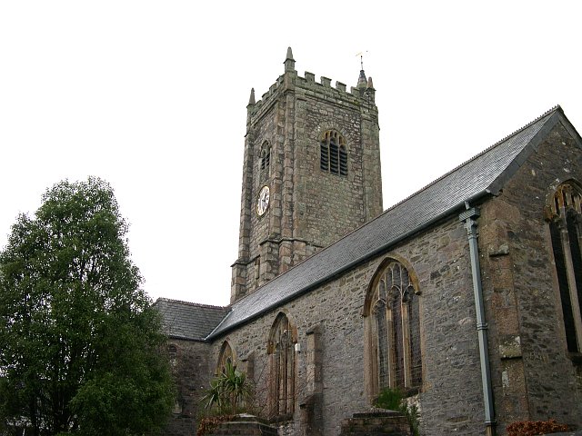
Church of St Maurice, Plympton

Church of St Maurice (also known as the Church of St Thomas at Plympton St Maurice) is located in Plympton, Devon, England. Dating to the 15th century...

Island House, Plympton

Island House is a Grade II listed building in Plympton, Devon, England. Standing at 4 Church Street, at the corner with Fore Street, Plympton's main street...

Nearby Amenities

Located within 500m of 50.392505,-4.03067
Steer Park
Place: suburb
Lat/Long: 50.3905781/-4.0243334
Chaddlewood
Place: suburb
Lat/Long: 50.3890997/-4.0340996
Barrier: bollard
Bollard: removable
Lat/Long: 50.3934314/-4.036612
Barrier: cycle_barrier
Bicycle: yes
Foot: yes
Horse: yes
Lat/Long: 50.3942158/-4.0323746
Barrier: cycle_barrier
Bicycle: yes
Foot: yes
Lat/Long: 50.3942277/-4.032204
Post Box
Brand: Royal Mail
Brand Wikidata: Q638098
Brand Wikipedia: en:Royal Mail
Collection Times: Mo-Fr 09:00; Sa 07:00; Su off
Drive Through: no
Operator: Royal Mail
Operator Wikidata: Q638098
Post Box Mounting: pier
Post Box Type: lamp
Ref: PL7 59D
Source: survey;streetlevel imagery;aerial imagery
Lat/Long: 50.3918921/-4.0278368
Direction: SSE
Generator Method: photovoltaic
Generator Output Electricity: yes
Generator Solar Modules: 6
Generator Source: solar
Generator Type: solar_photovoltaic_panel
Location: roof
Power: generator
Lat/Long: 50.3902192/-4.031275
Direction: SSE
Generator Method: photovoltaic
Generator Output Electricity: yes
Generator Solar Modules: 6
Generator Source: solar
Generator Type: solar_photovoltaic_panel
Location: roof
Power: generator
Lat/Long: 50.3902337/-4.0312126
Direction: 260
Generator Method: photovoltaic
Generator Output Electricity: yes
Generator Solar Modules: 10
Generator Source: solar
Generator Type: solar_photovoltaic_panel
Location: roof
Power: generator
Lat/Long: 50.3924384/-4.0373837
Direction: 80
Generator Method: photovoltaic
Generator Output Electricity: yes
Generator Solar Modules: 9
Generator Source: solar
Generator Type: solar_photovoltaic_panel
Location: roof
Power: generator
Lat/Long: 50.3924507/-4.0373194
Direction: 210
Generator Method: photovoltaic
Generator Output Electricity: yes
Generator Solar Modules: 18
Generator Source: solar
Generator Type: solar_photovoltaic_panel
Location: roof
Power: generator
Lat/Long: 50.3926932/-4.0359561
Direction: 260
Generator Method: photovoltaic
Generator Output Electricity: yes
Generator Solar Modules: 6
Generator Source: solar
Generator Type: solar_photovoltaic_panel
Location: roof
Power: generator
Lat/Long: 50.3921134/-4.0350569
Direction: 80
Generator Method: photovoltaic
Generator Output Electricity: yes
Generator Solar Modules: 6
Generator Source: solar
Generator Type: solar_photovoltaic_panel
Location: roof
Power: generator
Lat/Long: 50.3921165/-4.0349965
Direction: 195
Generator Method: photovoltaic
Generator Output Electricity: yes
Generator Solar Modules: 16
Generator Source: solar
Generator Type: solar_photovoltaic_panel
Location: roof
Power: generator
Lat/Long: 50.3916561/-4.0341899
Direction: 165
Generator Method: photovoltaic
Generator Output Electricity: yes
Generator Solar Modules: 12
Generator Source: solar
Generator Type: solar_photovoltaic_panel
Location: roof
Power: generator
Lat/Long: 50.3927188/-4.033988
Direction: 280
Generator Method: photovoltaic
Generator Output Electricity: yes
Generator Solar Modules: 8
Generator Source: solar
Generator Type: solar_photovoltaic_panel
Location: roof
Power: generator
Lat/Long: 50.3930411/-4.0340853
Direction: 100
Generator Method: photovoltaic
Generator Output Electricity: yes
Generator Solar Modules: 8
Generator Source: solar
Generator Type: solar_photovoltaic_panel
Location: roof
Power: generator
Lat/Long: 50.3930514/-4.034035
Direction: 280
Generator Method: photovoltaic
Generator Output Electricity: yes
Generator Solar Modules: 12
Generator Source: solar
Generator Type: solar_photovoltaic_panel
Location: ground
Power: generator
Lat/Long: 50.3931936/-4.0340326
Direction: 190
Generator Method: photovoltaic
Generator Output Electricity: yes
Generator Solar Modules: 8
Generator Source: solar
Generator Type: solar_photovoltaic_panel
Location: roof
Power: generator
Lat/Long: 50.3937253/-4.0317008
Direction: 190
Generator Method: photovoltaic
Generator Output Electricity: yes
Generator Solar Modules: 14
Generator Source: solar
Generator Type: solar_photovoltaic_panel
Location: roof
Power: generator
Lat/Long: 50.3932933/-4.0333346
Direction: 190
Generator Method: photovoltaic
Generator Output Electricity: yes
Generator Solar Modules: 10
Generator Source: solar
Generator Type: solar_photovoltaic_panel
Location: roof
Power: generator
Lat/Long: 50.3932405/-4.0329819
Direction: 190
Generator Method: photovoltaic
Generator Output Electricity: yes
Generator Solar Modules: 4
Generator Source: solar
Generator Type: solar_photovoltaic_panel
Location: roof
Power: generator
Lat/Long: 50.3932222/-4.0329105
Direction: 195
Generator Method: photovoltaic
Generator Output Electricity: yes
Generator Solar Modules: 12
Generator Source: solar
Generator Type: solar_photovoltaic_panel
Location: roof
Power: generator
Lat/Long: 50.392836/-4.0323727
Direction: 195
Generator Method: photovoltaic
Generator Output Electricity: yes
Generator Solar Modules: 14
Generator Source: solar
Generator Type: solar_photovoltaic_panel
Location: roof
Power: generator
Lat/Long: 50.3929862/-4.0316492
Direction: 195
Generator Method: photovoltaic
Generator Output Electricity: yes
Generator Solar Modules: 15
Generator Source: solar
Generator Type: solar_photovoltaic_panel
Location: roof
Power: generator
Lat/Long: 50.3932545/-4.0320448
Direction: 190
Generator Method: photovoltaic
Generator Output Electricity: yes
Generator Solar Modules: 15
Generator Source: solar
Generator Type: solar_photovoltaic_panel
Location: roof
Power: generator
Lat/Long: 50.3932534/-4.0318607
Direction: 190
Generator Method: photovoltaic
Generator Output Electricity: yes
Generator Solar Modules: 15
Generator Source: solar
Generator Type: solar_photovoltaic_panel
Location: roof
Power: generator
Lat/Long: 50.3932386/-4.0314959
Direction: 190
Generator Method: photovoltaic
Generator Output Electricity: yes
Generator Solar Modules: 16
Generator Source: solar
Generator Type: solar_photovoltaic_panel
Location: roof
Power: generator
Lat/Long: 50.3932284/-4.0313135
Direction: 190
Generator Method: photovoltaic
Generator Output Electricity: yes
Generator Solar Modules: 16
Generator Source: solar
Generator Type: solar_photovoltaic_panel
Location: roof
Power: generator
Lat/Long: 50.3932162/-4.0311335
Direction: E
Generator Method: photovoltaic
Generator Output Electricity: yes
Generator Solar Modules: 16
Generator Source: solar
Generator Type: solar_photovoltaic_panel
Location: roof
Power: generator
Lat/Long: 50.391677/-4.0312354
Direction: 275
Generator Method: photovoltaic
Generator Output Electricity: yes
Generator Solar Modules: 14
Generator Source: solar
Generator Type: solar_photovoltaic_panel
Location: roof
Power: generator
Lat/Long: 50.3920741/-4.0337869
Direction: 265
Generator Method: photovoltaic
Generator Output Electricity: yes
Generator Solar Modules: 14
Generator Source: solar
Generator Type: solar_photovoltaic_panel
Location: roof
Power: generator
Lat/Long: 50.3919197/-4.0337808
Direction: 190
Generator Method: photovoltaic
Generator Output Electricity: yes
Generator Solar Modules: 5
Generator Source: solar
Generator Type: solar_photovoltaic_panel
Location: roof
Power: generator
Lat/Long: 50.3920959/-4.0331787
Generator Method: photovoltaic
Generator Output Electricity: yes
Generator Source: solar
Generator Type: solar_photovoltaic_panel
Location: roof
Power: generator
Lat/Long: 50.3920634/-4.0331492
Direction: SSE
Generator Method: photovoltaic
Generator Output Electricity: yes
Generator Solar Modules: 14
Generator Source: solar
Generator Type: solar_photovoltaic_panel
Location: roof
Power: generator
Lat/Long: 50.3919091/-4.0320354
Direction: 215
Generator Method: photovoltaic
Generator Output Electricity: yes
Generator Solar Modules: 13
Generator Source: solar
Generator Type: solar_photovoltaic_panel
Location: roof
Power: generator
Lat/Long: 50.3921554/-4.0323915
Direction: SSW
Generator Method: photovoltaic
Generator Output Electricity: yes
Generator Solar Modules: 16
Generator Source: solar
Generator Type: solar_photovoltaic_panel
Location: roof
Power: generator
Lat/Long: 50.3921284/-4.0322185
Direction: SSW
Generator Method: photovoltaic
Generator Output Electricity: yes
Generator Solar Modules: 16
Generator Source: solar
Generator Type: solar_photovoltaic_panel
Location: roof
Power: generator
Lat/Long: 50.392016/-4.0327965
Direction: SSW
Generator Method: photovoltaic
Generator Output Electricity: yes
Generator Solar Modules: 14
Generator Source: solar
Generator Type: solar_photovoltaic_panel
Location: roof
Power: generator
Lat/Long: 50.3919091/-4.0324653
Direction: 190
Generator Method: photovoltaic
Generator Output Electricity: yes
Generator Solar Modules: 14
Generator Source: solar
Generator Type: solar_photovoltaic_panel
Location: roof
Power: generator
Lat/Long: 50.3917458/-4.033062
Direction: 275
Generator Method: photovoltaic
Generator Output Electricity: yes
Generator Solar Modules: 8
Generator Source: solar
Generator Type: solar_photovoltaic_panel
Location: roof
Power: generator
Lat/Long: 50.3911721/-4.0327515
Direction: 190
Generator Method: photovoltaic
Generator Output Electricity: yes
Generator Solar Modules: 16
Generator Source: solar
Generator Type: solar_photovoltaic_panel
Location: roof
Power: generator
Lat/Long: 50.3907283/-4.0345292
Direction: 190
Generator Method: photovoltaic
Generator Output Electricity: yes
Generator Solar Modules: 10
Generator Source: solar
Generator Type: solar_photovoltaic_panel
Location: roof
Power: generator
Lat/Long: 50.3907749/-4.0347585
Direction: 190
Generator Method: photovoltaic
Generator Output Electricity: yes
Generator Solar Modules: 10
Generator Source: solar
Generator Type: solar_photovoltaic_panel
Location: roof
Power: generator
Lat/Long: 50.3905027/-4.0348541
Direction: 190
Generator Method: photovoltaic
Generator Output Electricity: yes
Generator Solar Modules: 12
Generator Source: solar
Generator Type: solar_photovoltaic_panel
Location: roof
Power: generator
Lat/Long: 50.3902871/-4.0349999
Direction: SSW
Generator Method: photovoltaic
Generator Output Electricity: yes
Generator Solar Modules: 12
Generator Source: solar
Generator Type: solar_photovoltaic_panel
Location: roof
Power: generator
Lat/Long: 50.3892141/-4.0346194
Direction: 190
Generator Method: photovoltaic
Generator Output Electricity: yes
Generator Solar Modules: 12
Generator Source: solar
Generator Type: solar_photovoltaic_panel
Location: roof
Power: generator
Lat/Long: 50.3899854/-4.0335562
Generator Method: photovoltaic
Generator Output Electricity: yes
Generator Source: solar
Generator Type: solar_photovoltaic_panel
Location: roof
Power: generator
Lat/Long: 50.3897386/-4.0323848
Generator Method: photovoltaic
Generator Output Electricity: yes
Generator Source: solar
Generator Type: solar_photovoltaic_panel
Location: roof
Power: generator
Lat/Long: 50.3897344/-4.0323566
Direction: 195
Generator Method: photovoltaic
Generator Output Electricity: yes
Generator Solar Modules: 9
Generator Source: solar
Generator Type: solar_photovoltaic_panel
Location: roof
Power: generator
Lat/Long: 50.3904975/-4.032372
Generator Method: photovoltaic
Generator Output Electricity: yes
Generator Source: solar
Generator Type: solar_photovoltaic_panel
Location: roof
Power: generator
Lat/Long: 50.3904218/-4.0245339
Generator Method: photovoltaic
Generator Output Electricity: yes
Generator Source: solar
Generator Type: solar_photovoltaic_panel
Location: roof
Power: generator
Lat/Long: 50.390562/-4.0262237
Generator Method: photovoltaic
Generator Output Electricity: yes
Generator Source: solar
Generator Type: solar_photovoltaic_panel
Location: roof
Power: generator
Lat/Long: 50.3905638/-4.0262935
Generator Method: photovoltaic
Generator Output Electricity: yes
Generator Source: solar
Generator Type: solar_photovoltaic_panel
Location: roof
Power: generator
Lat/Long: 50.390733/-4.0261728
Generator Method: photovoltaic
Generator Output Electricity: yes
Generator Source: solar
Generator Type: solar_photovoltaic_panel
Location: roof
Power: generator
Lat/Long: 50.390757/-4.0258884
Generator Method: photovoltaic
Generator Output Electricity: yes
Generator Source: solar
Generator Type: solar_photovoltaic_panel
Location: roof
Power: generator
Lat/Long: 50.3916821/-4.0255411
Generator Method: photovoltaic
Generator Output Electricity: yes
Generator Source: solar
Generator Type: solar_photovoltaic_panel
Location: roof
Power: generator
Lat/Long: 50.391435/-4.0247512
Direction: SSW
Generator Method: photovoltaic
Generator Output Electricity: yes
Generator Solar Modules: 12
Generator Source: solar
Generator Type: solar_photovoltaic_panel
Location: roof
Power: generator
Lat/Long: 50.3950024/-4.0338304
Direction: 105
Generator Method: photovoltaic
Generator Output Electricity: yes
Generator Solar Modules: 8
Generator Source: solar
Generator Type: solar_photovoltaic_panel
Location: roof
Power: generator
Lat/Long: 50.3953104/-4.0347953
Direction: 235
Generator Method: photovoltaic
Generator Output Electricity: yes
Generator Solar Modules: 12
Generator Source: solar
Generator Type: solar_photovoltaic_panel
Location: roof
Power: generator
Lat/Long: 50.3964643/-4.033978
Direction: SSW
Generator Method: photovoltaic
Generator Output Electricity: yes
Generator Solar Modules: 18
Generator Source: solar
Generator Type: solar_photovoltaic_panel
Location: roof
Power: generator
Lat/Long: 50.3959048/-4.0340491
Direction: 285
Generator Method: photovoltaic
Generator Output Electricity: yes
Generator Solar Modules: 8
Generator Source: solar
Generator Type: solar_photovoltaic_panel
Location: roof
Power: generator
Lat/Long: 50.3958001/-4.0334825
Direction: 105
Generator Method: photovoltaic
Generator Output Electricity: yes
Generator Solar Modules: 8
Generator Source: solar
Generator Type: solar_photovoltaic_panel
Location: roof
Power: generator
Lat/Long: 50.395805/-4.0334033
Direction: 195
Generator Method: photovoltaic
Generator Output Electricity: yes
Generator Solar Modules: 16
Generator Source: solar
Generator Type: solar_photovoltaic_panel
Location: roof
Power: generator
Lat/Long: 50.3962305/-4.0330566
Direction: 105
Generator Method: photovoltaic
Generator Output Electricity: yes
Generator Solar Modules: 14
Generator Source: solar
Generator Type: solar_photovoltaic_panel
Location: roof
Power: generator
Lat/Long: 50.3958512/-4.0329718
Direction: 195
Generator Method: photovoltaic
Generator Output Electricity: yes
Generator Solar Modules: 14
Generator Source: solar
Generator Type: solar_photovoltaic_panel
Location: roof
Power: generator
Lat/Long: 50.3959556/-4.031228
Direction: 105
Generator Method: photovoltaic
Generator Output Electricity: yes
Generator Solar Modules: 8
Generator Source: solar
Generator Type: solar_photovoltaic_panel
Location: roof
Power: generator
Lat/Long: 50.3957011/-4.0313289
Direction: 195
Generator Method: photovoltaic
Generator Output Electricity: yes
Generator Solar Modules: 9
Generator Source: solar
Generator Type: solar_photovoltaic_panel
Location: roof
Power: generator
Lat/Long: 50.395127/-4.0316142
Direction: 195
Generator Method: photovoltaic
Generator Output Electricity: yes
Generator Solar Modules: 14
Generator Source: solar
Generator Type: solar_photovoltaic_panel
Location: roof
Power: generator
Lat/Long: 50.3944131/-4.0320102
Direction: 215
Generator Method: photovoltaic
Generator Output Electricity: yes
Generator Solar Modules: 12
Generator Source: solar
Generator Type: solar_photovoltaic_panel
Location: roof
Power: generator
Lat/Long: 50.394931/-4.0335729
Direction: 100
Generator Method: photovoltaic
Generator Output Electricity: yes
Generator Solar Modules: 13
Generator Source: solar
Generator Type: solar_photovoltaic_panel
Location: roof
Power: generator
Lat/Long: 50.3953942/-4.0334952
Direction: 195
Generator Method: photovoltaic
Generator Output Electricity: yes
Generator Solar Modules: 2
Generator Source: solar
Generator Type: solar_photovoltaic_panel
Location: roof
Power: generator
Lat/Long: 50.3950926/-4.0315529
Waste Basket
Lat/Long: 50.3941366/-4.0328126
Post Box
Brand: Royal Mail
Brand Wikidata: Q638098
Brand Wikipedia: en:Royal Mail
Collection Times: Mo-Fr 09:00; Sa 07:00; Su off
Drive Through: no
Operator: Royal Mail
Operator Wikidata: Q638098
Post Box Mounting: pier
Post Box Type: lamp
Ref: PL7 323D
Royal Cypher: EIIR
Royal Cypher Wikidata: Q33102113
Source: survey;streetlevel imagery;aerial imagery
Lat/Long: 50.3884147/-4.0314149
Post Box
Brand: Royal Mail
Brand Wikidata: Q638098
Brand Wikipedia: en:Royal Mail
Collection Times: Mo-Fr 09:00; Sa 07:00; Su off
Drive Through: no
Operator: Royal Mail
Operator Wikidata: Q638098
Post Box Mounting: pier
Post Box Type: lamp
Ref: PL7 820D
Royal Cypher: EIIR
Source: survey;streetlevel imagery;aerial imagery
Lat/Long: 50.390991/-4.0346572
Addr Housenumber: 204
Addr Street: Hemerdon Heights
Lat/Long: 50.3924193/-4.0344793
Addr Housenumber: 212
Addr Street: Hemerdon Heights
Lat/Long: 50.3928819/-4.0345863
Addr Housenumber: 194
Addr Street: Hemerdon Heights
Lat/Long: 50.3917803/-4.0343256
Addr Housenumber: 182
Addr Street: Hemerdon Heights
Lat/Long: 50.3922343/-4.0345852
Addr Housenumber: 29
Addr Street: Kingston Drive
Lat/Long: 50.3909562/-4.0361944
Addr Housenumber: 195
Addr Street: Hemerdon Heights
Lat/Long: 50.3918409/-4.0343122
Addr Housenumber: 193
Addr Street: Hemerdon Heights
Lat/Long: 50.3917311/-4.0343735
Fire Hydrant
Emergency: fire_hydrant
Survey Date: 2024-02-11
Lat/Long: 50.3910257/-4.0362121
Fire Hydrant
Emergency: fire_hydrant
Survey Date: 2024-02-11
Lat/Long: 50.3908669/-4.034684
Fire Hydrant
Emergency: fire_hydrant
Survey Date: 2024-02-11
Lat/Long: 50.3924458/-4.0346008
Bench
Backrest: yes
Survey Date: 2024-02-11
Lat/Long: 50.3942553/-4.0331931
Bench
Backrest: yes
Survey Date: 2024-02-11
Lat/Long: 50.3945083/-4.0337518
Access: yes
Leisure: playground
Survey Date: 2024-02-11
Lat/Long: 50.3948414/-4.0345274
Waste Basket
Survey Date: 2024-02-11
Lat/Long: 50.3949281/-4.0348662
Bench
Backrest: yes
Survey Date: 2024-02-11
Lat/Long: 50.3950019/-4.0353409
Waste Basket
Survey Date: 2024-02-11
Lat/Long: 50.3951751/-4.0357996
Leisure: picnic_table
Survey Date: 2024-02-11
Lat/Long: 50.3950682/-4.0357908
Addr Housenumber: 183
Addr Street: Hemerdon Heights
Lat/Long: 50.3921683/-4.0345659
Addr Housenumber: 172
Addr Street: Hemerdon Heights
Lat/Long: 50.3928778/-4.034769
The data included in this document is from www.openstreetmap.org. The data is made available under ODbL.

Have you been to Chaddlewood?

Leave your review of Chaddlewood below (or comments, questions and feedback).