Langage

Settlement in Devon South Hams

England

Langage

Devon Expressway (A38) between Voss Park and Deep Lane Junctions The A38 is a major A-class trunk route. When first designated in 1922, it ran from Derby to Plymouth but it was later extended at both ends so that it now runs for 292 miles from Mansfield in Nottinghamshire to Bodmin in Cornwall.

Prior to the opening of the M5 motorway in the 1960s and 1970s, the A38 formed the main "holiday route" from the Midlands to Somerset, Devon and Cornwall and the south-western section was notorious at holiday times for the congestion. Nowadays, for most of the southern section, the A38 is a fairly quiet road shadowing the M5 extremely closely; often running alongside the motorway as a single carriageway road. The section between Exeter and Plymouth is, however, a busy dual carriageway which serves as the southern extension of the M5 and is known as “the Devon Expressway”.

More information at <span class="nowrap"><a title="http://en.wikipedia.org/wiki/A38_road" rel="nofollow ugc noopener" href="http://en.wikipedia.org/wiki/A38_road">Link</a><img style="margin-left:2px;" alt="External link" title="External link - shift click to open in new window" src="https://s1.geograph.org.uk/img/external.png" width="10" height="10"/></span>  (Wikipedia) and <span class="nowrap"><a title="http://www.sabre-roads.org.uk/wiki/index.php?title=A38" rel="nofollow ugc noopener" href="http://www.sabre-roads.org.uk/wiki/index.php?title=A38">Link</a><img style="margin-left:2px;" alt="External link" title="External link - shift click to open in new window" src="https://s1.geograph.org.uk/img/external.png" width="10" height="10"/></span>  (SABRE).
Devon Expressway (A38) between Voss Park and Deep Lane Junctions Credit: David Dixon

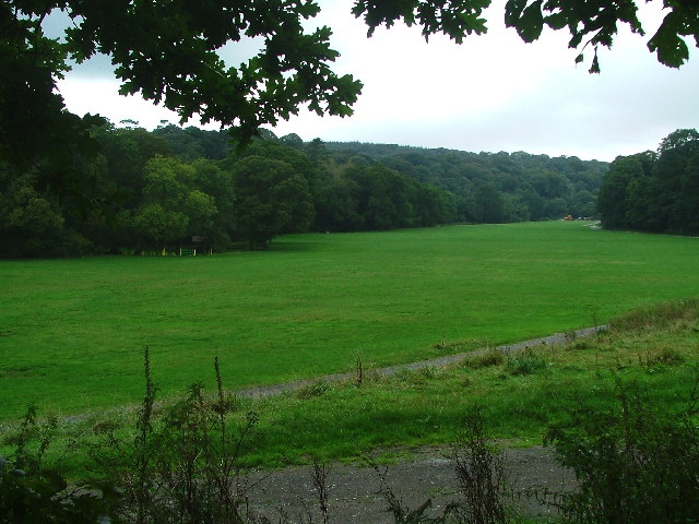
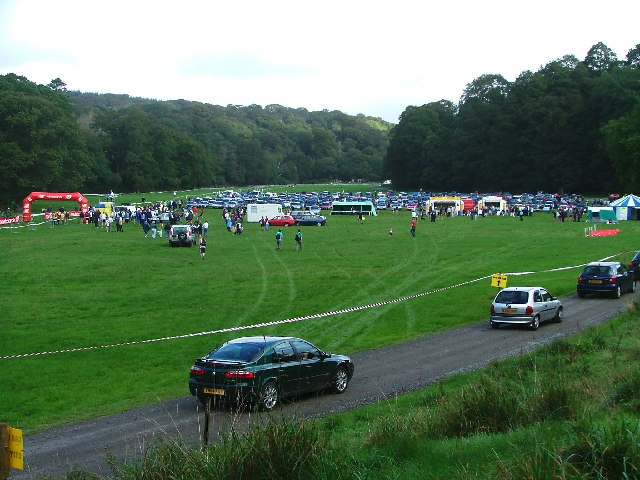
Langage is a small village located in the South Hams district of Devon, England. Situated approximately 10 miles northeast of Plymouth, Langage is a rural area surrounded by picturesque countryside and farmland. The village enjoys a tranquil atmosphere, making it an ideal place for those seeking a peaceful retreat.

Langage is renowned for its natural beauty and offers stunning views of the surrounding landscape. The village is home to Langage Farm, a popular attraction that specializes in dairy farming and produces a range of delicious ice creams and dairy products. Langage Farm also boasts a farm shop, where visitors can purchase fresh, local produce.

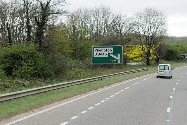
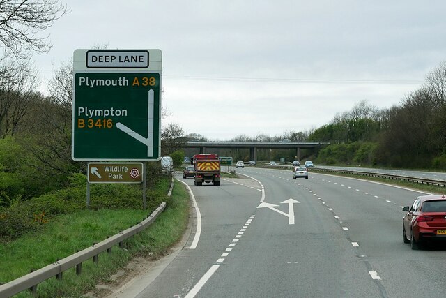
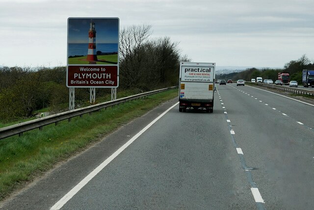
Despite its small size, Langage is well-connected to neighboring towns and cities. The A38 road runs just south of the village, providing easy access to Plymouth and other major towns in Devon. Additionally, the village is served by a regular bus service, making it convenient for residents and visitors to explore the wider area.

While Langage itself may not offer a wide range of amenities, the nearby city of Plymouth provides ample opportunities for shopping, dining, and entertainment. Plymouth is also home to a number of historical landmarks and cultural attractions, including the National Marine Aquarium and the historic Barbican area.

Overall, Langage is a charming village that offers a peaceful and idyllic setting for those looking to escape the hustle and bustle of city life, while still enjoying easy access to nearby amenities and attractions.

If you have any feedback on the listing, please let us know in the comments section below.
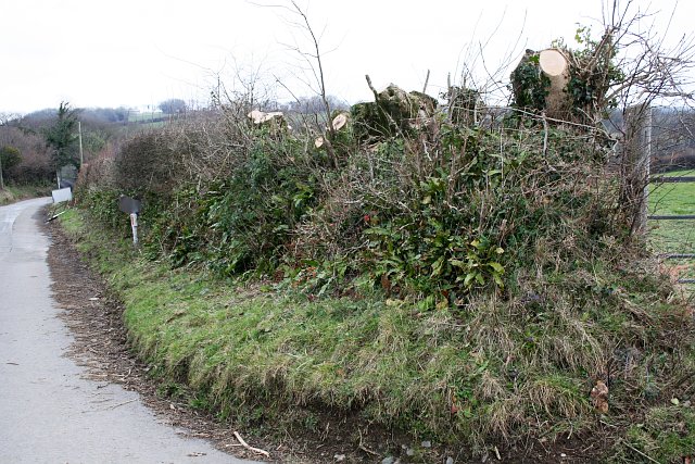
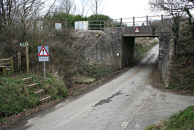
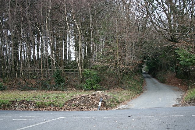
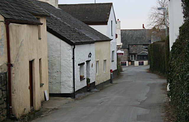
Langage Images

Images are sourced within 2km of 50.387758/-4.018781 or Grid Reference SX5656. Thanks to Geograph Open Source API. All images are credited.

Devon Expressway (A38) between Voss Park and Deep Lane Junctions The A38 is a major A-class trunk route. When first designated in 1922, it ran from Derby to Plymouth but it was later extended at both ends so that it now runs for 292 miles from Mansfield in Nottinghamshire to Bodmin in Cornwall.

Prior to the opening of the M5 motorway in the 1960s and 1970s, the A38 formed the main "holiday route" from the Midlands to Somerset, Devon and Cornwall and the south-western section was notorious at holiday times for the congestion. Nowadays, for most of the southern section, the A38 is a fairly quiet road shadowing the M5 extremely closely; often running alongside the motorway as a single carriageway road. The section between Exeter and Plymouth is, however, a busy dual carriageway which serves as the southern extension of the M5 and is known as “the Devon Expressway”.

More information at <span class="nowrap"><a title="http://en.wikipedia.org/wiki/A38_road" rel="nofollow ugc noopener" href="http://en.wikipedia.org/wiki/A38_road">Link</a><img style="margin-left:2px;" alt="External link" title="External link - shift click to open in new window" src="https://s1.geograph.org.uk/img/external.png" width="10" height="10"/></span>  (Wikipedia) and <span class="nowrap"><a title="http://www.sabre-roads.org.uk/wiki/index.php?title=A38" rel="nofollow ugc noopener" href="http://www.sabre-roads.org.uk/wiki/index.php?title=A38">Link</a><img style="margin-left:2px;" alt="External link" title="External link - shift click to open in new window" src="https://s1.geograph.org.uk/img/external.png" width="10" height="10"/></span>  (SABRE).
Devon Expressway (A38) between Voss Park and Deep Lane Junctions
The A38 is a major A-class trunk route. When first designated in 1922, it ran from Derby to Plymouth but it was later extended at both ends so that it now runs for 292 miles from Mansfield in Nottinghamshire to Bodmin in Cornwall. Prior to the opening of the M5 motorway in the 1960s and 1970s, the A38 formed the main "holiday route" from the Midlands to Somerset, Devon and Cornwall and the south-western section was notorious at holiday times for the congestion. Nowadays, for most of the southern section, the A38 is a fairly quiet road shadowing the M5 extremely closely; often running alongside the motorway as a single carriageway road. The section between Exeter and Plymouth is, however, a busy dual carriageway which serves as the southern extension of the M5 and is known as “the Devon Expressway”. More information at LinkExternal link (Wikipedia) and LinkExternal link (SABRE).
Devon Expressway, Deep Lane Junction The A38 is a major A-class trunk route. When first designated in 1922, it ran from Derby to Plymouth but it was later extended at both ends so that it now runs for 292 miles from Mansfield in Nottinghamshire to Bodmin in Cornwall.

Prior to the opening of the M5 motorway in the 1960s and 1970s, the A38 formed the main "holiday route" from the Midlands to Somerset, Devon and Cornwall and the south-western section was notorious at holiday times for the congestion. Nowadays, for most of the southern section, the A38 is a fairly quiet road shadowing the M5 extremely closely; often running alongside the motorway as a single carriageway road. The section between Exeter and Plymouth is, however, a busy dual carriageway which serves as the southern extension of the M5 and is known as “the Devon Expressway”.

More information at <span class="nowrap"><a title="http://en.wikipedia.org/wiki/A38_road" rel="nofollow ugc noopener" href="http://en.wikipedia.org/wiki/A38_road">Link</a><img style="margin-left:2px;" alt="External link" title="External link - shift click to open in new window" src="https://s1.geograph.org.uk/img/external.png" width="10" height="10"/></span>  (Wikipedia) and <span class="nowrap"><a title="http://www.sabre-roads.org.uk/wiki/index.php?title=A38" rel="nofollow ugc noopener" href="http://www.sabre-roads.org.uk/wiki/index.php?title=A38">Link</a><img style="margin-left:2px;" alt="External link" title="External link - shift click to open in new window" src="https://s1.geograph.org.uk/img/external.png" width="10" height="10"/></span>  (SABRE).
Devon Expressway, Deep Lane Junction
The A38 is a major A-class trunk route. When first designated in 1922, it ran from Derby to Plymouth but it was later extended at both ends so that it now runs for 292 miles from Mansfield in Nottinghamshire to Bodmin in Cornwall. Prior to the opening of the M5 motorway in the 1960s and 1970s, the A38 formed the main "holiday route" from the Midlands to Somerset, Devon and Cornwall and the south-western section was notorious at holiday times for the congestion. Nowadays, for most of the southern section, the A38 is a fairly quiet road shadowing the M5 extremely closely; often running alongside the motorway as a single carriageway road. The section between Exeter and Plymouth is, however, a busy dual carriageway which serves as the southern extension of the M5 and is known as “the Devon Expressway”. More information at LinkExternal link (Wikipedia) and LinkExternal link (SABRE).
Layby on the A38 near to Plympton St Maurice The A38 is a major A-class trunk route. When first designated in 1922, it ran from Derby to Plymouth but it was later extended at both ends so that it now runs for 292 miles from Mansfield in Nottinghamshire to Bodmin in Cornwall.

Prior to the opening of the M5 motorway in the 1960s and 1970s, the A38 formed the main "holiday route" from the Midlands to Somerset, Devon and Cornwall and the south-western section was notorious at holiday times for the congestion. Nowadays, for most of the southern section, the A38 is a fairly quiet road shadowing the M5 extremely closely; often running alongside the motorway as a single carriageway road. The section between Exeter and Plymouth is, however, a busy dual carriageway which serves as the southern extension of the M5 and is known as “the Devon Expressway”.

More information at <span class="nowrap"><a title="http://en.wikipedia.org/wiki/A38_road" rel="nofollow ugc noopener" href="http://en.wikipedia.org/wiki/A38_road">Link</a><img style="margin-left:2px;" alt="External link" title="External link - shift click to open in new window" src="https://s1.geograph.org.uk/img/external.png" width="10" height="10"/></span>  (Wikipedia) and <span class="nowrap"><a title="http://www.sabre-roads.org.uk/wiki/index.php?title=A38" rel="nofollow ugc noopener" href="http://www.sabre-roads.org.uk/wiki/index.php?title=A38">Link</a><img style="margin-left:2px;" alt="External link" title="External link - shift click to open in new window" src="https://s1.geograph.org.uk/img/external.png" width="10" height="10"/></span>  (SABRE).
Layby on the A38 near to Plympton St Maurice
The A38 is a major A-class trunk route. When first designated in 1922, it ran from Derby to Plymouth but it was later extended at both ends so that it now runs for 292 miles from Mansfield in Nottinghamshire to Bodmin in Cornwall. Prior to the opening of the M5 motorway in the 1960s and 1970s, the A38 formed the main "holiday route" from the Midlands to Somerset, Devon and Cornwall and the south-western section was notorious at holiday times for the congestion. Nowadays, for most of the southern section, the A38 is a fairly quiet road shadowing the M5 extremely closely; often running alongside the motorway as a single carriageway road. The section between Exeter and Plymouth is, however, a busy dual carriageway which serves as the southern extension of the M5 and is known as “the Devon Expressway”. More information at LinkExternal link (Wikipedia) and LinkExternal link (SABRE).
Devon Expressway on the Outskirts of Plymouth The A38 is a major A-class trunk route. When first designated in 1922, it ran from Derby to Plymouth but it was later extended at both ends so that it now runs for 292 miles from Mansfield in Nottinghamshire to Bodmin in Cornwall.

Prior to the opening of the M5 motorway in the 1960s and 1970s, the A38 formed the main "holiday route" from the Midlands to Somerset, Devon and Cornwall and the south-western section was notorious at holiday times for the congestion. Nowadays, for most of the southern section, the A38 is a fairly quiet road shadowing the M5 extremely closely; often running alongside the motorway as a single carriageway road. The section between Exeter and Plymouth is, however, a busy dual carriageway which serves as the southern extension of the M5 and is known as “the Devon Expressway”.

More information at <span class="nowrap"><a title="http://en.wikipedia.org/wiki/A38_road" rel="nofollow ugc noopener" href="http://en.wikipedia.org/wiki/A38_road">Link</a><img style="margin-left:2px;" alt="External link" title="External link - shift click to open in new window" src="https://s1.geograph.org.uk/img/external.png" width="10" height="10"/></span>  (Wikipedia) and <span class="nowrap"><a title="http://www.sabre-roads.org.uk/wiki/index.php?title=A38" rel="nofollow ugc noopener" href="http://www.sabre-roads.org.uk/wiki/index.php?title=A38">Link</a><img style="margin-left:2px;" alt="External link" title="External link - shift click to open in new window" src="https://s1.geograph.org.uk/img/external.png" width="10" height="10"/></span>  (SABRE).
Devon Expressway on the Outskirts of Plymouth
The A38 is a major A-class trunk route. When first designated in 1922, it ran from Derby to Plymouth but it was later extended at both ends so that it now runs for 292 miles from Mansfield in Nottinghamshire to Bodmin in Cornwall. Prior to the opening of the M5 motorway in the 1960s and 1970s, the A38 formed the main "holiday route" from the Midlands to Somerset, Devon and Cornwall and the south-western section was notorious at holiday times for the congestion. Nowadays, for most of the southern section, the A38 is a fairly quiet road shadowing the M5 extremely closely; often running alongside the motorway as a single carriageway road. The section between Exeter and Plymouth is, however, a busy dual carriageway which serves as the southern extension of the M5 and is known as “the Devon Expressway”. More information at LinkExternal link (Wikipedia) and LinkExternal link (SABRE).
Newnham Park Adjacent to Torry Brook and just off the Lee Moor Road, is Newnham Park; the photograph showing the 'meadow' which is frequently the focal point for a variety of activities ranging from mountain biking, carriage eventing through to trail running and music festivals, dependent on the time and date.
Newnham Park
Adjacent to Torry Brook and just off the Lee Moor Road, is Newnham Park; the photograph showing the 'meadow' which is frequently the focal point for a variety of activities ranging from mountain biking, carriage eventing through to trail running and music festivals, dependent on the time and date.
Newnham Park Scene of the 'gathering' for the 2005 Autumn Trail - an eight mile offroad run in the woods of Newnham Estate.
Newnham Park
Scene of the 'gathering' for the 2005 Autumn Trail - an eight mile offroad run in the woods of Newnham Estate.
Wiverton Crossroads, Sherford Valley Situated down lanes indicated for "local farm traffic only" Wiverton crossroads lie to the northern end of the Sherford Valley, the site of an intended new town development.
Wiverton Crossroads, Sherford Valley
Situated down lanes indicated for "local farm traffic only" Wiverton crossroads lie to the northern end of the Sherford Valley, the site of an intended new town development.
Lyneham Inn, near Plympton Once occupying a busy location on the 'old' main A38(seen), the inn is now bypassed by the "A38 Devon Expressway", which passes approximately a 100 yards over to the south (righthand side).
Lyneham Inn, near Plympton
Once occupying a busy location on the 'old' main A38(seen), the inn is now bypassed by the "A38 Devon Expressway", which passes approximately a 100 yards over to the south (righthand side).
Suburban Housing, Chaddlewood.
Local Supermarket, Chaddlewood Nobody walks around here.  Even though this supermarket serves an area of no more than 1km in any direction, in modern suburbia it is essential to provide a large car park.
Local Supermarket, Chaddlewood
Nobody walks around here. Even though this supermarket serves an area of no more than 1km in any direction, in modern suburbia it is essential to provide a large car park.
Langage Science Park Big boxes on the hillside!  Local authorities seem to want to theme their industrial/commercial estates.  This one is for high-tech companies.
Langage Science Park
Big boxes on the hillside! Local authorities seem to want to theme their industrial/commercial estates. This one is for high-tech companies.
Langage Park Office Campus Rather a grand title - and not a University in sight, but that is what these buildings have been called.  They are purpose-built offices on the edge of town and are occupied by companies, such as firms of solicitors, who are more often associated with inner-city locations.
Langage Park Office Campus
Rather a grand title - and not a University in sight, but that is what these buildings have been called. They are purpose-built offices on the edge of town and are occupied by companies, such as firms of solicitors, who are more often associated with inner-city locations.
The Old Cornwood Road, Plympton This section of country lane has been left untouched, even though it has now been completely surrounded by suburban housing.
The Old Cornwood Road, Plympton
This section of country lane has been left untouched, even though it has now been completely surrounded by suburban housing.
Yeoman's Way, Plympton Looking towards the steep ridge which marks the southern boundary of Plympton.
Yeoman's Way, Plympton
Looking towards the steep ridge which marks the southern boundary of Plympton.
Taming the Hedge This hedgerow at Langage Cross had been allowed to grow out into small trees.
Taming the Hedge
This hedgerow at Langage Cross had been allowed to grow out into small trees.
Under the Railway Line The bridge over this minor road carries the mainline railway.  The warning sign says the road is liable to flooding.
Under the Railway Line
The bridge over this minor road carries the mainline railway. The warning sign says the road is liable to flooding.
Beechwood Cross
Beechwood Cross
Hemerdon Village
Hemerdon Village
Show me another place!

Langage is located at Grid Ref: SX5656 (Lat: 50.387758, Lng: -4.018781)

Administrative County: Devon

District: South Hams

Police Authority: Devon and Cornwall

What 3 Words

///spun.patio.march. Near Plympton, Devon

Related Wikis

Langage Power Station

Langage Power Station is a combined-cycle power plant near the city of Plymouth in Devon, England. Centrica, the original owners of the site, announced...

Longcause Community Special School

Longcause Community Special School is a special school for students aged 4 to 16 with learning difficulties. The college has about 100 students.The school...

Plympton House

Plympton House is the principal residence at the Plympton House Estate, in the parish of Plympton St Maurice, Devon, England. It is a Grade I listed country...

Church of St Maurice, Plympton

Church of St Maurice (also known as the Church of St Thomas at Plympton St Maurice) is located in Plympton, Devon, England. Dating to the 15th century...

Newnham Park

Newnham Park (before circa 1718 Loughtor) is an historic estate in the civil parish of Sparkwell, Devon, UK. It was known as Loughtor until about 1700...

South West Devon (UK Parliament constituency)

South West Devon is a constituency represented in the House of Commons of the UK Parliament since 1997 by Sir Gary Streeter, a Conservative. == Boundaries... ==

Island House, Plympton

Island House is a Grade II listed building in Plympton, Devon, England. Standing at 4 Church Street, at the corner with Fore Street, Plympton's main street...

The Old Rectory, Plympton

The Old Rectory is a grade II* listed townhouse in Plympton, Devon, England. It was listed on 23 April, 1952.The building was formerly the rectory for...

Nearby Amenities

Located within 500m of 50.387758,-4.018781
Pub
Chaddlewood Inn
Indoor Seating: yes
Outdoor Seating: yes
Wikidata: Q79838077
Lat/Long: 50.3870255/-4.0235466
Post Office
Source: OS OpenData StreetView
Lat/Long: 50.3871734/-4.0241524
Atm
Check Date: 2022-09-25
Fee: no
Lat/Long: 50.3869878/-4.0238105
Langage Industrial Estate
Place: suburb
Lat/Long: 50.3872674/-4.0156001
Mini Roundabout
Direction: clockwise
Lat/Long: 50.3887758/-4.0232722
Crossing
Crossing Island: no
Crossing Markings: no
Crossing Signals: no
Tactile Paving: yes
Lat/Long: 50.3862626/-4.0251794
Crossing
Crossing: unmarked
Crossing Island: yes
Tactile Paving: yes
Lat/Long: 50.3862884/-4.0228619
Crossing
Crossing: unmarked
Crossing Island: yes
Tactile Paving: yes
Lat/Long: 50.3852364/-4.0232971
The Co-operative Food
Shop: supermarket
Lat/Long: 50.3870767/-4.0240696
Fast Food
Dragon City Chinese
Lat/Long: 50.3871896/-4.0244141
Fast Food
Domino's
Addr Country: GB
Brand: Domino's
Brand Wikidata: Q839466
Brand Wikipedia: en:Domino's Pizza
Contact Website: https://www.dominos.co.uk/pizza-near-me/plymouth/unit-5-chaddlewood-district-centre
Cuisine: pizza
Takeaway: yes
Lat/Long: 50.3871845/-4.0243248
Pharmacy
Well Pharmacy
Brand: Well Pharmacy
Brand Wikidata: Q7726524
Healthcare: pharmacy
Website: https://finder.well.co.uk/store/chaddlewood-glen-road
Lat/Long: 50.3871682/-4.0242418
Power: pole
Lat/Long: 50.3834956/-4.0188047
Power: pole
Lat/Long: 50.3841729/-4.0186384
Power: pole
Lat/Long: 50.3851033/-4.0175897
Power: pole
Lat/Long: 50.3841147/-4.0172946
Power: pole
Lat/Long: 50.3850742/-4.0177399
Direction: S
Generator Method: photovoltaic
Generator Output Electricity: yes
Generator Solar Modules: 9
Generator Source: solar
Generator Type: solar_photovoltaic_panel
Location: roof
Power: generator
Lat/Long: 50.3870234/-4.0224177
Direction: S
Generator Method: photovoltaic
Generator Output Electricity: yes
Generator Solar Modules: 9
Generator Source: solar
Generator Type: solar_photovoltaic_panel
Location: roof
Power: generator
Lat/Long: 50.3870322/-4.0225669
Generator Method: photovoltaic
Generator Output Electricity: yes
Generator Source: solar
Generator Type: solar_photovoltaic_panel
Location: roof
Power: generator
Lat/Long: 50.3886416/-4.0238312
Generator Method: photovoltaic
Generator Output Electricity: yes
Generator Source: solar
Generator Type: solar_photovoltaic_panel
Location: roof
Power: generator
Lat/Long: 50.3899789/-4.0246385
Generator Method: photovoltaic
Generator Output Electricity: yes
Generator Source: solar
Generator Type: solar_photovoltaic_panel
Location: roof
Power: generator
Lat/Long: 50.3899823/-4.0245929
Generator Method: photovoltaic
Generator Output Electricity: yes
Generator Source: solar
Generator Type: solar_photovoltaic_panel
Location: roof
Power: generator
Lat/Long: 50.3912854/-4.0223452
Generator Method: photovoltaic
Generator Output Electricity: yes
Generator Source: solar
Generator Type: solar_photovoltaic_panel
Location: roof
Power: generator
Lat/Long: 50.3907946/-4.0230721
Generator Method: photovoltaic
Generator Output Electricity: yes
Generator Source: solar
Generator Type: solar_photovoltaic_panel
Location: roof
Power: generator
Lat/Long: 50.3905432/-4.0220127
Generator Method: photovoltaic
Generator Output Electricity: yes
Generator Source: solar
Generator Type: solar_photovoltaic_panel
Location: roof
Power: generator
Lat/Long: 50.3903209/-4.0217578
Generator Method: photovoltaic
Generator Output Electricity: yes
Generator Source: solar
Generator Type: solar_photovoltaic_panel
Location: roof
Power: generator
Lat/Long: 50.3897566/-4.0217632
Generator Method: photovoltaic
Generator Output Electricity: yes
Generator Source: solar
Generator Type: solar_photovoltaic_panel
Location: roof
Power: generator
Lat/Long: 50.3896831/-4.0216854
Generator Method: photovoltaic
Generator Output Electricity: yes
Generator Source: solar
Generator Type: solar_photovoltaic_panel
Location: roof
Power: generator
Lat/Long: 50.3893684/-4.0221977
Generator Method: photovoltaic
Generator Output Electricity: yes
Generator Source: solar
Generator Type: solar_photovoltaic_panel
Location: roof
Power: generator
Lat/Long: 50.3890444/-4.0227811
Generator Method: photovoltaic
Generator Output Electricity: yes
Generator Source: solar
Generator Type: solar_photovoltaic_panel
Location: roof
Power: generator
Lat/Long: 50.3890649/-4.022824
Generator Method: photovoltaic
Generator Output Electricity: yes
Generator Source: solar
Generator Type: solar_photovoltaic_panel
Location: roof
Power: generator
Lat/Long: 50.3890931/-4.022812
Power: pole
Lat/Long: 50.3903765/-4.0138011
Location Transition: yes
Power: pole
Lat/Long: 50.3897233/-4.0138024
Location Transition: yes
Power: pole
Lat/Long: 50.3885724/-4.0138252
Power: pole
Lat/Long: 50.3878413/-4.0135449
Power: pole
Lat/Long: 50.3874069/-4.0133934
Power: pole
Lat/Long: 50.3864441/-4.0130688
Location Transition: yes
Power: pole
Lat/Long: 50.3858438/-4.0182871
Location Transition: yes
Power: pole
Lat/Long: 50.3921814/-4.0180457
Lexus Plymouth (Service & Parts Only)
Brand: Lexus
Brand Wikidata: Q35919
Shop: car_repair
Lat/Long: 50.3859128/-4.0222572
Post Box
Brand: Royal Mail
Brand Wikidata: Q638098
Brand Wikipedia: en:Royal Mail
Collection Times: Mo-Fr 17:30; Sa 12:30; Su off
Drive Through: no
Operator: Royal Mail
Operator Wikidata: Q638098
Post Box Apertures: 2
Post Box Design: type_c
Post Box Type: pillar
Ref: PL7 150;PL7 1500
Royal Cypher: EIIR
Royal Cypher Wikidata: Q33102113
Source: survey;streetlevel imagery;aerial imagery
Lat/Long: 50.3869995/-4.0241263
Post Box
Brand: Royal Mail
Brand Wikidata: Q638098
Brand Wikipedia: en:Royal Mail
Collection Times: Mo-Fr 18:00; Sa 12:30; Su off
Drive Through: no
Operator: Royal Mail
Operator Wikidata: Q638098
Post Box Design: type_k
Post Box Type: pillar
Ref: PL7 521
Royal Cypher: EIIR
Royal Cypher Wikidata: Q33102113
Source: survey;streetlevel imagery;aerial imagery
Lat/Long: 50.3876031/-4.0176149
Post Box
Brand: Royal Mail
Brand Wikidata: Q638098
Brand Wikipedia: en:Royal Mail
Collection Times: Mo-Fr 18:00; Sa 12:30; Su off
Drive Through: no
Operator: Royal Mail
Operator Wikidata: Q638098
Post Box Type: meter
Ref: PL7 156
Royal Cypher: no
Source: survey;streetlevel imagery;aerial imagery
Lat/Long: 50.3875655/-4.01758
Post Box
Brand: Royal Mail
Brand Wikidata: Q638098
Brand Wikipedia: en:Royal Mail
Collection Times: Mo-Fr 09:00; Sa 07:00; Su off
Drive Through: no
Operator: Royal Mail
Operator Wikidata: Q638098
Post Box Mounting: pier
Post Box Type: lamp
Ref: PL7 38D
Royal Cypher: EIIR
Royal Cypher Wikidata: Q33102113
Source: survey;streetlevel imagery;aerial imagery
Lat/Long: 50.3855728/-4.0245081
Post Box
Brand: Royal Mail
Brand Wikidata: Q638098
Brand Wikipedia: en:Royal Mail
Collection Times: Mo-Fr 09:00; Sa 07:00; Su off
Drive Through: no
Operator: Royal Mail
Operator Wikidata: Q638098
Post Box Design: type_k
Post Box Type: pillar
Ref: PL7 324D
Royal Cypher: EIIR
Royal Cypher Wikidata: Q33102113
Source: survey;streetlevel imagery;aerial imagery
Lat/Long: 50.3896004/-4.0242431
Post Office
Chaddlewood Post Office
Addr City: Plympton
Addr Housename: Unit 1 Chaddlewood District Centre
Addr Postcode: PL7 2XS
Addr Street: Glen Road
Brand: Post Office
Brand Wikidata: Q1783168
Brand Wikipedia: en:Post Office Ltd
Opening Hours: Mo-Sa 07:00-22:00; Su 10:00-16:00
Ref Pol Id: 21598
Lat/Long: 50.3873162/-4.0238703
Telephone
Booth: KX100
Survey Date: 2022-08-29
Lat/Long: 50.3863078/-4.0253192
Survitec Group
Man Made: works
Lat/Long: 50.3848756/-4.0142057
Swift Steel
Man Made: works
Lat/Long: 50.3859407/-4.0138832
Sw Tooling Ltd
Man Made: works
Lat/Long: 50.3854395/-4.0136101
Sigma
Man Made: works
Lat/Long: 50.3859039/-4.0147845
C Milar & Son Fabrications
Man Made: works
Lat/Long: 50.3859813/-4.0148634
TufCoat Shrink Wrap
Man Made: works
Lat/Long: 50.3861081/-4.0149873
Plymouth Self Storage
Shop: storage_rental
Lat/Long: 50.3866166/-4.01546
Hackworthy
Office: moving_company
Lat/Long: 50.3867386/-4.0149729
Tecalemit Garage Equipment
Shop: trade
Trade: yes
Lat/Long: 50.3867046/-4.0195125
Pro-Cut Europe
Man Made: works
Lat/Long: 50.3865749/-4.0199009
Skills Group
Office: educational_institution
Lat/Long: 50.3914537/-4.0198084
Bench
Backrest: yes
Survey Date: 2023-09-04
Lat/Long: 50.3867218/-4.0249666
Waste Basket
Survey Date: 2023-09-04
Lat/Long: 50.3870872/-4.0246882
Waste Basket
Survey Date: 2023-09-04
Lat/Long: 50.3871094/-4.0242646
Fire Hydrant
Emergency: fire_hydrant
Survey Date: 2023-09-04
Lat/Long: 50.3871253/-4.0241422
Bicycle Rental
Bicycle Rental: docking_station
Brand: Beryl
Brand Wikidata: Q106575365
Capacity: 6
Fee: yes
Mapillary: 596850358689464
Network: Beryl Plymouth
Operator: Beryl
Operator Type: business
Operator Wikidata: Q106575369
Survey Date: 2023-09-04
Lat/Long: 50.3872899/-4.0247936
Bus Stop
District Centre
Bench: yes
Bin: no
Shelter: yes
Survey Date: 2023-09-04
Tactile Paving: yes
Lat/Long: 50.3865259/-4.0241278
Fire Hydrant
Emergency: fire_hydrant
Fire Hydrant Diameter: 250
Fire Hydrant Position: sidewalk
Fire Hydrant Type: underground
Survey Date: 2024-05-06
Lat/Long: 50.3861479/-4.0227716
Power: substation
Survey Date: 2024-05-06
Lat/Long: 50.3857011/-4.0208396
Power: substation
Survey Date: 2024-05-06
Lat/Long: 50.3847009/-4.0206141
Fire Hydrant
Emergency: fire_hydrant
Fire Hydrant Diameter: 250
Fire Hydrant Position: green
Fire Hydrant Type: underground
Survey Date: 2024-05-06
Lat/Long: 50.3857331/-4.0209909
Fire Hydrant
Emergency: fire_hydrant
Fire Hydrant Position: sidewalk
Fire Hydrant Type: underground
Survey Date: 2024-05-06
Lat/Long: 50.3873393/-4.0219373
Defibrillator
Defibrillator Location: On outside wall of Little Orchard nursery in Branson Court
Emergency: defibrillator
Indoor: no
Mapillary: 800256942164672
Opening Hours: 24/7
Survey Date: 2024-05-06
Lat/Long: 50.3872834/-4.0228044
Fire Hydrant
Emergency: fire_hydrant
Fire Hydrant Position: sidewalk
Fire Hydrant Type: underground
Survey Date: 2024-05-06
Lat/Long: 50.3874691/-4.0229764
Fire Hydrant
Emergency: fire_hydrant
Fire Hydrant Position: lane
Fire Hydrant Type: underground
Survey Date: 2024-05-06
Lat/Long: 50.3874747/-4.0231304
Charging Station
Capacity: 2
Survey Date: 2024-05-06
Lat/Long: 50.3873123/-4.0248923
Defibrillator
Defibrillator Location: On outside wall of Chadlewood Farm Community Centre
Emergency: defibrillator
Indoor: no
Mapillary: 810385537187099
Opening Hours: 24/7
Survey Date: 2024-05-06
Lat/Long: 50.3875341/-4.0251757
The data included in this document is from www.openstreetmap.org. The data is made available under ODbL.

Have you been to Langage?

Leave your review of Langage below (or comments, questions and feedback).