Braundshill Plantation

Wood, Forest in Devon Torridge

England

Braundshill Plantation

Tarka Trail near Brightley Farm
Tarka Trail near Brightley Farm Credit: Grant Sherman

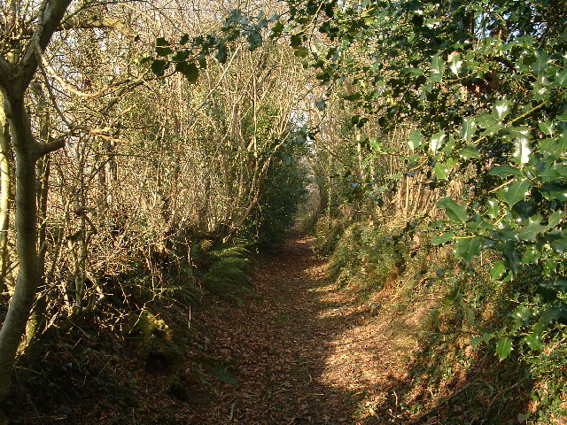
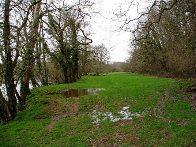
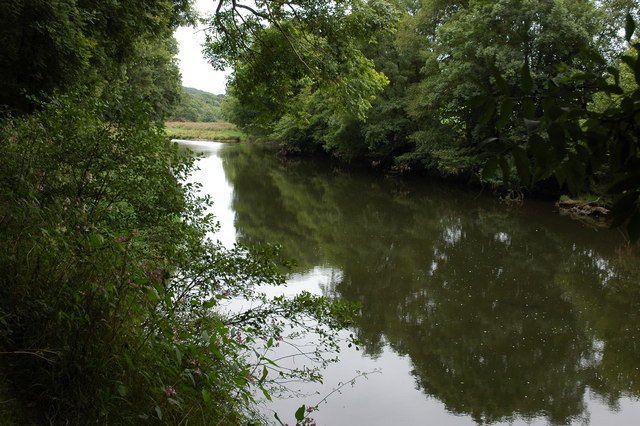
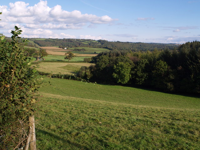
Braundshill Plantation is a picturesque woodland located in Devon, England. Situated in the heart of the countryside, it covers a vast area of approximately 100 acres. The plantation is renowned for its diverse and abundant variety of trees, making it a popular destination for nature enthusiasts and outdoor enthusiasts alike.

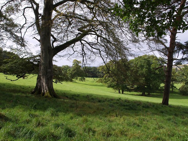
The woodland is predominantly composed of native species, including oak, beech, and ash trees, which have been meticulously preserved and maintained over the years. These mature trees provide a rich habitat for a wide range of wildlife, including birds, mammals, and insects, creating a thriving ecosystem within the plantation.

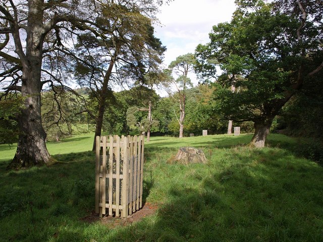
Visitors to Braundshill Plantation can enjoy a network of well-maintained walking trails that wind through the woods, allowing them to experience the tranquility and beauty of the natural surroundings. The paths are suitable for all skill levels, making it an ideal location for family outings or leisurely strolls.

In addition to its natural beauty, Braundshill Plantation also offers recreational facilities, including picnic areas and designated camping spots. These amenities make it a popular destination for outdoor activities such as camping, birdwatching, and photography.

The plantation is open to the public throughout the year, with free admission for visitors. It is managed by the local forestry commission, ensuring the preservation and conservation of this valuable natural resource for future generations to enjoy. Braundshill Plantation is a true gem of Devon, offering a tranquil escape from the hustle and bustle of everyday life.

If you have any feedback on the listing, please let us know in the comments section below.

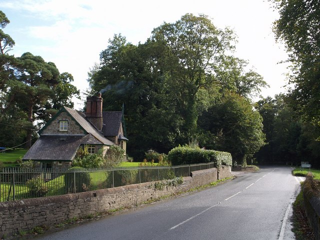
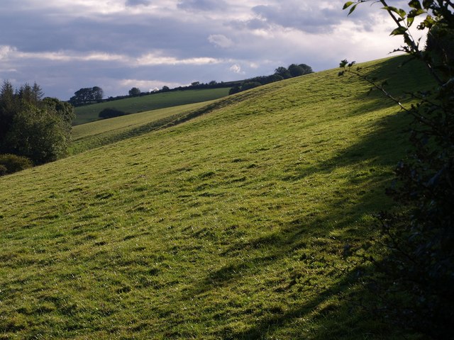
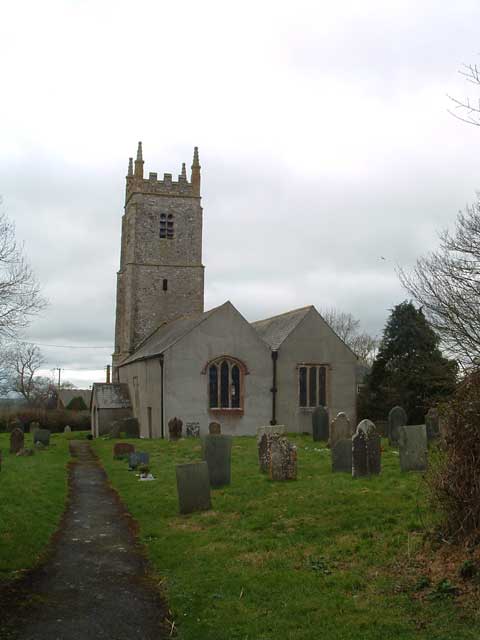
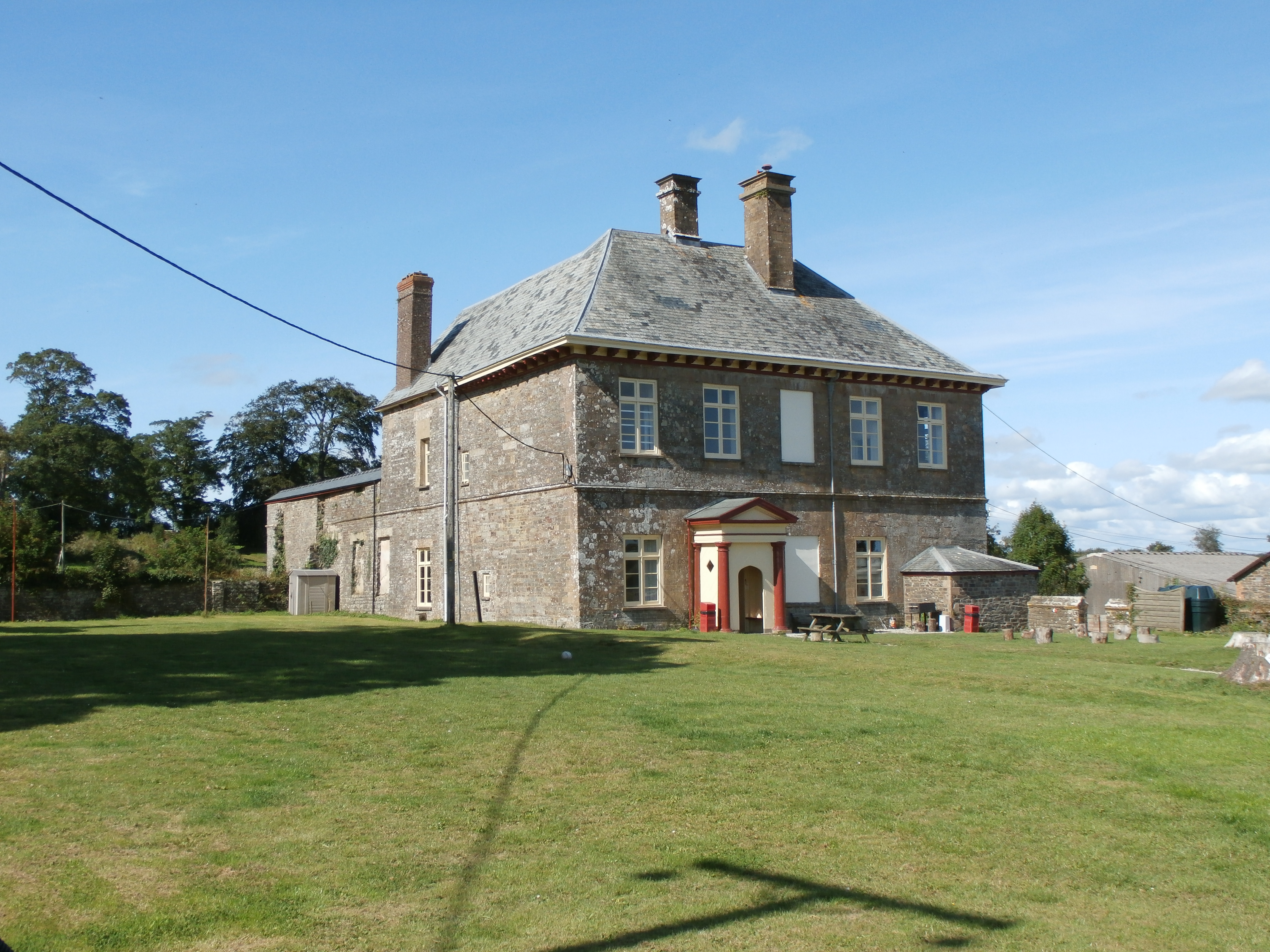
Braundshill Plantation Images

Images are sourced within 2km of 50.889827/-4.0793103 or Grid Reference SS5312. Thanks to Geograph Open Source API. All images are credited.

Tarka Trail near Brightley Farm
River Torridge at New Bridge There are lots of New Bridges in Devon. The Tarka Trail crosses this one a couple of miles west of Dolton.
River Torridge at New Bridge
There are lots of New Bridges in Devon. The Tarka Trail crosses this one a couple of miles west of Dolton.
Merton Church Another Devon location where my BLIGHT ancestors came from.
Merton Church
Another Devon location where my BLIGHT ancestors came from.
Merton: cottage by Merton Mill Cross As the signpost states, the road on the left leads to Beaford – via Balls Corner and Beaford Mill, on the river Torridge
Merton: cottage by Merton Mill Cross
As the signpost states, the road on the left leads to Beaford – via Balls Corner and Beaford Mill, on the river Torridge
View across the Torridge from Halsdon View across the Torridge from Halsdon (Devon Wildlife Trust reserve) showing a hide on the far bank.
View across the Torridge from Halsdon
View across the Torridge from Halsdon (Devon Wildlife Trust reserve) showing a hide on the far bank.
Gatehouse of the Clinton Estate, Merton This is one of two gatehouses of the Clinton Estate in Merton
Gatehouse of the Clinton Estate, Merton
This is one of two gatehouses of the Clinton Estate in Merton
View of the Torridge from Halsdon View of the Torridge valley from Halsdon (Devon Wildlife Trust reserve).
View of the Torridge from Halsdon
View of the Torridge valley from Halsdon (Devon Wildlife Trust reserve).
Overgrown Rover At the point where the Tarka Trail leaves the lane shown in <a href="https://www.geograph.org.uk/photo/483754">SS5511 : Lane to Woodridge Cross</a>, this Rover 100 has become one with its surroundings.
Overgrown Rover
At the point where the Tarka Trail leaves the lane shown in SS5511 : Lane to Woodridge Cross, this Rover 100 has become one with its surroundings.
The River Torridge near Beaford The River Torridge passing Beaford Wood to the south-west of the village of Beaford.
The River Torridge near Beaford
The River Torridge passing Beaford Wood to the south-west of the village of Beaford.
Leytown A farm in a shallow valley west of the Torridge, seen from the Tarka Trail as it follows the lane from Broadmead to New Bridge.
Leytown
A farm in a shallow valley west of the Torridge, seen from the Tarka Trail as it follows the lane from Broadmead to New Bridge.
St James the Less church, Huish The church was heavily restored by G E Street in 1873; only the medieval tower remains as it was.
St James the Less church, Huish
The church was heavily restored by G E Street in 1873; only the medieval tower remains as it was.
Lower Lodge Close to Kingsford Bridge on the A386 over the Little Mere River.
Lower Lodge
Close to Kingsford Bridge on the A386 over the Little Mere River.
Hillies Wood The view from a gateway near Whiteland Head. A rather small stream occupying quite a broad valley emerges from the wood. The lane to Balls Corner Cross  continues, on the left, into SS5413 - photos <a href="https://www.geograph.org.uk/photo/570031">SS5413 : Countryside near Balls</a>, <a href="https://www.geograph.org.uk/photo/569969">SS5413 : Balls</a> and <a href="https://www.geograph.org.uk/photo/569981">SS5413 : Lane to  Whiteland Head</a> were all taken from where the lane goes out of sight.
Hillies Wood
The view from a gateway near Whiteland Head. A rather small stream occupying quite a broad valley emerges from the wood. The lane to Balls Corner Cross continues, on the left, into SS5413 - photos SS5413 : Countryside near Balls, SS5413 : Balls and SS5413 : Lane to Whiteland Head were all taken from where the lane goes out of sight.
The Hellings Part of the parkland at Heanton Satchville, on slopes above the valley of the River Mere. Seen from Huish Footpath 3.
The Hellings
Part of the parkland at Heanton Satchville, on slopes above the valley of the River Mere. Seen from Huish Footpath 3.
The Hellings An assortment of parkland trees beside Huish Footpath 3. <a href="https://www.geograph.org.uk/photo/569628">SS5311 : The Hellings</a> looks across to the west.
The Hellings
An assortment of parkland trees beside Huish Footpath 3. SS5311 : The Hellings looks across to the west.
Lych gate, Huish Looking out from the churchyard of <a href="https://www.geograph.org.uk/photo/567493">SS5311 : St James the Less church, Huish</a>. The paving beyond the tiles in very similar to <a href="https://www.geograph.org.uk/photo/569349">SS5408 : Path to church, Meeth</a>. Beyond the roadway is a calvary.
Lych gate, Huish
Looking out from the churchyard of SS5311 : St James the Less church, Huish. The paving beyond the tiles in very similar to SS5408 : Path to church, Meeth. Beyond the roadway is a calvary.
Lower Lodge Another view of <a href="https://www.geograph.org.uk/photo/567513">SS5211 : Lower Lodge</a> from the A386 at Kingsford Bridge over the Little Mere River. The junction on the right is with a lane to Petrockstowe.
Lower Lodge
Another view of SS5211 : Lower Lodge from the A386 at Kingsford Bridge over the Little Mere River. The junction on the right is with a lane to Petrockstowe.
Field at Whiteland Head From the same gateway as <a href="https://www.geograph.org.uk/photo/568070">SS5313 : Hillies Wood</a>, a view of a steep field above Hillies Wood.
Field at Whiteland Head
From the same gateway as SS5313 : Hillies Wood, a view of a steep field above Hillies Wood.
Show me another place!

Braundshill Plantation is located at Grid Ref: SS5312 (Lat: 50.889827, Lng: -4.0793103)

Administrative County: Devon

District: Torridge

Police Authority: Devon and Cornwall

What 3 Words

///skyrocket.winded.caravan. Near Hatherleigh, Devon

Related Wikis

Barometer World

Barometer World was the world's only barometer museum, and was located in the village of Merton, near Great Torrington, Devon, England. Barometer World...
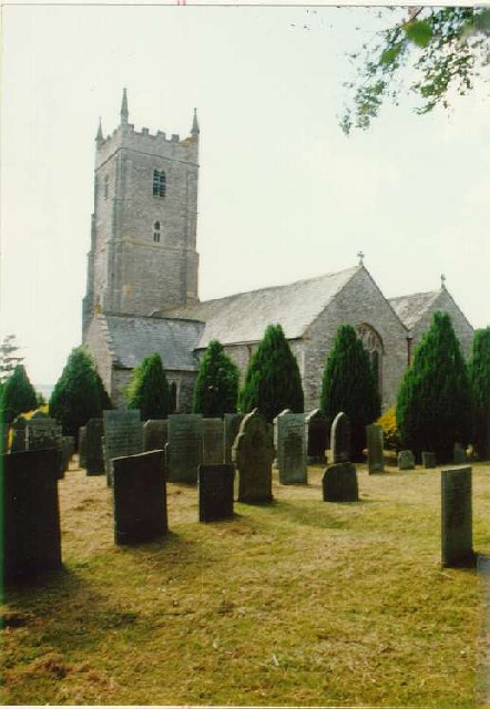
Merton, Devon

Merton is a village, ecclesiastical parish, former manor and civil parish administered by the local government district of Torridge, Devon, England. The...

Huish, Torridge

Huish (anciently Hiwis) is a small village, civil parish and former manor in the Torridge district of Devon, England. The eastern boundary of the parish...

Brealeys

Brealeys is a village in Devon, England. == References == == External links == Media related to Brealeys at Wikimedia Commons

Petrockstow railway station

Petrockstow railway station was a station serving the village of Petrockstowe in West Devon, which is about one mile away. The station was, throughout...

Dolton, Devon

Dolton is a small village and civil parish in the Torridge district of Devon, south-west England, surrounded, clockwise from the north, by Beaford, Ashreigney...

Dowland, Devon

Dowland is a civil parish in Devon, situated near Winkleigh. It is also the name of a hamlet in the parish. == References ==

Potheridge

Potheridge (alias Great Potheridge, Poderigge, Poderidge or Powdrich) is a former Domesday Book estate in the parish of Merton, in the historic hundred...

Have you been to Braundshill Plantation?

Leave your review of Braundshill Plantation below (or comments, questions and feedback).