Longmarsh Plantation

Wood, Forest in Devon Torridge

England

Longmarsh Plantation

Castle Hill Hillfort The northern rampart <span class="nowrap"><a title="https://historicengland.org.uk/listing/the-list/list-entry/1021417?section=official-list-entry" rel="nofollow ugc noopener" href="https://historicengland.org.uk/listing/the-list/list-entry/1021417?section=official-list-entry">Link</a><img style="margin-left:2px;" alt="External link" title="External link - shift click to open in new window" src="https://s1.geograph.org.uk/img/external.png" width="10" height="10"/></span>
Castle Hill Hillfort Credit: Sandy Gerrard

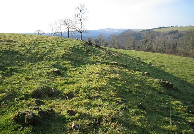
Longmarsh Plantation is a picturesque woodland area located in Devon, England. Covering an expansive area, the plantation is known for its lush greenery, diverse range of tree species, and tranquil atmosphere.

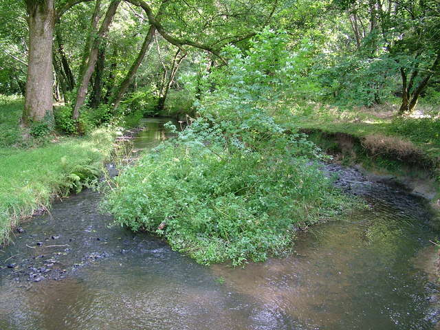
Situated in the heart of Devon, Longmarsh Plantation offers a serene escape from the bustling city life. The woodland is predominantly composed of oak, beech, and pine trees, creating a rich and diverse ecosystem. The canopies of these majestic trees provide shade and shelter for various wildlife species, including deer, foxes, rabbits, and numerous bird species.

The plantation offers several walking trails that wind through the woodland, allowing visitors to explore the natural beauty of the area. These paths are well-maintained and suitable for hikers of all levels, making it a popular destination for both avid walkers and families looking for a leisurely stroll.

Longmarsh Plantation is also home to a variety of plant species, including bluebells, wild garlic, and ferns, which add to the natural beauty of the woodland. The plantation provides a haven for nature enthusiasts and photographers, as the changing seasons bring about stunning displays of colors and textures.

Throughout the year, Longmarsh Plantation hosts various events and activities, such as guided nature walks, wildlife spotting sessions, and educational workshops for children. These events aim to raise awareness about the importance of conservation and the protection of natural habitats.

In conclusion, Longmarsh Plantation in Devon is a captivating woodland area that offers a peaceful retreat for nature lovers. With its diverse range of trees, wildlife, and well-maintained trails, it provides an ideal setting for outdoor enthusiasts to immerse themselves in the beauty of nature.

If you have any feedback on the listing, please let us know in the comments section below.

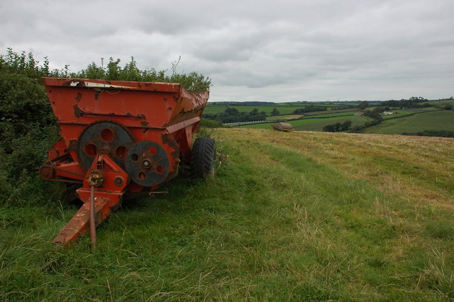
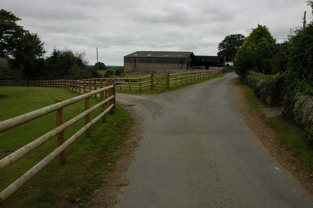
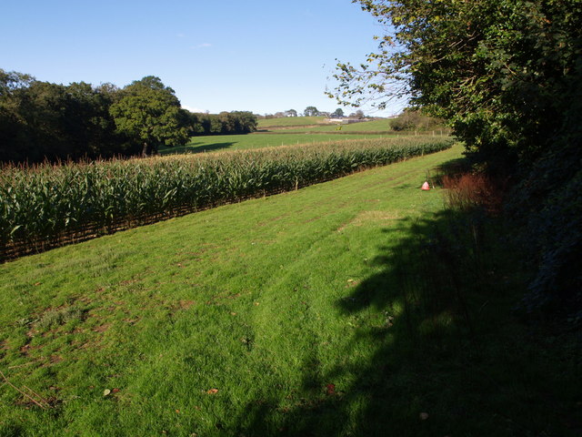
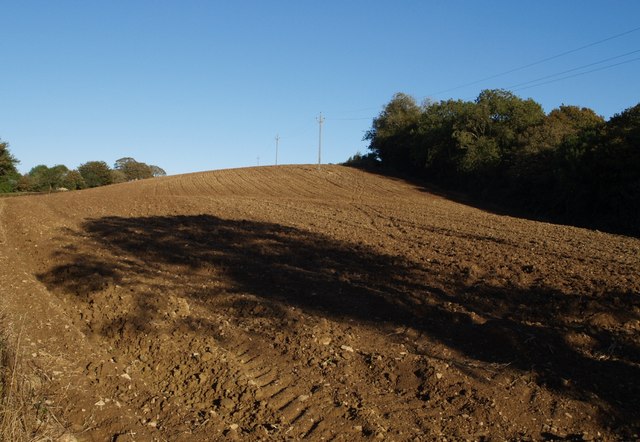
Longmarsh Plantation Images

Images are sourced within 2km of 50.92465/-4.0908808 or Grid Reference SS5315. Thanks to Geograph Open Source API. All images are credited.

Castle Hill Hillfort The northern rampart <span class="nowrap"><a title="https://historicengland.org.uk/listing/the-list/list-entry/1021417?section=official-list-entry" rel="nofollow ugc noopener" href="https://historicengland.org.uk/listing/the-list/list-entry/1021417?section=official-list-entry">Link</a><img style="margin-left:2px;" alt="External link" title="External link - shift click to open in new window" src="https://s1.geograph.org.uk/img/external.png" width="10" height="10"/></span>
Castle Hill Hillfort
The northern rampart LinkExternal link
The Wooleigh Brook. Two streams join at Whitsleighdown Cottage, St Giles in the Wood. A peaceful scene beside a quiet Devon lane, rarely used by visitors or locals alike.
The Wooleigh Brook.
Two streams join at Whitsleighdown Cottage, St Giles in the Wood. A peaceful scene beside a quiet Devon lane, rarely used by visitors or locals alike.
Wooleigh Brook, Devon The Wooleigh Brook, upstream from Whitsleighdown Cottage
Wooleigh Brook, Devon
The Wooleigh Brook, upstream from Whitsleighdown Cottage
Roping up the load A farmer, with his dog in attendance, ropes a trailer load of straw in a field to the north-west of Beaford.
Roping up the load
A farmer, with his dog in attendance, ropes a trailer load of straw in a field to the north-west of Beaford.
Large farm roll near Ramscliffe Farm Farm roll by a footpath through a stubble field near Ramscliffe Farm. Whitsley Barton is on the hill top across the valley in the background.
Large farm roll near Ramscliffe Farm
Farm roll by a footpath through a stubble field near Ramscliffe Farm. Whitsley Barton is on the hill top across the valley in the background.
Neglected muck spreader A muck spreader is left on the side of a field near Ramscliffe Farm and has weeds growing in it.
Neglected muck spreader
A muck spreader is left on the side of a field near Ramscliffe Farm and has weeds growing in it.
Farm buildings at Brealeys A footpath follows the driveway on the left.
Farm buildings at Brealeys
A footpath follows the driveway on the left.
Maize field by the Torridge The river, flowing in a deep incised meander, is just some 10 metres through the trees on the left. To the right is the edge of Poundcleave Wood. The farm in the distance is Yeory.
Maize field by the Torridge
The river, flowing in a deep incised meander, is just some 10 metres through the trees on the left. To the right is the edge of Poundcleave Wood. The farm in the distance is Yeory.
Ploughed field at Abbot's Hill A field on the slopes of the Torridge valley, occupying part of a narrow ridge between large incised meanders of the river. Abbot's Hill Wood, to the right, plunges 60 metres to the river.
Ploughed field at Abbot's Hill
A field on the slopes of the Torridge valley, occupying part of a narrow ridge between large incised meanders of the river. Abbot's Hill Wood, to the right, plunges 60 metres to the river.
Lane at Abbot's Hill The little lane is completely enclosed by trees as it climbs from Cannsdown to swing round two sharp left corners, of which this is the first.
Lane at Abbot's Hill
The little lane is completely enclosed by trees as it climbs from Cannsdown to swing round two sharp left corners, of which this is the first.
Cannsdown and Brealeys A view across a valley from Beaford Footpath 8 near Abbot's Hill. Cannsdown  House is on the left and buildings at Brealeys to the right. The trees in the centre mark the lane climbing from the valley.
Cannsdown and Brealeys
A view across a valley from Beaford Footpath 8 near Abbot's Hill. Cannsdown House is on the left and buildings at Brealeys to the right. The trees in the centre mark the lane climbing from the valley.
Farm buildings, Woolleigh Barton Seen along a track across a field from Woolleigh Cross, a junction on the A3124. The prominent hill in the left background is Castle Hill, in <a href="https://www.geograph.org.uk/gridref/SS5216">SS5216</a>.
Farm buildings, Woolleigh Barton
Seen along a track across a field from Woolleigh Cross, a junction on the A3124. The prominent hill in the left background is Castle Hill, in SS5216.
Track in Blinsham Wood This woodland is on the south side of the Woolleigh Brook valley, on the northern slopes of Castle Hill.
Track in Blinsham Wood
This woodland is on the south side of the Woolleigh Brook valley, on the northern slopes of Castle Hill.
River Torridge near Undercleave The river is flowing to the right, in one of the large incised meanders along this part of its course. A track can be seen on the far side, leading to the farm at Undercleave, and a ford connected it to a track on this bank.
River Torridge near Undercleave
The river is flowing to the right, in one of the large incised meanders along this part of its course. A track can be seen on the far side, leading to the farm at Undercleave, and a ford connected it to a track on this bank.
Meanders on the Woolleigh Brook The tributary of the Torridge wiggles its way through a meadow between steep wooded valley sides; on the far side is Blinsham Wood.
Meanders on the Woolleigh Brook
The tributary of the Torridge wiggles its way through a meadow between steep wooded valley sides; on the far side is Blinsham Wood.
A3124 at Southdown The main road between Beaford and Torrington takes a bend on its descent towards the Woolleigh Brook valley.
A3124 at Southdown
The main road between Beaford and Torrington takes a bend on its descent towards the Woolleigh Brook valley.
Towards the Woolleigh Brook valley from Southdown Looking north from the A3124 at Southdown. The land slopes increasingly steeply away into the Woolleigh Brook valley. On the far side, in SS5317, the wooded slopes of the valley of the Whitsleigh Down Brook join the valley; the wood to the left is Palmer's Hill Copse.
Towards the Woolleigh Brook valley from Southdown
Looking north from the A3124 at Southdown. The land slopes increasingly steeply away into the Woolleigh Brook valley. On the far side, in SS5317, the wooded slopes of the valley of the Whitsleigh Down Brook join the valley; the wood to the left is Palmer's Hill Copse.
Field at Southdown Looking in the other direction from the A3124 than that shown in <a href="https://www.geograph.org.uk/photo/655062">SS5316 : Towards the Woolleigh Brook valley from Southdown</a>, across the dome of the interfluve between the Torridge and the Woolleigh Brook valleys.
Field at Southdown
Looking in the other direction from the A3124 than that shown in SS5316 : Towards the Woolleigh Brook valley from Southdown, across the dome of the interfluve between the Torridge and the Woolleigh Brook valleys.
Show me another place!

Longmarsh Plantation is located at Grid Ref: SS5315 (Lat: 50.92465, Lng: -4.0908808)

Administrative County: Devon

District: Torridge

Police Authority: Devon and Cornwall

What 3 Words

///shackles.engulfing.stuck. Near Great Torrington, Devon

Related Wikis

Brealeys

Brealeys is a village in Devon, England. == References == == External links == Media related to Brealeys at Wikimedia Commons

Potheridge

Potheridge (alias Great Potheridge, Poderigge, Poderidge or Powdrich) is a former Domesday Book estate in the parish of Merton, in the historic hundred...

St Giles in the Wood

St Giles in the Wood is a village and civil parish in the Torridge district of Devon, England. The village lies about 2.5 miles east of the town of Great...

Parish church of St Giles, St Giles in the Wood

The large parish church of St Giles, which is in the village of St Giles in the Wood, Devon, England, came into being in 1309. When it was restored in...

Beaford

Beaford is a village and civil parish in the Torridge district of Devon, England. The village is about five miles south-east of Great Torrington, on the...
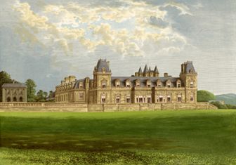
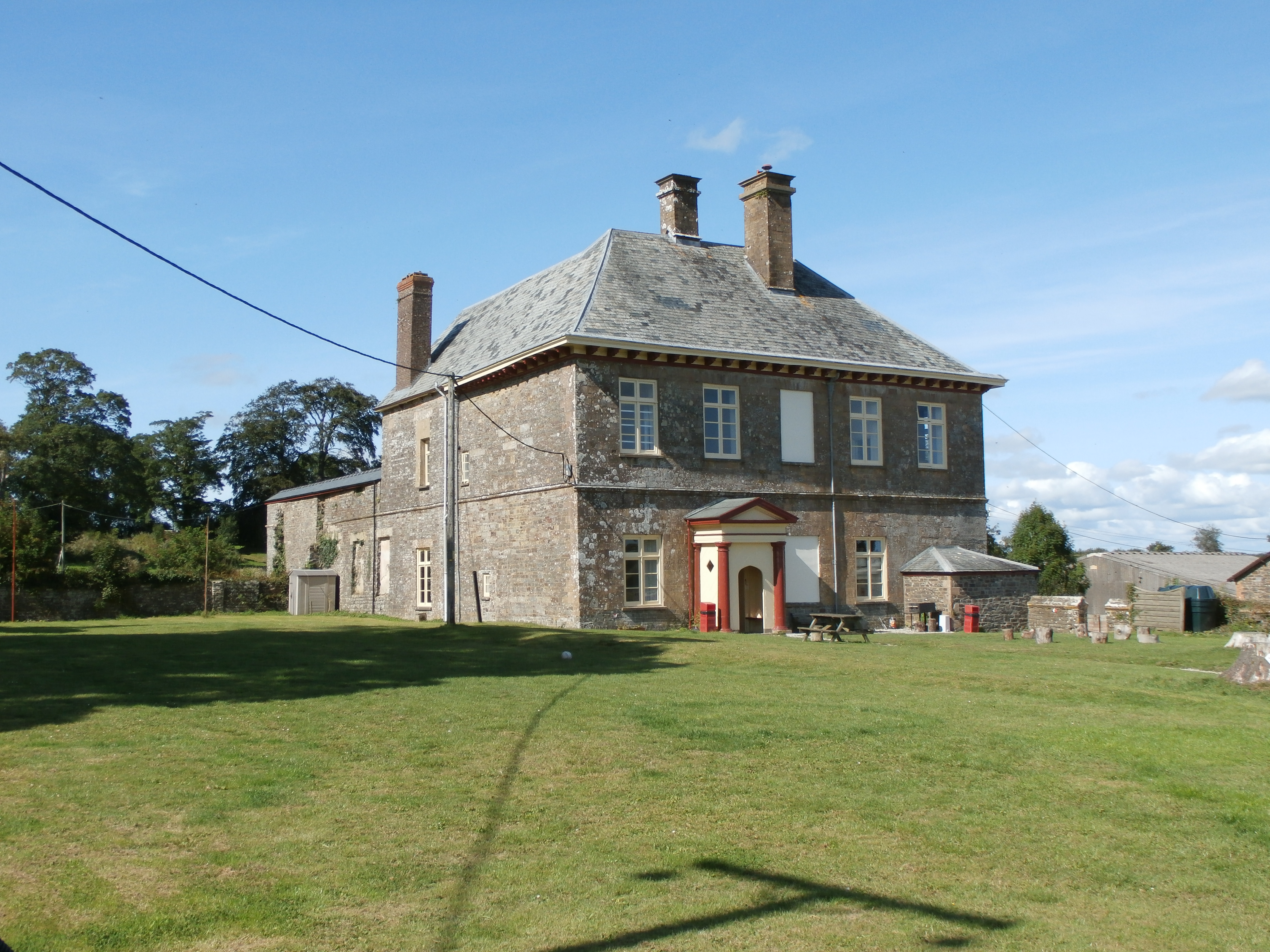
Stevenstone

Stevenstone is a former manor within the parish of St Giles in the Wood, near Great Torrington, North Devon. It was the chief seat of the Rolle family...
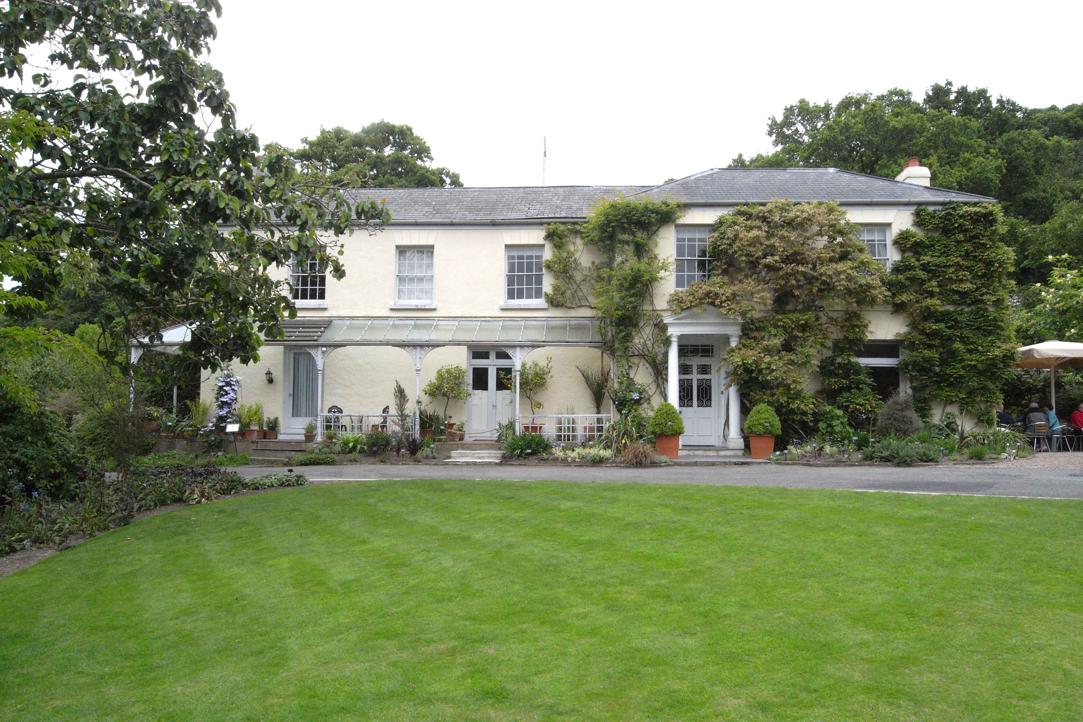
RHS Garden Rosemoor

RHS Garden Rosemoor is a public display garden run by the Royal Horticultural Society in north Devon, England. Rosemoor is about 1 mile (1.6 km) south...

Barometer World

Barometer World was the world's only barometer museum, and was located in the village of Merton, near Great Torrington, Devon, England. Barometer World...

Have you been to Longmarsh Plantation?

Leave your review of Longmarsh Plantation below (or comments, questions and feedback).