Chequerfield

Settlement in Yorkshire

England

Chequerfield

Old guidestone This Grade II Listed guidestone which was pushed over in 2016 has now been set upright, fortunately suffering no damage.   It is at a gateless field entrance and a nearby hedge has been removed so that it is easily seen.  It is at the junction of Moor Lane and Hardwick Road which may have been an old route from The Great North Road towards Wakefield.  Faint inscribed legends partially legible on three faces are Doncaster, Pontefract Road and Hardwick.  Listing - 1313231.
Old guidestone Credit: Chris Minto

Chequerfield is a small and picturesque village located in the county of Yorkshire, England. Situated approximately 3 miles east of Pontefract, Chequerfield is well-known for its charming rural setting and close-knit community.

The village is surrounded by stunning countryside, with rolling hills and lush green fields providing a picturesque backdrop. The area is a haven for nature lovers and outdoor enthusiasts, with numerous walking and cycling routes available to explore the natural beauty of Yorkshire.

Chequerfield itself offers a range of amenities to its residents. The village has a primary school, providing education for the local children, as well as a community center that hosts various activities and events throughout the year. There are also a few local shops and pubs, offering convenience to the residents.

One of the notable features of Chequerfield is its close proximity to Pontefract Racecourse, a renowned horse racing venue. The racecourse attracts visitors from far and wide, adding a touch of excitement and vibrancy to the area on race days.

Transport links in Chequerfield are excellent, with easy access to the A1(M) motorway, which connects the village to major cities such as Leeds, Sheffield, and York. The nearby Pontefract Monkhill railway station provides regular train services to destinations across the region.

Overall, Chequerfield offers a peaceful and idyllic retreat for those seeking a rural lifestyle, while still providing easy access to the amenities and attractions of nearby towns and cities.

If you have any feedback on the listing, please let us know in the comments section below.
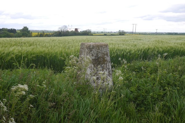
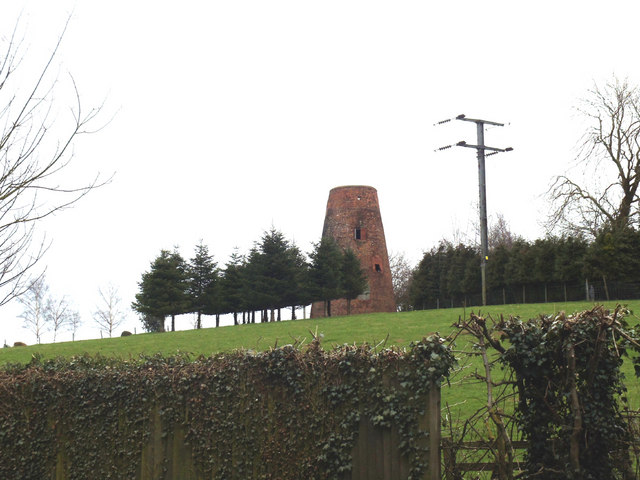
Chequerfield Images

Images are sourced within 2km of 53.683822/-1.294391 or Grid Reference SE4621. Thanks to Geograph Open Source API. All images are credited.

Old guidestone This Grade II Listed guidestone which was pushed over in 2016 has now been set upright, fortunately suffering no damage.   It is at a gateless field entrance and a nearby hedge has been removed so that it is easily seen.  It is at the junction of Moor Lane and Hardwick Road which may have been an old route from The Great North Road towards Wakefield.  Faint inscribed legends partially legible on three faces are Doncaster, Pontefract Road and Hardwick.  Listing - 1313231.
Old guidestone
This Grade II Listed guidestone which was pushed over in 2016 has now been set upright, fortunately suffering no damage. It is at a gateless field entrance and a nearby hedge has been removed so that it is easily seen. It is at the junction of Moor Lane and Hardwick Road which may have been an old route from The Great North Road towards Wakefield. Faint inscribed legends partially legible on three faces are Doncaster, Pontefract Road and Hardwick. Listing - 1313231.
Old guidestone A view of the other two faces of the re-erected guidestone.   It has suffered slight damage during resetting upright but that will weather in time.   Hardwick Road is to the left.
Old guidestone
A view of the other two faces of the re-erected guidestone. It has suffered slight damage during resetting upright but that will weather in time. Hardwick Road is to the left.
Old milestone The late 19C West Riding CC milestone on the A639, Hardwick Road, Carleton.  The original attached casting was stolen before August 2007.   Did the thief paint on the crossed swords?   But the 7 is a mystery.  It is not a mileage that can be accounted for looking at the other milestones on this road.  Without its metal attachment this shows how the stone was worked for its fixing in 4 places.   There are 6 of these milestones between Barnsdale Bar and Pontefract with just one remaining north of the town towards Leeds.  Grade II listed 1313284
Old milestone
The late 19C West Riding CC milestone on the A639, Hardwick Road, Carleton. The original attached casting was stolen before August 2007. Did the thief paint on the crossed swords? But the 7 is a mystery. It is not a mileage that can be accounted for looking at the other milestones on this road. Without its metal attachment this shows how the stone was worked for its fixing in 4 places. There are 6 of these milestones between Barnsdale Bar and Pontefract with just one remaining north of the town towards Leeds. Grade II listed 1313284
Looking towards Carleton Much of the village sits on a low ridge.
Looking towards Carleton
Much of the village sits on a low ridge.
Field of oilseed rape Carleton and Pontefract in the distance on the right.
Field of oilseed rape
Carleton and Pontefract in the distance on the right.
Magnesian limestone ridge A belt of magnesian limestone lies to the east of the Pennines. 
Between Darrington and Wentbridge it forms a narrow easily identified ridge.
Magnesian limestone ridge
A belt of magnesian limestone lies to the east of the Pennines. Between Darrington and Wentbridge it forms a narrow easily identified ridge.
Oilseed rape near Carleton In flower by Pontefract.
Oilseed rape near Carleton
In flower by Pontefract.
Hardwick Road No hedge on one side, long term arable.
Hardwick Road
No hedge on one side, long term arable.
Barley above Moor Lane I'm definitely heading southwards, first ears that I have seen this year.
Barley above Moor Lane
I'm definitely heading southwards, first ears that I have seen this year.
Triangulation pillar, Darrington View towards Darrington windmill and the Ferrybridge cooling towers.
Triangulation pillar, Darrington
View towards Darrington windmill and the Ferrybridge cooling towers.
Old windmill on the right, juxtaposed with new wind turbine on the left! On the photo's right, you have the disused Darrington windmill.  Forced perspective makes it appear the wind turbine is close by.  In fact, it is a long way off!  Autumn colours are just starting to appear. The photo was taken from Ackworth Road, just entering Pontefract.
Old windmill on the right, juxtaposed with new wind turbine on the left!
On the photo's right, you have the disused Darrington windmill. Forced perspective makes it appear the wind turbine is close by. In fact, it is a long way off! Autumn colours are just starting to appear. The photo was taken from Ackworth Road, just entering Pontefract.
Old Milestone, A639, Hardwick Road, Carleton 110m N of junction with Moor Lane, just S of railway bridge. Located on the East side of road, on verge at side of open field. Stone post (plate lost), WR casting design, erected by Barnsdale & Leeds turnpike trust, 19th century.    Alternative view see <a title="https://www.geograph.org.uk/photo/2738094" href="https://www.geograph.org.uk/photo/2738094">Link</a>
 
Inscription reads: (DONCASTER / 13 MILES) // (BOROUGHBRIDGE / 31 MILES / WETHERBY / 18¾ MILES / LEEDS / 14½ MILES / ABERFORD / 11½ MILES / PONTEFRACT / 1¼ MILES) // (BARNSDALE & LEEDS / ROAD / CARLETON)   

Grade II listed by Historic England.   see <span class="nowrap"><a title="https://historicengland.org.uk/listing/the-list/list-entry/1313284" rel="nofollow ugc noopener" href="https://historicengland.org.uk/listing/the-list/list-entry/1313284">Link</a><img style="margin-left:2px;" alt="External link" title="External link - shift click to open in new window" src="https://s1.geograph.org.uk/img/external.png" width="10" height="10"/></span>  

Milestone Society National ID: YW_DNLE13
Old Milestone, A639, Hardwick Road, Carleton
110m N of junction with Moor Lane, just S of railway bridge. Located on the East side of road, on verge at side of open field. Stone post (plate lost), WR casting design, erected by Barnsdale & Leeds turnpike trust, 19th century. Alternative view see Link Inscription reads: (DONCASTER / 13 MILES) // (BOROUGHBRIDGE / 31 MILES / WETHERBY / 18¾ MILES / LEEDS / 14½ MILES / ABERFORD / 11½ MILES / PONTEFRACT / 1¼ MILES) // (BARNSDALE & LEEDS / ROAD / CARLETON) Grade II listed by Historic England. see LinkExternal link Milestone Society National ID: YW_DNLE13
Old Guide stone, Hardwick Road At the junction with Moor Lane. Located on the South side of road, field entrance, no gate. Carved stone post, 18th/19th century.   
 
Inscription reads: Doncast(er) - east face // (P)on(tefr)a(ct) / Road - north face // Hardwic / k - south face   

Grade II listed by Historic England.   See <span class="nowrap"><a title="https://historicengland.org.uk/listing/the-list/list-entry/1313231" rel="nofollow ugc noopener" href="https://historicengland.org.uk/listing/the-list/list-entry/1313231">Link</a><img style="margin-left:2px;" alt="External link" title="External link - shift click to open in new window" src="https://s1.geograph.org.uk/img/external.png" width="10" height="10"/></span>  

Milestone Society National ID: YW_XDAR
Old Guide stone, Hardwick Road
At the junction with Moor Lane. Located on the South side of road, field entrance, no gate. Carved stone post, 18th/19th century. Inscription reads: Doncast(er) - east face // (P)on(tefr)a(ct) / Road - north face // Hardwic / k - south face Grade II listed by Historic England. See LinkExternal link Milestone Society National ID: YW_XDAR
Old guidestone At the junction of Moor Lane and Hardwick Road in Darrington parish.  This guidestone was pushed over in 2016, maybe by a large farm vehicle accessing the field.  The stone had not been broken.  This was reported to Darrington Parish Council as the stone is Grade II listed.  Checked November 2019 - no action taken yet.  The weathered legends are: east face - Doncast(er),  north face -(P)on(tefr)a(ct)/Road, south face - Hardwic/k
Old guidestone
At the junction of Moor Lane and Hardwick Road in Darrington parish. This guidestone was pushed over in 2016, maybe by a large farm vehicle accessing the field. The stone had not been broken. This was reported to Darrington Parish Council as the stone is Grade II listed. Checked November 2019 - no action taken yet. The weathered legends are: east face - Doncast(er), north face -(P)on(tefr)a(ct)/Road, south face - Hardwic/k
Old guidestone A view of the stone at the corner of Hardwick Road from Moor Lane in Darrington parish in 2016 when it was reported that it had been knocked over.
Old guidestone
A view of the stone at the corner of Hardwick Road from Moor Lane in Darrington parish in 2016 when it was reported that it had been knocked over.
Haverlands Farm
Haverlands Farm
Darrington Windmill
Darrington Windmill
Unofficial footpath from Carleton High School This well trodden path, although not officially a public footpath, has been used for years by children going to and from Carleton High school, as well as walkers, using it as a shortcut.
Unofficial footpath from Carleton High School
This well trodden path, although not officially a public footpath, has been used for years by children going to and from Carleton High school, as well as walkers, using it as a shortcut.
Show me another place!

Chequerfield is located at Grid Ref: SE4621 (Lat: 53.683822, Lng: -1.294391)

Division: West Riding

Unitary Authority: Wakefield

Police Authority: West Yorkshire

What 3 Words

///wounds.forces.splash. Near Pontefract, West Yorkshire

Related Wikis

Carleton, West Yorkshire

Carleton is a small village on the southern outskirts of Pontefract in West Yorkshire, England. The village is home to the parish church of St Michael...

Carleton High School

Carleton High School is a coeducational secondary school with academy status, at Carleton in Pontefract, West Yorkshire, England. It is a part of the Pontefract...

Pontefract Baghill railway station

Pontefract Baghill railway station is one of the three railway stations that serves the town of Pontefract, West Yorkshire, England. The other stations...

Pontefract Hospital

Pontefract Hospital is an acute District General Hospital in Pontefract, West Yorkshire operated by the Mid Yorkshire Teaching NHS Trust. The hospital...

Related Videos

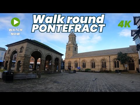
PONTEFRACT - A walking tour of Ponte in 4k - January 2024

Come with me as I walk round Pontefract Town Centre, filming in 4k. Filmed in January 2024, I walk around looking at the different ...

The Secret Tunnel Of Pontefract Castle | What's Inside?

Join us for an explore of Pontefract Castle, England's Most Fearsome Fort. We show you around the Castle Grounds, exploring all ...

Pontefract Castle - a wander around…

A wander around Pontefract Castle, with @ShadowTorStudios #oldtown #pontefract #castle #magic #oldcastle #tunnels ...

Traditional Plough Point Tarp Setup 3.5x3.5

I know this is slowly turning into a tarp channel but we're nearly done with the various setups & we'll move onto something ...

Nearby Amenities

Located within 500m of 53.683822,-1.294391
Bus Stop
Chequerfield Lane School Road
Bus: yes
Local Ref: 45018330
Naptan AtcoCode: 450018330
Naptan Bearing: SW
Naptan CommonName: Chequerfield Lane School Road
Naptan Crossing: School Road
Naptan Indicator: Stop 45018330
Naptan PlusbusZoneRef: LEEDS
Naptan ShortCommonName: School Road
Naptan Street: Chequerfield Lane
Naptan Verified: no
Public Transport: platform
Source: naptan_import
Lat/Long: 53.6881467/-1.2938164
Bus Stop
Chequerfield Road Church
Bus: yes
Local Ref: 45018331
Naptan AtcoCode: 450018331
Naptan Bearing: E
Naptan CommonName: Chequerfield Road Church
Naptan Crossing: West Drive
Naptan Indicator: Stop 45018331
Naptan Landmark: Church
Naptan PlusbusZoneRef: LEEDS
Naptan ShortCommonName: Chequerfield Church
Naptan Street: Chequerfield Road
Naptan Verified: no
Public Transport: platform
Source: naptan_import
Lat/Long: 53.6847022/-1.2992969
Bus Stop
The Circle Mountment Mews
Bus: yes
Departures Board: timetable
Local Ref: 45018332
Naptan AtcoCode: 450018332
Naptan Bearing: W
Naptan CommonName: Chequerfield Centre
Naptan Crossing: West Drive
Naptan Indicator: Stop 45018332
Naptan Landmark: Monument Mews
Naptan PlusbusZoneRef: LEEDS
Naptan ShortCommonName: Chequerfield Centre
Naptan Street: The Circle
Naptan Verified: no
Old Name: Chequerfield Centre
Public Transport: platform
Shelter: no
Source: naptan_import
Lat/Long: 53.6853553/-1.2987228
Bus Stop
East Drive School Road
Bus: yes
Local Ref: 45018333
Naptan AtcoCode: 450018333
Naptan Bearing: NE
Naptan CommonName: East Drive School Road
Naptan Crossing: Nr-At School Road
Naptan Indicator: Stop 45018333
Naptan PlusbusZoneRef: LEEDS
Naptan ShortCommonName: Kings Crescent
Naptan Street: East Drive
Naptan Verified: no
Public Transport: platform
Source: naptan_import
Lat/Long: 53.6870712/-1.2958786
Bus Stop
East Drive Kings Crescent
Bus: yes
Local Ref: 45018334
Naptan AtcoCode: 450018334
Naptan Bearing: SW
Naptan CommonName: East Drive Kings Crescent
Naptan Crossing: Kings Crescent
Naptan Indicator: Stop 45018334
Naptan PlusbusZoneRef: LEEDS
Naptan ShortCommonName: Kings Crescent
Naptan Street: East Drive
Naptan Verified: no
Public Transport: platform
Source: naptan_import
Lat/Long: 53.6865015/-1.2966969
Barrier: bollard
Lat/Long: 53.6828505/-1.2996375
Post Box
Brand: Royal Mail
Brand Wikidata: Q638098
Brand Wikipedia: en:Royal Mail
Operator: Royal Mail
Operator Wikidata: Q638098
Post Box Type: pillar
Ref: WF8 14
Lat/Long: 53.6854624/-1.2991062
Post Box
Brand: Royal Mail
Brand Wikidata: Q638098
Operator: Royal Mail
Operator Wikidata: Q638098
Post Box Mounting: brick_pillar
Post Box Type: wall
Ref: WF8 402
Royal Cypher: EIIR
Lat/Long: 53.6873776/-1.2943372
Fast Food
Pizza And Kebab House
Addr City: Pontefract
Addr Housenumber: 10
Addr Postcode: WF8 2AY
Addr Street: The Circle
Addr Town: Pontefract
Cuisine: pizza;kebab
Fhrs Id: 957080
Takeaway: yes
Lat/Long: 53.6852786/-1.2989142
Horners
Addr City: Pontefract
Addr Housenumber: 11
Addr Postcode: WF8 2AY
Addr Street: The Circle
Addr Town: Pontefract
Fhrs Id: 426572
Shop: bakery
Lat/Long: 53.6853262/-1.2990594
Fast Food
Atlantic Fish Bar
Addr City: Pontefract
Addr Housenumber: 8
Addr Postcode: WF8 2AY
Addr Street: The Circle
Addr Town: Pontefract
Cuisine: fish_and_chips
Fhrs Id: 869585
Takeaway: yes
Lat/Long: 53.6852331/-1.2986982
Addr City: Pontefract
Addr Housenumber: 7
Addr Postcode: WF8 2AY
Addr Street: The Circle
Addr Town: Pontefract
Old Name: Costless
Lat/Long: 53.6852125/-1.2985563
Restaurant
Masala Room
Addr City: Pontefract
Addr Housenumber: 3
Addr Postcode: WF8 2AY
Addr Street: The Circle
Addr Town: Pontefract
Cuisine: indian
Fhrs Id: 1126655
Lat/Long: 53.6852171/-1.2982187
Social Facility
Pontefract & District Live at Home
Addr City: Pontefract
Addr Housenumber: 21a
Addr Postcode: WF8 2BX
Addr Street: Moverley Flatts
Addr Town: Pontefract
Fhrs Id: 1099086
Social Facility: assisted_living
Social Facility For: senior
Lat/Long: 53.6833951/-1.3010283
Pharmacy
Chequerfield Pharmacy
Addr City: Pontefract
Addr Housenumber: 1
Addr Postcode: WF8 2AY
Addr Street: The Circle
Delivery: yes
Dispensing: yes
Drive Through: no
Healthcare: pharmacy
Lat/Long: 53.6852445/-1.2980663
Old Name: Betfred
Shop: vacant
Lat/Long: 53.6852114/-1.2983427
Social Facility
St Giles' Food Share and Pantry Club
Addr City: Pontefract
Addr Housenumber: 6-6a
Addr Postcode: WF8 2AY
Addr Street: The Circle
Fhrs Id: 1288585
Social Facility: food_bank
Social Facility For: community
Lat/Long: 53.6852107/-1.2984409
Best Cuts
Addr City: Pontefract
Addr Housenumber: 9
Addr Postcode: WF8 2AY
Addr Street: The Circle
Addr Town: Pontefract
Shop: hairdresser
Lat/Long: 53.685252/-1.2987941
Public Bookcase
St Mary's Little Library
Addr City: Pontefract
Addr Postcode: WF8 2AY
Addr Street: The Circle
Lat/Long: 53.6863578/-1.297672
Kreations by Kaz
Addr City: Pontefract
Addr Postcode: WF8 2AY
Addr Street: The Circle
Shop: craft
Lat/Long: 53.6853827/-1.2991708
Generator Method: photovoltaic
Generator Output Electricity: yes
Generator Source: solar
Generator Type: solar_photovoltaic_panel
Location: roof
Power: generator
Lat/Long: 53.6870978/-1.2909848
Generator Method: photovoltaic
Generator Output Electricity: yes
Generator Source: solar
Generator Type: solar_photovoltaic_panel
Location: roof
Power: generator
Lat/Long: 53.6867706/-1.2923875
Generator Method: photovoltaic
Generator Output Electricity: yes
Generator Source: solar
Generator Type: solar_photovoltaic_panel
Location: roof
Power: generator
Lat/Long: 53.6861146/-1.292814
Generator Method: photovoltaic
Generator Output Electricity: yes
Generator Source: solar
Generator Type: solar_photovoltaic_panel
Location: roof
Power: generator
Lat/Long: 53.6854935/-1.2925726
Generator Method: photovoltaic
Generator Output Electricity: yes
Generator Source: solar
Generator Type: solar_photovoltaic_panel
Location: roof
Power: generator
Lat/Long: 53.6856095/-1.292409
Generator Method: photovoltaic
Generator Output Electricity: yes
Generator Source: solar
Generator Type: solar_photovoltaic_panel
Location: roof
Power: generator
Lat/Long: 53.6856571/-1.292928
Generator Method: photovoltaic
Generator Output Electricity: yes
Generator Source: solar
Generator Type: solar_photovoltaic_panel
Location: roof
Power: generator
Lat/Long: 53.6856857/-1.2929079
Generator Method: photovoltaic
Generator Output Electricity: yes
Generator Source: solar
Generator Type: solar_photovoltaic_panel
Location: roof
Power: generator
Lat/Long: 53.6855443/-1.2946326
Generator Method: photovoltaic
Generator Output Electricity: yes
Generator Source: solar
Generator Type: solar_photovoltaic_panel
Location: roof
Power: generator
Lat/Long: 53.685862/-1.2954399
Generator Method: photovoltaic
Generator Output Electricity: yes
Generator Source: solar
Generator Type: solar_photovoltaic_panel
Location: roof
Power: generator
Lat/Long: 53.686437/-1.2948874
Generator Method: photovoltaic
Generator Output Electricity: yes
Generator Source: solar
Generator Type: solar_photovoltaic_panel
Location: roof
Power: generator
Lat/Long: 53.6864084/-1.2948391
Generator Method: photovoltaic
Generator Output Electricity: yes
Generator Source: solar
Generator Type: solar_photovoltaic_panel
Location: roof
Power: generator
Lat/Long: 53.6878396/-1.2965021
Generator Method: photovoltaic
Generator Output Electricity: yes
Generator Source: solar
Generator Type: solar_photovoltaic_panel
Location: roof
Power: generator
Lat/Long: 53.6878539/-1.2965584
Generator Method: photovoltaic
Generator Output Electricity: yes
Generator Source: solar
Generator Type: solar_photovoltaic_panel
Location: roof
Power: generator
Lat/Long: 53.6879269/-1.2961882
Generator Method: photovoltaic
Generator Output Electricity: yes
Generator Source: solar
Generator Type: solar_photovoltaic_panel
Location: roof
Power: generator
Lat/Long: 53.6864227/-1.2995893
Generator Method: photovoltaic
Generator Output Electricity: yes
Generator Source: solar
Generator Type: solar_photovoltaic_panel
Location: roof
Power: generator
Lat/Long: 53.6855205/-1.2974918
Generator Method: photovoltaic
Generator Output Electricity: yes
Generator Source: solar
Generator Type: solar_photovoltaic_panel
Location: roof
Power: generator
Lat/Long: 53.6855189/-1.2974274
Generator Method: photovoltaic
Generator Output Electricity: yes
Generator Source: solar
Generator Type: solar_photovoltaic_panel
Location: roof
Power: generator
Lat/Long: 53.6852012/-1.2972316
Generator Method: photovoltaic
Generator Output Electricity: yes
Generator Source: solar
Generator Type: solar_photovoltaic_panel
Location: roof
Power: generator
Lat/Long: 53.6851679/-1.297178
Generator Method: photovoltaic
Generator Output Electricity: yes
Generator Source: solar
Generator Type: solar_photovoltaic_panel
Location: roof
Power: generator
Lat/Long: 53.6815873/-1.2983823
Generator Method: photovoltaic
Generator Output Electricity: yes
Generator Source: solar
Generator Type: solar_photovoltaic_panel
Location: roof
Power: generator
Lat/Long: 53.6816191/-1.2989375
Generator Method: photovoltaic
Generator Output Electricity: yes
Generator Source: solar
Generator Type: solar_photovoltaic_panel
Location: roof
Power: generator
Lat/Long: 53.6826056/-1.299533
Generator Method: photovoltaic
Generator Output Electricity: yes
Generator Source: solar
Generator Type: solar_photovoltaic_panel
Location: roof
Power: generator
Lat/Long: 53.6833093/-1.299549
Generator Method: photovoltaic
Generator Output Electricity: yes
Generator Source: solar
Generator Type: solar_photovoltaic_panel
Location: roof
Power: generator
Lat/Long: 53.6835492/-1.2983635
Generator Method: photovoltaic
Generator Output Electricity: yes
Generator Source: solar
Generator Type: solar_photovoltaic_panel
Location: roof
Power: generator
Lat/Long: 53.6840226/-1.2950376
Generator Method: photovoltaic
Generator Output Electricity: yes
Generator Source: solar
Generator Type: solar_photovoltaic_panel
Location: roof
Power: generator
Lat/Long: 53.6840607/-1.2958932
The data included in this document is from www.openstreetmap.org. The data is made available under ODbL.

Have you been to Chequerfield?

Leave your review of Chequerfield below (or comments, questions and feedback).