Grove Town

Settlement in Yorkshire

England

Grove Town

Old guidestone This Grade II Listed guidestone which was pushed over in 2016 has now been set upright, fortunately suffering no damage.   It is at a gateless field entrance and a nearby hedge has been removed so that it is easily seen.  It is at the junction of Moor Lane and Hardwick Road which may have been an old route from The Great North Road towards Wakefield.  Faint inscribed legends partially legible on three faces are Doncaster, Pontefract Road and Hardwick.  Listing - 1313231.
Old guidestone Credit: Chris Minto

Grove Town is a charming village located in the picturesque region of Yorkshire, England. Situated amidst the rolling hills and lush greenery, it offers a tranquil and idyllic setting for residents and visitors alike. With a population of approximately 2,500, the village exudes a close-knit community feel and a strong sense of pride in its heritage.

The architecture of Grove Town is predominantly Georgian, with well-preserved buildings lining its quaint streets. The village center features a variety of local shops, boutiques, and cafes, where residents can indulge in a range of amenities and services. A weekly market held in the town square adds a lively and bustling atmosphere to the village.

Nature enthusiasts will find themselves in awe of Grove Town's surrounding countryside. The village is surrounded by vast expanses of rolling hills, offering ample opportunities for outdoor activities such as hiking, cycling, and horseback riding. The nearby Grove Wood is a popular spot for nature walks, with its dense foliage and tranquil atmosphere.

Grove Town is also known for its rich history and cultural heritage. The village boasts a medieval church, St. Mary's, which dates back to the 12th century. The church's stunning stained glass windows and intricate stone carvings make it a must-visit for history enthusiasts.

Overall, Grove Town is a picturesque and welcoming village that combines natural beauty, a strong sense of community, and a rich historical tapestry. It is a hidden gem in Yorkshire, offering a peaceful retreat from the hustle and bustle of city life.

If you have any feedback on the listing, please let us know in the comments section below.
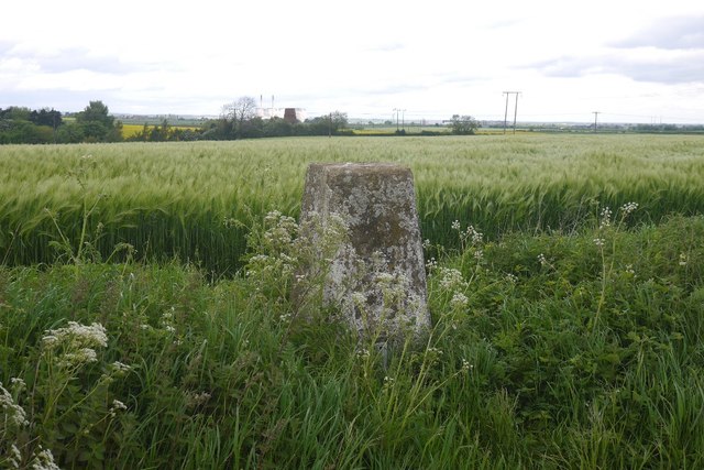
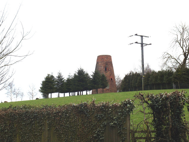
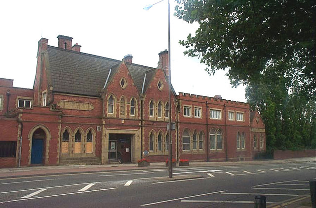
Grove Town Images

Images are sourced within 2km of 53.683441/-1.3050061 or Grid Reference SE4621. Thanks to Geograph Open Source API. All images are credited.

Old guidestone This Grade II Listed guidestone which was pushed over in 2016 has now been set upright, fortunately suffering no damage.   It is at a gateless field entrance and a nearby hedge has been removed so that it is easily seen.  It is at the junction of Moor Lane and Hardwick Road which may have been an old route from The Great North Road towards Wakefield.  Faint inscribed legends partially legible on three faces are Doncaster, Pontefract Road and Hardwick.  Listing - 1313231.
Old guidestone
This Grade II Listed guidestone which was pushed over in 2016 has now been set upright, fortunately suffering no damage. It is at a gateless field entrance and a nearby hedge has been removed so that it is easily seen. It is at the junction of Moor Lane and Hardwick Road which may have been an old route from The Great North Road towards Wakefield. Faint inscribed legends partially legible on three faces are Doncaster, Pontefract Road and Hardwick. Listing - 1313231.
Old guidestone A view of the other two faces of the re-erected guidestone.   It has suffered slight damage during resetting upright but that will weather in time.   Hardwick Road is to the left.
Old guidestone
A view of the other two faces of the re-erected guidestone. It has suffered slight damage during resetting upright but that will weather in time. Hardwick Road is to the left.
Old milestone The late 19C West Riding CC milestone on the A639, Hardwick Road, Carleton.  The original attached casting was stolen before August 2007.   Did the thief paint on the crossed swords?   But the 7 is a mystery.  It is not a mileage that can be accounted for looking at the other milestones on this road.  Without its metal attachment this shows how the stone was worked for its fixing in 4 places.   There are 6 of these milestones between Barnsdale Bar and Pontefract with just one remaining north of the town towards Leeds.  Grade II listed 1313284
Old milestone
The late 19C West Riding CC milestone on the A639, Hardwick Road, Carleton. The original attached casting was stolen before August 2007. Did the thief paint on the crossed swords? But the 7 is a mystery. It is not a mileage that can be accounted for looking at the other milestones on this road. Without its metal attachment this shows how the stone was worked for its fixing in 4 places. There are 6 of these milestones between Barnsdale Bar and Pontefract with just one remaining north of the town towards Leeds. Grade II listed 1313284
Looking towards Carleton Much of the village sits on a low ridge.
Looking towards Carleton
Much of the village sits on a low ridge.
Oilseed rape near Carleton In flower by Pontefract.
Oilseed rape near Carleton
In flower by Pontefract.
Hardwick Road No hedge on one side, long term arable.
Hardwick Road
No hedge on one side, long term arable.
Barley above Moor Lane I'm definitely heading southwards, first ears that I have seen this year.
Barley above Moor Lane
I'm definitely heading southwards, first ears that I have seen this year.
Triangulation pillar, Darrington View towards Darrington windmill and the Ferrybridge cooling towers.
Triangulation pillar, Darrington
View towards Darrington windmill and the Ferrybridge cooling towers.
Old windmill on the right, juxtaposed with new wind turbine on the left! On the photo's right, you have the disused Darrington windmill.  Forced perspective makes it appear the wind turbine is close by.  In fact, it is a long way off!  Autumn colours are just starting to appear. The photo was taken from Ackworth Road, just entering Pontefract.
Old windmill on the right, juxtaposed with new wind turbine on the left!
On the photo's right, you have the disused Darrington windmill. Forced perspective makes it appear the wind turbine is close by. In fact, it is a long way off! Autumn colours are just starting to appear. The photo was taken from Ackworth Road, just entering Pontefract.
Old Milestone, A639, Hardwick Road, Carleton 110m N of junction with Moor Lane, just S of railway bridge. Located on the East side of road, on verge at side of open field. Stone post (plate lost), WR casting design, erected by Barnsdale & Leeds turnpike trust, 19th century.    Alternative view see <a title="https://www.geograph.org.uk/photo/2738094" href="https://www.geograph.org.uk/photo/2738094">Link</a>
 
Inscription reads: (DONCASTER / 13 MILES) // (BOROUGHBRIDGE / 31 MILES / WETHERBY / 18¾ MILES / LEEDS / 14½ MILES / ABERFORD / 11½ MILES / PONTEFRACT / 1¼ MILES) // (BARNSDALE & LEEDS / ROAD / CARLETON)   

Grade II listed by Historic England.   see <span class="nowrap"><a title="https://historicengland.org.uk/listing/the-list/list-entry/1313284" rel="nofollow ugc noopener" href="https://historicengland.org.uk/listing/the-list/list-entry/1313284">Link</a><img style="margin-left:2px;" alt="External link" title="External link - shift click to open in new window" src="https://s1.geograph.org.uk/img/external.png" width="10" height="10"/></span>  

Milestone Society National ID: YW_DNLE13
Old Milestone, A639, Hardwick Road, Carleton
110m N of junction with Moor Lane, just S of railway bridge. Located on the East side of road, on verge at side of open field. Stone post (plate lost), WR casting design, erected by Barnsdale & Leeds turnpike trust, 19th century. Alternative view see Link Inscription reads: (DONCASTER / 13 MILES) // (BOROUGHBRIDGE / 31 MILES / WETHERBY / 18¾ MILES / LEEDS / 14½ MILES / ABERFORD / 11½ MILES / PONTEFRACT / 1¼ MILES) // (BARNSDALE & LEEDS / ROAD / CARLETON) Grade II listed by Historic England. see LinkExternal link Milestone Society National ID: YW_DNLE13
Old Guide stone, Hardwick Road At the junction with Moor Lane. Located on the South side of road, field entrance, no gate. Carved stone post, 18th/19th century.   
 
Inscription reads: Doncast(er) - east face // (P)on(tefr)a(ct) / Road - north face // Hardwic / k - south face   

Grade II listed by Historic England.   See <span class="nowrap"><a title="https://historicengland.org.uk/listing/the-list/list-entry/1313231" rel="nofollow ugc noopener" href="https://historicengland.org.uk/listing/the-list/list-entry/1313231">Link</a><img style="margin-left:2px;" alt="External link" title="External link - shift click to open in new window" src="https://s1.geograph.org.uk/img/external.png" width="10" height="10"/></span>  

Milestone Society National ID: YW_XDAR
Old Guide stone, Hardwick Road
At the junction with Moor Lane. Located on the South side of road, field entrance, no gate. Carved stone post, 18th/19th century. Inscription reads: Doncast(er) - east face // (P)on(tefr)a(ct) / Road - north face // Hardwic / k - south face Grade II listed by Historic England. See LinkExternal link Milestone Society National ID: YW_XDAR
Old guidestone At the junction of Moor Lane and Hardwick Road in Darrington parish.  This guidestone was pushed over in 2016, maybe by a large farm vehicle accessing the field.  The stone had not been broken.  This was reported to Darrington Parish Council as the stone is Grade II listed.  Checked November 2019 - no action taken yet.  The weathered legends are: east face - Doncast(er),  north face -(P)on(tefr)a(ct)/Road, south face - Hardwic/k
Old guidestone
At the junction of Moor Lane and Hardwick Road in Darrington parish. This guidestone was pushed over in 2016, maybe by a large farm vehicle accessing the field. The stone had not been broken. This was reported to Darrington Parish Council as the stone is Grade II listed. Checked November 2019 - no action taken yet. The weathered legends are: east face - Doncast(er), north face -(P)on(tefr)a(ct)/Road, south face - Hardwic/k
Old guidestone A view of the stone at the corner of Hardwick Road from Moor Lane in Darrington parish in 2016 when it was reported that it had been knocked over.
Old guidestone
A view of the stone at the corner of Hardwick Road from Moor Lane in Darrington parish in 2016 when it was reported that it had been knocked over.
Haverlands Farm
Haverlands Farm
Darrington Windmill
Darrington Windmill
Unofficial footpath from Carleton High School This well trodden path, although not officially a public footpath, has been used for years by children going to and from Carleton High school, as well as walkers, using it as a shortcut.
Unofficial footpath from Carleton High School
This well trodden path, although not officially a public footpath, has been used for years by children going to and from Carleton High school, as well as walkers, using it as a shortcut.
Streams Converge Two streams converge and form the Little Went.
Streams Converge
Two streams converge and form the Little Went.
Public Footpath This is the public footpath from the sewage works to Moor Lane.
Public Footpath
This is the public footpath from the sewage works to Moor Lane.
Show me another place!

Grove Town is located at Grid Ref: SE4621 (Lat: 53.683441, Lng: -1.3050061)

Division: West Riding

Unitary Authority: Wakefield

Police Authority: West Yorkshire

What 3 Words

///duke.posed.fears. Near Pontefract, West Yorkshire

Related Wikis

Pontefract Friary

St Richard's Friary, also known as Pontefract Friary, was a Dominican friary in Pontefract, West Yorkshire, England. It was located near today's Pontefract...

Carleton High School

Carleton High School is a coeducational secondary school with academy status, at Carleton in Pontefract, West Yorkshire, England. It is a part of the Pontefract...

Pontefract Hospital

Pontefract Hospital is an acute District General Hospital in Pontefract, West Yorkshire operated by the Mid Yorkshire Teaching NHS Trust. The hospital...

Pontefract Hermitage

Pontefract Hermitage is a medieval hermitage situated below the old Southgate entrance to the General Infirmary in Pontefract, West Yorkshire, England...

Related Videos

PONTEFRACT - A walking tour of Ponte in 4k - January 2024

Come with me as I walk round Pontefract Town Centre, filming in 4k. Filmed in January 2024, I walk around looking at the different ...

The Secret Tunnel Of Pontefract Castle | What's Inside?

Join us for an explore of Pontefract Castle, England's Most Fearsome Fort. We show you around the Castle Grounds, exploring all ...

Pontefract Castle - a wander around…

A wander around Pontefract Castle, with @ShadowTorStudios #oldtown #pontefract #castle #magic #oldcastle #tunnels ...

Pontefract, West Yorkshire | Town Centre Walk 2020

King Edward I once said that 'he who holds Pontefract, holds the key to the North'. That alone is evidence of how historic a town ...

Nearby Amenities

Located within 500m of 53.683441,-1.3050061
Bus Stop
Carleton Road Chestnut Grove
Bus: yes
Local Ref: 45016396
Naptan AtcoCode: 450016396
Naptan Bearing: NW
Naptan CommonName: Carleton Road Chestnut Grove
Naptan Crossing: Chestnut Grove
Naptan Indicator: Stop 45016396
Naptan PlusbusZoneRef: LEEDS
Naptan ShortCommonName: Chestnut Grove
Naptan Street: Carleton Road
Naptan Verified: no
Public Transport: platform
Source: naptan_import
Lat/Long: 53.6809664/-1.3048528
Bus Stop
Chequerfield Road Church
Bus: yes
Local Ref: 45018331
Naptan AtcoCode: 450018331
Naptan Bearing: E
Naptan CommonName: Chequerfield Road Church
Naptan Crossing: West Drive
Naptan Indicator: Stop 45018331
Naptan Landmark: Church
Naptan PlusbusZoneRef: LEEDS
Naptan ShortCommonName: Chequerfield Church
Naptan Street: Chequerfield Road
Naptan Verified: no
Public Transport: platform
Source: naptan_import
Lat/Long: 53.6847022/-1.2992969
Bus Stop
The Circle Mountment Mews
Bus: yes
Departures Board: timetable
Local Ref: 45018332
Naptan AtcoCode: 450018332
Naptan Bearing: W
Naptan CommonName: Chequerfield Centre
Naptan Crossing: West Drive
Naptan Indicator: Stop 45018332
Naptan Landmark: Monument Mews
Naptan PlusbusZoneRef: LEEDS
Naptan ShortCommonName: Chequerfield Centre
Naptan Street: The Circle
Naptan Verified: no
Old Name: Chequerfield Centre
Public Transport: platform
Shelter: no
Source: naptan_import
Lat/Long: 53.6853553/-1.2987228
Bus Stop
Monument Lane Rookhill Drive
Bus: yes
Local Ref: 45018335
Naptan AtcoCode: 450018335
Naptan Bearing: NE
Naptan CommonName: Monument Lane Rookhill Drive
Naptan Crossing: Rookhill Drive
Naptan Indicator: Stop 45018335
Naptan PlusbusZoneRef: LEEDS
Naptan ShortCommonName: Church Balk
Naptan Street: Monument Lane
Naptan Verified: no
Public Transport: platform
Source: naptan_import
Lat/Long: 53.6846809/-1.3021266
Bus Stop
Monument Lane Churchbalk Lane
Bus: yes
Local Ref: 45018336
Naptan AtcoCode: 450018336
Naptan Bearing: SW
Naptan CommonName: Monument Lane Churchbalk Lane
Naptan Crossing: Churchbalk Lane
Naptan Indicator: Stop 45018336
Naptan PlusbusZoneRef: LEEDS
Naptan ShortCommonName: Churchbalk Lane
Naptan Street: Monument Lane
Naptan Verified: no
Public Transport: platform
Source: naptan_import
Lat/Long: 53.6845468/-1.3022651
Bus Stop
Carleton Glen Swanhill Lane
Bus: yes
Local Ref: 45018349
Naptan AtcoCode: 450018349
Naptan Bearing: N
Naptan CommonName: Carleton Glen Swanhill Lane
Naptan Crossing: Swanhill Lane
Naptan Indicator: Stop 45018349
Naptan PlusbusZoneRef: LEEDS
Naptan ShortCommonName: Carleton Glen
Naptan Street: Carleton Glen
Naptan Verified: no
Public Transport: platform
Source: naptan_import
Lat/Long: 53.6842624/-1.3074634
Bus Stop
Carleton Glen Swanhill Lane
Bus: yes
Local Ref: 45018350
Naptan AtcoCode: 450018350
Naptan Bearing: S
Naptan CommonName: Carleton Glen Swanhill Lane
Naptan Crossing: Swanhill Lane
Naptan Indicator: Stop 45018350
Naptan PlusbusZoneRef: LEEDS
Naptan ShortCommonName: Carleton Glen
Naptan Street: Carleton Glen
Naptan Verified: no
Public Transport: platform
Source: naptan_import
Lat/Long: 53.6841091/-1.3073751
Bus Stop
Carleton Glen Starwort Close
Bus: yes
Local Ref: 45018351
Naptan AtcoCode: 450018351
Naptan Bearing: SE
Naptan CommonName: Carleton Glen Starwort Close
Naptan Crossing: Starwort Close
Naptan Indicator: Stop 45018351
Naptan PlusbusZoneRef: LEEDS
Naptan ShortCommonName: Starwort Close
Naptan Street: Carleton Glen
Naptan Verified: no
Public Transport: platform
Source: naptan_import
Lat/Long: 53.6848648/-1.3090434
Bus Stop
Carleton Glen Starwort Close
Bus: yes
Local Ref: 45018352
Naptan AtcoCode: 450018352
Naptan Bearing: NW
Naptan CommonName: Carleton Glen Starwort Close
Naptan Crossing: Starwort Close
Naptan Indicator: Stop 45018352
Naptan PlusbusZoneRef: LEEDS
Naptan ShortCommonName: Starwort Close
Naptan Street: Carleton Glen
Naptan Verified: no
Public Transport: platform
Source: naptan_import
Lat/Long: 53.6849568/-1.3094205
Bus Stop
Carleton Glen Mayors Walk Avenue
Bus: yes
Local Ref: 45018353
Naptan AtcoCode: 450018353
Naptan Bearing: NE
Naptan CommonName: Carleton Glen Mayors Walk Avenue
Naptan Crossing: Mayors Walk Avenue
Naptan Indicator: Stop 45018353
Naptan PlusbusZoneRef: LEEDS
Naptan ShortCommonName: Bluebell Close
Naptan Street: Carleton Glen
Naptan Verified: no
Public Transport: platform
Source: naptan_import
Lat/Long: 53.6865232/-1.3082743
Bus Stop
Carleton Glen Bluebell Close
Bus: yes
Local Ref: 45018354
Naptan AtcoCode: 450018354
Naptan Bearing: SW
Naptan CommonName: Carleton Glen Bluebell Close
Naptan Indicator: Stop 45018354
Naptan PlusbusZoneRef: LEEDS
Naptan ShortCommonName: Bluebell Close
Naptan Street: Carleton Glen
Naptan Verified: no
Public Transport: platform
Source: naptan_import
Lat/Long: 53.6864504/-1.3081089
Bus Stop
Churchbalk Lane Beech Street
Bus: yes
Local Ref: 45018355
Naptan AtcoCode: 450018355
Naptan Bearing: N
Naptan CommonName: Churchbalk Lane Beech Street
Naptan Crossing: Beech Street
Naptan Indicator: Stop 45018355
Naptan ShortCommonName: Beech Street
Naptan Street: Churchbalk Lane
Naptan Verified: no
Public Transport: platform
Source: naptan_import
Lat/Long: 53.6876953/-1.3042271
Bus Stop
Churchbalk Lane Beech Street
Bus: yes
Local Ref: 45018356
Naptan AtcoCode: 450018356
Naptan Bearing: S
Naptan CommonName: Churchbalk Lane Beech Street
Naptan Crossing: Beech Street
Naptan Indicator: Stop 45018356
Naptan ShortCommonName: Beech Street
Naptan Street: Churchbalk Lane
Naptan Verified: no
Public Transport: platform
Source: naptan_import
Lat/Long: 53.6873754/-1.3040488
Bus Stop
Churchbalk Lane Grove Lea Walk
Bus: yes
Local Ref: 45018357
Naptan AtcoCode: 450018357
Naptan Bearing: S
Naptan CommonName: Churchbalk Lane Grove Lea Walk
Naptan Crossing: Grove Lea Crescent
Naptan Indicator: Stop 45018357
Naptan ShortCommonName: Grove Lea Crescent
Naptan Street: Churchbalk Lane
Naptan Verified: no
Public Transport: platform
Source: naptan_import
Lat/Long: 53.6855008/-1.3040058
Bus Stop
Carleton Park Road Ackworth Road
Bus: yes
Local Ref: 45018383
Naptan AtcoCode: 450018383
Naptan Bearing: E
Naptan CommonName: Carleton Park Road Ackworth Road
Naptan Crossing: Ackworth Road
Naptan Indicator: Stop 45018383
Naptan PlusbusZoneRef: LEEDS
Naptan ShortCommonName: Ackworth Road
Naptan Street: Carleton Park Road
Naptan Verified: no
Public Transport: platform
Source: naptan_import
Lat/Long: 53.6832398/-1.3125071
Bus Stop
Carleton Park Road Pease Close
Bus: yes
Local Ref: 45018384
Naptan AtcoCode: 450018384
Naptan Bearing: SE
Naptan CommonName: Carleton Park Road Pease Close
Naptan Crossing: Pease Close
Naptan Indicator: Stop 45018384
Naptan Landmark: Scout Hall
Naptan PlusbusZoneRef: LEEDS
Naptan ShortCommonName: Pease Close
Naptan Street: Carleton Park Road
Naptan Verified: no
Public Transport: platform
Source: naptan_import
Lat/Long: 53.6825072/-1.310157
Bus Stop
Carleton Park Road Lyon Road
Bus: yes
Local Ref: 45018385
Naptan AtcoCode: 450018385
Naptan Bearing: E
Naptan CommonName: Carleton Park Road Lyon Road
Naptan Crossing: Lyon Road
Naptan Indicator: Stop 45018385
Naptan PlusbusZoneRef: LEEDS
Naptan ShortCommonName: Lyon Road
Naptan Street: Carleton Park Road
Naptan Verified: no
Public Transport: platform
Source: naptan_import
Lat/Long: 53.6813187/-1.3082536
Bus Stop
Crest Drive Churchbalk Drive
Bus: yes
Local Ref: 45023665
Naptan AtcoCode: 450023665
Naptan Bearing: SE
Naptan CommonName: Crest Drive Churchbalk Drive
Naptan Crossing: Churchbalk Drive
Naptan Indicator: Stop 45023665
Naptan ShortCommonName: Churchbalk Drive
Naptan Street: Crest Drive
Naptan Verified: no
Public Transport: platform
Source: naptan_import
Lat/Long: 53.6814824/-1.3039207
Bus Stop
Carleton Park Road Baden Powell Crescent
Bus: yes
Local Ref: 45023761
Naptan AtcoCode: 450023761
Naptan Bearing: NW
Naptan CommonName: Carleton Park Road Baden Powell Crescent
Naptan Crossing: Baden Powell Crescent
Naptan Indicator: Stop 45023761
Naptan PlusbusZoneRef: LEEDS
Naptan ShortCommonName: Baden Powell Cres
Naptan Street: Carleton Park Road
Naptan Verified: no
Public Transport: platform
Source: naptan_import
Lat/Long: 53.6829434/-1.3109826
Bus Stop
Swanhill Lane Carleton Glen
Bus: yes
Local Ref: 45023808
Naptan AtcoCode: 450023808
Naptan Bearing: E
Naptan CommonName: Swanhill Lane Carleton Glen
Naptan Crossing: Near-at Carleton Glen
Naptan Indicator: Stop 45023808
Naptan PlusbusZoneRef: LEEDS
Naptan ShortCommonName: Grove Lea Crescent
Naptan Street: Swanhill Lane
Naptan Verified: no
Public Transport: platform
Source: naptan_import
Lat/Long: 53.6837499/-1.305882
Bus Stop
Churchbalk Lane Grove Lea Walk
Bus: yes
Naptan AtcoCode: 450029060
Naptan Bearing: N
Naptan CommonName: Churchbalk Lane Grove Lea Walk
Naptan Crossing: Grove Lea Walk
Naptan Landmark: Unknown
Naptan ShortCommonName: Chrhblk Ln
Naptan Street: Churchbalk Lane
Naptan Verified: no
Public Transport: platform
Source: naptan_import
Lat/Long: 53.6859434/-1.3043922
Bus Stop
Crest Drive Churchbalk Drive
Bus: yes
Local Ref: 45051308
Naptan AtcoCode: 450051308
Naptan Bearing: NW
Naptan BusStopType: CUS
Naptan CommonName: Crest Drive Churchbalk Drive
Naptan Indicator: Stop 45051308
Naptan ShortCommonName: Churchbalk Drive
Naptan Street: Crest Drive
Naptan Verified: no
Public Transport: platform
Source: naptan_import
Lat/Long: 53.6814376/-1.3039517
Bus Stop
Chequerfield Churchbalk Lane
Bus: yes
Local Ref: 45050611
Naptan AtcoCode: 450050611
Naptan Bearing: SE
Naptan BusStopType: CUS
Naptan CommonName: Chequerfield Church Balk Lane
Naptan Indicator: Stop 45050611
Naptan PlusbusZoneRef: LEEDS
Naptan ShortCommonName: Chequerfield Church
Naptan Street: Churchbalk Lane
Naptan Verified: no
Public Transport: platform
Source: naptan_import
Lat/Long: 53.683865/-1.3024884
Bus Stop
Carleton Park Road Ackworth Road
Bus: yes
Local Ref: 45050628
Naptan AtcoCode: 450050628
Naptan Bearing: W
Naptan BusStopType: CUS
Naptan CommonName: Carleton Park Road Ackworth Road
Naptan Indicator: Stop 45050628
Naptan PlusbusZoneRef: LEEDS
Naptan ShortCommonName: Hardwick Road
Naptan Street: Carleton Park Road
Naptan Verified: no
Public Transport: platform
Source: naptan_import
Lat/Long: 53.683141/-1.3125238
Carleton Park
Local Ref: 45050629
Naptan AtcoCode: 450050629
Naptan Bearing: SW
Naptan BusStopType: CUS
Naptan CommonName: Carleton Park Estate Pontefract
Naptan Indicator: Stop 45050629
Naptan PlusbusZoneRef: LEEDS
Naptan ShortCommonName: Carleton Park Est
Naptan Street: Carleton Park Road
Naptan Verified: no
Source: naptan_import
Lat/Long: 53.6812026/-1.3082442
Stop
Direction: backward
Lat/Long: 53.6836629/-1.3085631
Barrier: bollard
Lat/Long: 53.6828505/-1.2996375
Turning Circle
Lat/Long: 53.68593/-1.3110986
Turning Circle
Lat/Long: 53.6858985/-1.3013019
Turning Circle
Lat/Long: 53.6865866/-1.3009677
Noexit: yes
Lat/Long: 53.6850807/-1.307555
Traffic Signals
Traffic Signals: signal
Traffic Signals Direction: forward
Lat/Long: 53.6811929/-1.3052079
Traffic Signals
Traffic Signals: signal
Traffic Signals Direction: backward
Lat/Long: 53.6814731/-1.30568
Turning Circle
Lat/Long: 53.6833873/-1.3107969
Post Box
Post Box Mounting: brick_pillar
Post Box Type: wall
Ref: WF8 403
Royal Cypher: EIIR
Royal Cypher Wikidata: Q33102113
Lat/Long: 53.6824842/-1.3101287
Fast Food
Carleton Park Fisheries
Addr City: Pontefract
Addr Postcode: WF8 3PR
Addr Street: Carleton Park Road
Cuisine: fish_and_chips
Fhrs Id: 1129503
Lat/Long: 53.6817994/-1.3091658
Post Box
Brand: Royal Mail
Brand Wikidata: Q638098
Brand Wikipedia: en:Royal Mail
Operator: Royal Mail
Operator Wikidata: Q638098
Post Box Type: pillar
Ref: WF8 3
Royal Cypher: GVIR
Royal Cypher Wikidata: Q33102169
Lat/Long: 53.6835335/-1.3083504
Post Box
Brand: Royal Mail
Brand Wikidata: Q638098
Brand Wikipedia: en:Royal Mail
Operator: Royal Mail
Operator Wikidata: Q638098
Post Box Type: pillar
Ref: WF8 14
Lat/Long: 53.6854624/-1.2991062
Fast Food
Pizza And Kebab House
Addr City: Pontefract
Addr Housenumber: 10
Addr Postcode: WF8 2AY
Addr Street: The Circle
Addr Town: Pontefract
Cuisine: pizza;kebab
Fhrs Id: 957080
Takeaway: yes
Lat/Long: 53.6852786/-1.2989142
Horners
Addr City: Pontefract
Addr Housenumber: 11
Addr Postcode: WF8 2AY
Addr Street: The Circle
Addr Town: Pontefract
Fhrs Id: 426572
Shop: bakery
Lat/Long: 53.6853262/-1.2990594
Fast Food
Atlantic Fish Bar
Addr City: Pontefract
Addr Housenumber: 8
Addr Postcode: WF8 2AY
Addr Street: The Circle
Addr Town: Pontefract
Cuisine: fish_and_chips
Fhrs Id: 869585
Takeaway: yes
Lat/Long: 53.6852331/-1.2986982
Addr City: Pontefract
Addr Housenumber: 7
Addr Postcode: WF8 2AY
Addr Street: The Circle
Addr Town: Pontefract
Old Name: Costless
Lat/Long: 53.6852125/-1.2985563
Restaurant
Masala Room
Addr City: Pontefract
Addr Housenumber: 3
Addr Postcode: WF8 2AY
Addr Street: The Circle
Addr Town: Pontefract
Cuisine: indian
Fhrs Id: 1126655
Lat/Long: 53.6852171/-1.2982187
Social Facility
Pontefract & District Live at Home
Addr City: Pontefract
Addr Housenumber: 21a
Addr Postcode: WF8 2BX
Addr Street: Moverley Flatts
Addr Town: Pontefract
Fhrs Id: 1099086
Social Facility: assisted_living
Social Facility For: senior
Lat/Long: 53.6833951/-1.3010283
Slimming World
Addr City: Pontefract
Addr Housenumber: 14
Addr Postcode: WF8 3PP
Addr Street: Carleton Park Road
Addr Town: Pontefract
Fhrs Id: 1196697
Lat/Long: 53.6827232/-1.3109659
Post Box
Collection Times: Mo-Fr 09:00; Sa 07:00
Operator: Royal Mail
Operator Wikidata: Q638098
Post Box Mounting: metal_post
Post Box Type: lamp
Ref: WF8 29
Royal Cypher: EIIR
Lat/Long: 53.6813099/-1.3049273
Barrier: cycle_barrier
Lat/Long: 53.6851269/-1.3074249
Pharmacy
Chequerfield Pharmacy
Addr City: Pontefract
Addr Housenumber: 1
Addr Postcode: WF8 2AY
Addr Street: The Circle
Delivery: yes
Dispensing: yes
Drive Through: no
Healthcare: pharmacy
Lat/Long: 53.6852445/-1.2980663
Old Name: Betfred
Shop: vacant
Lat/Long: 53.6852114/-1.2983427
Social Facility
St Giles' Food Share and Pantry Club
Addr City: Pontefract
Addr Housenumber: 6-6a
Addr Postcode: WF8 2AY
Addr Street: The Circle
Fhrs Id: 1288585
Social Facility: food_bank
Social Facility For: community
Lat/Long: 53.6852107/-1.2984409
Chartwells
Addr City: Pontefract
Addr Postcode: WF8 3PT
Addr Street: Moxon Close
Craft: caterer
Fhrs Id: 1027194
Lat/Long: 53.6810879/-1.3103308
Barrier: bollard
Lat/Long: 53.6811908/-1.3062573
Barrier: motorcycle_barrier
Lat/Long: 53.6863089/-1.304384
Barrier: motorcycle_barrier
Lat/Long: 53.6863715/-1.3023312
Barrier: motorcycle_barrier
Lat/Long: 53.6865821/-1.3021918
Barrier: motorcycle_barrier
Lat/Long: 53.6864266/-1.3075786
Barrier: motorcycle_barrier
Lat/Long: 53.6863827/-1.3080915
Mini Roundabout
Lat/Long: 53.683836/-1.3090284
Stop
Direction: forward
Stop: minor
Lat/Long: 53.6811489/-1.3049905
Best Cuts
Addr City: Pontefract
Addr Housenumber: 9
Addr Postcode: WF8 2AY
Addr Street: The Circle
Addr Town: Pontefract
Shop: hairdresser
Lat/Long: 53.685252/-1.2987941
Bicycle Parking
Access: customers
Bicycle Parking: stands
Capacity: 5
Covered: no
Fee: no
Operator: Tesco Express
Lat/Long: 53.6844828/-1.3028698
Kreations by Kaz
Addr City: Pontefract
Addr Postcode: WF8 2AY
Addr Street: The Circle
Shop: craft
Lat/Long: 53.6853827/-1.2991708
Telephone
Booth: KX100
Covered: booth
Lat/Long: 53.6837147/-1.3084646
Grove Town
Place: suburb
Lat/Long: 53.6838452/-1.3055386
Generator Method: photovoltaic
Generator Output Electricity: yes
Generator Source: solar
Generator Type: solar_photovoltaic_panel
Location: roof
Power: generator
Lat/Long: 53.6864227/-1.2995893
Generator Method: photovoltaic
Generator Output Electricity: yes
Generator Source: solar
Generator Type: solar_photovoltaic_panel
Location: roof
Power: generator
Lat/Long: 53.6815873/-1.2983823
Generator Method: photovoltaic
Generator Output Electricity: yes
Generator Source: solar
Generator Type: solar_photovoltaic_panel
Location: roof
Power: generator
Lat/Long: 53.6816191/-1.2989375
Generator Method: photovoltaic
Generator Output Electricity: yes
Generator Source: solar
Generator Type: solar_photovoltaic_panel
Location: roof
Power: generator
Lat/Long: 53.6826056/-1.299533
Generator Method: photovoltaic
Generator Output Electricity: yes
Generator Source: solar
Generator Type: solar_photovoltaic_panel
Location: roof
Power: generator
Lat/Long: 53.6833093/-1.299549
Generator Method: photovoltaic
Generator Output Electricity: yes
Generator Source: solar
Generator Type: solar_photovoltaic_panel
Location: roof
Power: generator
Lat/Long: 53.6835492/-1.2983635
The data included in this document is from www.openstreetmap.org. The data is made available under ODbL.

Have you been to Grove Town?

Leave your review of Grove Town below (or comments, questions and feedback).