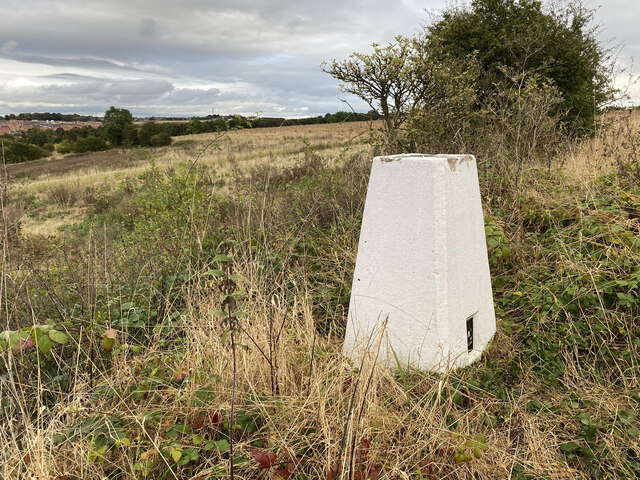
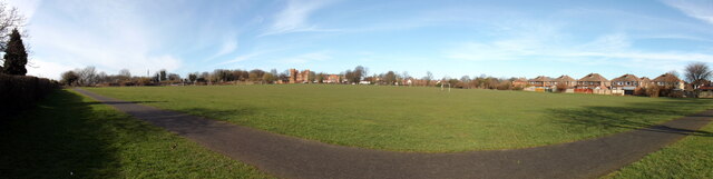
Harewood Park

Settlement in Yorkshire

England

Harewood Park

The M62 motorway
The M62 motorway Credit: derek dye

Harewood Park is a historic estate located in Yorkshire, England. Situated in the heart of the country, it covers an extensive area of approximately 1,000 acres, encompassing rolling hills, woodlands, and picturesque landscapes. The park is renowned for its grandeur and natural beauty, attracting visitors from all over the world.

The centerpiece of Harewood Park is Harewood House, an impressive stately home that dates back to the 18th century. Designed by renowned architect John Carr, the house boasts exquisite Georgian architecture and is surrounded by meticulously manicured gardens. It is considered one of the finest examples of the Palladian style in the country.

In addition to the stunning house and gardens, Harewood Park offers a range of attractions and activities for visitors. The Harewood Bird Garden is home to a diverse collection of rare and exotic birds, including penguins, flamingos, and owls. The estate also features a farm experience, where visitors can interact with farm animals and learn about traditional farming practices.

For those seeking outdoor adventures, Harewood Park offers numerous walking trails and cycling routes, allowing visitors to explore the scenic surroundings at their own pace. The park also hosts regular events throughout the year, including concerts, art exhibitions, and vintage car shows.

Harewood Park is not only a popular tourist destination but also a thriving community. It is home to a number of residents, who enjoy the peaceful and idyllic lifestyle offered by the estate. Overall, Harewood Park is a place of historical significance, natural beauty, and diverse attractions, making it a must-visit location in Yorkshire.

If you have any feedback on the listing, please let us know in the comments section below.

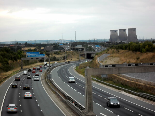
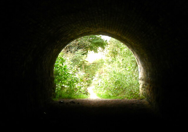
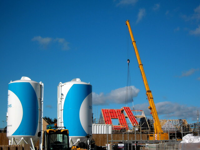
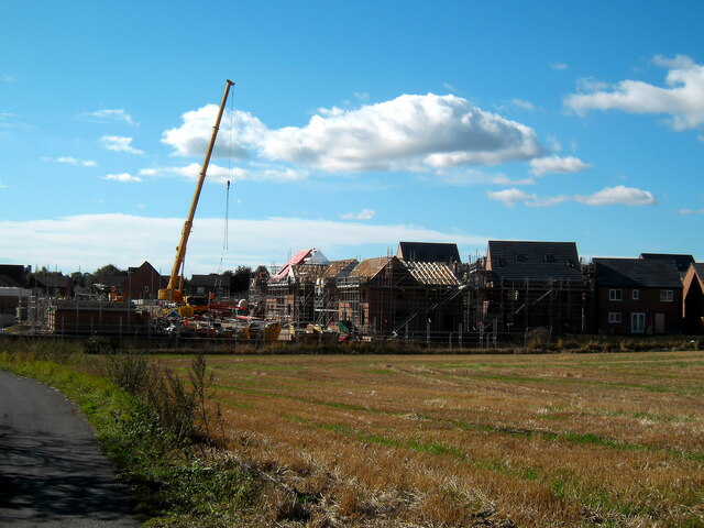
Harewood Park Images

Images are sourced within 2km of 53.692312/-1.2973032 or Grid Reference SE4621. Thanks to Geograph Open Source API. All images are credited.

The M62 motorway
The M62 motorway
The light at the end of the tunnel
Raising the roof Houses under construction off Sowgate lane Pontefract
Raising the roof
Houses under construction off Sowgate lane Pontefract
New housing at Pontefract
Tunnel under railway lines
Old milestone This West Riding CC milestone is on Park Road north of Pontefract, A639.  It is just north of a roundabout and behind it is a large Retail Park built on the site of the Prince of Wales Colliery. It has the maker's name on the bevel, Brayshaw & Booth, Liversedge.   It is Grade II listed, 1299786 and was last painted in 2010 by two Milestone Society members.
Old milestone
This West Riding CC milestone is on Park Road north of Pontefract, A639. It is just north of a roundabout and behind it is a large Retail Park built on the site of the Prince of Wales Colliery. It has the maker's name on the bevel, Brayshaw & Booth, Liversedge. It is Grade II listed, 1299786 and was last painted in 2010 by two Milestone Society members.
Dandy Mill Pontefract Dis-used old windmill on Water Lane Pontefract
Dandy Mill Pontefract
Dis-used old windmill on Water Lane Pontefract
View from Long Bull Hill Trig Point
Long Bull Hill Trig Point Flush Bracket S4238
Pontefract Barracks Field Panorama This is the Barracks field. On the Barracks field's far side, in the middle, you can see the Barracks (over Wakefield Road). Originally an army barracks, in the mid-late eighties, the building became a pub - but it is now a business centre. To the right of the Barracks is the Yorkshire Rifles building - and to the right of that, Kings Mead. On the photograph's far right, the houses are Alden Crescent. The Barracks field is used for football matches, dog-walking, and as a through route. This photograph is taken from Mill Hill Lane.
Pontefract Barracks Field Panorama
This is the Barracks field. On the Barracks field's far side, in the middle, you can see the Barracks (over Wakefield Road). Originally an army barracks, in the mid-late eighties, the building became a pub - but it is now a business centre. To the right of the Barracks is the Yorkshire Rifles building - and to the right of that, Kings Mead. On the photograph's far right, the houses are Alden Crescent. The Barracks field is used for football matches, dog-walking, and as a through route. This photograph is taken from Mill Hill Lane.
Pontefract Castle: aerial 2022 (1)
Pontefract Castle: aerial 2022 (2)
Church of All Saints, Pontefract: aerial 2022
Carleton Grange The former Banker's Villa on a heritage open day, now a community facility
Carleton Grange
The former Banker's Villa on a heritage open day, now a community facility
View up to St. Giles, from Woolmarket Two months ago, my mother passed away, and - looking through the family colour slides - I found this gem, as regards Pontefract's architectural history.

My late father dated this slide August 1974, when the 'new' library was being built. As a kid, I remember going to the old library (now Pontefract museum) as, going up the stairs, there was always a distinctive smell (cleaning products?).  By contrast, the 'new' library seemed enormous, at first.

Note how Pomfretians parked their cars in the town centre, without worrying. 

Most important of all, 'Middle Row' - or at least part of it - is visible (on the far left.)  Unfortunately, Middle Row is one of many parts of Pontefract's history that were  demolished, in the name of progress.
View up to St. Giles, from Woolmarket
Two months ago, my mother passed away, and - looking through the family colour slides - I found this gem, as regards Pontefract's architectural history. My late father dated this slide August 1974, when the 'new' library was being built. As a kid, I remember going to the old library (now Pontefract museum) as, going up the stairs, there was always a distinctive smell (cleaning products?). By contrast, the 'new' library seemed enormous, at first. Note how Pomfretians parked their cars in the town centre, without worrying. Most important of all, 'Middle Row' - or at least part of it - is visible (on the far left.) Unfortunately, Middle Row is one of many parts of Pontefract's history that were demolished, in the name of progress.
Pontefract's 'Middle Row' In our family colour slides I found this photograph, which may not look like much, but it's historically important as it records part of Middle Row, for posterity.

'Middle Row' was a part of Pontefract that got demolished, to build the Salter row shops.

My late father took this photo in August 1974, labeling it as the Woolmarket end of Middle Row.
Pontefract's 'Middle Row'
In our family colour slides I found this photograph, which may not look like much, but it's historically important as it records part of Middle Row, for posterity. 'Middle Row' was a part of Pontefract that got demolished, to build the Salter row shops. My late father took this photo in August 1974, labeling it as the Woolmarket end of Middle Row.
Pontefract Castle 1974 - Karate This is a gala at Pontefract Castle, in 1974.

It's one of my earliest memories.  There was a karate demonstration, with men breaking boards. Also, a 'Whistons' ice-cream van, depicting a Viking 'lolly'(at least that's what I remember!)

Until a few weeks ago, I never realized my father took a photo (colour-slide), corroborating my memory!

I'm guessing it's summer - so July or August 1974, perhaps?
Pontefract Castle 1974 - Karate
This is a gala at Pontefract Castle, in 1974. It's one of my earliest memories. There was a karate demonstration, with men breaking boards. Also, a 'Whistons' ice-cream van, depicting a Viking 'lolly'(at least that's what I remember!) Until a few weeks ago, I never realized my father took a photo (colour-slide), corroborating my memory! I'm guessing it's summer - so July or August 1974, perhaps?
Pontefract Castle
Pontefract Castle
Show me another place!

Harewood Park is located at Grid Ref: SE4621 (Lat: 53.692312, Lng: -1.2973032)

Division: West Riding

Unitary Authority: Wakefield

Police Authority: West Yorkshire

What 3 Words

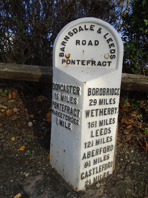
///slurs.acute.gifts. Near Pontefract, West Yorkshire

Related Wikis

Pontefract Baghill railway station

Pontefract Baghill railway station is one of the three railway stations that serves the town of Pontefract, West Yorkshire, England. The other stations...

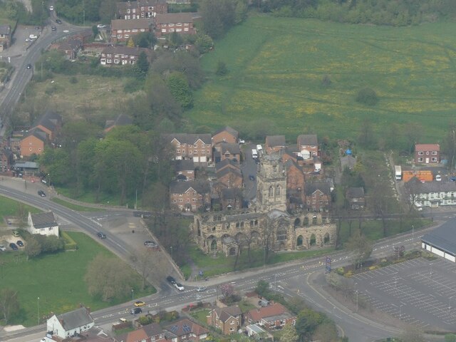
All Saints' Church, Pontefract

The Church of All Saints in Pontefract, West Yorkshire, England is an active Church of England parish church in the archdeaconry of Pontefract and the...

Micklegate Methodist Church, Pontefract

Micklegate Methodist Church is an active Methodist Church of Great Britain church in Pontefract, West Yorkshire, England. == Location == The church...
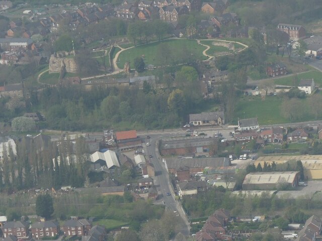
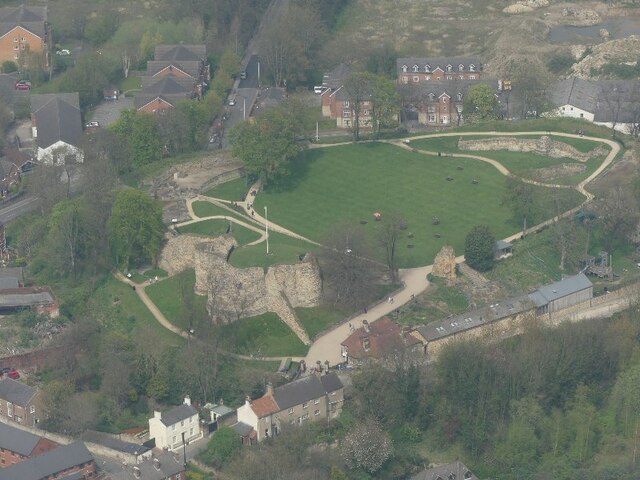
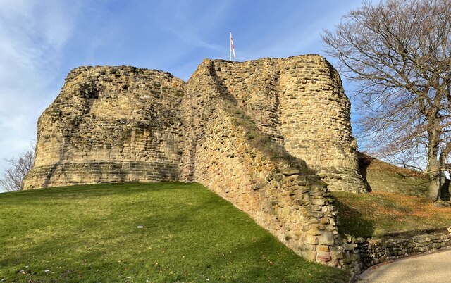
Pontefract Castle

Pontefract (or Pomfret) Castle is a castle ruin in the town of Pontefract, in West Yorkshire, England. King Richard II is thought to have died there. It...

Pontefract bus station

Pontefract bus station serves the town of Pontefract, West Yorkshire, England. The bus station is owned and managed by West Yorkshire Metro. The bus station...

Pontefract Hospital

Pontefract Hospital is an acute District General Hospital in Pontefract, West Yorkshire operated by the Mid Yorkshire Teaching NHS Trust. The hospital...

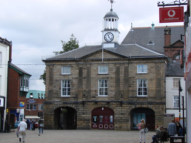
Old Town Hall, Pontefract

The Old Town Hall is a historic town hall in Market Place in Pontefract, West Yorkshire, England. It was completed in 1785 and was replaced by Pontefract...

Pontefract Town Hall

Pontefract Town Hall is a town hall in Pontefract, West Yorkshire, England. It was completed in 1882. It is now owned and used by Wakefield Council as...

Related Videos

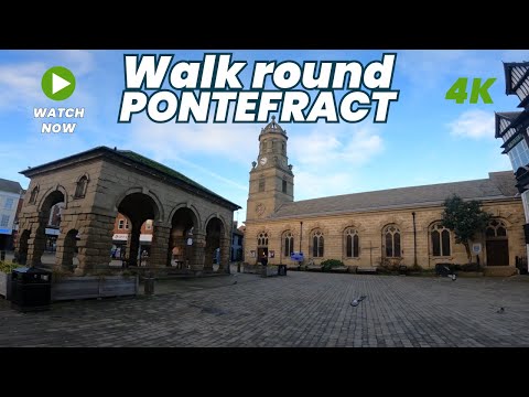
PONTEFRACT - A walking tour of Ponte in 4k - January 2024

Come with me as I walk round Pontefract Town Centre, filming in 4k. Filmed in January 2024, I walk around looking at the different ...

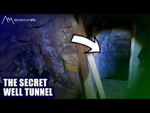
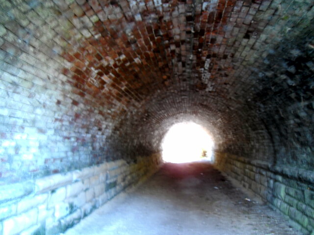
The Secret Tunnel Of Pontefract Castle | What's Inside?

Join us for an explore of Pontefract Castle, England's Most Fearsome Fort. We show you around the Castle Grounds, exploring all ...

UK August Bank Holiday - 23rd - 30th August 2022

What a lovely time seeing friends and family ❤️ x.

Pontefract Castle - a wander around…

A wander around Pontefract Castle, with @ShadowTorStudios #oldtown #pontefract #castle #magic #oldcastle #tunnels ...

Nearby Amenities

Located within 500m of 53.692312,-1.2973032
Bus Stop
South Baileygate North Baileygate
Bench: yes
Bin: no
Bus: yes
Local Ref: 45018265
Naptan AtcoCode: 450018265
Naptan Bearing: SW
Naptan CommonName: South Baileygate North Baileygate
Naptan Crossing: North Baileygate
Naptan Indicator: Stop 45018265
Naptan Landmark: Old Church
Naptan PlusbusZoneRef: LEEDS
Naptan ShortCommonName: North Baileygate
Naptan Street: South Baileygate
Naptan Verified: no
Public Transport: platform
Shelter: yes
Source: naptan_import
Tactile Paving: no
Lat/Long: 53.6960844/-1.3000751
Bus Stop
South Baileygate North Baileygate
Bench: yes
Bus: yes
Departures Board: yes
Local Ref: 45018266
Naptan AtcoCode: 450018266
Naptan Bearing: NE
Naptan CommonName: South Baileygate North Baileygate
Naptan Crossing: North Baileygate
Naptan Indicator: Stop 45018266
Naptan Landmark: Fox PH
Naptan PlusbusZoneRef: LEEDS
Naptan ShortCommonName: North Baileygate
Naptan Street: South Baileygate
Operator: Metro
Public Transport: platform
Ref: 18266
Shelter: yes
Source: naptan_import
Lat/Long: 53.6952041/-1.3017254
Bus Stop
Northfield Drive Eastfield Drive
Bus: yes
Local Ref: 45018315
Naptan AtcoCode: 450018315
Naptan Bearing: NE
Naptan CommonName: Northfield Drive Eastfield Drive
Naptan Crossing: Eastfield Drive
Naptan Indicator: Stop 45018315
Naptan PlusbusZoneRef: LEEDS
Naptan ShortCommonName: Eastfield Drive
Naptan Street: Northfield Drive
Naptan Verified: no
Public Transport: platform
Source: naptan_import
Lat/Long: 53.6926868/-1.2970268
Bus Stop
Northfield Drive Plane Green
Bus: yes
Local Ref: 45018316
Naptan AtcoCode: 450018316
Naptan Bearing: NE
Naptan CommonName: Northfield Drive Plane Green
Naptan Crossing: Plane Green
Naptan Indicator: Stop 45018316
Naptan PlusbusZoneRef: LEEDS
Naptan ShortCommonName: Plane Green
Naptan Street: Northfield Drive
Naptan Verified: no
Public Transport: platform
Source: naptan_import
Lat/Long: 53.6954293/-1.2939066
Bus Stop
Baghill Lane Harewood Avenue
Bus: yes
Local Ref: 45018317
Naptan AtcoCode: 450018317
Naptan Bearing: W
Naptan CommonName: Baghill Lane Harewood Avenue
Naptan Crossing: Harewood Avenue
Naptan Indicator: Stop 45018317
Naptan PlusbusZoneRef: LEEDS
Naptan ShortCommonName: Harewood Avenue
Naptan Street: Baghill Lane
Naptan Verified: no
Public Transport: platform
Source: naptan_import
Lat/Long: 53.6919913/-1.2964478
Bus Stop
Baghill Lane Willow Park
Bus: yes
Local Ref: 45018318
Naptan AtcoCode: 450018318
Naptan Bearing: SE
Naptan CommonName: Baghill Lane Willow Park
Naptan Crossing: Willow Park
Naptan Indicator: Stop 45018318
Naptan Landmark: Shops
Naptan PlusbusZoneRef: LEEDS
Naptan ShortCommonName: Willow Park
Naptan Street: Baghill Lane
Naptan Verified: no
Public Transport: platform
Source: naptan_import
Lat/Long: 53.6919675/-1.2954638
Bus Stop
Baghill Lane Willow Park
Bus: yes
Local Ref: 45018319
Naptan AtcoCode: 450018319
Naptan Bearing: SE
Naptan CommonName: Baghill Lane Willow Park
Naptan Crossing: Willow Park
Naptan Indicator: Stop 45018319
Naptan Landmark: Post Office
Naptan PlusbusZoneRef: LEEDS
Naptan ShortCommonName: Willow Park
Naptan Street: Baghill Lane
Naptan Verified: no
Public Transport: platform
Source: naptan_import
Lat/Long: 53.6913668/-1.2934693
Bus Stop
Baghill Lane Willow Park
Bus: yes
Local Ref: 45018320
Naptan AtcoCode: 450018320
Naptan Bearing: NW
Naptan CommonName: Baghill Lane Willow Park
Naptan Crossing: Willow Park
Naptan Indicator: Stop 45018320
Naptan Notes: Abacus shelter replaced by TF and 3P caseAbacus removed on 25th February 2008Trueform to be installed 100308
Naptan PlusbusZoneRef: LEEDS
Naptan ShortCommonName: Willow Park
Naptan Street: Baghill Lane
Naptan Verified: no
Public Transport: platform
Source: naptan_import
Lat/Long: 53.6913834/-1.2939591
Bus Stop
Baghill Lane Eastbourne Terrace
Bus: yes
Local Ref: 45018321
Naptan AtcoCode: 450018321
Naptan Bearing: SE
Naptan CommonName: Baghill Lane Eastbourne Terrace
Naptan Crossing: Eastbourne Terrace
Naptan Indicator: Stop 45018321
Naptan PlusbusZoneRef: LEEDS
Naptan ShortCommonName: Eastbourne Terrace
Naptan Street: Baghill Lane
Naptan Verified: no
Public Transport: platform
Source: naptan_import
Lat/Long: 53.6907384/-1.2912894
Bus Stop
Eastbourne View Eastbourne Terrace
Bus: yes
Local Ref: 45018322
Naptan AtcoCode: 450018322
Naptan Bearing: NW
Naptan CommonName: Eastbourne View Eastbourne Terrace
Naptan Crossing: Eastbourne Terrace
Naptan Indicator: Stop 45018322
Naptan PlusbusZoneRef: LEEDS
Naptan ShortCommonName: Eastbourne Terrace
Naptan Street: Eastbourne View
Naptan Verified: no
Public Transport: platform
Source: naptan_import
Lat/Long: 53.6905381/-1.2908536
Bus Stop
Chequerfield Lane Eastbourne View
Bus: yes
Local Ref: 45018327
Naptan AtcoCode: 450018327
Naptan Bearing: N
Naptan CommonName: Chequerfield Lane Eastbourne View
Naptan Crossing: Eastbourne View
Naptan Indicator: Stop 45018327
Naptan Notes: Trueform shelter installed 29/04/2008
Naptan PlusbusZoneRef: LEEDS
Naptan ShortCommonName: Eastbourne View
Naptan Street: Chequerfield Lane
Naptan Verified: no
Public Transport: platform
Source: naptan_import
Lat/Long: 53.6904459/-1.2919758
Bus Stop
Chequerfield Lane Baghill Lane
Bus: yes
Local Ref: 45018328
Naptan AtcoCode: 450018328
Naptan Bearing: S
Naptan CommonName: Chequerfield Lane Baghill Lane
Naptan Indicator: Stop 45018328
Naptan PlusbusZoneRef: LEEDS
Naptan ShortCommonName: Baghill Lane
Naptan Street: Chequerfield Lane
Naptan Verified: no
Public Transport: platform
Source: naptan_import
Lat/Long: 53.6899163/-1.2921058
Bus Stop
Chequerfield Lane Chequerfield
Bus: yes
Local Ref: 45018329
Naptan AtcoCode: 450018329
Naptan Bearing: NE
Naptan CommonName: Chequerfield Lane Chequerfield
Naptan Crossing: Chequerfield Avenue
Naptan Indicator: Stop 45018329
Naptan PlusbusZoneRef: LEEDS
Naptan ShortCommonName: Chequerfield Avenue
Naptan Street: Chequerfield Lane
Naptan Verified: no
Public Transport: platform
Source: naptan_import
Lat/Long: 53.6889229/-1.2928342
Bus Stop
Harewood Avenue Cromwell Crescent
Bus: yes
Local Ref: 45018337
Naptan AtcoCode: 450018337
Naptan Bearing: N
Naptan CommonName: Harewood Avenue Cromwell Crescent
Naptan Crossing: Cromwell Crescent
Naptan Indicator: Stop 45018337
Naptan PlusbusZoneRef: LEEDS
Naptan ShortCommonName: Cromwell Crescent
Naptan Street: Harewood Avenue
Naptan Verified: no
Public Transport: platform
Source: naptan_import
Lat/Long: 53.6919329/-1.2972211
Bus Stop
Harewood Avenue Cromwell Crescent
Bus: yes
Local Ref: 45018338
Naptan AtcoCode: 450018338
Naptan Bearing: N
Naptan CommonName: Harewood Avenue Cromwell Crescent
Naptan Crossing: Cromwell Crescent
Naptan Indicator: Stop 45018338
Naptan PlusbusZoneRef: LEEDS
Naptan ShortCommonName: Cromwell Crescent
Naptan Street: Harewood Avenue
Naptan Verified: no
Public Transport: platform
Source: naptan_import
Lat/Long: 53.6897522/-1.2978177
Bus Stop
Harewood Mount Grove Rise
Bus: yes
Local Ref: 45018339
Naptan AtcoCode: 450018339
Naptan Bearing: NW
Naptan CommonName: Harewood Mount Grove Rise
Naptan Crossing: Grove Rise
Naptan Indicator: Stop 45018339
Naptan PlusbusZoneRef: LEEDS
Naptan ShortCommonName: Grove Rise
Naptan Street: Harewood Mount
Naptan Verified: no
Public Transport: platform
Source: naptan_import
Lat/Long: 53.6893856/-1.2996865
Bus Stop
Harewood Mount Grove Mount
Bus: yes
Local Ref: 45018340
Naptan AtcoCode: 450018340
Naptan Bearing: SE
Naptan CommonName: Harewood Mount Grove Mount
Naptan Crossing: Grove Mount
Naptan Indicator: Stop 45018340
Naptan PlusbusZoneRef: LEEDS
Naptan ShortCommonName: Grove Mount
Naptan Street: Harewood Mount
Naptan Verified: no
Public Transport: platform
Source: naptan_import
Lat/Long: 53.6895752/-1.2998196
Bus Stop
South Baileygate Baghill Lane
Bench: no
Bus: yes
Local Ref: 45025616
Naptan AtcoCode: 450025616
Naptan Bearing: SW
Naptan CommonName: South Baileygate Baghill Lane
Naptan Crossing: Baghill Lane
Naptan Indicator: Stop 45025616
Naptan PlusbusZoneRef: LEEDS
Naptan ShortCommonName: Baghill Lane
Naptan Street: South Baileygate
Naptan Verified: no
Public Transport: platform
Shelter: no
Source: naptan_import
Lat/Long: 53.6946243/-1.3024771
Bus Stop
Northfield Drive Springfield Avenue
Local Ref: 45025742
Naptan AtcoCode: 450025742
Naptan Bearing: E
Naptan CommonName: Northfield Drive Springfield Avenue
Naptan Crossing: Springfiled Avenue
Naptan Indicator: Stop 45025742
Naptan PlusbusZoneRef: LEEDS
Naptan ShortCommonName: Springfield Avenue
Naptan Street: Northfield Drive
Naptan Verified: no
Source: naptan_import
Lat/Long: 53.6946951/-1.2961452
Post Office
Willow Park Post Office
Addr City: Pontefract
Addr Housenumber: 98
Addr Postcode: WF8 2HB
Addr Street: Baghill Lane
Addr Village: Willow Park
Brand: Post Office
Brand Wikidata: Q1783168
Brand Wikipedia: en:Post Office Ltd
Contact Website: https://www.postoffice.co.uk/branch-finder/5853230/willow-park
Opening Hours: Mo-Fr 09:00-17:30; Sa 09:30-12:30
Operator: Post Office Ltd
Ref Pol Id: 15792
Lat/Long: 53.6915341/-1.2935787
Mini Roundabout
Lat/Long: 53.6909562/-1.2922271
Mini Roundabout
Direction: clockwise
Lat/Long: 53.6921326/-1.2970375
Turning Circle
Lat/Long: 53.6913235/-1.3011938
Traffic Signals
Traffic Signals: bridge
Traffic Signals Direction: forward
Lat/Long: 53.6934494/-1.2993706
Noexit: yes
Lat/Long: 53.6931038/-1.302965
Post Box
Brand: Royal Mail
Brand Wikidata: Q638098
Operator: Royal Mail
Operator Wikidata: Q638098
Post Box Type: pillar
Ref: WF8 19
Royal Cypher: EVIIR
Royal Cypher Wikidata: Q33102324
Lat/Long: 53.6913848/-1.2935486
Pontefract Baghill
Addr City: Pontefract
Addr Postcode: WF8 1QR
Addr Street: Station Lane
Internet Access: no
Naptan AtcoCode: 9100PTFTBHL
Network: National Rail
Network Website: https://www.nationalrail.co.uk/stations/pfr/
Network Wikidata: Q26334
Operator: Northern Rail
Operator Website: https://www.northernrailway.co.uk/stations/pontefract-baghill
Operator Wikidata: Q85789775
Public Transport: station
Railway: station
Ref Crs: PFR
Source: NPE
Train: yes
Wikidata: Q4301181
Wikipedia: en:Pontefract Baghill railway station
Lat/Long: 53.6917363/-1.3034033
Fast Food
JJ's
Addr City: Pontefract
Addr Housenumber: 96
Addr Postcode: WF8 2HB
Addr Street: Baghill Lane
Addr Town: Pontefract
Cuisine: sandwich
Fhrs Id: 1015899
Takeaway: yes
Lat/Long: 53.6915743/-1.2937217
Mr Henris
Addr City: Pontefract
Addr Housenumber: 92
Addr Postcode: WF8 2HB
Addr Street: Baghill Lane
Addr Town: Pontefract
Shop: hairdresser
Lat/Long: 53.6916112/-1.2938527
A&S Motor Spares
Addr City: Pontefract
Addr Housenumber: 86
Addr Postcode: WF8 2HB
Addr Street: Baghill Lane
Addr Town: Pontefract
Shop: car_parts
Lat/Long: 53.6916664/-1.2940489
Fast Food
Kebab Ranch & Tandoori Balti
Addr City: Pontefract
Addr Housenumber: 88
Addr Postcode: WF8 2HB
Addr Street: Baghill Lane
Addr Town: Pontefract
Cuisine: indian;kebab
Takeaway: yes
Lat/Long: 53.6916485/-1.2939852
Willow Park Newsagents
Addr City: Pontefract
Addr Housenumber: 98
Addr Postcode: WF8 2HB
Addr Street: Baghill Lane
Addr Town: Pontefract
Fhrs Id: 313123
Shop: newsagent
Lat/Long: 53.6915529/-1.2936455
Fast Food
Khawars Ranch
Addr City: Pontefract
Addr Housenumber: 90
Addr Postcode: WF8 2HB
Addr Street: Baghill Lane
Addr Town: Pontefract
Cuisine: indian
Fhrs Id: 1083869
Takeaway: yes
Lat/Long: 53.6916296/-1.2939182
Fast Food
Page's Fisheries
Addr City: Pontefract
Addr Housenumber: 94
Addr Postcode: WF8 2HB
Addr Street: Baghill Lane
Addr Town: Pontefract
Cuisine: fish_and_chips
Fhrs Id: 283374
Takeaway: yes
Lat/Long: 53.6915928/-1.2937873
Spar
Addr City: Pontefract
Addr Housenumber: 84
Addr Postcode: WF8 2HB
Addr Street: Baghill Lane
Addr Town: Pontefract
Brand: Spar
Brand Wikidata: Q610492
Brand Wikipedia: en:Spar (retailer)
Fhrs Id: 313122
Shop: convenience
Lat/Long: 53.6916967/-1.2941464
Kindergarten
Pomfret Woodland Community Nursery
Addr City: Pontefract
Addr Housename: De Lacy Primary School
Addr Postcode: WF8 2DD
Addr Street: Chequerfield Lane
Addr Town: Pontefract
Fhrs Id: 284131
Not Addr Postcode: WF8 2TG
Lat/Long: 53.6883955/-1.2942785
Crossing
Crossing: uncontrolled
Crossing Island: no
Crossing Markings: zebra;dots
Crossing Ref: zebra
Kerb: lowered
Tactile Paving: yes
Lat/Long: 53.6949494/-1.3020354
Traffic Signals
Traffic Signals: bridge
Traffic Signals Direction: backward
Lat/Long: 53.693725/-1.3000771
Noexit: yes
Lat/Long: 53.694282/-1.2996098
Give Way
Direction: forward
Traffic Sign: GB:602
Lat/Long: 53.6955834/-1.3011192
Charging Station
Osprey
Access: yes
Capacity: 2
Fee: yes
Lat/Long: 53.6952296/-1.2993767
Waste Basket
Waste: dog_excrement
Lat/Long: 53.695644/-1.3020152
Stop
Direction: backward
Lat/Long: 53.6937379/-1.3002429
Noexit: yes
Lat/Long: 53.6962316/-1.2993058
Noexit: yes
Lat/Long: 53.6945395/-1.2989034
Barrier: kerb
Kerb: lowered
Tactile Paving: no
Lat/Long: 53.6959388/-1.3005596
Crossing
Crossing: unmarked
Crossing Island: yes
Tactile Paving: yes
Lat/Long: 53.6959075/-1.3005051
Man Made: surveillance
Surveillance: outdoor
Surveillance Type: ALPR
Surveillance Zone: parking
Lat/Long: 53.6958341/-1.2992339
Barrier: height_restrictor
Maxheight: 2.3
Lat/Long: 53.6916441/-1.2943276
Barrier: height_restrictor
Maxheight: 2.3
Lat/Long: 53.6913936/-1.293636
Midland Road Garage
Service Vehicle Air Conditioning: yes
Service Vehicle Exhausts: yes
Service Vehicle Mot Test Station: yes
Service Vehicle Repairs: yes
Service Vehicle Servicing: yes
Service Vehicle Tyres: yes
Service Vehicle Welding: yes
Shop: car_repair
Lat/Long: 53.6922304/-1.3040547
Barrier: bollard
Bollard: fixed
Colour: beige
Material: metal
Lat/Long: 53.6960303/-1.301582
Barrier: bollard
Bollard: fixed
Colour: beige
Material: metal
Lat/Long: 53.6960401/-1.3015519
Barrier: bollard
Bollard: fixed
Colour: beige
Material: metal
Lat/Long: 53.6960505/-1.30152
Barrier: bollard
Bollard: fixed
Colour: beige
Material: metal
Lat/Long: 53.6960581/-1.3014965
Barrier: bollard
Bollard: fixed
Colour: beige
Material: metal
Lat/Long: 53.696066/-1.3014723
Waste Basket
Colour: black
Operator: Wakefield Council
Waste: trash;recycling;mixed
Lat/Long: 53.6960466/-1.3015318
Barrier: bollard
Bollard: fixed
Colour: silver
Material: metal
Lat/Long: 53.6959524/-1.2996929
Barrier: bollard
Bollard: fixed
Colour: silver
Material: metal
Lat/Long: 53.6959413/-1.2996741
Barrier: bollard
Bollard: fixed
Colour: silver
Material: metal
Lat/Long: 53.6959297/-1.2996547
Barrier: bollard
Bollard: fixed
Colour: silver
Material: metal
Lat/Long: 53.6959179/-1.2996349
Barrier: bollard
Bollard: fixed
Colour: silver
Material: metal
Lat/Long: 53.695905/-1.2996132
Barrier: bollard
Bollard: fixed
Colour: silver
Material: metal
Lat/Long: 53.6958924/-1.2995919
Barrier: bollard
Bollard: fixed
Colour: silver
Material: metal
Lat/Long: 53.6958806/-1.299572
Barrier: bollard
Bollard: fixed
Colour: silver
Material: metal
Lat/Long: 53.69587/-1.2995542
Barrier: bollard
Bollard: fixed
Colour: silver
Material: metal
Lat/Long: 53.6958558/-1.2995304
Barrier: bollard
Bollard: fixed
Colour: silver
Material: metal
Lat/Long: 53.6958437/-1.2995099
Barrier: bollard
Bollard: fixed
Colour: silver
Material: metal
Lat/Long: 53.6958277/-1.299483
Barrier: bollard
Bollard: fixed
Colour: silver
Material: metal
Lat/Long: 53.6958089/-1.2994514
Barrier: bollard
Bollard: fixed
Colour: silver
Material: metal
Lat/Long: 53.6957914/-1.2994219
Barrier: bollard
Bollard: fixed
Colour: silver
Material: metal
Lat/Long: 53.6957695/-1.2993758
Barrier: bollard
Bollard: fixed
Colour: silver
Material: metal
Lat/Long: 53.6957672/-1.2993431
Barrier: bollard
Bollard: fixed
Colour: silver
Material: metal
Lat/Long: 53.6957688/-1.2993194
Barrier: bollard
Bollard: fixed
Colour: silver
Material: metal
Lat/Long: 53.6957988/-1.2992749
Barrier: bollard
Bollard: fixed
Colour: silver
Material: metal
Lat/Long: 53.6958088/-1.2992532
Barrier: bollard
Bollard: fixed
Colour: silver
Material: metal
Lat/Long: 53.6958182/-1.2992329
Barrier: bollard
Bollard: fixed
Colour: silver
Material: metal
Lat/Long: 53.6957797/-1.2994039
Barrier: bollard
Bollard: fixed
Colour: silver
Material: metal
Lat/Long: 53.6958234/-1.3002299
Barrier: bollard
Bollard: fixed
Colour: silver
Material: metal
Lat/Long: 53.6958048/-1.3002203
Barrier: bollard
Bollard: fixed
Colour: silver
Material: metal
Lat/Long: 53.6957959/-1.3002138
Barrier: bollard
Bollard: fixed
Colour: silver
Material: metal
Lat/Long: 53.6957794/-1.3002129
Barrier: bollard
Bollard: fixed
Colour: silver
Material: metal
Lat/Long: 53.6957643/-1.3002116
Natural: shrub
Lat/Long: 53.6949288/-1.2996373
Natural: shrub
Lat/Long: 53.6948938/-1.2995998
Natural: shrub
Lat/Long: 53.6948606/-1.2995886
Natural: shrub
Lat/Long: 53.6948461/-1.2995451
Natural: shrub
Lat/Long: 53.694821/-1.2995257
Noexit: yes
Lat/Long: 53.6911061/-1.3045361
Noexit: yes
Lat/Long: 53.6911936/-1.3045388
Crossing
Crossing: uncontrolled
Crossing Island: no
Crossing Markings: yes
Lat/Long: 53.6929679/-1.3039984
Crossing
Lat/Long: 53.6937127/-1.3035107
Crossing
Lat/Long: 53.694503/-1.3019667
Crossing
Lat/Long: 53.6924336/-1.3028928
Crossing
Lat/Long: 53.6924987/-1.3044077
All Saints Church
Board Type: history
Check Date: 2022-12-16
Direction: 132
Information: board
Tourism: information
Lat/Long: 53.6956965/-1.3010168
Noexit: yes
Lat/Long: 53.6942629/-1.2995909
Crossing
Lat/Long: 53.6947465/-1.2994685
Crossing
Lat/Long: 53.6950517/-1.2998268
Crossing
Lat/Long: 53.6951414/-1.3000015
Crossing
Lat/Long: 53.6929598/-1.3034457
Noexit: yes
Lat/Long: 53.6932749/-1.3042313
Crossing
Crossing: unmarked
Crossing Island: no
Crossing Markings: no
Lat/Long: 53.6931336/-1.3043941
Noexit: yes
Lat/Long: 53.6947024/-1.3020751
Addr City: Pontefract
Addr Housename: De Lacy Academy
Addr Postcode: WF8 2TG
Addr Street: Chequerfield Lane
Craft: caterer
Fhrs Id: 1027201
Lat/Long: 53.6885516/-1.2942163
Telephone
Booth: KX100
Covered: booth
Fee: yes
Operator: BT
Lat/Long: 53.696438/-1.2998523
Give Way
Direction: forward
Lat/Long: 53.6957329/-1.3006875
Crossing
Lat/Long: 53.6924495/-1.3030158
Turning Circle
Lat/Long: 53.6891258/-1.3012005
Noexit: yes
Lat/Long: 53.6963321/-1.2968301
Noexit: yes
Lat/Long: 53.696515/-1.2965559
Noexit: yes
Lat/Long: 53.6960977/-1.2959218
Clock
Date: no
Display: analog
Faces: 1
Support: building
Lat/Long: 53.6947909/-1.3018786
Noexit: yes
Lat/Long: 53.6935825/-1.3038946
Noexit: yes
Lat/Long: 53.6934261/-1.3033205
Noexit: yes
Lat/Long: 53.6940788/-1.3018482
Barrier: cycle_barrier
Lat/Long: 53.6888418/-1.2930302
Give Way
Direction: forward
Lat/Long: 53.6964948/-1.2996996
Artist Name: Rachel List
Artwork Type: mural
Tourism: artwork
Lat/Long: 53.6950201/-1.301586
Artist Name: Rachel List
Artwork Type: mural
Tourism: artwork
Lat/Long: 53.6950761/-1.3016466
Street Lamp
Direction: 110
Lamp Mount: pole
Lat/Long: 53.68949/-1.2979711
Street Lamp
Direction: 0
Lamp Mount: high_mast
Lat/Long: 53.6916717/-1.2972995
Street Lamp
Direction: 180
Lamp Mount: high_mast
Lat/Long: 53.6916651/-1.2972987
Direction: SSW
Generator Method: photovoltaic
Generator Output Electricity: yes
Generator Source: solar
Generator Type: solar_photovoltaic_panel
Location: roof
Power: generator
Lat/Long: 53.6933651/-1.2921944
Direction: SSW
Generator Method: photovoltaic
Generator Output Electricity: yes
Generator Source: solar
Generator Type: solar_photovoltaic_panel
Location: roof
Power: generator
Lat/Long: 53.6933381/-1.2921113
Direction: SSW
Generator Method: photovoltaic
Generator Output Electricity: yes
Generator Source: solar
Generator Type: solar_photovoltaic_panel
Location: roof
Power: generator
Lat/Long: 53.6938749/-1.290451
Noexit: yes
Lat/Long: 53.696364/-1.2950845
Access: private
Barrier: bollard
Bollard: foldable
Lat/Long: 53.6915878/-1.3042214
Noexit: yes
Lat/Long: 53.6963486/-1.2960447
Barrier: kerb
Kerb: lowered
Tactile Paving: no
Lat/Long: 53.6956501/-1.300653
Barrier: kerb
Kerb: flush
Lat/Long: 53.6957094/-1.3005385
Crossing
Crossing: unmarked
Crossing Island: separate
Lat/Long: 53.695684/-1.3005876
Barrier: kerb
Kerb: flush
Lat/Long: 53.6957223/-1.3005138
Barrier: kerb
Kerb: lowered
Tactile Paving: no
Lat/Long: 53.6957575/-1.3004459
Crossing
Crossing: unmarked
Crossing Island: separate
Tactile Paving: no
Lat/Long: 53.6957384/-1.3004826
Noexit: yes
Lat/Long: 53.6958925/-1.2989973
Crossing
Crossing: unmarked
Lat/Long: 53.695609/-1.2991195
Advertising: totem
Lit: yes
Operator: Aldi
Lat/Long: 53.6958608/-1.3003482
Crossing
Crossing: unmarked
Lat/Long: 53.6942503/-1.3032342
Crossing
Crossing: unmarked
Lat/Long: 53.6946898/-1.3022281
Noexit: yes
Lat/Long: 53.6944323/-1.3022191
Crossing
Lat/Long: 53.6957465/-1.2988182
Crossing
Lat/Long: 53.6957529/-1.2992402
Barrier: cycle_barrier
Lat/Long: 53.6888425/-1.2931057
Give Way
Direction: forward
Lat/Long: 53.6947337/-1.3023193
Kerb: lowered
Tactile Paving: yes
Lat/Long: 53.6949134/-1.30198
Kerb: lowered
Tactile Paving: yes
Lat/Long: 53.6949881/-1.3020948
Crossing
Crossing: unmarked
Crossing Island: yes
Kerb: lowered
Tactile Paving: no
Lat/Long: 53.6954179/-1.3012842
Kerb: lowered
Tactile Paving: no
Lat/Long: 53.6956533/-1.3010559
Kerb: lowered
Tactile Paving: no
Lat/Long: 53.6955568/-1.3012098
Crossing
Crossing: unmarked
Crossing Island: no
Kerb: lowered
Tactile Paving: no
Lat/Long: 53.6955995/-1.3011407
Kerb: flush
Tactile Paving: no
Lat/Long: 53.6965869/-1.2995936
Kerb: flush
Tactile Paving: no
Lat/Long: 53.696541/-1.2996691
Crossing: unmarked
Crossing Island: separate
Tactile Paving: no
Lat/Long: 53.6965033/-1.299731
Kerb: lowered
Tactile Paving: no
Lat/Long: 53.6964619/-1.2997989
Noexit: yes
Lat/Long: 53.6964522/-1.2998148
Generator Method: photovoltaic
Generator Output Electricity: yes
Generator Source: solar
Generator Type: solar_photovoltaic_panel
Location: roof
Power: generator
Lat/Long: 53.6878396/-1.2965021
Generator Method: photovoltaic
Generator Output Electricity: yes
Generator Source: solar
Generator Type: solar_photovoltaic_panel
Location: roof
Power: generator
Lat/Long: 53.6878539/-1.2965584
Generator Method: photovoltaic
Generator Output Electricity: yes
Generator Source: solar
Generator Type: solar_photovoltaic_panel
Location: roof
Power: generator
Lat/Long: 53.6879269/-1.2961882
Generator Method: photovoltaic
Generator Output Electricity: yes
Generator Source: solar
Generator Type: solar_photovoltaic_panel
Location: roof
Power: generator
Lat/Long: 53.6886115/-1.2940934
Generator Method: photovoltaic
Generator Output Electricity: yes
Generator Source: solar
Generator Type: solar_photovoltaic_panel
Location: roof
Power: generator
Lat/Long: 53.6898139/-1.2989455
Generator Method: photovoltaic
Generator Output Electricity: yes
Generator Source: solar
Generator Type: solar_photovoltaic_panel
Location: roof
Power: generator
Lat/Long: 53.6913878/-1.2900701
Generator Method: photovoltaic
Generator Output Electricity: yes
Generator Source: solar
Generator Type: solar_photovoltaic_panel
Location: roof
Power: generator
Lat/Long: 53.6913592/-1.2900138
Generator Method: photovoltaic
Generator Output Electricity: yes
Generator Source: solar
Generator Type: solar_photovoltaic_panel
Location: roof
Power: generator
Lat/Long: 53.6910503/-1.2901881
Generator Method: photovoltaic
Generator Output Electricity: yes
Generator Source: solar
Generator Type: solar_photovoltaic_panel
Location: roof
Power: generator
Lat/Long: 53.6910345/-1.2904671
Generator Method: photovoltaic
Generator Output Electricity: yes
Generator Source: solar
Generator Type: solar_photovoltaic_panel
Location: roof
Power: generator
Lat/Long: 53.6909114/-1.290683
The data included in this document is from www.openstreetmap.org. The data is made available under ODbL.

Have you been to Harewood Park?

Leave your review of Harewood Park below (or comments, questions and feedback).