Bicton Wood

Wood, Forest in Cornwall

England

Bicton Wood

Bus shelter on A390 at Keason Cottages
Bus shelter on A390 at Keason Cottages Credit: David Smith

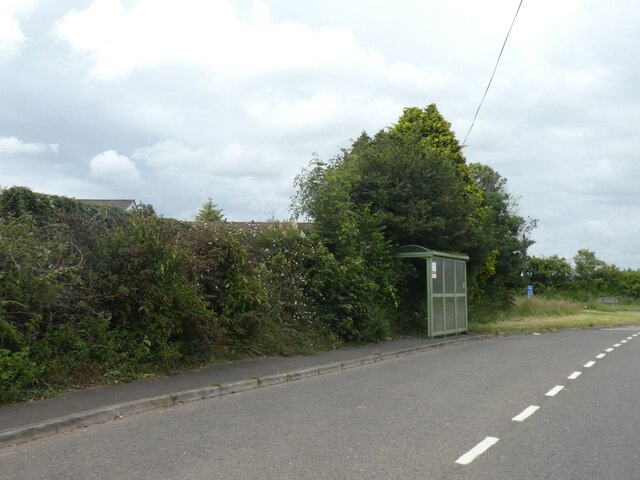
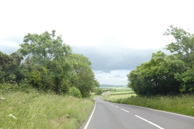
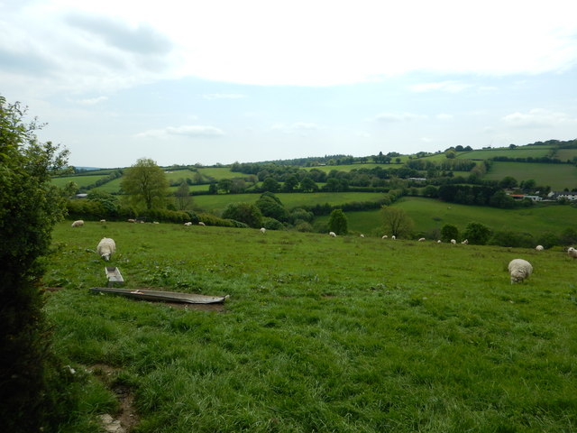
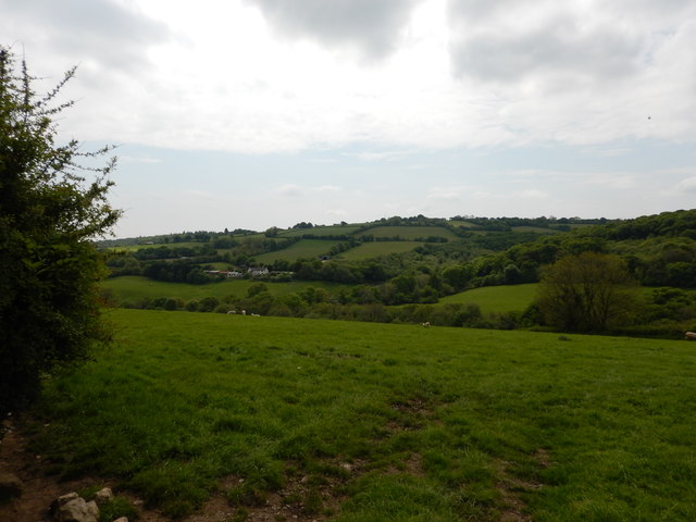
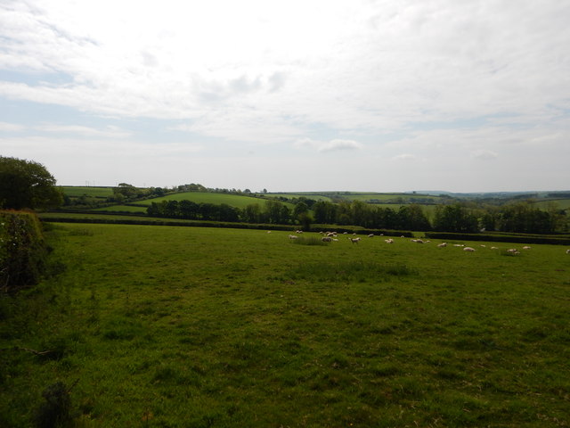
Bicton Wood is a beautiful woodland located in Cornwall, England. Situated near the village of Bicton, it covers an area of approximately 200 acres, making it one of the largest woodlands in the region. The wood is a popular destination for both locals and tourists due to its stunning natural beauty and diverse wildlife.

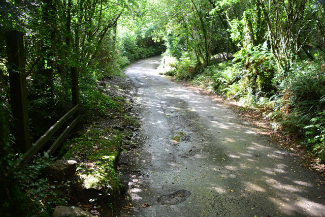
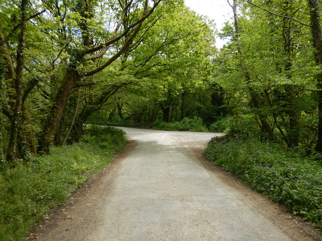
As visitors enter Bicton Wood, they are greeted by a dense canopy of mature trees, including oak, beech, and ash. The wood is characterized by its tall, straight trunks and lush undergrowth, creating a serene and tranquil atmosphere. The woodland floor is carpeted with a variety of flora, including bluebells, wild garlic, and foxgloves, adding bursts of color to the landscape.

Bicton Wood is not only visually appealing but also home to a wide range of wildlife. Visitors may be lucky enough to spot deer, badgers, and foxes roaming freely throughout the woodland. The vibrant birdlife includes species such as woodpeckers, owls, and various songbirds, making it a paradise for birdwatchers.

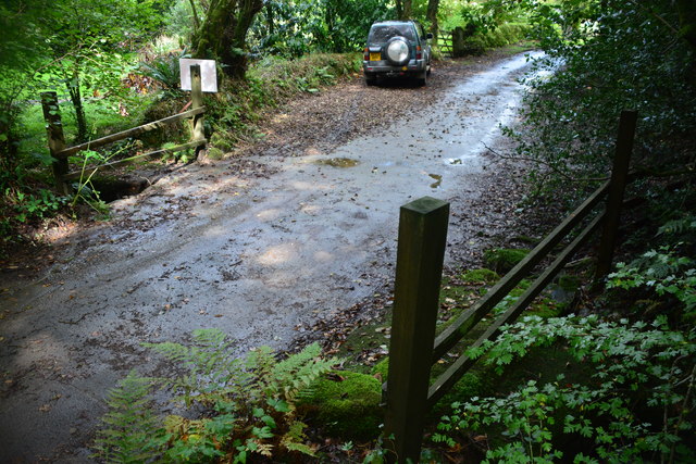
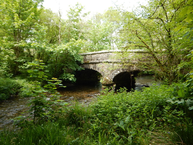
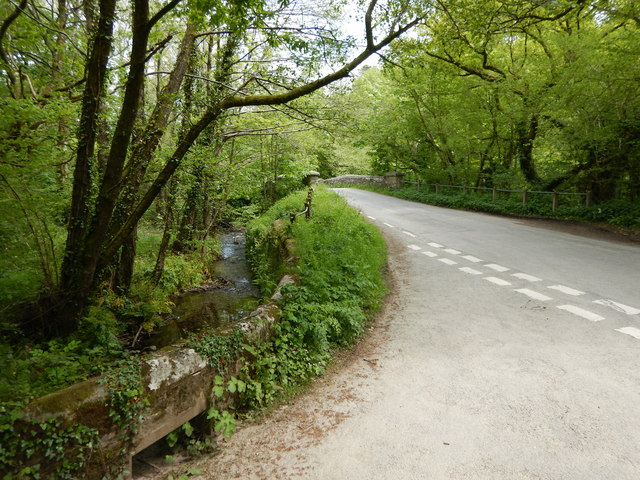
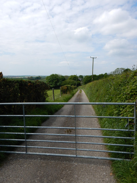
The wood offers several walking trails and footpaths, allowing visitors to explore its natural wonders at their own pace. These paths wind their way through the woodland, taking visitors past babbling brooks, ancient stone walls, and picturesque viewpoints. There are also picnic areas and benches scattered throughout the wood, providing perfect spots to relax and enjoy the peaceful surroundings.

Bicton Wood is open to the public year-round and offers a truly enchanting experience for nature enthusiasts and those seeking a respite from the hustle and bustle of everyday life. Its natural beauty and abundant wildlife make it an idyllic destination for a peaceful walk or a picnic in the heart of Cornwall's countryside.

If you have any feedback on the listing, please let us know in the comments section below.

Bicton Wood Images

Images are sourced within 2km of 50.503114/-4.3697401 or Grid Reference SX3269. Thanks to Geograph Open Source API. All images are credited.

Bus shelter on A390 at Keason Cottages
A390 east of St Ive
A390 east of St Ive
Batts Chapel A former Bethel Wesleyan Methodist Chapel.
Batts Chapel
A former Bethel Wesleyan Methodist Chapel.
Former chapel
Former chapel
Burnt Wood Ford This ford is found at the foot of the track leading down through Burnt Wood.
Burnt Wood Ford
This ford is found at the foot of the track leading down through Burnt Wood.
Penharget Ford This ford is found at Penharget Wood.
Penharget Ford
This ford is found at Penharget Wood.
Charaton Ford This is a second ford along the track in Penharget Wood.
Charaton Ford
This is a second ford along the track in Penharget Wood.
Kerney Bridge on the River Lynher
Junction at Kerney Bridge near Berrio Mill
Rural Road Junction near Berrio Mill
Fields near Longridge Farming in Cornwall
Fields near Longridge
Farming in Cornwall
Fields near Longridge
Moorshead Gated Driveway near Pensilva
Sheep Farming near Moorshead
Old Milestone by the A390 in Higher Keason Carved stone post by the A390, in parish of ST IVE (CARADON District), Higher Keason, Keason turn, against hedge (was in it). Broken - top half was loose, now restored, on North side of road. Callington CL tombstone, erected by the Callington turnpike trust in the 19th century. 

Inscription reads:-
C 3½
L 5   

Grade II Listed. List Entry Number: 1140829
<span class="nowrap"><a title="https://historicengland.org.uk/listing/the-list/list-entry/1140829" rel="nofollow ugc noopener" href="https://historicengland.org.uk/listing/the-list/list-entry/1140829">Link</a><img style="margin-left:2px;" alt="External link" title="External link - shift click to open in new window" src="https://s1.geograph.org.uk/img/external.png" width="10" height="10"/></span>

Milestone Society National ID: CW_CLLK03.
Old Milestone by the A390 in Higher Keason
Carved stone post by the A390, in parish of ST IVE (CARADON District), Higher Keason, Keason turn, against hedge (was in it). Broken - top half was loose, now restored, on North side of road. Callington CL tombstone, erected by the Callington turnpike trust in the 19th century. Inscription reads:- C 3½ L 5 Grade II Listed. List Entry Number: 1140829 LinkExternal link Milestone Society National ID: CW_CLLK03.
Old Guide Stone by the A390 at Higher Keason, St Ive Parish By the A390, in parish of St Ive (Caradon District), Higher Keason, turning at Higher Keason, set back from road by bank.

Inscription reads:-
: LA / UN / CES / TON : : LIS / KEA / RD : : CAL / LIN / GT / ON :

Grade II listed. List Entry Number: 1140829
<span class="nowrap"><a title="https://historicengland.org.uk/listing/the-list/list-entry/1140829" rel="nofollow ugc noopener" href="https://historicengland.org.uk/listing/the-list/list-entry/1140829">Link</a><img style="margin-left:2px;" alt="External link" title="External link - shift click to open in new window" src="https://s1.geograph.org.uk/img/external.png" width="10" height="10"/></span>

Surveyed

Milestone Society National ID: CW_XSTI3
Old Guide Stone by the A390 at Higher Keason, St Ive Parish
By the A390, in parish of St Ive (Caradon District), Higher Keason, turning at Higher Keason, set back from road by bank. Inscription reads:- : LA / UN / CES / TON : : LIS / KEA / RD : : CAL / LIN / GT / ON : Grade II listed. List Entry Number: 1140829 LinkExternal link Surveyed Milestone Society National ID: CW_XSTI3
Old Guide Stone by Gang Cottage, St Ive parish Moorland Guidepost by the UC road, in parish of St Ive (Caradon District), by Gang Cottage, set into parking bay.

Inscription reads:-
: CAL / LING / TON : : LAUN / CES / TON : : S / GER / MA / NS : 

Grade II listed.
List Entry Number: 1392532 <span class="nowrap"><a title="https://historicengland.org.uk/listing/the-list/list-entry/1392532" rel="nofollow ugc noopener" href="https://historicengland.org.uk/listing/the-list/list-entry/1392532">Link</a><img style="margin-left:2px;" alt="External link" title="External link - shift click to open in new window" src="https://s1.geograph.org.uk/img/external.png" width="10" height="10"/></span>

Surveyed

Milestone Society National ID: CW_XSTI2
Old Guide Stone by Gang Cottage, St Ive parish
Moorland Guidepost by the UC road, in parish of St Ive (Caradon District), by Gang Cottage, set into parking bay. Inscription reads:- : CAL / LING / TON : : LAUN / CES / TON : : S / GER / MA / NS : Grade II listed. List Entry Number: 1392532 LinkExternal link Surveyed Milestone Society National ID: CW_XSTI2
Old Guide Stone near 'Moorlands', southeast of Pensilva Milestone by the UC road, in parish of St Ive (Caradon District), 10m East of 'Moorlands', on apex of fork. Leaning against hedge.

Inscription reads:-
: RED / GAT / E : : ST / GER / MA / NS : : LAUN / CES / TON :

Grade II listed.
List Entry Number: 1140041 <span class="nowrap"><a title="https://historicengland.org.uk/listing/the-list/list-entry/1140041" rel="nofollow ugc noopener" href="https://historicengland.org.uk/listing/the-list/list-entry/1140041">Link</a><img style="margin-left:2px;" alt="External link" title="External link - shift click to open in new window" src="https://s1.geograph.org.uk/img/external.png" width="10" height="10"/></span>

Surveyed

Milestone Society National ID: CW_XSTI4
Old Guide Stone near 'Moorlands', southeast of Pensilva
Milestone by the UC road, in parish of St Ive (Caradon District), 10m East of 'Moorlands', on apex of fork. Leaning against hedge. Inscription reads:- : RED / GAT / E : : ST / GER / MA / NS : : LAUN / CES / TON : Grade II listed. List Entry Number: 1140041 LinkExternal link Surveyed Milestone Society National ID: CW_XSTI4
Show me another place!

Bicton Wood is located at Grid Ref: SX3269 (Lat: 50.503114, Lng: -4.3697401)

Unitary Authority: Cornwall

Police Authority: Devon and Cornwall

What 3 Words

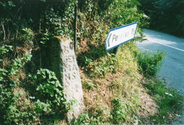
///draw.watching.warthog. Near Pensilva, Cornwall

Related Wikis

Golberdon

Golberdon is a village in Cornwall, England situated 6 miles (9.7 km) north-east of Liskeard. Golberdon is in the civil parish of South Hill (where the...

Trevigro

Trevigro is a hamlet in Cornwall, England, United Kingdom. It is about two miles west of Callington. == References ==

Gang, Cornwall

Gang is a hamlet in the parish of St Ive and Pensilva in east Cornwall, England, UK. == References ==

Parkfield, Cornwall

Parkfield is a hamlet in the parish of St Ive and Pensilva, Cornwall, England. == References ==

Have you been to Bicton Wood?

Leave your review of Bicton Wood below (or comments, questions and feedback).