Charlestown

Settlement in Cornwall

England

Charlestown

Charlestown Beach A view south west along Charlestown beach from the western harbour wall.
Charlestown Beach Credit: Kevin Pearson

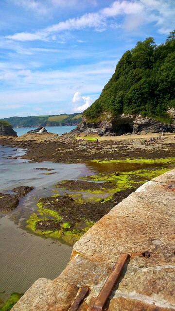
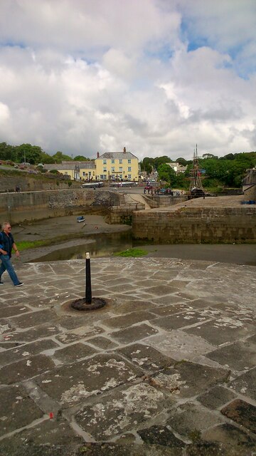
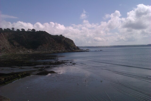
Charlestown is a small village located on the south coast of Cornwall, England. Situated approximately two miles south of St Austell, it is renowned for its picturesque harbor and rich maritime history. The village is often referred to as a "living museum" due to its well-preserved Georgian architecture and historic seafaring connections.

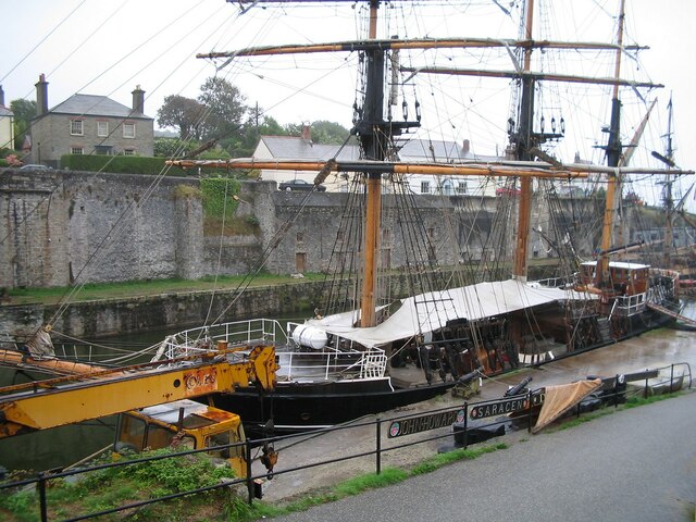
The harbor at Charlestown dates back to the late 18th century when it was constructed for the export of copper and china clay. Today, it serves as a popular filming location for period dramas and has featured in various movies and TV shows, including the likes of Poldark and Taboo. The harbor is home to a fleet of traditional tall ships and historic vessels, adding to the village's charm and character.

Charlestown offers visitors a range of attractions and activities. Besides exploring the harbor and its maritime heritage, tourists can visit the Charlestown Shipwreck and Heritage Centre, which houses an extensive collection of shipwreck artifacts. The village also boasts a selection of independent galleries, shops, and eateries, offering a mix of local crafts and culinary delights.

Surrounded by scenic coastal paths and sandy beaches, Charlestown attracts nature enthusiasts and outdoor enthusiasts alike. The nearby South West Coast Path provides stunning views of the rugged coastline and is a popular route for walkers. Additionally, the village is within close proximity to the famous Eden Project and the Lost Gardens of Heligan, both of which are major tourist attractions in Cornwall.

In summary, Charlestown is a charming Cornish village that offers a captivating glimpse into its maritime past, with its well-preserved harbor, historic architecture, and connection to the sea. It is a must-visit destination for history buffs and those seeking a tranquil coastal getaway.

If you have any feedback on the listing, please let us know in the comments section below.
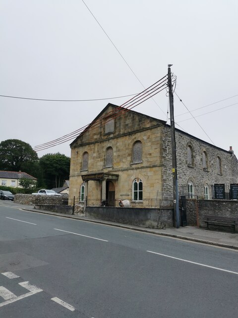
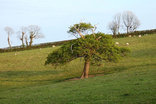
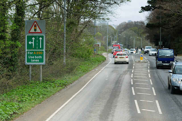
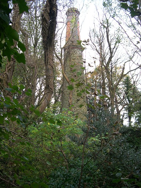
Charlestown Images

Images are sourced within 2km of 50.334776/-4.757132 or Grid Reference SX0351. Thanks to Geograph Open Source API. All images are credited.

Charlestown Beach A view south west along Charlestown beach from the western harbour wall.
Charlestown Beach
A view south west along Charlestown beach from the western harbour wall.
Charletown Harbour Photograph of the entrance into Charlestown Harbour, taken from the western harbour wall.
Charletown Harbour
Photograph of the entrance into Charlestown Harbour, taken from the western harbour wall.
Charlestown Beach Charlestown Beach, looking east from the harbour entrance.
Charlestown Beach
Charlestown Beach, looking east from the harbour entrance.
Tall Ship in Charlestown Harbour Charlestown is a village and port on the south coast of Cornwall. It is situated approximately 2 miles south east of St Austell town centre.
The port at Charlestown developed in the late-18th century from the fishing village of West Polmear. Charlestown has remained relatively unchanged since. Today the main focus of the village is tourism.
Wikipedia: <span class="nowrap"><a title="https://en.wikipedia.org/wiki/Charlestown,_Cornwall" rel="nofollow ugc noopener" href="https://en.wikipedia.org/wiki/Charlestown,_Cornwall">Link</a><img style="margin-left:2px;" alt="External link" title="External link - shift click to open in new window" src="https://s1.geograph.org.uk/img/external.png" width="10" height="10"/></span>
Tall Ship in Charlestown Harbour
Charlestown is a village and port on the south coast of Cornwall. It is situated approximately 2 miles south east of St Austell town centre. The port at Charlestown developed in the late-18th century from the fishing village of West Polmear. Charlestown has remained relatively unchanged since. Today the main focus of the village is tourism. Wikipedia: LinkExternal link
Charlestown Chapel Charlestown is a village and port on the south coast of Cornwall. It is situated approximately 2 miles south east of St Austell town centre.
The port at Charlestown developed in the late-18th century from the fishing village of West Polmear. Charlestown has remained relatively unchanged since. Today the main focus of the village is tourism.
Wikipedia: <span class="nowrap"><a title="https://en.wikipedia.org/wiki/Charlestown,_Cornwall" rel="nofollow ugc noopener" href="https://en.wikipedia.org/wiki/Charlestown,_Cornwall">Link</a><img style="margin-left:2px;" alt="External link" title="External link - shift click to open in new window" src="https://s1.geograph.org.uk/img/external.png" width="10" height="10"/></span>
Charlestown Chapel
Charlestown is a village and port on the south coast of Cornwall. It is situated approximately 2 miles south east of St Austell town centre. The port at Charlestown developed in the late-18th century from the fishing village of West Polmear. Charlestown has remained relatively unchanged since. Today the main focus of the village is tourism. Wikipedia: LinkExternal link
Pasture, St Austell Bay An oak seen from a footpath climbing to the west of Porthpean.
Pasture, St Austell Bay
An oak seen from a footpath climbing to the west of Porthpean.
St Austell, Southbourne Road The A390 on the southern outskirts of St Austell.
St Austell, Southbourne Road
The A390 on the southern outskirts of St Austell.
St Austell, Polmear Road A390 approaching Mount Charles Roundabout.
St Austell, Polmear Road
A390 approaching Mount Charles Roundabout.
Railway Bridge Crossing Holmbush Road The A390 on the outskirts of St Austell.
Railway Bridge Crossing Holmbush Road
The A390 on the outskirts of St Austell.
Holmbush Road, St Austell The A390  runs for 60 miles between Tavistock and a roundabout with the A30 at Three Burrows, 5 miles north west of the city of Truro in Cornwall, via Lostwithiel, St Blazey, and St Austell. It is an important road as it forms part of the main route (the Truro to Dobwalls section) from Truro to Plymouth. It can be used to travel along the spine of Cornwall as a more leisurely drive instead of using the A30.
Holmbush Road, St Austell
The A390 runs for 60 miles between Tavistock and a roundabout with the A30 at Three Burrows, 5 miles north west of the city of Truro in Cornwall, via Lostwithiel, St Blazey, and St Austell. It is an important road as it forms part of the main route (the Truro to Dobwalls section) from Truro to Plymouth. It can be used to travel along the spine of Cornwall as a more leisurely drive instead of using the A30.
A390 Holmbush Road The A390  runs for 60 miles between Tavistock and a roundabout with the A30 at Three Burrows, 5 miles north west of the city of Truro in Cornwall, via Lostwithiel, St Blazey, and St Austell. It is an important road as it forms part of the main route (the Truro to Dobwalls section) from Truro to Plymouth. It can be used to travel along the spine of Cornwall as a more leisurely drive instead of using the A30.
A390 Holmbush Road
The A390 runs for 60 miles between Tavistock and a roundabout with the A30 at Three Burrows, 5 miles north west of the city of Truro in Cornwall, via Lostwithiel, St Blazey, and St Austell. It is an important road as it forms part of the main route (the Truro to Dobwalls section) from Truro to Plymouth. It can be used to travel along the spine of Cornwall as a more leisurely drive instead of using the A30.
Holmbush Road (A390) The A390  runs for 60 miles between Tavistock and a roundabout with the A30 at Three Burrows, 5 miles north west of the city of Truro in Cornwall, via Lostwithiel, St Blazey, and St Austell. It is an important road as it forms part of the main route (the Truro to Dobwalls section) from Truro to Plymouth. It can be used to travel along the spine of Cornwall as a more leisurely drive instead of using the A30.
Holmbush Road (A390)
The A390 runs for 60 miles between Tavistock and a roundabout with the A30 at Three Burrows, 5 miles north west of the city of Truro in Cornwall, via Lostwithiel, St Blazey, and St Austell. It is an important road as it forms part of the main route (the Truro to Dobwalls section) from Truro to Plymouth. It can be used to travel along the spine of Cornwall as a more leisurely drive instead of using the A30.
A390, St Austell Road, St Blazey Gate The A390  runs for 60 miles between Tavistock and a roundabout with the A30 at Three Burrows, 5 miles north west of the city of Truro in Cornwall, via Lostwithiel, St Blazey, and St Austell. It is an important road as it forms part of the main route (the Truro to Dobwalls section) from Truro to Plymouth. It can be used to travel along the spine of Cornwall as a more leisurely drive instead of using the A30.
A390, St Austell Road, St Blazey Gate
The A390 runs for 60 miles between Tavistock and a roundabout with the A30 at Three Burrows, 5 miles north west of the city of Truro in Cornwall, via Lostwithiel, St Blazey, and St Austell. It is an important road as it forms part of the main route (the Truro to Dobwalls section) from Truro to Plymouth. It can be used to travel along the spine of Cornwall as a more leisurely drive instead of using the A30.
Signpost in Charlestown Shipwreck centre
Harbour front
Beach
Signpost in Charlestown
Shipwreck centre Harbour front Beach
Signpost in Charlestown Art gallery
Signpost in Charlestown
Art gallery
Old Milestone by Victoria Road, Mount Charles, St Austell Carved stone post by the UC road, in parish of ST AUSTELL (RESTORMEL District), Victoria Road, by No.11, Mount Charles, half buried in pavement until 1992, on North side of road. Erected by a private estate in the 19th century. 

Inscription reads:-
: PENRICE / 2 MILES : : ST / AUSTLE / 3/4 : 

Grade II listed. List Entry Number: 1394421

Milestone Society National ID: CW_PCSA02.
Old Milestone by Victoria Road, Mount Charles, St Austell
Carved stone post by the UC road, in parish of ST AUSTELL (RESTORMEL District), Victoria Road, by No.11, Mount Charles, half buried in pavement until 1992, on North side of road. Erected by a private estate in the 19th century. Inscription reads:- : PENRICE / 2 MILES : : ST / AUSTLE / 3/4 : Grade II listed. List Entry Number: 1394421 Milestone Society National ID: CW_PCSA02.
St Paul's Church
St Paul's Church
Charlestown Chapel
Charlestown Chapel
Show me another place!

Charlestown is located at Grid Ref: SX0351 (Lat: 50.334776, Lng: -4.757132)

Unitary Authority: Cornwall

Police Authority: Devon and Cornwall

What 3 Words

///surgical.bleaker.loves. Near St Austell, Cornwall

Related Wikis

Charlestown Shipwreck & Heritage Centre

The Shipwreck Treasure Museum (previously the Charlestown Shipwreck & Heritage Centre) located in the UNESCO World Heritage Site of Charlestown, Cornwall...

St Paul's Church, Charlestown

St Paul's Church is a Church of England church in Charlestown, Cornwall, England, UK. It was built in 1849-51 and has been Grade II listed since 1999....

Charlestown, Cornwall

Charlestown (Cornish: Porth Meur, meaning great cove) is a village and port on the south coast of Cornwall, England, in the civil parish of St Austell...

Holmbush, Cornwall

Holmbush is a village in Cornwall, England that is situated in the suburban area of St Austell (where the population at the 2011 census was included)....

Nearby Amenities

Located within 500m of 50.334776,-4.757132
Mini Roundabout
Direction: clockwise
Lat/Long: 50.3379976/-4.758694
Source: PGS
Lat/Long: 50.3306429/-4.756774
Source: PGS
Lat/Long: 50.3310356/-4.7559705
Source: PGS
Lat/Long: 50.3322046/-4.7524553
Charlestown
Is In: Cornwall, England, UK
Is In Country: England
Is In Country Code: GB
Is In County: Cornwall
Name En: Charlestown
Name Kw: Porthmeur
Place: village
Wikidata: Q937918
Lat/Long: 50.3329873/-4.7577601
Place Of Worship
Charlestown Methodist Church
Denomination: methodist
Node Id: 705650945
Religion: christian
Source Name: OS Open Local Important Buildings Layer
Vacant: yes
Lat/Long: 50.3333847/-4.7587082
Shipwreck Treasure Museum
Addr City: St Austell
Addr Postcode: PL25 3NJ
Addr Street: Quay Rd Charlestown Rd
Fee: yes
Museum: maritime:history
Note: Last Entry: 16:00
Old Name: Charlestown Shipwreck Centre
Opening Hours: Mo-Su 10:00-17:00
Tourism: museum
Website: https://www.shipwreckcharlestown.co.uk/
Wikidata: Q24895779
Wikipedia: en:Charlestown Shipwreck & Heritage Centre
Lat/Long: 50.3327867/-4.7567361
Place Of Worship
Place Of Worship: cemetery_chapel
Religion: christian
Lat/Long: 50.337446/-4.7559313
Post Box
Brand: Royal Mail
Brand Wikidata: Q638098
Collection Times: Mo-Fr 09:00; Sa 07:00
Operator: Royal Mail
Operator Wikidata: Q638098
Post Box Mounting: building
Post Box Type: wall
Ref: PL25 27
Royal Cypher: VR
Lat/Long: 50.3356013/-4.7620703
Source: PGS
Lat/Long: 50.3306122/-4.7565717
T'Gallants Guest House
Phone: +44 1726 70203
Tourism: guest_house
Website: www.tgallants.co.uk
Lat/Long: 50.3327709/-4.7580469
Restaurant
Pier House Hotel
Addr City: St Austell
Addr Place: Charlestown
Addr Postcode: PL25 3NJ
Addr Street: Charlestown Road
Cuisine: international
Fhrs Id: 402091
Operator: St Austell's Brewery
Outdoor Seating: yes
Source Addr: FHRS Open Data
Wikidata: Q26659713
Lat/Long: 50.331361/-4.7570051
Source: PGS
Lat/Long: 50.3306959/-4.7558576
Anna's
Fixme: needs to be confirmed, JAug 2021
Shop: yes
Lat/Long: 50.3330846/-4.758791
Pub
Harbour Side
Dog: yes
Food: yes
Image: https://archive.org/details/charlestown-photos/Charlestown%202020-08-25/DSCN1575.JPG
Internet Access: wlan
Internet Access Fee: no
Old Name: The Harbourside Inn
Operator: St Austell's Brewery
Real Ale: yes
Lat/Long: 50.3315282/-4.7571816
Barrier: bollard
Bollard: fixed
Lat/Long: 50.3313377/-4.7556386
Seamark Type: gate
Waterway: lock_gate
Lat/Long: 50.3312018/-4.7563952
Seamark Light Category: vertical
Seamark Light Character: F
Seamark Light Colour: red
Seamark Light Height: 5
Seamark Light Multiple: 2
Seamark Light Range: 1
Seamark Light Reference: A 0080.2
Seamark Type: light_minor
Source: US NGA Pub. 114. 2011-05-26.
Lat/Long: 50.3305029/-4.7558295
Seamark Light Category: vertical
Seamark Light Character: F
Seamark Light Colour: green
Seamark Light Height: 5
Seamark Light Multiple: 2
Seamark Light Range: 1
Seamark Light Reference: A 0080
Seamark Type: light_minor
Source: US NGA Pub. 114. 2011-05-26.
Lat/Long: 50.3307657/-4.7558859
Cafe
Charlies
Indoor Seating: yes
Outdoor Seating: yes
Lat/Long: 50.3336155/-4.7593197
Parking
Access: private
Parking: surface
Lat/Long: 50.3353407/-4.7603783
Old Mine
Historic: ruins
Lat/Long: 50.3302781/-4.7572437
Restaurant
Bosun's Diner
Cuisine: international
Lat/Long: 50.3329411/-4.7569834
Post Box
Brand: Royal Mail
Brand Wikidata: Q638098
Brand Wikipedia: en:Royal Mail
Collection Times: Mo-Fr 09:00; Sa 07:00
Operator: Royal Mail
Operator Wikidata: Q638098
Post Box Mounting: building
Post Box Type: wall
Ref: PL25 44D
Royal Cypher: GR
Royal Cypher Wikidata: Q33102273
Lat/Long: 50.3315697/-4.7561561
Cafe
Lat/Long: 50.3321201/-4.757804
Bench
Lat/Long: 50.3305073/-4.7572434
Bench
Backrest: yes
Lat/Long: 50.3324574/-4.7525951
Barrier: kissing_gate
Lat/Long: 50.3316346/-4.7550833
Restaurant
The Long Store
Addr City: St Austell
Addr Place: Charlestown
Addr Postcode: PL25 3NJ
Addr Street: Charlestown Road
Fhrs Id: 920719
Image: https://archive.org/details/charlestown-photos/Charlestown%202020-08-25/DSCN1613.JPG
Level: 1
Name En: The Long Store
Outdoor Seating: yes
Source Addr: FHRS Open Data
Lat/Long: 50.33177/-4.7578762
Post Box
Collection Times: Mo-Fr 09:00; Sa 07:00
Post Box Mounting: building
Post Box Type: wall
Ref: PL25 135D
Royal Cypher: EIIR
Royal Cypher Wikidata: Q33102113
Lat/Long: 50.3336787/-4.7593462
Generator Method: photovoltaic
Generator Output Electricity: yes
Generator Source: solar
Generator Type: solar_photovoltaic_panel
Location: roof
Power: generator
Lat/Long: 50.3368071/-4.7518631
Crossing
Crossing: unmarked
Crossing Island: no
Crossing Markings: no
Kerb: flush
Tactile Paving: no
Lat/Long: 50.3370043/-4.7515645
Access: yes
Leisure: playground
Lat/Long: 50.334735/-4.7598663
Generator Method: photovoltaic
Generator Output Electricity: yes
Generator Source: solar
Generator Type: solar_photovoltaic_panel
Location: roof
Power: generator
Lat/Long: 50.3392021/-4.7574878
Generator Method: photovoltaic
Generator Output Electricity: yes
Generator Source: solar
Generator Type: solar_photovoltaic_panel
Location: roof
Power: generator
Lat/Long: 50.3388529/-4.7574207
Generator Method: photovoltaic
Generator Output Electricity: yes
Generator Source: solar
Generator Type: solar_photovoltaic_panel
Location: roof
Power: generator
Lat/Long: 50.3389231/-4.7589281
Generator Method: photovoltaic
Generator Output Electricity: yes
Generator Source: solar
Generator Type: solar_photovoltaic_panel
Location: roof
Power: generator
Lat/Long: 50.3389402/-4.7584292
Generator Method: photovoltaic
Generator Output Electricity: yes
Generator Source: solar
Generator Type: solar_photovoltaic_panel
Location: roof
Power: generator
Lat/Long: 50.3383719/-4.7597221
Generator Method: photovoltaic
Generator Output Electricity: yes
Generator Source: solar
Generator Type: solar_photovoltaic_panel
Location: roof
Power: generator
Lat/Long: 50.3339651/-4.7510773
Generator Method: photovoltaic
Generator Output Electricity: yes
Generator Source: solar
Generator Type: solar_photovoltaic_panel
Location: roof
Power: generator
Lat/Long: 50.3348075/-4.7501573
Generator Method: photovoltaic
Generator Output Electricity: yes
Generator Source: solar
Generator Type: solar_photovoltaic_panel
Location: roof
Power: generator
Lat/Long: 50.3337837/-4.7507957
Generator Method: photovoltaic
Generator Output Electricity: yes
Generator Source: solar
Generator Type: solar_photovoltaic_panel
Location: roof
Power: generator
Lat/Long: 50.3349821/-4.7522306
Generator Method: photovoltaic
Generator Output Electricity: yes
Generator Source: solar
Generator Type: solar_photovoltaic_panel
Location: roof
Power: generator
Lat/Long: 50.3377641/-4.7539902
Generator Method: photovoltaic
Generator Output Electricity: yes
Generator Source: solar
Generator Type: solar_photovoltaic_panel
Location: roof
Power: generator
Lat/Long: 50.3380243/-4.7526115
Generator Method: photovoltaic
Generator Output Electricity: yes
Generator Source: solar
Generator Type: solar_photovoltaic_panel
Location: roof
Power: generator
Lat/Long: 50.3380312/-4.7540814
Generator Method: photovoltaic
Generator Output Electricity: yes
Generator Source: solar
Generator Type: solar_photovoltaic_panel
Location: roof
Power: generator
Lat/Long: 50.3386475/-4.7537461
Generator Method: photovoltaic
Generator Output Electricity: yes
Generator Source: solar
Generator Type: solar_photovoltaic_panel
Location: roof
Power: generator
Lat/Long: 50.3390566/-4.7551382
Generator Method: photovoltaic
Generator Output Electricity: yes
Generator Source: solar
Generator Type: solar_photovoltaic_panel
Location: roof
Power: generator
Lat/Long: 50.3390481/-4.7550711
Condition: abandoned
Man Made: adit
Lat/Long: 50.3304587/-4.7571372
Traffic Calming: bump
Lat/Long: 50.3383792/-4.7541939
Traffic Calming: bump
Lat/Long: 50.3385161/-4.7540196
Traffic Calming: bump
Lat/Long: 50.3385392/-4.7548363
Traffic Calming: bump
Lat/Long: 50.338719/-4.7545681
WW2 Pillbox
Building: bunker
Bunker Type: pillbox
Military: bunker
Lat/Long: 50.3314099/-4.7552849
Entrance: yes
Lat/Long: 50.3360849/-4.7609138
Entrance: yes
Lat/Long: 50.3330999/-4.7574074
Entrance: yes
Lat/Long: 50.3327748/-4.7585199
Bus Stop
Opp Foundry Parc
Bench: no
Bin: no
Bus: yes
Lit: yes
Long Name: Charlestown, opp Opp Foundry Parc
Naptan AdministrativeAreaCode: 73
Naptan AtcoCode: 0800COA15313
Naptan Bearing: NW
Naptan BusStopType: CUS
Naptan CommonName: Opp Foundry Parc
Naptan Indicator: opp
Naptan LocalityName: Charlestown
Naptan ModificationDate: 2021-07-07
Naptan NaptanCode: corgdmdm
Naptan NptgLocalityCode: E0004505
Naptan ParentLocalityName: St Austell
Naptan Street: Charlestown Road
Public Transport: platform
Shelter: no
Tactile Paving: no
Lat/Long: 50.3361668/-4.7630762
Bus Stop
Glebe House
Bench: yes
Bin: yes
Bus: yes
Lit: yes
Long Name: Carlyon Bay Glebe House (NW-bound)
Naptan AdministrativeAreaCode: 73
Naptan AtcoCode: 0800COC31465
Naptan Bearing: NW
Naptan BusStopType: CUS
Naptan CommonName: Glebe House
Naptan Indicator: NW-bound
Naptan LocalityName: Carlyon Bay
Naptan ModificationDate: 2020-02-25 08:31
Naptan NaptanCode: cordjtmg
Naptan NptgLocalityCode: E0004490
Naptan RegionCode: cordjtmg
Naptan Street: Crinnis Road
Public Transport: platform
Shelter: no
Tactile Paving: no
Lat/Long: 50.3370431/-4.7531878
Bench
Backrest: yes
Material: wood
Lat/Long: 50.3308602/-4.7569406
Bench
Backrest: yes
Material: wood
Lat/Long: 50.3308876/-4.7569413
Bench
Backrest: yes
Material: wood
Lat/Long: 50.3309222/-4.7569413
Bench
Backrest: yes
Material: wood
Lat/Long: 50.3311431/-4.7570284
Bench
Backrest: yes
Material: wood
Lat/Long: 50.3311251/-4.7570258
Bench
Backrest: yes
Material: wood
Lat/Long: 50.3311029/-4.7570197
Bench
Backrest: yes
Material: wood
Lat/Long: 50.3310828/-4.757017
Life Ring
Emergency: life_ring
Lat/Long: 50.3315797/-4.7569352
Life Ring
Emergency: life_ring
Lat/Long: 50.332358/-4.7575918
Historic: yes
Image: https://archive.org/details/charlestown-photos/Charlestown%202020-08-25/DSCN1572.JPG
Lat/Long: 50.3321358/-4.7567837
Life Ring
Emergency: life_ring
Lat/Long: 50.3321592/-4.7568305
Note: There are disused steps here
Lat/Long: 50.3319505/-4.7574082
Street Lamp
Lat/Long: 50.331902/-4.7575019
Bench
Backrest: yes
Material: wood
Lat/Long: 50.3319132/-4.7575186
Historic: boat
Note: Boat permanently placed on land. Probably too small to be tagged as a historic=ship
Lat/Long: 50.3325184/-4.7575253
Give Way
Lat/Long: 50.3325762/-4.7580189
Sail Loft Emporium
Image: https://archive.org/details/charlestown-photos/Charlestown%202020-08-25/DSCN1631.JPG
Shop: antiques
Lat/Long: 50.3325347/-4.7587256
Telephone
Booth: KX100
Operator: BT
Operator Wikidata: Q593786
Lat/Long: 50.3329824/-4.7583793
Bicycle Parking
Bicycle Parking: stands
Capacity: 8
Covered: no
Lat/Long: 50.3329537/-4.7583571
Homes of Cornwall
Level: 0
Office: estate_agent
Lat/Long: 50.3317257/-4.7578526
Street Lamp
Ref: D198
Lat/Long: 50.3316257/-4.7572074
Life Ring
Emergency: life_ring
Lat/Long: 50.330987/-4.7561205
Bench
Backrest: yes
Material: wood
Lat/Long: 50.3312313/-4.7562315
Life Ring
Emergency: life_ring
Lat/Long: 50.331184/-4.7562596
Bench
Backrest: yes
Material: wood
Lat/Long: 50.331145/-4.756205
Bench
Backrest: yes
Material: wood
Lat/Long: 50.3311639/-4.7562141
Bench
Backrest: yes
Material: wood
Lat/Long: 50.3311679/-4.7562345
Life Ring
Emergency: life_ring
Lat/Long: 50.330487/-4.7558142
Bench
Backrest: yes
Material: wood
Lat/Long: 50.3310096/-4.755979
Bus Stop
Glebe House
Bench: no
Bin: no
Bus: yes
Lit: yes
Long Name: Carlyon Bay, opp Glebe House
Naptan AdministrativeAreaCode: 73
Naptan AtcoCode: 0800COC31466
Naptan Bearing: E
Naptan BusStopType: CUS
Naptan CommonName: Glebe House
Naptan Indicator: opp
Naptan LocalityName: Carlyon Bay
Naptan ModificationDate: 2015-04-25 12:19
Naptan NptgLocalityCode: E0004490
Naptan RegionCode: cordjtmp
Naptan Street: Beach Road
Public Transport: platform
Shelter: no
Survey Date: 2022-04-09
Tactile Paving: no
Lat/Long: 50.337076/-4.7526149
Waste Basket
Survey Date: 2022-04-09
Lat/Long: 50.3312222/-4.7559184
Waste Basket
Survey Date: 2022-04-09
Lat/Long: 50.3314383/-4.7568581
Fire Hydrant
Emergency: fire_hydrant
Fire Hydrant Diameter: 100
Fire Hydrant Position: sidewalk
Fire Hydrant Type: underground
Survey Date: 2022-04-09
Lat/Long: 50.3370149/-4.7512892
Waste Basket
Survey Date: 2022-04-09
Lat/Long: 50.3370409/-4.7531797
Fire Hydrant
Emergency: fire_hydrant
Survey Date: 2022-04-09
Lat/Long: 50.3316096/-4.7570966
Fire Hydrant
Emergency: fire_hydrant
Fire Hydrant Type: underground
Survey Date: 2022-04-09
Lat/Long: 50.3333478/-4.7576541
Waste Basket
Survey Date: 2022-04-09
Lat/Long: 50.3311222/-4.7559712
Bench
Backrest: yes
Survey Date: 2022-04-09
Lat/Long: 50.3310577/-4.7562169
Life Ring
Emergency: life_ring
Survey Date: 2022-04-09
Lat/Long: 50.3307778/-4.7568681
Barrier: yes
Lat/Long: 50.330813/-4.7569913
Ice Cream
Tallships Creamery
Check Date: 2022-09-13
Indoor Seating: no
Outdoor Seating: yes
Lat/Long: 50.3325887/-4.7578333
coast path sign
Hiking: yes
Information: guidepost
Tourism: information
Lat/Long: 50.3316263/-4.7572052
Bus Stop
Charlestown Old Chapel (SE-bound)
Bench: no
Bin: no
Bus: yes
Lit: yes
Long Name: Charlestown Old Chapel (SE-bound)
Naptan AdministrativeAreaCode: 73
Naptan AtcoCode: 0800COC31472
Naptan Bearing: SE
Naptan BusStopType: CUS
Naptan CommonName: Old Chapel
Naptan Indicator: SE-bound
Naptan LocalityName: Charlestown
Naptan ModificationDate: 2016-02-29 16:47
Naptan NptgLocalityCode: E0004505
Naptan ParentLocalityName: St Austell
Naptan RegionCode: cordjtdj
Naptan Street: Charlestown Road
Naptan Verified: no
Public Transport: platform
Shelter: no
Tactile Paving: no
Lat/Long: 50.33369/-4.75911
Bus Stop
Charlestown Old Chapel (NW-bound)
Bench: no
Bin: no
Bus: yes
Lit: yes
Long Name: Charlestown Old Chapel (NW-bound)
Naptan AdministrativeAreaCode: 73
Naptan AtcoCode: 0800COC31471
Naptan Bearing: NW
Naptan BusStopType: MKD
Naptan CommonName: Old Chapel
Naptan Indicator: NW-bound
Naptan LocalityName: Charlestown
Naptan ModificationDate: 2015-03-19 08:09
Naptan NptgLocalityCode: E0004505
Naptan ParentLocalityName: St Austell
Naptan RegionCode: cordjtdm
Naptan Street: Charlestown Road
Naptan Verified: no
Public Transport: platform
Shelter: no
Tactile Paving: no
Lat/Long: 50.33351/-4.75909
Bus Stop
Charlestown, opp Church
Bench: no
Bin: no
Bus: yes
Lit: yes
Long Name: Charlestown, opp Church
Naptan AdministrativeAreaCode: 73
Naptan AtcoCode: 0800COC31470
Naptan Bearing: NE
Naptan BusStopType: CUS
Naptan CommonName: Church
Naptan Indicator: opp
Naptan LocalityName: Charlestown
Naptan ModificationDate: 2021-07-07 13:30
Naptan NptgLocalityCode: E0004505
Naptan ParentLocalityName: St Austell
Naptan RegionCode: cordjtag
Naptan Street: Church Road
Naptan Verified: no
Public Transport: platform
Shelter: no
Tactile Paving: no
Lat/Long: 50.33602/-4.76133
Bus Stop
Charlestown Church (SW-bound)
Bench: no
Bin: no
Bus: yes
Lit: yes
Long Name: Charlestown Church (SW-bound)
Naptan AdministrativeAreaCode: 73
Naptan AtcoCode: 0800COC31469
Naptan Bearing: SW
Naptan BusStopType: CUS
Naptan CommonName: Church
Naptan Indicator: SW-bound
Naptan LocalityName: Charlestown
Naptan ModificationDate: 2021-07-07 13:30
Naptan NptgLocalityCode: E0004505
Naptan ParentLocalityName: St Austell
Naptan RegionCode: cordjtaj
Naptan Street: Church Road
Naptan Verified: no
Public Transport: platform
Shelter: no
Tactile Paving: no
Lat/Long: 50.33622/-4.761
Bus Stop
Holmbush Arch Road
Bench: no
Bin: no
Bus: yes
Lit: no
Long Name: Charlestown, opp Holmbush Arch Road
Naptan AdministrativeAreaCode: 73
Naptan AtcoCode: 0800COC31468
Naptan Bearing: SW
Naptan BusStopType: CUS
Naptan CommonName: Holmbush Arch Road
Naptan Indicator: opp
Naptan LocalityName: Charlestown
Naptan ModificationDate: 2021-07-07 13:30
Naptan NptgLocalityCode: E0004505
Naptan ParentLocalityName: St Austell
Naptan RegionCode: cordjtdt
Naptan Street: Church Road
Naptan Verified: no
Public Transport: platform
Shelter: no
Tactile Paving: no
Lat/Long: 50.3376846/-4.7591743
Bus Stop
Holmbush Arch Road
Bench: no
Bin: no
Bus: yes
Lit: no
Long Name: Charlestown Holmbush Arch Road (NE-bound)
Naptan AdministrativeAreaCode: 73
Naptan AtcoCode: 0800COC31467
Naptan Bearing: NE
Naptan BusStopType: CUS
Naptan CommonName: Holmbush Arch Road
Naptan Indicator: NE-bound
Naptan LocalityName: Charlestown
Naptan ModificationDate: 2021-07-07 13:30
Naptan NptgLocalityCode: E0004505
Naptan ParentLocalityName: St Austell
Naptan RegionCode: cordjtdg
Naptan Street: Church Road
Naptan Verified: no
Public Transport: platform
Shelter: no
Tactile Paving: no
Lat/Long: 50.3375409/-4.7596877
Bus Stop
Foundry Parc
Bus: yes
Long Name: Charlestown Foundry Parc (SE-bound)
Naptan AdministrativeAreaCode: 73
Naptan AtcoCode: 0800COA15312
Naptan Bearing: SE
Naptan BusStopType: CUS
Naptan CommonName: Foundry Parc
Naptan Indicator: SE-bound
Naptan LocalityName: Charlestown
Naptan ModificationDate: 2017-01-04
Naptan NaptanCode: corgdmdj
Naptan NptgLocalityCode: E0004505
Naptan ParentLocalityName: St Austell
Naptan Verified: no
Public Transport: platform
Lat/Long: 50.3363692/-4.7632734
The Ore Floor - Historic Site of Interest
Board Type: history
Information: board
Tourism: information
Lat/Long: 50.3331078/-4.757387
Bench
Backrest: yes
Survey Date: 2024-04-13
Lat/Long: 50.3324895/-4.7574987
Bench
Backrest: yes
Survey Date: 2024-04-13
Lat/Long: 50.3324765/-4.7575442
Waste Basket
Survey Date: 2024-04-13
Lat/Long: 50.3323465/-4.7577391
Life Ring
Emergency: life_ring
Survey Date: 2024-04-13
Lat/Long: 50.3320242/-4.7573288
Life Ring
Emergency: life_ring
Survey Date: 2024-04-13
Lat/Long: 50.3322704/-4.7576189
Life Ring
Emergency: life_ring
Survey Date: 2024-04-13
Lat/Long: 50.3320146/-4.7566401
Life Ring
Emergency: life_ring
Survey Date: 2024-04-13
Lat/Long: 50.3316967/-4.7564131
Bench
Backrest: yes
Survey Date: 2024-04-13
Lat/Long: 50.333281/-4.758758
Bench
Backrest: yes
Survey Date: 2024-04-13
Lat/Long: 50.3330115/-4.758408
Life Ring
Emergency: life_ring
Survey Date: 2024-04-13
Lat/Long: 50.3305545/-4.7563093
Waste Basket
Survey Date: 2024-04-13
Lat/Long: 50.336074/-4.7630698
Defibrillator
Defibrillator Location: On outside wall of Pattern Hall, facing south
Emergency: defibrillator
Indoor: no
Survey Date: 2024-04-13
Lat/Long: 50.3369827/-4.7632428
Bench
Backrest: yes
Survey Date: 2024-04-13
Lat/Long: 50.3356494/-4.7618202
Fire Hydrant
Emergency: fire_hydrant
Fire Hydrant Diameter: 3"
Fire Hydrant Position: sidewalk
Fire Hydrant Type: underground
Survey Date: 2024-04-13
Lat/Long: 50.3357022/-4.7616867
Fire Hydrant
Emergency: fire_hydrant
Fire Hydrant Diameter: 75
Fire Hydrant Position: sidewalk
Fire Hydrant Type: underground
Survey Date: 2024-04-13
Lat/Long: 50.3361759/-4.7612065
Defibrillator
Defibrillator Location: On outside wall of St Paul's Church Hall facing car park
Emergency: defibrillator
Indoor: no
Survey Date: 2024-04-13
Lat/Long: 50.3366731/-4.7600674
Bus Stop
Bench: no
Shelter: no
Survey Date: 2024-04-13
Lat/Long: 50.3384462/-4.7573042
Waste Basket
Survey Date: 2024-04-13
Lat/Long: 50.3379653/-4.7586414
Fire Hydrant
Emergency: fire_hydrant
Fire Hydrant Diameter: 150
Fire Hydrant Position: lane
Fire Hydrant Type: underground
Survey Date: 2024-04-13
Lat/Long: 50.3380747/-4.7585743
The data included in this document is from www.openstreetmap.org. The data is made available under ODbL.

Have you been to Charlestown?

Leave your review of Charlestown below (or comments, questions and feedback).