Polmear Island

Coastal Feature, Headland, Point in Cornwall

England

Polmear Island

Coastline, St Austell Bay Silvermine Point viewed from the coast path to its south.
Coastline, St Austell Bay Credit: Andrew Smith

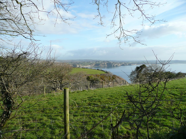
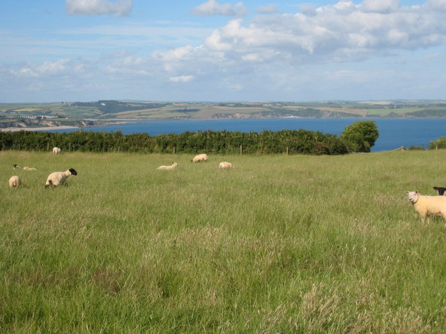
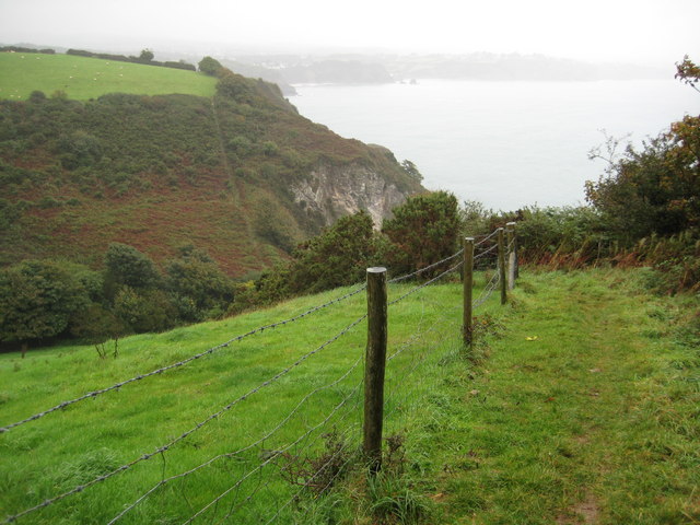
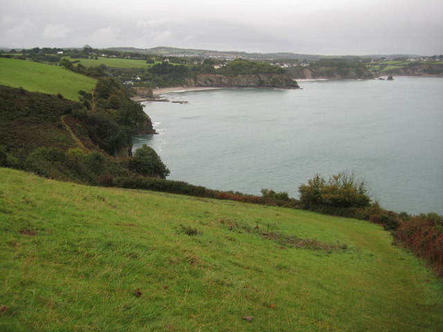
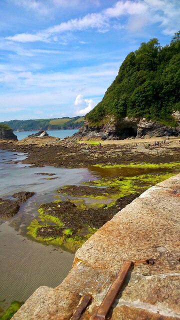
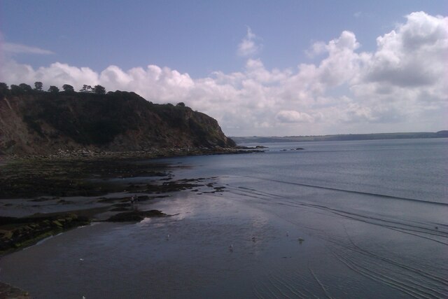
Polmear Island is a picturesque coastal feature located in Cornwall, England. Positioned along the southwestern coast, this small headland juts out into the Atlantic Ocean, forming a stunning point that offers breathtaking views and natural beauty.

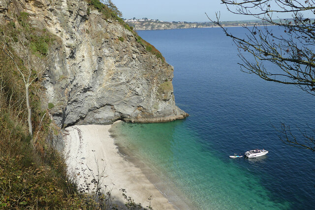
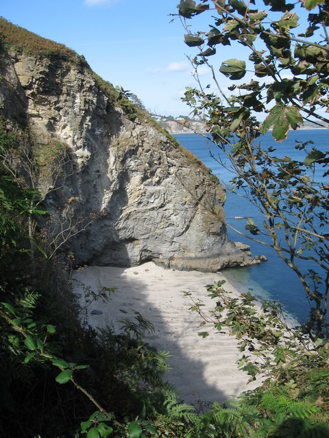
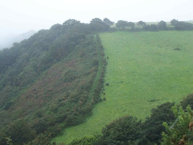
The island is characterized by its rugged cliffs and rocky shoreline, providing a haven for a diverse range of marine life. The surrounding waters are teeming with various species of fish, making it a popular spot for fishing enthusiasts and wildlife enthusiasts alike. The area is also home to a wide array of seabirds, including gulls, cormorants, and puffins, which nest on the cliffs and provide a mesmerizing display of aerial acrobatics.

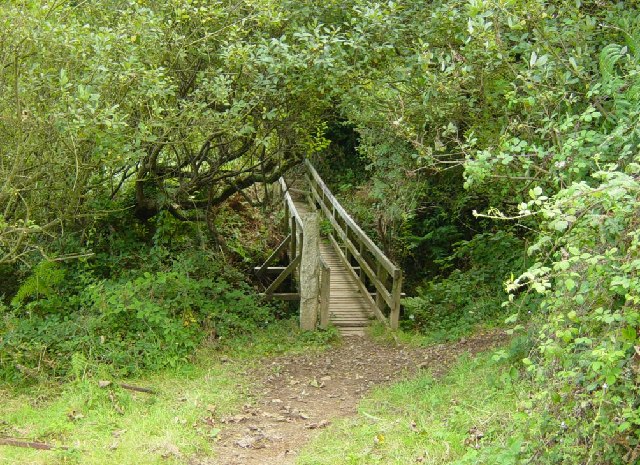
Polmear Island is accessible by foot during low tide, but caution must be exercised due to the treacherous nature of the rocks and strong tides. The island's geographical features, such as sea caves and rock pools, offer opportunities for exploration and discovery, making it an attractive destination for adventurous visitors.

The island is surrounded by pristine sandy beaches, providing a perfect spot for sunbathing and relaxation. The clear azure waters are inviting for swimming and snorkeling, with the chance to encounter a variety of marine life up close.

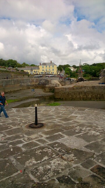
Polmear Island is a place of natural beauty and tranquility, offering visitors a chance to escape the hustle and bustle of daily life and immerse themselves in the stunning coastal landscape of Cornwall. Whether it's exploring the rocky shores, observing the abundant wildlife, or simply enjoying the peaceful surroundings, Polmear Island is a must-visit destination for nature lovers and outdoor enthusiasts.

If you have any feedback on the listing, please let us know in the comments section below.

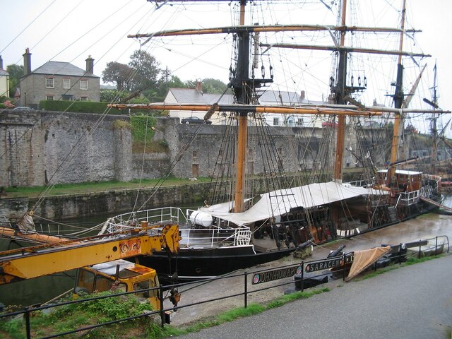
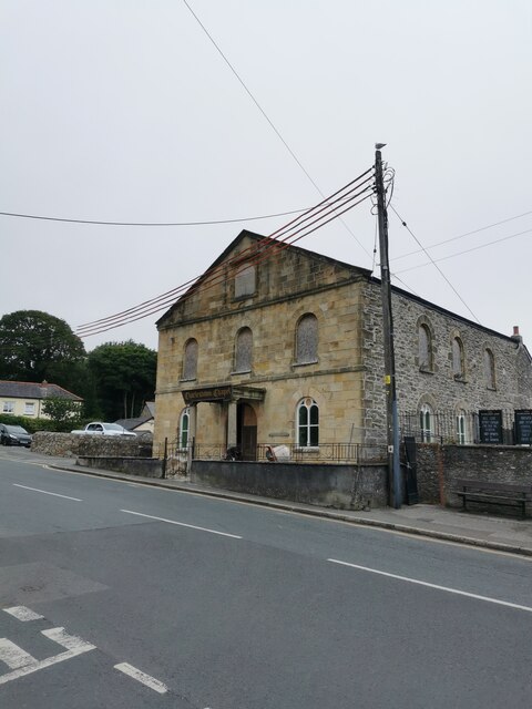
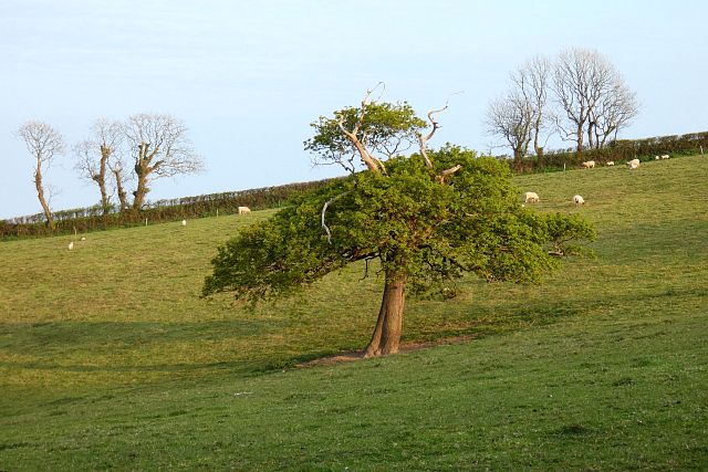
Polmear Island Images

Images are sourced within 2km of 50.32875/-4.7564785 or Grid Reference SX0351. Thanks to Geograph Open Source API. All images are credited.

Coastline, St Austell Bay Silvermine Point viewed from the coast path to its south.
Coastline, St Austell Bay
Silvermine Point viewed from the coast path to its south.
Silvermine Point Silvermine Point (as named on 1:25k map) and small un-named cove, as seen from the South West Coast Path.
Silvermine Point
Silvermine Point (as named on 1:25k map) and small un-named cove, as seen from the South West Coast Path.
Steps on the Coast Path near Silvermine Point The Southwest Coast Path crosses a steep coombe.  You could get this sort of exercise in a gym but it would be much more boring!
Steps on the Coast Path near Silvermine Point
The Southwest Coast Path crosses a steep coombe. You could get this sort of exercise in a gym but it would be much more boring!
Footbridge on the South West Coast Path near Silvermine Point The footbridge crosses a deep but narrow gorge between Phoebe's Point and Gwendra Point. There are 172 steps up both sides of the gorge. Looking south.
Footbridge on the South West Coast Path near Silvermine Point
The footbridge crosses a deep but narrow gorge between Phoebe's Point and Gwendra Point. There are 172 steps up both sides of the gorge. Looking south.
The Ropehaven Cliffsnear to the Blackhead, Cornwall
Countryside south of Castle Gotha Looking north with St Austell in the far distance.
Countryside south of Castle Gotha
Looking north with St Austell in the far distance.
A glimpse of the coast Northerly view towards Carrickowel Point and St Austell Bay.
A glimpse of the coast
Northerly view towards Carrickowel Point and St Austell Bay.
Cornish Coastal Path, Near Porthpean The path snakes climbs up a steep hill
Cornish Coastal Path, Near Porthpean
The path snakes climbs up a steep hill
Castle Gotha An ancient settlement dating from the C2nd BC. Little evidence remains visible except for the shape of the surrounding hedges, which follow the line of the ramparts <span class="nowrap"><a title="http://www.themodernantiquarian.com/site/4911/castle_gotha_settlement.html" rel="nofollow ugc noopener" href="http://www.themodernantiquarian.com/site/4911/castle_gotha_settlement.html">Link</a><img style="margin-left:2px;" alt="External link" title="External link - shift click to open in new window" src="https://s1.geograph.org.uk/img/external.png" width="10" height="10"/></span>
Castle Gotha
An ancient settlement dating from the C2nd BC. Little evidence remains visible except for the shape of the surrounding hedges, which follow the line of the ramparts LinkExternal link
Coast path near Slivermine Point After a short section of level walking the coast path descends into this valley and climbs steeply out on the north side.
Coast path near Slivermine Point
After a short section of level walking the coast path descends into this valley and climbs steeply out on the north side.
Above Phoebe's Point The coast path above Phoebe's Point with Porth Paen in the background.
Above Phoebe's Point
The coast path above Phoebe's Point with Porth Paen in the background.
Charlestown Beach A view south west along Charlestown beach from the western harbour wall.
Charlestown Beach
A view south west along Charlestown beach from the western harbour wall.
Charletown Harbour Photograph of the entrance into Charlestown Harbour, taken from the western harbour wall.
Charletown Harbour
Photograph of the entrance into Charlestown Harbour, taken from the western harbour wall.
Charlestown Beach Charlestown Beach, looking east from the harbour entrance.
Charlestown Beach
Charlestown Beach, looking east from the harbour entrance.
Tall Ship in Charlestown Harbour Charlestown is a village and port on the south coast of Cornwall. It is situated approximately 2 miles south east of St Austell town centre.
The port at Charlestown developed in the late-18th century from the fishing village of West Polmear. Charlestown has remained relatively unchanged since. Today the main focus of the village is tourism.
Wikipedia: <span class="nowrap"><a title="https://en.wikipedia.org/wiki/Charlestown,_Cornwall" rel="nofollow ugc noopener" href="https://en.wikipedia.org/wiki/Charlestown,_Cornwall">Link</a><img style="margin-left:2px;" alt="External link" title="External link - shift click to open in new window" src="https://s1.geograph.org.uk/img/external.png" width="10" height="10"/></span>
Tall Ship in Charlestown Harbour
Charlestown is a village and port on the south coast of Cornwall. It is situated approximately 2 miles south east of St Austell town centre. The port at Charlestown developed in the late-18th century from the fishing village of West Polmear. Charlestown has remained relatively unchanged since. Today the main focus of the village is tourism. Wikipedia: LinkExternal link
Charlestown Chapel Charlestown is a village and port on the south coast of Cornwall. It is situated approximately 2 miles south east of St Austell town centre.
The port at Charlestown developed in the late-18th century from the fishing village of West Polmear. Charlestown has remained relatively unchanged since. Today the main focus of the village is tourism.
Wikipedia: <span class="nowrap"><a title="https://en.wikipedia.org/wiki/Charlestown,_Cornwall" rel="nofollow ugc noopener" href="https://en.wikipedia.org/wiki/Charlestown,_Cornwall">Link</a><img style="margin-left:2px;" alt="External link" title="External link - shift click to open in new window" src="https://s1.geograph.org.uk/img/external.png" width="10" height="10"/></span>
Charlestown Chapel
Charlestown is a village and port on the south coast of Cornwall. It is situated approximately 2 miles south east of St Austell town centre. The port at Charlestown developed in the late-18th century from the fishing village of West Polmear. Charlestown has remained relatively unchanged since. Today the main focus of the village is tourism. Wikipedia: LinkExternal link
Pasture, St Austell Bay An oak seen from a footpath climbing to the west of Porthpean.
Pasture, St Austell Bay
An oak seen from a footpath climbing to the west of Porthpean.
St Austell, Southbourne Road The A390 on the southern outskirts of St Austell.
St Austell, Southbourne Road
The A390 on the southern outskirts of St Austell.
Show me another place!

Polmear Island is located at Grid Ref: SX0351 (Lat: 50.32875, Lng: -4.7564785)

Unitary Authority: Cornwall

Police Authority: Devon and Cornwall

What 3 Words

///cage.fatter.remaking. Near St Austell, Cornwall

Related Wikis

Charlestown, Cornwall

Charlestown (Cornish: Porth Meur, meaning great cove) is a village and port on the south coast of Cornwall, England, in the civil parish of St Austell...

Charlestown Shipwreck & Heritage Centre

The Shipwreck Treasure Museum (previously the Charlestown Shipwreck & Heritage Centre) located in the UNESCO World Heritage Site of Charlestown, Cornwall...

St Austell Bay

St Austell Bay (Cornish: Baya Ti war Dreth) is a bay on Cornwall's south coast which is bounded to the east by Gribbin Head and to the west by Black Head...

Duporth

Duporth (Cornish: Dewborth; also Duporth Holiday Village) was situated on Porthpean Road, just outside St Austell in south Cornwall, England, UK. For over...

Nearby Amenities

Located within 500m of 50.32875,-4.7564785
Source: PGS
Lat/Long: 50.3306429/-4.756774
Source: PGS
Lat/Long: 50.3310356/-4.7559705
Source: PGS
Lat/Long: 50.3322046/-4.7524553
Charlestown
Is In: Cornwall, England, UK
Is In Country: England
Is In Country Code: GB
Is In County: Cornwall
Name En: Charlestown
Name Kw: Porthmeur
Place: village
Wikidata: Q937918
Lat/Long: 50.3329873/-4.7577601
Shipwreck Treasure Museum
Addr City: St Austell
Addr Postcode: PL25 3NJ
Addr Street: Quay Rd Charlestown Rd
Fee: yes
Museum: maritime:history
Note: Last Entry: 16:00
Old Name: Charlestown Shipwreck Centre
Opening Hours: Mo-Su 10:00-17:00
Tourism: museum
Website: https://www.shipwreckcharlestown.co.uk/
Wikidata: Q24895779
Wikipedia: en:Charlestown Shipwreck & Heritage Centre
Lat/Long: 50.3327867/-4.7567361
Source: PGS
Lat/Long: 50.3306122/-4.7565717
T'Gallants Guest House
Phone: +44 1726 70203
Tourism: guest_house
Website: www.tgallants.co.uk
Lat/Long: 50.3327709/-4.7580469
Restaurant
Pier House Hotel
Addr City: St Austell
Addr Place: Charlestown
Addr Postcode: PL25 3NJ
Addr Street: Charlestown Road
Cuisine: international
Fhrs Id: 402091
Operator: St Austell's Brewery
Outdoor Seating: yes
Source Addr: FHRS Open Data
Wikidata: Q26659713
Lat/Long: 50.331361/-4.7570051
Source: PGS
Lat/Long: 50.3306959/-4.7558576
Pub
Harbour Side
Dog: yes
Food: yes
Image: https://archive.org/details/charlestown-photos/Charlestown%202020-08-25/DSCN1575.JPG
Internet Access: wlan
Internet Access Fee: no
Old Name: The Harbourside Inn
Operator: St Austell's Brewery
Real Ale: yes
Lat/Long: 50.3315282/-4.7571816
WW2 Crinnis Cliff Gun Battery
Alt Name: Charlestown Gun Battery
Building: bunker
Bunker Type: gun_emplacement
Military: bunker
Lat/Long: 50.32944/-4.757552
Barrier: bollard
Bollard: fixed
Lat/Long: 50.3313377/-4.7556386
Seamark Type: gate
Waterway: lock_gate
Lat/Long: 50.3312018/-4.7563952
Seamark Light Category: vertical
Seamark Light Character: F
Seamark Light Colour: red
Seamark Light Height: 5
Seamark Light Multiple: 2
Seamark Light Range: 1
Seamark Light Reference: A 0080.2
Seamark Type: light_minor
Source: US NGA Pub. 114. 2011-05-26.
Lat/Long: 50.3305029/-4.7558295
Seamark Light Category: vertical
Seamark Light Character: F
Seamark Light Colour: green
Seamark Light Height: 5
Seamark Light Multiple: 2
Seamark Light Range: 1
Seamark Light Reference: A 0080
Seamark Type: light_minor
Source: US NGA Pub. 114. 2011-05-26.
Lat/Long: 50.3307657/-4.7558859
Old Mine
Historic: ruins
Lat/Long: 50.3302781/-4.7572437
Restaurant
Bosun's Diner
Cuisine: international
Lat/Long: 50.3329411/-4.7569834
Post Box
Brand: Royal Mail
Brand Wikidata: Q638098
Brand Wikipedia: en:Royal Mail
Collection Times: Mo-Fr 09:00; Sa 07:00
Operator: Royal Mail
Operator Wikidata: Q638098
Post Box Mounting: building
Post Box Type: wall
Ref: PL25 44D
Royal Cypher: GR
Royal Cypher Wikidata: Q33102273
Lat/Long: 50.3315697/-4.7561561
Cafe
Lat/Long: 50.3321201/-4.757804
Bench
Lat/Long: 50.3305073/-4.7572434
Bench
Backrest: yes
Lat/Long: 50.3295176/-4.7573668
Bench
Backrest: yes
Lat/Long: 50.3324574/-4.7525951
Barrier: kissing_gate
Lat/Long: 50.3316346/-4.7550833
Restaurant
The Long Store
Addr City: St Austell
Addr Place: Charlestown
Addr Postcode: PL25 3NJ
Addr Street: Charlestown Road
Fhrs Id: 920719
Image: https://archive.org/details/charlestown-photos/Charlestown%202020-08-25/DSCN1613.JPG
Level: 1
Name En: The Long Store
Outdoor Seating: yes
Source Addr: FHRS Open Data
Lat/Long: 50.33177/-4.7578762
Generator Method: photovoltaic
Generator Output Electricity: yes
Generator Source: solar
Generator Type: solar_photovoltaic_panel
Location: roof
Power: generator
Lat/Long: 50.3283389/-4.7633404
Generator Method: photovoltaic
Generator Output Electricity: yes
Generator Source: solar
Generator Type: solar_photovoltaic_panel
Location: roof
Power: generator
Lat/Long: 50.3281797/-4.7625679
Generator Method: photovoltaic
Generator Output Electricity: yes
Generator Source: solar
Generator Type: solar_photovoltaic_panel
Location: roof
Power: generator
Lat/Long: 50.3288903/-4.7625196
Generator Method: photovoltaic
Generator Output Electricity: yes
Generator Source: solar
Generator Type: solar_photovoltaic_panel
Location: roof
Power: generator
Lat/Long: 50.3286694/-4.7632465
Generator Method: photovoltaic
Generator Output Electricity: yes
Generator Source: solar
Generator Type: solar_photovoltaic_panel
Location: roof
Power: generator
Lat/Long: 50.3288389/-4.7616506
Generator Method: photovoltaic
Generator Output Electricity: yes
Generator Source: solar
Generator Type: solar_photovoltaic_panel
Location: roof
Power: generator
Lat/Long: 50.3287636/-4.7619858
Generator Method: photovoltaic
Generator Output Electricity: yes
Generator Source: solar
Generator Type: solar_photovoltaic_panel
Location: roof
Power: generator
Lat/Long: 50.3290683/-4.7632492
Generator Method: photovoltaic
Generator Output Electricity: yes
Generator Source: solar
Generator Type: solar_photovoltaic_panel
Location: roof
Power: generator
Lat/Long: 50.3291985/-4.7618195
Generator Method: photovoltaic
Generator Output Electricity: yes
Generator Source: solar
Generator Type: solar_photovoltaic_panel
Location: roof
Power: generator
Lat/Long: 50.329356/-4.7604194
Generator Method: photovoltaic
Generator Output Electricity: yes
Generator Source: solar
Generator Type: solar_photovoltaic_panel
Location: roof
Power: generator
Lat/Long: 50.3298628/-4.7613716
Generator Method: photovoltaic
Generator Output Electricity: yes
Generator Source: solar
Generator Type: solar_photovoltaic_panel
Location: roof
Power: generator
Lat/Long: 50.3298697/-4.7611222
Condition: abandoned
Man Made: adit
Lat/Long: 50.3304587/-4.7571372
WW2 Pillbox
Building: bunker
Bunker Type: pillbox
Military: bunker
Lat/Long: 50.329862/-4.7574253
WW2 Pillbox
Building: bunker
Bunker Type: pillbox
Military: bunker
Lat/Long: 50.3314099/-4.7552849
Entrance: yes
Lat/Long: 50.3330999/-4.7574074
Entrance: yes
Lat/Long: 50.3327748/-4.7585199
Bench
Backrest: yes
Material: wood
Lat/Long: 50.3308602/-4.7569406
Bench
Backrest: yes
Material: wood
Lat/Long: 50.3308876/-4.7569413
Bench
Backrest: yes
Material: wood
Lat/Long: 50.3309222/-4.7569413
Bench
Backrest: yes
Material: wood
Lat/Long: 50.3311431/-4.7570284
Bench
Backrest: yes
Material: wood
Lat/Long: 50.3311251/-4.7570258
Bench
Backrest: yes
Material: wood
Lat/Long: 50.3311029/-4.7570197
Bench
Backrest: yes
Material: wood
Lat/Long: 50.3310828/-4.757017
Life Ring
Emergency: life_ring
Lat/Long: 50.3315797/-4.7569352
Life Ring
Emergency: life_ring
Lat/Long: 50.332358/-4.7575918
Historic: yes
Image: https://archive.org/details/charlestown-photos/Charlestown%202020-08-25/DSCN1572.JPG
Lat/Long: 50.3321358/-4.7567837
Life Ring
Emergency: life_ring
Lat/Long: 50.3321592/-4.7568305
Note: There are disused steps here
Lat/Long: 50.3319505/-4.7574082
Street Lamp
Lat/Long: 50.331902/-4.7575019
Bench
Backrest: yes
Material: wood
Lat/Long: 50.3319132/-4.7575186
Historic: boat
Note: Boat permanently placed on land. Probably too small to be tagged as a historic=ship
Lat/Long: 50.3325184/-4.7575253
Give Way
Lat/Long: 50.3325762/-4.7580189
Sail Loft Emporium
Image: https://archive.org/details/charlestown-photos/Charlestown%202020-08-25/DSCN1631.JPG
Shop: antiques
Lat/Long: 50.3325347/-4.7587256
Telephone
Booth: KX100
Operator: BT
Operator Wikidata: Q593786
Lat/Long: 50.3329824/-4.7583793
Bicycle Parking
Bicycle Parking: stands
Capacity: 8
Covered: no
Lat/Long: 50.3329537/-4.7583571
Homes of Cornwall
Level: 0
Office: estate_agent
Lat/Long: 50.3317257/-4.7578526
Street Lamp
Ref: D198
Lat/Long: 50.3316257/-4.7572074
Life Ring
Emergency: life_ring
Lat/Long: 50.330987/-4.7561205
Bench
Backrest: yes
Material: wood
Lat/Long: 50.3312313/-4.7562315
Life Ring
Emergency: life_ring
Lat/Long: 50.331184/-4.7562596
Bench
Backrest: yes
Material: wood
Lat/Long: 50.331145/-4.756205
Bench
Backrest: yes
Material: wood
Lat/Long: 50.3311639/-4.7562141
Bench
Backrest: yes
Material: wood
Lat/Long: 50.3311679/-4.7562345
Life Ring
Emergency: life_ring
Lat/Long: 50.330487/-4.7558142
Bench
Backrest: yes
Material: wood
Lat/Long: 50.3310096/-4.755979
Waste Basket
Survey Date: 2022-04-09
Lat/Long: 50.3312222/-4.7559184
Waste Basket
Survey Date: 2022-04-09
Lat/Long: 50.3314383/-4.7568581
Fire Hydrant
Emergency: fire_hydrant
Survey Date: 2022-04-09
Lat/Long: 50.3316096/-4.7570966
Waste Basket
Survey Date: 2022-04-09
Lat/Long: 50.3311222/-4.7559712
Bench
Backrest: yes
Survey Date: 2022-04-09
Lat/Long: 50.3310577/-4.7562169
Life Ring
Emergency: life_ring
Survey Date: 2022-04-09
Lat/Long: 50.3307778/-4.7568681
Barrier: yes
Lat/Long: 50.330813/-4.7569913
Ice Cream
Tallships Creamery
Check Date: 2022-09-13
Indoor Seating: no
Outdoor Seating: yes
Lat/Long: 50.3325887/-4.7578333
Duporth Beach
Tourism: attraction
Lat/Long: 50.3274954/-4.7614401
coast path sign
Hiking: yes
Information: guidepost
Tourism: information
Lat/Long: 50.3316263/-4.7572052
The Ore Floor - Historic Site of Interest
Board Type: history
Information: board
Tourism: information
Lat/Long: 50.3331078/-4.757387
Bench
Backrest: yes
Survey Date: 2024-04-13
Lat/Long: 50.3324895/-4.7574987
Bench
Backrest: yes
Survey Date: 2024-04-13
Lat/Long: 50.3324765/-4.7575442
Waste Basket
Survey Date: 2024-04-13
Lat/Long: 50.3323465/-4.7577391
Life Ring
Emergency: life_ring
Survey Date: 2024-04-13
Lat/Long: 50.3320242/-4.7573288
Life Ring
Emergency: life_ring
Survey Date: 2024-04-13
Lat/Long: 50.3322704/-4.7576189
Life Ring
Emergency: life_ring
Survey Date: 2024-04-13
Lat/Long: 50.3320146/-4.7566401
Life Ring
Emergency: life_ring
Survey Date: 2024-04-13
Lat/Long: 50.3316967/-4.7564131
Bench
Backrest: yes
Survey Date: 2024-04-13
Lat/Long: 50.3330115/-4.758408
Life Ring
Emergency: life_ring
Survey Date: 2024-04-13
Lat/Long: 50.3305545/-4.7563093
The data included in this document is from www.openstreetmap.org. The data is made available under ODbL.

Have you been to Polmear Island?

Leave your review of Polmear Island below (or comments, questions and feedback).