Ardiebrown Wood

Wood, Forest in Aberdeenshire

Scotland

Ardiebrown Wood

Burn of Blairdaff Geocaching is a type of global treasure hunt of people looking for caches, or hidden stashes of objects. Geocaching may also be described as a series of hide-and-seek games, where hiders provide online clues for seekers. Seekers use global positioning system (GPS) devices to find hidden caches
Burn of Blairdaff Credit: Ralph Greig

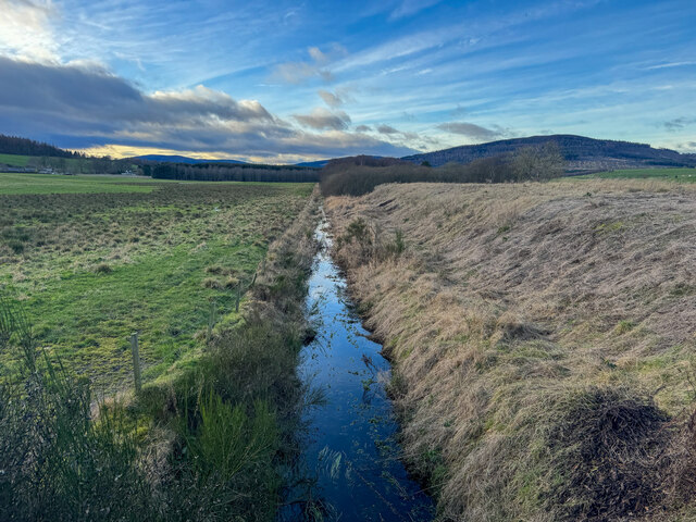
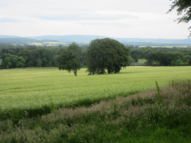
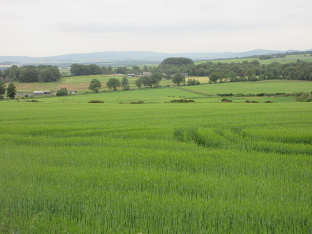
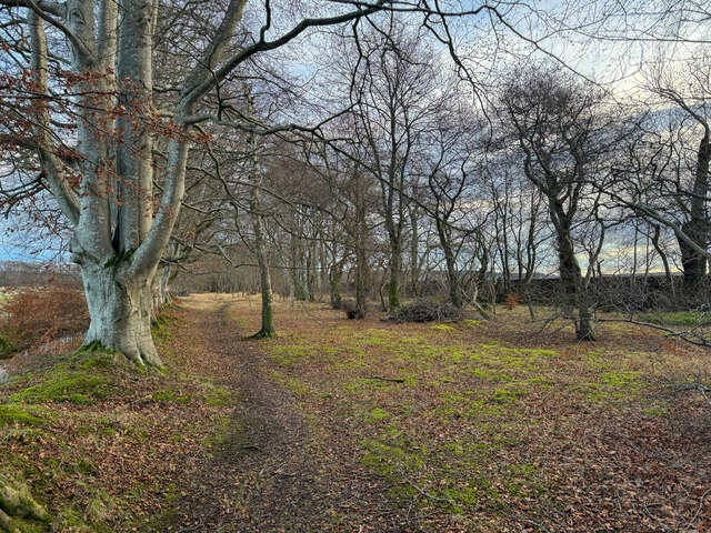
Ardiebrown Wood is a picturesque forest located in Aberdeenshire, Scotland. Situated in the heart of the countryside, this wood covers an area of approximately 100 acres and is known for its stunning natural beauty and diverse flora and fauna.

The wood is home to a wide variety of tree species, including oak, birch, and pine, which create a dense and lush canopy. These trees provide a habitat for numerous bird species, such as woodpeckers and owls, making it a popular spot for birdwatchers.

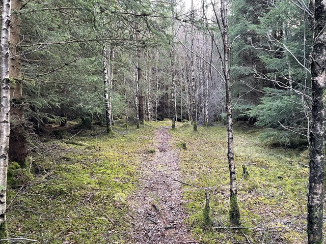
Walking trails wind through the wood, offering visitors the chance to explore its peaceful surroundings and discover its hidden treasures. The paths are well-maintained and suitable for all ages and abilities, making it an ideal destination for families and nature enthusiasts alike.

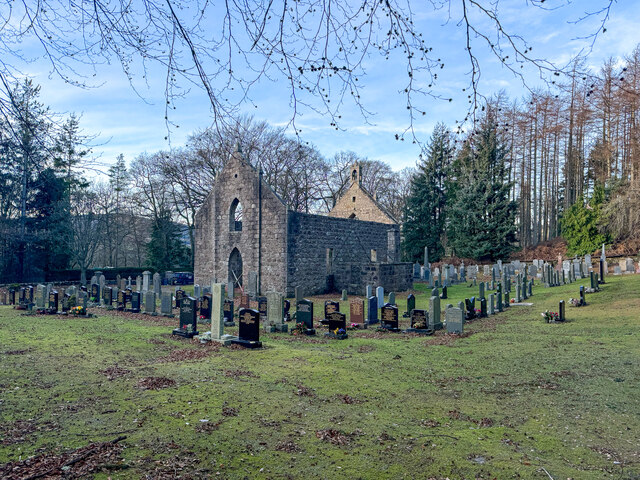
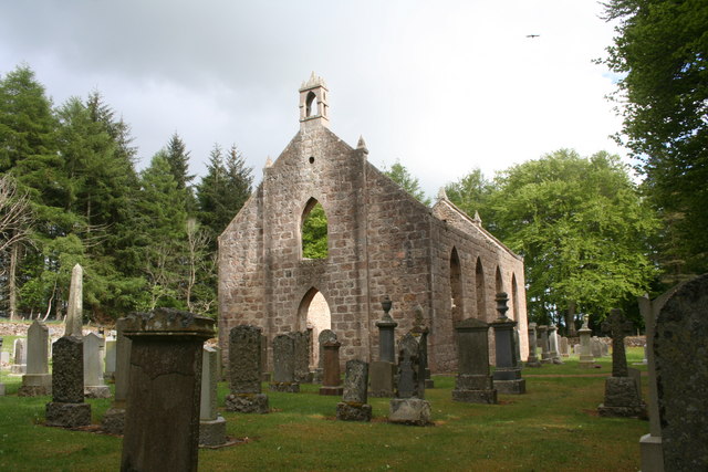
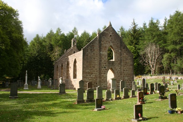
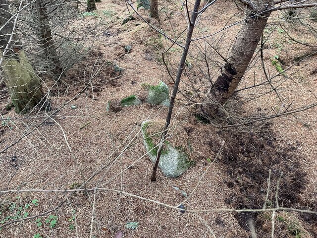
In addition to its scenic beauty, Ardiebrown Wood also has historical significance. It is believed to have been a part of the ancient Caledonian Forest, which covered much of Scotland thousands of years ago. The wood has remnants of old stone walls and ruins, adding to its charm and providing a glimpse into its past.

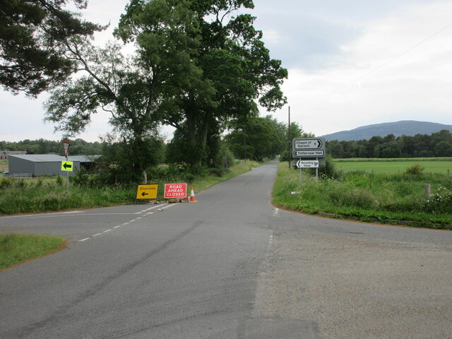
Ardiebrown Wood is easily accessible, with ample parking available nearby. It offers a tranquil escape from the hustle and bustle of everyday life, allowing visitors to immerse themselves in nature and enjoy the peacefulness that this woodland has to offer.

If you have any feedback on the listing, please let us know in the comments section below.

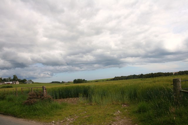
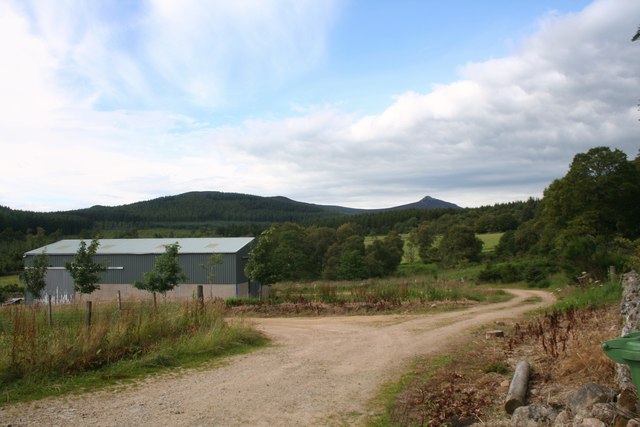
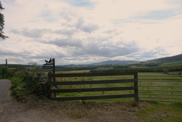
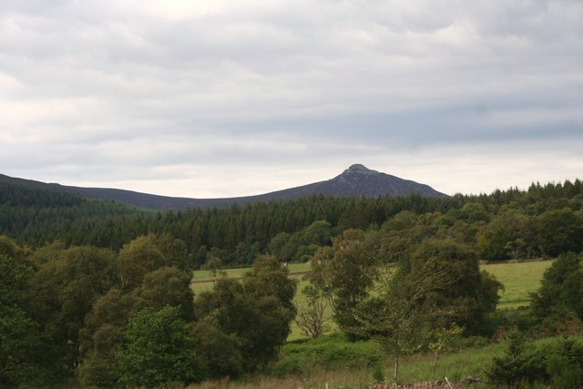
Ardiebrown Wood Images

Images are sourced within 2km of 57.246338/-2.4789766 or Grid Reference NJ7117. Thanks to Geograph Open Source API. All images are credited.

Burn of Blairdaff Geocaching is a type of global treasure hunt of people looking for caches, or hidden stashes of objects. Geocaching may also be described as a series of hide-and-seek games, where hiders provide online clues for seekers. Seekers use global positioning system (GPS) devices to find hidden caches
Burn of Blairdaff
Geocaching is a type of global treasure hunt of people looking for caches, or hidden stashes of objects. Geocaching may also be described as a series of hide-and-seek games, where hiders provide online clues for seekers. Seekers use global positioning system (GPS) devices to find hidden caches
Blairdaff kirk Geocaching is a type of global treasure hunt of people looking for caches, or hidden stashes of objects. Geocaching may also be described as a series of hide-and-seek games, where hiders provide online clues for seekers. Seekers use global positioning system (GPS) devices to find hidden caches
Blairdaff kirk
Geocaching is a type of global treasure hunt of people looking for caches, or hidden stashes of objects. Geocaching may also be described as a series of hide-and-seek games, where hiders provide online clues for seekers. Seekers use global positioning system (GPS) devices to find hidden caches
War Memorial at Blairdaff A memorial in the grounds of the ruined church at Blairdaff.
War Memorial at Blairdaff
A memorial in the grounds of the ruined church at Blairdaff.
Blairdaff Church The ruinous church at Blairdaff.
Blairdaff Church
The ruinous church at Blairdaff.
Blairdaff Churchyard The churchyard and earview of the ruined church at Blairdaff.
Blairdaff Churchyard
The churchyard and earview of the ruined church at Blairdaff.
Barley Field Barley in a field by Blairdaff.
Barley Field
Barley in a field by Blairdaff.
Fairview Farm Fairview farm by Blairdaff.
Fairview Farm
Fairview farm by Blairdaff.
Fairview Farm Sign The roadside sign for Fairview Farm beside a field gate.
Fairview Farm Sign
The roadside sign for Fairview Farm beside a field gate.
The View at Fairview A view over farmland and woodland to Bennachie from the appropriately named Fairview.
The View at Fairview
A view over farmland and woodland to Bennachie from the appropriately named Fairview.
Summit of Cot-Town Hill Path takes you most of the way to summit but last few metres is through thick tree cover. A couple of stones marks summit
Summit of Cot-Town Hill
Path takes you most of the way to summit but last few metres is through thick tree cover. A couple of stones marks summit
Cot-Town Hill As close to the big point as you can get using the walkers paths around this wooded hill area.
Cot-Town Hill
As close to the big point as you can get using the walkers paths around this wooded hill area.
Kemnay Academy Secondary school in pretty countryside setting
Kemnay Academy
Secondary school in pretty countryside setting
Cot-town Triangulation Pillar The trig pillar in a clearing at the top of Cot-town Wood.
Cot-town Triangulation Pillar
The trig pillar in a clearing at the top of Cot-town Wood.
Copse in barley field Copse in a field of barley near Fetternear.
Copse in barley field
Copse in a field of barley near Fetternear.
Road closed and diversion Road closed heading west near Fetternear Hall.
Road closed and diversion
Road closed heading west near Fetternear Hall.
Green field near Overton Looking south over fields and distant Aberdeenshire, near Overton.
Green field near Overton
Looking south over fields and distant Aberdeenshire, near Overton.
Resting cattle Cattle lying down in a field at West Aquhorthies.
Resting cattle
Cattle lying down in a field at West Aquhorthies.
Woodland walk Geocaching is a type of global treasure hunt of people looking for caches, or hidden stashes of objects. Geocaching may also be described as a series of hide-and-seek games, where hiders provide online clues for seekers. Seekers use global positioning system (GPS) devices to find hidden caches
Woodland walk
Geocaching is a type of global treasure hunt of people looking for caches, or hidden stashes of objects. Geocaching may also be described as a series of hide-and-seek games, where hiders provide online clues for seekers. Seekers use global positioning system (GPS) devices to find hidden caches
Show me another place!

Ardiebrown Wood is located at Grid Ref: NJ7117 (Lat: 57.246338, Lng: -2.4789766)

Unitary Authority: Aberdeenshire

Police Authority: North East

What 3 Words

///compelled.fled.school. Near Kemnay, Aberdeenshire

Related Wikis

Nearby Amenities

Located within 500m of 57.246338,-2.4789766
Power: pole
Lat/Long: 57.2490645/-2.4724182
Power: pole
Lat/Long: 57.2487885/-2.4735514
Power: pole
Lat/Long: 57.2486326/-2.4742477
Power: pole
Lat/Long: 57.2479643/-2.4744384
Power: pole
Lat/Long: 57.2471413/-2.4746669
Power: pole
Lat/Long: 57.2464682/-2.4748664
Power: pole
Lat/Long: 57.2456548/-2.4751037
Power: pole
Lat/Long: 57.2450093/-2.4752856
Power: pole
Lat/Long: 57.2443866/-2.4754563
Power: pole
Lat/Long: 57.2437891/-2.4755916
Power: pole
Lat/Long: 57.2436151/-2.4745227
Power: pole
Lat/Long: 57.2435071/-2.4732343
Power: pole
Lat/Long: 57.2474244/-2.4793016
Power: pole
Lat/Long: 57.2476896/-2.4781706
Power: pole
Lat/Long: 57.2479271/-2.4771905
Power: pole
Lat/Long: 57.2481371/-2.4763323
Power: pole
Lat/Long: 57.2483758/-2.4753255
Power: pole
Lat/Long: 57.2451149/-2.4846748
Power: pole
Lat/Long: 57.2447561/-2.4837523
Power: pole
Lat/Long: 57.244293/-2.482557
Power: pole
Lat/Long: 57.2441382/-2.4812154
Power: pole
Lat/Long: 57.2439714/-2.4797917
Power: pole
Lat/Long: 57.2438167/-2.4784811
Power: pole
Lat/Long: 57.2436937/-2.4772304
Power: pole
Lat/Long: 57.2437459/-2.4759076
The data included in this document is from www.openstreetmap.org. The data is made available under ODbL.

Have you been to Ardiebrown Wood?

Leave your review of Ardiebrown Wood below (or comments, questions and feedback).