Fountain Wood

Wood, Forest in Aberdeenshire

Scotland

Fountain Wood

Burn of Blairdaff Geocaching is a type of global treasure hunt of people looking for caches, or hidden stashes of objects. Geocaching may also be described as a series of hide-and-seek games, where hiders provide online clues for seekers. Seekers use global positioning system (GPS) devices to find hidden caches
Burn of Blairdaff Credit: Ralph Greig

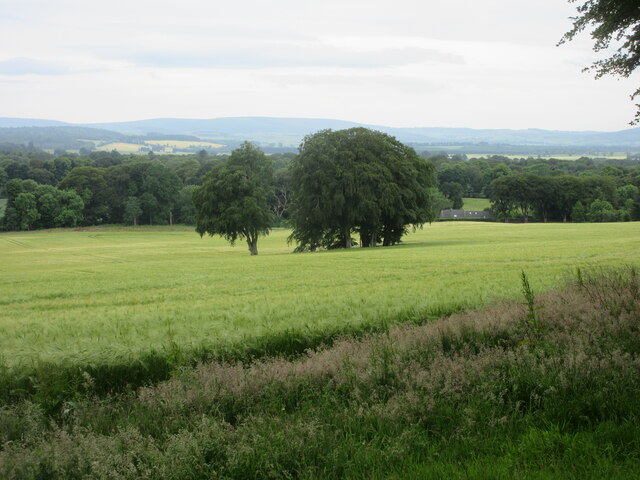
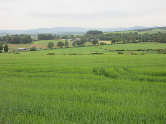
Fountain Wood is a picturesque forest located in Aberdeenshire, Scotland. Spanning over an area of approximately 100 hectares, this woodland is a popular destination for nature enthusiasts and outdoor enthusiasts alike.

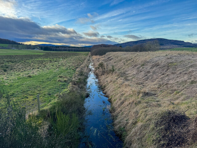
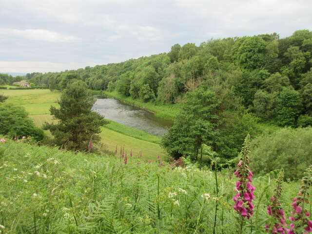
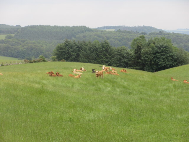
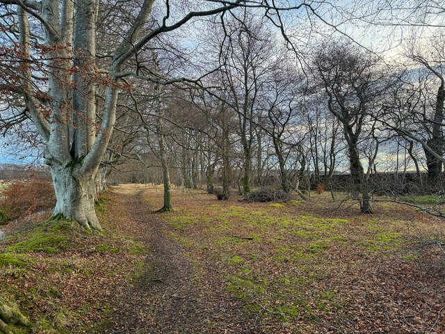
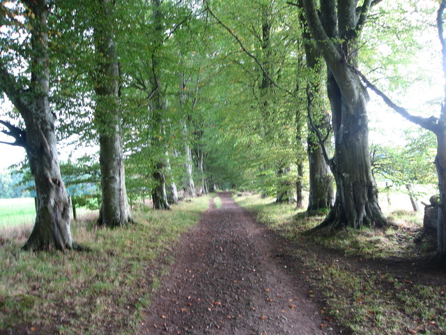
The forest is predominantly made up of native broadleaf trees such as oak, birch, and beech, creating a diverse and vibrant ecosystem. The woodland floor is covered in a lush carpet of ferns, wildflowers, and mosses, adding to its natural beauty. It is home to a variety of wildlife including red squirrels, roe deer, and a wide range of bird species.

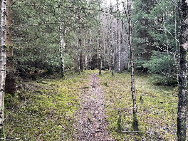
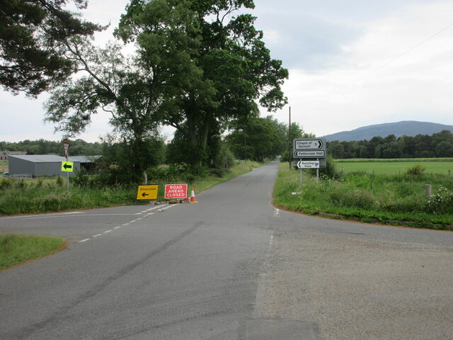
Fountain Wood offers a network of well-maintained trails and paths, making it an ideal location for walking, hiking, and cycling. The paths wind through the forest, offering visitors stunning views of the surrounding countryside and the opportunity to immerse themselves in the tranquility of nature. Along the way, there are several designated picnic areas where visitors can take a break and enjoy a meal amidst the peaceful surroundings.

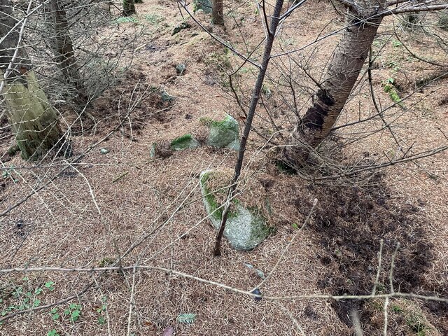
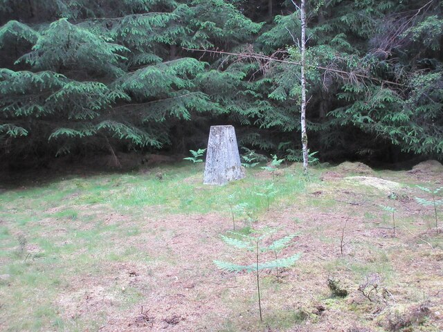
The forest is also notable for its historical significance. Within Fountain Wood, there are remnants of ancient settlements, including stone circles and burial cairns, providing insight into the area's rich history.

Fountain Wood is easily accessible, with ample parking available for visitors. It is open year-round, allowing visitors to experience the changing seasons and the beauty they bring to the woodland. Whether it's a leisurely stroll, a challenging hike, or simply a desire to connect with nature, Fountain Wood offers a serene and captivating experience for all who visit.

If you have any feedback on the listing, please let us know in the comments section below.

Fountain Wood Images

Images are sourced within 2km of 57.246757/-2.4678794 or Grid Reference NJ7117. Thanks to Geograph Open Source API. All images are credited.

Burn of Blairdaff Geocaching is a type of global treasure hunt of people looking for caches, or hidden stashes of objects. Geocaching may also be described as a series of hide-and-seek games, where hiders provide online clues for seekers. Seekers use global positioning system (GPS) devices to find hidden caches
Burn of Blairdaff
Geocaching is a type of global treasure hunt of people looking for caches, or hidden stashes of objects. Geocaching may also be described as a series of hide-and-seek games, where hiders provide online clues for seekers. Seekers use global positioning system (GPS) devices to find hidden caches
Summit of Cot-Town Hill Path takes you most of the way to summit but last few metres is through thick tree cover. A couple of stones marks summit
Summit of Cot-Town Hill
Path takes you most of the way to summit but last few metres is through thick tree cover. A couple of stones marks summit
Cot-Town Hill As close to the big point as you can get using the walkers paths around this wooded hill area.
Cot-Town Hill
As close to the big point as you can get using the walkers paths around this wooded hill area.
Kemnay Quarry The quarry in mid June 2023 on a wall to wall blue sky day
Kemnay Quarry
The quarry in mid June 2023 on a wall to wall blue sky day
Kemnay Academy Secondary school in pretty countryside setting
Kemnay Academy
Secondary school in pretty countryside setting
Glimpse of the River Don The River Don viewed from the road above to the north.
Glimpse of the River Don
The River Don viewed from the road above to the north.
Cot-town Triangulation Pillar The trig pillar in a clearing at the top of Cot-town Wood.
Cot-town Triangulation Pillar
The trig pillar in a clearing at the top of Cot-town Wood.
Copse in barley field Copse in a field of barley near Fetternear.
Copse in barley field
Copse in a field of barley near Fetternear.
Road closed and diversion Road closed heading west near Fetternear Hall.
Road closed and diversion
Road closed heading west near Fetternear Hall.
Green field near Overton Looking south over fields and distant Aberdeenshire, near Overton.
Green field near Overton
Looking south over fields and distant Aberdeenshire, near Overton.
Resting cattle Cattle lying down in a field at West Aquhorthies.
Resting cattle
Cattle lying down in a field at West Aquhorthies.
Woodland walk Geocaching is a type of global treasure hunt of people looking for caches, or hidden stashes of objects. Geocaching may also be described as a series of hide-and-seek games, where hiders provide online clues for seekers. Seekers use global positioning system (GPS) devices to find hidden caches
Woodland walk
Geocaching is a type of global treasure hunt of people looking for caches, or hidden stashes of objects. Geocaching may also be described as a series of hide-and-seek games, where hiders provide online clues for seekers. Seekers use global positioning system (GPS) devices to find hidden caches
This way to paradise? Looking down Paradise Road, Kemnay.  Several roads in the village have been deemed one-way streets.
This way to paradise?
Looking down Paradise Road, Kemnay. Several roads in the village have been deemed one-way streets.
The Burnett Arms Hotel, Kemnay The Burnetts have been major landowners in Kemnay since 1688: for the history of the Kemnay branch of the family, see: <span class="nowrap"><a title="http://www.burnett.uk.com/kemnay.htm" rel="nofollow ugc noopener" href="http://www.burnett.uk.com/kemnay.htm">Link</a><img style="margin-left:2px;" alt="External link" title="External link - shift click to open in new window" src="https://s1.geograph.org.uk/img/external.png" width="10" height="10"/></span>
The Burnett Arms Hotel, Kemnay
The Burnetts have been major landowners in Kemnay since 1688: for the history of the Kemnay branch of the family, see: LinkExternal link
Kemnay Pharmacy and Post Office, High Street, Kemnay
Kemnay Village Hall
Kemnay Village Hall
Kemnay Petrol Station, Station Road, Kemnay It only seems to sell diesel, perhaps to farm vehicles.
Kemnay Petrol Station, Station Road, Kemnay
It only seems to sell diesel, perhaps to farm vehicles.
Beech lined track leading towards Kemnay This looks as though it may have originally been the main exit drive from the nearby ruined Fetternear House
Beech lined track leading towards Kemnay
This looks as though it may have originally been the main exit drive from the nearby ruined Fetternear House
Show me another place!

Fountain Wood is located at Grid Ref: NJ7117 (Lat: 57.246757, Lng: -2.4678794)

Unitary Authority: Aberdeenshire

Police Authority: North East

What 3 Words

///sticks.prefect.journey. Near Kemnay, Aberdeenshire

Related Wikis

Fetternear Palace

Fetternear Bishop's Palace is an archaeological site of what was one of the palaces (or residences) of the medieval bishops of Aberdeen. It is near Kemnay...
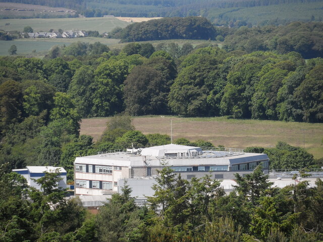
Kemnay Academy

Kemnay Academy is a secondary school in Kemnay, Aberdeenshire, situated on the banks of the River Don. It is one of seventeen secondary schools run by...

Kemnay, Aberdeenshire

Kemnay (Gaelic: Camnaidh) is a village 16 miles (26 km) west of Aberdeen in Garioch, Aberdeenshire, Scotland. == History == The village name Kemnay is...

Kemnay railway station

Kemnay railway station was a station on the Alford Valley Railway in Kemnay, Aberdeenshire, which opened in 1858 and closed in 1950. == References... ==

Bograxie

Bograxie is a farm in Aberdeenshire, Scotland. == References ==

Blairdaff

Blairdaff is a parish in Garioch, Aberdeenshire, Scotland, next to the villages of Kemnay and Monymusk. Blairdaff had a grocery store, a post office, and...

Kemnay House

Kemnay House is a 17th-century tower house, now incorporated in a later house, about 5.5 miles (8.9 km) south and west of Inverurie, Aberdeenshire, Scotland...

Aquithie

Aquithie is a hamlet in Aberdeenshire, Scotland, belonging to the parish of Kemnay. It is best known for its Aquithie Boarding & Quarantine Kennels....

Nearby Amenities

Located within 500m of 57.246757,-2.4678794
Power: pole
Lat/Long: 57.2424023/-2.4676756
Power: pole
Lat/Long: 57.2434454/-2.4688773
Power: pole
Lat/Long: 57.2509695/-2.465475
Power: pole
Lat/Long: 57.2507992/-2.4662644
Power: pole
Lat/Long: 57.2505772/-2.4668188
Power: pole
Lat/Long: 57.2502989/-2.467646
Power: pole
Lat/Long: 57.2500698/-2.4686572
Power: pole
Lat/Long: 57.2498886/-2.4695221
Power: pole
Lat/Long: 57.2496967/-2.4704002
Power: pole
Lat/Long: 57.2493824/-2.4714137
Power: pole
Lat/Long: 57.2490645/-2.4724182
Power: pole
Lat/Long: 57.2487885/-2.4735514
Power: pole
Lat/Long: 57.2486326/-2.4742477
Power: pole
Lat/Long: 57.2479643/-2.4744384
Power: pole
Lat/Long: 57.2471413/-2.4746669
Power: pole
Lat/Long: 57.2464682/-2.4748664
Power: pole
Lat/Long: 57.2456548/-2.4751037
Power: pole
Lat/Long: 57.2450093/-2.4752856
Power: pole
Lat/Long: 57.2435071/-2.4732343
Power: pole
Lat/Long: 57.2433691/-2.4716997
Power: pole
Lat/Long: 57.2432587/-2.4703537
Power: pole
Lat/Long: 57.2434231/-2.4680318
Power: pole
Lat/Long: 57.2435083/-2.467147
Power: pole
Lat/Long: 57.2436019/-2.4662622
Power: pole
Lat/Long: 57.2436943/-2.4653486
Power: pole
Lat/Long: 57.2437771/-2.4645125
Power: pole
Lat/Long: 57.2438682/-2.4636632
Power: pole
Lat/Long: 57.2439546/-2.4627252
Power: pole
Lat/Long: 57.2438742/-2.4616807
Power: pole
Lat/Long: 57.2507764/-2.4684377
Power: pole
Lat/Long: 57.2510439/-2.4670805
Power: pole
Lat/Long: 57.2483758/-2.4753255
The data included in this document is from www.openstreetmap.org. The data is made available under ODbL.

Have you been to Fountain Wood?

Leave your review of Fountain Wood below (or comments, questions and feedback).