The Bank Wood

Wood, Forest in Roxburghshire

Scotland

The Bank Wood

Charterhouse Wood A wide strip, recently felled and replanted.
Charterhouse Wood Credit: Richard Webb

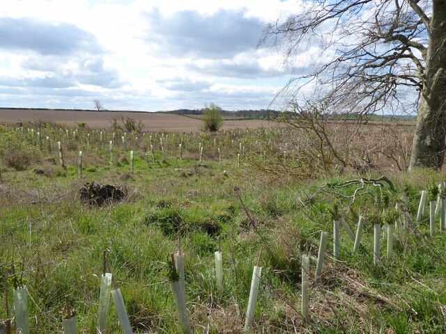
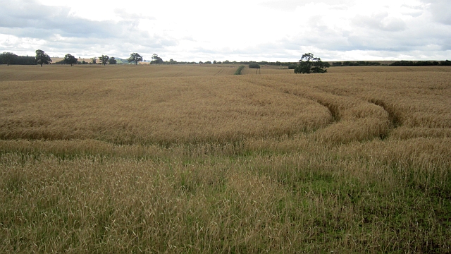
The Bank Wood is a picturesque forest located in Roxburghshire, Scotland. Covering an area of approximately 500 acres, this woodland is renowned for its natural beauty and diverse range of flora and fauna. It is situated near the village of Roxburgh, just a few miles south of the town of Kelso.

The forest is predominantly composed of native broadleaf trees, including oak, birch, and ash. These trees provide a dense canopy that offers a haven for various wildlife species. The Bank Wood is home to a plethora of bird species, such as woodpeckers, thrushes, and owls, making it a popular spot for birdwatchers.

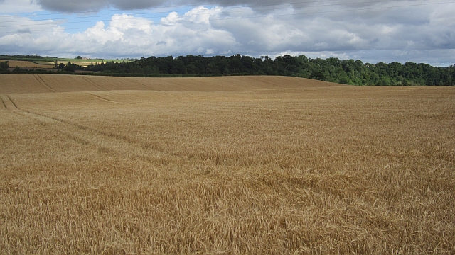
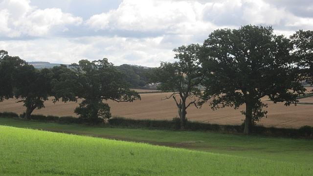
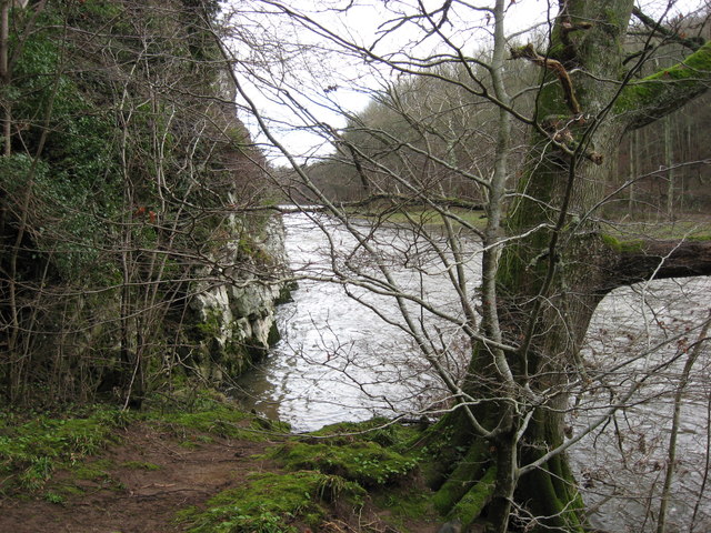
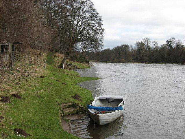
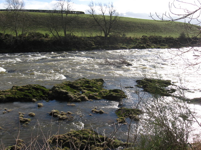
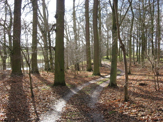
The woodland also boasts a network of well-maintained footpaths, allowing visitors to explore the area and enjoy its tranquil ambiance. These paths wind through the forest, offering stunning views of the surrounding countryside and the meandering River Tweed.

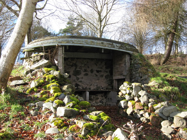
In addition to its natural beauty, The Bank Wood holds historical significance. The remnants of an ancient hill fort can be found within its boundaries, dating back to the Iron Age. This archaeological site provides a glimpse into the region's rich past and attracts history enthusiasts.

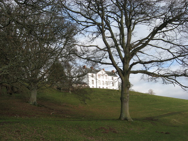
The Bank Wood is a cherished recreational space for locals and visitors alike. Its peaceful atmosphere, scenic surroundings, and abundance of wildlife make it an ideal destination for nature lovers and those seeking a peaceful retreat in the heart of Roxburghshire.

If you have any feedback on the listing, please let us know in the comments section below.

The Bank Wood Images

Images are sourced within 2km of 55.588432/-2.520816 or Grid Reference NT6732. Thanks to Geograph Open Source API. All images are credited.

Charterhouse Wood A wide strip, recently felled and replanted.
Charterhouse Wood
A wide strip, recently felled and replanted.
A phone box at Makerstoun It appears to be used as the village library.
A phone box at Makerstoun
It appears to be used as the village library.
Makerstoun phone box The box is being used as a library.
Makerstoun phone box
The box is being used as a library.
A sundial at Makerstoun Parish Churchyard According to The Churches and Graveyards of Roxburghshire by G A C Binnie, the sundial and pedestal was gifted by General Sir Thomas Makdougall Brisbane, once Governor General of New South Wales.
A sundial at Makerstoun Parish Churchyard
According to The Churches and Graveyards of Roxburghshire by G A C Binnie, the sundial and pedestal was gifted by General Sir Thomas Makdougall Brisbane, once Governor General of New South Wales.
Charterhouse Wood Felled and replanted.
Charterhouse Wood
Felled and replanted.
Roxburgh Newtown Sheep graze beside the Stockstruther Burn on land obviously unsuited to arable use.
Roxburgh Newtown
Sheep graze beside the Stockstruther Burn on land obviously unsuited to arable use.
Stockstruther Burn Flowing between steep banks towards the Tweed.
Stockstruther Burn
Flowing between steep banks towards the Tweed.
Barley, Trows Above the unseen River Tweed.
Barley, Trows
Above the unseen River Tweed.
Field, Trows A grass field in a mainly arable area.
Field, Trows
A grass field in a mainly arable area.
Water tower, Trows A water tower with a slate roof opposite the steadings at Trows.
Water tower, Trows
A water tower with a slate roof opposite the steadings at Trows.
Barley near Trows
Barley near Trows
'Footpaths End' This footpath near Corbie Craigs by the River Tweed suddenly ends,needing one to detour somewhat. Unless of course you can walk on water.
'Footpaths End'
This footpath near Corbie Craigs by the River Tweed suddenly ends,needing one to detour somewhat. Unless of course you can walk on water.
Makerstoun House The house stands in a prominent position above the River Tweed.
Makerstoun House
The house stands in a prominent position above the River Tweed.
River Tweed Looking downstream from below Makerstoun House
River Tweed
Looking downstream from below Makerstoun House
Rough Water Rocky extrusions causing white water on the River Tweed downstream from Makerstoun House.
Rough Water
Rocky extrusions causing white water on the River Tweed downstream from Makerstoun House.
Tweed Shelter A novel use for an old boat beside the River Tweed.
Tweed Shelter
A novel use for an old boat beside the River Tweed.
'Winter Woodland' A pleasant track passing through broadleaved woodland above the River Tweed.
'Winter Woodland'
A pleasant track passing through broadleaved woodland above the River Tweed.
A dedicated bench seat at Makerstoun Kirkyard The kirk is in the background to the left.
A dedicated bench seat at Makerstoun Kirkyard
The kirk is in the background to the left.
Show me another place!

The Bank Wood is located at Grid Ref: NT6732 (Lat: 55.588432, Lng: -2.520816)

Unitary Authority: The Scottish Borders

Police Authority: The Lothians and Scottish Borders

What 3 Words

///divisible.forgiven.unless. Near Kelso, Scottish Borders

Related Wikis

Makerstoun

Makerstoun is a parish in the Scottish Borders area of Scotland, as well as the historic county of Roxburghshire, 4 miles (6 km) south-west of Kelso.The...

Rutherford railway station

Rutherford railway station served the parish of Maxton, Roxburghshire, Scotland from 1851 to 1964 on the Kelso Line. == History == The station opened in...

Borders Abbeys Way

The Borders Abbeys Way is a long-distance footpath in the Scottish Borders area of Scotland. It is a circular walkway and is 109 kilometres (68 mi) in...

Roxburgh railway station

Roxburgh railway station was on the Kelso Line, and served the village of Roxburgh, Scottish Borders, from 1850 to 1964. == History == The station was...

Nearby Amenities

Located within 500m of 55.588432,-2.520816
Historic: memorial
Lat/Long: 55.5901394/-2.5254106
Telephone
Booth: K6
Covered: booth
Note: the box is also being used as a book exchange even though there is still a phone in the box
Lat/Long: 55.5864696/-2.5255777
Post Box
Post Box Type: wall
Postal Code: TD5
Ref: TD5 25
Royal Cypher: GR
Royal Cypher Wikidata: Q33102273
Source: survey
Lat/Long: 55.5855974/-2.5241529
Makerstoun
Place: hamlet
Lat/Long: 55.5902818/-2.5256567
Manorhill
Place: hamlet
Lat/Long: 55.5863723/-2.5255765
Makerstoun Lodge
Place: hamlet
Lat/Long: 55.5852547/-2.5245577
Ettrickbraes
Place: isolated_dwelling
Lat/Long: 55.5925292/-2.5222584
Give Way
Direction: backward
Lat/Long: 55.5901951/-2.5255691
Power: pole
Lat/Long: 55.5903261/-2.5137234
Power: pole
Lat/Long: 55.5898305/-2.5147976
Power: pole
Lat/Long: 55.5893515/-2.515841
Power: pole
Lat/Long: 55.5888702/-2.516887
Power: pole
Lat/Long: 55.5883942/-2.5179371
Power: pole
Lat/Long: 55.5879259/-2.5189698
Power: pole
Lat/Long: 55.5874393/-2.520036
Power: pole
Lat/Long: 55.5869732/-2.5278787
Power: pole
Lat/Long: 55.587409/-2.5213596
Power: pole
Lat/Long: 55.5873544/-2.5225747
Power: pole
Lat/Long: 55.5873089/-2.5239962
Power: pole
Lat/Long: 55.5871073/-2.526657
Defibrillator
Defibrillator Location: next to red phone box in Makerstoun
Emergency: defibrillator
Indoor: no
Lat/Long: 55.5864909/-2.5256207
Power: pole
Lat/Long: 55.5872039/-2.5253823
Power: pole
Lat/Long: 55.5872776/-2.5253802
Power: pole
Lat/Long: 55.5879957/-2.5254037
Power: pole
Lat/Long: 55.5886788/-2.5254399
Power: pole
Lat/Long: 55.5893161/-2.5254676
Power: pole
Lat/Long: 55.5900437/-2.5255038
Power: pole
Lat/Long: 55.5904051/-2.5254975
Power: pole
Lat/Long: 55.5904497/-2.5260922
Power: pole
Lat/Long: 55.5905473/-2.5273969
The data included in this document is from www.openstreetmap.org. The data is made available under ODbL.

Have you been to The Bank Wood?

Leave your review of The Bank Wood below (or comments, questions and feedback).