Tomscairn Wood

Wood, Forest in Aberdeenshire

Scotland

Tomscairn Wood

There is a large track here according to the OS!
There is a large track here according to the OS! Credit: thejackrustles

Tomscairn Wood is a picturesque forest located in Aberdeenshire, Scotland. Spread across an area of approximately 100 acres, it is nestled in the heart of the beautiful Cairngorms National Park. The wood is situated near the small village of Ballater, offering visitors a peaceful escape from the hustle and bustle of city life.

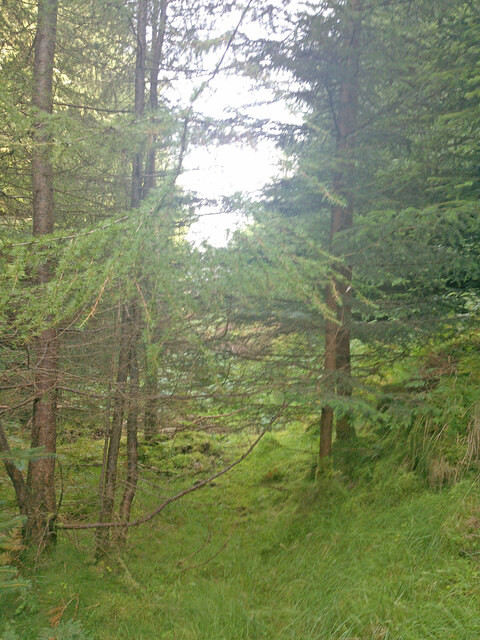
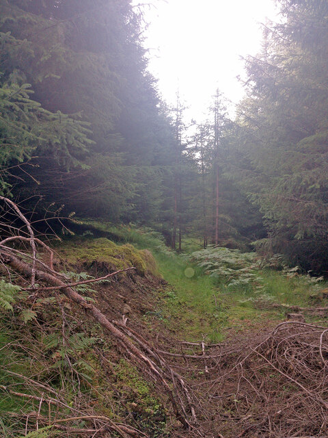
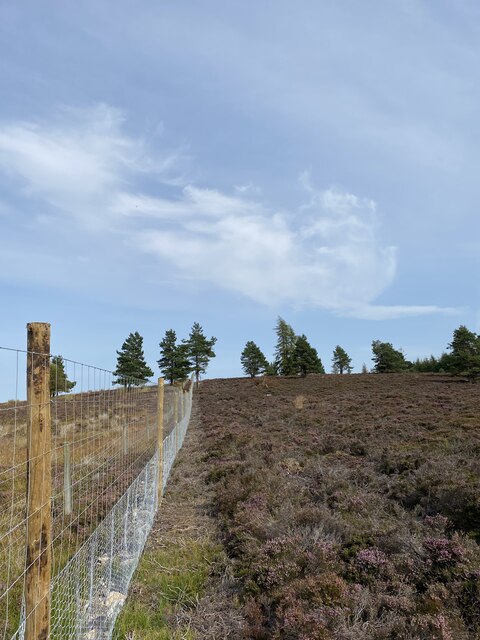
The woodland is characterized by a diverse range of flora and fauna, making it an ideal spot for nature enthusiasts and hikers. Tall coniferous trees dominate the landscape, including Scots Pine, Norway Spruce, and European Larch. These towering trees create a dense canopy, providing shade and shelter for various woodland creatures.

Tomscairn Wood is also home to numerous bird species, such as the Great Spotted Woodpecker, Eurasian Jay, and Common Buzzard. Birdwatchers can often spot these feathered creatures perched on branches or soaring through the sky. Additionally, the forest harbors a variety of mammals, including red squirrels, roe deer, and occasionally, pine martens.

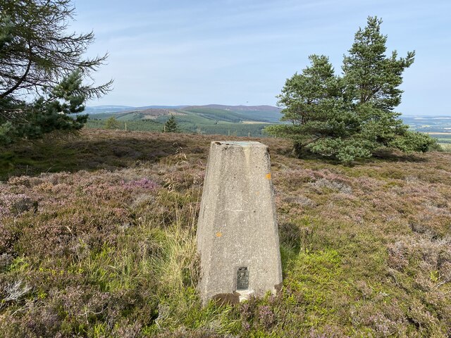
The wood offers several well-maintained walking trails, allowing visitors to explore its natural wonders at their own pace. These paths wind through the forest, offering breathtaking views of the surrounding landscapes and the nearby Lochnagar Mountain. Some trails even lead to a peaceful loch, where visitors can enjoy a picnic or relax by the water's edge.

Tomscairn Wood is not only a haven for wildlife but also a place of tranquility and serenity. Its natural beauty and peaceful atmosphere make it a popular destination for nature lovers and those seeking an escape into the great outdoors.

If you have any feedback on the listing, please let us know in the comments section below.

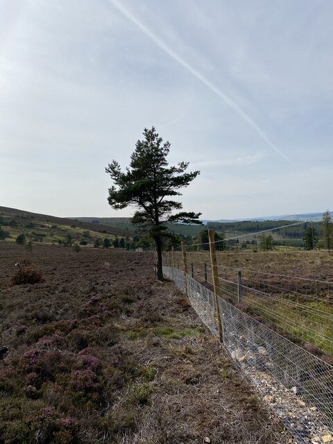
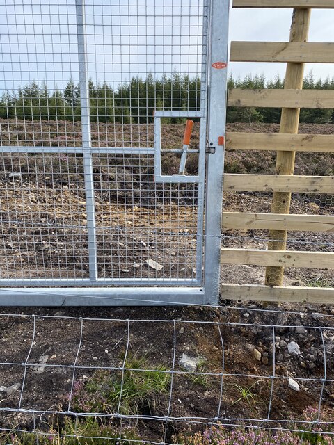
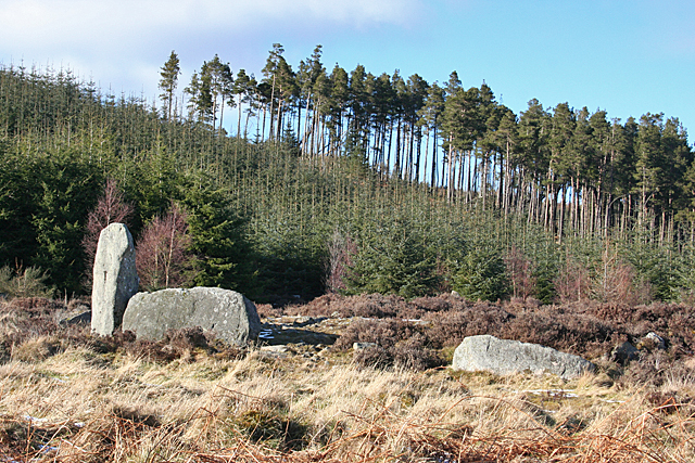
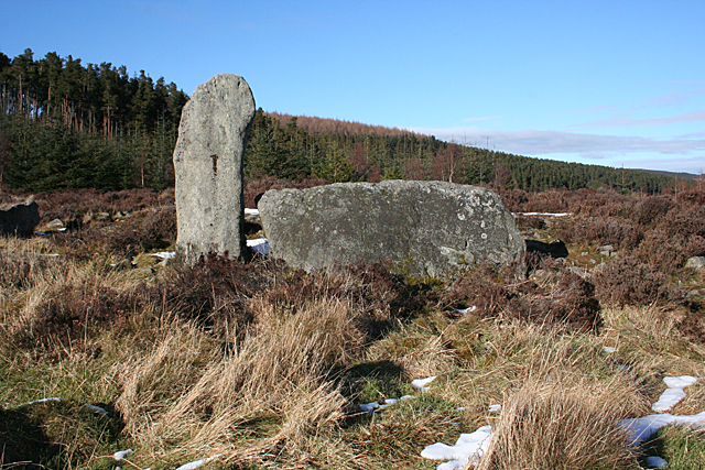
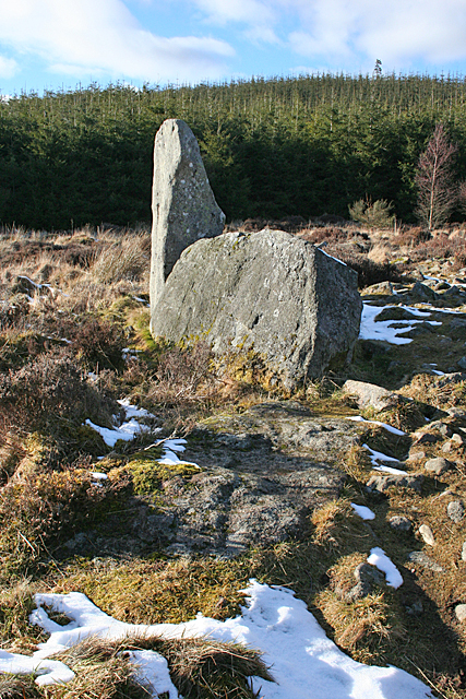
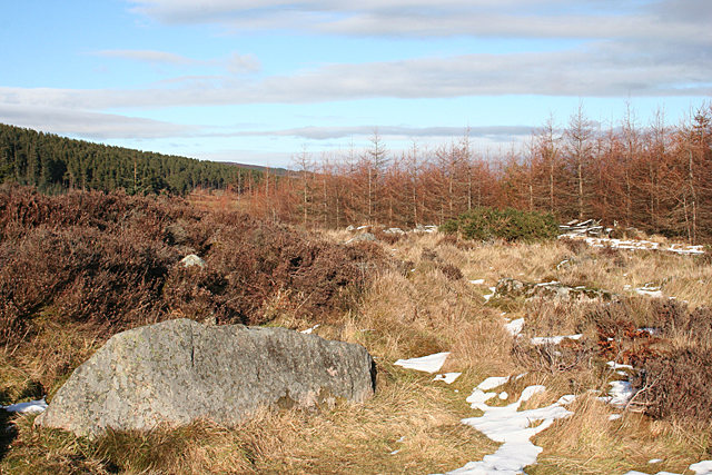
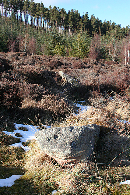
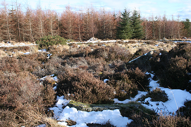
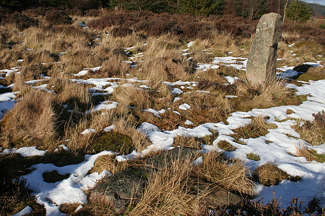
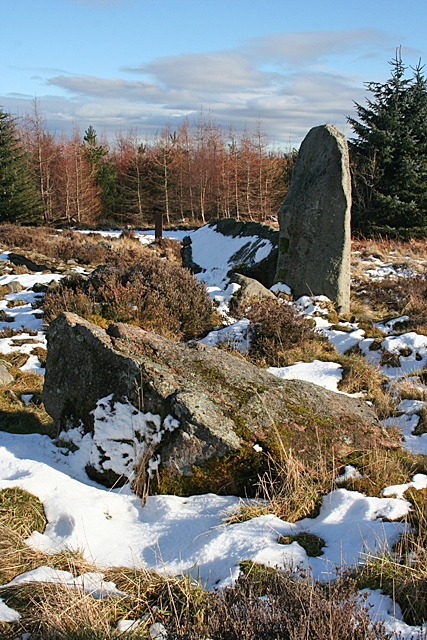
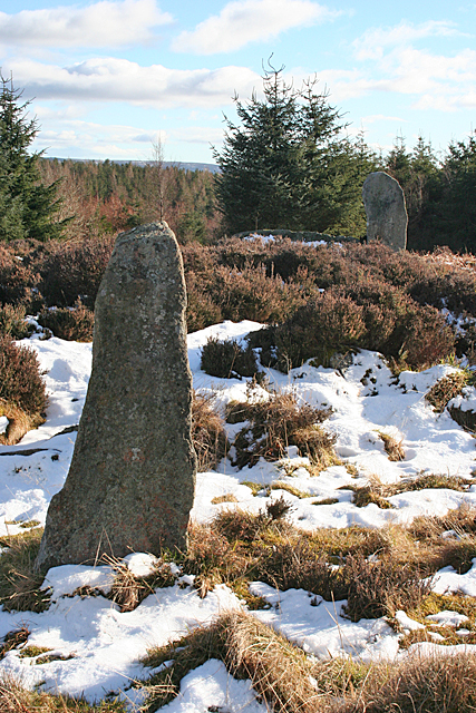
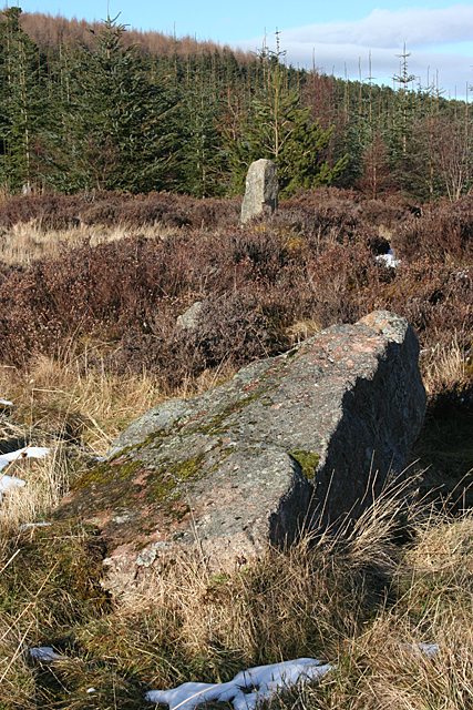
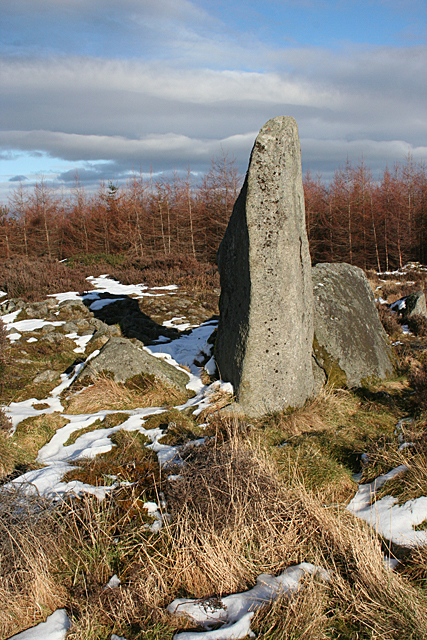
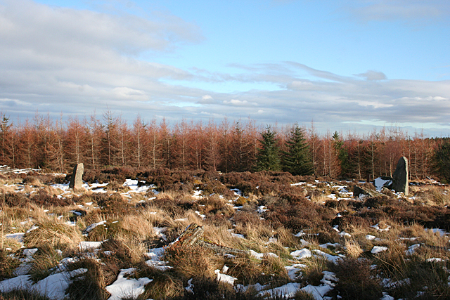
Tomscairn Wood Images

Images are sourced within 2km of 57.197039/-2.5754133 or Grid Reference NJ6511. Thanks to Geograph Open Source API. All images are credited.

There is a large track here according to the OS!
Still no sign of the track shown on the OS Map
New deer fence near Whitehill
Whitehill Trig Point Flush Bracket S5394
New deer fence near Whitehill
New gate and old barbed wire fence! Strange new human gate and along the way a large vehicle gate but all the other side of a barbed wire fence?
New gate and old barbed wire fence!
Strange new human gate and along the way a large vehicle gate but all the other side of a barbed wire fence?
Tillyfourie Recumbent Stone Circle (1) Just to confuse people, this circle is signposted as Whitehill Stone Circle, and also so named in the 'Stone Circle Trail' leaflet published in 2014. I am sticking to the name used by the Royal Commission on the Ancient and Historical Monuments of Scotland, now part of Historic Environment Scotland. See <span class="nowrap"><a title="https://canmore.org.uk/site/18074/tillyfourie" rel="nofollow ugc noopener" href="https://canmore.org.uk/site/18074/tillyfourie">Link</a><img style="margin-left:2px;" alt="External link" title="External link - shift click to open in new window" src="https://s1.geograph.org.uk/img/external.png" width="10" height="10"/></span> for more information. <a href="https://www.geograph.org.uk/photo/4855469">NJ6413 : Tillyfourie Recumbent Stone Circle (2)</a>
Tillyfourie Recumbent Stone Circle (1)
Just to confuse people, this circle is signposted as Whitehill Stone Circle, and also so named in the 'Stone Circle Trail' leaflet published in 2014. I am sticking to the name used by the Royal Commission on the Ancient and Historical Monuments of Scotland, now part of Historic Environment Scotland. See LinkExternal link for more information. NJ6413 : Tillyfourie Recumbent Stone Circle (2)
Tillyfourie Recumbent Stone Circle (2) This is the recumbent setting. Only the west flanker and the recumbent are still standing.  See <span class="nowrap"><a title="https://canmore.org.uk/site/18074/tillyfourie" rel="nofollow ugc noopener" href="https://canmore.org.uk/site/18074/tillyfourie">Link</a><img style="margin-left:2px;" alt="External link" title="External link - shift click to open in new window" src="https://s1.geograph.org.uk/img/external.png" width="10" height="10"/></span> for more information. <a href="https://www.geograph.org.uk/photo/4855473">NJ6413 : Tillyfourie Recumbent Stone Circle (3)</a>
Tillyfourie Recumbent Stone Circle (2)
This is the recumbent setting. Only the west flanker and the recumbent are still standing. See LinkExternal link for more information. NJ6413 : Tillyfourie Recumbent Stone Circle (3)
Tillyfourie Recumbent Stone Circle (3) From this angle, the fallen east flanker can be seen embedded in the ground almost in line with the recumbent. When erect it would have been about the same height as the west flanker. See <span class="nowrap"><a title="https://canmore.org.uk/site/18074/tillyfourie" rel="nofollow ugc noopener" href="https://canmore.org.uk/site/18074/tillyfourie">Link</a><img style="margin-left:2px;" alt="External link" title="External link - shift click to open in new window" src="https://s1.geograph.org.uk/img/external.png" width="10" height="10"/></span> for more information. 
<a href="https://www.geograph.org.uk/photo/4855479">NJ6413 : Tillyfourie Recumbent Stone Circle (4)</a>
Tillyfourie Recumbent Stone Circle (3)
From this angle, the fallen east flanker can be seen embedded in the ground almost in line with the recumbent. When erect it would have been about the same height as the west flanker. See LinkExternal link for more information. NJ6413 : Tillyfourie Recumbent Stone Circle (4)
Tillyfourie Recumbent Stone Circle (4) The large stone in the left foreground is a fallen orthostat, and another one is visible lying in the grass towards the right. The heather behind the nearer one is growing on the internal cairn, which is raised above the level of the base of the stones.  See <span class="nowrap"><a title="https://canmore.org.uk/site/18074/tillyfourie" rel="nofollow ugc noopener" href="https://canmore.org.uk/site/18074/tillyfourie">Link</a><img style="margin-left:2px;" alt="External link" title="External link - shift click to open in new window" src="https://s1.geograph.org.uk/img/external.png" width="10" height="10"/></span> for more information. <a href="https://www.geograph.org.uk/photo/4855481">NJ6413 : Tillyfourie Recumbent Stone Circle (5)</a>
Tillyfourie Recumbent Stone Circle (4)
The large stone in the left foreground is a fallen orthostat, and another one is visible lying in the grass towards the right. The heather behind the nearer one is growing on the internal cairn, which is raised above the level of the base of the stones. See LinkExternal link for more information. NJ6413 : Tillyfourie Recumbent Stone Circle (5)
Tillyfourie Recumbent Stone Circle (5) The two fallen stones in this view are part of the eastern arc of the circle.  See <span class="nowrap"><a title="https://canmore.org.uk/site/18074/tillyfourie" rel="nofollow ugc noopener" href="https://canmore.org.uk/site/18074/tillyfourie">Link</a><img style="margin-left:2px;" alt="External link" title="External link - shift click to open in new window" src="https://s1.geograph.org.uk/img/external.png" width="10" height="10"/></span> for more information. <a href="https://www.geograph.org.uk/photo/4855485">NJ6413 : Tillyfourie Recumbent Stone Circle (6)</a>
Tillyfourie Recumbent Stone Circle (5)
The two fallen stones in this view are part of the eastern arc of the circle. See LinkExternal link for more information. NJ6413 : Tillyfourie Recumbent Stone Circle (6)
Tillyfourie Recumbent Stone Circle (6) It's quite hard to make out the fallen stones in this view. There is one in the foreground, with snow on the nearer face of it, and the next one is lying at an angle, with a thin layer of snow on top picking it out. These are the orthostats on the north-eastern arc of the circle.  See <span class="nowrap"><a title="https://canmore.org.uk/site/18074/tillyfourie" rel="nofollow ugc noopener" href="https://canmore.org.uk/site/18074/tillyfourie">Link</a><img style="margin-left:2px;" alt="External link" title="External link - shift click to open in new window" src="https://s1.geograph.org.uk/img/external.png" width="10" height="10"/></span> for more information. <a href="https://www.geograph.org.uk/photo/4855491">NJ6413 : Tillyfourie Recumbent Stone Circle (7)</a>
Tillyfourie Recumbent Stone Circle (6)
It's quite hard to make out the fallen stones in this view. There is one in the foreground, with snow on the nearer face of it, and the next one is lying at an angle, with a thin layer of snow on top picking it out. These are the orthostats on the north-eastern arc of the circle. See LinkExternal link for more information. NJ6413 : Tillyfourie Recumbent Stone Circle (7)
Tillyfourie Recumbent Stone Circle (7) At top right is the only orthostat still standing, and in the foreground are several fragments of another stone, almost hidden by a combination of grass and shadow. See <span class="nowrap"><a title="https://canmore.org.uk/site/18074/tillyfourie" rel="nofollow ugc noopener" href="https://canmore.org.uk/site/18074/tillyfourie">Link</a><img style="margin-left:2px;" alt="External link" title="External link - shift click to open in new window" src="https://s1.geograph.org.uk/img/external.png" width="10" height="10"/></span> for more information. <a href="https://www.geograph.org.uk/photo/4855496">NJ6413 : Tillyfourie Recumbent Stone Circle (8)</a>
Tillyfourie Recumbent Stone Circle (7)
At top right is the only orthostat still standing, and in the foreground are several fragments of another stone, almost hidden by a combination of grass and shadow. See LinkExternal link for more information. NJ6413 : Tillyfourie Recumbent Stone Circle (8)
Tillyfourie Recumbent Stone Circle (8) Nearest the camera is a large fallen orthostat, and behind it is the recumbent setting.  See <span class="nowrap"><a title="https://canmore.org.uk/site/18074/tillyfourie" rel="nofollow ugc noopener" href="https://canmore.org.uk/site/18074/tillyfourie">Link</a><img style="margin-left:2px;" alt="External link" title="External link - shift click to open in new window" src="https://s1.geograph.org.uk/img/external.png" width="10" height="10"/></span> for more information. <a href="https://www.geograph.org.uk/photo/4855503">NJ6413 : Tillyfourie Recumbent Stone Circle (9)</a>
Tillyfourie Recumbent Stone Circle (8)
Nearest the camera is a large fallen orthostat, and behind it is the recumbent setting. See LinkExternal link for more information. NJ6413 : Tillyfourie Recumbent Stone Circle (9)
Tillyfourie Recumbent Stone Circle (9) In this view are all the stones still standing. The closest one is the stone standing on the north arc, and in the background is the west flanker. The recumbent, to the left of the flanker, is almost hidden by the heather growing on the raised internal cairn.  See <span class="nowrap"><a title="https://canmore.org.uk/site/18074/tillyfourie" rel="nofollow ugc noopener" href="https://canmore.org.uk/site/18074/tillyfourie">Link</a><img style="margin-left:2px;" alt="External link" title="External link - shift click to open in new window" src="https://s1.geograph.org.uk/img/external.png" width="10" height="10"/></span> for more information. <a href="https://www.geograph.org.uk/photo/4855507">NJ6413 : Tillyfourie Recumbent Stone Circle (10)</a>
Tillyfourie Recumbent Stone Circle (9)
In this view are all the stones still standing. The closest one is the stone standing on the north arc, and in the background is the west flanker. The recumbent, to the left of the flanker, is almost hidden by the heather growing on the raised internal cairn. See LinkExternal link for more information. NJ6413 : Tillyfourie Recumbent Stone Circle (10)
Tillyfourie Recumbent Stone Circle (10) The nearest stone is the fallen stone next to the recumbent setting, and in the background is the only orthostat still upright.  See <span class="nowrap"><a title="https://canmore.org.uk/site/18074/tillyfourie" rel="nofollow ugc noopener" href="https://canmore.org.uk/site/18074/tillyfourie">Link</a><img style="margin-left:2px;" alt="External link" title="External link - shift click to open in new window" src="https://s1.geograph.org.uk/img/external.png" width="10" height="10"/></span> for more information. <a href="https://www.geograph.org.uk/photo/4855510">NJ6413 : Tillyfourie Recumbent Stone Circle (11)</a>
Tillyfourie Recumbent Stone Circle (10)
The nearest stone is the fallen stone next to the recumbent setting, and in the background is the only orthostat still upright. See LinkExternal link for more information. NJ6413 : Tillyfourie Recumbent Stone Circle (11)
Tillyfourie Recumbent Stone Circle (11) The recumbent setting, with the west flanker nearer the camera and the recumbent behind it.  See <span class="nowrap"><a title="https://canmore.org.uk/site/18074/tillyfourie" rel="nofollow ugc noopener" href="https://canmore.org.uk/site/18074/tillyfourie">Link</a><img style="margin-left:2px;" alt="External link" title="External link - shift click to open in new window" src="https://s1.geograph.org.uk/img/external.png" width="10" height="10"/></span> for more information. <a href="https://www.geograph.org.uk/photo/4855513">NJ6413 : Tillyfourie Recumbent Stone Circle (12)</a>
Tillyfourie Recumbent Stone Circle (11)
The recumbent setting, with the west flanker nearer the camera and the recumbent behind it. See LinkExternal link for more information. NJ6413 : Tillyfourie Recumbent Stone Circle (12)
Tillyfourie Recumbent Stone Circle (12) Thanks to the forest having been cleared around it, it is possible to get the whole circle in view, though all you really see are the west flanker, on the right, and the sole standing orthostat, on the left. You can also see that the height of the cairn in the interior of the circle is above the height of the base of the stones.  See <span class="nowrap"><a title="https://canmore.org.uk/site/18074/tillyfourie" rel="nofollow ugc noopener" href="https://canmore.org.uk/site/18074/tillyfourie">Link</a><img style="margin-left:2px;" alt="External link" title="External link - shift click to open in new window" src="https://s1.geograph.org.uk/img/external.png" width="10" height="10"/></span> for more information. <a href="https://www.geograph.org.uk/photo/4855515">NJ6413 : Tillyfourie Recumbent Stone Circle (13)</a>
Tillyfourie Recumbent Stone Circle (12)
Thanks to the forest having been cleared around it, it is possible to get the whole circle in view, though all you really see are the west flanker, on the right, and the sole standing orthostat, on the left. You can also see that the height of the cairn in the interior of the circle is above the height of the base of the stones. See LinkExternal link for more information. NJ6413 : Tillyfourie Recumbent Stone Circle (13)
Show me another place!

Tomscairn Wood is located at Grid Ref: NJ6511 (Lat: 57.197039, Lng: -2.5754133)

Unitary Authority: Aberdeenshire

Police Authority: North East

What 3 Words

///widely.depending.decently. Near Sauchen, Aberdeenshire

Related Wikis

Tillyfourie railway station

Tillyfourie railway station was a railway station serving Tillyfourie, Aberdeenshire, Scotland. The station opened on 2 June 1860 on the Alford Valley...

Tillycairn Castle

Tillycairn Castle is an L-plan castle, dating from the 16th century, standing on high ground around 2.0 miles (3.2 km) south-east of Cluny in Aberdeenshire...

Tillyfourie

Tillyfourie is a hamlet in Aberdeenshire, Scotland. It is situated at the junction between the A944 road and the B993 road. A disused quarry and a stone...

A944 road

The A944 road connects Aberdeen with Strathdon in north-east Scotland. == Route == It originates at the Lang Stracht in the city, which is a re-routing...

Nearby Amenities

Located within 500m of 57.197039,-2.5754133
Power: pole
Lat/Long: 57.1940445/-2.5785354
Power: pole
Lat/Long: 57.1938926/-2.5796077
Power: pole
Lat/Long: 57.1937578/-2.5806491
Power: pole
Lat/Long: 57.1926252/-2.5763927
Power: pole
Lat/Long: 57.193256/-2.5763137
The data included in this document is from www.openstreetmap.org. The data is made available under ODbL.

Have you been to Tomscairn Wood?

Leave your review of Tomscairn Wood below (or comments, questions and feedback).