Demmings Plantation

Wood, Forest in Roxburghshire

Scotland

Demmings Plantation

Field above Cleuch Head Grass field with left overs from Winter.
Field above Cleuch Head Credit: Richard Webb

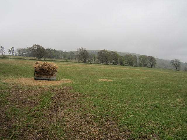
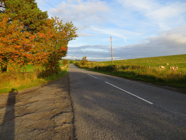
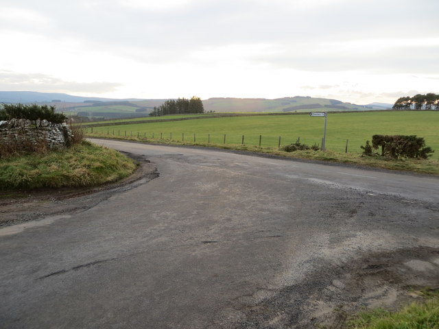
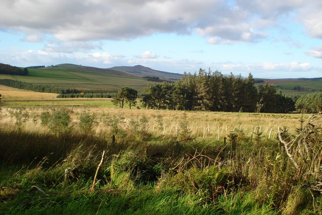
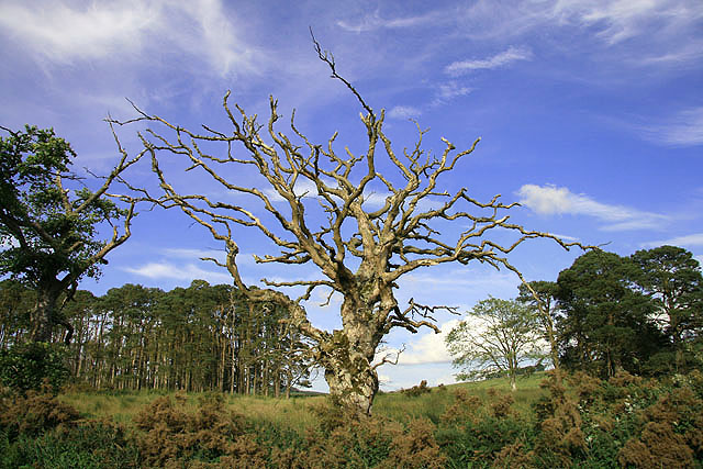
Demmings Plantation is a picturesque woodland located in Roxburghshire, Scotland. Covering a vast area, it is renowned for its enchanting beauty and rich biodiversity. The plantation is situated near the village of Demmings, surrounded by rolling hills and lush green fields.

The woodland is predominantly composed of native Scottish trees such as oak, birch, and pine, creating a diverse and vibrant ecosystem. The dense canopy provides shelter for a wide range of wildlife, including deer, squirrels, and various bird species. The tranquil atmosphere of the plantation makes it a popular destination for nature enthusiasts and hikers seeking to immerse themselves in the natural beauty of the area.

Visitors to Demmings Plantation can enjoy a network of well-maintained trails that crisscross through the forest, offering breathtaking views of the surrounding countryside. These paths cater to both casual strollers and experienced hikers, with varying levels of difficulty and lengths. Along the way, walkers can spot numerous plant species, from delicate wildflowers to towering ferns.

The plantation also holds historical significance, with remnants of old stone walls and ruins of former buildings scattered throughout the woodland. These remnants serve as a reminder of the area's past and add an intriguing dimension to the overall experience.

Overall, Demmings Plantation in Roxburghshire is a captivating destination for nature lovers and history enthusiasts alike. Its idyllic setting, diverse flora and fauna, and well-maintained trails make it an ideal location for leisurely walks, wildlife spotting, and exploring the region's natural and historical heritage.

If you have any feedback on the listing, please let us know in the comments section below.

Demmings Plantation Images

Images are sourced within 2km of 55.388174/-2.618337 or Grid Reference NT6010. Thanks to Geograph Open Source API. All images are credited.

Field above Cleuch Head Grass field with left overs from Winter.
Field above Cleuch Head
Grass field with left overs from Winter.
Ordnance Survey Flush Bracket (11416) This OS Flush Bracket can be found on the east face of the former Post Office. It marks a point 205.637m above mean sea level.
Ordnance Survey Flush Bracket (11416)
This OS Flush Bracket can be found on the east face of the former Post Office. It marks a point 205.637m above mean sea level.
Ordnance Survey Flush Bracket 11416 This can be found on the wall of a building - a private dwelling - at the crossroads in Chesters.
For more detail see : <span class="nowrap"><a title="http://www.bench-marks.org.uk/bm512" rel="nofollow ugc noopener" href="http://www.bench-marks.org.uk/bm512">Link</a><img style="margin-left:2px;" alt="External link" title="External link - shift click to open in new window" src="https://s1.geograph.org.uk/img/external.png" width="10" height="10"/></span>
Ordnance Survey Flush Bracket 11416
This can be found on the wall of a building - a private dwelling - at the crossroads in Chesters. For more detail see : LinkExternal link
Chesters Village Hall Viewed from the north-west.
Chesters Village Hall
Viewed from the north-west.
Ordnance Survey Flush Bracket 11417 This can be found on the wall of a cottage - a private dwelling - at Doorpool.
For more detail see : <span class="nowrap"><a title="http://www.bench-marks.org.uk/bm1550" rel="nofollow ugc noopener" href="http://www.bench-marks.org.uk/bm1550">Link</a><img style="margin-left:2px;" alt="External link" title="External link - shift click to open in new window" src="https://s1.geograph.org.uk/img/external.png" width="10" height="10"/></span>
Ordnance Survey Flush Bracket 11417
This can be found on the wall of a cottage - a private dwelling - at Doorpool. For more detail see : LinkExternal link
Road (A6088) at Doorpool Cottages Looking eastward.
Road (A6088) at Doorpool Cottages
Looking eastward.
Junction of roads at Coatlaw Plantation Looking south-westward.
Junction of roads at Coatlaw Plantation
Looking south-westward.
Jed Water
Jed Water
Grass track northeast of Wolfelee Hill
Very rough grazing with small patches of woodland The valley of the White Burn seen from the edge of the Lustruther Strip of woodland.  The hill in the middle distance is Rubers Law.
Very rough grazing with small patches of woodland
The valley of the White Burn seen from the edge of the Lustruther Strip of woodland. The hill in the middle distance is Rubers Law.
White Burn White Burn beneath Bents Plantation.
White Burn
White Burn beneath Bents Plantation.
A dead tree near Whiteburn A Dutch elm disease victim by the A6088 road south of Chesters.
A dead tree near Whiteburn
A Dutch elm disease victim by the A6088 road south of Chesters.
A dead elm tree near Whiteburn A closer view of the upper part of this tree <a href="https://www.geograph.org.uk/photo/1947228">NT6209 : A dead tree near Whiteburn</a>.
A dead elm tree near Whiteburn
A closer view of the upper part of this tree NT6209 : A dead tree near Whiteburn.
Southdean Church - the interior Southdean Kirk, opened in 1876, is the latest in a line of churches which could back as far as the 8th. - 9th. century. An old story from Southdean Parish was of the Borders Reivers having a son baptised in a font which could immerse the whole body of the baby. The reiver would always request of the vicar not to baptise the boy's right arm - that would be carrying out 'some develish deeds in the future'. The reivers, when not fighting the English, fought amongst themselves. Southdean Church only opens for up to six services a year.
Southdean Church - the interior
Southdean Kirk, opened in 1876, is the latest in a line of churches which could back as far as the 8th. - 9th. century. An old story from Southdean Parish was of the Borders Reivers having a son baptised in a font which could immerse the whole body of the baby. The reiver would always request of the vicar not to baptise the boy's right arm - that would be carrying out 'some develish deeds in the future'. The reivers, when not fighting the English, fought amongst themselves. Southdean Church only opens for up to six services a year.
The Old Smiddy, Chesters In a hamlet on a bend on the A6088, Carter Bar to Hawick main road, which is also a crossroads with two minor roads. The name Chesters implies a Roman origin, but any information on this has proved elusive.
The Old Smiddy, Chesters
In a hamlet on a bend on the A6088, Carter Bar to Hawick main road, which is also a crossroads with two minor roads. The name Chesters implies a Roman origin, but any information on this has proved elusive.
Entrance to Chesters
Southdean Hall The community hall is situated in the village of Chesters.
Southdean Hall
The community hall is situated in the village of Chesters.
Old Southdean Parish Church at Chesters This ruin was the second parish church of Southdean but was replaced in 1874 by another kirk which, in the modern day, is used very sparingly.
Old Southdean Parish Church at Chesters
This ruin was the second parish church of Southdean but was replaced in 1874 by another kirk which, in the modern day, is used very sparingly.
Show me another place!

Demmings Plantation is located at Grid Ref: NT6010 (Lat: 55.388174, Lng: -2.618337)

Unitary Authority: The Scottish Borders

Police Authority: The Lothians and Scottish Borders

What 3 Words

///decking.took.life. Near Jedburgh, Scottish Borders

Related Wikis

Abbotrule

Abbotrule is a hamlet south of the B6357 road, in the Scottish Borders area of Scotland, on Rule Burn, east of the Rule Water. Places nearby include Bedrule...

Hobkirk

Hobkirk (Scottish Gaelic: Eaglais Ruail) is a village and civil parish in the Scottish Borders area of Scotland, by the Rule Water, south-west of Jedburgh...

Southdean

Southdean is a hamlet in the Scottish Borders area of Scotland, on the A6088, by the Jed Water and in the Wauchope Forest area. Other settlements nearby...

Bonchester Bridge

Bonchester Bridge (Scots Binster Brig) is a village in Roxburghshire, within the Scottish Borders area of Scotland, lying on the Rule Water, six miles...

Related Videos

BONCHESTER BRIDGE LOOP

Hello Jamie here and with another video. So after my massive Ruberslaw walk, somehow in the afternoon period. I managed to ...

Nearby Amenities

Located within 500m of 55.388174,-2.618337
Doorpool
Place: hamlet
Lat/Long: 55.3902575/-2.6178398
Power: pole
Lat/Long: 55.3898853/-2.6251162
Power: pole
Lat/Long: 55.3900457/-2.6238615
Power: pole
Lat/Long: 55.390212/-2.6226093
Power: pole
Lat/Long: 55.3903363/-2.6216804
Power: pole
Lat/Long: 55.3905025/-2.6204409
Power: pole
Lat/Long: 55.3906529/-2.6192396
Power: pole
Lat/Long: 55.390942/-2.6171094
Power: pole
Lat/Long: 55.3904765/-2.615931
Power: pole
Lat/Long: 55.3900183/-2.6147399
Power: pole
Lat/Long: 55.3897609/-2.6141036
Power: pole
Lat/Long: 55.3893865/-2.6131365
Power: pole
Lat/Long: 55.3889384/-2.6119505
Power: pole
Lat/Long: 55.3884772/-2.6107721
Power: pole
Lat/Long: 55.3907757/-2.617285
Power: pole
Lat/Long: 55.3902192/-2.6174402
Power: pole
Lat/Long: 55.389774/-2.6175624
Power: pole
Lat/Long: 55.3900067/-2.6181605
Power: pole
Lat/Long: 55.3898274/-2.6187637
Power: pole
Lat/Long: 55.3896467/-2.6193872
Power: pole
Lat/Long: 55.3894805/-2.6199853
Power: pole
Lat/Long: 55.3892203/-2.6207667
The data included in this document is from www.openstreetmap.org. The data is made available under ODbL.

Have you been to Demmings Plantation?

Leave your review of Demmings Plantation below (or comments, questions and feedback).