Footie Wood

Wood, Forest in Aberdeenshire

Scotland

Footie Wood

A980 towards Torphins
A980 towards Torphins Credit: Steven Brown

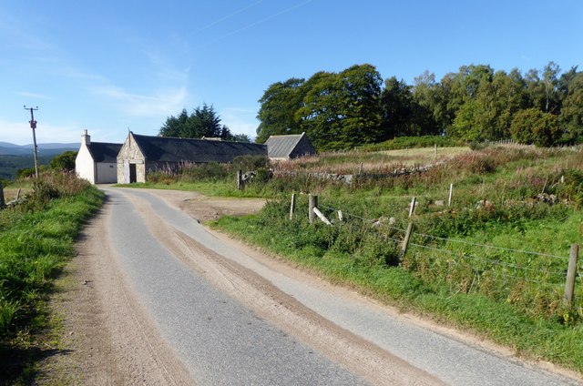
Footie Wood is a picturesque forest located in Aberdeenshire, Scotland. Spread over a vast area, the wood is known for its natural beauty and diverse flora and fauna. It is a popular destination for nature enthusiasts, hikers, and those seeking tranquility amidst nature.

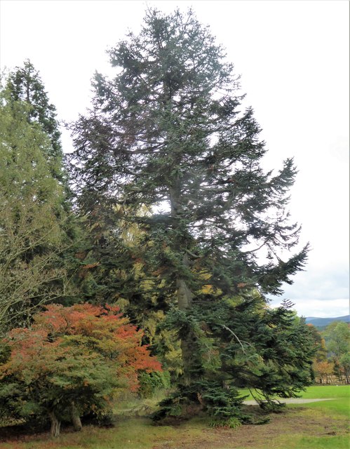
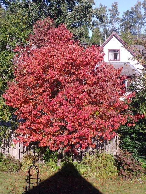
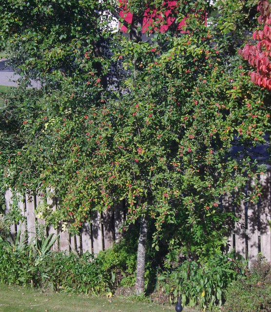
The wood is characterized by its dense canopy of trees, primarily consisting of native species such as oak, birch, and pine. These trees create a peaceful and serene environment, providing shade and shelter to various wildlife species. Visitors to Footie Wood can expect to encounter a variety of bird species, including woodpeckers, owls, and thrushes, as well as small mammals like squirrels and rabbits.

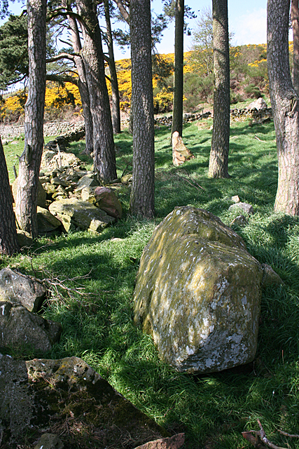
Several well-maintained trails crisscross the wood, allowing visitors to explore its hidden treasures. These trails offer opportunities for leisurely walks, birdwatching, and photography. The wood also features picnic areas, providing a perfect spot for families to enjoy a day out surrounded by nature.

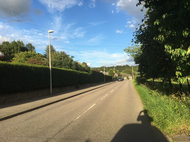
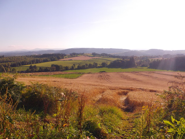
Footie Wood is easily accessible by car, with ample parking available nearby. The surrounding area offers stunning views of the Aberdeenshire countryside, making it an ideal spot for nature lovers and photography enthusiasts. The wood is open to the public throughout the year, and its changing colors during autumn make it a particularly popular destination during that season.

Overall, Footie Wood is a peaceful haven in Aberdeenshire, offering a chance to immerse oneself in the beauty of nature and escape the hustle and bustle of everyday life.

If you have any feedback on the listing, please let us know in the comments section below.

Footie Wood Images

Images are sourced within 2km of 57.105172/-2.6463758 or Grid Reference NJ6001. Thanks to Geograph Open Source API. All images are credited.

A980 towards Torphins
A980 near Torphins
A980 near Torphins
A980 at Torphins
A980 at Torphins
Part of a shelter belt around Kincardine Castle Enclosing the Castle, and the sloping 'meadow' in front of it.
Part of a shelter belt around Kincardine Castle
Enclosing the Castle, and the sloping 'meadow' in front of it.
Approach to Upper Craigton On minor road from Leyton.
Approach to Upper Craigton
On minor road from Leyton.
Stone field boundary with a few trees Near the Leyton road summit. The Roddens resplendent in fruit.
Stone field boundary with a few trees
Near the Leyton road summit. The Roddens resplendent in fruit.
Minor Road near Stranduff On a frosty day.
Minor Road near Stranduff
On a frosty day.
Lane to Stranduff and Tillyneckle From the minor road junction at Stranduff Croft.
Lane to Stranduff and Tillyneckle
From the minor road junction at Stranduff Croft.
Lodge Croft, Stranduff By minor road from Kincardine O'Neil to Sundayswells.
Lodge Croft, Stranduff
By minor road from Kincardine O'Neil to Sundayswells.
Minor road at Straduff Lodge Croft Looking north-eastward.
Minor road at Straduff Lodge Croft
Looking north-eastward.
Wooded track leading to Little Minew Looking westward.
Wooded track leading to Little Minew
Looking westward.
'New England' style autumn foliage At the start of October in NE Scotland.
'New England' style autumn foliage
At the start of October in NE Scotland.
Fruiting crab apple tree October in a Torphins garden.
Fruiting crab apple tree
October in a Torphins garden.
Harvest time near Learney Gownieburn cottage at extreme left.
Harvest time near Learney
Gownieburn cottage at extreme left.
Sundayswells Farm farmyard Access off the minor road from Bogenchapel.
Sundayswells Farm farmyard
Access off the minor road from Bogenchapel.
Balnacraig Recumbent Stone Circle (1) This is one of just four surviving stones of this circle, which had a diameter of 29 metres and originally extended into the adjacent field. See <span class="nowrap"><a title="https://canmore.org.uk/site/18024/balnacraig" rel="nofollow ugc noopener" href="https://canmore.org.uk/site/18024/balnacraig">Link</a><img style="margin-left:2px;" alt="External link" title="External link - shift click to open in new window" src="https://s1.geograph.org.uk/img/external.png" width="10" height="10"/></span> for more information. <a href="https://www.geograph.org.uk/photo/4955876">NJ6003 : Balnacraig Recumbent Stone Circle (2)</a>
Balnacraig Recumbent Stone Circle (1)
This is one of just four surviving stones of this circle, which had a diameter of 29 metres and originally extended into the adjacent field. See LinkExternal link for more information. NJ6003 : Balnacraig Recumbent Stone Circle (2)
Balnacraig Recumbent Stone Circle (2) Nearest to the camera is the recumbent, with one of its support stones just visible to its right. Roughly in line with it is the only orthostat still standing upright. All the other stones have been cleared from the fields. See <span class="nowrap"><a title="https://canmore.org.uk/site/18024/balnacraig" rel="nofollow ugc noopener" href="https://canmore.org.uk/site/18024/balnacraig">Link</a><img style="margin-left:2px;" alt="External link" title="External link - shift click to open in new window" src="https://s1.geograph.org.uk/img/external.png" width="10" height="10"/></span> for more details. <a href="https://www.geograph.org.uk/photo/4955883">NJ6003 : Balnacraig Recumbent Stone Circle (3)</a>
Balnacraig Recumbent Stone Circle (2)
Nearest to the camera is the recumbent, with one of its support stones just visible to its right. Roughly in line with it is the only orthostat still standing upright. All the other stones have been cleared from the fields. See LinkExternal link for more details. NJ6003 : Balnacraig Recumbent Stone Circle (3)
Balnacraig Recumbent Stone Circle (3) The large stone here is possibly a displaced orthostat. It is surrounded by field cleared boulders. See <span class="nowrap"><a title="https://canmore.org.uk/site/18024/balnacraig" rel="nofollow ugc noopener" href="https://canmore.org.uk/site/18024/balnacraig">Link</a><img style="margin-left:2px;" alt="External link" title="External link - shift click to open in new window" src="https://s1.geograph.org.uk/img/external.png" width="10" height="10"/></span> for more details. <a href="https://www.geograph.org.uk/photo/4955887">NJ6003 : Balnacraig Recumbent Stone Circle (4)</a>
Balnacraig Recumbent Stone Circle (3)
The large stone here is possibly a displaced orthostat. It is surrounded by field cleared boulders. See LinkExternal link for more details. NJ6003 : Balnacraig Recumbent Stone Circle (4)
Show me another place!

Footie Wood is located at Grid Ref: NJ6001 (Lat: 57.105172, Lng: -2.6463758)

Unitary Authority: Aberdeenshire

Police Authority: North East

What 3 Words

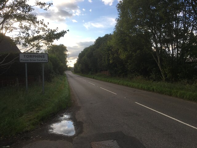
///profile.insects.headstone. Near Torphins, Aberdeenshire

Related Wikis

Torphins

Torphins ( tor-FINZ; Scottish Gaelic: Tòrr Fionn) is a village in Royal Deeside, Aberdeenshire, Scotland which lies about 22 miles (35 km) west of Aberdeen...

Torphins railway station

Torphins railway station served the village of Torphins from 1859 to 1966 on the Deeside Railway that ran from Aberdeen (Joint) to Ballater. == History... ==

Kincardine Castle, Royal Deeside

Kincardine Castle is a Victorian country house in Royal Deeside, Scotland. Formerly known as Kincardine House, it is the private home of the Bradford family...

Kincardine O'Neil

Kincardine O'Neil (Scottish Gaelic: Cinn Chàrdainn, Scots: Kinker) is a village in Aberdeenshire, Scotland. It is situated between the towns of Banchory...

Nearby Amenities

Located within 500m of 57.105172,-2.6463758
North Footie
Place: hamlet
Lat/Long: 57.1052492/-2.63912
Power: pole
Lat/Long: 57.1088374/-2.6503788
Power: pole
Lat/Long: 57.1085176/-2.6496214
Power: pole
Lat/Long: 57.1081747/-2.64879
Power: pole
Lat/Long: 57.1078047/-2.6479086
Power: pole
Lat/Long: 57.1074366/-2.647005
Power: pole
Lat/Long: 57.107332/-2.6459032
Power: pole
Lat/Long: 57.1072224/-2.6448477
Power: pole
Lat/Long: 57.1071138/-2.6437423
Power: pole
Lat/Long: 57.1070072/-2.6426146
Power: pole
Lat/Long: 57.1069288/-2.6416591
Power: pole
Lat/Long: 57.1068353/-2.6405481
Power: pole
Lat/Long: 57.1065416/-2.6394278
Power: pole
Lat/Long: 57.1064743/-2.639176
Power: pole
Lat/Long: 57.1078419/-2.649627
Power: pole
Lat/Long: 57.1075412/-2.6503862
Power: pole
Lat/Long: 57.1072295/-2.6511676
Power: pole
Lat/Long: 57.1070847/-2.6524434
Power: pole
Lat/Long: 57.1069358/-2.6537544
Power: pole
Lat/Long: 57.1016849/-2.6421719
Power: pole
Lat/Long: 57.1023428/-2.6426971
Power: pole
Lat/Long: 57.1029325/-2.6431587
Power: pole
Lat/Long: 57.1034963/-2.643599
Power: pole
Lat/Long: 57.1040072/-2.6428085
Power: pole
Lat/Long: 57.1045345/-2.6419756
Power: pole
Lat/Long: 57.1051309/-2.6410349
Power: pole
Lat/Long: 57.105614/-2.640278
Power: pole
Lat/Long: 57.104182/-2.652904
Power: pole
Lat/Long: 57.1036231/-2.6537652
Power: pole
Lat/Long: 57.1066387/-2.6512382
Power: pole
Lat/Long: 57.1085511/-2.6430596
Power: pole
Lat/Long: 57.107852/-2.6433992
The data included in this document is from www.openstreetmap.org. The data is made available under ODbL.

Have you been to Footie Wood?

Leave your review of Footie Wood below (or comments, questions and feedback).