Mackside

Settlement in Roxburghshire

Scotland

Mackside

B6357 towards Bonchester Bridge
B6357 towards Bonchester Bridge Credit: Steven Brown

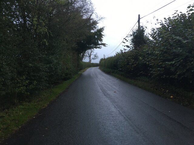
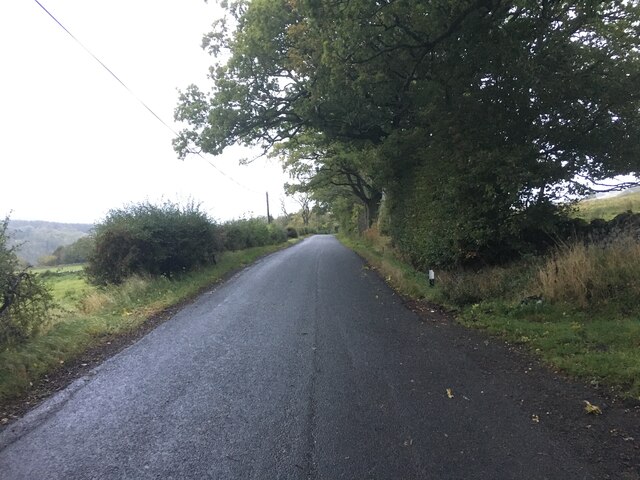
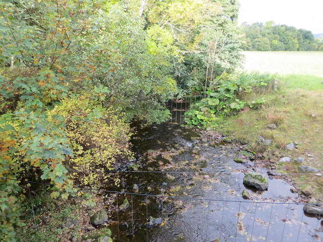
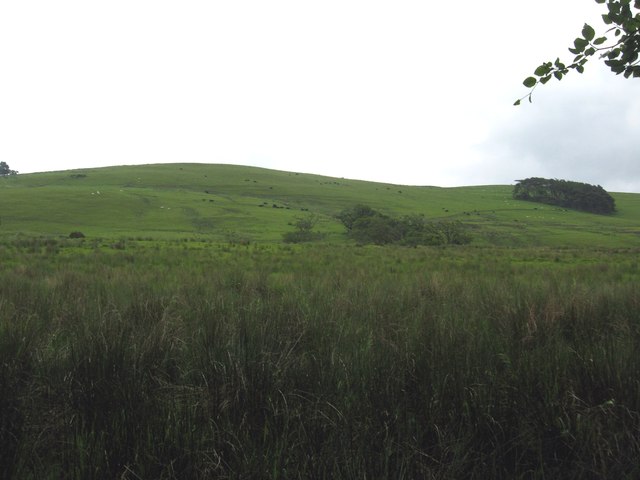
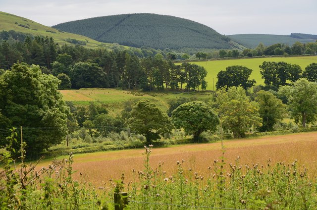
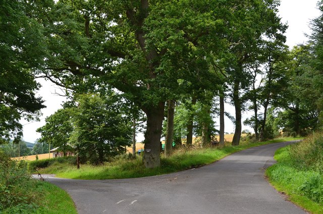
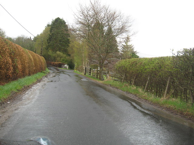
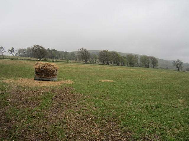
Mackside is a small village located in the historical county of Roxburghshire, in the southern region of Scotland. Situated on the banks of the River Teviot, the village is known for its picturesque scenery and tranquil atmosphere. It is nestled amidst rolling hills and lush green landscapes, offering residents and visitors a delightful escape from the hustle and bustle of urban life.

The village itself is composed of charming stone cottages, some dating back to the 18th century, giving it a distinct rural character. The community is close-knit, with a population of around 300 residents, who take pride in preserving the traditional way of life in the area.

Mackside is well-connected to nearby towns and cities, with the market town of Hawick just a short drive away. This provides residents with access to a range of amenities, including shops, schools, and healthcare facilities. Additionally, the village benefits from excellent transport links, making it an ideal base for those looking to explore the surrounding countryside.

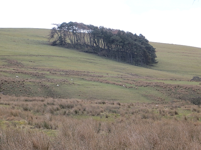
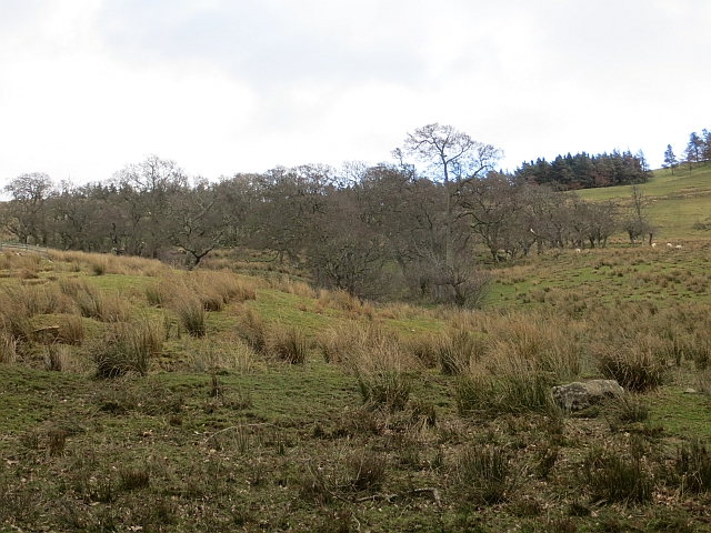
Nature enthusiasts will find plenty to enjoy in Mackside, as the village is surrounded by stunning natural beauty. The River Teviot offers opportunities for fishing and boating, while the nearby hills provide excellent walking and hiking trails. The area is also home to a diverse range of wildlife, making it a haven for birdwatchers and nature lovers.

Overall, Mackside offers a peaceful and idyllic setting for those seeking a slower pace of life in the heart of Scotland's beautiful countryside.

If you have any feedback on the listing, please let us know in the comments section below.

Mackside Images

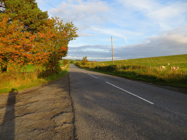
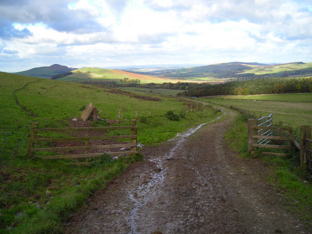
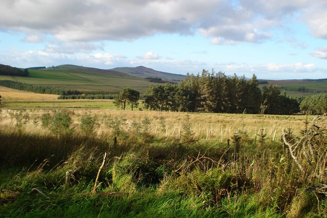
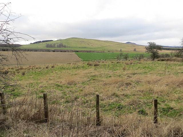
Images are sourced within 2km of 55.382331/-2.6328608 or Grid Reference NT6010. Thanks to Geograph Open Source API. All images are credited.

B6357 towards Bonchester Bridge
Ordnance Survey Flush Bracket 11419 This can be found on the parapet wall of a bridge over Catlee Burn at Forkins.
For more detail see : <span class="nowrap"><a title="http://www.bench-marks.org.uk/bm16610" rel="nofollow ugc noopener" href="http://www.bench-marks.org.uk/bm16610">Link</a><img style="margin-left:2px;" alt="External link" title="External link - shift click to open in new window" src="https://s1.geograph.org.uk/img/external.png" width="10" height="10"/></span>
Ordnance Survey Flush Bracket 11419
This can be found on the parapet wall of a bridge over Catlee Burn at Forkins. For more detail see : LinkExternal link
Catlee Burn viewed from the bridge at Forkins Looking north-westward.
Catlee Burn viewed from the bridge at Forkins
Looking north-westward.
Grazing lands on Wolflee Hill In Roxburghshire.
Grazing lands on Wolflee Hill
In Roxburghshire.
Forestry beyond the fields, Harwoodmill A view across the catchment of the Rule Water to the forested Wolfhopelee Hill, at the N end of the extensive Wauchope Forest.
Forestry beyond the fields, Harwoodmill
A view across the catchment of the Rule Water to the forested Wolfhopelee Hill, at the N end of the extensive Wauchope Forest.
Road junction near Forkins A sign on the tree indicates 'Harwood' to the left.
Road junction near Forkins
A sign on the tree indicates 'Harwood' to the left.
The B6357heading south towards Wolfelee in Roxburghshire
Field above Cleuch Head Grass field with left overs from Winter.
Field above Cleuch Head
Grass field with left overs from Winter.
Field under Wolfelee Hill Rashy ground beside the B6357.
Field under Wolfelee Hill
Rashy ground beside the B6357.
Wolfelee Hill A circular wood on Wolfelee Hill. This is what the now forested Wauchope would have been like judging by evidence of old maps.
Wolfelee Hill
A circular wood on Wolfelee Hill. This is what the now forested Wauchope would have been like judging by evidence of old maps.
Alder wood, Wolfelee
Ordnance Survey Flush Bracket 11417 This can be found on the wall of a cottage - a private dwelling - at Doorpool.
For more detail see : <span class="nowrap"><a title="http://www.bench-marks.org.uk/bm1550" rel="nofollow ugc noopener" href="http://www.bench-marks.org.uk/bm1550">Link</a><img style="margin-left:2px;" alt="External link" title="External link - shift click to open in new window" src="https://s1.geograph.org.uk/img/external.png" width="10" height="10"/></span>
Ordnance Survey Flush Bracket 11417
This can be found on the wall of a cottage - a private dwelling - at Doorpool. For more detail see : LinkExternal link
Road (A6088) at Doorpool Cottages Looking eastward.
Road (A6088) at Doorpool Cottages
Looking eastward.
Farm track on east side of Wolfelee Hill
Grass track northeast of Wolfelee Hill
Very rough grazing with small patches of woodland The valley of the White Burn seen from the edge of the Lustruther Strip of woodland.  The hill in the middle distance is Rubers Law.
Very rough grazing with small patches of woodland
The valley of the White Burn seen from the edge of the Lustruther Strip of woodland. The hill in the middle distance is Rubers Law.
Field, Doorpool
Field, Doorpool
Show me another place!

Mackside is located at Grid Ref: NT6010 (Lat: 55.382331, Lng: -2.6328608)

Unitary Authority: The Scottish Borders

Police Authority: The Lothians and Scottish Borders

What 3 Words

///graphics.inert.cloak. Near Hawick, Scottish Borders

Related Wikis

Hobkirk

Hobkirk (Scottish Gaelic: Eaglais Ruail) is a village and civil parish in the Scottish Borders area of Scotland, by the Rule Water, south-west of Jedburgh...

Wauchope, Scottish Borders

Wauchope is a hamlet in the Scottish Borders council area of Scotland, near Southdean. Wauchope House was demolished in 1932. == See also == Wauchope Forest...

Bonchester Bridge

Bonchester Bridge (Scots Binster Brig) is a village in Roxburghshire, within the Scottish Borders area of Scotland, lying on the Rule Water, six miles...

Abbotrule

Abbotrule is a hamlet south of the B6357 road, in the Scottish Borders area of Scotland, on Rule Burn, east of the Rule Water. Places nearby include Bedrule...

Related Videos

BONCHESTER BRIDGE LOOP

Hello Jamie here and with another video. So after my massive Ruberslaw walk, somehow in the afternoon period. I managed to ...

Nearby Amenities

Located within 500m of 55.382331,-2.6328608
Mackside
Place: hamlet
Lat/Long: 55.3832869/-2.6277914
Power: pole
Lat/Long: 55.3851537/-2.6271389
Power: pole
Lat/Long: 55.3845478/-2.6270708
Power: pole
Lat/Long: 55.3839478/-2.6269996
Power: pole
Lat/Long: 55.3834056/-2.627221
Power: pole
Lat/Long: 55.3849338/-2.6282874
Power: pole
Lat/Long: 55.3847011/-2.629509
Power: pole
Lat/Long: 55.3844654/-2.6307332
Power: pole
Lat/Long: 55.3845666/-2.6314102
Power: pole
Lat/Long: 55.3846808/-2.6321865
Power: pole
Lat/Long: 55.3830182/-2.6339349
The data included in this document is from www.openstreetmap.org. The data is made available under ODbL.

Have you been to Mackside?

Leave your review of Mackside below (or comments, questions and feedback).