Chadlington

Settlement in Oxfordshire West Oxfordshire

England

Chadlington

Tornado near Shorthampton A1 4-6-2 No. 60163 'Tornado' speeds through the Cotswolds, about to pass under the Catsham Lane bridge with the 'Red Rose' railtour from London to Worcester.
Tornado near Shorthampton Credit: Bob Walters

Chadlington is a charming village located in the county of Oxfordshire, England. Situated in the rolling hills of the Cotswolds, it is approximately 15 miles northwest of Oxford and 7 miles south of Chipping Norton. The village is nestled amidst picturesque countryside, offering stunning views and a serene atmosphere.

Chadlington is a small community with a population of around 1,000 residents. It boasts a rich history dating back to the Roman times, evident through the remnants of a Roman villa discovered in the area. The village grew during the medieval period and still retains much of its ancient charm, with several well-preserved historic buildings.

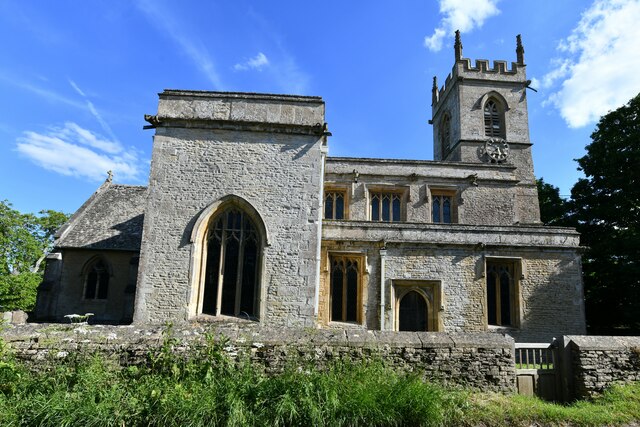
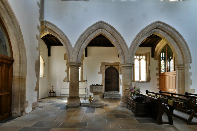
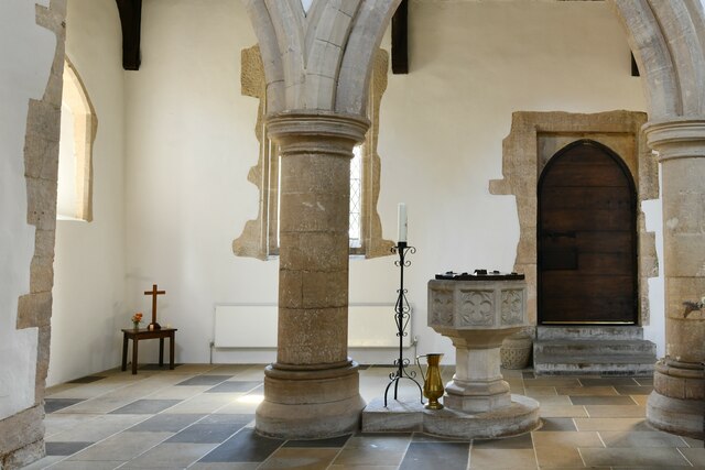
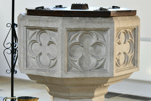
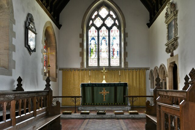
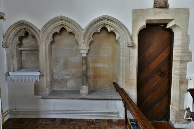
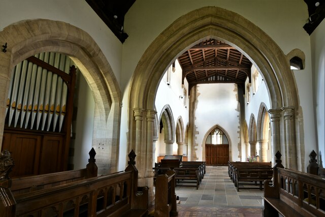
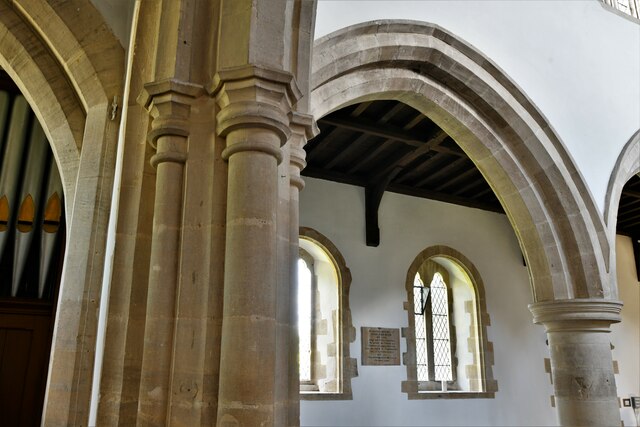
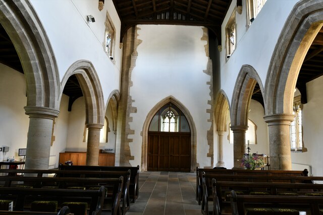
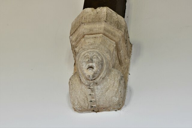
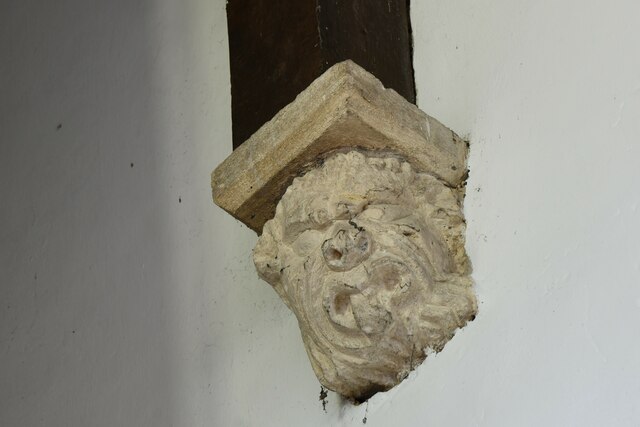
The heart of Chadlington is its village green, a focal point for local events and gatherings. Surrounding the green, there are a variety of period houses, traditional cottages, and a 12th-century church dedicated to St. Nicholas. The village also has a primary school, a local shop, a post office, and a pub, providing essential amenities for its residents.

For outdoor enthusiasts, Chadlington offers ample opportunities for exploration. The surrounding countryside is crisscrossed with footpaths and bridleways, allowing visitors to enjoy scenic walks and bike rides. Nearby attractions include the ancient Rollright Stones, a prehistoric stone circle, and the historic market town of Chipping Norton.

Chadlington is a close-knit community that exudes a sense of tranquility and rural charm. Its idyllic location, combined with its rich history and amenities, make it an attractive place to live or visit in Oxfordshire.

If you have any feedback on the listing, please let us know in the comments section below.

Chadlington Images

Images are sourced within 2km of 51.89553/-1.525013 or Grid Reference SP3221. Thanks to Geograph Open Source API. All images are credited.

Tornado near Shorthampton A1 4-6-2 No. 60163 'Tornado' speeds through the Cotswolds, about to pass under the Catsham Lane bridge with the 'Red Rose' railtour from London to Worcester.
Tornado near Shorthampton
A1 4-6-2 No. 60163 'Tornado' speeds through the Cotswolds, about to pass under the Catsham Lane bridge with the 'Red Rose' railtour from London to Worcester.
Chadlington, St. Nicholas Church: Northern aspect
Chadlington, St. Nicholas Church: The Victorian font 1
Chadlington, St. Nicholas Church: The Victorian font 2
Chadlington, St. Nicholas Church: The Victorian font 3
Chadlington, St. Nicholas Church: The Victorian font 4
Chadlington, St. Nicholas Church: The chancel
Chadlington, St. Nicholas Church: Piscina and double sedilia
Chadlington, St. Nicholas Church: Sedilia carving
Chadlington, St. Nicholas Church: The chancel and nave beyond
Chadlington, St. Nicholas Church: Carved leaf poppyhead
Chadlington, St. Nicholas Church: c13th Early English period arch
Chadlington, St. Nicholas Church: The nave
Chadlington, St. Nicholas Church: Roof corbel 1
Chadlington, St. Nicholas Church: Roof corbel 2
Chadlington, St. Nicholas Church: Roof corbel 3
Chadlington, St. Nicholas Church: All that remains of a Saxon arch in the north arcade
Chadlington, St. Nicholas Church: Stained glass window
Show me another place!

Chadlington is located at Grid Ref: SP3221 (Lat: 51.89553, Lng: -1.525013)

Administrative County: Oxfordshire

District: West Oxfordshire

Police Authority: Thames Valley

What 3 Words

///gazed.congested.scornful. Near Charlbury, Oxfordshire

Related Wikis

Chadlington

Chadlington is a village and civil parish in the Evenlode Valley about 3 miles (5 km) south of Chipping Norton, Oxfordshire. The village has four neighbourhoods...

Knollbury

Knollbury is a scheduled Iron Age hillfort enclosure to the north west of Chadlington in Oxfordshire. Believed to be defensive in nature the enclosure...

Dean, Oxfordshire

Dean is a hamlet in Spelsbury civil parish, about 2 miles (3 km) north of Charlbury and 3.5 miles (5.6 km) southeast of Chipping Norton, Oxfordshire. Its...

Shorthampton

Shorthampton is a hamlet in Chilson civil parish about 2 miles (3 km) west of Charlbury, in Oxfordshire, England. The oldest parts of the Church of England...

Hawk Stone

The Hawk Stone is a neolithic standing stone just north of the hamlet of Dean, Oxfordshire, England on Diddly Squat Farm belonging to Jeremy Clarkson....

Spelsbury

Spelsbury is a village and civil parish about 1.5 miles (2.4 km) north of Charlbury and about 4 miles (6.4 km) southeast of Chipping Norton, Oxfordshire...

Chilson

Chilson is a hamlet and civil parish in the Evenlode Valley in West Oxfordshire, England, about 4+1⁄2 miles (7 km) south of Chipping Norton. The civil...

Cornbury Park

Cornbury Park is an estate near Charlbury, Oxfordshire. It comprises about 5000 acres, mostly farmland and woods, including a remnant of the Wychwood Forest...

Nearby Amenities

Located within 500m of 51.89553,-1.525013
Chadlington
Place: village
Wikidata: Q2428852
Wikipedia: en:Chadlington
Lat/Long: 51.8958295/-1.5233375
Chadlington
Traffic Sign: city_limit
Lat/Long: 51.893681/-1.5248563
Bus Stop
Auburn House
Bus: yes
Naptan AtcoCode: 340001113OPP
Naptan Bearing: E
Naptan CommonName: Auburn House
Naptan Indicator: Opposite
Naptan Landmark: Auburn House
Naptan NaptanCode: oxfadgwj
Naptan Street: East End
Naptan Verified: no
Public Transport: platform
Source: naptan_import
Lat/Long: 51.8951461/-1.5213537
Bus Stop
Auburn House
Bus: yes
Naptan AtcoCode: 340001113OUT
Naptan Bearing: W
Naptan CommonName: Auburn House
Naptan Indicator: Outside
Naptan Landmark: Auburn House
Naptan NaptanCode: oxfadjdm
Naptan Street: East End
Naptan Verified: no
Public Transport: platform
Source: naptan_import
Lat/Long: 51.8952116/-1.5219779
Bus Stop
Post Office
Bus: yes
Naptan AtcoCode: 340001905OPP
Naptan Bearing: E
Naptan CommonName: Post Office
Naptan Indicator: Opposite
Naptan Landmark: Post Office
Naptan NaptanCode: oxfgjdjg
Naptan Street: Bull Hill
Naptan Verified: no
Public Transport: platform
Source: naptan_import
Lat/Long: 51.8956723/-1.5247342
Post Office Van
Naptan AtcoCode: 340001905OUT
Naptan Bearing: W
Naptan BusStopType: CUS
Naptan CommonName: Post Office
Naptan Indicator: Outside
Naptan Landmark: Post Office
Naptan NaptanCode: oxfgjdmp
Naptan Street: Bull Hill
Naptan Verified: no
Source: naptan_import
Lat/Long: 51.8956285/-1.52185
Bus Stop
Church Road
Bus: yes
Naptan AtcoCode: 340003197CNR
Naptan Bearing: S
Naptan CommonName: Church Road
Naptan Indicator: Corner
Naptan Landmark: Church Road
Naptan NaptanCode: oxfgapam
Naptan Street: Chipping Norton Road
Naptan Verified: no
Public Transport: platform
Source: naptan_import
Lat/Long: 51.8985656/-1.5264913
Bus Stop
Church Road
Bus: yes
Naptan AtcoCode: 340003197OPP
Naptan Bearing: N
Naptan CommonName: Church Road
Naptan Indicator: Opposite
Naptan Landmark: Bus Shelter
Naptan NaptanCode: oxfgapap
Naptan Street: Chipping Norton Road
Naptan Verified: no
Public Transport: platform
Source: naptan_import
Lat/Long: 51.8991426/-1.5268922
Brookend
Place: neighbourhood
Source: OS_OpenData_StreetView
Lat/Long: 51.8933235/-1.5287794
Westend
Place: neighbourhood
Source: OS_OpenData_StreetView
Lat/Long: 51.895633/-1.5256381
Chadlington Quality Foods
Shop: deli
Lat/Long: 51.8962084/-1.5260207
Chadlington Mobile Post Office Service
Brand: Post Office
Mobile Amenity: post_office
Note: Mobile service with limited opening hours
Opening Hours: Mo,We,Fr 13:00-14:30; Tu,Th 10:00-12:00; Sa,Su off
Source: http://www.chadlington.com/local-info/postoffice
Lat/Long: 51.8989522/-1.5265757
Barrier: stile
Lat/Long: 51.8920601/-1.5276485
Slatters
Shop: butcher
Lat/Long: 51.8962856/-1.5260696
Post Box
Operator: Royal Mail
Post Box Type: pillar
Ref: OX7 96
Royal Cypher: EIIR
Royal Cypher Wikidata: Q33102113
Lat/Long: 51.8956598/-1.5253012
Chadlington Parish Council
Board Type: notice
Information: board
Tourism: information
Lat/Long: 51.8956381/-1.5252602
Addr Housenumber: 11
Lat/Long: 51.8991539/-1.5270764
Addr Housenumber: 5
Lat/Long: 51.8984945/-1.5260154
Addr Housenumber: 10
Lat/Long: 51.8984324/-1.5254789
Addr Housenumber: 5
Lat/Long: 51.8979864/-1.5258089
Addr Housenumber: 12
Lat/Long: 51.8979566/-1.5252671
Addr Housenumber: 14
Lat/Long: 51.8978813/-1.5252054
Noexit: yes
Lat/Long: 51.8977282/-1.5253851
Addr Housename: Rope Cottage
Lat/Long: 51.8970503/-1.5257013
Addr Housenumber: 1
Lat/Long: 51.8969148/-1.5256861
Addr Housenumber: 2
Lat/Long: 51.8970611/-1.5253803
Addr Housename: The Old Bakehouse
Lat/Long: 51.8965926/-1.5259205
Addr Housename: Middle Barn
Lat/Long: 51.8964346/-1.5242039
Addr Housenumber: 2
Lat/Long: 51.8963891/-1.5246598
Addr Housenumber: 1
Lat/Long: 51.8961813/-1.5247188
Addr Housename: Talet Cottage
Lat/Long: 51.8963882/-1.5238887
Addr Housename: The Croft
Lat/Long: 51.8965/-1.5238579
Addr Housename: The Paddock
Lat/Long: 51.8962211/-1.5238485
Addr Housename: Holywell House
Lat/Long: 51.8960845/-1.5241006
Addr Housename: Stable Cottage
Lat/Long: 51.896178/-1.5241636
Addr Housename: The Farmhouse
Lat/Long: 51.8959802/-1.5240577
Addr Housename: Chadlington Farm
Lat/Long: 51.8953937/-1.5234127
Addr Housename: South Barn
Lat/Long: 51.8949221/-1.5228427
Addr Housename: Harvest View
Lat/Long: 51.8949535/-1.5224622
Addr Housename: Granary Barn
Lat/Long: 51.8953119/-1.5227826
Addr Housename: Dairy Cottage
Lat/Long: 51.8951579/-1.5228427
Addr Housename: Plough Shares
Lat/Long: 51.8953889/-1.5230784
Natural: spring
Lat/Long: 51.8946693/-1.5198274
Addr Housenumber: 8
Lat/Long: 51.8989938/-1.5256419
Addr Housename: Ashcroft Close
Lat/Long: 51.8989783/-1.5257867
Addr Housenumber: 1
Lat/Long: 51.8986777/-1.5263168
Addr Housenumber: 9
Lat/Long: 51.8985473/-1.526754
Addr Housenumber: 3
Lat/Long: 51.896606/-1.5186199
Addr Housenumber: 4
Lat/Long: 51.8965232/-1.5186011
Addr Housenumber: 7
Lat/Long: 51.8962634/-1.5185206
Addr Housename: Chadlington House
Lat/Long: 51.8956907/-1.5186038
Addr Housename: The School House
Lat/Long: 51.8954275/-1.518754
Addr Housename: Vale Bank
Lat/Long: 51.8954027/-1.5194138
Addr Housename: Pately Close
Lat/Long: 51.8958595/-1.5196364
Addr Housenumber: 1
Addr Postcode: OX7 3LY
Addr Street: East End
Lat/Long: 51.8957271/-1.5177937
Addr Housename: The Manse
Lat/Long: 51.8947355/-1.5214444
Addr Housename: Myrtle Cottage
Lat/Long: 51.8949588/-1.5214668
Addr Housename: Ivy Cottage
Lat/Long: 51.8949764/-1.5212615
Addr Housename: The Old Post Office
Lat/Long: 51.8949638/-1.5211456
Addr Housename: Berkeley Cottage
Lat/Long: 51.8949538/-1.5210399
Addr Housename: Jasmine Cottage
Lat/Long: 51.8949199/-1.5209118
Addr Housename: Cob Cottage
Lat/Long: 51.8948886/-1.5207614
Addr Housenumber: 5
Lat/Long: 51.8948083/-1.5203671
Addr Housename: The Grove
Lat/Long: 51.8947669/-1.5200439
Addr Housenumber: 6
Lat/Long: 51.8948459/-1.520548
Addr Housenumber: 1
Lat/Long: 51.8939572/-1.5245186
Addr Housenumber: 2
Lat/Long: 51.8939018/-1.5245011
Addr Housename: Catsum House
Lat/Long: 51.894066/-1.5243972
Addr Housename: Mount Pleasant
Lat/Long: 51.8947759/-1.5262038
Addr Housename: The Old Brew House
Lat/Long: 51.8951103/-1.525662
Addr Housename: Bull Hill House
Lat/Long: 51.8950871/-1.5259798
Addr Housename: St Christophers
Lat/Long: 51.8949704/-1.5261649
Addr Housename: Post Office Cottage
Lat/Long: 51.8953304/-1.5249766
Addr Housename: Maple Cottage
Lat/Long: 51.8954248/-1.5250638
Addr Housename: Sandys House
Lat/Long: 51.8953423/-1.5255471
Addr Housename: Horseshoe Cottage
Lat/Long: 51.8944395/-1.5250423
Addr Housename: April Cottage
Lat/Long: 51.8943363/-1.5250508
Addr Housename: Apple Brook House
Lat/Long: 51.8941377/-1.5250917
Addr Housename: Boot Cottage
Lat/Long: 51.8921939/-1.5277344
Addr Housename: The Willows
Lat/Long: 51.8926574/-1.5285565
Addr Housename: Brookside Cottage
Lat/Long: 51.8926698/-1.5278403
Addr Housename: Little Brook
Lat/Long: 51.8926339/-1.5275537
Addr Housename: Rose Cottage
Lat/Long: 51.8934685/-1.5280083
Addr Housename: Millbrook
Lat/Long: 51.8933455/-1.5280246
The data included in this document is from www.openstreetmap.org. The data is made available under ODbL.

Have you been to Chadlington?

Leave your review of Chadlington below (or comments, questions and feedback).