Amberley

Settlement in Herefordshire

England

Amberley

Preston Wynne church Preston Wynne church is dedicated to the Holy Trinity.  Undulations in the field nearby suggests there was once a medieval village here though this church is later.  To get to this isolated parish church one has to follow a footpath across a field.  The church was consecrated in 1730 and the keystone above the door is inscribe '1727'.  The tower is built in a provincial Baroque-style west.  Here the church is reflected in partially frozen water, the result of heavy recent rainfall.
Preston Wynne church Credit: Philip Halling

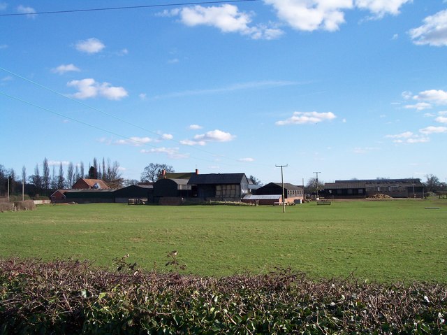
Amberley is a small village located in Herefordshire, England. Nestled in the picturesque countryside, the village is known for its tranquility and natural beauty. It is situated approximately 7 miles southwest of the city of Hereford, making it an ideal retreat from the bustling city life.

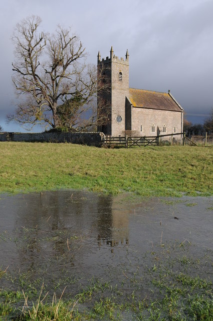
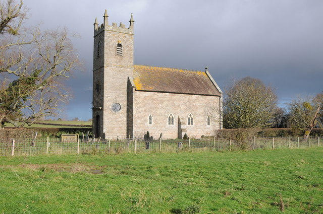
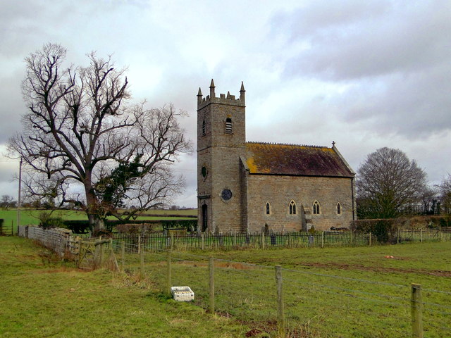
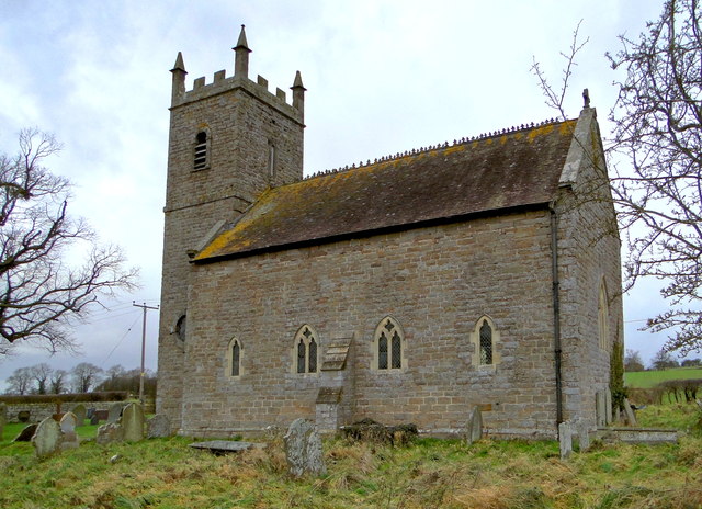
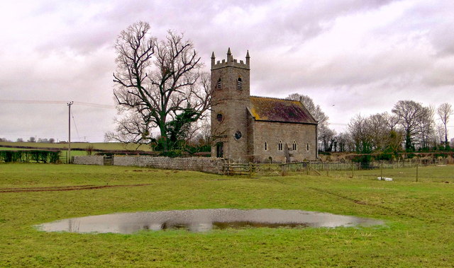
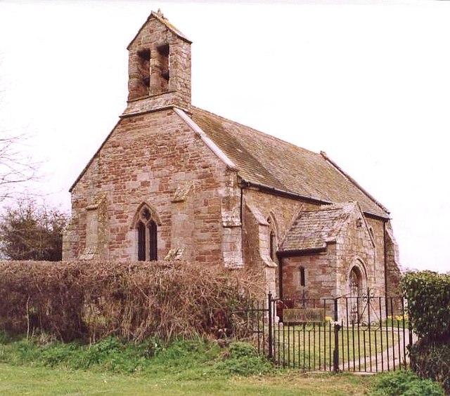
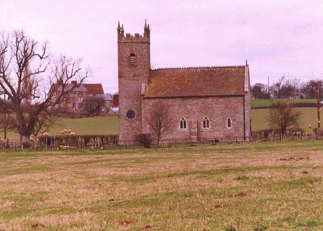
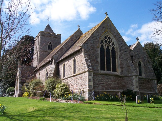
The village is characterized by its charming stone cottages and well-maintained gardens. It has a close-knit community, with a population of around 300 residents. The village is centered around a traditional village green and features a quaint parish church that dates back to the 12th century.

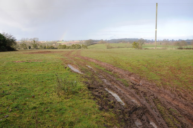
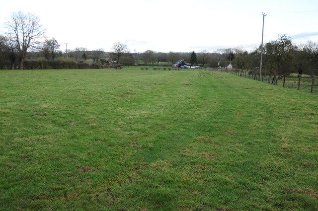
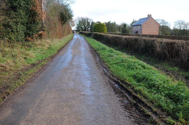
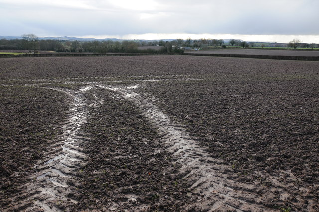
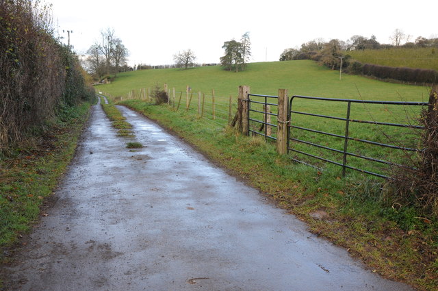
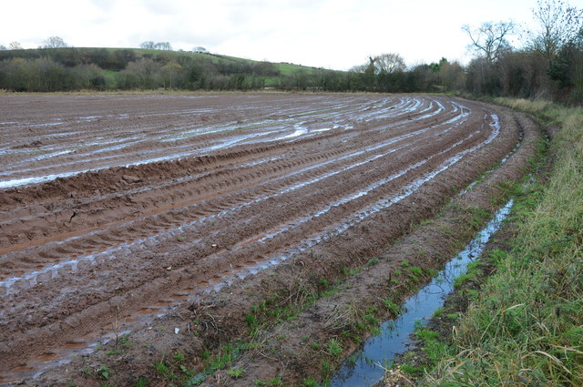
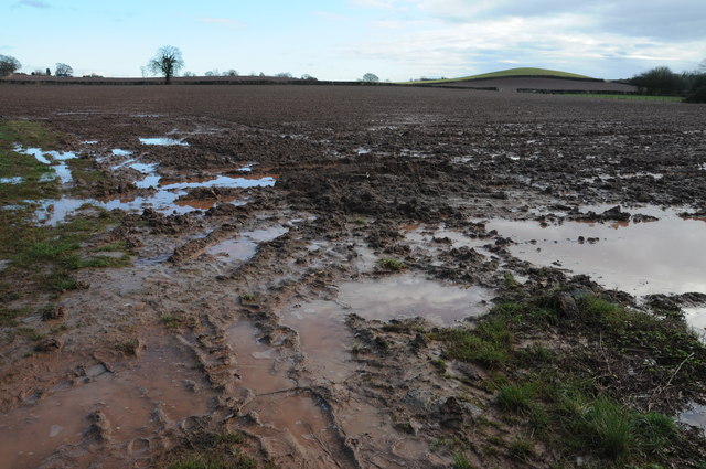
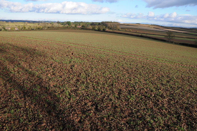
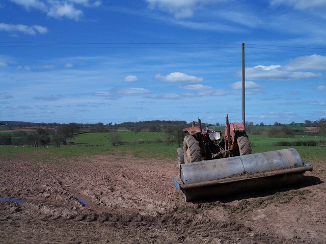
Amberley is surrounded by rolling hills and lush green fields, providing ample opportunities for outdoor activities such as hiking, cycling, and horseback riding. The area is also a haven for wildlife enthusiasts, with an abundance of bird species and small mammals inhabiting the nearby woodlands.

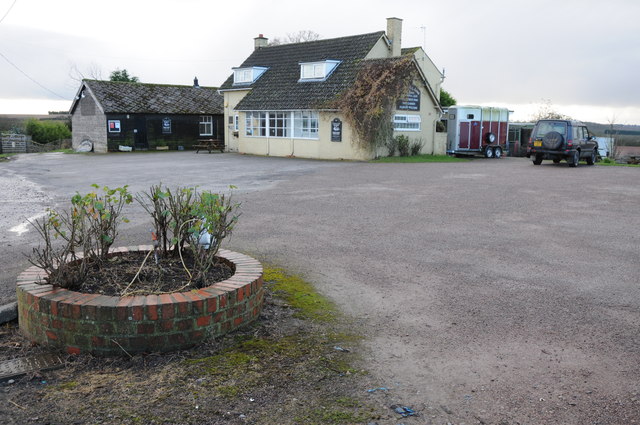
Despite its small size, Amberley offers a few amenities to its residents and visitors. There is a local pub, The Amberley Arms, where locals gather for a pint and a chat. Additionally, a few shops and services can be found nearby in the neighboring towns.

For those seeking a peaceful rural escape, Amberley provides a serene and idyllic setting. Its proximity to Hereford allows for easy access to urban amenities while still enjoying the tranquility of village life.

If you have any feedback on the listing, please let us know in the comments section below.

Amberley Images

Images are sourced within 2km of 52.126618/-2.6673094 or Grid Reference SO5447. Thanks to Geograph Open Source API. All images are credited.

Preston Wynne church Preston Wynne church is dedicated to the Holy Trinity.  Undulations in the field nearby suggests there was once a medieval village here though this church is later.  To get to this isolated parish church one has to follow a footpath across a field.  The church was consecrated in 1730 and the keystone above the door is inscribe '1727'.  The tower is built in a provincial Baroque-style west.  Here the church is reflected in partially frozen water, the result of heavy recent rainfall.
Preston Wynne church
Preston Wynne church is dedicated to the Holy Trinity. Undulations in the field nearby suggests there was once a medieval village here though this church is later. To get to this isolated parish church one has to follow a footpath across a field. The church was consecrated in 1730 and the keystone above the door is inscribe '1727'. The tower is built in a provincial Baroque-style west. Here the church is reflected in partially frozen water, the result of heavy recent rainfall.
Preston Wynne church Preston Wynne church is dedicated to the Holy Trinity. Undulations in the field nearby suggests there was once a medieval village here though this church is later. To get to this isolated parish church one has to follow a footpath across a field. The church was consecrated in 1730 and the keystone above the door is inscribed '1727'. The tower is built in a provincial Baroque-style west.
Preston Wynne church
Preston Wynne church is dedicated to the Holy Trinity. Undulations in the field nearby suggests there was once a medieval village here though this church is later. To get to this isolated parish church one has to follow a footpath across a field. The church was consecrated in 1730 and the keystone above the door is inscribed '1727'. The tower is built in a provincial Baroque-style west.
Farmland at Preston Wynne Wet farmland at Preston Wynne.
Farmland at Preston Wynne
Wet farmland at Preston Wynne.
Houses at Sutton Lakes Houses at Sutton Lakes near Sutton St Nicholas.
Houses at Sutton Lakes
Houses at Sutton Lakes near Sutton St Nicholas.
Amberley Arms Sutton St Nicholas
Road to Upper Holbach A no through road to Upper Holbach.
Road to Upper Holbach
A no through road to Upper Holbach.
Arable land at Holbach Wet arable land near Upper Holbach.
Arable land at Holbach
Wet arable land near Upper Holbach.
Road to Vennwood Access road to Vennwood and also the route of a bridleway.
Road to Vennwood
Access road to Vennwood and also the route of a bridleway.
A very wet ploughed field near Marden Can't help but wonder how the soil is affected when tractors are driven on land as wet as this?
A very wet ploughed field near Marden
Can't help but wonder how the soil is affected when tractors are driven on land as wet as this?
Wet ploughed field A very wet ploughed field to the south of Marden.
Wet ploughed field
A very wet ploughed field to the south of Marden.
Arable land viewed from Sutton Walls Fort View across arable land to the east of Sutton Walls Fort.  The Malvern Hills are just visible in the distance.
Arable land viewed from Sutton Walls Fort
View across arable land to the east of Sutton Walls Fort. The Malvern Hills are just visible in the distance.
Holy Trinity, Preston Wynne Standing alone in the fields, accessible only by footpath, this charming small church was first built in 1727 (consecrated in 1730). Only the west tower escaped the attention of Victorian restorers. Thomas Nicholson gothicised the rest, starting in 1858. Humps and bumps in the surrounding fields suggest a lost village.
Holy Trinity, Preston Wynne
Standing alone in the fields, accessible only by footpath, this charming small church was first built in 1727 (consecrated in 1730). Only the west tower escaped the attention of Victorian restorers. Thomas Nicholson gothicised the rest, starting in 1858. Humps and bumps in the surrounding fields suggest a lost village.
Holy Trinity, Preston Wynne Standing alone in the fields, accessible only by footpath, this charming small church was first built in 1727 (consecrated in 1730). Only the Baroque west tower escaped the attention of Victorian restorers. Thomas Nicholson gothicised the rest, starting in 1858. Humps and bumps in the surrounding fields suggest a lost village.
Holy Trinity, Preston Wynne
Standing alone in the fields, accessible only by footpath, this charming small church was first built in 1727 (consecrated in 1730). Only the Baroque west tower escaped the attention of Victorian restorers. Thomas Nicholson gothicised the rest, starting in 1858. Humps and bumps in the surrounding fields suggest a lost village.
Holy Trinity, Preston Wynne Standing alone in the fields, accessible only by very swampy footpaths, this charming small church was first built in 1727 (consecrated in 1730). Only the west tower escaped the attention of Victorian restorers. Thomas Nicholson gothicised the rest, starting in 1858. Humps and bumps in the surrounding fields suggest a lost village.
Holy Trinity, Preston Wynne
Standing alone in the fields, accessible only by very swampy footpaths, this charming small church was first built in 1727 (consecrated in 1730). Only the west tower escaped the attention of Victorian restorers. Thomas Nicholson gothicised the rest, starting in 1858. Humps and bumps in the surrounding fields suggest a lost village.
Amberley Chapel Marden
Holy Trinity Church Preston Wynne
Lower Venn Viewed from the north.
Lower Venn
Viewed from the north.
Field  near Stonehouse Farm Just to the West of the farm in the hamlet of Preston Wynne.
Field near Stonehouse Farm
Just to the West of the farm in the hamlet of Preston Wynne.
Show me another place!

Amberley is located at Grid Ref: SO5447 (Lat: 52.126618, Lng: -2.6673094)

Unitary Authority: County of Herefordshire

Police Authority: West Mercia

What 3 Words

///donor.full.sandbags. Near Bodenham, Herefordshire

Nearby Locations

Amberley Tumpy Lakes

Related Wikis

Amberley, Herefordshire

Amberley is a settlement in the civil parish of Marden, in Herefordshire, England. Recorded in the Domesday Book, it was in the hundred of Tornelaus. In...

Preston Wynne

Preston Wynne is a small village and civil parish in Herefordshire, England. Civil parish population at the 2011 census was 172. Preston Wynne is 5 miles...

Marden, Herefordshire

Marden is a village and civil parish in the English county of Herefordshire. Marden village is approximately 7 miles (11 km) due north of the city of Hereford...

Sutton Walls Hill Fort

Sutton Walls Hillfort is an elongated ovoid Iron Age Hill fort located four miles north of the city of Hereford, England. It was added to the Sites and...

Sutton, Herefordshire

Sutton is a civil parish in Herefordshire, England, about 3 miles (5 km) north-east from the county town and city of Hereford. The major settlement is...

Sutton Camera

Sutton Camera was a priory in Herefordshire, England at grid reference SO52654582. == References ==

Cornett, Herefordshire

Cornett is a hamlet in the English county of Herefordshire. It lies on the main A417 road southeast of the town of Leominster. == External links == Map...

Felton, Herefordshire

Felton is a small village and civil parish in the county of Herefordshire, England, and is 7 miles (11 km) north-east from the city and county town of...

Related Videos

Chase Distillery TOUR (VLOG)

Chase Distillery TOUR - THE VLOG O μεγάλος νικητής του Chasing Tails Competition Αργύρης Σελιμάς από το Abbey στην Πάτρα ...

Bodenham Lake and Kenchester water gardens

Today we went to visit Bodenham Lake even though the weather wasn't good and on the way back home we stopped at ...

Englands Gate, Bodenham - GlassHouse Properties - 4K - Video Tour

Englands Field, Bodenham, Hereford, HR1 3JL An Executive Detached 4 Double Bedroom Family Home, spacious and superbly ...

Ишенби күнү кечинде Мафия менен эс алып Англия 2022/2023

Аксы #Англия2022_2023 #кербен #agriculture #Ag-hr #londonkyrgyz.

Nearby Amenities

Located within 500m of 52.126618,-2.6673094
Pub
Amberley Arms
Lat/Long: 52.1249135/-2.6726961
Amberley Arms PH
Naptan AtcoCode: 2090A18500
Naptan Bearing: N
Naptan BusStopType: CUS
Naptan CommonName: Amberley Arms PH
Naptan Indicator: adj
Naptan Landmark: Amberley Arms
Naptan NaptanCode: heragtmj
Naptan Street: Hereford - Bodenham road
Naptan Verified: no
Source: naptan_import
Lat/Long: 52.1253157/-2.6721748
Amberley Arms PH
Naptan AtcoCode: 2090A18502
Naptan Bearing: S
Naptan BusStopType: CUS
Naptan CommonName: Amberley Arms PH
Naptan Indicator: opp
Naptan Landmark: Amberley Arms
Naptan NaptanCode: heragtmp
Naptan Street: Hereford - Bodenham road
Naptan Verified: no
Source: naptan_import
Lat/Long: 52.1253258/-2.671985
Power: pole
Lat/Long: 52.128183/-2.6690339
Power: pole
Lat/Long: 52.130366/-2.670464
Power: pole
Lat/Long: 52.1253142/-2.6671389
Power: pole
Lat/Long: 52.126757/-2.6680897
Power: pole
Lat/Long: 52.1294113/-2.6697956
Power: pole
Lat/Long: 52.1233019/-2.6673588
Power: pole
Lat/Long: 52.1240893/-2.6672743
Generator Method: photovoltaic
Generator Output Electricity: yes
Generator Source: solar
Generator Type: solar_photovoltaic_panel
Location: roof
Power: generator
Lat/Long: 52.1310118/-2.668519
Public Transport: stop_position
Lat/Long: 52.1253178/-2.6720649
The data included in this document is from www.openstreetmap.org. The data is made available under ODbL.

Have you been to Amberley?

Leave your review of Amberley below (or comments, questions and feedback).