Tumpy Lakes

Settlement in Herefordshire

England

Tumpy Lakes

Redundant stile near Marden The second of two bypassed stiles on this stretch of footpath near the village.
Redundant stile near Marden Credit: Jeremy Bolwell

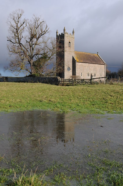
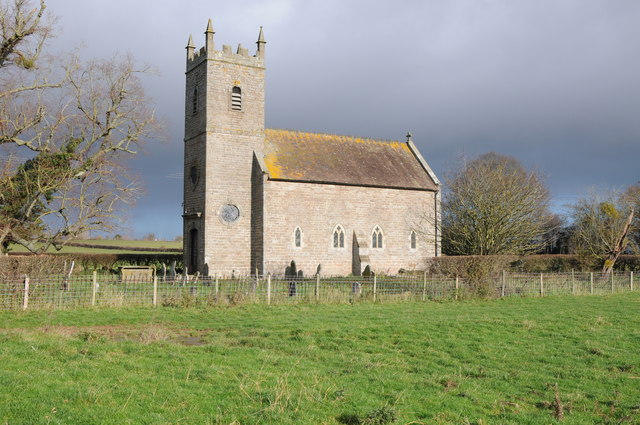
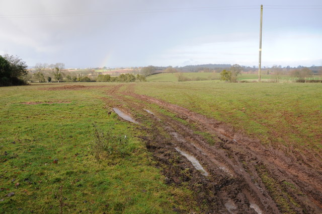
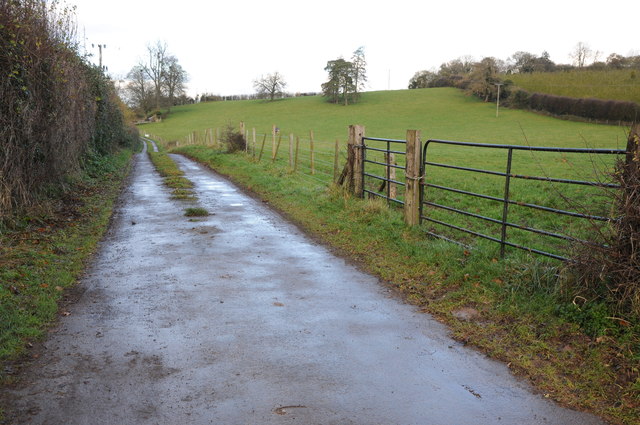
Tumpy Lakes is a picturesque village located in the county of Herefordshire, England. Nestled in the stunning countryside, this tranquil hamlet offers visitors a peaceful and idyllic escape from the hustle and bustle of modern life.

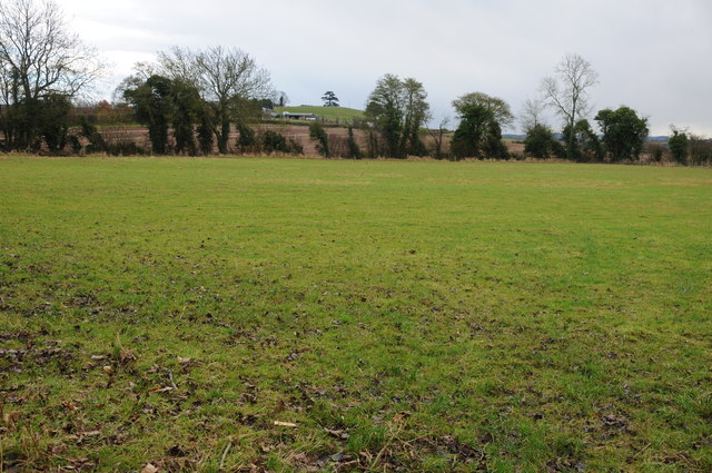
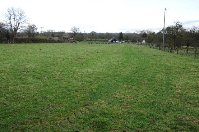
The village is renowned for its stunning lakes, which are the main attraction for both locals and tourists. Tumpy Lakes consists of three interconnected lakes, each surrounded by lush greenery and rolling hills. The lakes are a haven for nature enthusiasts, offering a variety of wildlife and bird species, making it a perfect spot for birdwatching and nature walks.

Tumpy Lakes is also a popular destination for fishing enthusiasts, with the lakes stocked with a diverse range of fish species. Anglers can enjoy a day of fishing in the serene surroundings, providing a relaxing and enjoyable experience.

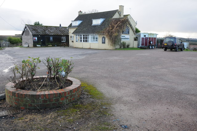
The village itself is small but charming, with traditional stone cottages lining the streets. The local community is friendly and welcoming, and visitors can explore the quaint village pub, which offers delicious food and a warm atmosphere.

For those looking to explore the wider area, Tumpy Lakes is conveniently located just a short drive from the market town of Hereford. Here, visitors can immerse themselves in the rich history and culture of the region, with attractions such as Hereford Cathedral and the Hereford Museum and Art Gallery.

In summary, Tumpy Lakes offers a peaceful and scenic retreat for nature lovers and those seeking a tranquil getaway. With its stunning lakes, abundant wildlife, and charming village, it is a hidden gem in the heart of Herefordshire.

If you have any feedback on the listing, please let us know in the comments section below.
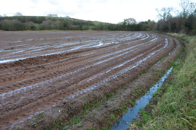
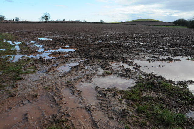
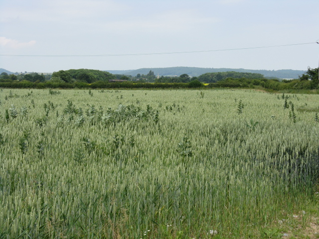
Tumpy Lakes Images

Images are sourced within 2km of 52.119392/-2.673248 or Grid Reference SO5447. Thanks to Geograph Open Source API. All images are credited.

Redundant stile near Marden The second of two bypassed stiles on this stretch of footpath near the village.
Redundant stile near Marden
The second of two bypassed stiles on this stretch of footpath near the village.
Footpath approaching Sutton Walls hillfort from the north Sutton Walls is not a lofty eminence but certainly would have been a natural defensible site in a loop of the River Lugg. Apparently skeletons were excavated from a section of the hillfort's single defensive ditch with battle wounds / broken bones and a number were decapitated, presumably by the Romans as an example after a battle here. The interior of the hill has been quarried and backfilled.
Footpath approaching Sutton Walls hillfort from the north
Sutton Walls is not a lofty eminence but certainly would have been a natural defensible site in a loop of the River Lugg. Apparently skeletons were excavated from a section of the hillfort's single defensive ditch with battle wounds / broken bones and a number were decapitated, presumably by the Romans as an example after a battle here. The interior of the hill has been quarried and backfilled.
Part of the interior of Sutton Walls The tarmac area of hard standing is associated with the gravel quarrying activities in the hillfort. The path on the left cuts across the hillfort at this point.
Part of the interior of Sutton Walls
The tarmac area of hard standing is associated with the gravel quarrying activities in the hillfort. The path on the left cuts across the hillfort at this point.
Track in Sutton Walls This track must be associated with the gravel quarrying activities on the site. Rabbits have been pretty active here too, with a large warren on both banks alongside this track.
Track in Sutton Walls
This track must be associated with the gravel quarrying activities on the site. Rabbits have been pretty active here too, with a large warren on both banks alongside this track.
Hillside just to the south of Sutton Walls hillfort From Sutton Walls the hillside slopes down to the valley of the River Lugg and also has extensive views towards the eastern flank of the Black Mountains, the Sugar Loaf at Abergavenny and Coles Tump near the Monnow Valley.
Hillside just to the south of Sutton Walls hillfort
From Sutton Walls the hillside slopes down to the valley of the River Lugg and also has extensive views towards the eastern flank of the Black Mountains, the Sugar Loaf at Abergavenny and Coles Tump near the Monnow Valley.
Herefordshire countryside in early April Just as supermarkets and retailers have been reducing carrier bags to help the environment then agriculture takes up the slack. Frost protection that will break down under UV rays I suppose but this one field alone has hundreds and hundreds of metres of it. But consumers want their crops on the shelves early so who really is at the start of this mad cycle?
Herefordshire countryside in early April
Just as supermarkets and retailers have been reducing carrier bags to help the environment then agriculture takes up the slack. Frost protection that will break down under UV rays I suppose but this one field alone has hundreds and hundreds of metres of it. But consumers want their crops on the shelves early so who really is at the start of this mad cycle?
St. Michael's church, Sutton, Herefordshire A very picturesque village church with a large graveyard.
St. Michael's church, Sutton, Herefordshire
A very picturesque village church with a large graveyard.
Preston Wynne church Preston Wynne church is dedicated to the Holy Trinity.  Undulations in the field nearby suggests there was once a medieval village here though this church is later.  To get to this isolated parish church one has to follow a footpath across a field.  The church was consecrated in 1730 and the keystone above the door is inscribe '1727'.  The tower is built in a provincial Baroque-style west.  Here the church is reflected in partially frozen water, the result of heavy recent rainfall.
Preston Wynne church
Preston Wynne church is dedicated to the Holy Trinity. Undulations in the field nearby suggests there was once a medieval village here though this church is later. To get to this isolated parish church one has to follow a footpath across a field. The church was consecrated in 1730 and the keystone above the door is inscribe '1727'. The tower is built in a provincial Baroque-style west. Here the church is reflected in partially frozen water, the result of heavy recent rainfall.
Preston Wynne church Preston Wynne church is dedicated to the Holy Trinity. Undulations in the field nearby suggests there was once a medieval village here though this church is later. To get to this isolated parish church one has to follow a footpath across a field. The church was consecrated in 1730 and the keystone above the door is inscribed '1727'. The tower is built in a provincial Baroque-style west.
Preston Wynne church
Preston Wynne church is dedicated to the Holy Trinity. Undulations in the field nearby suggests there was once a medieval village here though this church is later. To get to this isolated parish church one has to follow a footpath across a field. The church was consecrated in 1730 and the keystone above the door is inscribed '1727'. The tower is built in a provincial Baroque-style west.
Farmland at Preston Wynne Wet farmland at Preston Wynne.
Farmland at Preston Wynne
Wet farmland at Preston Wynne.
Field headland Field headland and bridleway near Thing-hill Grange near Sutton St Nicholas.
Field headland
Field headland and bridleway near Thing-hill Grange near Sutton St Nicholas.
Field near Sutton St Nicholas View across a field near Sutton St Nicholas to Thing-hill Farm.
Field near Sutton St Nicholas
View across a field near Sutton St Nicholas to Thing-hill Farm.
Houses at Sutton Lakes Houses at Sutton Lakes near Sutton St Nicholas.
Houses at Sutton Lakes
Houses at Sutton Lakes near Sutton St Nicholas.
Amberley Arms Sutton St Nicholas
Road to Vennwood Access road to Vennwood and also the route of a bridleway.
Road to Vennwood
Access road to Vennwood and also the route of a bridleway.
A very wet ploughed field near Marden Can't help but wonder how the soil is affected when tractors are driven on land as wet as this?
A very wet ploughed field near Marden
Can't help but wonder how the soil is affected when tractors are driven on land as wet as this?
Wet ploughed field A very wet ploughed field to the south of Marden.
Wet ploughed field
A very wet ploughed field to the south of Marden.
Ploughed field below Sutton Walls Fort A footpath circumnavigates Sutton Walls Fort, the hedge on the right marks the line of the footpath and the southern boundary of the hillfort.
Ploughed field below Sutton Walls Fort
A footpath circumnavigates Sutton Walls Fort, the hedge on the right marks the line of the footpath and the southern boundary of the hillfort.
Show me another place!

Tumpy Lakes is located at Grid Ref: SO5447 (Lat: 52.119392, Lng: -2.673248)

Unitary Authority: County of Herefordshire

Police Authority: West Mercia

What 3 Words

///that.tiling.eliminate. Near Sutton, Herefordshire

Nearby Locations

Tumpy Lakes Amberley

Related Wikis

Amberley, Herefordshire

Amberley is a settlement in the civil parish of Marden, in Herefordshire, England. Recorded in the Domesday Book, it was in the hundred of Tornelaus. In...

Preston Wynne

Preston Wynne is a small village and civil parish in Herefordshire, England. Civil parish population at the 2011 census was 172. Preston Wynne is 5 miles...

Sutton Walls Hill Fort

Sutton Walls Hillfort is an elongated ovoid Iron Age Hill fort located four miles north of the city of Hereford, England. It was added to the Sites and...

Sutton, Herefordshire

Sutton is a civil parish in Herefordshire, England, about 3 miles (5 km) north-east from the county town and city of Hereford. The major settlement is...

Sutton Camera

Sutton Camera was a priory in Herefordshire, England at grid reference SO52654582. == References ==

Marden, Herefordshire

Marden is a village and civil parish in the English county of Herefordshire. Marden village is approximately 7 miles (11 km) due north of the city of Hereford...

Moreton-on-Lugg railway station

Moreton-on-Lugg railway station was a station in Moreton-on-Lugg, Herefordshire, England. The station was opened in 1853, closed to passengers in 1958...

Lower Lyde

Lower Lyde is a small village in Herefordshire, around 3 miles (5 km) north of Hereford city centre. It forms part of the Pipe and Lyde civil parish....

Nearby Amenities

Located within 500m of 52.119392,-2.673248
Power: pole
Lat/Long: 52.1218925/-2.6675855
Post Box
Lat/Long: 52.1217216/-2.6739852
The data included in this document is from www.openstreetmap.org. The data is made available under ODbL.

Have you been to Tumpy Lakes?

Leave your review of Tumpy Lakes below (or comments, questions and feedback).