Ball's Plantation

Wood, Forest in Roxburghshire

Scotland

Ball's Plantation

A horse reflection at Riddell A large pond formed in this horse field after periods of heavy rain. I walked by here two days previously and there was no lying water in the field.
A horse reflection at Riddell Credit: Walter Baxter

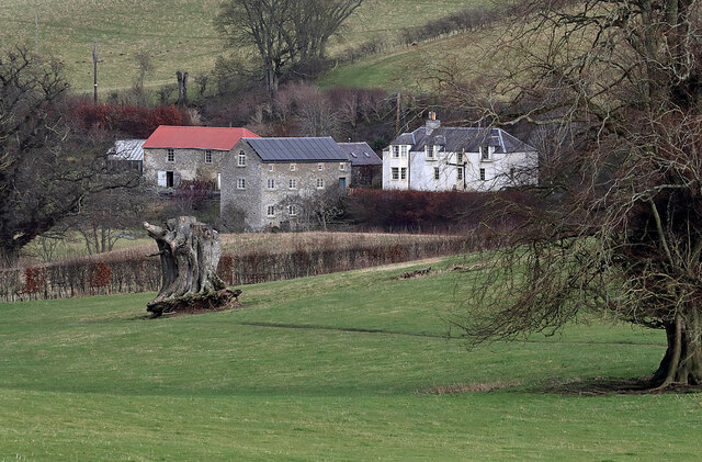
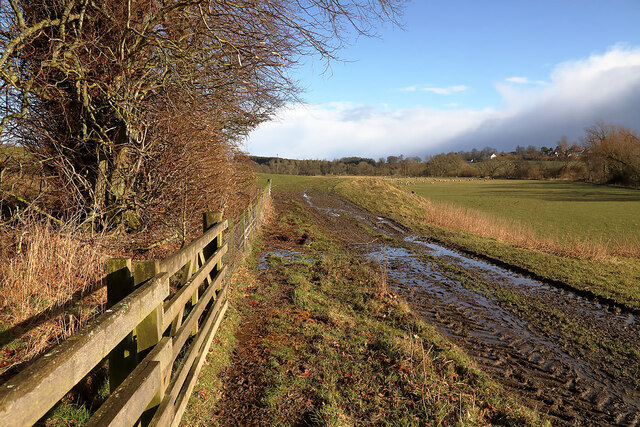
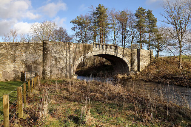
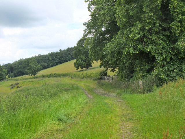
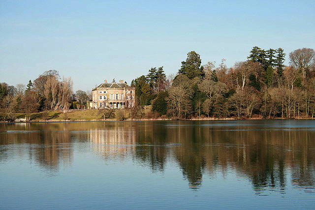
Ball's Plantation is a sprawling woodland located in Roxburghshire, a historic county in the Scottish Borders region of Scotland. This picturesque forest covers an area of approximately 500 acres and is renowned for its natural beauty and rich biodiversity.

The plantation is predominantly composed of a variety of native tree species, including oak, beech, and birch, which create a dense and lush canopy. The forest floor is adorned with a diverse range of flora, such as bluebells, wild garlic, and ferns, adding to the enchanting atmosphere of the woodland.

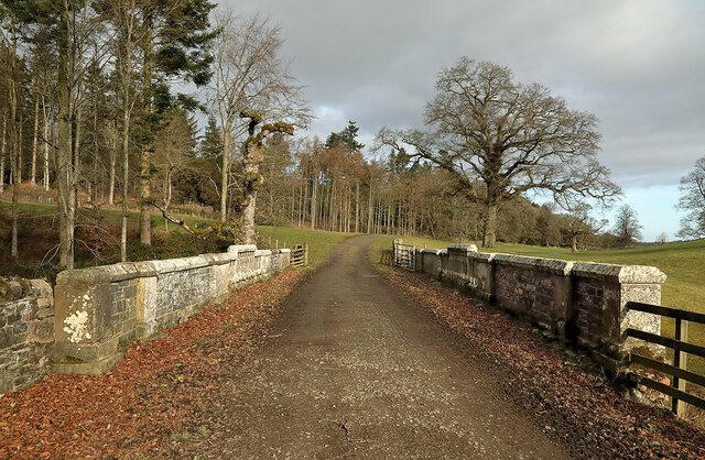
Traversing through Ball's Plantation is a network of well-maintained trails that offer visitors the opportunity to explore and immerse themselves in this tranquil environment. These paths wind through the forest, providing stunning views of the surrounding landscape and allowing visitors to experience the peacefulness and serenity of nature.

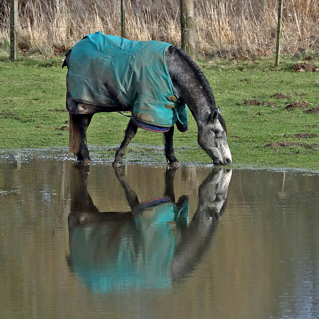
The plantation is not only a haven for nature enthusiasts but also a habitat for a wide array of wildlife. It is home to various bird species, including woodpeckers, owls, and thrushes, which can be spotted and heard throughout the forest. Additionally, the woodland provides shelter and sustenance for mammals such as red squirrels, deer, and foxes.

Ball's Plantation offers a sanctuary for those seeking solace in nature, with its captivating beauty, diverse flora and fauna, and tranquil ambiance. Whether it is a peaceful walk, birdwatching, or simply enjoying the sights and sounds of the forest, this woodland is a true gem in the heart of Roxburghshire.

If you have any feedback on the listing, please let us know in the comments section below.

Ball's Plantation Images

Images are sourced within 2km of 55.515318/-2.7795473 or Grid Reference NT5024. Thanks to Geograph Open Source API. All images are credited.

A horse reflection at Riddell A large pond formed in this horse field after periods of heavy rain. I walked by here two days previously and there was no lying water in the field.
A horse reflection at Riddell
A large pond formed in this horse field after periods of heavy rain. I walked by here two days previously and there was no lying water in the field.
The General’s Tower at Riddell This 25m high observation tower, surrounded by trees, was built in memory of the Sprot family on a medieval motte and bailey in 1885 by A. Herbertson & Son for Major-General John Sprot. An internal vertiginous metal spiral staircase in one corner leads to a caphouse and corbelled parapet walkway. For a long distance autumnal view, see <a href="https://www.geograph.org.uk/photo/2142196">NT5224 : The General's Tower at Riddell</a>.
The General’s Tower at Riddell
This 25m high observation tower, surrounded by trees, was built in memory of the Sprot family on a medieval motte and bailey in 1885 by A. Herbertson & Son for Major-General John Sprot. An internal vertiginous metal spiral staircase in one corner leads to a caphouse and corbelled parapet walkway. For a long distance autumnal view, see NT5224 : The General's Tower at Riddell.
Sheep at Riddell This winter feeding station is by a farm track.
Sheep at Riddell
This winter feeding station is by a farm track.
The caphouse on the General’s Tower at Riddell The caphouse and corbelled parapet walkway can be accessed by an internal vertiginous metal spiral staircase. For a wider view of the 25m high tower, see <a href="https://www.geograph.org.uk/photo/7098037">NT5224 : The General’s Tower at Riddell</a>.
The caphouse on the General’s Tower at Riddell
The caphouse and corbelled parapet walkway can be accessed by an internal vertiginous metal spiral staircase. For a wider view of the 25m high tower, see NT5224 : The General’s Tower at Riddell.
A crest above the entrance door to the general’s Tower The crest features a heron, three fish and a boar’s head. The initials J. S. stand for Major-General John Sprot who commissioned the tower. For a view of the tower, see <a href="https://www.geograph.org.uk/photo/7098037">NT5224 : The General’s Tower at Riddell</a>.
A crest above the entrance door to the general’s Tower
The crest features a heron, three fish and a boar’s head. The initials J. S. stand for Major-General John Sprot who commissioned the tower. For a view of the tower, see NT5224 : The General’s Tower at Riddell.
An old Riddell milepost The milepost is in the southeast edge of a strip wood by a farm track. For some historical information, see <a href="https://www.geograph.org.uk/photo/6814513">NT5225 : Old milepost</a>.
An old Riddell milepost
The milepost is in the southeast edge of a strip wood by a farm track. For some historical information, see NT5225 : Old milepost.
The Sprot family mausoleum This small mortuary chapel surrounded by a locked iron railed enclosure is situated about 80m south of the General’s Tower on the Riddell Estate. Three window tablets are inscribed with details of Sprot family members.
The Sprot family mausoleum
This small mortuary chapel surrounded by a locked iron railed enclosure is situated about 80m south of the General’s Tower on the Riddell Estate. Three window tablets are inscribed with details of Sprot family members.
A window tablet on the Sprot family mausoleum The inscription reads:-

IN
THIS VAULT REST
THE REMAINS OF
JAMES LEWIS BOYD SPROT,
WHO DIED AT SCHOOL
AT EALING NEAR LONDON,
25TH APRIL 1857 AGED 13 YEARS.
THIRD SON OF MARK SPROT,
OF RIDDELL, ROXBURGHSHIRE.
ALSO
MARK GEORGE SPROT,
CAPTAIN OF THE 93RD HIGHLANDERS
SECOND SON ON MARK SPROT,
WHO AFTER A LONG ILLNESS
DEPARTED THIS LIFE AT THE
HOTEL BYRON, LAKE GENEVA
ON 16TH SEPTEMBER 1853
AGED 28 YEARS.
ALSO
EDWARD WILLIAM SPROT,
OF DRYGRANGE
FOURTH SON OF MARK SPROT
WHO DIED AT DRYGRANGE
1ST FEBRUARY 1898
AGED 52 YEARS
AND IS BURIED AT MELROSE.

For a wider view of the mausoleum, see <a href="https://www.geograph.org.uk/photo/7098055">NT5224 : The Sprot family mausoleum</a>.
A window tablet on the Sprot family mausoleum
The inscription reads:- IN THIS VAULT REST THE REMAINS OF JAMES LEWIS BOYD SPROT, WHO DIED AT SCHOOL AT EALING NEAR LONDON, 25TH APRIL 1857 AGED 13 YEARS. THIRD SON OF MARK SPROT, OF RIDDELL, ROXBURGHSHIRE. ALSO MARK GEORGE SPROT, CAPTAIN OF THE 93RD HIGHLANDERS SECOND SON ON MARK SPROT, WHO AFTER A LONG ILLNESS DEPARTED THIS LIFE AT THE HOTEL BYRON, LAKE GENEVA ON 16TH SEPTEMBER 1853 AGED 28 YEARS. ALSO EDWARD WILLIAM SPROT, OF DRYGRANGE FOURTH SON OF MARK SPROT WHO DIED AT DRYGRANGE 1ST FEBRUARY 1898 AGED 52 YEARS AND IS BURIED AT MELROSE. For a wider view of the mausoleum, see NT5224 : The Sprot family mausoleum.
A window tablet on the Sprot family mausoleum The inscription reads:-

IN
THIS VAULT REST
THE REMAINS OF
ELIZABETH,
THE BELOVED WIFE OF MARK SPROT,
RIDDELL, AND ELDEST DAUGHTER OF
JOHN SHEWELL OF CLAPHAM COMMON
WHO DIED SUDDENLY AT EDINBURGH
MUCH REGRETTED 9TH FEBY 1871
AGED 60 YEARS.
ALSO
MARK SPROT ESQR OF RIDDELL
WHO DIED AT EDINBURGH
21ST NOVEMBER 1883,
AGED 82 YEARS.
ALSO
LIEUT. GENERAL JOHN SPROT,
OF RIDDELL,
ELDEST SON OF MARK SPROT,
OF RIDDELL,
LATE 83RD FOOT AND 91ST HIGHLANDERS
WHO DIED AT RIDDELL
19TH MARCH 1907
AGED 77 YEARS.

For a wider view of the mausoleum, see <a href="https://www.geograph.org.uk/photo/7098055">NT5224 : The Sprot family mausoleum</a>.
A window tablet on the Sprot family mausoleum
The inscription reads:- IN THIS VAULT REST THE REMAINS OF ELIZABETH, THE BELOVED WIFE OF MARK SPROT, RIDDELL, AND ELDEST DAUGHTER OF JOHN SHEWELL OF CLAPHAM COMMON WHO DIED SUDDENLY AT EDINBURGH MUCH REGRETTED 9TH FEBY 1871 AGED 60 YEARS. ALSO MARK SPROT ESQR OF RIDDELL WHO DIED AT EDINBURGH 21ST NOVEMBER 1883, AGED 82 YEARS. ALSO LIEUT. GENERAL JOHN SPROT, OF RIDDELL, ELDEST SON OF MARK SPROT, OF RIDDELL, LATE 83RD FOOT AND 91ST HIGHLANDERS WHO DIED AT RIDDELL 19TH MARCH 1907 AGED 77 YEARS. For a wider view of the mausoleum, see NT5224 : The Sprot family mausoleum.
A window tablet on the Sprot family mausoleum The inscription reads:-

IN
THIS VAULT REST
THE REMAINS OF
GEORGINA MARY SPROT,
THE BELOVED WIFE OF 
COLONEL JAMES SPROT,
ASST ADJUT GENERAL FOR SCOTLAND
AND THIRD DAUGHTER OF
HENRY E. SURTEES ESQR OF REDWORTH
HALL & CO DURHAM & DANE END & HERTS
WHO DIED AT EDINBURGH
16TH MARCH 1876 AGED 27 YEARS.
ALSO
IN MEMORY OF HER INFANT DAUGHTERS
LOUISE SPROT,
WHO DIED AT FORT GEORGE 1873
AND IS BURRIED AT ARDERSEER
GEORGIE CAROLINE SPROT,
WHO DIED AT EDINBURGH 1876
AND WHOSE REMAINS LIE IN THIS VAULT
ALSO
CECELIA ELIZABETH SPROT
THE BELOVED WIFE OF
COLONEL J. SPROT OF RIDDELL,
AND DAUGHTER OF THE
REVD. WILLIAM BLAKE DOVETON
OF CORSTON SOMERSET
WHO DIED AT EASTBOURNE
8TH JUNE 1884 AGED 32 YEARS.

For a wider view of the mausoleum, see <a href="https://www.geograph.org.uk/photo/7098055">NT5224 : The Sprot family mausoleum</a>.
A window tablet on the Sprot family mausoleum
The inscription reads:- IN THIS VAULT REST THE REMAINS OF GEORGINA MARY SPROT, THE BELOVED WIFE OF COLONEL JAMES SPROT, ASST ADJUT GENERAL FOR SCOTLAND AND THIRD DAUGHTER OF HENRY E. SURTEES ESQR OF REDWORTH HALL & CO DURHAM & DANE END & HERTS WHO DIED AT EDINBURGH 16TH MARCH 1876 AGED 27 YEARS. ALSO IN MEMORY OF HER INFANT DAUGHTERS LOUISE SPROT, WHO DIED AT FORT GEORGE 1873 AND IS BURRIED AT ARDERSEER GEORGIE CAROLINE SPROT, WHO DIED AT EDINBURGH 1876 AND WHOSE REMAINS LIE IN THIS VAULT ALSO CECELIA ELIZABETH SPROT THE BELOVED WIFE OF COLONEL J. SPROT OF RIDDELL, AND DAUGHTER OF THE REVD. WILLIAM BLAKE DOVETON OF CORSTON SOMERSET WHO DIED AT EASTBOURNE 8TH JUNE 1884 AGED 32 YEARS. For a wider view of the mausoleum, see NT5224 : The Sprot family mausoleum.
Hedge trimming on the Riddell Estate
Riddell Mill This is the site of a former watermill.
Riddell Mill
This is the site of a former watermill.
A farm road on the Riddell Estate This is Park Bridge which spans a small burn and culvert.
A farm road on the Riddell Estate
This is Park Bridge which spans a small burn and culvert.
A farm track on the Riddell Estate The ground was saturated after periods of heavy rain.
A farm track on the Riddell Estate
The ground was saturated after periods of heavy rain.
Riddell South Bridge The bridge spans the Ale Water on the Riddell Estate. There is a sign at the junction of the estate road to the southeast and the B6400 warning of a maximum weight of two tonnes for this bridge.
Riddell South Bridge
The bridge spans the Ale Water on the Riddell Estate. There is a sign at the junction of the estate road to the southeast and the B6400 warning of a maximum weight of two tonnes for this bridge.
A crest and Celtic cross detail at the Sprot Mausoleum For a view of the mausoleum, see <a href="https://www.geograph.org.uk/photo/7098055">NT5224 : The Sprot family mausoleum</a>.
A crest and Celtic cross detail at the Sprot Mausoleum
For a view of the mausoleum, see NT5224 : The Sprot family mausoleum.
Field track to Riddell The track through farmland to the Riddell estate passing the end of a strip wood with a sheepfold.
Field track to Riddell
The track through farmland to the Riddell estate passing the end of a strip wood with a sheepfold.
Field track to Riddell A pleasant walk through farmland near the Ale Water.
Field track to Riddell
A pleasant walk through farmland near the Ale Water.
Show me another place!

Ball's Plantation is located at Grid Ref: NT5024 (Lat: 55.515318, Lng: -2.7795473)

Unitary Authority: The Scottish Borders

Police Authority: The Lothians and Scottish Borders

What 3 Words

///radically.working.battling. Near Selkirk, Scottish Borders

Related Wikis

Lothian and Borders

Lothian and Borders is an area in Scotland consisting of the East Lothian, City of Edinburgh, Midlothian, West Lothian council areas (collectively known...

Lilliesleaf

Lilliesleaf is a small village and civil parish 7 miles (11 km) south east of Selkirk in the Roxburghshire area of Scottish Borders of Scotland. Other...

Bowismiln

Bowismiln is a village in the Scottish Borders area of Scotland. == See also == List of places in the Scottish Borders List of places in Scotland ��2...

Selkirk transmitting station

The Selkirk transmitting station is a telecommunications facility located next to Lindean Loch, near Selkirk in the Scottish Borders. It includes a 229...

The Haining

The Haining is a country house and estate in Selkirk in the Scottish Borders. The present house dates from the 1790s, and was a property of the Pringle...

Selkirk High School

Selkirk High School is a high school in Selkirk, Scotland, which serves the town and its surrounding area including the Ettrick and Yarrow valleys and...

Woll

Woll is a village on the Ale Water, off the A7, in the Ettrick Forest, north of Hawick, and south of Selkirk in the Scottish Borders area of Scotland....

Selkirk Town House

Selkirk Town House is a municipal building in the Market Place, Selkirk, Scottish Borders, Scotland. The structure, which is used as a local history museum...

Related Videos

St Cuthberts Way - April 2023

https://www.walkhighlands.co.uk/borders/st-cuthberts-way.shtml 0:14 - Day One 9:34 - Day Two 16:02 - Day Three 21:12 - Day ...

TRAVEL GUIDE NORTHUMBERLAND: Where to stay & which places to visit (Part 1)

TRAVEL GUIDE NORTHUMBERLAND: Where to stay & which places to visit (Part 1)// Hello lovely people, We are so happy to ...

Nearby Amenities

Located within 500m of 55.515318,-2.7795473
Natural: peak
Lat/Long: 55.5179675/-2.7780991
Riddell Cottage
Place: isolated_dwelling
Lat/Long: 55.5130357/-2.7791575
Power: pole
Lat/Long: 55.5112372/-2.7768025
Power: pole
Lat/Long: 55.5117767/-2.7767742
Power: pole
Lat/Long: 55.5121281/-2.776769
Power: pole
Lat/Long: 55.5120872/-2.7754094
Power: pole
Lat/Long: 55.5122811/-2.7778479
Power: pole
Lat/Long: 55.5124386/-2.7789166
Power: pole
Lat/Long: 55.51279/-2.7799028
Power: pole
Lat/Long: 55.5129402/-2.7809534
Power: pole
Lat/Long: 55.5130874/-2.7819808
Power: pole
Lat/Long: 55.5132566/-2.7832296
Power: pole
Lat/Long: 55.5134038/-2.7842854
Power: pole
Lat/Long: 55.5135613/-2.7853669
Power: pole
Lat/Long: 55.5136925/-2.7863299
Power: pole
Lat/Long: 55.5123934/-2.7741711
The data included in this document is from www.openstreetmap.org. The data is made available under ODbL.

Have you been to Ball's Plantation?

Leave your review of Ball's Plantation below (or comments, questions and feedback).