Loch Plantation

Wood, Forest in Angus

Scotland

Loch Plantation

Potato Field at Reswallie
Potato Field at Reswallie Credit: Sandy Gerrard

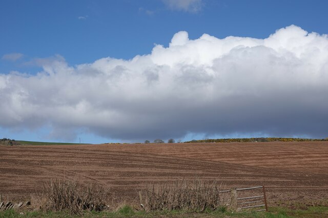
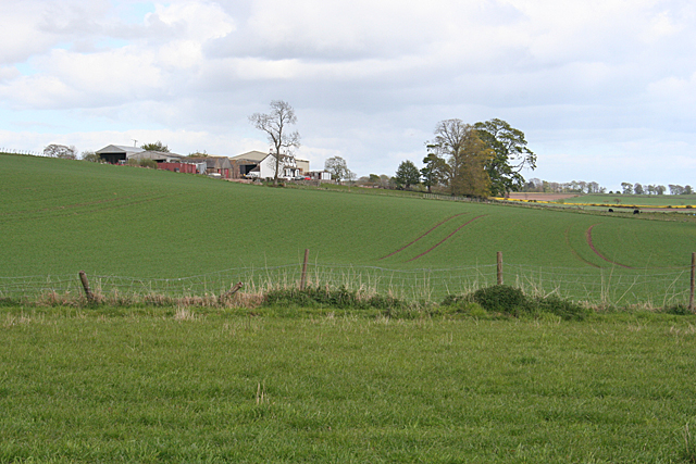
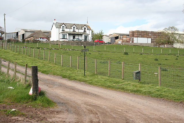
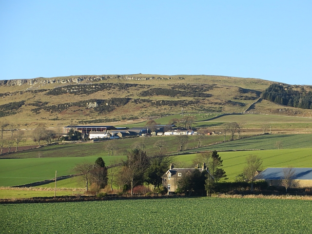
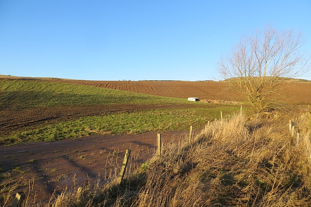
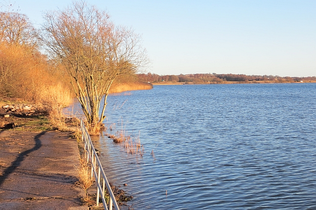
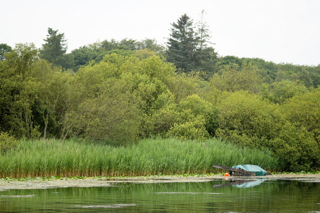
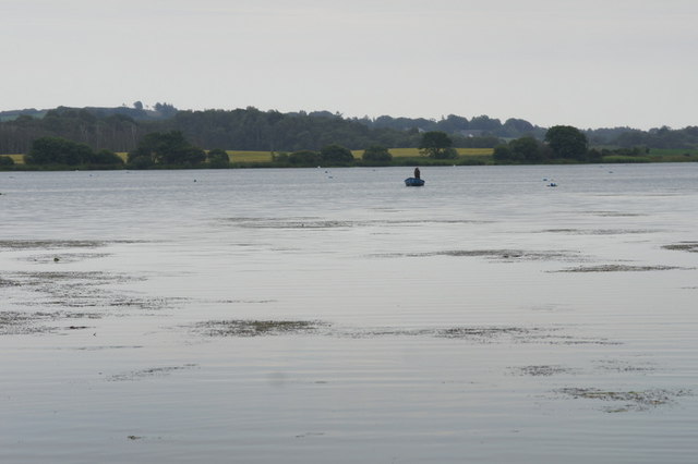
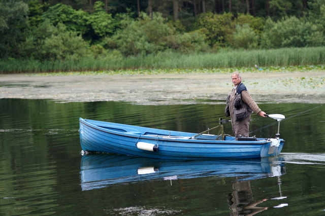
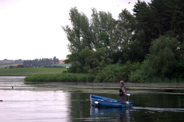
Loch Plantation, located in Angus, Scotland, is a picturesque woodland area known for its scenic beauty and diverse plant and animal life. Covering an extensive area of land, the plantation is a popular destination for nature enthusiasts, hikers, and birdwatchers.

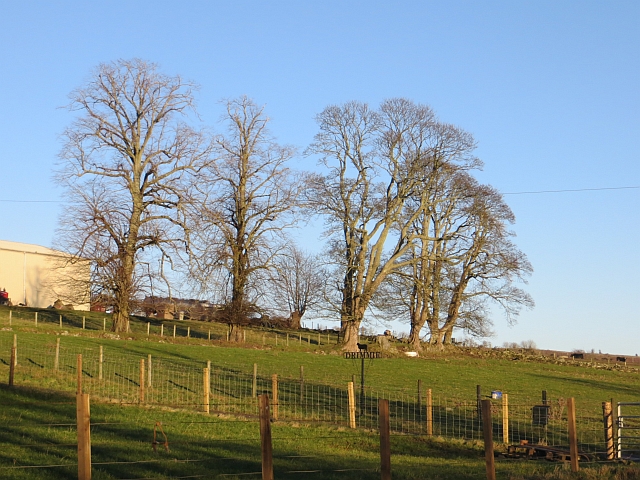
The woodland is characterized by its dense canopy of trees, primarily composed of native species such as oak, birch, and pine. These trees provide a habitat for a wide variety of wildlife, including red squirrels, roe deer, and numerous bird species. Loch Plantation is particularly renowned for its bird population, with sightings of rare and elusive species such as the osprey and golden eagle.

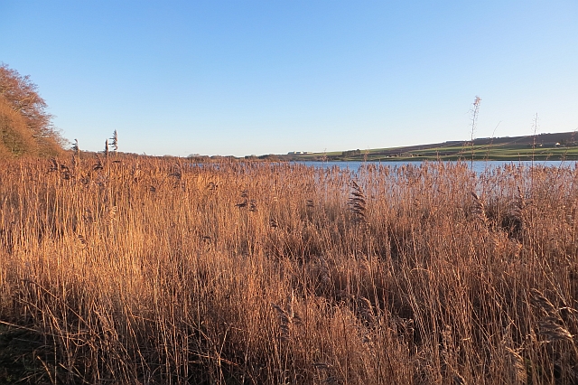
Visitors to Loch Plantation can explore the area through a network of well-maintained trails, which offer stunning views of the surrounding landscape, including the nearby loch from which the plantation derives its name. The calm waters of the loch provide a tranquil backdrop, perfect for picnicking or simply enjoying the serenity of nature.

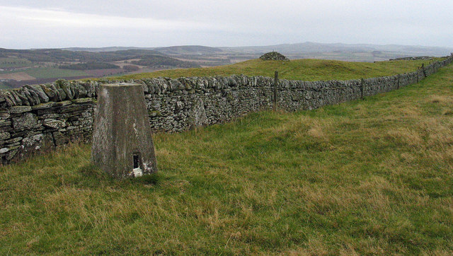
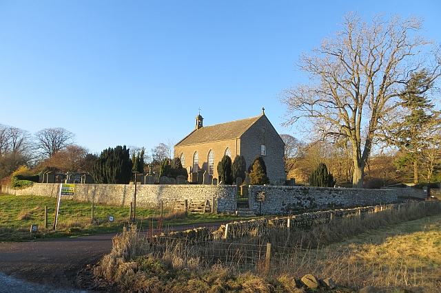
In addition to its natural beauty, Loch Plantation also has historical significance. The plantation has a rich cultural heritage, with traces of ancient settlements and historical landmarks scattered throughout the area. Archaeological sites and remnants of old structures can be found, offering visitors a glimpse into the region's past.

Overall, Loch Plantation in Angus is a captivating destination that combines breathtaking scenery, diverse wildlife, and a touch of history. It offers a unique opportunity to immerse oneself in the tranquility of nature and discover the wonders of this enchanting woodland.

If you have any feedback on the listing, please let us know in the comments section below.

Loch Plantation Images

Images are sourced within 2km of 56.654568/-2.8027443 or Grid Reference NO5051. Thanks to Geograph Open Source API. All images are credited.

Potato Field at Reswallie
Field near Rescobie Loch Newly ploughed and sewn field near Rescobie Loch.
Field near Rescobie Loch
Newly ploughed and sewn field near Rescobie Loch.
The Forfar-Arbroath railway line Long disused, it now forms an attractive path through the SWT Balgavies Loch Wildlife Reserve.
The Forfar-Arbroath railway line
Long disused, it now forms an attractive path through the SWT Balgavies Loch Wildlife Reserve.
Old grassland at the Balgavies Loch Wildlife reserve Scrub and wildflower meadow vegetation in an open part of the reserve, interestingly rich in wax-cap fungi. The wall in the distance marks the line of the Arbroath-Forfar railway, now disused.
Old grassland at the Balgavies Loch Wildlife reserve
Scrub and wildflower meadow vegetation in an open part of the reserve, interestingly rich in wax-cap fungi. The wall in the distance marks the line of the Arbroath-Forfar railway, now disused.
Drimmie Farm Viewed from near the parish kirk. A substantial farm on good arable land, set just up the slope from Rescobie Loch.
Drimmie Farm
Viewed from near the parish kirk. A substantial farm on good arable land, set just up the slope from Rescobie Loch.
Drimmie from the B9113 The farm house and buildings are sited a little way uphill from the B9113 which follows the north shore of Rescobie Loch.
Drimmie from the B9113
The farm house and buildings are sited a little way uphill from the B9113 which follows the north shore of Rescobie Loch.
Trig point on Turin Hill Turin Hill is the location of considerable Iron Age history; see - <span class="nowrap"><a title="http://canmore.rcahms.gov.uk/en/site/34899/details/turin+hill/" rel="nofollow ugc noopener" href="http://canmore.rcahms.gov.uk/en/site/34899/details/turin+hill/">Link</a><img style="margin-left:2px;" alt="External link" title="External link - shift click to open in new window" src="https://s1.geograph.org.uk/img/external.png" width="10" height="10"/></span>.
A dry stone wall crosses the top of the hill close to which is the trig point bearing the flush bracket, S4480.
Trig point on Turin Hill
Turin Hill is the location of considerable Iron Age history; see - LinkExternal link. A dry stone wall crosses the top of the hill close to which is the trig point bearing the flush bracket, S4480.
Nethermuir View towards Turin Hill.
Nethermuir
View towards Turin Hill.
Drimmie A clump of trees beside Drimmie
Drimmie
A clump of trees beside Drimmie
Reed bed,  Rescobie Loch
Reed bed, Rescobie Loch
Rescobie Parish Church A Telford kirk with the four windows on either side. Thomas Telford was commissioned to design a simple and inexpensive church building. Many were built, mostly in the Highlands. View from beside the loch.
Rescobie Parish Church
A Telford kirk with the four windows on either side. Thomas Telford was commissioned to design a simple and inexpensive church building. Many were built, mostly in the Highlands. View from beside the loch.
Fields, Rescobie A burn drains to Rescobie Loch.
Fields, Rescobie
A burn drains to Rescobie Loch.
Rescobie Loch A shallow loch in an area of glacial depositional features. The view is from the angling club and the water level is quite high.
Rescobie Loch
A shallow loch in an area of glacial depositional features. The view is from the angling club and the water level is quite high.
West end of Rescobie Loch, Forfar
Rescobie Loch, Forfar
Fisherman on Rescobie Loch, Forfar
Fields at Rescobie, Forfar Turin Hill in the background.
Fields at Rescobie, Forfar
Turin Hill in the background.
Show me another place!

Loch Plantation is located at Grid Ref: NO5051 (Lat: 56.654568, Lng: -2.8027443)

Unitary Authority: Angus

Police Authority: Tayside

What 3 Words

///display.weeds.drag. Near Letham, Angus

Related Wikis

Rescobie Loch

Rescobie Loch is a post glacial fresh water body located in the parish of Rescobie, 4 km (2.5 mi) to the East of Forfar, in the county of Angus, Scotland...

Clocksbriggs railway station

Clocksbriggs railway station served the town of Forfar, Angus, Scotland from 1848 to 1964 on the Arbroath and Forfar Railway. == History == The station...

Loch Fithie

Loch Fithie is a small, lowland freshwater loch lying approximately 2 miles (3.2 km) east of Forfar, Scotland. It is approximately 800 m (2,600 ft) in...

Restenneth Priory

Restenneth Priory was a monastic house of Augustinian canons founded by Jedburgh Abbey, with the patronage of King Malcolm IV of Scotland, in 1153. Although...

Related Videos

Turin Hill Hike

we hill just beside forfar.

Balgavies Loch, Angus, Scotland VR180 3D Canon RF 5.2mm F2.8L Dual Fisheye lens.

Balgavies Loch, Near Forfar in Angus Scotland. Photos taken on Canon RF 5.2mm F2.8L Dual Fisheye lens VR180 3D System.

Nearby Amenities

Located within 500m of 56.654568,-2.8027443
Bus Stop
Parish Church
Local Ref: AT
Naptan AtcoCode: 6490IM107
Naptan Bearing: E
Naptan BusStopType: CUS
Naptan CommonName: Parish Church
Naptan Indicator: at
Naptan Landmark: Rescobie Loch
Naptan NaptanCode: 26425659
Naptan Street: B9113
Naptan Verified: no
Source: naptan_import
Lat/Long: 56.6572859/-2.8030246
Bus Stop
Parish Church
Naptan AtcoCode: 6490IM157
Naptan Bearing: W
Naptan BusStopType: CUS
Naptan CommonName: Parish Church
Naptan Indicator: opp
Naptan Landmark: Rescobie Loch
Naptan NaptanCode: 26426762
Naptan Street: B9113
Naptan Verified: no
Source: naptan_import
Lat/Long: 56.6571152/-2.803021
Rescobie
Name Gd: Ros Sgolban
Place: hamlet
Lat/Long: 56.6577502/-2.8032159
Waterway: boatyard
Lat/Long: 56.6570941/-2.8061222
Kirk Hill
Ele: 67
Natural: hill
Place: locality
Lat/Long: 56.6541554/-2.802283
Lochside
Place: isolated_dwelling
Lat/Long: 56.6517064/-2.8010406
Power: pole
Lat/Long: 56.6587598/-2.8029459
The data included in this document is from www.openstreetmap.org. The data is made available under ODbL.

Have you been to Loch Plantation?

Leave your review of Loch Plantation below (or comments, questions and feedback).